Next Issue
Volume 14, January-1
Previous Issue
Volume 13, December-1
 
 
water-logo

Journal Browser

Journal Browser

Water, Volume 13, Issue 24 (December-2 2021) – 183 articles

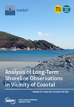
Cover Story (view full-size image): The beach is a natural heritage that requires maintenence. Recently, many rigid structures have been installed to cope with and efficiently manage coastal erosion. However, the changes in the coastline or isocenter and the movements of coastal sediment are poorly understood. In this paper, we examined the Model of Estimating Equilibrium Parabolic-type Shorelines and the inverse method was introduced in order to estimate littoral drift sediment transport from long-term beach profile observations, as well as the equilibrium shoreline. View this paper.
  • Issues are regarded as officially published after their release is announced to the table of contents alert mailing list.
  • You may sign up for e-mail alerts to receive table of contents of newly released issues.
  • PDF is the official format for papers published in both, html and pdf forms. To view the papers in pdf format, click on the "PDF Full-text" link, and use the free Adobe Reader to open them.
Order results
Result details
Section
Select all
Export citation of selected articles as:
12 pages, 9357 KiB  
Article
Effective Purification of Eutrophic Wastewater from the Beverage Industry by Microbubbles
by Kimio Fukami, Tatsuro Oogi, Kohtaro Motomura, Tomoka Morita, Masaoki Sakamoto and Takashi Hata
Water 2021, 13(24), 3661; https://doi.org/10.3390/w13243661 - 20 Dec 2021
Cited by 5 | Viewed by 3422
Abstract
Beverage industries often discharge large amounts of organic matter with their wastewater. Purification of the effluent is their obligation, but it is nontrivial. Among wastewater components, removal of dissolved organic matter often requires much effort. Therefore, a special effective technique must be considered. [...] Read more.
Beverage industries often discharge large amounts of organic matter with their wastewater. Purification of the effluent is their obligation, but it is nontrivial. Among wastewater components, removal of dissolved organic matter often requires much effort. Therefore, a special effective technique must be considered. Microbubbles (1–100 μm) have several special properties of relevance to wastewater treatment. In this study, the effectiveness of microbubbles for treating and purifying beverage wastewater was evaluated. Orange juice, lactic acid drink, and milk were used as model substrates of dissolved organic matter, and degradation experiments were carried out. Rates of air supply by microbubbles were 0.05% (air/wastewater) min−1. Results indicated that the total organic carbon (TOC) in an experimental vessel containing milk (high nitrogen content) decreased by 93.1% from 11.0 to 0.76 g during a 10-day incubation. The TOC of lactic acid drink (least nitrogen content) decreased by 66.3%, from 15.6 to 5.26 g, and the TOC of orange juice (medium nitrogen content) decreased by 82.7%, from 14.8 to 2.55 g. Large amounts of particulate organic matter floated on the water surface in the milk with microbubbles and were removed easily, while almost no floating materials were observed in the orange juice and lactic acid drink. In contrast, in the macrobubble treatment (diameter 0.1 to 2 mm), only 37.0% of TOC in the milk was removed. Whereas the macrobubble treatments were anaerobic throughout the incubations, the microbubble treatments returned to aerobic conditions quickly, and brought 10 times greater bacterial abundances (>108 cells mL−1). These results suggest that microbubbles are much superior to macrobubbles in supplying oxygen and accelerating the growth of aerobic bacteria, and that wastewater containing more nitrogenous compounds was purified more effectively than that with less nitrogen by microbial degradation and floating separation. Full article
Show Figures

Graphical abstract

19 pages, 22471 KiB  
Article
Hydrochemistry of the Lhasa River, Tibetan Plateau: Spatiotemporal Variations of Major Ions Compositions and Controlling Factors Using Multivariate Statistical Approaches
by Meizhuang Zhu, Xingxing Kuang, Yuqing Feng, Yinlei Hao, Qiule He, Hui Zhou, Jianxin Chen, Yiguang Zou and Chunmiao Zheng
Water 2021, 13(24), 3660; https://doi.org/10.3390/w13243660 - 20 Dec 2021
Cited by 9 | Viewed by 3349
Abstract
Spatiotemporal variations of the hydrochemical major ions compositions and their controlling factors are essential features of a river basin. However, similar studies in the southern Tibetan Plateau are relatively limited. This study focuses on the chemical compositions of the dissolved loads in the [...] Read more.
Spatiotemporal variations of the hydrochemical major ions compositions and their controlling factors are essential features of a river basin. However, similar studies in the southern Tibetan Plateau are relatively limited. This study focuses on the chemical compositions of the dissolved loads in the Lhasa River (LR) in the southern Tibetan Plateau. Two sampling campaigns were conducted during the rainy and dry seasons across the LR basin to systematically investigate the spatiotemporal variations of water chemistry and sources of the dissolved loads. The results show that the river water possesses slight alkalinity with an average pH of 8.05 ± 0.04. Total dissolved solids (TDS) and oxidation-reduction potential (ORP) range widely from 39.8 mg/L to 582.6 mg/L with an average value of 165.6 ± 7.7 mg/L and from −9.4 mV to 295 mV with a mean value of 153.7 ± 6.9 mV, respectively. The major cations follow the decreasing order of Ca2+, Mg2+, Na+, and K+ while HCO3, SO42−, Cl, and NO3 for anions. Ca2+ and Mg2+ account for 87.8% of the total cations, while HCO3 and SO42− accounts for 93.9% of the total anions. All the major ions show higher concentrations in the dry season. NO3, HCO3, and Mg2+ show significant spatial variations due to the influence of basin lithology and anthropogenic activity. Multi-variables statistical analysis reveals that the mechanisms controlling the LR hydrochemistry are mainly carbonate weathering followed by silicate weathering. Geothermal springs and anthropogenic activities also play crucial roles in altering river water ions composition in the middle stream and downstream. The relatively high NO3 value (3 ± 0.2 mg/L) suggests water quality will be under the threat of pollution with the increase of anthropogenic activities. Full article
(This article belongs to the Section Water Quality and Contamination)
Show Figures

Figure 1

21 pages, 3652 KiB  
Article
Process Monitoring of Quality-Related Variables in Wastewater Treatment Using Kalman-Elman Neural Network-Based Soft-Sensor Modeling
by Yiqi Liu, Longhua Yuan, Dong Li, Yan Li and Daoping Huang
Water 2021, 13(24), 3659; https://doi.org/10.3390/w13243659 - 20 Dec 2021
Cited by 7 | Viewed by 3355
Abstract
Proper monitoring of quality-related but hard-to-measure effluent variables in wastewater plants is imperative. Soft sensors, such as dynamic neural network, are widely used to predict and monitor these variables and then to optimize plant operations. However, the traditional training methods of dynamic neural [...] Read more.
Proper monitoring of quality-related but hard-to-measure effluent variables in wastewater plants is imperative. Soft sensors, such as dynamic neural network, are widely used to predict and monitor these variables and then to optimize plant operations. However, the traditional training methods of dynamic neural network may lead to poor local optima and low learning rates, resulting in inaccurate estimations of parameters and deviation of predictions. This study introduces a general Kalman-Elman method to monitor the effluent qualities, such as biochemical oxygen demand (BOD), chemical oxygen demand (COD), and total nitrogen (TN). The method couples an Elman neural network with the square-root unscented Kalman filter (SR-UKF) to build a soft-sensor model. In the proposed methodology, adaptive noise estimation and weight constraining are introduced to estimate the unknown noise and constrain the parameter values. The main merits of the proposed approach include the following: First, improving the mapping accuracy of the model and overcoming the underprediction phenomena in data-driven process monitoring; second, implementing the parameter constraint and avoid large weight values; and finally, providing a new way to update the parameters online. The proposed method is verified from a dataset of the University of California database (UCI database). The obtained results show that the proposed soft-sensor model achieved better prediction performance with root mean square error (RMSE) being at least 50% better than the Elman network based on back propagation through the time algorithm (Elman-BPTT), Elman network based on momentum gradient descent algorithm (Elman-GDM), and Elman network based on Levenberg-Marquardt algorithm (Elman-LM). This method can give satisfying prediction of quality-related effluent variables with the largest correlation coefficient (R) for approximately 0.85 in output suspended solids (SS-S) and 0.95 in BOD and COD. Full article
(This article belongs to the Section Wastewater Treatment and Reuse)
Show Figures

Figure 1

22 pages, 9543 KiB  
Article
Operationalizing Water Security Concept in Water Investment Planning: Case Study of São Francisco River Basin
by Alexandre Lima de F. Teixeira, Anik Bhaduri, Stuart E. Bunn and Sérgio R. Ayrimoraes
Water 2021, 13(24), 3658; https://doi.org/10.3390/w13243658 - 20 Dec 2021
Cited by 5 | Viewed by 3597
Abstract
Despite advances in water resources management and planning, the São Francisco River Basin in Brazil has suffered from systematic drought problems in recent years, leading to severe human and environmental water security threats. This paper aims to track the water security for different [...] Read more.
Despite advances in water resources management and planning, the São Francisco River Basin in Brazil has suffered from systematic drought problems in recent years, leading to severe human and environmental water security threats. This paper aims to track the water security for different periods and its relations with the changes in physical and natural asset conditions. The paper explores how investment planning to mitigate the water security threats and explore opportunities to increase the value of investments. The paper finds that grey infrastructure has regulated threats from increasing in the downstream of the river basin, however, continuous increase in water security threats in the upstream of the basin threatens water security downstream. This is evident from the spatial connectivity and unidirection externalities. As the capacity to further increase in grey investment is reaching its limit in the downstream, the increases in green infrastructure investment upstream, especially in the Grande River basin, could be one the way to reduce the externalities and minimise the water security risks. Full article
(This article belongs to the Special Issue Advances in Water Scarcity and Conservation)
Show Figures

Figure 1

21 pages, 2579 KiB  
Article
Drought Vulnerability Assessment and Cluster Analysis of Island Areas Taking Korean Island Areas at Eup (Town) and Myeon (Subcounty) Levels as Study Targets
by Intae Shim, Heejin Kim, Bongchang Hong, Jusuk An and Taemun Hwang
Water 2021, 13(24), 3657; https://doi.org/10.3390/w13243657 - 20 Dec 2021
Cited by 3 | Viewed by 3269
Abstract
The purpose of this study is to conduct drought vulnerability assessment and cluster analysis of Korean island areas at eup (town) myeon (subcounty) level. Drought vulnerability assessment was conducted using factor analysis and entropy method, and cluster analysis was analyzed using K-means, a [...] Read more.
The purpose of this study is to conduct drought vulnerability assessment and cluster analysis of Korean island areas at eup (town) myeon (subcounty) level. Drought vulnerability assessment was conducted using factor analysis and entropy method, and cluster analysis was analyzed using K-means, a nonhierarchical cluster analysis method. Vulnerability consisted of climate exposure, sensitivity, and adaptive capacity. Twenty-two indicators were used to evaluate and analyze vulnerability of drought in small island areas. The results of entropy method showed that winter rainfall, no rainfall days, agricultural population rate, cultivation area rate, water supply rate and groundwater capacity have a substantial impact on drought assessment. The overall assessment of vulnerability indicated that Seodo-myeon Ganghwa-gun, Seolcheon-myeon Namhae-gun, and Samsan-myeon Ganghwa-gun were most vulnerable to drought. The cluster analysis was evaluated by categorizing the regions into three clusters, and policy support and planning are needed to suit the characteristics of each cluster was observed. Full article
(This article belongs to the Section Water Resources Management, Policy and Governance)
Show Figures

Figure 1

15 pages, 4914 KiB  
Article
Remote Triggering of Damage Followed by Healing Recorded in Groundwater Pressure
by Eyal Shalev, Hallel Lutzky, Ittai Kurzon and Vladimir Lyakhovsky
Water 2021, 13(24), 3656; https://doi.org/10.3390/w13243656 - 20 Dec 2021
Cited by 2 | Viewed by 2648
Abstract
Water levels in three adjacent water wells in the Yarmouk Gorge area have all responded to the 2020 Elazığ Mw 6.8 teleseismic earthquake. Water levels in two aquifers exhibited reciprocal behavior: during the first eight days after the earthquake, water level decreased by [...] Read more.
Water levels in three adjacent water wells in the Yarmouk Gorge area have all responded to the 2020 Elazığ Mw 6.8 teleseismic earthquake. Water levels in two aquifers exhibited reciprocal behavior: during the first eight days after the earthquake, water level decreased by 40 cm in the deeper highly confined aquifer, and increased by 90 cm in the shallower less confined aquifer. The recovery of the water levels in both aquifers continued for at least three months. We interpret these observations as reflecting the increase in damage along the fault at the Yarmouk Gorge. Ground shaking increased the damage and permeability of this fault, temporarily connecting the two aquifers, allowing flow from the deep aquifer to the shallow one. Model results showing decreased permeability suggest that the fault healed by one order of magnitude within three days. This is the first documentation of decrease in permeability in a fault zone within such short time scales. Full article
(This article belongs to the Special Issue Earthquakes and Groundwater)
Show Figures

Figure 1

21 pages, 1479 KiB  
Article
Not All Disasters Are Created Equal: An Evaluation of Water Issues in Fire and Hurricane Media Coverage in the United States
by Danielle Sanchez, Holly Eagleston, Benjamin Anker, La Tonya Jenkins and Thushara Gunda
Water 2021, 13(24), 3655; https://doi.org/10.3390/w13243655 - 20 Dec 2021
Cited by 1 | Viewed by 3423
Abstract
Water resources are greatly impacted by natural disasters, but very little is known about how these issues are portrayed in the media across different types of disasters. Using a corpus of over 600 thousand local newspaper articles, this research evaluates whether the amount [...] Read more.
Water resources are greatly impacted by natural disasters, but very little is known about how these issues are portrayed in the media across different types of disasters. Using a corpus of over 600 thousand local newspaper articles, this research evaluates whether the amount of coverage of water-related concerns of fires and hurricanes reflects news values associated with magnitude and proximity. A more detailed analysis focused on wildfires, which occur on undeveloped land and have the potential to spread rapidly, was also conducted to further evaluate spatial patterns in disaster-related water coverage. Our results indicate that the newspaper coverage patterns for water issues are not equally connected to magnitude and proximity values for fires and hurricanes. In our sample, coverage of water issues in relation to fires and wildfires consistently had an inverse relationship with overall event magnitudes, whereas the coverage of water issues in relation to hurricanes demonstrated a positive correlation. Although wildfires are more likely to be clustered in the western part of the country, there was a lack of positive correlations with wildfire magnitudes in this region. Possible influences for these patterns (e.g., limited impacts to humans and lack of shock-value) are discussed. Given the media’s role in facilitating disaster management and recovery, these nuances in coverage variations provide insight into opportunities for informing water security, which is especially important given the increasing frequency of natural disasters. Full article
(This article belongs to the Section Water Resources Management, Policy and Governance)
Show Figures

Figure 1

14 pages, 1363 KiB  
Article
Construction and Application of Reservoir Flood Control Operation Rules Using the Decision Tree Algorithm
by Yanfang Diao, Chengmin Wang, Hao Wang and Yanli Liu
Water 2021, 13(24), 3654; https://doi.org/10.3390/w13243654 - 20 Dec 2021
Cited by 7 | Viewed by 3884
Abstract
Current conventional and optimal reservoir flood control operation methods insufficiently utilize historical reservoir operation data, which include rainfall, runoff generation, and inflow from the watershed, as well as the operational experience of decision makers over many years. Therefore, this study proposed and evaluated [...] Read more.
Current conventional and optimal reservoir flood control operation methods insufficiently utilize historical reservoir operation data, which include rainfall, runoff generation, and inflow from the watershed, as well as the operational experience of decision makers over many years. Therefore, this study proposed and evaluated a new method for extracting reservoir flood control operation rules from historical operation data using the C4.5 algorithm. Thus, in this paper, the C4.5 algorithm is first introduced; then, the generation of the flood control operation dataset, the construction of decision tree-based (DT-based) rules, and the subsequent design of a real-time operating scheme are detailed. A case study of the Rizhao Reservoir is then employed to demonstrate the feasibility and even superiority of the operating scheme formulated using DT-based rules. Compared with previously proposed conventional and optimal reservoir operation methods, the DT-based method has the advantages of strong and convenient adaptability, enabling decision makers to effectively guide real-time reservoir operation. Full article
Show Figures

Figure 1

14 pages, 3598 KiB  
Article
Optimization of Magnetic Nanoparticles Draw Solution for High Water Flux in Forward Osmosis
by MhdAmmar Hafiz, Mohammed Talhami, Muneer M. Ba-Abbad and Alaa H. Hawari
Water 2021, 13(24), 3653; https://doi.org/10.3390/w13243653 - 20 Dec 2021
Cited by 11 | Viewed by 3207
Abstract
In this study, bare iron oxide nanoparticles were synthesized using a co-precipitation method and used as a draw solute in forward osmosis. The synthesis conditions of the nanoparticles were optimized using the Box-Behnken method to increase the water flux of the forward osmosis [...] Read more.
In this study, bare iron oxide nanoparticles were synthesized using a co-precipitation method and used as a draw solute in forward osmosis. The synthesis conditions of the nanoparticles were optimized using the Box-Behnken method to increase the water flux of the forward osmosis process. The studied parameters were volume of ammonia solution, reaction temperature, and reaction time. The optimum reaction conditions were obtained at reaction temperature of 30 °C, reaction time of 2.73 h and 25.3 mL of ammonia solution. The water flux from the prediction model was found to be 2.06 LMH which is close to the experimental value of 1.98 LMH. The prediction model had high correlation factors (R2 = 98.82%) and (R2adj = 96.69%). This study is expected to be the base for future studies aiming at developing magnetic nanoparticles draw solution using co-precipitation method. Full article
Show Figures

Graphical abstract

17 pages, 2751 KiB  
Article
Open-Source Application for Water Supply System Management: Implementation in a Water Transmission System in Southern Spain
by José Pérez-Padillo, Jorge García Morillo, Emilio Camacho Poyato and Pilar Montesinos
Water 2021, 13(24), 3652; https://doi.org/10.3390/w13243652 - 20 Dec 2021
Cited by 8 | Viewed by 6498
Abstract
Sustainable water use has become a critical issue for the future of the planet in face of highly probable climate change. The drinking water supply sector has made significant progress over the last 20 years, although improvements in the management of urban hydraulic [...] Read more.
Sustainable water use has become a critical issue for the future of the planet in face of highly probable climate change. The drinking water supply sector has made significant progress over the last 20 years, although improvements in the management of urban hydraulic infrastructures are still required. The proposed system, Integrated Tool for Water Supply Systems Management (ITWSM), built on three interconnected modules (QGIS database, Epanet hydraulic model, and Google My Maps app), was developed on open-source software. The core of ITWSM allows analyzing the behavior of water supply systems under several operation/failure scenarios. It facilitates decision making supported by the mobile application ITWSM-app. Information flows easily through the different decision levels involved in the management process, keeping updated the georeferenced database after system changes. ITWSM has been implemented in a real public water supply company and applied to manage breakdown repairs in water transmission systems. The use of the proposed methodology reduces the average cost of failure repair by 13.6%, mainly due to the optimal planning of the resources involved. Full article
Show Figures

Figure 1

14 pages, 766 KiB  
Review
A Synthesis of Social and Economic Benefits Linked to Green Infrastructure
by Ranish Shakya and Laurent Ahiablame
Water 2021, 13(24), 3651; https://doi.org/10.3390/w13243651 - 20 Dec 2021
Cited by 11 | Viewed by 6354
Abstract
Green infrastructure (GI) is a land development approach that uses a network of natural and built areas and waterways to create healthier urban environments. This study presents a synthesis of GI planning and adoption in 16 cities selected from around the world; 12 [...] Read more.
Green infrastructure (GI) is a land development approach that uses a network of natural and built areas and waterways to create healthier urban environments. This study presents a synthesis of GI planning and adoption in 16 cities selected from around the world; 12 of these cities are located in the United States. The study highlights key socio-economic benefits associated with GI adoption and documents analytical procedures used to quantify the benefits linked to GI implementation. The benefits as identified and reported in this study are qualitative rather than quantitative. Full article
(This article belongs to the Special Issue Case Studies of Green Infrastructure Adoption)
Show Figures

Figure 1

21 pages, 2515 KiB  
Article
Improving Flow Discharge-Suspended Sediment Relations: Intelligent Algorithms versus Data Separation
by Haniyeh Asadi, Mohammad T. Dastorani, Roy C. Sidle and Kaka Shahedi
Water 2021, 13(24), 3650; https://doi.org/10.3390/w13243650 - 19 Dec 2021
Cited by 8 | Viewed by 3637
Abstract
Information on the transport of fluvial suspended sediment loads (SSL) is crucial due to its effects on water quality, pollutant transport and transformation, dam operations, and reservoir capacity. As such, adopting a reliable method to accurately estimate SSL is a key topic for [...] Read more.
Information on the transport of fluvial suspended sediment loads (SSL) is crucial due to its effects on water quality, pollutant transport and transformation, dam operations, and reservoir capacity. As such, adopting a reliable method to accurately estimate SSL is a key topic for watershed managers, hydrologists, river engineers, and hydraulic engineers. One of the most common methods for estimating SSL or suspended sediment concentrations (SSC) is sediment rating curve (SRC), which has several weaknesses. Here, we optimize the SRC equation using two main approaches. Firstly, three well recognized metaheuristic algorithms (genetic algorithm (GA), particle swarm optimization (PSO), and imperialist competitive algorithm (ICA)) were used together with two classical approaches (food and agriculture organization (FAO) and non-parametric smearing estimator (CF2)) to optimize the coefficients of the SRC regression model. The second approach uses separation of data based on season and flow discharge (Qw) characteristics. A support vector regression (SVR) model using only Qw as an input was employed for SSC estimation and the results were compared with the SRC and its optimized versions. Metaheuristic algorithms improved the performance of the SRC model and the PSO model outperformed the other algorithms. These results also indicate that the model performance was directly related to the temporal separation of data. Based on these findings, if data are more homogenous and related to the limited climatic conditions used in the estimation of SSC, the estimations are improved. Moreover, it was observed that optimizing SRC through metaheuristic models was much more effective than separating data in the SCR model. The results also indicated that with the same input data, SVR was superior to the SRC model and its optimized version. Full article
Show Figures

Figure 1

19 pages, 4702 KiB  
Article
Use of Monitoring Approaches to Verify the Predictive Accuracy of the Modeling of Particle-Bound Solid Inputs to Surface Waters
by Katharina Allion, Michael Gebel, Mario Uhlig, Stefan Halbfass, Stephan Bürger, Lisa Kiemle and Stephan Fuchs
Water 2021, 13(24), 3649; https://doi.org/10.3390/w13243649 - 18 Dec 2021
Cited by 3 | Viewed by 3059
Abstract
For particle-bound substances such as phosphorus, erosion is an important input pathway to surface waters. Therefore, knowledge of soil erosion by water and sediment inputs to water bodies at high spatial resolution is essential to derive mitigation measures at the regional scale. Models [...] Read more.
For particle-bound substances such as phosphorus, erosion is an important input pathway to surface waters. Therefore, knowledge of soil erosion by water and sediment inputs to water bodies at high spatial resolution is essential to derive mitigation measures at the regional scale. Models are used to calculate soil erosion and associated sediment inputs to estimate the resulting loads. However, validation of these models is often not sufficiently possible. In this study, sediment input was modeled on a 10 × 10 m grid for a subcatchment of the Kraichbach river in Baden-Wuerttemberg (Germany). In parallel, large-volume samplers (LVS) were operated at the catchment outlet, which allowed a plausibility check of the modeled sediment inputs. The LVS produced long-term composite samples (2 to 4 weeks) over a period of 4 years. The comparison shows a very good agreement between the modeled and measured sediment loads. In addition, the monitoring concept of the LVS offers the possibility to identify the sources of the sediment inputs to the water body. In the case of the Kraichbach river, it was found that around 67% of the annual sediment load in the water body is contributed by rainfall events and up to 33% represents dry-weather load. This study shows that the modeling approaches for calculating the sediment input provide good results for the test area Kraichbach and the transfer for a German wide modeling will produce plausible values. Full article
(This article belongs to the Special Issue Monitoring, Modelling and Management of Water Quality II)
Show Figures

Figure 1

14 pages, 5578 KiB  
Communication
Features of the Distribution of Chlorophyll-a Concentration along the Western Coast of the Novaya Zemlya Archipelago in Spring
by Pavel R. Makarevich, Veronika V. Vodopianova, Aleksandra S. Bulavina, Pavel S. Vashchenko and Tatiana G. Ishkulova
Water 2021, 13(24), 3648; https://doi.org/10.3390/w13243648 - 18 Dec 2021
Cited by 9 | Viewed by 3122
Abstract
In spring 2016, the thermohaline characteristics of water masses and the distribution of chlorophyll-a concentration in the pelagic zone of the eastern part of the Barents Sea were studied. For the first time, in the conditions of an abnormally warm year and [...] Read more.
In spring 2016, the thermohaline characteristics of water masses and the distribution of chlorophyll-a concentration in the pelagic zone of the eastern part of the Barents Sea were studied. For the first time, in the conditions of an abnormally warm year and the absence of ice cover, a complex of hydrobiological works was carried out on a section crossing the Barents Sea from south to north along the western coast of the Novaya Zemlya archipelago. High concentrations of chlorophyll-a > 1 ˂ 6 mg/m3 at all stations of the transect indicate a stage of spring bloom in the successional cycle of microalgae. Significant differences in the content of chlorophyll-a in waters of various origins were revealed. The highest concentrations of chlorophyll-a corresponded to Arctic surface water (5.56 mg/m3). Slightly lower values were observed in the transformed Atlantic waters of the Novozemelskoe and Kolguevo–Pechorskoe currents (3.53 ± 0.97–3.71 ± 1.04 mg/m3), and the lowest was in the Barents waters (1.24 ± 0.84–1.45 ± 1.13 mg/m3). Full article
(This article belongs to the Special Issue Plankton Ecology in Shallow Coastal Waters)
Show Figures

Figure 1

23 pages, 8177 KiB  
Article
Estimation of Potential Soil Erosion and Sediment Yield: A Case Study of the Transboundary Chenab River Catchment
by Muhammad Gufran Ali, Sikandar Ali, Rao Husnain Arshad, Aftab Nazeer, Muhammad Mohsin Waqas, Muhammad Waseem, Rana Ammar Aslam, Muhammad Jehanzeb Masud Cheema, Megersa Kebede Leta and Imran Shauket
Water 2021, 13(24), 3647; https://doi.org/10.3390/w13243647 - 18 Dec 2021
Cited by 15 | Viewed by 4769
Abstract
Near real-time estimation of soil loss from river catchments is crucial for minimizing environmental degradation of complex river basins. The Chenab river is one of the most complex river basins of the world and is facing severe soil loss due to extreme hydrometeorological [...] Read more.
Near real-time estimation of soil loss from river catchments is crucial for minimizing environmental degradation of complex river basins. The Chenab river is one of the most complex river basins of the world and is facing severe soil loss due to extreme hydrometeorological conditions, unpredictable hydrologic response, and complex orography. Resultantly, huge soil erosion and sediment yield (SY) not only cause irreversible environmental degradation in the Chenab river catchment but also deteriorate the downstream water resources. In this study, potential soil erosion (PSE) is estimated from the transboundary Chenab river catchment using the Revised Universal Soil Loss Equation (RUSLE), coupled with remote sensing (RS) and geographic information system (GIS). Land Use of the European Space Agency (ESA), Climate Hazards Group InfraRed Precipitation with Station (CHIRPS) data, and world soil map of Food and Agriculture Organization (FAO)/The United Nations Educational, Scientific and Cultural Organization were incorporated into the study. The SY was estimated on monthly, quarterly, seasonal, and annual time-scales using sediment delivery ratio (SDR) estimated through the area, slope, and curve number (CN)-based approaches. The 30-year average PSE from the Chenab river catchment was estimated as 177.8, 61.5, 310.3, 39.5, 26.9, 47.1, and 99.1 tons/ha for annual, rabi, kharif, fall, winter, spring, and summer time scales, respectively. The 30-year average annual SY from the Chenab river catchment was estimated as 4.086, 6.163, and 7.502 million tons based on area, slope, and CN approaches. The time series trends analysis of SY indicated an increase of 0.0895, 0.1387, and 0.1698 million tons per year for area, slope, and CN-based approaches, respectively. It is recommended that the areas, except for slight erosion intensity, should be focused on framing strategies for control and mitigation of soil erosion in the Chenab river catchment. Full article
(This article belongs to the Special Issue Soil Water Erosion)
Show Figures

Figure 1

16 pages, 2957 KiB  
Article
Importance of Infiltration Rates for Fate and Transport of Benzene in High-Tiered Risk-Based Assessment Considering Korean Site-Specific Factors at Contaminated Sites
by Sun Woo Chang, Il-Moon Chung, Il Hwan Kim, Jin Chul Joo and Hee Sun Moon
Water 2021, 13(24), 3646; https://doi.org/10.3390/w13243646 - 18 Dec 2021
Cited by 2 | Viewed by 2728
Abstract
Widely used conservative approaches for risk-based assessments of the subsurface transport processes have been calculated using simple analytical equations or general default values. Higher-tier risk assessment of contaminated sites requires the numerical models or additional site-specific values for input parameters. Previous studies have [...] Read more.
Widely used conservative approaches for risk-based assessments of the subsurface transport processes have been calculated using simple analytical equations or general default values. Higher-tier risk assessment of contaminated sites requires the numerical models or additional site-specific values for input parameters. Previous studies have focused on the development of sophisticated models fit into risk-based frameworks. Our study mainly aims to explore the applicability of site-specific parameters and to modify the risk-based fate and transport model according to the types of the site-specific parameters. To apply the modified fate and transport equation and the site-specific default infiltration range, this study assessed the source depletion, leachate concentrations, and exposure concentration of benzene, which is a representative organic contaminant. The numerical models consist of two continuous processes, the fate and transport of contaminants from (1) the soil to the groundwater table in the vadose zone and subsequently (2) from the groundwater table to exposure wells in the saturated zone. Spatially varied Korean domestic recharge data were successfully incorporated into site-specific infiltration parameters in the models. The numerical simulation results were expressed as transient time series of concentrations over time. Results presented the narrow range of predicted concentrations at the groundwater table when site-specific infiltration was applied, and the dilution–attenuation factors for the unsaturated zone (DAFunsat) were derived based on the prediction. When a contaminant travels to the longest path length of 10 m with a source depth of 1 m in the vadoze zone, the simulated DAFunsat ranged from 3 to 4. The highest DAFunsat simulation results are close to 1 when contaminants travel to a source depth of 5 m and the shortest path length of 1 m. In the saturated aquifer below the contaminated sites, the variation in exposure concentration with time at monitoring wells is detected differently depending on the depth of the saturated zone. Full article
(This article belongs to the Special Issue Remediation of NAPL-Contaminated Groundwater Aquifers)
Show Figures

Figure 1

12 pages, 1331 KiB  
Article
Stress Resistance and Adaptation of the Aquatic Invasive Species Tubastraea Coccinea (Lesson, 1829) to Climate Change and Ocean Acidification
by Kevin B. Strychar, Briana Hauff-Salas, Joshua A. Haslun, Jessica DeBoer, Katherine Cryer, Scott Keith and Sam Wooten
Water 2021, 13(24), 3645; https://doi.org/10.3390/w13243645 - 18 Dec 2021
Cited by 1 | Viewed by 3344
Abstract
A great number of studies published on long-term ocean warming and increased acidification have forecasted changes in regional biodiversity preempted by aquatic invasive species (AIS). The present paper is focused on invasive Tubastraea coccinea (TC), an azooxanthellate AIS coral thriving in regions of [...] Read more.
A great number of studies published on long-term ocean warming and increased acidification have forecasted changes in regional biodiversity preempted by aquatic invasive species (AIS). The present paper is focused on invasive Tubastraea coccinea (TC), an azooxanthellate AIS coral thriving in regions of the Gulf of Mexico, which has shown an ability to invade altered habitats, including endemic Indo-Pacific T. coccinea (TCP) populations. To determine if invasive TC are more stress resistant than endemic Indo-Pacific T. coccinea (TCP), authors measured tissue loss and heat shock protein 70 (HSP70) expression, using a full factorial design, post exposure to changes in pH (7.5 and 8.1) and heat stress (31 °C and 34 °C). Overall, the mean time required for TCP to reach 50% tissue loss (LD50) was less than observed for TC by a factor of 0.45 (p < 0.0003). Increasing temperature was found to be a significant main effect (p = 0.004), decreasing the LD50 by a factor of 0.58. Increasing acidity to pH 7.5 from 8.1 did not change the sensitivity of TC to temperature; however, TCP displayed increased sensitivity at 31 °C. Increases in the relative density of HSP70 (TC) were seen at all treatment levels. Hence, TC appears more robust compared to TCP and may emerge as a new dominant coral displacing endemic populations as a consequence of climate change. Full article
(This article belongs to the Special Issue Climate Change Studies of Coral Reefs)
Show Figures

Figure 1

20 pages, 7311 KiB  
Article
Characteristics of Beaver Ponds and Landforms Induced by Beaver Activity, S Part of the Tuchola Pinewoods, Poland
by Mirosław Rurek
Water 2021, 13(24), 3641; https://doi.org/10.3390/w13243641 - 18 Dec 2021
Cited by 3 | Viewed by 3639
Abstract
Currently, there are only two species of beavers described—the North American beaver (Castor canadensis) and Eurasian beaver (Castor fiber). Their natural habitats are confined to the northern hemisphere but instances of beaver introduction to regions of the world they [...] Read more.
Currently, there are only two species of beavers described—the North American beaver (Castor canadensis) and Eurasian beaver (Castor fiber). Their natural habitats are confined to the northern hemisphere but instances of beaver introduction to regions of the world they do not normally inhabit have also been recorded. The activity of beavers leads to changes in the natural environment linked to hydrological and geomorphological and plant cover transformations. Beavers live in natural and artificial water reservoirs and rivers. If the water level in the river is too low, they build dams to create a comfortable living environment. This paper aims to present changes in the relief of the valley inhabited by beavers in which sediments accumulate. During the field study, detailed measurements of dams and of the spatial range of beaver ponds were made, and the thickness and spatial distribution of accumulated sediments were determined. In addition, measurements of geomorphological forms in beaver ponds were also made. The samples of sediments were subject to grain-size distribution analysis, the results of which allowed calculating sediment parameters. Beavers appeared in the Gajdówka valley in the southern part of the Tuchola Forest (Poland) in 2008. In 2008–2011 they built 17 beaver dams that impounded ponds. The beaver ponds and beaver dams were of different sizes. They either flooded the whole flat bottom of the valley or only raised the level of water in the riverbed. A characteristic feature of beaver ponds is that they capture sediments. Different landforms were created in the course of the formation and disappearance of beaver ponds. It was established that these include alluvial fans, levees, sand shadow dunes and microterraces formed by deposition and erosion. They do not occur in all ponds. Points at which mineral sediments are supplied to the watercourse, including beaver burrows and erosion hollows, are presented together with the points at which sediments are transferred from ponds upstream to ponds downstream the watercourse. Beaver activity during valley colonization shows changes in the landscape caused by their presence and in particular their impact on the relief and deposition of sediments. Analysis of contemporary changes in the morphology of the Gajdówka Valley leads to the conclusion that beaver activity has had an intense impact on the terrain relief of the valley inhabited by beavers. Full article
(This article belongs to the Section Ecohydrology)
Show Figures

Figure 1

19 pages, 3952 KiB  
Article
A Biological Method of Treating Surface Water Contaminated with Industrial Waste Leachate
by Justyna Zamorska and Izabela Kiełb-Sotkiewicz
Water 2021, 13(24), 3644; https://doi.org/10.3390/w13243644 - 17 Dec 2021
Cited by 7 | Viewed by 3848
Abstract
The progressive chemicalization of all areas of everyday life and the development of the industry cause the appearance of various types of pollutants, both in groundwater and surface waters. Kalina Pond (Świętochłowice, Poland) is an example of a degraded water reservoir as a [...] Read more.
The progressive chemicalization of all areas of everyday life and the development of the industry cause the appearance of various types of pollutants, both in groundwater and surface waters. Kalina Pond (Świętochłowice, Poland) is an example of a degraded water reservoir as a result of many years of activity, among others hard coal mines, storing metallurgical waste by zinc plants, and the activities of the Hajduki Chemical Plants from Chorzów. Inadequate securing of waste heaps resulted in the penetration of pollutants, i.e., phenol, petroleum compounds, PAHs, cyanides, and heavy metals. The aim of the research was to determine the suitability of biopreparations for the removal of pollutants. The research used a bacterial biopreparation from BioArcus, “DBC plus type R5”, to remove petroleum compounds and phenol. Then, in order to restore the microbiological balance, “ACS ODO-1” from the biopreparation was used. The research was carried out in laboratory conditions, using three variants: direct dosing of biopreparations, dosing of biopreparations previously activated by multiplication on the medium, and dosing of biopreparations into water after filtration on a diatomite bed. The optimal method of recultivating water from a reservoir was to filter this water through a diatomite bed and then dose the multiplied bacteria. After the filtration process, the obtained percentage of TOC reduction allowed for the rapid development of microorganisms from the biopreparation, despite the 100 times lower dose used. In addition, the application of lyophilized biopreparation to contaminated water resulted in a very fast biodegradation effect of pollutants, despite the high concentration of numerous toxic compounds. Full article
Show Figures

Figure 1

25 pages, 3960 KiB  
Review
Multiagent System and Rainfall-Runoff Model in Hydrological Problems: A Systematic Literature Review
by Bruna Leitzke and Diana Adamatti
Water 2021, 13(24), 3643; https://doi.org/10.3390/w13243643 - 17 Dec 2021
Cited by 3 | Viewed by 3640
Abstract
Typically, hydrological problems require approaches capable of describing and simulating part of the hydrological system, or the environmental consequences of natural or anthropic actions. Tools such as Multiagent System (MAS) and Rainfall-Runoff Model (RRM) have been used to help researchers to develop and [...] Read more.
Typically, hydrological problems require approaches capable of describing and simulating part of the hydrological system, or the environmental consequences of natural or anthropic actions. Tools such as Multiagent System (MAS) and Rainfall-Runoff Model (RRM) have been used to help researchers to develop and better understand water systems. Thus, this study presents a Systematic Literature Review (SLR) on the joint use of MAS and RRM tools, in the context of hydrological problems. SLR was performed based on a protocol defined from the research question. Initially, 79 papers were found among six bibliographic databases. This total was reduced over four stages of selection, according to exclusion criteria. In the end, three papers were considered satisfactory within the scope of the research, where they were summarized, analyzed, and compared. While the MAS and RRM tools can interact with their results in a coupled model, SLR showed that there are still major challenges to be explored concerning the dynamics between them, as the steps of scales and validation. However, the coupling of MAS and RRM can provide an interesting alternative tool to analyse decision-making about water resources management systems. Full article
(This article belongs to the Section Hydrology)
Show Figures

Figure 1

12 pages, 8982 KiB  
Article
Heavy Metal Removal from the Water of the River Nile Using Riverbank Filtration
by Mohamed H. Hegazy, Ahmed Essam, Ashraf Y. Elnaggar and Enas E. Hussein
Water 2021, 13(24), 3642; https://doi.org/10.3390/w13243642 - 17 Dec 2021
Cited by 2 | Viewed by 4035
Abstract
Riverbank filtration (RBF) is considered as a natural treatment process. During this process, a group of chemical, physical, and biological processes occur when water moves through the soil along the bank of the River Nile, which can act as a conventional treatment process. [...] Read more.
Riverbank filtration (RBF) is considered as a natural treatment process. During this process, a group of chemical, physical, and biological processes occur when water moves through the soil along the bank of the River Nile, which can act as a conventional treatment process. RBF is one of the most effective solutions that the Egyptian government and responsible parties should embrace. Egypt has started to use the RBF technique widely in many sites through the path of the River Nile. This study provides a detailed analysis of the RBF technique; it represents the outlet quality of the water in a study performed on the River Nile. The effect of RBF on water quality can be measured using the software designed for this study. The study’s main aim is to improve the water quality of the River Nile by removing heavy metals from the water by using an effective and fast method of treatment, which is riverbank filtration. The results of the research’s experimental study show the average percentage of metal removal for iron, cobalt, lead, zinc, and copper are 74.04%, 74.44%, 70.72%, 75.1%, and 70.8%, respectively. These results have proved that RBF acts as a substantial barrier versus heavy metals. Full article
Show Figures

Figure 1

15 pages, 4520 KiB  
Article
Assessment of Water Quality Based on Trophic Status and Nutrients-Chlorophyll Empirical Models of Different Elevation Reservoirs
by Md Mamun, Usman Atique and Kwang-Guk An
Water 2021, 13(24), 3640; https://doi.org/10.3390/w13243640 - 17 Dec 2021
Cited by 15 | Viewed by 4821
Abstract
Water quality degradation is one of the most pressing environmental challenges in reservoirs around the world and makes the trophic status assessment of reservoirs essential for their restoration and sustainable use. The main aims of this study were to determine the spatial variations [...] Read more.
Water quality degradation is one of the most pressing environmental challenges in reservoirs around the world and makes the trophic status assessment of reservoirs essential for their restoration and sustainable use. The main aims of this study were to determine the spatial variations in water quality and trophic state of 204 South Korean reservoirs at different altitude levels. The results demonstrated mean total phosphorus (TP), chlorophyll-a (CHL-a), total suspended solids (TSS), organic matter indicators (chemical oxygen demand: COD; total organic carbon: TOC), water temperature (WT), and electrical conductivity (EC) remain consistently higher in the very lowland reservoirs (VLLR) than those in other altitudes, due to sedimentary or alluvial watersheds. The average TP and CHL-a levels in VLLR crossed the limit of the eutrophic water, symptomizing a moderate risk of cyanobacterial blooms. Empirical models were developed to identify critical variables controlling algal biomass and water clarity in reservoirs. The empirical analyses of all reservoir categories illustrated TP as a better predictor of CHL-a (R2 = 0.44, p < 0.01) than TN (R2 = 0.02, p < 0.05) as well as showed strong P-limitation based on TN:TP ratios. The algal productivity of VLLR (R2 = 0.61, p < 0.01) was limited by phosphorus, while highland reservoirs (HLR) were phosphorus (R2 = 0.23, p < 0.03) and light-limited (R2 = 0.31, p < 0.01). However, TSS showed a highly significant influence on water clarity compared to TP and algal CHL-a in all reservoirs. TP and TSS explained 47% and 34% of the variance in non-algal turbidity (NAT) in HLR. In contrast, the TP and TSS variances were 18% and 29% in midland reservoirs (MLR) and 32% and 20% in LLR. The trophic state index (TSI) of selected reservoirs varied between mesotrophic to eutrophic states as per TSI (TP), TSI (CHL-a), and TSI (SD). Mean TSI (CHL-a) indicated all reservoirs as eutrophic. Trophic state index deviation (TSID) assessment also complemented the phosphorus limitation characterized by the blue-green algae (BGA) domination in all reservoirs. Overall, reservoirs at varying altitudes reflect the multiplying impacts of anthropogenic factors on water quality, which can provide valuable insights into reservoir water quality management. Full article
(This article belongs to the Special Issue Water Quality Changes of Lakes and Rivers)
Show Figures

Figure 1

16 pages, 2597 KiB  
Article
Driving Force Analysis of Agricultural Economic Growth Related to Water Utilization Effects Based on LMDI Method in Ningxia, Northwest China
by Jie Du, Zhaohui Yang, Guiyu Yang, Shuoyang Li and Ziteng Luo
Water 2021, 13(24), 3639; https://doi.org/10.3390/w13243639 - 17 Dec 2021
Cited by 7 | Viewed by 2812
Abstract
Agricultural economy is usually studied by total factor analysis, while it is uncertain what factors affect agricultural production in the perspective of water utilization. The aim of this study was to investigate driving forces of agricultural economy related to water utilization effects in [...] Read more.
Agricultural economy is usually studied by total factor analysis, while it is uncertain what factors affect agricultural production in the perspective of water utilization. The aim of this study was to investigate driving forces of agricultural economy related to water utilization effects in Ningxia during 2007 to 2017. The logarithmic mean Divisia index (LMDI) method was selected to decompose the driving forces of agricultural production value. Results showed that the agricultural production value increased significantly in 2007–2017 in all of Ningxia and in each city. In terms of the whole region, the effect of agriculture water efficiency played a leading and positive role in the increase of the agricultural production value. The effects of water stress, water utilization structure, and water resource endowment all showed a negative driving force, while population exerted a positive effect. For five cities, the effect of agriculture water efficiency and water utilization structure showed no spatial difference; whereas the other effects expressed different driving forces between cities in the northern plain area and southern hilly area due to varied natural conditions and agricultural activities. The results of this research suggested that the first and foremost strategy of agricultural development and water resource management in Ningxia should be to promote water-saving irrigation and optimize agricultural structure. Full article
(This article belongs to the Special Issue Improving Agricultural Water Productivity in the Dry Areas)
Show Figures

Figure 1

12 pages, 1349 KiB  
Article
A Lagrangian Backward Air Parcel Trajectories Clustering Framework
by Iulia-Maria Rădulescu, Alexandru Boicea, Florin Rădulescu and Daniel-Călin Popeangă
Water 2021, 13(24), 3638; https://doi.org/10.3390/w13243638 - 17 Dec 2021
Viewed by 2845
Abstract
Many studies concerning atmosphere moisture paths use Lagrangian backward air parcel trajectories to determine the humidity sources for specific locations. Automatically grouping trajectories according to their geographical position simplifies and speeds up their analysis. In this paper, we propose a framework for clustering [...] Read more.
Many studies concerning atmosphere moisture paths use Lagrangian backward air parcel trajectories to determine the humidity sources for specific locations. Automatically grouping trajectories according to their geographical position simplifies and speeds up their analysis. In this paper, we propose a framework for clustering Lagrangian backward air parcel trajectories, from trajectory generation to cluster accuracy evaluation. We employ a novel clustering algorithm, called DenLAC, to cluster troposphere air currents trajectories. Our main contribution is representing trajectories as a one-dimensional array consisting of each trajectory’s points position vector directions. We empirically test our pipeline by employing it on several Lagrangian backward trajectories initiated from Břeclav District, Czech Republic. Full article
(This article belongs to the Special Issue Smart Water Solutions with Big Data)
Show Figures

Figure 1

16 pages, 2970 KiB  
Article
Light or Dark Greywater for Water Reuse? Economic Assessment of On-Site Greywater Treatment Systems in Rural Areas
by Eduardo Leiva, Carolina Rodríguez, Rafael Sánchez and Jennyfer Serrano
Water 2021, 13(24), 3637; https://doi.org/10.3390/w13243637 - 17 Dec 2021
Cited by 7 | Viewed by 4195
Abstract
Water scarcity is causing a great impact on the population. Rural areas are most affected by often lacking a stable water supply, being more susceptible to the impact of drought events, and with greater risk of contamination due to the lack of appropriate [...] Read more.
Water scarcity is causing a great impact on the population. Rural areas are most affected by often lacking a stable water supply, being more susceptible to the impact of drought events, and with greater risk of contamination due to the lack of appropriate water treatment systems. Decentralized greywater treatment systems for water reuse in rural areas can be a powerful alternative to alleviate these impacts. However, the economic feasibility of these systems must be thoroughly evaluated. This study reports an economic analysis carried out on the viability of greywater reuse considering scenarios with light greywater or dark greywater to be treated. For this, data obtained from the assembly and monitoring of greywater treatment systems located in the north-central zone of Chile, supplemented with data obtained from the literature were used. The results showed that both scenarios are not economically viable, since the investment and operating costs are not amortized by the savings in water. In both evaluated cases (public schools), the economic indicators were less negative when treating light greywater compared with the sum of light greywater and dark greywater as the inlet water to be treated. The investment and operating costs restrict the implementation of these water reuse systems, since in the evaluation period (20 years) a return on the initial investment is not achieved. Even so, our results suggest that the best alternative to reuse greywater in small-scale decentralized systems is to treat light greywater, but it is necessary to consider a state subsidy that not only supports capital costs but also reduces operating and maintenance costs. These findings support the idea that the type of water to be treated is a factor to consider in the implementation of decentralized greywater treatment systems for the reuse of water in rural areas and can help decision-making on the design and configuration of these systems. Full article
(This article belongs to the Special Issue Urban Wastewater Reuse – Challenges, Risks and Opportunities)
Show Figures

Figure 1

18 pages, 2554 KiB  
Article
Future Climate Change Impact on the Nyabugogo Catchment Water Balance in Rwanda
by Adeline Umugwaneza, Xi Chen, Tie Liu, Zhengyang Li, Solange Uwamahoro, Richard Mind’je, Edovia Dufatanye Umwali, Romaine Ingabire and Aline Uwineza
Water 2021, 13(24), 3636; https://doi.org/10.3390/w13243636 - 17 Dec 2021
Cited by 10 | Viewed by 4900
Abstract
Droughts and floods are common in tropical regions, including Rwanda, and are likely to be aggravated by climate change. Consequently, assessing the effects of climate change on hydrological systems has become critical. The goal of this study is to analyze the impact of [...] Read more.
Droughts and floods are common in tropical regions, including Rwanda, and are likely to be aggravated by climate change. Consequently, assessing the effects of climate change on hydrological systems has become critical. The goal of this study is to analyze the impact of climate change on the water balance in the Nyabugogo catchment by downscaling 10 global climate models (GCMs) from CMIP6 using the inverse distance weighting (IDW) method. To apply climate change signals under the Shared Socioeconomic Pathways (SSPs) (low and high emission) scenarios, the Soil and Water Assessment Tool (SWAT) model was used. For the baseline scenario, the period 1950–2014 was employed, whereas the periods 2020–2050 and 2050–2100 were used for future scenario analysis. The streamflow was projected to decrease by 7.2 and 3.49% under SSP126 in the 2020–2050 and 2050–2100 periods, respectively; under SSP585, it showed a 3.26% increase in 2020–2050 and a 4.53% decrease in 2050–2100. The average annual surface runoff was projected to decrease by 11.66 (4.40)% under SSP126 in the 2020–2050 (2050–2100) period, while an increase of 3.25% in 2020–2050 and a decline of 5.42% in 2050–2100 were expected under SSP585. Climate change is expected to have an impact on the components of the hydrological cycle (such as streamflow and surface runoff). This situation may, therefore, lead to an increase in water stress, calling for the integrated management of available water resources in order to match the increasing water demand in the study area. This study’s findings could be useful for the establishment of adaptation plans to climate change, managing water resources, and water engineering. Full article
Show Figures

Figure 1

19 pages, 3674 KiB  
Article
Hybrid Approach for Excess Stormwater Management: Combining Decentralized and Centralized Strategies for the Enhancement of Urban Flooding Resilience
by Roberta D’Ambrosio, Antonia Longobardi, Alessandro Balbo and Anacleto Rizzo
Water 2021, 13(24), 3635; https://doi.org/10.3390/w13243635 - 17 Dec 2021
Cited by 10 | Viewed by 3933
Abstract
Urban sprawl and soil sealing has gradually led to an impervious surface increase with consequences on the enhancement of flooding risk. During the last decades, a hybrid approach involving both traditional storm water detention tanks (SWDTs) and low-impact development (LID) has resulted in [...] Read more.
Urban sprawl and soil sealing has gradually led to an impervious surface increase with consequences on the enhancement of flooding risk. During the last decades, a hybrid approach involving both traditional storm water detention tanks (SWDTs) and low-impact development (LID) has resulted in the best solution to manage urban flooding and to improve city resilience. This research aimed at a modeling comparison between drainage scenarios involving the mentioned hybrid approach (H-SM), with (de)centralized LID supporting SWDTs, and a scenario representative of the centralized approach only involving SWDTs (C-SM). Results highlighted that the implementation of H-SM approaches could be a great opportunity to reduce SWDTs volumes. However, the performances varied according to the typology of implemented LID, their parameterization with specific reference to the draining time, and the rainfall severity. Overall, with the increase of rainfall severity and the decrease of draining time, a decrease of retention performances can be observed with SWDTs volume reductions moving from 100% to 28%. In addition, without expecting to implement multicriteria techniques, a preliminary cost analysis pointed out that the larger investment effort of the (de)centralized LID could be, in specific cases, overtaken by the cost advantages resulting from the reduction of the SWDTs volumes. Full article
(This article belongs to the Special Issue Nature Based Solutions as Urban Blue-Green-Brown Infrastructures)
Show Figures

Figure 1

20 pages, 3795 KiB  
Article
Multivariate Analysis of Water Quality Measurements on the Danube River
by Zoltan Horvat, Mirjana Horvat, Kristian Pastor, Vojislava Bursić and Nikola Puvača
Water 2021, 13(24), 3634; https://doi.org/10.3390/w13243634 - 17 Dec 2021
Cited by 9 | Viewed by 3550
Abstract
This study investigates the potential of using principal component analysis and other multivariate analysis techniques to evaluate water quality data gathered from natural watercourses. With this goal in mind, a comprehensive water quality data set was used for the analysis, gathered on a [...] Read more.
This study investigates the potential of using principal component analysis and other multivariate analysis techniques to evaluate water quality data gathered from natural watercourses. With this goal in mind, a comprehensive water quality data set was used for the analysis, gathered on a reach of the Danube River in 2011. The considered measurements included physical, chemical, and biological parameters. The data were collected within seven data ranges (cross-sections) of the Danube River. Each cross-section had five verticals, each of which had five sampling points distributed over the water column. The gathered water quality data was then subjected to several multivariate analysis techniques. However, the most attention was attributed to the principal component analysis since it can provide an insight into possible grouping tendencies within verticals, cross-sections, or the entire considered reach. It has been concluded that there is no stratification in any of the analyzed water columns. However, there was an unambiguous clustering of sampling points with respect to their cross-sections. Even though one can attribute these phenomena to the unsteady flow in rivers, additional considerations suggest that the position of a cross-section can have a significant impact on the measured water quality parameters. Furthermore, the presented results indicate that these measurements, combined with several multivariate analysis methods, especially the principal component analysis, may be a promising approach for investigating the water quality tendencies of alluvial rivers. Full article
Show Figures

Figure 1

20 pages, 4074 KiB  
Article
A Physics-Informed, Machine Learning Emulator of a 2D Surface Water Model: What Temporal Networks and Simulation-Based Inference Can Help Us Learn about Hydrologic Processes
by Reed M. Maxwell, Laura E. Condon and Peter Melchior
Water 2021, 13(24), 3633; https://doi.org/10.3390/w13243633 - 17 Dec 2021
Cited by 17 | Viewed by 5924
Abstract
While machine learning approaches are rapidly being applied to hydrologic problems, physics-informed approaches are still relatively rare. Many successful deep-learning applications have focused on point estimates of streamflow trained on stream gauge observations over time. While these approaches show promise for some applications, [...] Read more.
While machine learning approaches are rapidly being applied to hydrologic problems, physics-informed approaches are still relatively rare. Many successful deep-learning applications have focused on point estimates of streamflow trained on stream gauge observations over time. While these approaches show promise for some applications, there is a need for distributed approaches that can produce accurate two-dimensional results of model states, such as ponded water depth. Here, we demonstrate a 2D emulator of the Tilted V catchment benchmark problem with solutions provided by the integrated hydrology model ParFlow. This emulator model can use 2D Convolution Neural Network (CNN), 3D CNN, and U-Net machine learning architectures and produces time-dependent spatial maps of ponded water depth from which hydrographs and other hydrologic quantities of interest may be derived. A comparison of different deep learning architectures and hyperparameters is presented with particular focus on approaches such as 3D CNN (that have a time-dependent learning component) and 2D CNN and U-Net approaches (that use only the current model state to predict the next state in time). In addition to testing model performance, we also use a simplified simulation based inference approach to evaluate the ability to calibrate the emulator to randomly selected simulations and the match between ML calibrated input parameters and underlying physics-based simulation. Full article
Show Figures

Figure 1

13 pages, 3361 KiB  
Article
Using Geochemical Fingerprints for Assessing Sediment Source Apportionment in an Agricultural Catchment in Central Argentina
by Yanina Garcias, Romina Torres Astorga, Guillermo Ojeda, Sergio de los Santos Villalobos, Samuel Tejeda and Hugo Velasco
Water 2021, 13(24), 3632; https://doi.org/10.3390/w13243632 - 17 Dec 2021
Cited by 3 | Viewed by 2934
Abstract
In the hilly semi-arid region of central Argentina, where the agricultural frontier expands at the expense of natural ecosystems, soil erosion is one of the most alarming environmental problems. Thus, obtaining knowledge about the dynamics of erosive processes and identifying erosion hotspots constitutes [...] Read more.
In the hilly semi-arid region of central Argentina, where the agricultural frontier expands at the expense of natural ecosystems, soil erosion is one of the most alarming environmental problems. Thus, obtaining knowledge about the dynamics of erosive processes and identifying erosion hotspots constitutes a primary scientific objective. This investigation is focused on estimating the apportionments of main sources of sediments, at the mouth of a small catchment called Durazno del Medio, located in the province of San Luis, Argentina. Elemental Analysis, measured by Energy Dispersive X-ray Fluorescence (EDXRF), was used to select potential geochemical fingerprints of sediment. The unmixing model MixSIAR was applied to approximate the contribution of each identified source in the sediment accumulation areas at the mouth of the catchment. Potential sediment sources were selected using two criteria: (i) a hierarchical approach to identify the main geomorphological units (GUs) and (ii) the main land uses (LU), recognized by examining satellite images and field recognitions. The selected geochemical tracers were able to distinguish sources located in the Crystalline basement hills with loess-patched (CBH) as the main sediment contributors. Full article
Show Figures

Figure 1

Previous Issue
Back to TopTop