Next Issue
Volume 16, August-2
Previous Issue
Volume 16, July-2
 
 
water-logo

Journal Browser

Journal Browser

Water, Volume 16, Issue 15 (August-1 2024) – 144 articles

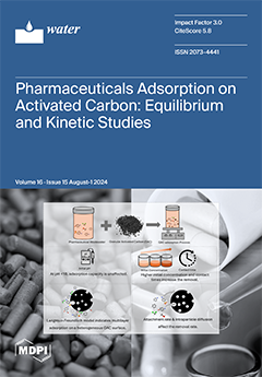
Cover Story (view full-size image): The demand for pharmaceuticals and personal care products (PPCPs) has increased wastewater from manufacturing facilities due to higher production volumes, stringent cleaning protocols, and facility expansions. This wastewater contains volatile organic compounds, aromatic amines, and sulfa drugs, posing health risks. Activated carbon removes PPCPs due to its high adsorption capacity, eliminating pharmaceuticals without generating toxic by-products. This study investigates the adsorption of pharmaceuticals using granular activated carbon, assessing total organic carbon reduction. By applying various isotherm and kinetic models to multicomponent wastewater under batch conditions, the study reveals adsorption mechanisms and offers practical insights for efficient contaminant removal. View this paper
  • Issues are regarded as officially published after their release is announced to the table of contents alert mailing list.
  • You may sign up for e-mail alerts to receive table of contents of newly released issues.
  • PDF is the official format for papers published in both, html and pdf forms. To view the papers in pdf format, click on the "PDF Full-text" link, and use the free Adobe Reader to open them.
Order results
Result details
Section
Select all
Export citation of selected articles as:
14 pages, 5415 KiB  
Article
Improving Knowledge and Awareness and Contributing to Policy Making on River Pressures through a Citizen Science Approach: Tagus Web Viewer Case (Spain)
by Beatriz Larraz, Raúl Urquiaga, Antonio Martínez and Beatriz Martín
Water 2024, 16(15), 2214; https://doi.org/10.3390/w16152214 - 5 Aug 2024
Viewed by 1131
Abstract
Citizen science is considered one of the most appropriate tools to raise public awareness of environmental issues. With the aim of improving knowledge on river environments, this article presents a web application for mobile phones and other portable devices that allows, through the [...] Read more.
Citizen science is considered one of the most appropriate tools to raise public awareness of environmental issues. With the aim of improving knowledge on river environments, this article presents a web application for mobile phones and other portable devices that allows, through the active participation of society, the collection of detailed and systematic information on the main problems facing rivers. The initiative uses a web viewer (Tagus Web Viewer—TagusWV) developed as a pilot project in the Tagus River basin (Spain). This web viewer allows information on river pressures to be collected and the aggregated data to be visualised and extracted for interpretation and analysis. Pressure is defined as any use or activity, legal/illegal, authorised/unauthorised, that has an impact on water quality, morphology, river dynamics or the ecosystem. The data are mainly collected by different groups of citizens. In addition to contributing to the environmental education of citizens involved in a river environment, the data provided in the TagusWV are of particular interest to river managers. The tool is designed to be relevant for any river basin in the world, by simply loading the map, the names of the rivers and the corresponding locations. Full article
Show Figures

Figure 1

13 pages, 2378 KiB  
Article
Analysis of the Role of Aquatic Gases in the Formation of Sea-Ice Porosity
by Vadim K. Goncharov and Natalia Yu. Klementieva
Water 2024, 16(15), 2213; https://doi.org/10.3390/w16152213 - 5 Aug 2024
Viewed by 833
Abstract
The porosity of freshwater ice and sea ice is one of the main parameters that determine their strength. The strength of ice varies over a wide range of values, and the differences in the intensity of the mechanisms of ice porosity formation in [...] Read more.
The porosity of freshwater ice and sea ice is one of the main parameters that determine their strength. The strength of ice varies over a wide range of values, and the differences in the intensity of the mechanisms of ice porosity formation in different water areas can be one of the possible reasons for these variations. The water mass contains gases in two forms: gases dissolved in the water mass, as well as gas bubbles that are formed when wind waves break up, and bubbles that float up from the seabed. This article presents the results of an analysis of the role of each of these forms in the formation of gas inclusions (pores) in the crystal structure of ice. The results showed that the main source of gas pores in ice crystals is the gas bubbles coming to the surface from the bottom, formed during the decomposition of bottom sediments or during gas leaks from near-bottom oil and gas fields. The possibility of gas bubbles occurring and rising to the ice–water boundary depends on the presence of bottom sources of the gases, the intensity of dissolution of the bubbles and the depth of the water area. Therefore, the variation in the porosity and the strength of ice over the space of the water areas can be associated with the changes in their depths, and the presence and location of the natural gas sources. Full article
Show Figures

Figure 1

21 pages, 12487 KiB  
Article
The Impact of Foreshore Slope on Cross-Shore Sediment Transport and Sandbar Formation in Beach Berm Nourishment
by Xinglu Liu, Xiaofeng Luo, Chuanteng Lu, Gongjin Zhang and Wei Ding
Water 2024, 16(15), 2212; https://doi.org/10.3390/w16152212 - 5 Aug 2024
Viewed by 1074
Abstract
Foreshore slope is crucial in designing beach berm nourishment schemes and understanding coastal responses to wave forces. Beach berm nourishment often suffers from a high loss rate, necessitating theoretical research and design parameter comparison to mitigate these losses early on. This study uses [...] Read more.
Foreshore slope is crucial in designing beach berm nourishment schemes and understanding coastal responses to wave forces. Beach berm nourishment often suffers from a high loss rate, necessitating theoretical research and design parameter comparison to mitigate these losses early on. This study uses Bagnold’s energy conservation method and the small-angle approximation method to establish a relationship between cross-shore sediment transport and foreshore slope. The feedback mechanism between these factors shows that when the foreshore slope is fewer than 10 degrees, a smaller initial slope results in a reduced rate of sediment transport. Over time, the foreshore slope decreases and eventually reaches equilibrium, promoting the formation of an offshore sandbar, which helps reduce sediment loss. Using data from Guanhu Beach in Dapeng Bay, this study constructs a realistic numerical beach model to simulate the dynamic behavior of beach profiles with varying foreshore slopes under the influence of monsoon waves and storm surges. The simulation results support the feedback mechanism findings, demonstrating that profiles with minimal foreshore slopes experience the least initial sediment loss, thus facilitating sandbar formation more effectively. These insights can inform beach berm nourishment strategies, emphasizing early-stage efforts to expand beach areas and reduce sediment loss. Full article
Show Figures

Figure 1

21 pages, 6213 KiB  
Article
Multifactor Mathematical Modeling and Analysis of the Impact of Extreme Climate on Geological Disasters
by Xiaoyu Yang, Xiaohui Sun and Li Tang
Water 2024, 16(15), 2211; https://doi.org/10.3390/w16152211 - 5 Aug 2024
Viewed by 841
Abstract
Objective: To investigate the impact of extreme climate on geological disasters in Shanxi and propose effective disaster prevention and mitigation strategies. Methods: Using daily temperature and precipitation data from 27 meteorological stations in Shanxi Province from 1975 to 2020, 32 extreme climate indices [...] Read more.
Objective: To investigate the impact of extreme climate on geological disasters in Shanxi and propose effective disaster prevention and mitigation strategies. Methods: Using daily temperature and precipitation data from 27 meteorological stations in Shanxi Province from 1975 to 2020, 32 extreme climate indices were calculated. Combined with geological disaster site data, the distribution characteristics of extreme climates and their relationship with geological disasters were analyzed, and a regression model for geological disaster risk zones was constructed. Results: Sixteen extreme climate indices in Shanxi Province showed significant changes, especially TMAXmean (100% significant). Indices related to negative precipitation effects showed a declining trend, with 77.78% being significant, while 96.3% of positive temperature effect indices showed an increasing trend, with 73.6% being significant. Geological disaster hotspots were concentrated in the mid-altitude (500–1500 m) hilly and low mountain areas along the central north–south axis and on Q and Pz strata. Extreme high-temperature indices were significantly positively correlated with geological disaster hotspots, while extreme low-temperature indices were negatively correlated. Indices related to extreme heavy precipitation (e.g., R99p.Slope, RX5day.Slope) were associated with an increase in geological disaster hotspots, whereas higher total precipitation and frequent heavy precipitation events were associated with a decrease in disaster hotspots. The grey relational degree between the Z-score and TXn.Slope, TXx.Slope, GSL.Slope, and TX90P.Slope was greater than 0.8. The random forest model performed best in evaluation metrics such as MAE, RMSE, and R2. Conclusions: Shanxi is likely to experience more extreme high-temperature and precipitation events in the future. The low-altitude hilly and terraced areas in Zones III and VII are key regions for geological disaster prevention and control. High temperatures and extreme rainfall events generally increase the disaster risk, while higher total precipitation reduces it. The random forest model is the optimal tool for predicting geological disaster risks in Shanxi Province. Full article
Show Figures

Figure 1

27 pages, 8869 KiB  
Article
Finite Element Method-Peridynamics Coupled Analysis of Slope Stability Affected by Rainfall Erosion
by Xin Gu, Laike Song, Xiaozhou Xia and Cheng Yu
Water 2024, 16(15), 2210; https://doi.org/10.3390/w16152210 - 5 Aug 2024
Viewed by 1026
Abstract
Rainfall is a pivotal factor resulting in the cause of slope instability. The traditional finite element method often fails to converge when dealing with the strongly nonlinear fluid–solid coupling problems, making it impossible to fully analyze the sliding process under the state of [...] Read more.
Rainfall is a pivotal factor resulting in the cause of slope instability. The traditional finite element method often fails to converge when dealing with the strongly nonlinear fluid–solid coupling problems, making it impossible to fully analyze the sliding process under the state of slope instability. Therefore, this paper uses the coupling of peridynamics (PD) and the finite element method (FEM) to propose a data exchange mode between the seepage field and the deformation field. The influencing factors of fine particle erosion during rainfall are further considered. According to the damage mechanism of the slope sliding process to the original structure of the soil, a modified erosion constitutive relationship is proposed, which takes into account the destructive effect of plastic deformation on coarse particles. Then, the influence of rainfall duration, rainfall intensity, erosion, and initial saturated permeability coefficient on slope stability was simulated and analyzed. This paper provides a novel concept for slope stability analysis and safety evaluation under rainfall conditions. Full article
(This article belongs to the Section Soil and Water)
Show Figures

Figure 1

14 pages, 3414 KiB  
Article
Trimethoprim Removal from Aqueous Solutions via Volcanic Ash-Soil Adsorption: Process Modeling and Optimization
by Roberto Lavecchia, Antonio Zuorro, Oussama Baaloudj and Monica Brienza
Water 2024, 16(15), 2209; https://doi.org/10.3390/w16152209 - 5 Aug 2024
Viewed by 1198
Abstract
Antibiotic contamination of water sources is a significant environmental and public health concern. This contamination is classified among the most dangerous types of pollution currently because of their harmful effects. Therefore, it is essential to identify effective and environmentally friendly ways to deal [...] Read more.
Antibiotic contamination of water sources is a significant environmental and public health concern. This contamination is classified among the most dangerous types of pollution currently because of their harmful effects. Therefore, it is essential to identify effective and environmentally friendly ways to deal with those dangerous compounds. Within this context, this work looked into whether soils made from volcanic ash could be used as cost-effective adsorbents to remove the antibiotic trimethoprim (TRM) from aqueous solutions. To examine the impacts of the main operating parameters on TRM removal, which are the initial antibiotic concentration (C), contact time (t), stirring speed (S), and solid-to-liquid ratio (R), a Central Composite Design (CCD) based on the Response Surface Methodology (RSM) was employed. Full quadratic polynomial models were used to correlate the experimental data, allowing for the estimation of each factor’s influence. With a predicted removal efficiency of 77.59%, the removal process optimization yielded the following set of optimal conditions: C = 4.5 mg/L, t = 45.5 min, S = 747 rpm, and R = 0.04 g/mL. Experiments conducted under predicted ideal conditions supported both the result and the previously developed model’s capacity for prediction. Additionally, the adsorption mechanism was also proposed based on the characterization of the adsorbent before and after the treatment. The study’s findings provide the possibility of using soils formed from volcanic ash as a cost-effective adsorbent material for the removal of TRM and likely other similar pollutants from contaminated waters. Full article
(This article belongs to the Section Wastewater Treatment and Reuse)
Show Figures

Graphical abstract

19 pages, 7451 KiB  
Article
Phosphorus Fraction in Hydrochar from Co-Hydrothermal Carbonization of Swine Manure and Rice Straw: An Optimization Analysis Based on Response Surface Methodology
by Xiaohua Su, Tao Zhang, Jingyang Zhao, Santanu Mukherjee, Nahaa M. Alotaibi, Salah F. Abou-Elwafa, Huu-Tuan Tran and Nanthi S. Bolan
Water 2024, 16(15), 2208; https://doi.org/10.3390/w16152208 - 4 Aug 2024
Cited by 1 | Viewed by 1235
Abstract
Livestock manure and crop residues are significant sources of phosphorus. However, the ineffectiveness of current processing technologies often leads to the suboptimal recovery of this phosphorus, causing considerable resource wastage and environmental pollution. Recently, global research has increasingly been focused on the resource [...] Read more.
Livestock manure and crop residues are significant sources of phosphorus. However, the ineffectiveness of current processing technologies often leads to the suboptimal recovery of this phosphorus, causing considerable resource wastage and environmental pollution. Recently, global research has increasingly been focused on the resource recovery of organic waste materials using hydrothermal carbonization technology. This study investigated variations in phosphorus forms in the hydrochar produced from swine manure and rice straw, employing diverse hydrothermal carbonization conditions and applying the Box–Behnken response surface methodology and Hedley’s phosphorus fractionation method. The results indicated that inorganic phosphorus predominates in the hydrochar, with organic phosphorus comprising 5–30% of the total phosphorus. Furthermore, the study found that the available phosphorus content, as measured by NaHCO3 extraction, decreased as the reaction time and temperature of the hydrothermal carbonization process increased. The concentrations of H2O-P and NaHCO3-P fractions decreased with increasing reaction times and temperatures but increased with a higher swine manure-to-straw ratio. Conversely, the concentrations of NaOH-P and HCl-P fractions showed an increasing trend with rising reaction temperature, prolonging reaction time, andusing a high swine manure-to-straw ratio. Consequently, this study offers vital theoretical and practical insights into the resource utilization of livestock manure and crop straw, significantly contributing to the challenges of waste management and environmental sustainability in agriculture. Full article
Show Figures

Figure 1

20 pages, 6228 KiB  
Article
Evaluation of Future Changes in Climate Extremes over Southeast Asia Using Downscaled CMIP6 GCM Projections
by Sophal Try and Xiaosheng Qin
Water 2024, 16(15), 2207; https://doi.org/10.3390/w16152207 - 4 Aug 2024
Cited by 1 | Viewed by 2026
Abstract
This study presented an assessment of climate extremes in the Southeast Asia (SEA) region, utilizing downscaled climate projections from the Coupled Model Intercomparison Project Phase 6 (CMIP6) Global Climate Models (GCMs). The study outputs uncovered statistically significant trends indicating a rise in extreme [...] Read more.
This study presented an assessment of climate extremes in the Southeast Asia (SEA) region, utilizing downscaled climate projections from the Coupled Model Intercomparison Project Phase 6 (CMIP6) Global Climate Models (GCMs). The study outputs uncovered statistically significant trends indicating a rise in extreme precipitation and temperature events throughout SEA for both the near-term (2021–2060) and long-term (2061–2100) future under both SSP245 and SSP585 scenarios, in comparison to the historical period (1950–2014). Moreover, we investigated the seasonal fluctuations in rainfall and temperature distributions, accentuating the occurrence of drier dry seasons and wetter rainy seasons in particular geographic areas. The focused examination of seven prominent cities in SEA underscored the escalating frequency of extreme rainfall events and rising temperatures, heightening the urban vulnerability to urban flooding and heatwaves. This study’s findings enhance our comprehension of potential climate extremes in SEA, providing valuable insights to inform climate adaptation, mitigation strategies, and natural disaster preparedness efforts within the region. Full article
(This article belongs to the Special Issue Analysis of Extreme Precipitation Under Climate Change)
Show Figures

Figure 1

18 pages, 1133 KiB  
Review
A Review of Drip Irrigation’s Effect on Water, Carbon Fluxes, and Crop Growth in Farmland
by Hui Guo and Sien Li
Water 2024, 16(15), 2206; https://doi.org/10.3390/w16152206 - 4 Aug 2024
Cited by 3 | Viewed by 2973
Abstract
The substantial depletion of freshwater reserves in many pivotal agricultural regions, attributable to the dual pressures of global climate change and the excessive extraction of water resources, has sparked considerable apprehension regarding the sustainability of future food and water security. Drip irrigation, as [...] Read more.
The substantial depletion of freshwater reserves in many pivotal agricultural regions, attributable to the dual pressures of global climate change and the excessive extraction of water resources, has sparked considerable apprehension regarding the sustainability of future food and water security. Drip irrigation, as an efficient and precise irrigation method, reduces water loss caused by deep percolation, soil evaporation, and runoff by controlling the irrigation dosage and frequency, thus improving the efficiency of water resource utilization. Studies have shown that compared with traditional irrigation methods, drip irrigation can significantly decrease water consumption, optimize the water–energy relationship by reducing soil evaporation, increase the leaf area index, and promote crop growth, thereby enhancing plant transpiration. Although more wet and dry soil cycles from drip irrigation may increase soil CO2 emissions, it also enhances crop photosynthesis and improves crop net ecosystem productivity (NEP) by creating more favorable soil moisture conditions, indicating greater carbon sequestration potential. The advantages of drip irrigation, such as a short irrigation cycle, moderate soil moisture, and obvious dry and wet interfaces, can improve a crop’s leaf area index and biomass accumulation, improve root dynamics, promote the distribution of photosynthetic products to the aboveground parts, and thus enhance crop yields. This study highlights the potential for the application of drip irrigation in arid regions where resource optimization is sought, providing strong technical support for the achievement of sustainable agricultural development. Future research needs to consider specific agricultural practices, soil types, and environmental conditions to further optimize the implementation and effectiveness of drip irrigation. Full article
Show Figures

Figure 1

23 pages, 4096 KiB  
Article
Impact of Design and Mixing Strategies on Biogas Production in Anaerobic Digesters
by Thomas Neuner, Michael Meister, Martin Pillei, Thomas Senfter, Simon Draxl-Weiskopf, Christian Ebner, Jacqueline Winkler and Wolfgang Rauch
Water 2024, 16(15), 2205; https://doi.org/10.3390/w16152205 - 4 Aug 2024
Viewed by 1539
Abstract
Anaerobic digestion (AD) is a biological process that breaks down organic matter in the absence of oxygen, producing biogas and nutrient-rich digestate. Various reactor designs and mixing strategies are well-established in AD processes, each with their own advantages and benefits. The presented study [...] Read more.
Anaerobic digestion (AD) is a biological process that breaks down organic matter in the absence of oxygen, producing biogas and nutrient-rich digestate. Various reactor designs and mixing strategies are well-established in AD processes, each with their own advantages and benefits. The presented study summarizes and investigates the state of the art of AD in domestic wastewater treatment plants (WWTPs) in an Austrian alpine region, with a primary focus on finding similarities among the most efficient plants regarding digester design, mixing approaches, and biogas production. By combining surveys and detailed field studies in cooperation with 34 WWTPs, the study provides a comprehensive overview of common AD practices, reactor shapes, and inherent mixing methods, highlighting their potential regarding energetic efficiency and biogas production. The results of the survey reveal qualitative trends in efficient AD design alongside detailed quantitative data derived from the supervised in-field optimization studies. Notably, one of the studies demonstrated energetic savings of 52% with no decrease in biogas production, achieved by transitioning from gas injection to mechanical agitation. Redundant impeller-based overmixing was also practically investigated and demonstrated in another field study. After optimization, the adaptations also resulted in energy savings of 30%, still proving sufficient substrate mixing with biomethane potential analysis. In conclusion, this research emphasizes the economic and environmental importance of energy-refined practices and optimized processes while highlighting the sustainability of AD, particularly for large domestic WWTPs but also for different comparable applications. Full article
(This article belongs to the Special Issue Water Quality Engineering and Wastewater Treatment III)
Show Figures

Figure 1

27 pages, 11768 KiB  
Article
Evaluating Empirical, Field, and Laboratory Approaches for Estimating the Hydraulic Conductivity in the Kabul Aquifer
by Alimahdi Mohammaddost, Zargham Mohammadi, Javad Hussainzadeh, Asadullah Farahmand, Vianney Sivelle and David Labat
Water 2024, 16(15), 2204; https://doi.org/10.3390/w16152204 - 3 Aug 2024
Viewed by 1307
Abstract
The evaluation of saturated hydraulic conductivity (Ks) constitutes an invaluable tool for the management and protection of groundwater resources. This study attempted to estimate Ks in the shallow aquifer of Kabul City, Afghanistan, in response to the occurring groundwater crisis caused by overexploitation [...] Read more.
The evaluation of saturated hydraulic conductivity (Ks) constitutes an invaluable tool for the management and protection of groundwater resources. This study attempted to estimate Ks in the shallow aquifer of Kabul City, Afghanistan, in response to the occurring groundwater crisis caused by overexploitation and a lack of an appropriate monitoring system on pumping wells, based on datasets from well drilling logs, various analytical methods for pumping test analyses, and laboratory-based methodologies. The selection of Ks estimation methods was influenced by data availability and various established equations, including Theis, developed by Cooper–Jacob, Kruger, Zamarin, Zunker, Sauerbrei, and Chapuis, and pre-determined Ks values dedicated to well log segments exhibited the highest correlation coefficients, ranging between 60% and 75%, with the real conditions of the phreatic aquifer system with respect to the drawdown rate map. The results successfully obtained local-specific quantitative Ks value ranges for gravel, sand, silt, clay, and conglomerate. The obtained results fall within the high range of Ks classification, ranging from 30.0 to 139.8 m per day (m/d) on average across various calculation methods. This study proved that the combination of pumping test results, predetermined values derived from empirical and laboratory approaches, geological description, and classified soil materials and analyses constitutes reliable Ks values through cost-effective and accessible results compared with conducting expensive tests in arid and semi-arid areas. Full article
(This article belongs to the Section Hydrogeology)
Show Figures

Figure 1

22 pages, 9734 KiB  
Article
Implications of Water Quality Index and Multivariate Statistics for Improved Environmental Regulation in the Irtysh River Basin (Kazakhstan)
by Ultuar Zhalmagambetova, Daulet Assanov, Alexandr Neftissov, Andrii Biloshchytskyi and Ivan Radelyuk
Water 2024, 16(15), 2203; https://doi.org/10.3390/w16152203 - 2 Aug 2024
Viewed by 1393
Abstract
The selection of sites for permanent environmental monitoring of natural water bodies should rely on corresponding source apportionment studies. Tools like the water quality index (WQI) assessment may support this objective. This study aims to analyze a decade-long dataset of measurements of 26 [...] Read more.
The selection of sites for permanent environmental monitoring of natural water bodies should rely on corresponding source apportionment studies. Tools like the water quality index (WQI) assessment may support this objective. This study aims to analyze a decade-long dataset of measurements of 26 chemical components at 26 observation points within the Irtysh River Basin, aiming to identify priority zones for stricter environmental regulations. It was achieved through the WQI tool integrated with geoinformation systems (GISs) and multivariate statistical techniques. The findings highlighted that both upstream sections of tributaries (Oba and Bukhtarma rivers) and the mainstream of the basin are generally in good condition, with slight fluctuations observed during flooding periods. Areas in the basin experiencing significant impacts from mining and domestic wastewater treatment activities were identified. The rivers Glubochanka (GL) and Krasnoyarka (KR) consistently experienced marginal water quality throughout the observation period. Various contaminant sources were found to influence water quality. The impact of domestic wastewater treatment facilities was represented by twofold elevated concentrations of chemical oxygen demand, reaching 22.6 and 27.1 mg/L for the KR and GL rivers, respectively. Natural factors were indicated by consistent slight exceedings of recommended calcium levels at the KR and GL rivers. These exceedances were most pronounced during the cold seasons, with an average value equal to 96 mg/L. Mining operations introduced extremal concentrations of trace elements like copper, reaching 0.046–0.051 mg/L, which is higher than the threshold by 12–13 times; zinc, which peaked at 1.57–2.96 mg/L, exceeding the set limit by almost 50–100 times; and cadmium, peaking at levels surpassing 1000 times the safe limit, reaching 0.8 mg/L. The adverse impact of mining activities was evident in the Tikhaya, Ulba, and Breksa rivers, showing similar trends in trace element concentrations. Seasonal effects were also investigated. Ice cover formation during cold seasons led to oxygen depletion and the exclusion of pollutants into the stream when ice melted, worsening water quality. Conversely, flooding events led to contaminant dilution, partially improving the WQI during flood seasons. Principal component analysis and hierarchical cluster analysis indicated that local natural processes, mining activities, and domestic wastewater discharge were the predominant influences on water quality within the study area. These findings can serve as a basis for enhanced environmental regulation in light of updated ecological legislation in Kazakhstan, advocating for the establishment of a comprehensive monitoring network and the reinforcement of requirements governing contaminating activities. Full article
(This article belongs to the Section Water Quality and Contamination)
Show Figures

Figure 1

15 pages, 6394 KiB  
Article
Toxic Congo Red Dye Photodegradation Employing Green Synthesis of Zinc Oxide Nanoparticles Using Gum Arabic
by Huda S. Alhasan, Alaa R. Omran, Abdullah Al Mahmud, Amr Hussein Mady and Mohammad R. Thalji
Water 2024, 16(15), 2202; https://doi.org/10.3390/w16152202 - 2 Aug 2024
Cited by 2 | Viewed by 1185
Abstract
A green synthesis method for producing zinc oxide nanoparticles (ZnO NPs) was presented using natural Gum Arabic (GA) as a natural stabilizing agent. For the first time, the as-synthesized ZnO NPs were employed to photodegrade the toxic Congo Red (CR) dye in an [...] Read more.
A green synthesis method for producing zinc oxide nanoparticles (ZnO NPs) was presented using natural Gum Arabic (GA) as a natural stabilizing agent. For the first time, the as-synthesized ZnO NPs were employed to photodegrade the toxic Congo Red (CR) dye in an aqueous solution. The structural and morphological characterizations confirmed the successful synthesis of ZnO NPs. The ZnO NPs possessed an average crystallite size of 42.7 nm. In addition, it was found that a concentration of 20 mg L−1 of CR dye yielded the most favorable photodegradation results, and 4 mg mL−1 of the photocatalyst was the optimal amount. The results showed a maximum degradation percentage of 99.5% at pH 8 after 30 min of irradiation. This indicates that the as-synthesized ZnO NPs have remarkable photocatalytic properties. Moreover, the study demonstrated the suitability of the pseudo-first-order kinetic model for representing the photodegradation process through kinetic studies of the photocatalyst process of CR dye by ZnO NPs using the Langmuir-Hinshelwood (L-H) model. Full article
Show Figures

Graphical abstract

22 pages, 3913 KiB  
Article
Flood Extent Delineation and Exposure Assessment in Senegal Using the Google Earth Engine: The 2022 Event
by Bocar Sy, Fatoumata Bineta Bah and Hy Dao
Water 2024, 16(15), 2201; https://doi.org/10.3390/w16152201 - 2 Aug 2024
Viewed by 1497
Abstract
This study addresses the pressing need for flood extent and exposure information in data-scarce and vulnerable regions, with a specific focus on West Africa, particularly Senegal. Leveraging the Google Earth Engine (GEE) platform and integrating data from the Sentinel-1 SAR, Global Surface Water, [...] Read more.
This study addresses the pressing need for flood extent and exposure information in data-scarce and vulnerable regions, with a specific focus on West Africa, particularly Senegal. Leveraging the Google Earth Engine (GEE) platform and integrating data from the Sentinel-1 SAR, Global Surface Water, HydroSHEDS, the Global Human Settlement Layer, and MODIS land cover type, our primary objective is to delineate the extent of flooding and compare this with flooding for a one-in-a-hundred-year flood event, offering a comprehensive assessment of exposure during the period from July to October 2022 across Senegal’s 14 regions. The findings underscore a total inundation area of 2951 square kilometers, impacting 782,681 people, 238 square kilometers of urbanized area, and 21 square kilometers of farmland. Notably, August witnessed the largest flood extent, reaching 780 square kilometers, accounting for 0.40% of the country’s land area. Other regions, including Saint-Louis, Ziguinchor, Fatick, and Matam, experienced varying extents of flooding, with the data for August showing a 1.34% overlap with flooding for a one-in-a-hundred-year flood event derived from hydrological and hydraulic modeling. This low percentage reveals the distinct purpose and nature of the two approaches (remote sensing and modeling), as well as their complementarity. In terms of flood exposure, October emerges as the most critical month, affecting 281,406 people (1.56% of the population). The Dakar, Diourbel, Thiès, and Saint-Louis regions bore substantial impacts, affecting 437,025; 171,537; 115,552; and 77,501 people, respectively. These findings emphasize the imperative for comprehensive disaster preparation and mitigation efforts. This study provides a crucial national-scale perspective to guide Senegal’s authorities in formulating effective flood management, intervention, and adaptation strategies. Full article
Show Figures

Graphical abstract

14 pages, 4131 KiB  
Article
Multi-Objective Optimization of Urban Drainage System by Integrating Rule-Based Control with Permeable Pavement
by Zhengsheng Lu, Liming Shi, Hong Zhou and Jun Liu
Water 2024, 16(15), 2200; https://doi.org/10.3390/w16152200 - 2 Aug 2024
Viewed by 1021
Abstract
This study integrated rule-based control (RBC) and permeable pavements to assess the combined effectiveness in reducing the combined sewer overflow (CSO) and energy consumption of the urban drainage system (UDS). Non-dominated sorting was employed to identify the optimal RBC preset parameters under varying [...] Read more.
This study integrated rule-based control (RBC) and permeable pavements to assess the combined effectiveness in reducing the combined sewer overflow (CSO) and energy consumption of the urban drainage system (UDS). Non-dominated sorting was employed to identify the optimal RBC preset parameters under varying rainfall intensities and permeable pavement installation proportion. Cost-effectiveness was calculated for different RBC parameters and permeable pavement installation scenarios. The contribution of installing permeable pavements in each sub-catchment to the cost-effectiveness was quantified using frequency statistics. The combined effectiveness of the RBC and LID achieved maximum reduction rates of 51.12% to 72.46% in the CSO volume and 14.75% to 33.89% in energy consumption across return periods from 2-year to 20-year. The key findings were as follows: (1) Optimization of the RBC preset parameters can reduce the CSO volume and energy consumption, but the effectiveness is limited by the capacity of the UDS. (2) In the UDS, the permeable pavement installation area and return periods of design rainfall significantly impact the optimization of RBC. (3) The impact of the RBC parameters on the cost-effectiveness of installing permeable pavements in each sub-catchment is minimal. (4) The cost-effectiveness of installing permeable pavement varies across different sub-catchments. Full article
(This article belongs to the Special Issue Water-Sensitive and Sustainable Urban Development)
Show Figures

Figure 1

24 pages, 2913 KiB  
Article
Applying Machine Learning Methods to Improve Rainfall–Runoff Modeling in Subtropical River Basins
by Haoyuan Yu and Qichun Yang
Water 2024, 16(15), 2199; https://doi.org/10.3390/w16152199 - 2 Aug 2024
Cited by 2 | Viewed by 1101
Abstract
Machine learning models’ performance in simulating monthly rainfall–runoff in subtropical regions has not been sufficiently investigated. In this study, we evaluate the performance of six widely used machine learning models, including Long Short-Term Memory Networks (LSTMs), Support Vector Machines (SVMs), Gaussian Process Regression [...] Read more.
Machine learning models’ performance in simulating monthly rainfall–runoff in subtropical regions has not been sufficiently investigated. In this study, we evaluate the performance of six widely used machine learning models, including Long Short-Term Memory Networks (LSTMs), Support Vector Machines (SVMs), Gaussian Process Regression (GPR), LASSO Regression (LR), Extreme Gradient Boosting (XGB), and the Light Gradient Boosting Machine (LGBM), against a rainfall–runoff model (WAPABA model) in simulating monthly streamflow across three subtropical sub-basins of the Pearl River Basin (PRB). The results indicate that LSTM generally demonstrates superior capability in simulating monthly streamflow than the other five machine learning models. Using the streamflow of the previous month as an input variable improves the performance of all the machine learning models. When compared with the WAPABA model, LSTM demonstrates better performance in two of the three sub-basins. For simulations in wet seasons, LSTM shows slightly better performance than the WAPABA model. Overall, this study confirms the suitability of machine learning methods in rainfall–runoff modeling at the monthly scale in subtropical basins and proposes an effective strategy for improving their performance. Full article
Show Figures

Figure 1

23 pages, 2655 KiB  
Article
Wastewater Treatment for Nutrients and Pathogens in a Demonstration-Scale Outdoor Constructed Wetland System
by Syed I. Hussain, David W. Blowes, Carol J. Ptacek, Brent C. Wootton, Gordon Balch and James Higgins
Water 2024, 16(15), 2198; https://doi.org/10.3390/w16152198 - 2 Aug 2024
Viewed by 1011
Abstract
A demonstration-scale outdoor constructed wetland (CW) wastewater treatment system was evaluated for about two years for its effectiveness in treating septic system effluents. The system included three treatment cells: an anaerobic cell, an aerated cell, and a basic oxygen furnace slag (BOFS)-based phosphorus [...] Read more.
A demonstration-scale outdoor constructed wetland (CW) wastewater treatment system was evaluated for about two years for its effectiveness in treating septic system effluents. The system included three treatment cells: an anaerobic cell, an aerated cell, and a basic oxygen furnace slag (BOFS)-based phosphorus (P) treatment cell. High removal efficiencies were achieved, with reductions of >99% for PO4-P, >83% for NH3-N, >99% for cBOD5, and >76% for COD, with influent concentrations averaging 6, 48, 63, and 143 mg L−1, respectively. Additionally, pathogens removal were high, with an over 99% decrease in E. coli and total coliform levels. The BOFS cell was critical, elevating effluent pH to 10.9 ± 1.5, which effectively inactivated pathogens. Environmental safety before discharge was ensured by CO2(g) sparging to adjust the pH and a zero-valent iron layer in the BOFS cell to control dissolved metal concentrations. Analytical techniques (FESEM-EDX, FTIR, and XANES) confirmed the formation of Ca carbonate and Ca phosphate on spent BOFS, highlighting their role in the treatment process. This study highlights the potential of integrating complementary technologies in constructed wetlands for sustainable and efficient wastewater management. Full article
(This article belongs to the Special Issue Wastewater Treatment Technologies: Theory, Methods and Applications)
Show Figures

Figure 1

20 pages, 3057 KiB  
Review
Carbon Capture and Resource Utilization by Algal–Bacterial Consortium in Wastewater Treatment: A Mini-Review
by Ting Yu, Siya Wang, Hui Yang, Yuxin Sun, Zhongtai Chen, Guangjing Xu and Cuiya Zhang
Water 2024, 16(15), 2197; https://doi.org/10.3390/w16152197 - 2 Aug 2024
Viewed by 1894
Abstract
This review critically evaluates the algal–bacterial consortium (ABC) as a promising technology for wastewater treatment, carbon capture and storage, while also assessing its challenges and opportunities. The ABC system, characterized by the coupling of algae and bacteria, not only removes pollutants and reclaims [...] Read more.
This review critically evaluates the algal–bacterial consortium (ABC) as a promising technology for wastewater treatment, carbon capture and storage, while also assessing its challenges and opportunities. The ABC system, characterized by the coupling of algae and bacteria, not only removes pollutants and reclaims resources but also helps in reducing greenhouse gas emissions. This system harnesses algal photosynthesis and bacterial degradation of organic matters to establish a carbon cycle, enhancing biomass production and pollutant removal. Despite its promise, the ABC process is subject to several hurdles, including sensitivity to low temperatures, reliance on artificial illumination, and the potential for algal biomass contamination by toxic substances. To capitalize on its full potential, continued research and technological advancements are imperative. Future investigations should focus on optimizing the system’s operational efficiency, developing precise process models, exploring avenues for resource recovery, and broadening the scope of its applications. By surmounting these challenges, the ABC system has the capacity to make a significant impact on sustainable wastewater management and carbon fixation. Full article
(This article belongs to the Section Wastewater Treatment and Reuse)
Show Figures

Figure 1

15 pages, 2319 KiB  
Article
Water Quality in Estero Salado of Guayaquil Using Three-Way Multivariate Methods of the STATIS Family
by Ana Grijalva-Endara, Juan Diego Valenzuela-Cobos, Fabricio Guevara-Viejó, Patricia Antonieta Macías Mora, Jorge Stalin Quichimbo Moran, Geovanny Ruiz-Muñoz, Purificación Galindo-Villardón and Purificación Vicente-Galindo
Water 2024, 16(15), 2196; https://doi.org/10.3390/w16152196 - 2 Aug 2024
Viewed by 994
Abstract
Water property parameters were analyzed over 9 months across six stations within the Estero Salado. The parameters under evaluation included nitrite (NO2), nitrate (NO3), phosphate (PO43−), ammonium (NH4+ [...] Read more.
Water property parameters were analyzed over 9 months across six stations within the Estero Salado. The parameters under evaluation included nitrite (NO2), nitrate (NO3), phosphate (PO43−), ammonium (NH4+), temperature, pH, biochemical oxygen demand (BOD), conductivity, salinity, color, turbidity, suspended solids, hardness, and alkalinity. Additionally, the TRIX index (which measures chlorophyll, oxygen saturation, nitrogen, and phosphorus) was considered. The multivariate technique employed was partial triadic analysis (PTA), a specialized variant developed from STATIS, enabling the examination of the common structure’s stability across months and the positioning of stations and variables within a compromise space. This analysis elucidated a variability of 69% and 96%, respectively. Stations could be characterized based on their associations with specific variables, while the analysis also facilitated the identification of months impacting the common structure of pollution indicators. Full article
Show Figures

Figure 1

16 pages, 5857 KiB  
Article
Effect of In Situ Aeration on Ultrafiltration Membrane Fouling Control in Treating Seasonal High-Turbidity Surface Water
by Jiaoying Luo, Yating Hu, Xishou Guo, Ao Wang, Chenghai Lin, Yaru Zhang, Haochun Wang, Yanrui Wang and Xiaobin Tang
Water 2024, 16(15), 2195; https://doi.org/10.3390/w16152195 - 2 Aug 2024
Viewed by 1044
Abstract
Direct ultrafiltration (UF) is anticipated to be a promising technology for rural water supply due to its stable permeate quality and ease of automatic operation & maintenance. However, seasonal high turbidity in the surface water resources caused severe membrane fouling, resulting in the [...] Read more.
Direct ultrafiltration (UF) is anticipated to be a promising technology for rural water supply due to its stable permeate quality and ease of automatic operation & maintenance. However, seasonal high turbidity in the surface water resources caused severe membrane fouling, resulting in the requirement of frequent cleaning of the UF process, and limiting the broad application of the direct UF in treating rural surface water. To address this issue, this study investigated the feasibility and mechanism of in situ aeration in alleviating the UF membrane fouling in treating surface water with high turbidity (200, 500, and 800 NTU). The results indicated that with the weak aeration (0.4 m3/(m2·min)), the concentration of polysaccharides accumulated on the membrane surface was high, and serious membrane fouling was observed. With medium aeration (0.8 and 1.2 m3/(m2·min)), bubble shear force could effectively reduce the foulants accumulated on the membrane surface to alleviate the membrane fouling. During the whole experiment, the optimal group (1.2 m3/(m2·min)) showed a 45% lower TMP compared to the control. However, strong aeration (1.6 m3/(m2·min)) caused floc breakage and was less conducive to the membrane fouling control compared to the medium aeration. Furthermore, under in situ aeration, the contents of polysaccharide accumulated on the membrane surface and deposited in the membrane pores were reduced by 8.85%~49.29%, and the structures of the cake layer turned out to be porous and permeable, implying that in situ aeration could significantly modify the structure and composition of the cake layer, contributing to the UF membrane fouling control in treating the seasonal high-turbidity surface water. These findings will provide novel approaches for the application of UF technology in rural water supply. Full article
(This article belongs to the Special Issue Application of Membrane-Based Technology in Water Treatment)
Show Figures

Figure 1

17 pages, 1645 KiB  
Article
Study on the Effects of Irrigation Quotas and Amendments on Salinized Soil and Maize Growth
by Liang Chen, Shaoli Yue, Lifeng Sun, Ming Gao and Rui Wang
Water 2024, 16(15), 2194; https://doi.org/10.3390/w16152194 - 2 Aug 2024
Cited by 2 | Viewed by 975
Abstract
Salt damage affects crop yields and wastes limited water resources. Implementing water-saving and salt-controlling strategies along with amendments can enhance crop productivity and support the development of salinized soils towards. In this study, we used “Jia Liang 0987” maize as the test material, [...] Read more.
Salt damage affects crop yields and wastes limited water resources. Implementing water-saving and salt-controlling strategies along with amendments can enhance crop productivity and support the development of salinized soils towards. In this study, we used “Jia Liang 0987” maize as the test material, and a two-factor split block design was executed to investigate the effects of synergistic management of irrigation volume (W1: 360 mm, W2: 450 mm, and W3: 540 mm) and amendments (T1: microbial agent 816.33 kg·hm−2, T2: humic acid 6122.45 kg·hm−2, T3: microsilica powder 612.25 kg·hm−2) on water, salt and soil indices, and growth characteristics. The combination of 450 mm of irrigation with humic acid (W2T2) or with microsilica powder (W2T3) significantly lowered the groundwater level by 0.24 m and 0.19 m, respectively. The soil mineralization was significantly reduced by 2.60 g/L and 1.75 g/L with W2T2 and 540 mm of irrigation combined with humic acid (W3T2), respectively. The soil moisture content increased with depth and over time, showing the greatest improvement with W2T2. This combination also showed optimal results for pH and total salt, organic matter, available phosphorus, quick-acting potassium, Cl, and SO42− contents. W2T2 and W3T2 improved soil field capacity and HCO3 contents, and significantly increased total nitrogen and phosphorus content, improving the soil nutrient grade. W2T2 showed the greatest maize plant height (323.67 cm) and stem thickness (21.54 mm for diameter), enhancing above-ground dry biomass (72,985.49 kg·hm−2) and grain yield (14,646.57 kg·hm−2). Implementing water-saving and salt-controlling strategies with amendments effectively improved soil fertility and crop yield in salinized soils, and the amendments factor played a major role. In saline–alkali soils in the northwest of China, 450 mm of irrigation combined with humic acid is especially helpful for enhancing soil fertility and maize productivity. Full article
(This article belongs to the Special Issue Effects of Hydrology on Soil Erosion and Soil Conservation)
Show Figures

Figure 1

2 pages, 172 KiB  
Correction
Correction: Bănăduc et al. Multi-Interacting Natural and Anthropogenic Stressors on Freshwater Ecosystems: Their Current Status and Future Prospects for 21st Century. Water 2024, 16, 1483
by Doru Bănăduc, Angela Curtean-Bănăduc, Sophia Barinova, Verónica L. Lozano, Sergey Afanasyev, Tamara Leite, Paulo Branco, Daniel F. Gomez Isaza, Juergen Geist, Aristoteles Tegos, Snežana B. Simić, Horea Olosutean and Kevin Cianfanglione
Water 2024, 16(15), 2193; https://doi.org/10.3390/w16152193 - 2 Aug 2024
Viewed by 681
Abstract
In the original publication [...] Full article
17 pages, 5523 KiB  
Article
Construction Stability Analysis and Field Monitoring of Shallowly Buried Large-Section Tunnels in Loess Strata
by Fang Zheng, Wenqiang Li, Zhanping Song, Jiahui Wang, Yuwei Zhang, Naifei Liu, Kehui Xiao and Yan Wang
Water 2024, 16(15), 2192; https://doi.org/10.3390/w16152192 - 2 Aug 2024
Cited by 2 | Viewed by 956
Abstract
Reasonable excavation step footage and lining support timing are highly important for improving tunnel construction efficiency and ensuring construction safety. Taking the Huanxian No. 1 Tunnel of the Xi-Yin railway as the basis of this study, a 3D numerical model was established using [...] Read more.
Reasonable excavation step footage and lining support timing are highly important for improving tunnel construction efficiency and ensuring construction safety. Taking the Huanxian No. 1 Tunnel of the Xi-Yin railway as the basis of this study, a 3D numerical model was established using MIDAS GTS NX290 finite element software. This model was used to investigate the deformation and force characteristics of the tunnel-surrounding rock and support structures under three different excavation footages and four different lining construction timings; the numerical results were then compared with the on-site monitoring results. This research aimed to determine reasonable excavation parameters for the three-bench seven-step excavation method used in shallowly buried loess tunnels. The results revealed positive correlations between the excavation step footage and surface subsidence, crown subsidence, and clearance convergence. An excavation footage of 3 m could balance construction efficiency and safety effectively. Keeping the secondary lining construction time unchanged, the early closure of the initial support was beneficial for reducing the force on the secondary lining. Keeping the early closure time of the initial support unchanged, the early construction of the secondary lining would lead to an increase in the force on the secondary lining. The initial support of the tunnel is recommended to be closed as early as possible, and the construction of the secondary lining should be shifted by 21 m behind the upper step palm surface. By comparing the on-site monitoring data with the numerical simulation results, similar trends were observed, providing reference and guidance for the subsequent construction of large-section tunnels in shallowly buried loess formations. Full article
Show Figures

Figure 1

15 pages, 8921 KiB  
Article
Surface and Subsurface Water Impacts of Forestry and Grassland Land Use in Paired Watersheds: Electrical Resistivity Tomography and Water Balance Analysis
by Éricklis Edson Boito de Souza, Franciele de Bastos, Pedro Daniel da Cunha Kemerich, Marieli Machado Zago, Éderson Diniz Ebling, Elias Frank de Araujo, Antonio Celso Dantas Antonino and José Miguel Reichert
Water 2024, 16(15), 2191; https://doi.org/10.3390/w16152191 - 2 Aug 2024
Viewed by 910
Abstract
Global forest plantations are expanding, causing land-use changes and impacting the water cycle. This study assesses whether eucalyptus plantations reduce groundwater levels compared to grasslands in paired subtropical watersheds. The hydrological dynamics of surface and subsurface water were compared in three small watersheds [...] Read more.
Global forest plantations are expanding, causing land-use changes and impacting the water cycle. This study assesses whether eucalyptus plantations reduce groundwater levels compared to grasslands in paired subtropical watersheds. The hydrological dynamics of surface and subsurface water were compared in three small watersheds in southern Brazil, mainly occupied by Eucalyptus saligna (Es-W, 79.9 ha), Eucalyptus benthamii (Eb-W, 82.1 ha), and degraded anthropized natural grassland (G-W, 109.4 ha). Rainfall, flow, and piezometric levels were monitored. Runoff, evapotranspiration, and water balance in the soil profile were estimated, and the subsurface environment was characterized using electrical resistivity tomography. During higher accumulated rainfall, water surplus increased for all watersheds. In the wet period (accumulated rainfall of 1098.0 mm), evapotranspiration was higher for eucalyptus (624.3 mm for Eb-W and 512.5 mm for Es-W) than for the grassland watershed (299.5 mm), resulting in the highest runoff in G-W (649.6 mm). During the dry period (accumulated rainfall of 478.5 mm), water deficit and withdrawal were mainly observed in forested watersheds, decreasing groundwater. Combining water balance and electrical resistivity tomography estimations results in a better understanding of the hydrological dynamics in paired watersheds with different land uses. This information is useful for developing best-practice management strategies for sustainable water resource use and forest production. Full article
(This article belongs to the Special Issue Soil Dynamics and Water Resource Management)
Show Figures

Figure 1

17 pages, 3501 KiB  
Article
A Novel Flood Regional Composition Method for Design Flood Estimation in the Cascade Reservoirs
by Sirui Zhong, Shenglian Guo, Yanfeng He and Yuzuo Xie
Water 2024, 16(15), 2190; https://doi.org/10.3390/w16152190 - 2 Aug 2024
Viewed by 726
Abstract
The regulation of upstream cascade reservoirs has significantly altered the downstream hydrologic regime and should be taken into account in design flood estimation. The current flood regional composition (FRC) methods do not consider the unfavorable situations for reservoir flood control operation. In this [...] Read more.
The regulation of upstream cascade reservoirs has significantly altered the downstream hydrologic regime and should be taken into account in design flood estimation. The current flood regional composition (FRC) methods do not consider the unfavorable situations for reservoir flood control operation. In this paper, a novel framework, the most unfavorable flood regional composition (MUFRC) method, was proposed based on flood risk analysis to estimate design flood in the cascade reservoir operation period. The cascade reservoirs in the Yalong River basin were selected as a case study. The results indicated that (1) the proposed MUFRC method would allocate more flood volume to the downstream uncontrolled sub-basin, and the precise definition of flood disaster loss could have a significant impact on the MUFRC method for the rational estimation of design flood. (2) The 1000-year design flood peak, and 3-day and 7-day flood volumes at the outlet section estimated by the MUFRC method are 15,400 m3/s, 3.91, and 8.42 billion m3, respectively, which are higher than the values estimated by other FRC methods. (3) The flood control water level in the downstream reservoir can be adjusted for the reduction in design floods in the operation period, which can additionally generate 460 million kW·h (+1.82%) of hydropower during the flood season. A comparison study and sensitivity analysis further proved that the MUFRC method can rationally allocate flood volume while balancing the flood risk and comprehensive utilization benefits, which is worth further study and practical application. Full article
Show Figures

Figure 1

14 pages, 3747 KiB  
Article
A Theoretical Derivation and Comparison Method for the Optimal Location for Energy Dissipation Boxes
by Weixiang Ni, Yanan Hu and Zhonghua Li
Water 2024, 16(15), 2189; https://doi.org/10.3390/w16152189 - 1 Aug 2024
Viewed by 796
Abstract
In long-distance, high-elevation gravitational water supply systems, it is essential to incorporate energy dissipation to lower pipeline pressures. The energy dissipation box is a novel device for pressure reduction, extensively utilized in gravitational flow transition systems. Despite its appealing contribution, systematic selection methods [...] Read more.
In long-distance, high-elevation gravitational water supply systems, it is essential to incorporate energy dissipation to lower pipeline pressures. The energy dissipation box is a novel device for pressure reduction, extensively utilized in gravitational flow transition systems. Despite its appealing contribution, systematic selection methods still need to be used regarding its optimum location. Hence, this paper considers the sum-of-the-maximum hydrostatic pressure head (SMHPH) and derives an extreme location equation for the energy dissipation box (EDB) in the design stage, and then, it comprehensively accounts for the overcurrent capacity and proposes a theoretical comparison and selection method for the optimal location (OL) between the critical and extreme locations. A theoretical analysis with an engineering case study is conducted to compare the theoretical OL, and numerical simulations are carried out to compare the pressure protection effect of the same box cross-sectional area and initial water volume of the theoretical OL and other possible locations with different initial water depths. The results show that the location of the EDB in the design stage should comprehensively consider the overcurrent capacity and the SMHPH. On the basis of both conditions, the oscillation amplitudes of the pressure gradient beyond the box are significantly decreased as the OL approaches closer to the downstream pipe. If the initial water depth in the box is large, the EDB provides greater protection to the pressure head (PH) by decreasing the cross-sectional area and then maximizing the utilization of water depth in the box and decreasing the volume of the EDB. Full article
(This article belongs to the Section Hydraulics and Hydrodynamics)
Show Figures

Figure 1

11 pages, 1123 KiB  
Article
Enhancing Point-of-Use Sand Filters through Integration of Copper Mesh
by Varun K. Kasaraneni, Nelson M. Anaya and Maria Taliani
Water 2024, 16(15), 2188; https://doi.org/10.3390/w16152188 - 1 Aug 2024
Viewed by 860
Abstract
Ensuring access to safe drinking water remains a crucial global challenge, particularly in low-income and developing regions. Point-of-use (POU) sand filters, known for their affordability and efficiency, hold promise for improving water quality. This study explores the use of copper mesh (M-Cu) as [...] Read more.
Ensuring access to safe drinking water remains a crucial global challenge, particularly in low-income and developing regions. Point-of-use (POU) sand filters, known for their affordability and efficiency, hold promise for improving water quality. This study explores the use of copper mesh (M-Cu) as a disinfectant in sand filters, focusing on its effectiveness against Escherichia coli (E. coli). Through a series of experiments—kinetic, batch, and column—we investigated the impact of M-Cu on bacterial inactivation. Our findings reveal that the contact time between the M-Cu and bacteria is more critical than the M-Cu mass for achieving significant microbial reduction. Specifically, 1.0 g of M-Cu can substantially reduce E. coli levels, achieving log removal values (LRVs) between 2.03 and 4.81 after 30 min of exposure, across initial bacterial concentrations ranging from 102 to 106 CFU/100 mL. For sand filter testing under dynamic conditions, columns containing 1.0 g of M-Cu achieved a 3.1 LRV, significantly outperforming control columns, which only achieved a 0.6 LRV. These results support the integration of M-Cu into sand filters as a viable strategy for enhancing microbial safety in water treatment, potentially reducing waterborne disease incidence in vulnerable populations. Full article
(This article belongs to the Special Issue Fate, Transport, Removal and Modeling of Pollutants in Water)
Show Figures

Graphical abstract

18 pages, 4808 KiB  
Article
Spatiotemporal Variation of Soil Erosion in the Northern Foothills of the Qinling Mountains Using the RUSLE Model
by Yuxiang Cheng, Aidi Huo, Feng Liu, Adnan Ahmed, Mohamed EL-Sayed Abuarab, Ahmed Elbeltagi and Dmitri Evgenievich Kucher
Water 2024, 16(15), 2187; https://doi.org/10.3390/w16152187 - 1 Aug 2024
Viewed by 936
Abstract
The Qinling region in central China, known as the ‘Dragon Vein of China’, is a vital ecological barrier facing significant soil erosion challenges. This study aims to enhance soil erosion management and analyse the spatiotemporal changes of soil erosion in the northern foothills [...] Read more.
The Qinling region in central China, known as the ‘Dragon Vein of China’, is a vital ecological barrier facing significant soil erosion challenges. This study aims to enhance soil erosion management and analyse the spatiotemporal changes of soil erosion in the northern foothills of the Qinling Mountains. We collected data on precipitation, terrain, land use types, and soil in the designated region. Using GIS technology and the Revised Universal Soil Loss Equation (RUSLE) model, we created a detailed soil erosion map and analysed its evolution from 2018 to 2022. Results show a significant reduction in soil erosion in 2020–2021 despite a general upward trend in other years. Innovation includes integrating remote sensing with RUSLE for high-precision mapping and introducing a hierarchical approach for erosion risk assessment. The study found erosion peaks in summer and autumn, with higher levels in the southern parts compared to the northern parts. Influential factors include climate variables, human activities, soil, and vegetation types. The average soil erosion modulus in 2023 is 233.515 t/(km2·a), with total soil erosion of 85,233.046 t/a, mainly concentrated in the valley and mountain basin areas. This research provides a theoretical basis for improving the natural environment and implementing comprehensive soil and water conservation measures in the Qinling region, offering a model for similar ecological regions globally. Full article
Show Figures

Figure 1

18 pages, 3277 KiB  
Article
Assessment of Trunk Diameter Fluctuation-Derived Indices for Detecting Water Stress in Sweet Cherry Trees
by Pedro J. Blaya-Ros, Víctor Blanco, Roque Torres-Sánchez, Fulgencio Soto-Valles, Martín E. Espósito and Rafael Domingo
Water 2024, 16(15), 2186; https://doi.org/10.3390/w16152186 - 1 Aug 2024
Viewed by 941
Abstract
The continuous and reliable assessment of crop water status through water indicators enables the sustainable management of water resources, especially in arid or semi-arid climate scenarios exacerbated by climate change. Therefore, the main objective of this study is to determine and compare the [...] Read more.
The continuous and reliable assessment of crop water status through water indicators enables the sustainable management of water resources, especially in arid or semi-arid climate scenarios exacerbated by climate change. Therefore, the main objective of this study is to determine and compare the sensitivity of indices derived from trunk diameter fluctuations for the accurate and automatic detection of changes in the water status of cherry trees. The water stress indicators examined are maximum daily trunk shrinkage (MDS), trunk growth rate (TGR), early daily trunk shrinkage (EDS), and late daily trunk shrinkage (LDS). During two growing seasons, ‘Lapins’ sweet cherry trees were subjected to different water stress levels: (i) a control treatment irrigated at 115% of crop evapotranspiration demand to ensure non-limiting water conditions, and (ii) a deficit irrigation treatment, with two irrigation withholding cycles. Vegetative growth was affected by water stress. Trunk daily growth rate and late daily trunk shrinkage exhibited a high variability and did not clearly show differences in plant water status. Both EDS and MDS showed a third-degree polynomial relationship with Ψstem. MDS had a lineal relationship with Ψstem of up to −1.4 MPa; however, further decreases in Ψstem did not necessarily lead to increased MDS. In contrast, EDS became non-linear at −1.8 MPa, making it a more useful plant water indicator than MDS for ‘Lapins’ sweet cherry trees when detecting severe water stress conditions. The frequencies of both MDS and EDS decreased from 85% to 35% when water stress increased. Therefore, the information provided by MDS and EDS frequencies, along with their daily values, could be useful as irrigation management tools for sweet cherry trees. Full article
Show Figures

Figure 1

24 pages, 8969 KiB  
Article
Analysis of Surface Water Area Changes and Driving Factors in the Tumen River Basin (China and North Korea) Using Google Earth Engine (2015–2023)
by Di Wu, Donghe Quan and Ri Jin
Water 2024, 16(15), 2185; https://doi.org/10.3390/w16152185 - 1 Aug 2024
Viewed by 1048
Abstract
Understanding the dynamics of water bodies is crucial for managing water resources and protecting ecosystems, especially in regions prone to climatic extremes. The Tumen River Basin, a transboundary area in Northeast Asia, has seen significant water body changes influenced by natural and anthropogenic [...] Read more.
Understanding the dynamics of water bodies is crucial for managing water resources and protecting ecosystems, especially in regions prone to climatic extremes. The Tumen River Basin, a transboundary area in Northeast Asia, has seen significant water body changes influenced by natural and anthropogenic factors. Using Landsat 8 and Sentinel-1 data on Google Earth Engine, we systematically analyzed the spatiotemporal variations and drivers of water body changes in this basin from 2015 to 2023. The water body extraction process demonstrated high accuracy, with overall precision rates of 95.75% for Landsat 8 and 98.25% for Sentinel-1. Despite observed annual fluctuations, the overall water area exhibited an increasing trend, notably peaking in 2016 due to an extraordinary flood event. Emerging Hot Spot Analysis revealed upstream areas as declining cold spots and downstream regions as increasing hot spots, with artificial water bodies showing a growth trend. Utilizing Random Forest Regression, key factors such as precipitation, potential evaporation, population density, bare land, and wetlands were identified, accounting for approximately 81.9–85.3% of the observed variations in the water body area. During the anomalous flood period from June to September 2016, the Geographically Weighted Regression (GWR) model underscored the predominant influence of precipitation, potential evaporation, and population density at the sub-basin scale. These findings provide critical insights for strategic water resource management and environmental conservation in the Tumen River Basin. Full article
Show Figures

Figure 1

Previous Issue
Next Issue
Back to TopTop