Next Issue
Volume 10, May
Previous Issue
Volume 10, March


Land, Volume 10, Issue 4 (April 2021) – 107 articles

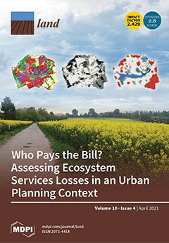
Cover Story (view full-size image): Urban planning regulations already consider mandatory compensation for the loss of nature. However, compensation is often restricted to replacing green with green in other locations, without considering the whole range of ecosystem services. This might lead to the loss of ecosystem services in areas subject to urban development, a loss that would eventually be replaced elsewhere. Therefore, a wide range of assessments should be included in urban planning to improve the environmental conditions of urban landscapes where development takes place. Our findings show that an ecosystem services assessment provides a solid basis for the selection of development alternatives, the identification of compensation areas, and the estimation of compensation amounts, with the benefit of improving the environmental quality of the areas affected by urban development. View this paper
  • Issues are regarded as officially published after their release is announced to the table of contents alert mailing list.
  • You may sign up for e-mail alerts to receive table of contents of newly released issues.
  • PDF is the official format for papers published in both, html and pdf forms. To view the papers in pdf format, click on the "PDF Full-text" link, and use the free Adobe Reader to open them.
Order results
Result details
Section
Select all
Export citation of selected articles as:
21 pages, 5143 KiB  
Article
Tourism Imaginary and Landscape at Heritage Site: A Case in Honghe Hani Rice Terraces, China
by Zhe Wang and Lawal Marafa
Land 2021, 10(4), 439; https://doi.org/10.3390/land10040439 - 20 Apr 2021
Cited by 21 | Viewed by 4897
Abstract
The relationship between tourism and landscape has been extensively studied, but a conceptual framework to study cultural relationships between tourism and landscape is not specified in the literature. On the basis of the theory of social imaginary, this article takes China’s Honghe Hani [...] Read more.
The relationship between tourism and landscape has been extensively studied, but a conceptual framework to study cultural relationships between tourism and landscape is not specified in the literature. On the basis of the theory of social imaginary, this article takes China’s Honghe Hani Terraces as an example to study how the landscape is imagined in tourism and the potential cultural conflicts. Content analysis on tourist discourses and images in social media was conducted in order to identify tourist imaginaries about the landscape. A gap between tourism imaginaries and the Hani landscape was found: the latter was imagined as an overlooking view of stereotyped terraced imagery, a schema separated and independent from other landscape components. In-depth interviews on stakeholders and participant observations were used to study the production process of tourism imaginaries. Findings show that the viewing platforms and roads provided an enclave space from local contexts, wherein the Hani landscape was staged for gazing. The tourism company’s strategies dominated the process, leading to local communities’ marginalization and threats to the landscape. We suggest that tourism planning and marketing should maintain the integrity of landscape in tourism imaginaries and empower the local communities, thereby reducing cultural tensions between tourism and the landscape. Full article
(This article belongs to the Special Issue Landscape and Tourism, Landscapes of Tourism)
Show Figures

Graphical abstract

13 pages, 2228 KiB  
Article
Adding Space to Disease Models: A Case Study with COVID-19 in Oregon, USA
by Nathan H. Schumaker and Sydney M. Watkins
Land 2021, 10(4), 438; https://doi.org/10.3390/land10040438 - 20 Apr 2021
Cited by 1 | Viewed by 2619
Abstract
We selected the COVID-19 outbreak in the state of Oregon, USA as a system for developing a general geographically nuanced epidemiological forecasting model that balances simplicity, realism, and accessibility. Using the life history simulator HexSim, we inserted a mathematical SIRD disease model into [...] Read more.
We selected the COVID-19 outbreak in the state of Oregon, USA as a system for developing a general geographically nuanced epidemiological forecasting model that balances simplicity, realism, and accessibility. Using the life history simulator HexSim, we inserted a mathematical SIRD disease model into a spatially explicit framework, creating a distributed array of linked compartment models. Our spatial model introduced few additional parameters, but casting the SIRD equations into a geographic setting significantly altered the system’s emergent dynamics. Relative to the non-spatial model, our simple spatial model better replicated the record of observed infection rates in Oregon. We also observed that estimates of vaccination efficacy drawn from the non-spatial model tended to be higher than those obtained from models that incorporate geographic variation. Our spatially explicit SIRD simulations of COVID-19 in Oregon suggest that modest additions of spatial complexity can bring considerable realism to a traditional disease model. Full article
(This article belongs to the Section Landscape Ecology)
Show Figures

Graphical abstract

18 pages, 315 KiB  
Article
Good Practices in Updating Land Information Systems that Used Unconventional Approaches in Systematic Land Registration
by Mireille Biraro, Jaap Zevenbergen and Berhanu Kefale Alemie
Land 2021, 10(4), 437; https://doi.org/10.3390/land10040437 - 20 Apr 2021
Cited by 16 | Viewed by 4242
Abstract
To properly govern people-to-land relationships, there is a need to formally recognize land rights, and for this to bring recognizable societal change, the established Land Information System (LIS) has to be updated continuously. Though existing literature suggests different parameters to consider when updating [...] Read more.
To properly govern people-to-land relationships, there is a need to formally recognize land rights, and for this to bring recognizable societal change, the established Land Information System (LIS) has to be updated continuously. Though existing literature suggests different parameters to consider when updating an LIS, little is said on how countries are doing this, especially when unconventional approaches through systematic land registration were initially used. This paper comes up with recommendable good practices where the suggested needs for updating land records were made workable. Nine countries with similar data collection procedures for the initial registration were selected based on literature study; questionnaires designed and distributed to LIS experts from each country using internet; and the collected data were analyzed qualitatively. Fortunately, all the case countries possess infrastructure supporting land records updating (procedures, mobilization means, institutional and legal frameworks, and so on). For the majority, the systems are simplified; registration fees are reasonable; services are decentralized; the database is accessible by citizens and local officers; staff are trained; the system effectiveness is assessed; and the political support is offered. However, the procedures are long, data sharing is inexistent, financial and technical sustainability is uncertain, and many different institutions are involved in the registration. Whilst updating used to appear as a forgotten activity, good practices now exist. Full article
17 pages, 2635 KiB  
Article
Howland Forest, ME, USA: Multi-Gas Flux (CO2, CH4, N2O) Social Cost Product Underscores Limited Carbon Proxies
by Bruno D. V. Marino, Nahuel Bautista and Brandt Rousseaux
Land 2021, 10(4), 436; https://doi.org/10.3390/land10040436 - 20 Apr 2021
Cited by 3 | Viewed by 3600
Abstract
Forest carbon sequestration is a widely accepted natural climate solution. However, methods to determine net carbon offsets are based on commercial carbon proxies or CO2 eddy covariance research with limited methodological comparisons. Non-CO2 greenhouse gases (GHG) (e.g., CH4, N [...] Read more.
Forest carbon sequestration is a widely accepted natural climate solution. However, methods to determine net carbon offsets are based on commercial carbon proxies or CO2 eddy covariance research with limited methodological comparisons. Non-CO2 greenhouse gases (GHG) (e.g., CH4, N2O) receive less attention in the context of forests, in part, due to carbon denominated proxies and to the cost for three-gas eddy covariance platforms. Here we describe and analyze results for direct measurement of CO2, CH4, and N2O by eddy covariance and forest carbon estimation protocols at the Howland Forest, ME, the only site where these methods overlap. Limitations of proxy-based protocols, including the exclusion of sink terms for non-CO2 GHGs, applied to the Howland project preclude multi-gas forest products. In contrast, commercial products based on direct measurement are established by applying molecule-specific social cost factors to emission reductions creating a new forest offset (GHG-SCF), integrating multiple gases into a single value of merit for forest management of global warming. Estimated annual revenue for GHG-SCF products, applicable to the realization of a Green New Deal, range from ~$120,000 USD covering the site area of ~557 acres in 2021 to ~$12,000,000 USD for extrapolation to 40,000 acres in 2040, assuming a 3% discount rate. In contrast, California Air Resources Board compliance carbon offsets determined by the Climate Action Reserve protocol show annual errors of up to 2256% relative to eddy covariance data from two adjacent towers across the project area. Incomplete carbon accounting, offset over-crediting and inadequate independent offset verification are consistent with error results. The GHG-SCF product contributes innovative science-to-commerce applications incentivizing restoration and conservation of forests worldwide to assist in the management of global warming. Full article
Show Figures

Figure 1

17 pages, 1972 KiB  
Article
Carbon Storage of Single Tree and Mixed Tree Dominant Species Stands in a Reserve Forest—Case Study of the Eastern Sub-Himalayan Region of India
by Prakash Rai, Vineeta, Gopal Shukla, Abha Manohar K, Jahangeer A Bhat, Amit Kumar, Munesh Kumar, Marina Cabral-Pinto and Sumit Chakravarty
Land 2021, 10(4), 435; https://doi.org/10.3390/land10040435 - 19 Apr 2021
Cited by 26 | Viewed by 3855
Abstract
In recent decades, carbon (C) management is an important point on the agenda to identify the best viable mitigation strategies for its reduction. The study was conducted at Jaldapara National Park located in the Eastern Himalayan region of India. The study quantified litter [...] Read more.
In recent decades, carbon (C) management is an important point on the agenda to identify the best viable mitigation strategies for its reduction. The study was conducted at Jaldapara National Park located in the Eastern Himalayan region of India. The study quantified litter production, decomposition, periodic nutrient release, soil fertility status, and soil organic carbon (SOC) of five major forest stands i.e., Tectona grandis (TGDS), Shorea robusta (SRDS), Michelia champaca (MCDS), Lagerstroemia parviflora (LPDS) and miscellaneous stand (MS). A stratified random nested quadrate method was adopted for sample collection. Results reveal that the greatest amount of litter production and decomposition was under MCDS followed by MS, LPDS, SRDS, and the smallest under TGDS. The material annual turnover through litter decomposition in all the stands varies between 96.46% and 99.34%. The content and amount of the available nutrients in litter varied significantly among the stands. Moreover, release of these nutrients was nearly equal to the amount available in the initial litter mass. In general, the magnitude of the total nutrient return was in the same order as the total litter fall and the nutrient availability was more closely related to litter nutrient content and soil organic carbon. The range of pH (4.86–5.16), EC (0.34–0.50), soil moisture (27.01–31.03) and available primary nutrients (N: (0.21–0.26 Mg/ha), P: (0.09–0.12 Mg/ha), K: (0.13–0.14 Mg/ha)) also varied significantly among the stands. Significant positive correlations were observed between SOC, N and K. Both the fertility indices exhibited no definite pattern in the stands but a significant correlation between the two indicates the healthy soil fertility status of the stands. SOC varies significantly under different forest stands, but the greatest content was found under MS. The estimated SOC ranges between 75.9 and 107.7 Mg ha−1 up to 60 cm and is reported to be below the Indian average of 182.94 Mg ha−1. The present study strongly recommends that Tectona grandis, Shorea robusta, Michelia champaca, and Lagerstroemia parviflora should be the important commercial timbers of the Eastern Himalayan region because they may help further to increase the C sink in agricultural and degraded landscapes. Full article
(This article belongs to the Special Issue Geochemical Mapping in Land Managing)
Show Figures

Figure 1

16 pages, 3180 KiB  
Article
Influence of Land Use on Avian Diversity in North African Urban Environments
by Hani Amir Aouissi, Alexandru-Ionuţ Petrişor, Mostefa Ababsa, Maria Boştenaru-Dan, Mahmoud Tourki and Zihad Bouslama
Land 2021, 10(4), 434; https://doi.org/10.3390/land10040434 - 18 Apr 2021
Cited by 30 | Viewed by 5248
Abstract
Land cover and use changes are important to study for their impact on ecosystem services and ultimately on sustainability. In urban environments, a particularly important research question addresses the relationship between urbanization-related changes and biodiversity, subject to controversies in the literature. Birds are [...] Read more.
Land cover and use changes are important to study for their impact on ecosystem services and ultimately on sustainability. In urban environments, a particularly important research question addresses the relationship between urbanization-related changes and biodiversity, subject to controversies in the literature. Birds are an important ecological group, and useful for answering this question. The present study builds upon the hypothesis according to which avian diversity decreases with urbanization. In order to answer it, a sample of 4245 observations from 650 sites in Annaba, Algeria, obtained through the point abundance index method, were investigated by computing Shannon-Wiener’s diversity index and the species richness, mapping them, and analyzing the results statistically. The findings confirm the study hypothesis and are relevant for planning, as they stress the role of urban green spaces as biodiversity hotspots, and plead for the need of connecting them. From a planning perspective, the results emphasize the need for interconnecting the green infrastructure through avian corridors. Moreover, the results fill in an important lack of data on the biodiversity of the region, and are relevant for other similar Mediterranean areas. Future studies could use the findings to compare with data from other countries and continents. Full article
(This article belongs to the Special Issue Conservation of Bio- and Geo-Diversity and Landscape Changes)
Show Figures

Graphical abstract

16 pages, 5377 KiB  
Article
Estimating Forest Canopy Cover by Multiscale Remote Sensing in Northeast Jiangxi, China
by Xiaolan Huang, Weicheng Wu, Tingting Shen, Lifeng Xie, Yaozu Qin, Shanling Peng, Xiaoting Zhou, Xiao Fu, Jie Li, Zhenjiang Zhang, Ming Zhang, Yixuan Liu, Jingheng Jiang, Penghui Ou, Wenchao Huangfu and Yang Zhang
Land 2021, 10(4), 433; https://doi.org/10.3390/land10040433 - 18 Apr 2021
Cited by 10 | Viewed by 7694
Abstract
This research was focused on estimation of tree canopy cover (CC) by multiscale remote sensing in south China. The key aim is to establish the relationship between CC and woody NDVI (NDVIW) or to build a CC-NDVIW model taking northeast [...] Read more.
This research was focused on estimation of tree canopy cover (CC) by multiscale remote sensing in south China. The key aim is to establish the relationship between CC and woody NDVI (NDVIW) or to build a CC-NDVIW model taking northeast Jiangxi as an example. Based on field CC measurements, this research used Google Earth as a complementary source to measure CC. In total, 63 sample plots of CC were created, among which 45 were applied for modeling and the remaining 18 were employed for verification. In order to ascertain the ratio R of NDVIW to the satellite observed NDVI, a 20-year time-series MODIS NDVI dataset was utilized for decomposition to obtain the NDVIW component, and then the ratio R was calculated with the equation R = (NDVIW/NDVI) *100%, respectively, for forest (CC > 60%), medium woodland (CC = 25–60%) and sparse woodland (CC 1–25%). Landsat TM and OLI images that had been orthorectified by the provider USGS were atmospherically corrected using the COST model and used to derive NDVIL. R was multiplied for the NDVIL image to extract the woody NDVI (NDVIWL) from Landsat data for each of these plots. The 45 plots of CC data were linearly fitted to the NDVIWL, and a model with CC = 103.843 NDVIW + 6.157 (R2 = 0.881) was obtained. This equation was applied to predict CC at the 18 verification plots and a good agreement was found (R2 = 0.897). This validated CC-NDVIW model was further applied to the woody NDVI of forest, medium woodland and sparse woodland derived from Landsat data for regional CC estimation. An independent group of 24 measured plots was utilized for validation of the results, and an accuracy of 83.0% was obtained. Thence, the developed model has high predictivity and is suitable for large-scale estimation of CC using high-resolution data. Full article
(This article belongs to the Special Issue Management and Conservation of Forest Biodiversity)
Show Figures

Figure 1

18 pages, 3140 KiB  
Article
The Benefits of Combining Global and Local Data—A Showcase for Valuation and Mapping of Mangrove Climate Regulation and Food Provisioning Services within a Protected Area in Pará, North Brazil
by Robin Gutting, Ralf-Uwe Syrbe, Karsten Grunewald, Ulf Mehlig, Véronique Helfer and Martin Zimmer
Land 2021, 10(4), 432; https://doi.org/10.3390/land10040432 - 18 Apr 2021
Cited by 4 | Viewed by 3365
Abstract
Mangrove forests provide a large variety of ecosystem services (ES) to coastal societies. Using a case study focusing on the Ajuruteua peninsula in Northern Brazil and two ES, food provisioning (ES1) and global climate regulation (ES2), this paper proposes a new framework for [...] Read more.
Mangrove forests provide a large variety of ecosystem services (ES) to coastal societies. Using a case study focusing on the Ajuruteua peninsula in Northern Brazil and two ES, food provisioning (ES1) and global climate regulation (ES2), this paper proposes a new framework for quantifying and valuing mangrove ES and allow for their small-scale mapping. We modelled and spatialised the two ES from different perspectives, the demand (ES1) and the supply (ES2) side respectively. This was performed by combining worldwide databases related to the global human population (ES1) or mangrove distribution and canopy height (ES2) with locally derived parameters, such as crab catches (ES1) or species-specific allometric equations based on local estimates of tree structural parameters (ES2). Based on this approach, we could estimate that the area delivers the basic nutrition of about 1400 households, which equals 2.7 million USD, and that the mangrove biomass in the area contains 2.1 million Mg C, amounting to 50.9 million USD, if it were paid as certificates. In addition to those figures, we provide high-resolution maps showing which areas are more valuable for the two respective ES, information that could help inform management strategies in the future. Full article
Show Figures

Graphical abstract

14 pages, 2511 KiB  
Article
Pollination Potential in Portugal: Leveraging an Ecosystem Service for Sustainable Agricultural Productivity
by Caroline Wentling, Felipe S. Campos, João David and Pedro Cabral
Land 2021, 10(4), 431; https://doi.org/10.3390/land10040431 - 17 Apr 2021
Cited by 9 | Viewed by 4093
Abstract
As urbanization and agriculture increase worldwide, habitats and food sources for wild pollinators are often fragmented or destroyed. As wild pollinators contribute both resilience and variety to agricultural fields, it is desirable to implement land management practices that preserve their well-being and ability [...] Read more.
As urbanization and agriculture increase worldwide, habitats and food sources for wild pollinators are often fragmented or destroyed. As wild pollinators contribute both resilience and variety to agricultural fields, it is desirable to implement land management practices that preserve their well-being and ability to contribute to food production systems. This study evaluates continental Portugal for its change in suitability to host bee’s pollinator species (Apis mellifera) from 1990 to 2018. It uses the InVEST crop pollination modeling tool and CORINE Land Cover, as well as parameterization to produce pollinator abundance and supply maps. These are generalized to municipality boundaries to provide actionable insights to farmers and policymakers and strengthen land management practices. It finds that the potential for pollination services is growing, with averages of both pollinator abundance and supply indices improving by 8.76% across the continental territory in 28 years. The study results are validated using another pollination index derived from a study that is based on expert opinion and field sampling in a sub-region of Portugal. This method of aggregation of model results and comparison of the percent difference by administrative boundary has the potential to better inform both policymakers and farmers about the pollination potential on a local level, as well as inspire interventions for future productivity. Full article
(This article belongs to the Special Issue Multiple Roles for Landscape Ecology in Future Farming Systems)
Show Figures

Figure 1

38 pages, 930 KiB  
Article
Evidence of Similarities in Ecosystem Service Flow across the Rural-Urban Spectrum
by Indunee Welivita, Simon Willcock, Amy Lewis, Dilshaad Bundhoo, Tim Brewer, Sarah Cooper, Kenneth Lynch, Sneha Mekala, Prajna Paramita Mishra, Kongala Venkatesh, Dolores Rey Vicario and Paul Hutchings
Land 2021, 10(4), 430; https://doi.org/10.3390/land10040430 - 17 Apr 2021
Cited by 5 | Viewed by 3835
Abstract
In 2006, the world’s population passed the threshold of being equally split between rural and urban areas. Since this point, urbanisation has continued, and the majority of the global population are now urban inhabitants. With this ongoing change, it is likely that the [...] Read more.
In 2006, the world’s population passed the threshold of being equally split between rural and urban areas. Since this point, urbanisation has continued, and the majority of the global population are now urban inhabitants. With this ongoing change, it is likely that the way people receive benefits from nature (ecosystem services; ES) has also evolved. Environmental theory suggests that rural residents depend directly on their local environment (conceptualised as green-loop systems), whereas urban residents have relatively indirect relationships with distant ecosystems (conceptualised as red-loop systems). Here, we evaluate this theory using survey data from >3000 households in and around Hyderabad, India. Controlling for other confounding socioeconomic variables, we investigate how flows of 10 ES vary across rural, peri-urban and urban areas. For most of the ES we investigated, we found no statistical differences in the levels of direct or indirect use of an ecosystem, the distance to the ecosystem, nor the quantities of ES used between rural and urban residents (p > 0.05). However, our results do show that urban people themselves often travel shorter distances than rural people to access most ES, likely because improved infrastructure in urban areas allows for the transport of ES from wider ecosystems to the locality of the beneficiaries’ place of residence. Thus, while we find some evidence to support red-loop–green-loop theory, we conclude that ES flows across the rural-urban spectrum may show more similarities than might be expected. As such, the impact of future urbanisation on ES flows may be limited, because many flows in both rural and urban areas have already undergone globalisation. Full article
(This article belongs to the Special Issue Exploring the Relationships between Land Use and Ecosystem Services)
Show Figures

Figure 1

25 pages, 4920 KiB  
Article
Assessing Land Use and Land Cover Change and Farmers’ Perceptions of Deforestation and Land Degradation in South-West Côte d’Ivoire, West Africa
by Jean-Luc Kouassi, Amos Gyau, Lucien Diby, Yeboi Bene and Christophe Kouamé
Land 2021, 10(4), 429; https://doi.org/10.3390/land10040429 - 16 Apr 2021
Cited by 43 | Viewed by 8402
Abstract
Deforestation and land degradation remain two major economic and environmental threats in Côte d’Ivoire. This study assessed land use and land cover (LULC) change and farmers’ perceptions of the drivers and effects of deforestation and land degradation in south-western Côte d’Ivoire. We used [...] Read more.
Deforestation and land degradation remain two major economic and environmental threats in Côte d’Ivoire. This study assessed land use and land cover (LULC) change and farmers’ perceptions of the drivers and effects of deforestation and land degradation in south-western Côte d’Ivoire. We used remotely sensed data to determine LULC change trends, and a household survey to collect farmers’ perceptions of deforestation and land degradation. A total of 411 households were interviewed using a structured questionnaire and the focus group discussions involved 25 farmers. Landsat image analysis reported a drastic LULC change and a conversion of forestlands into agriculture from 1987 to 2015 at a rate of 1.44%/year and 3.44%/year for dense forests and degraded forests, respectively. The household survey revealed that the major causes of deforestation perceived by farmers included population growth (79.3%), extensive agriculture (72.9%), migration (54.2%) and logging (47.7%). Land degradation evolved, from a shortened fallow period (46.7%) and an inappropriate application of inputs (31.4%). The perceived major effects linked to deforestation encompassed land degradation (70.6%), loss of biodiversity (63.8%), global warming (56.9%) and loss of livelihood assets (54.3%). Therefore, this study recommends participatory landscape planning, reforestation and capacity building of stakeholders for sustainable intensification of the production systems to reduce LULC challenges for enhanced productive and protective functions of remaining forests. Full article
(This article belongs to the Special Issue Land Use and Climate Change Effects on Food Security in Africa)
Show Figures

Figure 1

15 pages, 399 KiB  
Article
Real Estate Investment, Loan Preference, and National Happiness: Evidence from China
by Shangan Ke and Xinhai Lu
Land 2021, 10(4), 428; https://doi.org/10.3390/land10040428 - 16 Apr 2021
Cited by 3 | Viewed by 3030
Abstract
With two-stage least squares and LS models, this paper investigates the effects of real estate investment and loan preference on national happiness with data of 31 provinces in China from 2000 to 2018. The conclusions are that a rapid growth of real estate [...] Read more.
With two-stage least squares and LS models, this paper investigates the effects of real estate investment and loan preference on national happiness with data of 31 provinces in China from 2000 to 2018. The conclusions are that a rapid growth of real estate investment has significant adverse effects on national happiness in modern China. Specifically, real estate investment has negative impacts on disposable income, consumption structure, and personal development. Moreover, the rapid growth of real estate investment and institutions’ loan preference leads to other inhibitory effects on national happiness. The intermediary effect model confirms the transmission mechanism of the rapid growth of real estate investment, the loan structure, and national happiness. According to our research, we propose conductive suggestions for the governments. Full article
(This article belongs to the Section Land Socio-Economic and Political Issues)
Show Figures

Figure 1

16 pages, 7081 KiB  
Article
Rural Tourism Network Evaluation Based on Resource Control Ability Analysis: A Case Study of Ning’an, China
by Xue Jiang, Xiaoya Song, Hongyu Zhao and Haoran Zhang
Land 2021, 10(4), 427; https://doi.org/10.3390/land10040427 - 16 Apr 2021
Cited by 5 | Viewed by 2858
Abstract
Organization of rural tourism resources is important for optimizing rural land use based on rational resource classification. Quantitative analysis was performed to evaluate the resource control ability of rural tourism networks. This was achieved by determining the resource control relationship and assessing the [...] Read more.
Organization of rural tourism resources is important for optimizing rural land use based on rational resource classification. Quantitative analysis was performed to evaluate the resource control ability of rural tourism networks. This was achieved by determining the resource control relationship and assessing the structure of the rural tourism network. The ability of resource control was analyzed via resource abstraction, which included the extraction of resource nodes and corridors, control scope analysis, and network structure level evaluation. The proposed approach was applied to the Ning’an in Heilongjiang Province, China, and proved to be effective for exploring the network degree and development trends in rural tourism resources. By examining the resource control ability, the spatial characteristics and development trend in rural tourism networks were quantitatively analyzed, especially the connection mode of key tourism resources, network structure analysis, and resource linking ability. The core resources showed a lack of outward ability in the network, and the secondary resource expansion ability was limited. Via resource control ability analysis, this study focused on areas with rich tourism but an unbalanced spatial structure, combining the directional characteristics of the network to provide suggestions for the optimization rural tourism resources network in other regions of the world. Full article
(This article belongs to the Special Issue New Pattern of Land Use in the Context of Sharing Economy)
Show Figures

Figure 1

19 pages, 36000 KiB  
Article
Changes in Land-Use and Ecosystem Service Value in Guangdong Province, Southern China, from 1990 to 2018
by Yanqiong Ye, Jiaen Zhang, Ting Wang, Hui Bai, Xuan Wang and Wei Zhao
Land 2021, 10(4), 426; https://doi.org/10.3390/land10040426 - 16 Apr 2021
Cited by 40 | Viewed by 4500
Abstract
Land-use/cover is one of the major factors that affect the ecosystem and the services it provides. The impact of land-use change on ecosystem service value is a hotspot in developing countries, especially China—a region with rapid economic development and rapid population growth. As [...] Read more.
Land-use/cover is one of the major factors that affect the ecosystem and the services it provides. The impact of land-use change on ecosystem service value is a hotspot in developing countries, especially China—a region with rapid economic development and rapid population growth. As the leading area of China’s reform and opening-up, Guangdong province in southern China is subjected to land-use conversion that significantly alters the capacity of natural ecosystem to provide ecosystem services supporting human well-being. We analyzed the characteristics of land-use changes from 1990 to 2018 using the four-phase land-use data interpreted from Landsat satellite images. We estimated the ecosystem service value through a well-established benefit transfer method using modified local value coefficients, analyzed the trade-offs and synergies among ecosystem services through ecosystem service trade-off degree, and compared the relationship between ecosystem services value, economic development, and population in Guangdong province. The results indicated that the following: (1) Built-Up Area drastically expanded from 6783.1 km2 in 1990 to 13,142.0 km2 in 2018 (93.7%), especially in the Pearl River Delta, where the growth rate of Built-Up Area expansion was up to 169.0%. The other land-use types were all contracted as Cropland (−10.9%), Forestland (−1.0%), Grassland (−4.0%), Water Body (−2.1%), and Unused Land (−24.4%). (2) Total ecosystem service value decreased from US$121,666 billion in 1990 to US$116,432 billion in 2018 (−4.3%). Cropland, Forestland, and Water Body played the most important roles for the total ecosystem service value. Water supply experienced the largest declines in ecosystem services value (US$ −1866.3 million, −10.1%), followed by waste treatment (7.6%) and gas regulation (−4.9%). (3) Synergy was the dominant relationship among ecosystem services. The above results can not only serve as reference case for other provinces/regions/countries/ to carry out relevant research work but also provide much focus on land-use planning to manage the impacts of land-use change on regional ecosystem services function. Full article
(This article belongs to the Special Issue Exploring the Relationships between Land Use and Ecosystem Services)
Show Figures

Figure 1

17 pages, 11068 KiB  
Article
Farmers’ and Herders’ Perceptions on Rangeland Management in Two Agroecological Zones of Benin
by Rodrigue Vivien Cao Diogo, Luc Hippolyte Dossa, Sèyi Fridaïus Ulrich Vanvanhossou, Badirou Dine Abdoulaye, Kossi Hélliot Dosseh, Marcel Houinato, Eva Schlecht and Andreas Buerkert
Land 2021, 10(4), 425; https://doi.org/10.3390/land10040425 - 16 Apr 2021
Cited by 9 | Viewed by 4958
Abstract
The sustainable use of rangelands in pastoral areas requires the inclusion of all stakeholders to develop sound management strategies. However, the role of these actors in the sustainable management of natural resources is still poorly understood. The present study aims to (i) assess [...] Read more.
The sustainable use of rangelands in pastoral areas requires the inclusion of all stakeholders to develop sound management strategies. However, the role of these actors in the sustainable management of natural resources is still poorly understood. The present study aims to (i) assess the perception of farmers and herders of the risks and opportunities of transhumance on rangeland resource use and management, and to (ii) generate useful knowledge for the design and implementation of policies that favor the coexistence of these actors and reduce competition over rangeland resources use in Benin. To this end, interviews were conducted with 240 crop farmers and herders using a semi-structured questionnaire in two contrasting agroecological zones in the northern (Kandi) and the southern (Kétou) part of the country. Among the respondents, 64% of farmers in the North were agro-pastoralists (owning 10.6 ha of land and 10.7 cattle) and 36% were herders (keeping 45.8 cattle and cultivating about 3.7 ha of land). They perceived that communal rangelands were entirely degraded. In the South, 36% of respondents were agro-pastoralists (with 0.3 cattle and farming 4 ha of land) and 64% cattle herders (raising 45.3 cattle and farming 0.9 ha of land only). Of the herders, 50% kept cattle for more than 20 years, while agro-pastoralists had no previous experience in cattle herding. Cultivation practices among crop farmers, such as high use of mineral fertilization (23.8%) and bush fires for land clearing (22.5%), were reported in Kandi (North) and Kétou (South) as factors that might contribute to land degradation. However, these farmers perceived transhumance as a threat to the sustainable use of natural resources. In contrast, herders perceived transhumance as an opportunity to valorize unused land and increase the availability of manure to cropland. The prevalent negative attitude of crop farmers regarding transhumant herders increases the vulnerability of cattle herding in both regions. There is an urgent need of raising awareness concerning the mutual benefits provided by the coexistence of crop farmers with herders to promote participative rangeland management strategies. This may contribute towards coping with the current challenges of food insecurity and increasing climate variability as well as to reducing recurrent conflicts in the region. Full article
(This article belongs to the Special Issue Sustainable Management of Natural Resources in Livestock System)
Show Figures

Figure 1

16 pages, 903 KiB  
Article
Study on Herders’ Willingness to Protect Grassland Based on the IAD Extended Decision Model
by Lan Yao, Xiaobo Yan, Miaomiao Xu, Mengya Wu, Zhenning Yu and Min Li
Land 2021, 10(4), 424; https://doi.org/10.3390/land10040424 - 16 Apr 2021
Cited by 4 | Viewed by 2002
Abstract
In an attempt to resolve the increasingly severe grassland degradation, China has implemented a series of grassland protection policies. Herders are one of the key stakeholders in these policies, and their willingness to participate in grassland protection directly affects the effective implementation of [...] Read more.
In an attempt to resolve the increasingly severe grassland degradation, China has implemented a series of grassland protection policies. Herders are one of the key stakeholders in these policies, and their willingness to participate in grassland protection directly affects the effective implementation of these policies. We conducted a field survey of herders in Qinghai and Gansu Provinces to identify the factors that impact the willingness of herders to adopt these policies and then incorporated a number of these factors in the extension framework of the Institutional Analysis and Design (IAD) model. First, we analyzed the willingness of herders to adopt grassland protection policies using binary logistic regression. After dividing the herders into two categories based on whether or not they had participated in grassland protection, we repeated the binary regression analysis for both categories of herders. The results indicate that their willingness to adopt protection measures was influenced by their household characteristics, procedures and rules, the market environment, and cognitive reform. Herders who had not participated were mainly concerned about the impact of protection policies on household livelihoods and whether they would receive adequate subsidies. Based on this analysis, we understand that problems still exist with China’s grassland governance policies and have proposed strategies to improve these. Full article
(This article belongs to the Section Land Socio-Economic and Political Issues)
Show Figures

Figure 1

23 pages, 19194 KiB  
Article
Combining Site Characterization, Monitoring and Hydromechanical Modeling for Assessing Slope Stability
by Shirin Moradi, Thomas Heinze, Jasmin Budler, Thanushika Gunatilake, Andreas Kemna and Johan Alexander Huisman
Land 2021, 10(4), 423; https://doi.org/10.3390/land10040423 - 15 Apr 2021
Cited by 12 | Viewed by 2914
Abstract
Rainfall-induced landslides are a disastrous natural hazard causing loss of life and significant damage to infrastructure, farmland and housing. Hydromechanical models are one way to assess the slope stability and to predict critical combinations of groundwater levels, soil water content and precipitation. However, [...] Read more.
Rainfall-induced landslides are a disastrous natural hazard causing loss of life and significant damage to infrastructure, farmland and housing. Hydromechanical models are one way to assess the slope stability and to predict critical combinations of groundwater levels, soil water content and precipitation. However, hydromechanical models for slope stability evaluation require knowledge about mechanical and hydraulic parameters of the soils, lithostratigraphy and morphology. In this work, we present a multi-method approach of site characterization and investigation in combination with a hydromechanical model for a landslide-prone hillslope near Bonn, Germany. The field investigation was used to construct a three-dimensional slope model with major geological units derived from drilling and refraction seismic surveys. Mechanical and hydraulic soil parameters were obtained from previously published values for the study site based on laboratory analysis. Water dynamics were monitored through geoelectrical monitoring, a soil water content sensor network and groundwater stations. Historical data were used for calibration and validation of the hydromechanical model. The well-constrained model was then used to calculate potentially hazardous precipitation events to derive critical thresholds for monitored variables, such as soil water content and precipitation. This work introduces a potential workflow to improve numerical slope stability analysis through multiple data sources from field investigations and outlines the usage of such a system with respect to a site-specific early-warning system. Full article
(This article belongs to the Special Issue Landslide Hazard and Environment Risk Assessment)
Show Figures

Figure 1

35 pages, 543 KiB  
Review
Modeling Approaches to Assess Soil Erosion by Water at the Field Scale with Special Emphasis on Heterogeneity of Soils and Crops
by Ahsan Raza, Hella Ahrends, Muhammad Habib-Ur-Rahman and Thomas Gaiser
Land 2021, 10(4), 422; https://doi.org/10.3390/land10040422 - 15 Apr 2021
Cited by 37 | Viewed by 7479
Abstract
Information on soil erosion and related sedimentation processes are very important for natural resource management and sustainable farming. Plenty of models are available for studying soil erosion but only a few are suitable for dynamic soil erosion assessments at the field-scale. To date, [...] Read more.
Information on soil erosion and related sedimentation processes are very important for natural resource management and sustainable farming. Plenty of models are available for studying soil erosion but only a few are suitable for dynamic soil erosion assessments at the field-scale. To date, there are no field-scale dynamic models available considering complex agricultural systems for the simulation of soil erosion. We conducted a review of 51 different models evaluated based on their representation of the processes of soil erosion by water. Secondly, we consider their suitability for assessing soil erosion for more complex field designs, such as patch cropping, strip cropping and agroforestry (alley-cropping systems) and other land management practices. Several models allow daily soil erosion assessments at the sub-field scale, such as EPIC, PERFECT, GUEST, EPM, TCRP, SLEMSA, APSIM, RillGrow, WaNuLCAS, SCUAF, and CREAMS. However, further model development is needed with respect to the interaction of components, i.e., rainfall intensity, overland flow, crop cover, and their scaling limitations. A particular shortcoming of most of the existing field scale models is their one-dimensional nature. We further suggest that platforms with modular structure, such as SIMPLACE and APSIM, offer the possibility to integrate soil erosion as a separate module/component and link to GIS capabilities, and are more flexible to simulate fluxes of matter in the 2D/3D dimensions. Since models operating at daily scales often do not consider a horizontal transfer of matter, such modeling platforms can link erosion components with other environmental components to provide robust estimations of the three-dimensional fluxes and sedimentation processes occurring during soil erosion events. Full article
(This article belongs to the Special Issue Soil Erosion and Desertification)
Show Figures

Figure 1

19 pages, 3596 KiB  
Article
Future Runoff Variation and Flood Disaster Prediction of the Yellow River Basin Based on CA-Markov and SWAT
by Guangxing Ji, Zhizhu Lai, Haibin Xia, Hao Liu and Zheng Wang
Land 2021, 10(4), 421; https://doi.org/10.3390/land10040421 - 15 Apr 2021
Cited by 43 | Viewed by 4092
Abstract
The purpose of this paper is to simulate the future runoff change of the Yellow River Basin under the combined effect of land use and climate change based on Cellular automata (CA)-Markov and Soil & Water Assessment Tool (SWAT). The changes in the [...] Read more.
The purpose of this paper is to simulate the future runoff change of the Yellow River Basin under the combined effect of land use and climate change based on Cellular automata (CA)-Markov and Soil & Water Assessment Tool (SWAT). The changes in the average runoff, high extreme runoff and intra-annual runoff distribution in the middle of the 21st century are analyzed. The following conclusions are obtained: (1) Compared with the base period (1970–1990), the average runoff of Tangnaihai, Toudaoguai, Sanmenxia and Lijin hydrological stations in the future period (2040–2060) all shows an increasing trend, and the probability of flood disaster also tends to increase; (2) Land use/cover change (LUCC) under the status quo continuation scenario will increase the possibility of future flood disasters; (3) The spring runoff proportion of the four hydrological stations in the future period shows a decreasing trend, which increases the risk of drought in spring. The winter runoff proportion tends to increase; (4) The monthly runoff proportion of the four hydrological stations in the future period tends to decrease in April, May, June, July and October. The monthly runoff proportion tends to increase in January, February, August, September and December. Full article
(This article belongs to the Special Issue Advances in Hydrologic and Water Quality Modeling of Water Systems)
Show Figures

Figure 1

22 pages, 4737 KiB  
Article
Forests to the Foreigners: Large-Scale Land Acquisitions in Gabon
by Danielle D. Legault and Logan Cochrane
Land 2021, 10(4), 420; https://doi.org/10.3390/land10040420 - 15 Apr 2021
Cited by 7 | Viewed by 8243
Abstract
For the past decade, the land rush discourse has analyzed foreign investment in land and agriculture around the world, with Africa being a continent of particular focus due to the scale of acquisitions that have taken place. Gabon, a largely forested state in [...] Read more.
For the past decade, the land rush discourse has analyzed foreign investment in land and agriculture around the world, with Africa being a continent of particular focus due to the scale of acquisitions that have taken place. Gabon, a largely forested state in Central Africa, has been neglected in the land rush conversations, despite having over half of its land allocated to forestry, agriculture, and mining concessions. This paper draws on existing evidence and contributes new empirical data through expert interviews to fill this critical knowledge gap. We situate Gabon’s historic relationship with land, establishing the intrinsic relationship between colonial land tenure systems and present-day land rights. Our findings analyze the macro context of investors and investments, as well as the impacts related to rural–urban linkages and infrastructure development into the forests, civil society, human–environment relationships, and certification programs. While challenges continue to be experienced, the promise of Gabon’s first national land use plan—the use of sustainable concessions and mandatory forestry certification—offers a unique opportunity for Gabon to transition towards a future that better benefits its population while also protecting its natural resources. Full article
(This article belongs to the Special Issue Land Rush in Africa)
Show Figures

Figure 1

16 pages, 3096 KiB  
Article
Developing an Ecosystem Services-Based Approach for Land Use Planning
by Wenbo Cai, Wei Jiang and Yongli Cai
Land 2021, 10(4), 419; https://doi.org/10.3390/land10040419 - 15 Apr 2021
Cited by 3 | Viewed by 2867
Abstract
Rapid urbanization has altered many ecosystems, causing the decline in many ecosystem services (ES), and generating serious ecological crisis. The Yangtze River Delta (YRD) region is one of the most rapidly urbanized regions in China and has experienced a remarkable period of population [...] Read more.
Rapid urbanization has altered many ecosystems, causing the decline in many ecosystem services (ES), and generating serious ecological crisis. The Yangtze River Delta (YRD) region is one of the most rapidly urbanized regions in China and has experienced a remarkable period of population growth, and built-up area expansion. To cope with these challenges, this paper proposed a four-step key ES zone delineation framework by land-use matrix for land management in a rapidly urbanizing region. This framework was applied in key ES zone delineation in the YRD region. The results showed that there was obvious spatial heterogeneity in the distribution of total ES capacities: The high-capacity levels were mainly distributed in the south of the region, while the low-capacity levels were densely distributed in the middle and north of the region. V (80–100) and II (20–40) accounted for 27.44% and 47.12% of the total area, respectively. Among the five levels, Level II occupied the largest area of the region. I (0–20) and IV (60–80) had patchy patterns in the region and clustered in the middle of the region. I and IV accounted for 13.24% and 5.48% of the total area, respectively. III (40–60) had belt distribution in the region and accounted for 6.72% of the total area. This paper not only contributes to the guidance of land management for the Ecological Redline Policy in the YRD Region but also helps to improve the application of ecosystem service approach in decision support in rapidly urbanizing regions. Full article
Show Figures

Figure 1

35 pages, 16170 KiB  
Article
Following Rural Functions to Classify Rural Sites: An Application in Jixi, Anhui Province, China
by Kai Ren
Land 2021, 10(4), 418; https://doi.org/10.3390/land10040418 - 15 Apr 2021
Cited by 13 | Viewed by 4863
Abstract
Rural areas are a type of self-organized regional living environment, with multi-functional symbiosis between humans and land; their functional attributes are function superposition, function difference, and dominant function. The evolution of rural functions is a gradual process and follows the general law of [...] Read more.
Rural areas are a type of self-organized regional living environment, with multi-functional symbiosis between humans and land; their functional attributes are function superposition, function difference, and dominant function. The evolution of rural functions is a gradual process and follows the general law of the development of self-organizing systems, which evolutes from the state of general development, competition without rules, and, finally, to an order controlled by the dominant function. By constructing an indicator system and measurement model of rural function evaluation, this study took 11 towns in a hilly area of Jixi County as regional units to analyze the differentiation characteristics and rules of rural functions; the functions include agricultural production functions, nonagricultural production functions, life and leisure functions, and ecological functions. The results show the following: (1) The index of agricultural production functions, life and leisure functions, and ecological functions in Jixi County is higher, while the index of nonagricultural production functions is lower; (2) all towns have at least one function belongings to the “high state strong potential zone”, and some towns show a weak comprehensiveness; (3) the interaction between different functions should be considered when determining the dominant functions of the towns; (4) the formation mechanism of a dominant function has a high correlation with its main influencing factors; and (5) nine types of characteristic village are determined, according to the coupling of village characteristic resources and town dominant functions. Full article
(This article belongs to the Special Issue Ecosystem Services, Sustainable Rural Development and Protected Areas)
Show Figures

Figure 1

25 pages, 4649 KiB  
Review
The Tourism–Landscape Nexus: Assessment and Insights from a Bibliographic Analysis
by Sabrina Meneghello
Land 2021, 10(4), 417; https://doi.org/10.3390/land10040417 - 15 Apr 2021
Cited by 11 | Viewed by 4062
Abstract
Over the last two decades, the awareness about landscape as a common good and the definition of tourism as a relevant driver of territorial development have both increased contributions to contemporary reflections on places and mobilities. From a scientific point of view, the [...] Read more.
Over the last two decades, the awareness about landscape as a common good and the definition of tourism as a relevant driver of territorial development have both increased contributions to contemporary reflections on places and mobilities. From a scientific point of view, the need for structured contributions on the “landscape–tourism” nexus has been stressed. In fact, tourism and landscape studies are fed by many disciplines, often returning sectorial articles, sometimes lacking in organicity. Considering recent literary reviews carried out through bibliometric and content analyses, the present paper intends to map different ways of defining and understanding this complex interrelation as it emerges from the main research areas. From geographical contributions to managerial perspectives addressing destination planning and development, and from sociological non-representational to actor network theories applied to tourism, among others, the nexus is faced by approaches and concepts that are both specific and recurrent. Expressions such as “tourist landscape”, “tourism landscape”, “touristscape” with their different meanings orient this literary investigation informing a tentative conceptual framework where interrelated spatial, social, and symbolic dimensions emerge with a key definitional role. The general aim was to possibly enrich the reflection on this relationship, providing new definitional contributions and conceptual frameworks able to coherently influence both theory and practice. Full article
(This article belongs to the Special Issue Landscape and Tourism, Landscapes of Tourism)
Show Figures

Figure 1

17 pages, 1927 KiB  
Article
Evaluation of Scale Management Suitability Based on the Entropy-TOPSIS Method
by Xiaoteng Cao, Chaofu Wei and Deti Xie
Land 2021, 10(4), 416; https://doi.org/10.3390/land10040416 - 15 Apr 2021
Cited by 12 | Viewed by 2293
Abstract
The evaluation of scale management suitability provides a comprehensive assessment of the various factors driving farmland management conditions. This research objectively evaluated the conditions for scale management suitability by applying the entropy-TOPSIS method with the aim of effectively balancing the space for agricultural [...] Read more.
The evaluation of scale management suitability provides a comprehensive assessment of the various factors driving farmland management conditions. This research objectively evaluated the conditions for scale management suitability by applying the entropy-TOPSIS method with the aim of effectively balancing the space for agricultural production, the development of towns, and ecological protection. First, to ensure a balance between agricultural production, urban development, and ecological protection, 13 indexes were selected to represent the following three areas: natural factors, socioeconomic factors, and characteristics of cultivated land factors. The original matrix was standardized to evaluate the suitability of natural resources, the social economy, and cultivated land conditions, and a comprehensive suitability evaluation of scale management in the Jiangjin District of Chongqing was conducted. The research results divide the study area into four regions based on the level of scale management suitability. Examining the spatial distribution, the level of scale management suitability decreased gradually from north to south, regions at the high and middle levels of scale management suitability were concentrated in the northern area beside the Yangtze river, and the regions at a low level were concentrated in the southern mountain area. This research can provide a reference for the rational utilization of land resources and land use policymaking. Full article
(This article belongs to the Section Land Planning and Landscape Architecture)
Show Figures

Figure 1

15 pages, 779 KiB  
Article
Farmer Evaluation of Irrigation Services. Collective or Self-Supplied?
by Laura Mirra, Bernardo Corrado de Gennaro and Giacomo Giannoccaro
Land 2021, 10(4), 415; https://doi.org/10.3390/land10040415 - 15 Apr 2021
Cited by 5 | Viewed by 3057
Abstract
Economic evaluation of farmland is an important issue in the agricultural sector. The aim of this study was to quantify the economic value of land in the farmland area of the Reclamation and Irrigation Board of Capitanata (Apulia region), differentiating by irrigation water [...] Read more.
Economic evaluation of farmland is an important issue in the agricultural sector. The aim of this study was to quantify the economic value of land in the farmland area of the Reclamation and Irrigation Board of Capitanata (Apulia region), differentiating by irrigation water service type (collective or self-supplied). The analysis involved a heuristic evaluation using the hedonic pricing method of the sales comparison approach. The data was gathered through a survey on a group of 75 farmers. The results showed higher capitalization values in the case of lands served by self-supplied sources from groundwater. Actually, in the long-term, an enhanced reliability was found for the self-supplied rather than collective services. The findings highlight the importance for collective water associations of differentiating water rights allocations on the basis of a volume guarantee. In future, water user associations of collective services could consider a different water right system along with price discrimination to efficiently allocate the resource among farmers and improve the sustainability of current water management. Full article
(This article belongs to the Section Land Socio-Economic and Political Issues)
Show Figures

Figure 1

16 pages, 262 KiB  
Article
Initial Insights on Land Adjudication in a Fit-for-Purpose Land Administration
by Monica Lengoiboni, Christine Richter, Paul van Asperen and Jaap Zevenbergen
Land 2021, 10(4), 414; https://doi.org/10.3390/land10040414 - 14 Apr 2021
Cited by 7 | Viewed by 6475
Abstract
Land adjudication constitute a series of sequential steps that if followed carefully and correctly, can lead to a sufficient determination of the varied interests in land including whether, and where they overlap, complement, conflict or compete with each other. This is a preliminary [...] Read more.
Land adjudication constitute a series of sequential steps that if followed carefully and correctly, can lead to a sufficient determination of the varied interests in land including whether, and where they overlap, complement, conflict or compete with each other. This is a preliminary study aiming to find out how the adjudication process as it is conducted in the context of a fit-for-purpose land administration (FFPLA). A framework of components for adjudication in the FFPLA context is first developed. Further, the steps involved in accomplishing the adjudication components are compiled, assessed, and discussed from the perspective of the theory of collaborative governance. The study poses questions for consideration by implementers of land tenure documentation activities on how to identify the interests in land as they exist in their undocumented form. An understanding of the interaction between different types of interests in land in undocumented form as defined from the perspective of the communities themselves rather than from the law, could help assess which tenures and their attributes—can overlap or complement each other, or inform how they equate to specific rights in the legal perspective with minimal conflicts. Full article
23 pages, 3993 KiB  
Article
How to Define a New Metropolitan Area? The Case of Quito, Ecuador, and Contributions for Urban Planning
by Esthela Salazar, Cristián Henríquez, Gustavo Durán, Jorge Qüense and Fernando Puente-Sotomayor
Land 2021, 10(4), 413; https://doi.org/10.3390/land10040413 - 14 Apr 2021
Cited by 11 | Viewed by 6523
Abstract
The Metropolitan Area of Quito has experienced exponential growth in recent decades, especially in peri-urban sectors. The literature has described this process as “urban sprawl”, a phenomenon that is changing the landscape by increasing land consumption and forming conurbations with the nearest populated [...] Read more.
The Metropolitan Area of Quito has experienced exponential growth in recent decades, especially in peri-urban sectors. The literature has described this process as “urban sprawl”, a phenomenon that is changing the landscape by increasing land consumption and forming conurbations with the nearest populated centers. This article proposes a new, broader and more complex metropolitan structure for the metropolis of Quito, the linking of neighboring and conurbed areas to the form a new metropolitan area based on the case study of the Metropolitan District of Quito (DMQ). This new metropolitan area identification considers the interpretation of satellite images and the classification of land uses, highlighting the main urban growth areas located outside, but contiguous to the administrative limit of the DMQ, over a period of 19 years (1998 to 2017), the demographics analysis, particularly the densification of new urban peripheral areas close to the DMQ border and the mobility links of population, goods and services between human settlements that allows the configuration of urban corridors and the integration of the territory. The main findings evaluated are the need to evaluate urban planning strategies aimed at sustainable development. Full article
(This article belongs to the Section Urban Contexts and Urban-Rural Interactions)
Show Figures

Figure 1

19 pages, 11232 KiB  
Article
Consumer Preferences for Labeled Plant-Based Products Associated with Traditional Knowledge: A Study in Protected Natural Areas of Northwest Mexico
by Gerzaín Avilés-Polanco, Marco Antonio Almendarez-Hernández, Luis Felipe Beltrán-Morales, Ileana Serrano-Fraire and Alfredo Ortega-Rubio
Land 2021, 10(4), 412; https://doi.org/10.3390/land10040412 - 14 Apr 2021
Cited by 1 | Viewed by 3314
Abstract
The use of plants associated with traditional knowledge by pharmaceutical, cosmetic, agro-food, and biotechnology industries represents a potential source of benefits for indigenous groups and local communities within the access and benefit-sharing mechanisms established in the Nagoya Protocol. We used a consumer-choice experiment [...] Read more.
The use of plants associated with traditional knowledge by pharmaceutical, cosmetic, agro-food, and biotechnology industries represents a potential source of benefits for indigenous groups and local communities within the access and benefit-sharing mechanisms established in the Nagoya Protocol. We used a consumer-choice experiment to evaluate consumer preferences concerning a cosmetic product with attributes related to the traditional knowledge of local plants (efficacy, price, and information). The results indicate that consumers experience higher wellness levels by consuming a cosmetic product with an information label associated with a plant of traditional use. A rise in consumer income increases the likelihood of consuming products with traditional-knowledge attributes. Higher prices are associated with a lower probability of purchase. The random coefficient reveals mixed preferences related to product efficacy level. This work shows the potential demand, by high-income consumers, of cosmetic products labeled with formulation information based on traditional knowledge associated with local plants growing in Protected Natural Areas of northwest Mexico. Full article
Show Figures

Figure 1

11 pages, 3205 KiB  
Article
Long Term Sediment Modification Effects after Applications of P Inactivation Method in Meromictic Lake (Starodworskie Lake, Olsztyn Lakeland, Poland)
by Renata Augustyniak, Renata Tandyrak, Michał Łopata and Jolanta Grochowska
Land 2021, 10(4), 411; https://doi.org/10.3390/land10040411 - 13 Apr 2021
Cited by 4 | Viewed by 2095
Abstract
Lake restoration is a part of geoengineering, which is a useful tool for landscape management. The phosphorus inactivation method is one of the most popular lake restoration methods. Using chemical compounds for P binding is leading to the creation of sediment “active layer”, [...] Read more.
Lake restoration is a part of geoengineering, which is a useful tool for landscape management. The phosphorus inactivation method is one of the most popular lake restoration methods. Using chemical compounds for P binding is leading to the creation of sediment “active layer”, which should show higher P adsorption abilities, compared to non-modified sediment. Howewer, it provides rather little information, how long the modified sediment remains active, and whether it is effective in continuous P binding. Lake meromixis is not commonly observed phenomenon, and sediment located in monimolimnion area is subjected long term anoxia. Therefore, observation of “active layer” in a meromictic lake can give very important data about durability of restoration effects. The object of our study was meromictic Starodworskie Lake (5.57 ha, max. depth 24.5 m), located in Olsztyn Lakeland, Poland. In the past the analyzed lake was subjected to various restoration methods, and phosphorus inactivation method by alum use (1994–1995) was the last used treatment type. The mixing regime of this lake had changed from bradimictic (before and during restoration time) into durable meromictic (post-restoration period). The research made two decades after implementing of P inactivation showed the presence of “active” sediment layer 10–15 cm below sediment surface. This sediment layer showed much higher content of P bound to aluminum, compared to surficial sediment layer. P binding molar ratio was assessed and amounted to 16.1 straightly after restoration and 6.1 after 21 years. This fraction amounts were higher that the values noted before restoration (ca. 358% higher than in 1994) and during restoration (ca. 86% higher than in 1995), which was probably the effect of continuous phosphorus adsorption by “active layer” in post-restoration period. Full article
(This article belongs to the Special Issue Geochemical Mapping in Land Managing)
Show Figures

Figure 1

24 pages, 4417 KiB  
Article
Remotely Sensed Derived Land Surface Temperature (LST) as a Proxy for Air Temperature and Thermal Comfort at a Small Geographical Scale
by Ran Goldblatt, Abdullah Addas, Daynan Crull, Ahmad Maghrabi, Gabriel Gene Levin and Steven Rubinyi
Land 2021, 10(4), 410; https://doi.org/10.3390/land10040410 - 13 Apr 2021
Cited by 50 | Viewed by 7666
Abstract
Urban Heat Islands (UHIs) and Urban Cool Islands (UCIs) can be measured by means of in situ measurements and interpolation methods, which often require densely distributed networks of sensors and can be time-consuming, expensive and in many cases infeasible. The use of satellite [...] Read more.
Urban Heat Islands (UHIs) and Urban Cool Islands (UCIs) can be measured by means of in situ measurements and interpolation methods, which often require densely distributed networks of sensors and can be time-consuming, expensive and in many cases infeasible. The use of satellite data to estimate Land Surface Temperature (LST) and spectral indices such as the Normalized Difference Vegetation Index (NDVI) has emerged in the last decade as a promising technique to map Surface Urban Heat Islands (SUHIs), primarily at large geographical scales. Furthermore, thermal comfort, the subjective perception and experience of humans of micro-climates, is also an important component of UHIs. It remains unanswered whether LST can be used to predict thermal comfort. The objective of this study is to evaluate the accuracy of remotely sensed data, including a derived LST, at a small geographical scale, in the case study of King Abdulaziz University (KAU) campus (Jeddah, Saudi Arabia) and four surrounding neighborhoods. We evaluate the potential use of LST estimates as proxy for air temperature (Tair) and thermal comfort. We estimate LST based on Landsat-8 measurements, Tair and other climatological parameters by means of in situ measurements and subjective thermal comfort by means of a Physiological Equivalent Temperature (PET) model. We find a significant correlation (r = 0.45, p < 0.001) between LST and mean Tair and the compatibility of LST and Tair as equivalent measures using Bland-Altman analysis. We evaluate several models with LST, NDVI, and Normalized Difference Built-up Index (NDBI) as data inputs to proxy Tair and find that they achieve error rates across metrics that are two orders of magnitude below that of a comparison with LST and Tair alone. We also find that, using only remotely sensed data, including LST, NDVI, and NDBI, random forest classifiers can detect sites with “very hot” classification of thermal comfort nearly as effectively as estimates using in situ data, with one such model attaining an F1 score of 0.65. This study demonstrates the potential use of remotely sensed measurements to infer the Physiological Equivalent Temperature (PET) and subjective thermal comfort at small geographical scales as well as the impacts of land cover and land use characteristics on UHI and UCI. Such insights are fundamental for sustainable urban planning and would contribute enormously to urban planning that considers people’s well-being and comfort. Full article
Show Figures

Graphical abstract

Previous Issue
Next Issue
Back to TopTop