Next Issue
Volume 12, March
Previous Issue
Volume 12, January


Geosciences, Volume 12, Issue 2 (February 2022) – 57 articles

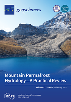
Cover Story (view full-size image): Climate change is expected to reduce global water security in arid mountains, where the vulnerable water supply is further projected to be stressed through changes in air temperature, precipitation, radiation, and wind. Together with glacier recession, this will negatively impact water availability. However, the response of permafrost to climate change is complex, where surface conditions and water flow influence heat transfer and the time over which changes occur. Mountain permafrost, particularly of rock glaciers, is often conceptualized as (frozen) water reservoirs, but an understanding of how its degradation contributes to runoff is lacking. Based on the Dry Andes, we summarize current understanding of mountain permafrost hydrology, discuss challenges and limitations, and provide suggestions for future research. View this paper
  • Issues are regarded as officially published after their release is announced to the table of contents alert mailing list.
  • You may sign up for e-mail alerts to receive table of contents of newly released issues.
  • PDF is the official format for papers published in both, html and pdf forms. To view the papers in pdf format, click on the "PDF Full-text" link, and use the free Adobe Reader to open them.
Order results
Result details
Section
Select all
Export citation of selected articles as:
42 pages, 12124 KiB  
Article
Soil Formation and Mass Redistribution during the Holocene Using Meteoric 10Be, Soil Chemistry and Mineralogy
by Alessandra Musso, Dmitry Tikhomirov, Michael L. Plötze, Konrad Greinwald, Anne Hartmann, Clemens Geitner, Fabian Maier, Fanny Petibon and Markus Egli
Geosciences 2022, 12(2), 99; https://doi.org/10.3390/geosciences12020099 - 21 Feb 2022
Cited by 9 | Viewed by 4523
Abstract
Soil development and erosion are important and opposing processes in the evolution of high-mountainous landscapes, though their dynamics are not fully understood. We compared soil development between a calcareous and a siliceous chronosequence in the central Swiss Alps at high altitudes, which both [...] Read more.
Soil development and erosion are important and opposing processes in the evolution of high-mountainous landscapes, though their dynamics are not fully understood. We compared soil development between a calcareous and a siliceous chronosequence in the central Swiss Alps at high altitudes, which both cover soil formation over the Holocene. We calculated element mass balances, long-term erosion rates based on meteoric 10Be and we determined the rates of soil formation. We also analyzed the shifts in the mineralogical composition, weathering indices, the particle size distribution, carbon stocks and oxalate extractable Fe, Al, and Mn. The siliceous soils had high chemical weathering rates at the early stage of soil formation that strongly decreased after a few millennia. The development of calcareous soil was characterized by high carbonate losses and a shift to finer soil texture. Soil erosion hampered the upbuilding of soil horizons in the early stages of soil development, which led to a delay in soil and vegetation development. This study shows how soil formation drivers change over time. In the early stages of soil development, the parent material predominantly drives soil formation while at later stages the vegetation becomes more dominant as it influences surface stability, hydrological pathways, and chemical weathering that determine water drainage and retention. Full article
(This article belongs to the Special Issue Cutting Edge Earth Sciences: Three Decades of Cosmogenic Nuclides)
Show Figures

Figure 1

28 pages, 7127 KiB  
Review
Geoheritage and Cultural Heritage—A Review of Recurrent and Interlinked Themes
by Edyta Pijet-Migoń and Piotr Migoń
Geosciences 2022, 12(2), 98; https://doi.org/10.3390/geosciences12020098 - 21 Feb 2022
Cited by 73 | Viewed by 8473
Abstract
Relationships between geoheritage and cultural heritage are being increasingly explored and have become one of the mainstreams within studies of geoheritage and geodiversity. In this review paper, we identify the main and secondary themes at the geoheritage—cultural heritage interface and provide examples of [...] Read more.
Relationships between geoheritage and cultural heritage are being increasingly explored and have become one of the mainstreams within studies of geoheritage and geodiversity. In this review paper, we identify the main and secondary themes at the geoheritage—cultural heritage interface and provide examples of specific topics and approaches. These themes include added cultural value to geoheritage sites, geoheritage in urban spaces, cultural landscapes, and the contribution of geoheritage to their identity, mining and quarrying heritage, linkages with natural disasters, history of science, and art. Intangible cultural heritage is also reviewed in the geoheritage context. In the closing part of the paper, various classifications of geoheritage—cultural heritage linkages are proposed, although it is concluded that themes and fields of inquiry are overlapping and interlinked, rendering one classification system not very feasible. Instead, a mind map to show these diverse connections is offered. The paper closes with recommendations for future studies, arising from this review and the identification of research gaps and under-researched areas. Full article
Show Figures

Figure 1

17 pages, 7346 KiB  
Article
Behavior of Shallow Circular Tunnels—Impact of the Soil Spatial Variability
by Adam Hamrouni, Daniel Dias and Xiangfeng Guo
Geosciences 2022, 12(2), 97; https://doi.org/10.3390/geosciences12020097 - 21 Feb 2022
Cited by 3 | Viewed by 2835
Abstract
Spatial variability is unavoidable for soils and it is important to consider such a feature in the design of geotechnical engineering as it may lead to some structure behaviors which cannot be predicted by a calculation assuming homogenous soils. This paper attempts to [...] Read more.
Spatial variability is unavoidable for soils and it is important to consider such a feature in the design of geotechnical engineering as it may lead to some structure behaviors which cannot be predicted by a calculation assuming homogenous soils. This paper attempts to evaluate the performance of a shallow circular tunnel, in a context of the service limit state, considering the soil spatial variability. The Log-normal distributed random fields, generated by the Karhunen–Loeve expansion method, are used for the spatial modeling. A two-dimensional numerical model, based on the finite difference method, is constructed to deterministically estimate two quantities of interest (i.e., tunnel lining bending moment and surface settlement). The model is combined with the random fields and is implemented into the Monte Carlo simulation to investigate the effects of the soil spatial variability on the tunnel responses. The autocorrelation distance, an important parameter for random fields, is varied within multiple probabilistic analyses. For both of the two tunnel responses, their variabilities are increased with increasing the autocorrelation distance, while a minimum mean value can be observed with this parameter being approximately the tunnel radius. Such finding is very useful for practical designs. A sensitivity analysis is also conducted to show the importance of each random parameter. Full article
(This article belongs to the Collection New Advances in Geotechnical Engineering)
Show Figures

Figure 1

28 pages, 15192 KiB  
Review
Energy Demand in Surface Soils for Earthquake Engineering by Vertical Array Strong Motion Records
by Takaji Kokusho
Geosciences 2022, 12(2), 102; https://doi.org/10.3390/geosciences12020102 - 21 Feb 2022
Cited by 1 | Viewed by 2334
Abstract
In earthquake engineering, acceleration has played a major role, while wave energy has rarely been considered as a demand in design. In order to understand earthquake damage mechanism in terms of energy, the demand in terms of wave energy in surface soil layers [...] Read more.
In earthquake engineering, acceleration has played a major role, while wave energy has rarely been considered as a demand in design. In order to understand earthquake damage mechanism in terms of energy, the demand in terms of wave energy in surface soil layers is studied here, assuming one-dimensional SH wave propagation by using a number of vertical array records during nine strong earthquakes in Japan. A clear decreasing trend of the energy demand with decreasing ground depth and decreasing surface soil stiffness has been found as well as a propensity of incident energies calculated at bedrocks being roughly compatible with empirical formulas. How the energy demand is correlated with structural damage is also discussed in simplified models to show that induced structural strain is governed by upward energy flux, degree of structural resonance, and impedance ratio between structure and ground and structural stiffness. In low-damping brittle superstructures, wave energy flux in resonance and associated predominant frequency are decisive in determining the damage, while cumulative wave energy determines the damage in high damping ductile soil and massive concrete structures. The trend of lower energy demand in softer soil sites may not be contradictory, with a widely accepted perception that softer soil sites tend to suffer heavier earthquake damage as far as geotechnical damage is concerned. Full article
(This article belongs to the Special Issue Engineering Analysis of Near-Source Strong Ground Motion)
Show Figures

Figure 1

31 pages, 11666 KiB  
Article
Intraplate Strike-Slip Corridor within South America (NE Border of the Paraná Basin) Unveiled by Structural Analysis of Faults and Fracture Swarms
by Paola Cianfarra, Marcos Roberto Pinheiro, Fernando Nadal Junqueira Villela and Francesco Salvini
Geosciences 2022, 12(2), 101; https://doi.org/10.3390/geosciences12020101 - 21 Feb 2022
Cited by 6 | Viewed by 4037
Abstract
We present the effect of neotectonics in intracratonic settings as revealed by the surface, brittle deformation associated to a regionally-sized shear corridor, which affects Southeastern Brazil. The deformation zone is characterized by the presence of nearly orthogonal fracture sets, interpreted as systematic and [...] Read more.
We present the effect of neotectonics in intracratonic settings as revealed by the surface, brittle deformation associated to a regionally-sized shear corridor, which affects Southeastern Brazil. The deformation zone is characterized by the presence of nearly orthogonal fracture sets, interpreted as systematic and non-systematic joints often cutting Quaternary deposits. An original methodology of fault and joint inversion by the Monte Carlo converging approach is used to infer multiple paleostress fields. The method provides the best orientation of the principal paleo-stresses responsible for the observed fracturing. At each step of the inversion process, structures are uniquely associated to the stress tensor that provides the lowest error. The results showed the poly-phased tectonic history of the shear corridor studied and paleostresses compatible with a regional strike-slip motion. Specifically, an E-W, left-lateral shear was followed by an E-W, right-lateral kinematics related to the post-Paleogene drifting of South American Plate and its clockwise rotation. The latter tectonic event is presently responsible for brittle deformation observed in Quaternary deposits. The proposed deformation corridor may represent the Cenozoic reactivation of an ancient weakness zone. We speculate that the described intraplate strike-slip deformation belt represents the continental prosecution of the Rio de Janeiro fracture zone. Full article
(This article belongs to the Special Issue Landscape Evolution in Tectonically Active Regions)
Show Figures

Figure 1

27 pages, 12347 KiB  
Article
A Step towards a Sustainable Tourism in Apennine Mountain Areas: A Proposal of Geoitinerary across the Matese Mountains (Central-Southern Italy)
by Francesca Filocamo, Carmen Maria Rosskopf, Vincenzo Amato and Massimo Cesarano
Geosciences 2022, 12(2), 100; https://doi.org/10.3390/geosciences12020100 - 21 Feb 2022
Cited by 5 | Viewed by 3450
Abstract
The Apennine mountain areas suffer progressive abandonment and marginality, although being characterized by an extraordinary richness in natural and cultural resources, and landscapes of great beauty. Therefore, their natural heritage, and especially their geoheritage, tranformed into geotourism initiatives, can represent an essential resource [...] Read more.
The Apennine mountain areas suffer progressive abandonment and marginality, although being characterized by an extraordinary richness in natural and cultural resources, and landscapes of great beauty. Therefore, their natural heritage, and especially their geoheritage, tranformed into geotourism initiatives, can represent an essential resource to support local economy andsustainable development. The present study illustrates the case of Matese Mountains (Southern Apennines), particularly rich in protected areas, including the Matese National Park currently taking off, which is characterized by a rich geoheritage, based on 59 geosites. Among these geosites, examining the specially built geosite GIS database, 16 geosites were selected to construct a geoitinerary crossing the Matese Mountains. The geoitinerary was delineated to optimally represent the major geomorphological and geological (especially geohistorical) features of the Matese area. The selected geosites were associated to a new procedure to assess their Scientific Value (SV) and Potential Tourism Use (PTU), and to confirm their suitability for the purpose. To illustrate the geoitinerary, a geoitinerary map, and illustration material such as descriptive cards were produced. As an overall result, the proposed geoitinerary represents a valuable contribution for the geotourism promotion of the Matese Mountains on which to base future studies and initiatives in this perspective. Full article
Show Figures

Figure 1

22 pages, 4830 KiB  
Article
Biostratigraphy and Paleoenvironmental Reconstruction at the Gebel Nezzazat (Central Sinai, Egypt): A Paleocene Record for the Southern Tethys
by Atef M. Kasem, Mahmoud Faris, Luigi Jovane, Taysir Abdelhamid Ads, Fabrizio Frontalini and Amr S. Zaky
Geosciences 2022, 12(2), 96; https://doi.org/10.3390/geosciences12020096 - 20 Feb 2022
Cited by 3 | Viewed by 3223
Abstract
The variations in assemblages of calcareous nannofossils are tracked in the Dakhla and Tarawan Formations exposed at Gebel Nezzazat (central Sinai, Egypt). Five calcareous nannofossil biozones, namely NP2/3, NP4, NP5, NP6, and NP7/8 are identified. A distinct marker bed related to the Latest [...] Read more.
The variations in assemblages of calcareous nannofossils are tracked in the Dakhla and Tarawan Formations exposed at Gebel Nezzazat (central Sinai, Egypt). Five calcareous nannofossil biozones, namely NP2/3, NP4, NP5, NP6, and NP7/8 are identified. A distinct marker bed related to the Latest Danian Event (LDE) occurs within the Dakhla Fm. The earliest representative of fasciculiths, Lithoptychius schmitzii, first occurs just below the LDE distinct bed and is followed by the Los of Diantholitha alata, D. mariposa, L. varolii, L. felis, and L. collaris. The abundance of calcareous nannofossils drops within the LDE distinctive bed. The base of Selandian Stage is here approximated at the base of Zone NP5 in concurrence with a sudden drop in the abundance of calcareous nannofossils. No considerable lithological changes are noted across this transition. The absence of subsequent occurrences of L. ulii, L. janii, L. billii, and L. stegostus suggest inconsistent lowest occurrences (Los) of these taxa, insufficient sampling resolution, and/or a hiatus. The base of Thanetian is approximated with the base of Zone NP7/8 in the topmost of Dakhla Fm. No considerable changes in calcareous nannofossil assemblages are associated in correspondence to this transition except the LO of D. mohleri, lowest continuous occurrence (LctO) of Bomolithus megastypus, and the increase in abundance of Heliolithus kleinpellii as well as a sudden drop in abundance within Zone NP7/8. The variations in calcareous nannofossil assemblages at Gebel Nezzazat suggest prevailing warm-water and oligotrophic conditions during the Paleocene and particularly along the Danian Stage that are interrupted by minor fluctuations in paleoclimatic conditions. In particular, the Danian–Selandian transition marks a decrease in warm and oligotrophic conditions that persisted along the Selandian Stage. The Selandian–Thanetian transition shows an increase of warm and oligotrophic conditions prevailed in the Thanetian record. The sudden decrease in abundance of calcareous nannofossils in both the Selandian and Thanetian is likely resulted from an increase in dissolution of carbonates rather than variations in the paleotemperature and/or paleofertility. Full article
(This article belongs to the Section Sedimentology, Stratigraphy and Palaeontology)
Show Figures

Figure 1

15 pages, 3737 KiB  
Article
Field Determination of Unsaturated Permeability and Flow Properties through Subgrade Instrumentation
by Asif Ahmed and Sahadat Hossain
Geosciences 2022, 12(2), 95; https://doi.org/10.3390/geosciences12020095 - 18 Feb 2022
Cited by 2 | Viewed by 2430
Abstract
Due to the representation of a particular field condition of soil rather than the real time scenario from laboratory experiments, the selection of unsaturated permeability and flow parameters becomes challenging when conducting numerical modeling. Keeping this in mind, the objective of the study [...] Read more.
Due to the representation of a particular field condition of soil rather than the real time scenario from laboratory experiments, the selection of unsaturated permeability and flow parameters becomes challenging when conducting numerical modeling. Keeping this in mind, the objective of the study was to determine the permeability in both directions along with the unsaturated flow parameters from field data. Although it is conventional to determine the flow parameters from the curve fitting of laboratory results, a novel approach was carried out during the course of study, wherein field soil water characteristic curves were used to determine the unsaturated flow parameters. Two two-lane roads in Kaufman County and Ellis County, Texas were selected for data acquisition and monitoring in this study. For the investigation of in situ moisture content and matric suction, soil moisture and suction sensors were installed at up to a depth of 4.5 m into the ground, while the precipitation was recorded using rain gauges installed at the sites. Field determination yielded hydraulic conductivity values in the range of 10−4 to 10−5 m/s, representing the rapid flow of water due to desiccation cracks on expansive soil. Field-generated unsaturated flow parameters also indicated variability while constructing the SWCC. Finally, PLAXIS 2D was used for the transient flow analysis. The close agreement of the FE results with the direct field measurements validated the estimated flow parameters. The approach described in the study can be used for determining permeability and unsaturated flow parameter values from field data, which offers a dynamic situation in contrast to the static laboratory condition. Full article
(This article belongs to the Special Issue Slope Stability Analyses and Remedial Measure of Failed Slopes)
Show Figures

Figure 1

21 pages, 37109 KiB  
Article
Early Jurassic–Early Cretaceous Calcareous Nannofossil Biostratigraphy and Geochemistry, Northeastern Iraqi Kurdistan: Implications for Paleoclimate and Paleoecological Conditions
by Nagham Omar, Tom McCann, Ali I. Al-Juboury, Maria A. Ustinova and Arkan O. Sharezwri
Geosciences 2022, 12(2), 94; https://doi.org/10.3390/geosciences12020094 - 17 Feb 2022
Cited by 3 | Viewed by 2990
Abstract
Early Jurassic- to Early Cretaceous-age calcareous nannofossils from the Sarki, Sehkanyian, Sargelu, Naokelekan, Barsarin and Chia Gara formations are investigated for the first time from the Warte area, northeastern Iraqi Kurdistan. A range of isotopic and inorganic geochemical analyses are carried out in [...] Read more.
Early Jurassic- to Early Cretaceous-age calcareous nannofossils from the Sarki, Sehkanyian, Sargelu, Naokelekan, Barsarin and Chia Gara formations are investigated for the first time from the Warte area, northeastern Iraqi Kurdistan. A range of isotopic and inorganic geochemical analyses are carried out in order to reconstruct the paleoecological and paleoclimatic conditions during which the Sarki, Sehkanyian, Sargelu, Naokelekan, Barsarin and Chia Gara formations were deposited. The age of the Sargelu Formation was determined as Bajocian–Callovian based on the first occurrence of Cyclagelosphaera margerelii, Watznaueria britannica, W. fossacincta, W. manivitiae, Watznaueria barnesiae and Watznaueria ovata. Geochemical proxies (Sr, Ca, Al, Rb/Sr, Sr/Cu and Sr/Ba) for paleoclimate and paleoecological conditions, along with oxygen isotopes (δ18O) data, suggest that warm and arid climatic conditions were predominant during the Early Jurassic–Early Cretaceous period. Full article
(This article belongs to the Special Issue Jurassic Paleoenvironments)
Show Figures

Figure 1

17 pages, 3381 KiB  
Article
Ostracod Response to a Major Middle Jurassic Sea-Level Fall: A Case Study from Southern Tunisia (North Gondwana) with Implications on Regional Stratigraphy and Palaeoenvironmental Reconstruction
by Khaled Trabelsi, Lassad Tiss, Benjamin Sames, Yassine Houla, Amine Hanini, Faycel Elferhi, Ahmed Skanji, Fekri Kamoun, Mohamed Faouzi Zagrarni and Michael Wagreich
Geosciences 2022, 12(2), 93; https://doi.org/10.3390/geosciences12020093 - 17 Feb 2022
Viewed by 2675
Abstract
Marginal-marine to non-marine ostracod assemblages from the Bajocian (Mid-Jurassic) of southern Tunisia, precisely from the Krachoua Formation at the Kef El Anneba section near the Beni Kheddache area, are here described and tested for their utility to improve the stratigraphic accuracy and palaeoenvironmental [...] Read more.
Marginal-marine to non-marine ostracod assemblages from the Bajocian (Mid-Jurassic) of southern Tunisia, precisely from the Krachoua Formation at the Kef El Anneba section near the Beni Kheddache area, are here described and tested for their utility to improve the stratigraphic accuracy and palaeoenvironmental reconstructions. This particular microfauna consists of 11 species belonging to 6 genera and represents 2 distinct types of species-rich assemblages from this time interval, allowing the interpretation of the depositional setting of the fossiliferous horizon from which the samples derive. The first ostracod assemblage is mainly composed of the brackish to shallow marine species Fastigatocythere sp. Mette, 1995; Vernoniella aff. V. bajociana Bate, 1965b; Paracypris sp. A, Paracypris sp. B, Fabanella sarda Malz et al., 1985; Marslatourella aff. M. bathonica Andreu, 1999; and Fabanella aff. F. bathonica Oertli, 1957. This ostracod biofacies reflects marginal marine (shallow platform, restricted lagoon) conditions in the studied area. In contrast, the second ostracod assemblage is exclusively dominated by the non-marine limnic species Alicenula sp., Theriosynoecum pusilla Rohr, 1976; Theriosynoecum aff. T. aveyronensis Rohr, 1976; and Theriosynoecum sp. Such ostracod biofacies reflects the establishment of (a) permanent freshwater lake(s) in the studied area, triggered by the total emersion of the Bajocian Krachoua platform, presumably as response to the short-term sea-level fall event JBj3 of Haq (2017). The recognized ostracod species from the upper part of the Krachoua Formation at Kef El Anneba section (Medenine area) are particularly similar to those already described from the neighbouring sections of Kezzani (Dhaher area) and Krachoua (Tataouine area), facilitating a stratigraphic calibration of the Krachoua Formation, as well as regional correlations of the respective Bajocian continental event within the southern Tunisian palaeogeographic domain. Moreover, the biogeography of the studied ostracod microfauna from the Mid-Jurassic of southern Tunisia provides further arguments to support the hypothesis of significant biological exchanges between Laurasian and Gondwanan islands, as recently demonstrated by means of a charophyte microflora, indicating that Peri-Tethyan biogeography remained relatively uniform during that time interval and challenging the previous assumption of their endemism. Full article
(This article belongs to the Special Issue Jurassic Paleoenvironments)
Show Figures

Figure 1

36 pages, 109424 KiB  
Article
A Multi-Method Approach for Deciphering Rockshelter Microstratigraphies—The Role of the Sodicho Rockshelter (SW Ethiopia) as a Geoarchaeological Archive
by Elena A. Hensel, Martin Kehl, Luisa Wöstehoff, Katharina Neumann, Ralf Vogelsang and Olaf Bubenzer
Geosciences 2022, 12(2), 92; https://doi.org/10.3390/geosciences12020092 - 17 Feb 2022
Cited by 1 | Viewed by 3180
Abstract
The Sodicho Rockshelter in the southwestern Ethiopian Highlands presents a unique site that contains sediments of Upper Pleistocene and Holocene occupation phases of hunter-gatherer communities. Excavations and previous geoarchaeological research provided a first 14C chronostratigraphic framework for the last 27 ka cal [...] Read more.
The Sodicho Rockshelter in the southwestern Ethiopian Highlands presents a unique site that contains sediments of Upper Pleistocene and Holocene occupation phases of hunter-gatherer communities. Excavations and previous geoarchaeological research provided a first 14C chronostratigraphic framework for the last 27 ka cal BP, which supports the hypothesis of a potential environmental refugium during the Late Glacial Maximum (LGM, ~21 ± 2 ka). Nonetheless, it is necessary to extend the preliminary interpretation of stone tool assemblages, and the geoarchaeological analyses carried out so far to provide in-depth information on prehistoric human behavior at the site under changing climatic and environmental conditions. In this study, we reinvestigate the complex stratigraphy and the paleoclimatic context of Sodicho in order to expand the knowledge about site formation, post-depositional disturbances, weathering influences, and the anthropogenic impact on the sediment deposits. Micromorphological observations and the determination of active pedogenic oxides offered a more detailed look at the microstratigraphic record in relation to shifting moisture conditions during the African Humid Period (AHP, ~15 − 5 ka). Sediment alteration and reworking are connected to the influence of sheet flow, biological activity, and human impacts such as dumping activity and site maintenance. A comparison with black carbon (BC) analyses and a qualitative phytolith ratio (quantification of dark and light phytoliths) provided evidence for variations in human fire intensity. Our collaborative and multidisciplinary approach demonstrates how the complex formation of a rockshelter site in a tropical setting with changing climatic and anthropogenic impacts can be tackled. Full article
(This article belongs to the Special Issue Pleistocene Hunter-Gatherers Geoarchaeology)
Show Figures

Figure 1

16 pages, 3704 KiB  
Article
Comparison between Calculation and Measurement of Total Sediment Load: Application to Streams of NE Greece
by Loukas Avgeris, Konstantinos Kaffas and Vlassios Hrissanthou
Geosciences 2022, 12(2), 91; https://doi.org/10.3390/geosciences12020091 - 17 Feb 2022
Cited by 2 | Viewed by 2491
Abstract
Sediment transport and stream discharge are two of the natural procedures which affect the hydromorphological profile of a watercourse. Measurements of water discharge, bed load transport rate and suspended sediment concentration were conducted in Kosynthos River and Kimmeria Torrent –two intermittent streams– in [...] Read more.
Sediment transport and stream discharge are two of the natural procedures which affect the hydromorphological profile of a watercourse. Measurements of water discharge, bed load transport rate and suspended sediment concentration were conducted in Kosynthos River and Kimmeria Torrent –two intermittent streams– in north-eastern Greece. The total sediment concentration was calculated, in both streams, by means of various nonlinear regression equations and by means of the formulas of Yang, after calibrating the coefficients of the formulas. In the computations according to the Yang formulas, two different states were examined regarding the incipient motion: one considering and one disregarding the critical conditions. The results obtained from Yang’s multiple regression-derived equations had a better fit compared to the original equations and were acceptable in both cases. Ultimately, two counterparts of Yang’s stream sediment transport formulas were constructed and made available to the readership. The comparison between the calculated and measured total sediment concentrations was achieved by means of several statistical criteria. The results indicate that the modified formulas of Yang can be successfully used for the determination of the total sediment concentration in Kosynthos River and Kimmeria Torrent. Full article
(This article belongs to the Special Issue Recent Advances on Sediment Transport and River Morphodynamics)
Show Figures

Figure 1

15 pages, 1634 KiB  
Article
OH-Defects in Detrital Quartz Grains from the Julian Basin (NE Italy and Slovenia): A Fourier Transform Infrared Study
by Francesco Bernardi, Henrik Skogby and Davide Lenaz
Geosciences 2022, 12(2), 90; https://doi.org/10.3390/geosciences12020090 - 16 Feb 2022
Cited by 2 | Viewed by 2459 | Correction
Abstract
In this study, we analyzed up to 80 detrital quartz grains from four lithic greywackes along the stratigraphic column of the Julian Basin, a synorogenic basin in the southeastern Alps between Italy and Slovenia. Fourier transform infrared spectroscopy of detrital quartz was used [...] Read more.
In this study, we analyzed up to 80 detrital quartz grains from four lithic greywackes along the stratigraphic column of the Julian Basin, a synorogenic basin in the southeastern Alps between Italy and Slovenia. Fourier transform infrared spectroscopy of detrital quartz was used to investigate the sample set with interest to its OH-defect speciation and content of each associated substitution. According to several recent studies, OH-defects in quartz are correlated to petrogenetic conditions of the source material and can be used as a provenance tool. The aim of this study is to compare results based on this method with previous studies that used other methods, to better constrain the palaeogeographical reconstruction of sedimentary fluxes. Detrital quartz within the samples of the basin shows different patterns of OH-defects and water content, indicating substantial petrogenetic differences between the sediment source rocks. For the oldest analyzed sample (ca. 66 Ma), the distribution of OH-defects suggests a mixed source between igneous and non-igneous rocks, with a predominance of metamorphic material supply. Another sample (56 Ma) reveals a great variability of OH-defects and water content, indicating that the magmatic component dominates over the metamorphic component. The distribution of OH-defects in the samples at the top of the sequence (52–53 Ma) suggests an almost solely metamorphic source. These results are in line with previous studies based on heavy minerals and geochemistry. Full article
(This article belongs to the Collection Detrital Minerals: Their Application in Palaeo-Reconstruction)
Show Figures

Figure 1

19 pages, 7953 KiB  
Article
An Approach for the Automatic Characterization of Underwater Dunes in Fluviomarine Context
by Willian Ney Cassol, Sylvie Daniel and Éric Guilbert
Geosciences 2022, 12(2), 89; https://doi.org/10.3390/geosciences12020089 - 16 Feb 2022
Cited by 6 | Viewed by 3312
Abstract
The identification of underwater landforms represents an important role in the study of the seafloor morphology. In this context, the segmentation and characterization of underwater dunes allow a better understanding of the dynamism of the seafloor, since the formation of these structures is [...] Read more.
The identification of underwater landforms represents an important role in the study of the seafloor morphology. In this context, the segmentation and characterization of underwater dunes allow a better understanding of the dynamism of the seafloor, since the formation of these structures is directly related to environmental conditions, such as current, tide, grain size, etc. In addition, it helps to ensure safe navigation, especially in the context of navigation channels requiring periodic maintenance. This paper proposes a novel method to automatically characterize the underwater dunes. Its originality relies on the extraction of morphological descriptors not only related to the dune itself, but also to the fields where the dunes are located. Furthermore, the proposed approach involves the entire surface of the dunes, rather than profiles or group of pixels as generally found in previous works. Considering the surface modelled by a digital bathymetric model (DBM), the salient features of the dunes (i.e., crest line, stoss trough, and lee trough) are first identified using a geomorphometric analysis of the DBM. The individual dunes are built by matching the crest lines with their respective troughs according to an object-oriented approach. Then, a series of morphological descriptors, selected through a literature review, are computed by taking advantage of the dune salient features, surface representation, and spatial distribution in the fields where they are located. The validation of the proposed method has been conducted using more than 1200 dunes in the fluvio-marine context of the Northern Traverse of the Saint Lawrence River. Full article
Show Figures

Figure 1

29 pages, 115725 KiB  
Article
Successive Modes of Carbonate Precipitation in Microbialites along the Hydrothermal Spring of La Salsa in Laguna Pastos Grandes (Bolivian Altiplano)
by Elodie Muller, Magali Ader, Giovanni Aloisi, Cédric Bougeault, Christophe Durlet, Emmanuelle Vennin, Karim Benzerara, Eric C. Gaucher, Aurélien Virgone, Marco Chavez, Pierre Souquet and Emmanuelle Gérard
Geosciences 2022, 12(2), 88; https://doi.org/10.3390/geosciences12020088 - 16 Feb 2022
Cited by 3 | Viewed by 3056
Abstract
Interpreting the paleoecosystems of ancient microbialites relies on our understanding of how modern microbialites form in relation with the bio-physico-chemical conditions of their environment. In this study, we investigated the formation of modern carbonate microbialites in the hydrothermal system of La Salsa in [...] Read more.
Interpreting the paleoecosystems of ancient microbialites relies on our understanding of how modern microbialites form in relation with the bio-physico-chemical conditions of their environment. In this study, we investigated the formation of modern carbonate microbialites in the hydrothermal system of La Salsa in Laguna Pastos Grandes (Bolivia), which spans a wide range of physicochemical conditions and associated microbial communities. By combining dissolved inorganic carbon (DIC) isotope mass balance modeling, analysis of carbonates solubility diagram, and imaging of the microorganisms–mineral assemblages within microbial mats, we found that several modes of carbonate precipitation dominate in distinct portions of the hydrothermal system. (1) In high-[DIC] waters, undersaturated to slightly saturated with respect to calcite, cyanobacterial calcification is promoted by CO2 degassing and photosynthetic activity within the microbial mats. (2) In alkaline waters undergoing sustained evaporation, the precipitation of an amorphous calcium carbonate phase seems to control the water a(Ca2+)/a(CO32−) ratio and to serve as a precursor to micritic calcite formation in microbial mats. (3) In saline ephemeral ponds, where the carbonate precipitation is the highest, calcite precipitation probably occurs through a different pathway, leading to a different calcite texture, i.e., aggregates of rhombohedral crystals. Full article
(This article belongs to the Special Issue Current and Future Perspectives in Microbial Carbonate Precipitation)
Show Figures

Figure 1

14 pages, 5383 KiB  
Article
Ice Core Chronologies from the Antarctic Peninsula: The Palmer, Jurassic, and Rendezvous Age-Scales
by B. Daniel Emanuelsson, Elizabeth R. Thomas, Dieter R. Tetzner, Jack D. Humby and Diana O. Vladimirova
Geosciences 2022, 12(2), 87; https://doi.org/10.3390/geosciences12020087 - 16 Feb 2022
Cited by 12 | Viewed by 4737
Abstract
In this study, we present the age scales for three Antarctic Peninsula (AP) ice cores: Palmer, Rendezvous, and Jurassic. The three cores are all intermediate-depth cores, in the 133–141 m depth range. Non-sea-salt sulfate ([nssSO42−]) and hydrogen peroxide (H2 [...] Read more.
In this study, we present the age scales for three Antarctic Peninsula (AP) ice cores: Palmer, Rendezvous, and Jurassic. The three cores are all intermediate-depth cores, in the 133–141 m depth range. Non-sea-salt sulfate ([nssSO42−]) and hydrogen peroxide (H2O2) display marked seasonal variability suitable for annual-layer counting. The Palmer ice core covers 390 years, 1621–2011 C.E., and is one of the oldest AP cores. Rendezvous and Jurassic are lower elevation high-snow accumulation sites and therefore cover shorter intervals, 1843–2011 C.E. and 1874–2011 C.E., respectively. The age scales show good agreement with known volcanic age horizons. The three chronologies’ start and end dates of volcanic events are compared to the volcanic events in the published WAIS Divide core. The age difference for the Palmer age scale is ±6 months, Rendezvous ±9 months, and Jurassic ±7 months. Our results demonstrate the advantage of dating several cores from the same region at the same time. Additional confidence can be gained in the age scales by evaluating and finding synchronicity of [nssSO42−] peaks amongst the sites. Full article
Show Figures

Figure 1

2 pages, 147 KiB  
Editorial
Editorial of Special Issue “Tectonics and Morphology of Back-Arc Basins”
by Maria Filomena Loreto
Geosciences 2022, 12(2), 86; https://doi.org/10.3390/geosciences12020086 - 14 Feb 2022
Viewed by 2085
Abstract
Back-arc basins are tectonic domains within subduction systems shaped mainly by extensional and transtensional tectonics or in some cases by compression, volcanism and intense hydrothermalism [...] Full article
(This article belongs to the Special Issue Tectonics and Morphology of Back-Arc Basins)
3 pages, 795 KiB  
Editorial
Editorial of the Special Issue “Geomorphology, Geoheritage, Geoparks and Geotourism in Volcanic Areas”
by Javier Dóniz-Páez
Geosciences 2022, 12(2), 85; https://doi.org/10.3390/geosciences12020085 - 14 Feb 2022
Cited by 1 | Viewed by 2095
Abstract
Volcanic landscapes represent very attractive sites for the population, and offer many resources to the communities that live within them (soils, materials, energy, and tourism) (Figure 1) [...] Full article
(This article belongs to the Special Issue Geomorphology, Geoheritage, Geoparks and Geotourism in Volcanic Areas)
Show Figures

Figure 1

16 pages, 6429 KiB  
Article
Contributions for the Understanding of the São Pedro do Sul (North of Portugal) Geohydraulic and Thermomineral System: Hydrochemistry and Stable Isotopes Studies
by Solange Almeida, Luís Gomes, Alcino Oliveira and Paula Carreira
Geosciences 2022, 12(2), 84; https://doi.org/10.3390/geosciences12020084 - 13 Feb 2022
Cited by 3 | Viewed by 2700
Abstract
São Pedro do Sul thermomineral aquifer system is located in the North of Portugal. Hydrogeochemistry and isotopic studies were conducted in order to improve knowledge of this groundwater system, known since ancient Roman times for their therapeutic properties. One thermomineral spring (NT) and [...] Read more.
São Pedro do Sul thermomineral aquifer system is located in the North of Portugal. Hydrogeochemistry and isotopic studies were conducted in order to improve knowledge of this groundwater system, known since ancient Roman times for their therapeutic properties. One thermomineral spring (NT) and three boreholes (AC1, SDV1 and SDV2) have a mean temperature around 68 °C. Currently, these waters are mainly used in thermal spas and for geothermal energy supply. Major cations and anions were used to identify and characterize different water types and sub-systems. Stable isotopes composition, δ18O and δ2H, have been used to determine the origin and have been used as a first approach to estimate the mean preferential recharge altitude of thermomineral water. The results suggest a single aquifer system with a relative composition of cations and anions and similar mineralization values. δ18O and δ2H values indicate a meteoric origin with no significant evaporation before infiltration. Besides, the isotopic composition points to recharge areas located at altitudes of about 1000 m a.s.l. This suggests a recharge area in the Freita/Arada mountains located NW of the thermomineral poles. Full article
Show Figures

Figure 1

15 pages, 3311 KiB  
Review
Defining the Boundary Conditions for Seismic Response Analysis—A Practical Review of Some Widely-Used Codes
by Anna Chiaradonna
Geosciences 2022, 12(2), 83; https://doi.org/10.3390/geosciences12020083 - 11 Feb 2022
Cited by 15 | Viewed by 6026
Abstract
The first step for learning any calculation code for seismic response analysis is an adequate understanding of how to properly set the boundary conditions and the properties of the soil model at the initial stage, i.e., before the shaking event. To pursue this [...] Read more.
The first step for learning any calculation code for seismic response analysis is an adequate understanding of how to properly set the boundary conditions and the properties of the soil model at the initial stage, i.e., before the shaking event. To pursue this aim, nine different computer codes suitable for seismic response analyses of soil profiles have been reviewed. An ideal twenty-meter soil column with visco-elastic linear behavior, subjected to a pulse-like input motion, has been reproduced with the different codes with the scope to practically show the differences and peculiarities of each of them. In the definition of the soil properties in the small-strain range, special attention has been devoted to the definition of the damping ratio, usually defined in non-linear codes as viscous damping according to the Rayleigh formulation. This simple one-dimensional exercise has been considered as a useful benchmark for verifying the rightness of the application of the boundary conditions and setting the initial soil properties. The same analysis can be easily reproduced by beginner users and, therefore, constitutes a starting point in the learning phase of new and/or more sophisticated 2D and 3D calculation codes for seismic site response analysis. Full article
(This article belongs to the Section Natural Hazards)
Show Figures

Figure 1

21 pages, 3793 KiB  
Article
Comparative Analysis of Two Assessment Methods for the Geoeducational Values of Geosites: A Case Study from the Volcanic Island of Nisyros, SE Aegean Sea, Greece
by George Zafeiropoulos and Hara Drinia
Geosciences 2022, 12(2), 82; https://doi.org/10.3390/geosciences12020082 - 10 Feb 2022
Cited by 19 | Viewed by 3475
Abstract
In this study, the geoeducational value of five geosites, located in the aspiring geopark of the volcanic island of Nisyros, SE Aegean Sea, was assessed by means of two methods: the G-P method of Brilha (2016) and the M-GAM method. The first method [...] Read more.
In this study, the geoeducational value of five geosites, located in the aspiring geopark of the volcanic island of Nisyros, SE Aegean Sea, was assessed by means of two methods: the G-P method of Brilha (2016) and the M-GAM method. The first method takes into account 12 criteria belonging to the educational potential. The M-GAM method, on the other hand, takes into account the opinions of visitors who, as non-experts, express a different point of view that is rarely calculated or evaluated in different geosite assessment methods. For the better and more objective comparison of the two methods of evaluation of the educational potential of the study areas, the results were converted to a percentage scale (%). The first G-P method clearly highlights the high geological value of the studied geosites, which have a relatively high score and can be used for geotourism and geoeducation. The second method, on the other hand, yields a moderate score in areas with objectively high geological value. This is clearly evident, as this method considers the opinions of visitors who lack the necessary cognitive geological background, thereby underestimating the significance and potential of certain geological features due to lack of formal training. Full article
Show Figures

Figure 1

7 pages, 1149 KiB  
Correction
Correction: King et al. Surface-Rupturing Historical Earthquakes in Australia and Their Environmental Effects: New Insights from Re-Analyses of Observational Data. Geosciences 2019, 9, 408
by Tamarah R. King, Mark Quigley and Dan Clark
Geosciences 2022, 12(2), 81; https://doi.org/10.3390/geosciences12020081 - 10 Feb 2022
Viewed by 1800
Abstract
The authors would like to correct the published article [...] Full article
Show Figures

Figure 1

15 pages, 1374 KiB  
Article
Educational Resources for Geoethical Aspects of Water Management
by Sebastian Handl, Cristina S. C. Calheiros, Markus Fiebig and Guenter Langergraber
Geosciences 2022, 12(2), 80; https://doi.org/10.3390/geosciences12020080 - 8 Feb 2022
Cited by 6 | Viewed by 2845
Abstract
Global water resources are a critical value for the future of humankind. Conflicts and wars seem to rise because of such critical resources. While water-scarce countries are under extreme pressure on the long-term scale, also water-rich countries in Europe, such as Austria, face [...] Read more.
Global water resources are a critical value for the future of humankind. Conflicts and wars seem to rise because of such critical resources. While water-scarce countries are under extreme pressure on the long-term scale, also water-rich countries in Europe, such as Austria, face local conflicts of interest between water supply, tourism, agriculture, hydropower and ecology, for instance. Higher Education must address these conflicts and the new concepts of geoethics offer the conceptional thinking to do so. Based on educational resources for Higher Education that have been developed in the field of “Geoethics and Water Management” under the Erasmus+ co-funded project GOAL (Geoethics Outcomes and Awareness Learning), selected water-related conflicts are discussed. The cases selected for developing the educational resources are water use conflicts and geoethical aspects of hydropower plants. The educational resources include a subsequent procedure for applying them with students. Outcomes from the educational resources show that issues related to water management often create geoethical conflicts and dilemmas, and an interconnection between several Sustainable Development Goals can be established. Applying the educational resources shall enable geoscientists to contribute towards sustainable development of Earth’s future by a more holistic view. Full article
(This article belongs to the Collection Education in Geosciences)
Show Figures

Figure 1

21 pages, 10734 KiB  
Article
Characteristics of Sub-Aerially Emplaced Pyroclasts in the Surtsey Eruption Deposits: Implications for Diverse Surtseyan Eruptive Styles
by Andrea Verolino, James D. L. White, Rachael J. M. Baxter, C. Ian Schipper and Thor Thordarson
Geosciences 2022, 12(2), 79; https://doi.org/10.3390/geosciences12020079 - 8 Feb 2022
Cited by 4 | Viewed by 4020
Abstract
The 1963–1967 shallow-to-emergent eruption in Iceland’s Vestmannaeyjar earned a place in the history of volcanology by creating the island of Surtsey while under close observation of volcanologist Sigurdur Thorarinsson (Sigurður Þórarinsson in Icelandic). This is an example of what is now called Surtseyan [...] Read more.
The 1963–1967 shallow-to-emergent eruption in Iceland’s Vestmannaeyjar earned a place in the history of volcanology by creating the island of Surtsey while under close observation of volcanologist Sigurdur Thorarinsson (Sigurður Þórarinsson in Icelandic). This is an example of what is now called Surtseyan volcanism, and it included explosive and effusive phases from multiple vents that formed the island of Surtsey itself, as well as one fully subaqueous pyroclastic edifice and two additional, but ephemeral, islands. Sigurdur Thorarinsson identified tephra jetting and continuous uprush as characteristic types of subaerial explosive activity of Surtseyan volcanism. Subaerial cone-forming deposits of Surtseyan volcanism are typically poorly sorted, with fine-grained beds rich in sideromelane ash fragments, punctuated by larger, ubiquitously composite bombs, whereas deposits sampled by coring deep into the submarine edifice include fines-poor horizons dominated by vesicular coarse sideromelane ash. Here, we present new textural data and highlight the diversity of pyroclasts and microtextures from Surtsey (Surtur I and Surtur II) and its satellite vents (Surtla, Syrtlingur and Jolnir), in the context of Surtseyan volcanism. We used several sample sets. Some were collected during the 3.5-year long eruption and were conserved in the Icelandic Natural History Museum, including one sample from the core drilled into Surtsey in 1979. Other samples were collected during more recent field campaigns on Surtsey Island. In closing, we discuss the implications of this diversity for the range of activity and products produced by Surtsey. Full article
(This article belongs to the Special Issue Present and Past Submarine Volcanic Activity)
Show Figures

Figure 1

22 pages, 55976 KiB  
Article
Digital Tools to Serve Geotourism and Sustainable Development at Psiloritis UNESCO Global Geopark in COVID Times and Beyond
by Charalampos Fassoulas, Emmanouel Nikolakakis and Spiridon Staridas
Geosciences 2022, 12(2), 78; https://doi.org/10.3390/geosciences12020078 - 7 Feb 2022
Cited by 24 | Viewed by 4599
Abstract
Digital tools that aid geolocation, geointerpretation and geomodelling are increasingly used in the promotion of geoheritage and geoconservation. UNESCO Global Geoparks (UGGps) are complex regions that require a variety of approaches to advance geoconservation and public awareness, holistic heritage management and sustainable development. [...] Read more.
Digital tools that aid geolocation, geointerpretation and geomodelling are increasingly used in the promotion of geoheritage and geoconservation. UNESCO Global Geoparks (UGGps) are complex regions that require a variety of approaches to advance geoconservation and public awareness, holistic heritage management and sustainable development. UGGps need more diversified and applied digital tools to address these subjects. Additional efforts are made through their commitment to achieving sustainable development goals (SDGs) in the changing and challenging world of the COVID-19 pandemic and the exacerbation of climate change. In this study, we present three new digital applications developed for the Psiloritis UGGp in Southern Greece. These digital tools were developed under the implementation of the “Enhancement Plan” of the geopark via the RURITAGE, a project that supports rural regeneration through conservation, with a focus on local heritage. Digital tools developed in the project include an interactive digital map that demonstrates all properties of local heritage, products and services, two story maps focusing on historic churches and monasteries of the Amari district and on the natural and cultural values of Nida plateau, and a business-listing map with the affiliated geopark enterprises. These digital tools combine multiple applications and methods such as Wordpress webpages, web maps, spherical panoramas, multimedia, site interpretation, geolocation and virtual reality to aid the interpretation of natural and cultural heritage, promote important sites, demonstrate overlaps between nature and human society and support local productivity. Digital tools offer online access to interested parties in any area and are also used for in situ information sites. They are user-friendly, device-adjusted and available for sharing on social media and webpages. The applicability and effectiveness of these digital tools are proven to advance geotourism and the SDGs, in line with the provisions of the “World After roadmap” of UGGps. During the COVID-19 pandemic, the “visibility” of the Psiloritis UGGp was doubled via the use of these digital tools, as they have become popular among the general public. Full article
Show Figures

Figure 1

13 pages, 2053 KiB  
Article
Geospatial Synthesis of Biogeochemical Attributions of Porphyrins to Oil Pollution in Marine Sediments of the Gulf of México
by Francisco Muñoz-Arriola and José Vinicio Macías-Zamora
Geosciences 2022, 12(2), 77; https://doi.org/10.3390/geosciences12020077 - 6 Feb 2022
Cited by 3 | Viewed by 2287
Abstract
Porphyrins are highly persistent in the environment and represent a helpful biogeochemical attribute to assess the spatial distribution of the effects of oil spills on ecosystems and their resilience. In areas prone to natural and human-originated oil spills, the measurement of VO– and [...] Read more.
Porphyrins are highly persistent in the environment and represent a helpful biogeochemical attribute to assess the spatial distribution of the effects of oil spills on ecosystems and their resilience. In areas prone to natural and human-originated oil spills, the measurement of VO– and nickel–porphyrins in marine–sediment samples can identify the effects of oil pollution across spatiotemporal scales. The goal is to explore whether or not these compounds can be useful indicators of the geospatial attributions of oil contamination in the surficial sediments. We hypothesize that the geospatial gradients of porphyrins in marine sediments from petroleum spills and seepage activities—related to traditional indices of oil pollution, such as heavy metals and polycyclic aromatic hydrocarbons—can be identified in small sediment samples and concentrations. The objectives are two-fold: (1) extract and measure VO– and nickel–porphyrins from small marine sediment samples using high-pressure liquid chromatography, and (2) use cluster analysis and the canonical correlation analysis to identify the biogeochemical and geospatial attributions between VO–porphyrins and another index of oil pollution extracted and analyzed from sediments of the Campeche Shelf, in the Gulf of Mexico. High-pressure liquid chromatography with diode array detectors, two inverse phase columns and an isocratic separation method, was used to analyze the marine sediments. We identified 5.1 ng/g to 240.3 ng/g to VO–porphyrins concentrations with gradients toward areas identified as potential sources of oil pollution. Similar patterns were present for nickel–porphyrins, with values two orders of magnitude below those for the VO–porphyrins. The results represent a valuable opportunity to measure the biomarkers associated with oil pollution in small sediment samples. Furthermore, the results can find the potential drawbacks of benthic ecosystem resilience. Full article
(This article belongs to the Section Biogeosciences)
Show Figures

Figure 1

13 pages, 16223 KiB  
Article
Geological and Mining Heritage as a Driver of Development: The NE Sector of the Linares-La Carolina District (Southeastern Spain)
by Rosendo Mendoza, Javier Rey, Julián Martínez and Maria Carmen Hidalgo
Geosciences 2022, 12(2), 76; https://doi.org/10.3390/geosciences12020076 - 6 Feb 2022
Cited by 4 | Viewed by 2578
Abstract
Conservation, rehabilitation and post-valuation of the facilities of old mining districts is considered a valid strategy to revitalize these areas. In this study, the northeastern sector of the Linares-La Carolina mining district was analyzed, integrating geological information with mining to assess its value. [...] Read more.
Conservation, rehabilitation and post-valuation of the facilities of old mining districts is considered a valid strategy to revitalize these areas. In this study, the northeastern sector of the Linares-La Carolina mining district was analyzed, integrating geological information with mining to assess its value. The characteristics of the three most emblematic veins (consisting of galena, sphalerite, chalcopyrite, pyrite, quartz, ankerite and calcite) were analyzed, namely El Guindo, Federico and El Sinapismo. In this study, each mining exploitation was evaluated according to their geological context. Currently, old mining operations can only be visited from drainage galleries or from some exploration galleries. However, some of the old mining shafts could be adapted for visitation. On the surface, the remains of the most important extraction shafts and part of the associated facilities are still visible. One can also visit old tailings dumps with a high contents of heavy metals associated with ore concentration plants. The contaminating potential of these wastes is being monitored thanks to control piezometers and sensors installed at different depths within the tailings ponds, which assist in controlling evolution in the latter years. Different localities of special interest from geological, mining and mineralogical points of view are indicated. Therefore, the guided tour described in this work is attractive for tourism and educational purposes. Full article
Show Figures

Figure 1

25 pages, 9638 KiB  
Article
Sensitivity Analysis of the Global Response of Flexible Rockfall Barriers
by Cyril Douthe, Chloé Girardon and Romain Boulaud
Geosciences 2022, 12(2), 75; https://doi.org/10.3390/geosciences12020075 - 6 Feb 2022
Cited by 4 | Viewed by 2302
Abstract
Protection barriers against the fall of boulders and rocks are structures with non-linear mechanical behaviour that make the study particularly complex. In this study, the understanding of an experimentally observed variability was investigated numerically using a non-linear spring-mass equivalence. First, key figures of [...] Read more.
Protection barriers against the fall of boulders and rocks are structures with non-linear mechanical behaviour that make the study particularly complex. In this study, the understanding of an experimentally observed variability was investigated numerically using a non-linear spring-mass equivalence. First, key figures of the experiments on which this study is based are detailed. Then, the numerical model for the dynamic simulation of the barrier deformation under impact is presented. Finally, the variability due to block-related parameters and then net-related parameters are explored and evidence the role of the cables’ geometric stiffness in the global response of the fence. Full article
(This article belongs to the Special Issue Rockfall Protection and Mitigation)
Show Figures

Figure 1

17 pages, 5512 KiB  
Article
Isotopic and Chemical Tracing for Residence Time and Recharge Mechanisms of Groundwater under Semi-Arid Climate: Case from Rif Mountains (Northern Morocco)
by Mohammed Hssaisoune, Lhoussaine Bouchaou, Mohamed Qurtobi, Hamid Marah, Mohamed Beraaouz and Jamal Stitou El Messari
Geosciences 2022, 12(2), 74; https://doi.org/10.3390/geosciences12020074 - 5 Feb 2022
Cited by 10 | Viewed by 2852
Abstract
Karstic aquifers play an important role for drinking and irrigation supply in Morocco. However, in some areas, a deeper understanding is needed in order to improve their sustainable management under global changes. Our study, based on chemical and isotopic investigation of 67 groundwater [...] Read more.
Karstic aquifers play an important role for drinking and irrigation supply in Morocco. However, in some areas, a deeper understanding is needed in order to improve their sustainable management under global changes. Our study, based on chemical and isotopic investigation of 67 groundwater samples from the karst aquifer in the Rif Mountains, provides crucial information about the principal factors and processes influencing groundwater recharge and residence time. The δ18O and δ2H isotopic values indicate that the recharge is derived from meteoric water at high, intermediate, and low elevations for Lakraa Mountain, North of Lao River, and Haouz and Dersa Mountain aquifers, respectively. All samples show an isotopic signature from Atlantic Ocean except for those from the Lakraa Mountain aquifer, which shows Mediterranean Sea influence. Groundwater age determined by radiocarbon dating using the IAEA model indicates that the ages range from modern to 1460 years. This short residence time is consistent with the detectable tritium values (>2.7 TU) measured in groundwater. These values are similar to those of precipitation at the nearest GNIP stations of Gibraltar and Fez-Saiss, situated around 100 km north and 250 km south of the study area, respectively. This evidence indicates that groundwater in the Rif Mountains contains modern recharge (<60 years), testifying to significant renewability and the vulnerability of the hydrological system to climate variability and human activities. The results also indicate the efficiency of isotopic tracing in mountainous springs and would be helpful to decision makers for water in this karstic zone. Full article
(This article belongs to the Special Issue Groundwater in Arid and Semiarid Areas II)
Show Figures

Figure 1

16 pages, 3773 KiB  
Article
Establishing a Provenance Framework for Sandstones in the Greenland–Norway Rift from the Composition of Moraine/Outwash Sediments
by Adam G. Szulc, Andrew C. Morton, Andrew G. Whitham, Sidney R. Hemming and Stuart N. Thomson
Geosciences 2022, 12(2), 73; https://doi.org/10.3390/geosciences12020073 - 4 Feb 2022
Cited by 2 | Viewed by 2617
Abstract
The crystalline basement and Caledonian orogenic belt of East Greenland between 70 and 78° N are divided into five source regions on the basis of heavy mineral assemblages, mineral geochemistry, and isotopic age data from 42 modern moraine/outwash samples. The sand types generated [...] Read more.
The crystalline basement and Caledonian orogenic belt of East Greenland between 70 and 78° N are divided into five source regions on the basis of heavy mineral assemblages, mineral geochemistry, and isotopic age data from 42 modern moraine/outwash samples. The sand types generated by the five source regions can be recognized in the Mesozoic sedimentary rocks of Mid-Norway, and are named, from south to north, MN7 (Gåseland), MN4i (Milne Land–Renland), MN2ii (Hinks Land–Suess Land), MN2iii (Payer Land–Dronning Louise Land), and MN6 (Germania Land). These provide a framework for interpreting the provenance of Greenland–Norway rift sedimentary deposits. The provenance characteristics of Liverpool Land have also been defined, but whether this relatively small region merits a separate provenance status is unclear. Provenance links can be made by comparing the source region sand types with the composition of onshore and offshore sediments from previous studies. Triassic sandstones of the Nordland Ridge and the far south of the Møre Basin, along with Jurassic sandstones of the Heidrun Field in the Haltenbanken area, were derived from the MN4i source region. The provenance of Cretaceous sandstones in East Greenland can be linked to the MN2ii source region. The source of Turonian sandstones on Traill Ø can be pinpointed by zircon U–Pb ages to the Neoproterozoic Lyell Land Group of the Franz Josef Allochthon. Cretaceous sandstones in the Vøring and Møre basins were derived from the MN2iii and MN4i source regions. In addition, some of the Cenomanian–Campanian sedimentary rocks of East Greenland and Mid-Norway contain Permian–Cretaceous-aged zircon grains that are absent from the moraine/outwash samples. The most likely source of these zircon grains is the circum-Arctic region, implying the existence of a long-lived axial drainage system that entered the Greenland–Norway rift from the north. Full article
(This article belongs to the Collection Detrital Minerals: Their Application in Palaeo-Reconstruction)
Show Figures

Figure 1

Previous Issue
Next Issue
Back to TopTop