Next Issue
Volume 13, April
Previous Issue
Volume 13, February


Geosciences, Volume 13, Issue 3 (March 2023) – 32 articles

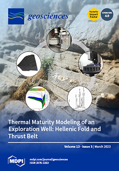
Cover Story (view full-size image): Fold and thrust belts (FTB) are sedimentary successions that are deformed by folding and faulting. They commonly form on foreland basins, as part of orogenic belts. As a function of burial history, thermal maturity, and thus hydrocarbon generation timing understanding, are critical in such settings. Thermal modeling provides a way of understanding the latter, and thermal parameters can be combined to calibrate the model. These parameters include the vitrinite reflectance, Tmax and biomarkers. This method was used in an area in the Hellenic FTB (Western Greece), providing insight into the burial history and overburden eroded thickness, as well as the thermal maturity of the Lower Cretaceous potential source rocks. View this paper
  • Issues are regarded as officially published after their release is announced to the table of contents alert mailing list.
  • You may sign up for e-mail alerts to receive table of contents of newly released issues.
  • PDF is the official format for papers published in both, html and pdf forms. To view the papers in pdf format, click on the "PDF Full-text" link, and use the free Adobe Reader to open them.
Order results
Result details
Section
Select all
Export citation of selected articles as:
17 pages, 13950 KiB  
Article
Steel Baffles as a Rockfall Protection Measure for Mountainous Urban Settings
by Jude Shalitha Perera and Nelson Lam
Geosciences 2023, 13(3), 93; https://doi.org/10.3390/geosciences13030093 - 22 Mar 2023
Cited by 1 | Viewed by 1866
Abstract
A form of steel baffles, which is made of steel poles encased in concrete and embedded into the ground, are introduced in this article. This type of protective installation is to be located on previously identified/designed catchment at multiple levels up the hillslope [...] Read more.
A form of steel baffles, which is made of steel poles encased in concrete and embedded into the ground, are introduced in this article. This type of protective installation is to be located on previously identified/designed catchment at multiple levels up the hillslope to fence off large fallen boulders during landslides or rockfalls. These baffles are intended to serve as added-on protection to filter barriers (array of baffles) that have recently gained popularity as a means of filtering out coarse debris. The aforementioned protective devices are to be installed in strategic positions close to unstable rocks (noting that the velocity of impact can be much reduced at the upstream end of the rockfall trajectory). The proposed design involves only a simple hollow steel section, which is embedded into the ground. The installation process involves manually excavating a hole in the ground to accommodate the baffle, followed by backfilling with concrete. A straightforward calculation method, which is found on the established principles of structural dynamics and soil mechanics, has been developed to determine the section sizes and embedment depths for a given impact scenario. Based on the presented design procedure, a set of design charts have been developed for expediting the design and analysis process. The presented calculation methodology based on use of design charts have been validated by comparison with data generated by LS-DYNA simulations. Full article
(This article belongs to the Special Issue Rockfall Protection and Mitigation)
Show Figures

Figure 1

11 pages, 1235 KiB  
Article
Use of Webcams in Support of Operational Snow Monitoring
by Cemal Melih Tanis, Elisa Lindgren, Anna Frey, Lasse Latva, Ali Nadir Arslan and Kari Luojus
Geosciences 2023, 13(3), 92; https://doi.org/10.3390/geosciences13030092 - 22 Mar 2023
Viewed by 1990
Abstract
Ultrasonic sensors are one of the most common automatic monitoring methods in operational snow depth monitoring with reliable results. On the other hand, there is significant uncertainty when measuring small snow depths (<2 cm), thus it cannot provide binary snow presence (on/off) information. [...] Read more.
Ultrasonic sensors are one of the most common automatic monitoring methods in operational snow depth monitoring with reliable results. On the other hand, there is significant uncertainty when measuring small snow depths (<2 cm), thus it cannot provide binary snow presence (on/off) information. The use of webcams in monitoring snow cover has proven to be successful in recent studies and applications. In this study, we applied an adaptive thresholding technique on images from webcams to obtain reliable snow on/off information to complement the ultrasonic snow depth measurements. Camera and ultrasonic sensor data from two weather stations in Finland were studied. The webcam data was processed using FMIPROT (Finnish Meteorological Institute Image Processing Tool) software, operating in a cloud computing environment, which can generate near real-time data. Our results indicate that webcam-derived data can be successfully used for quality control or as auxiliary data to support operational ultrasonic sensor measurements and provide a cost-effective improvement to operational monitoring capabilities. Webcam monitoring is especially useful during the melting season when the snow depth is below 15 mm, with accuracy values between 72% and 94%. Full article
Show Figures

Figure 1

25 pages, 5918 KiB  
Article
The Importance of Eurekan Mountains on Cenozoic Sediment Routing on the Western Barents Shelf
by Michael J. Flowerdew, Edward J. Fleming, David M. Chew, Andrew C. Morton, Dirk Frei, Aukje Benedictus, Jenny Omma, Teal. R. Riley, Eszter Badenszki and Martin J. Whitehouse
Geosciences 2023, 13(3), 91; https://doi.org/10.3390/geosciences13030091 - 21 Mar 2023
Cited by 2 | Viewed by 2419
Abstract
The importance of topography generated by Eocene Eurekan deformation as a sediment source for sandstones deposited on the western Barents Shelf margin is evaluated through a sediment provenance study conducted on wellbore materials retrieved from Spitsbergen and from the Vestbakken Volcanic Province and [...] Read more.
The importance of topography generated by Eocene Eurekan deformation as a sediment source for sandstones deposited on the western Barents Shelf margin is evaluated through a sediment provenance study conducted on wellbore materials retrieved from Spitsbergen and from the Vestbakken Volcanic Province and the Sørvestsnaget Basin in the southwest Barents Sea. A variety of complementary techniques record a provenance change across the Paleocene-Eocene boundary in wellbore BH 10-2008, which samples Paleogene strata of the Central Tertiary Basin in Spitsbergen. Sandstones containing K-feldspar with radiogenic Pb isotopic compositions, chrome spinel in the heavy mineral assemblage, and detrital zircons and rutiles with prominent Palaeoproterozoic and Late Palaeozoic—Early Mesozoic U-Pb age populations are up-section replaced by sandstone containing albitic plagioclase feldspar, metasedimentary schist rock fragments, a heavy mineral assemblage with abundant chloritoid, metamorphic apatite with low REE contents, metapelitic rutile with Silurian U-Pb ages and zircons with predominantly Archaean and Palaeoproterozoic U-Pb age populations. Our results clearly demonstrate the well-known regional change in source area from an exposed Barents Shelf terrain east of the Central Tertiary Basin during the Paleocene to the emerging Eurekan mountains west and north of the Central Tertiary Basin during the Eocene. Eocene sandstones deposited in the marginal basins of the southwestern Barents Shelf, which were sampled in wellbores 7316/5-1 and 7216/11-1S, contain elements of both the Eurekan and the eastern Barents Shelf provenance signatures. The mixing of the two sand types and delivery to the southwest margin of the Barents Shelf is consistent with a fill and spill model for the Central Teritary Basin, with transport of Eurekan-derived sediment east then south hundreds of kilometres across the Shelf. Full article
(This article belongs to the Collection Detrital Minerals: Their Application in Palaeo-Reconstruction)
Show Figures

Figure 1

14 pages, 2080 KiB  
Article
The Current State of Irrigated Soils in the Central Fergana Desert under the Effect of Anthropogenic Factors
by Evgeny Abakumov, Gulomjon Yuldashev, Ulugbek Mirzayev, Murodjon Isagaliev, Guzalkhon Sotiboldieva, Sultonkhuja Makhramhujaev, Inomjon Mamajonov, Zikrjon Azimov, Omonjon Sulaymonov, Khasanboy Askarov, Barchinoy Umarkulova, Abror Rahimov and Timur Nizamutdinov
Geosciences 2023, 13(3), 90; https://doi.org/10.3390/geosciences13030090 - 21 Mar 2023
Cited by 6 | Viewed by 2145
Abstract
This article highlights the role of anthropogenic factors in the modern and stage-by-stage development of soils, using the meadow-marsh soils of Central Fergana as an example. Information on the anthropogenic evolution of desert subtropical soils under long-term irrigation is provided. Data on the [...] Read more.
This article highlights the role of anthropogenic factors in the modern and stage-by-stage development of soils, using the meadow-marsh soils of Central Fergana as an example. Information on the anthropogenic evolution of desert subtropical soils under long-term irrigation is provided. Data on the component composition of readily soluble salts in soils are discussed. It has been revealed that marsh-meadow soils under the influence of long-term irrigation gradually evolve into the irrigated meadow-saz soils of deserts. It is necessary to organize and conduct monitoring, the results of which could be implemented for the selection of agricultural crops, the development of methods of their sowing and planting, and for development of soil protection methods. In the initial period of using hydromorphic soils for irrigation in desert landscapes, there is a decrease in humus and total nitrogen content. The agrogenic transformation of hydromorphic soils under long-term and intensive use leads to significant changes in a number of soil properties. Each region-specific, soil-climatic condition may have its own pattern of soil areal evolution which is closely linked with the geochemical landscapes and the dynamics of the soil fertility. It is therefore necessary to consider the trends of soil transformation and evolution to improve soil fertility. Full article
(This article belongs to the Section Biogeosciences)
Show Figures

Figure 1

20 pages, 5681 KiB  
Article
Comparison of Deterministic and Probabilistic Variational Data Assimilation Methods Using Snow and Streamflow Data Coupled in HBV Model for Upper Euphrates Basin
by Gökçen Uysal, Rodolfo Alvarado-Montero, Aynur Şensoy and Ali Arda Şorman
Geosciences 2023, 13(3), 89; https://doi.org/10.3390/geosciences13030089 - 19 Mar 2023
Viewed by 2082
Abstract
The operation of upstream reservoirs in mountainous regions fed by snowmelt is highly challenging. This is partly due to scarce information given harsh topographic conditions and a lack of monitoring stations. In this sense, snow observations from remote sensing provide additional and relevant [...] Read more.
The operation of upstream reservoirs in mountainous regions fed by snowmelt is highly challenging. This is partly due to scarce information given harsh topographic conditions and a lack of monitoring stations. In this sense, snow observations from remote sensing provide additional and relevant information about the current conditions of the basin. This information can be used to improve the model states of a forecast using data assimilation techniques, therefore enhancing the operation of reservoirs. Typical data assimilation techniques can effectively reduce the uncertainty of forecast initialization by merging simulations and observations. However, they do not take into account model, structural, or parametric uncertainty. The uncertainty intrinsic to the model simulations introduces complexity to the forecast and restricts the daily work of operators. The novel Multi-Parametric Variational Data Assimilation (MP-VarDA) uses different parameter sets to create a pool of models that quantify the uncertainty arising from model parametrization. This study focuses on the sensitivity of the parametric reduction techniques of MP-VarDA coupled in the HBV hydrological model to create model pools and the impact of the number of parameter sets on the performance of streamflow and Snow Cover Area (SCA) forecasts. The model pool is created using Monte Carlo simulation, combined with an Aggregated Distance (AD) Method, to create different model pool instances. The tests are conducted in the Karasu Basin, located at the uppermost part of the Euphrates River in Türkiye, where snowmelt is a significant portion of the yearly runoff. The analyses were conducted for different thresholds based on the observation exceedance probabilities. According to the results in comparison with deterministic VarDA, probabilistic MP-VarDA improves the m-CRPS gains of the streamflow forecasts from 57% to 67% and BSS forecast skill gains from 52% to 68% when streamflow and SCA are assimilated. This improvement rapidly increases for the first additional model parameter sets but reaches a maximum benefit after 5 parameter sets in the model pool. The improvement is notable for both methods in SCA forecasts, but the best m-CRPS gain is obtained for VarDA (31%), while the best forecast skill is detected in MP-VarDA (12%). Full article
Show Figures

Figure 1

26 pages, 2290 KiB  
Article
Risk-Reduction, Coping, and Adaptation to Flood Hazards in Manitoba, Canada: Evidence from Communities in the Red River Valley
by C. Emdad Haque, Jobaed Ragib Zaman and David Walker
Geosciences 2023, 13(3), 88; https://doi.org/10.3390/geosciences13030088 - 18 Mar 2023
Cited by 4 | Viewed by 2538
Abstract
In general, much is known about patterns relating to flood risk reduction, coping, and adaptation in various types of communities; however, knowledge of their drivers—which are critical for building community resilience to natural hazards—is limited. The present study investigates the influencing factors of [...] Read more.
In general, much is known about patterns relating to flood risk reduction, coping, and adaptation in various types of communities; however, knowledge of their drivers—which are critical for building community resilience to natural hazards—is limited. The present study investigates the influencing factors of coping and adaptation measures vis-a-vis flood hazards at the community level and examines their interrelationships. This work employs a “case study” approach and analyzes two towns—St. Adolphe and Ste. Agathe—in the Red River Valley in the province of Manitoba, Canada. Data collection consisted of in-depth interviews with key informants and obtaining oral histories from the locals, along with an examination of secondary official records and documents. The results revealed that the major drivers of local-level coping and adaptation include functioning partnerships among stakeholders, strong institutional structures that facilitate interactive learning, knowledge co-production, resources sharing, communication and information sharing, and infrastructure supports. It was observed that an institutional atmosphere conducive to spontaneous network development yields diverse coping and adaptation strategies. To improve the outcomes of coping and adaptation measures, close collaboration between community-based groups and formal and quasi-formal institutions, and transparency in decision-making processes are vital. Full article
(This article belongs to the Section Natural Hazards)
Show Figures

Figure 1

24 pages, 7988 KiB  
Article
Influence of Climatic Trends and Cycles on Varve Deposition in Crawford Lake, Ontario, Canada
by Krysten M. Lafond, Carling R. Walsh, R. Timothy Patterson, Francine M. G. McCarthy, Brendan M. Llew-Williams, Paul B. Hamilton, Nawaf A. Nasser and Brian Cumming
Geosciences 2023, 13(3), 87; https://doi.org/10.3390/geosciences13030087 - 17 Mar 2023
Cited by 1 | Viewed by 2362
Abstract
Varves accumulating below the chemocline of meromictic Crawford Lake, Milton, Ontario, Canada, consist of dark-colored organic matter laminations that are primarily deposited during the fall plankton die-off, alternating with light-colored laminations comprising calcite crystals that are precipitated during a relatively narrow water temperature [...] Read more.
Varves accumulating below the chemocline of meromictic Crawford Lake, Milton, Ontario, Canada, consist of dark-colored organic matter laminations that are primarily deposited during the fall plankton die-off, alternating with light-colored laminations comprising calcite crystals that are precipitated during a relatively narrow water temperature and pH-controlled depositional window in the summer. A novel high-resolution imaging protocol was used to photograph the varve record in the 87 cm-long freeze core CRA19-2FT-B2, collected from the deepest part (~23 m) of the lake in February 2019. High-resolution images were used to: (1) characterize varve couplets deposited between AD 1870 and 2000 (chronology verified through 137Cs/210Pb analysis of freeze core CRA22-1FRA-3, and consistent with the historic record of nuclear fallout and other proxies of the Great Acceleration); (2) document distinctive varves that permit a correlation between cores throughout the deep basin of Crawford Lake; (3) measure the thickness of individual dark and light- colored laminations, which were found to vary between 0.04 mm and 3.76 mm; and (4) carry out wavelet and spectral time series analyses based on varve thickness data that can be correlated to climatic trends and cycles. Time series analyses identified cycles with statistically significant periodicities that were attributed to the Quasi-biennial Oscillation (2.3 years), El Niño Southern Oscillation (2–7 years), the 11-year Schwabe Sunspot cycle and a possible Pacific Decadal Oscillation (50–70 years). This research not only provides baseline chronostratigraphic data that allow the correlation between freeze cores subsampled for various proxies, but also documents the dynamics of the climate drivers that influence the deposition of both organic matter and inorganically precipitated calcite. Crawford Lake is currently a candidate site under consideration for the Global boundary Stratotype Section and Point (GSSP) to define the Anthropocene series/epoch. Full article
Show Figures

Figure 1

7 pages, 512 KiB  
Concept Paper
Cladistics and Stratigraphy
by Spencer G. Lucas
Geosciences 2023, 13(3), 86; https://doi.org/10.3390/geosciences13030086 - 16 Mar 2023
Cited by 1 | Viewed by 2994
Abstract
Using cladistic phylogenies (cladograms) to evaluate stratigraphy (taxon distributions and correlations) necessitates various assumptions that include all of the assumptions built into the cladogram, assuming the cladogram is “correct” and that new taxa only arise by dichotomous splitting. Ghost lineages extend back the [...] Read more.
Using cladistic phylogenies (cladograms) to evaluate stratigraphy (taxon distributions and correlations) necessitates various assumptions that include all of the assumptions built into the cladogram, assuming the cladogram is “correct” and that new taxa only arise by dichotomous splitting. Ghost lineages extend back the temporal ranges of sister taxa by assuming that both taxa’s oldest records are the time of dichotomous splitting, the only mode of evolution in cladistics. Other modes of evolution require no ghost lineages (anagenesis) or indicate unequal temporal ranges of closely related taxa (punctuation). Evaluating congruence between cladistic branching patterns and stratigraphic distributions reveals much congruence, simply because the cladogram and the taxa in the stratigraphic distribution are overlapping datasets, and the pattern of evolution is to evolve derived taxa after more primitive taxa. Correlating fossil assemblages based on the phylogenetic signals of their included taxa is little more than correlating by stage of evolution. Claiming that paraphyletic taxa are of less biochronological utility than monophyletic taxa is not borne out by examining correlations provided by the actual stratigraphic ranges of the taxa, regardless of their status in an a posteriori cladistic analysis. Thus, using cladistics to evaluate stratigraphy is assumption laden and of questionable value. Full article
(This article belongs to the Section Biogeosciences)
Show Figures

Figure 1

7 pages, 1045 KiB  
Brief Report
Visual Stratigraphy-Based Age Scale Developed for the Shallow Mount Siple Firn Core, Antarctica
by Joseph W. Brown, Dorothea E. Moser, Daniel B. Emanuelsson and Elizabeth R. Thomas
Geosciences 2023, 13(3), 85; https://doi.org/10.3390/geosciences13030085 - 15 Mar 2023
Cited by 1 | Viewed by 1962
Abstract
Here we present a case study for using visual stratigraphy to date a shallow firn core from coastal West Antarctica. The Mount Siple ice core has the potential to reconstruct climate in this data-sparse region over recent decades. Line scanned images of the [...] Read more.
Here we present a case study for using visual stratigraphy to date a shallow firn core from coastal West Antarctica. The Mount Siple ice core has the potential to reconstruct climate in this data-sparse region over recent decades. Line scanned images of the 24 m firn core were used to generate a grey-scale, which displays variability consistent with annual cycles. The resulting Mount Siple age scale spans from 1998 ± 1 to 2017 CE. This study demonstrates that the seasonal changes in the grey-scale record provide an independent method of dating firn cores. However, the presence of melt layers at this site has introduced an error of ±1 year. Visual line stratigraphy has the unique advantage over traditional annual layer counting, based on chemical or isotopic species, of being non-destructive and relatively inexpensive. Visual line stratigraphy has proved to be an effective dating method for this site. Full article
Show Figures

Figure 1

24 pages, 5705 KiB  
Article
Engineering Geological and Geophysical Studies Supporting Finite Element Analysis of Historical Buildings after Dynamic Identification
by Sebastiano Imposa, Massimo Cuomo, Loredana Contrafatto, Simone Mineo, Sabrina Grassi, Davide Li Rosi, Maria Serafina Barbano, Gabriele Morreale, Mirko Galasso and Giovanna Pappalardo
Geosciences 2023, 13(3), 84; https://doi.org/10.3390/geosciences13030084 - 13 Mar 2023
Cited by 3 | Viewed by 1891
Abstract
Resonance frequencies of a masonry bell tower were estimated by means of ambient noise measurements and compared with those computed by using fixed base, Winkler, and FE numerical, including subsoil. Given the geological complexity that characterizes the subsurface of the analyzed area, despite [...] Read more.
Resonance frequencies of a masonry bell tower were estimated by means of ambient noise measurements and compared with those computed by using fixed base, Winkler, and FE numerical, including subsoil. Given the geological complexity that characterizes the subsurface of the analyzed area, despite the presence of massive volcanic outcrops near the bell tower, we carried out a geophysical characterization of the subsoil by using active and passive seismic surveys. These surveys have identified a soft substrate underneath the construction; for this reason, the dynamic identification of the tower was performed, including the interaction with the soil. The resonance frequencies of the masonry bell tower computed by the models are very similar to those obtained using ambient noise. Results suggest that building resonance frequencies, estimated by ambient noise surveys, can be used because of their reliability especially when quick analyses are required at historical buildings located in seismically active areas needing plan actions to reduce their vulnerability. Moreover, such analyses, being performed on samplings acquired within the structure, allow for estimating its dynamic response, taking into account the effect of subsurface characteristics as well. Full article
Show Figures

Figure 1

27 pages, 13746 KiB  
Article
Investigation of the Geological Structure of the Tramutola Area (Agri Valley): Inferences for the Presence of Geofluids at Shallow Crustal Levels
by Fabio Olita, Valeria Giampaolo, Enzo Rizzo, Giuseppe Palladino, Luigi Capozzoli, Gregory De Martino and Giacomo Prosser
Geosciences 2023, 13(3), 83; https://doi.org/10.3390/geosciences13030083 - 13 Mar 2023
Cited by 2 | Viewed by 2590
Abstract
The Tramutola area in the High Agri Valley represents a key for the Southern Apennines fold and thrust belt. There, natural oil seeps from small carbonate reservoirs located at shallow depths that have been historically known since the 19th century, and hypothermal water [...] Read more.
The Tramutola area in the High Agri Valley represents a key for the Southern Apennines fold and thrust belt. There, natural oil seeps from small carbonate reservoirs located at shallow depths that have been historically known since the 19th century, and hypothermal water was discovered during hydrocarbon exploration. From a geological point of view, the study area, extending for about 11 km2, is characterized with the presence of a complete section of the tectonic units of the southern Apennines and a complex structural framework that has not yet been fully clarified. In this work, geological analysis is based on new lithological and structural data, acquired during a detailed geological survey, compared with well logs obtained during exploration for hydrocarbons. Furthermore, a new geophysical investigation down to a 1 km depth (deep electrical resistivity tomography) allowed inference of buried structural and geological characteristics of the studied area. Through combining surface and subsurface data, some preliminary considerations about the structural setting and geofluid presence down to a 1 km depth have been made. Furthermore, geological–structural cross-sections have been constructed with the purpose of depicting the geometries of structures affecting the Apennine nappe pile in the subsurface, possibly favoring early uprising of hydrocarbons as well as circulation of hypothermal fluids and associated gases rising from deeper reservoirs. Full article
(This article belongs to the Special Issue Methods for Exploration of the Continental Crust)
Show Figures

Figure 1

23 pages, 2340 KiB  
Article
Reinforcement Learning for the Face Support Pressure of Tunnel Boring Machines
by Enrico Soranzo, Carlotta Guardiani and Wei Wu
Geosciences 2023, 13(3), 82; https://doi.org/10.3390/geosciences13030082 - 13 Mar 2023
Cited by 8 | Viewed by 3160
Abstract
In tunnel excavation with boring machines, the tunnel face is supported to avoid collapse and minimise settlement. This article proposes the use of reinforcement learning, specifically the deep Q-network algorithm, to predict the face support pressure. The algorithm uses a neural network to [...] Read more.
In tunnel excavation with boring machines, the tunnel face is supported to avoid collapse and minimise settlement. This article proposes the use of reinforcement learning, specifically the deep Q-network algorithm, to predict the face support pressure. The algorithm uses a neural network to make decisions based on the expected rewards of each action. The approach is tested both analytically and numerically. By using the soil properties ahead of the tunnel face and the overburden depth as the input, the algorithm is capable of predicting the optimal tunnel face support pressure whilst minimising settlement, and adapting to changes in geological and geometrical conditions. The algorithm reaches maximum performance after 400 training episodes and can be used for random geological settings without retraining. Full article
(This article belongs to the Special Issue Benchmarks of AI in Geotechnics and Tunnelling)
Show Figures

Figure 1

16 pages, 15620 KiB  
Article
Automating the Process for Estimating Tunneling Induced Ground Stability and Settlement
by Jim Shiau, Mathew Sams, Mohammad Reza Arvin and Pornkasem Jongpradist
Geosciences 2023, 13(3), 81; https://doi.org/10.3390/geosciences13030081 - 10 Mar 2023
Cited by 1 | Viewed by 1593
Abstract
An automatic process for estimating ground stability and settlement of circular tunnels is developed for practitioners in this paper using finite difference method FLAC code. The numerical model aims to simulate the movement and relaxation of the soil around the shield and lining [...] Read more.
An automatic process for estimating ground stability and settlement of circular tunnels is developed for practitioners in this paper using finite difference method FLAC code. The numerical model aims to simulate the movement and relaxation of the soil around the shield and lining annulus that occurs due to the overcutting and grouting of the tunnel void by a tunnel boring machine. To achieve this, the model uses a pressure relaxation technique that progressively reduces the tunnel support pressure from the initial at rest condition until a point of failure is detected. At this stage, the stability number is calculated, and settlement data are exported for analysis. This is conducted for a range of geometry and soil ratios which cover most practical cases for cohesive soils. These stability numbers are then compared to rigorous upper and lower bound solutions. Using the settlement data, a trough width parameter ix is also determined for each case using regression of the commonly used Gaussian equation. The results of this study are quite positive, with the stability results from this study remaining within 5% of the upper and lower bound solutions; settlement results also compare well with previous experimental and observational results. The proposed automatic process can be used effectively and efficiently in most practical design projects. Full article
(This article belongs to the Special Issue Advanced Numerical Modelling and Analysis in Geotechnical Engineering)
Show Figures

Figure 1

15 pages, 10216 KiB  
Article
A Late Triassic Nuculanoid Clam (Bivalvia: Nuculanoidea) and Associated Mollusks: Implications for Luning Formation (Nevada, USA) Paleobathymetry
by Mark A. S. McMenamin
Geosciences 2023, 13(3), 80; https://doi.org/10.3390/geosciences13030080 - 10 Mar 2023
Viewed by 2897
Abstract
A silicified, thick-shelled, smooth-surfaced nuculanoid bivalve has been recovered using acid maceration of the Late Triassic (Carnian–Norian) strata of the Luning Formation, Nevada. Comparable modern nuculanoid clams inhabit water depths from 525 to 2562 m, and the living clam (an undescribed species of [...] Read more.
A silicified, thick-shelled, smooth-surfaced nuculanoid bivalve has been recovered using acid maceration of the Late Triassic (Carnian–Norian) strata of the Luning Formation, Nevada. Comparable modern nuculanoid clams inhabit water depths from 525 to 2562 m, and the living clam (an undescribed species of Pseudoneilonella from Caleta Sierra, Coquimbo, Chile) most similar to the fossil lives at 878–933 m. The Triassic nuculanoid clam (possibly a neilonellid) is inferred here to have inhabited marine waters at approximately 1000 m deep during the deposition of the Shaly Limestone Member of the Luning Formation. The acid maceration sample also produced a silicified specimen of an abyssochrysoid gastropod. The most similar living species to the fossil snail is Abyssochrysos brasilianus, an abyssochrysoid known to occur in water depths from 1540 to 620 m. This depth range also suggests an approximate 1000 m depositional depth for the silicified fossil-producing acid maceration sample from the Luning Formation. These new fossil discoveries falsify hypotheses that the ichthyosaurs (Shonisaurus popularis) of Berlin-Ichthyosaur State Park, Nevada, USA, were deposited, respectively, in either shoreline deposits or in strata that accumulated above the storm wave base. Evidence is also presented here for the existence of a giant Triassic cephalopod that, by comparison with the modern Mesonychoteuthis, preferred water depths of approximately 1000 m. Full article
(This article belongs to the Topic Problems and Hypotheses in Palaeontology)
Show Figures

Figure 1

21 pages, 6559 KiB  
Article
Shear-Wave Anisotropy Measurements in the Crust from Receiver Functions: An Interplay of Lower and Upper Crustal Anisotropy
by Kevin L. McCormack, Mark D. Zoback, Andrew W. Frederiksen and Noam Z. Dvory
Geosciences 2023, 13(3), 79; https://doi.org/10.3390/geosciences13030079 - 10 Mar 2023
Viewed by 1857
Abstract
We report a study using teleseismic P-wave receiver functions to infer the orientation of the maximum horizontal principal stress from the direction of upper crustal shear-wave velocity anisotropy. We apply an inverse approach using the Neighborhood Algorithm to conduct a nonlinear search, [...] Read more.
We report a study using teleseismic P-wave receiver functions to infer the orientation of the maximum horizontal principal stress from the direction of upper crustal shear-wave velocity anisotropy. We apply an inverse approach using the Neighborhood Algorithm to conduct a nonlinear search, attaining a best-fitting crustal model that includes shear velocity anisotropy. Unlike previous methods reported in the literature, this method is able to distinguish anisotropy in the upper, brittle crust from that in the lower, ductile crust in certain instances. We apply this method to teleseismically recorded earthquakes in the Central Valley of California, the Permian Basin, Texas, northern Oklahoma and sites near the San Andreas Fault in California. Of the forty-one stations to which we apply this method, twenty have a good apparent signal. A misfit calculation is performed by calculating a zero-lag cross-correlation coefficient for each modeled receiver function with the data for a given back azimuth range. While the fast polarization direction in the upper crust of some of these stations aligns with independent indicators of the direction of the maximum horizontal principal stress, the fast direction in the upper crust at other stations does not, apparently indicating that the anisotropy was resulting from a different mechanism. Full article
Show Figures

Figure 1

14 pages, 3552 KiB  
Review
A Systematic Review of the Geotechnical and Structural Behaviors of Fiber-Reinforced Polymer Composite Piles
by Fadhil Al-Darraji, Monower Sadique, Tina Marolt Čebašek, Abhijit Ganguli, Zelong Yu and Khalid Hashim
Geosciences 2023, 13(3), 78; https://doi.org/10.3390/geosciences13030078 - 9 Mar 2023
Cited by 2 | Viewed by 2219
Abstract
Composite piles have emerged as a popular alternative to conventional piling materials for deep foundations and have gained significant traction as a specific type of pile due to their potential to mitigate durability issues often associated with standard piling materials. A new type [...] Read more.
Composite piles have emerged as a popular alternative to conventional piling materials for deep foundations and have gained significant traction as a specific type of pile due to their potential to mitigate durability issues often associated with standard piling materials. A new type of composite piles can improve structural behavior and extend service life. This research uses an inclusive review methodology to evaluate the geotechnical and structural behaviors of fiber-reinforced polymer (FRP) composite piles. Scopus was utilized to address the relevant keywords and state-of-the-art documents, and VSOviewer software was adopted to spot recurring patterns in the data using scientometric maps. Low-stiffness composite materials are a concern, according to the research work. Thus, researchers are working on confined concrete-filled FRP piles to improve the structural and geotechnical properties used in various load-bearing conditions. However, more research is required to comprehensively understand the behaviors of the studied types of composite piles. Indeed, there is a need for large-scale lab and field studies to determine how axial and lateral loads influence composite piles. This could help create guidelines for constructing the reviewed types of composite piles. Full article
(This article belongs to the Special Issue Advances in Earthquake Geotechnical Engineering)
Show Figures

Figure 1

20 pages, 5642 KiB  
Article
Evaluating the Effect of Overburden Depth, Mining Height, and Support Density on Coal Rib Damage Using DEM Modeling
by Maurice Sunkpal, Taghi Sherizadeh and Dogukan Guner
Geosciences 2023, 13(3), 77; https://doi.org/10.3390/geosciences13030077 - 8 Mar 2023
Cited by 1 | Viewed by 1925
Abstract
There has been a global effort in the past decade, especially in major coal-producing countries, toward understanding the mechanics involved in the stability of coal mine ribs. Buckling and spalling of mine ribs are known to have an impact on their stability and [...] Read more.
There has been a global effort in the past decade, especially in major coal-producing countries, toward understanding the mechanics involved in the stability of coal mine ribs. Buckling and spalling of mine ribs are known to have an impact on their stability and degradation. The generation, propagation, and coalescence of cracks in mine pillar ribs are significantly affected by the overburden depths. In addition, the in situ stress magnitudes tend to affect the rib damage process. High horizontal stresses and increased depths can lead to unfavorable stress conditions, inducing coal mass damage and strength loss. Understanding the dynamics involved in rib behavior will inform better rib control practices. This study intended to assess the effect of mining depth, mining height, and supports on coal mine rib stability. In this research, the response of the coal mass was studied using distinct element modeling to better understand the failure process of coal mine ribs. The study confirmed mining depth as a significant factor controlling the rib loading and failure mechanism. In addition, increased mining heights increased the rib deformation and failure process. The evaluated support effect revealed that at shallower depths, shorter bolt lengths are sufficient to control rib stability. Increasing the bolt length for depths greater than 250 m is in order, but higher depths do not correlate with longer supports. The approach used in this study demonstrated its capacity to be used in designing rib support requirements and understanding coal mass and support mechanisms. Full article
(This article belongs to the Collection New Advances in Geotechnical Engineering)
Show Figures

Figure 1

17 pages, 5401 KiB  
Article
An Integrated Approach for the Thermal Maturity Modeling Re-Assessment of an Exploration Well in the Hellenides Fold and Thrust Belt
by Vagia Ioanna Makri, Spyridon Bellas, Georgia Moschou and Nikos Pasadakis
Geosciences 2023, 13(3), 76; https://doi.org/10.3390/geosciences13030076 - 8 Mar 2023
Cited by 4 | Viewed by 2352
Abstract
Utilizing geological and geochemical data, we re-assessed the thermal maturity of the Lower Cretaceous Vigla shales of the AY-3 well, located in the Internal Ionian geotectonic zone of Greece, using 1D thermal maturity modeling. Vigla shales primarily containing kerogen type I to II, [...] Read more.
Utilizing geological and geochemical data, we re-assessed the thermal maturity of the Lower Cretaceous Vigla shales of the AY-3 well, located in the Internal Ionian geotectonic zone of Greece, using 1D thermal maturity modeling. Vigla shales primarily containing kerogen type I to II, incorporated within alternations of carbonates, cherts, and marly limestones, were selected as the main source rock intervals. Biomarkers and Rock-Eval data were used on top of vitrinite reflectance data for the calibration of the 1D model. Hopane and sterane isomerization ratios for the Vigla shales appear to hold values of 58–64% and 44–49%, respectively, while vitrinite reflectance ranges from 0.61% to 0.71% and Tmax between 431 and 451 °C. One-dimensional thermal maturity modeling suggests that lower Cretaceous Vigla shales entered the oil window in early Miocene times and reached the expulsion onset during the middle Miocene. Additionally, thermal modeling estimates the overburden eroded thickness to range between 2.1 and 2.6 km. This unravels the pre-eroded shape of this part of the belt of Miocene times alongside the burial history of the area and its evident relation to the hydrocarbon potential. This assessment comprises a step towards the understanding of the belt and the different timings of hydrocarbon generation in the External Hellenides. Full article
Show Figures

Figure 1

21 pages, 4525 KiB  
Article
Probabilistic Analyses of Root-Reinforced Slopes Using Monte Carlo Simulation
by Marilene Pisano and Giuseppe Cardile
Geosciences 2023, 13(3), 75; https://doi.org/10.3390/geosciences13030075 - 8 Mar 2023
Cited by 5 | Viewed by 1914
Abstract
Among measures that are used to prevent the triggering of shallow landslides and for erosion control, root reinforcement has spread out widely as its contribution to environmental sustainability is high. Although in recent years reliability-based design (RBD) has been applied increasingly to the [...] Read more.
Among measures that are used to prevent the triggering of shallow landslides and for erosion control, root reinforcement has spread out widely as its contribution to environmental sustainability is high. Although in recent years reliability-based design (RBD) has been applied increasingly to the assessment of slope stability to address the shortcomings of the deterministic approach (which does not consider geotechnical uncertainties explicitly), there is still a lack in the application of this method to root reinforcement. Plants are characterised by high inherent uncertainty, making it necessary to investigate the level of reliability of these soil-bioengineering techniques. In this context, to determine whether or not root-reinforced slopes designed according to Eurocodes (that is, by applying their statistical partial factors), and providing satisfactory factors of safety, may lead to a probability of failure that is, in contrast, unacceptable, the Authors carried out several probabilistic analyses by using Monte Carlo simulation (MCS). MCS was applied to the simplified Bishop Method modified to bear pseudo-static forces representing earthquake loading in mind. To take into account the mechanical effect provided by roots, an apparent root cohesion was added to the Mohr–Coulomb failure criterion. Results showed that not every slope configuration that satisfies the safety criterion has acceptable levels of reliability, and this evidence is caused by the high variability of the design parameters. Full article
Show Figures

Graphical abstract

5 pages, 501 KiB  
Editorial
Shoreline Dynamics and Beach Erosion
by Gianluigi Di Paola, Germán Rodríguez and Carmen M. Rosskopf
Geosciences 2023, 13(3), 74; https://doi.org/10.3390/geosciences13030074 - 7 Mar 2023
Cited by 4 | Viewed by 2696
Abstract
Coasts are highly dynamic and geomorphologic complex systems that evolve under the increasing pressure of climate change and anthropogenic activities, having direct or indirect impacts on the coastal environment. Among the major adverse effects, coastal erosion represents one of the most pressing global [...] Read more.
Coasts are highly dynamic and geomorphologic complex systems that evolve under the increasing pressure of climate change and anthropogenic activities, having direct or indirect impacts on the coastal environment. Among the major adverse effects, coastal erosion represents one of the most pressing global issues, especially in flat and low-lying coastal areas that appear to be particularly susceptible to beach erosion and related shoreline retreat. This Special Issue collects a set of twelve papers on “Shoreline Dynamics and Beach Erosion”. Of course, this collection of papers does not cover all the broad number of topics concerning the dynamics and spatial-temporal evolution of shorelines and beach systems, but, in our opinion, they contribute to the growing body of knowledge. Coastal systems of variable complexity located in different geographic and climatic contexts are investigated from various points of view by using multi- and interdisciplinary approaches, as well as new experimental ones. The major topics covered concern the morphodynamics and hydrodynamics of coastal systems, the driving factors of coastal erosion, and the use of models/indexes to study coastal vulnerability and the mitigation of human/natural pressures affecting coastal ecosystems. Full article
(This article belongs to the Special Issue Shoreline Dynamics and Beach Erosion)
Show Figures

Figure 1

3 pages, 167 KiB  
Editorial
Special Issue: “Seismotectonics, Active Deformation, and Structure of the Crust”
by Ioannis Kassaras, Athanassios Ganas and Paolo Pace
Geosciences 2023, 13(3), 73; https://doi.org/10.3390/geosciences13030073 - 6 Mar 2023
Viewed by 1349
Abstract
Knowledge of seismotectonics, active deformation, and the structure of Earth’s crust is key for the first-order perception and assessment of the seismic hazard, and consequently the seismic risk, of an area [...] Full article
(This article belongs to the Special Issue Seismotectonics, Active Deformation, and Structure of the Crust)
19 pages, 4241 KiB  
Article
Simulating Landslide Generated Tsunamis in Palu Bay, Sulawesi, Indonesia
by Alexey Androsov, Sven Harig and Natalja Rakowsky
Geosciences 2023, 13(3), 72; https://doi.org/10.3390/geosciences13030072 - 2 Mar 2023
Viewed by 1948
Abstract
The results of an extensive series of numerical experiments of the GNOM-LS model for modelling the physical and energy characteristics of tsunami waves generated by landslides are presented. Based on the published data on the tsunami on 28 September 2018 in Palu Bay, [...] Read more.
The results of an extensive series of numerical experiments of the GNOM-LS model for modelling the physical and energy characteristics of tsunami waves generated by landslides are presented. Based on the published data on the tsunami on 28 September 2018 in Palu Bay, we analysed the sensitivity of the distribution of wave heights along the coastline formed by the landslide system, depending on the characteristics of these landslides and model parameters. The complexity of the work lies in the lack of a holistic picture of the initial information about landslides, their number and accurate measurement data on the height of the waves of the event. We attempted to restore these conditions by comparing numerical simulations for various initialisations of the landslide system with available observational data. It is revealed that the simulated system has a very high sensitivity to the initial conditions and characteristics of landslides. An essential task of the work is interpreting a complex picture of the nonlinear interaction of tsunami waves with minor changes in the initial characteristics of landslides. Based on the numerical simulation of single landslides and a complete system of landslides, an analysis of the complex structure of the nonlinear interaction of tsunami waves is carried out. Full article
Show Figures

Figure 1

15 pages, 2648 KiB  
Article
The Relative Stability of Planktic Foraminifer Thermal Preferences over the Past 3 Million Years
by Harry Dowsett, Marci Robinson, Kevin Foley, Timothy Herbert, Stephen Hunter, Carin Andersson and Whittney Spivey
Geosciences 2023, 13(3), 71; https://doi.org/10.3390/geosciences13030071 - 2 Mar 2023
Cited by 2 | Viewed by 2229
Abstract
Stationarity of species’ ecological tolerances is a first-order assumption of paleoenvironmental reconstruction based upon analog methods. To test this and other assumptions used in quantitative analysis of foraminiferal faunas for paleoceanographic reconstruction, we analyzed paired alkenone unsaturation ratio ( [...] Read more.
Stationarity of species’ ecological tolerances is a first-order assumption of paleoenvironmental reconstruction based upon analog methods. To test this and other assumptions used in quantitative analysis of foraminiferal faunas for paleoceanographic reconstruction, we analyzed paired alkenone unsaturation ratio (U37K)  sea surface temperature (SST) estimates and relative abundances of planktic foraminifera within Late Pliocene assemblages. We established Pliocene temperature preferences for nine species in the North Atlantic: Dentoglobigerina altispira, Globorotalia menardii, Globoconella puncticulata, Neogloboquadrina atlantica, Neogloboquadrina incompta, Neogloboquadrina pachyderma, Trilobatus sacculifer, Globigerinita glutinata, and Globigerina bulloides. We compared these to the temperature preferences of the same extant species, and in the three cases where the species are now extinct (Dentoglobigerina altispira, Neogloboquadrina atlantica, and Globoconella puncticulata), comparisons were made to either the descendant species or other modern species commonly used as analogs. In general, the taxa tested show similar temperature responses in both Late Pliocene and present-day (core-top) distributions. The data from these comparisons are mostly encouraging, supporting past paleoceanographic conclusions, and are otherwise valuable for testing previous taxonomic grouping decisions that are often necessary for interpreting the paleoenvironment based upon Pliocene foraminiferal assemblages. Full article
(This article belongs to the Section Sedimentology, Stratigraphy and Palaeontology)
Show Figures

Figure 1

25 pages, 9682 KiB  
Article
Nisyros Aspiring UNESCO Global Geopark: Crucial Steps for Promoting the Volcanic Landscape’s Unique Geodiversity
by Paraskevi Nomikou, Dimitrios Panousis, Elisavet Nikoli, Varvara Antoniou, Dimitrios Emmanouloudis, Georgios Pehlivanides, Marios Agiomavritis, Panagiotis Nastos, Emma Cieslak-Jones and Aris Batis
Geosciences 2023, 13(3), 70; https://doi.org/10.3390/geosciences13030070 - 1 Mar 2023
Cited by 2 | Viewed by 2774
Abstract
Nisyros Geopark, an island geopark in the Southeastern Aegean Sea, Greece, is here presented as an official candidate for the UNESCO Global Geoparks designation, featuring outstanding geological, natural and cultural characteristics tightly connected to its volcanic origin. It covers a total area of [...] Read more.
Nisyros Geopark, an island geopark in the Southeastern Aegean Sea, Greece, is here presented as an official candidate for the UNESCO Global Geoparks designation, featuring outstanding geological, natural and cultural characteristics tightly connected to its volcanic origin. It covers a total area of 481 km2 and includes Nisyros, an active volcano and the main island, the surrounding islets of Pachia, Strongyli, Pergousa, Kandeliousa and the marine region among them. It features 24 geosites and a network of well-established walking trails. Furthermore, there are two internationally designated Natura 2000 areas covering its entire surface and also exceptional archaeological and cultural sites, including fortresses, remnants of ancient habituations and numerous churches and monasteries. It is the only area in the broader region of the Eastern Mediterranean that hosts all these features within such a restricted area. The initial efforts of the management body of Nisyros Geopark and its scientific team to promote its unique geodiversity included the complete design, construction and launch of the official website, the mobile application “Nisyros Volcano App’’, a modern informative leaflet regarding the region of the hydrothermal craters (Lakki), a Geopark guidebook and a series of panels and signs for the geosites. Full article
Show Figures

Figure 1

38 pages, 32166 KiB  
Review
Historical Overview of Geoheritage in France
by Patrick De Wever and Isabelle Rouget
Geosciences 2023, 13(3), 69; https://doi.org/10.3390/geosciences13030069 - 28 Feb 2023
Cited by 3 | Viewed by 2993
Abstract
In recent years, interest in geoheritage among scientists and the broader public alike seems to be growing. However, concern for geological heritage is relatively late, compared to that of living heritage. Actions for protections have long remained marginal. The increase in the number [...] Read more.
In recent years, interest in geoheritage among scientists and the broader public alike seems to be growing. However, concern for geological heritage is relatively late, compared to that of living heritage. Actions for protections have long remained marginal. The increase in the number of views on this notion has gone along with a reflection on its meaning and a multiplication of the number of laws to accommodate situations and be able to take into account the diversity of possible cases. In this paper, after a historical review, we propose a synthesis of this notion of geoheritage, as it is currently underway in France. We support our point on specific examples, and especially those that have an echo at the international level: in stratigraphy, for example, with the list of stages based on French localities, as well as in petrography and mineralogy with the lithotypes or minerals whose name is linked to the territory. Finally, we deal with the legal aspects, which apply to objects (movable geoheritage), geosites, especially with recent developments because of these texts, and databases that govern the operation and current development of geoheritage. Full article
(This article belongs to the Special Issue Geoheritage, Geoconservation and Geotourism in France)
Show Figures

Figure 1

23 pages, 4288 KiB  
Article
Late Mesozoic and Cenozoic Geodynamics of the Arctic Region: Implications for Abiogenic Generation of Hydrocarbons
by Nickolay Sorokhtin, Leopold Lobkovsky, Igor Semiletov, Eduard Shipilov, Sergey Nikiforov, Nikolay Kozlov, Natalia Shakhova, Roman Ananiev and Dmitry Alekseev
Geosciences 2023, 13(3), 68; https://doi.org/10.3390/geosciences13030068 - 28 Feb 2023
Cited by 2 | Viewed by 2086
Abstract
Late Mesozoic and Cenozoic geodynamics of the Arctic region is discussed in the context of possible mechanisms which provide multistage cyclic transformations and transport of carbon through crust and mantle. Geodynamic processes control the abiogenic generation of hydrocarbons and the patterns of their [...] Read more.
Late Mesozoic and Cenozoic geodynamics of the Arctic region is discussed in the context of possible mechanisms which provide multistage cyclic transformations and transport of carbon through crust and mantle. Geodynamic processes control the abiogenic generation of hydrocarbons and the patterns of their localization. Possible mechanisms of abiotic hydrocarbon generation are explained in the context of carbon transport from subduction zones to rifts and serpentinization of ultramafic rocks in the rifts in the case of the Laptev Sea and Gakkel Ridge areas. The carbon of shallow crust origin migrates with encapsulated fragments of marine sediments which are consumed in the Pacific subduction zone where they become destroyed and transformed by different chemical and physical processes. The resulting C-species are involved in mantle convection flows and reach the continental rifts of the Laptev Sea and the Gakkel mid-ocean ridge. Thus, the hydrocarbons formed in the crust and in the mantle acquire signatures of abiotic origin. According to the authors, the scale of manifestation of abiogenic methanogenesis in the lower parts of the lithosphere and in the upper mantle is not so wide. Numerous small (mm and fractions of the mm) particles of exogenous matter and dispersed carbon pulled into the mantle can only form a stable crustal geochemical plume that propagates in the plane of movement of convective flows. Indirectly, the scale of manifestation of this process can be judged by the volumes of degassing of hydrocarbon and carbon dioxide gases, as well as hydrogen and its compounds in the rift systems of the earth’s crust, which are extremely insignificant. However, in the cold seas of the Eastern Arctic, massive emissions of bubble methane of mixed genesis were found. As shown in the literature, the range of variability of stable isotopes of carbon and 14C of methane in certain areas of discharge associated with rifting demonstrates values (anomalously heavy 13C, and young 14C) that can be considered as examples of presumably abiogenic origin. Our work is mostly theoretical and suggests further discussion and improvement of the mechanism of formation of abiogenic hydrocarbons and the processes of their transformation. Full article
(This article belongs to the Special Issue Permafrost and Gas Hydrate Response to Ground Temperature Rising)
Show Figures

Figure 1

13 pages, 3363 KiB  
Article
Sensitivity Analysis of Modelled Flood Inundation Extents over Hawkesbury–Nepean Catchment
by S. L. Kesav Unnithan, Basudev Biswal, Wendy Sharples, Christoph Rüdiger, Katayoon Bahramian and Jiawei Hou
Geosciences 2023, 13(3), 67; https://doi.org/10.3390/geosciences13030067 - 27 Feb 2023
Cited by 1 | Viewed by 2225
Abstract
Rainfall runoff and topography are among the major factors controlling the accuracy of modelled riverine inundation extents. We have evaluated the sensitivity of both these variables on a novel 1-D conceptual flood inundation model employing Height Above Nearest Drainage (HAND) thresholds within sub-catchment [...] Read more.
Rainfall runoff and topography are among the major factors controlling the accuracy of modelled riverine inundation extents. We have evaluated the sensitivity of both these variables on a novel 1-D conceptual flood inundation model employing Height Above Nearest Drainage (HAND) thresholds within sub-catchment units called Reach Contributing Area (RCA). We examined the March 2021 flood extent over the Hawkesbury–Nepean Valley (HNV) with 0.05′ gridded runoff derived from the Australian Water Resources Assessment (AWRA) modelling framework. HAND thresholds were enforced within each RCA using rating curve relationships generated by a modelled river geometry dataset obtained from Jet Propulsion Laboratory (JPL) and by modelling Manning’s roughness coefficient as a function of channel slope. We found that the step-like topographic nature of HNV significantly influences the back-water effect within the floodplain. At the same time, the improved accuracy of the GeoFabric Digital Elevation Model (DEM) outperforms SRTM DEM-derived flood output. The precision of HAND thresholds does not add significant value to the analysis. With enhanced access to river bathymetry and an ensemble point-based runoff modelling approach, we can generate an ensemble runoff-based probabilistic extent of inundation. Full article
(This article belongs to the Special Issue Geo-Hydrological Risks Management, Volume II)
Show Figures

Figure 1

20 pages, 3327 KiB  
Article
Syndepositional Uptake of Uranium, Molybdenum and Vanadium into Modern Bahamian Carbonate Sediments during Early Diagenesis
by Evan Magette, Adam Turner, Yongbo Peng and Achim D. Herrmann
Geosciences 2023, 13(3), 66; https://doi.org/10.3390/geosciences13030066 - 26 Feb 2023
Cited by 1 | Viewed by 2014
Abstract
Syndepositional diagenesis is a complicating factor when interpreting geochemical proxies in carbonate sedimentary environments. Previous studies have suggested that carbonate deposits may preserve the geochemical and isotopic signatures of seawater that can be used for paleo-redox reconstructions. However, more work is necessary to [...] Read more.
Syndepositional diagenesis is a complicating factor when interpreting geochemical proxies in carbonate sedimentary environments. Previous studies have suggested that carbonate deposits may preserve the geochemical and isotopic signatures of seawater that can be used for paleo-redox reconstructions. However, more work is necessary to understand how these trace metals are preserved. The present study examines shallow marine carbonate sediments from the Bahamas to better understand diagenetic effects on trace metal uptake and sequestration. Analysis of diagenetic effects and trace metal uptake follows a multi-method approach, combining sequential extraction, stable isotope analyses, and rare earth elemental analysis. Stable isotopes track bacterial sulfate reduction, denitrification, and organic matter source and provide insight into thresholds and processes for the authigenic trace metal uptake. Importantly, exchangeable phases exhibit authigenic accumulation of molybdenum, uranium and vanadium, and intensified bacterial sulfate reduction is evidenced by most depleted sulfur isotope signatures. In addition, rare earth element values are very indicative proxies that suggest altered primary seawater trace element in carbonates (no cerium or lanthanum anomaly, moderate heavy rare earth element enrichment, decreased y/ho ratios and positive correlations between aluminum, manganese, and iron). Taken together, these results allow the development of a framework to better understand how to apply sedimentary geochemistry of carbonate rocks to paleo-environments as this study shows significant authigenic accumulation of redox-sensitive trace metals by exchangeable phases. Full article
(This article belongs to the Special Issue Advances in Carbonate Sedimentology)
Show Figures

Figure 1

14 pages, 10024 KiB  
Article
Low-Cost Real-Time Water Level Monitoring Network for Falling Water River Watershed: A Case Study
by Alfred Kalyanapu, Collins Owusu, Tyler Wright and Tania Datta
Geosciences 2023, 13(3), 65; https://doi.org/10.3390/geosciences13030065 - 26 Feb 2023
Cited by 3 | Viewed by 2168
Abstract
Streamflow monitoring for flood warning and watershed management applications in the United States is a cost-intensive venture, and usually performed by government agencies such as the US Geological Survey (USGS). With reduced resources across the federal agencies towards environmental monitoring, agencies and stakeholders [...] Read more.
Streamflow monitoring for flood warning and watershed management applications in the United States is a cost-intensive venture, and usually performed by government agencies such as the US Geological Survey (USGS). With reduced resources across the federal agencies towards environmental monitoring, agencies and stakeholders are challenged to respond with cross-cutting, collaborative, and low-cost alternatives for streamflow monitoring. One such alternative is using low-cost environmental sensors and developing a real-time gage/sensor network using IoT (Internet of Things) devices. With this technology, smaller watersheds (e.g., HUC-8 and HUC-10 level) can be equipped with low-cost gages at many locations and a clear picture of the hydrological response can be obtained. This paper presents the development and implementation of a low-cost real-time water monitoring network for the Falling Water River (FWR) watershed in the middle Tennessee region in the US. To develop and implement this gage network, the following three tasks were performed: (i) assemble a low-cost, real-time internet enabled water level gage, (ii) field-test the sensor prototype and, (iii) deploy the sensors and build a network. A collaborative partnership was developed with stakeholders including the Tennessee Department of Environment and Conservation, Tennessee Department of Transportation, Burgess Falls State Park, City of Cookeville, and Friends of Burgess Falls. The performance of the gages in water level estimation was compared with the water levels measured with a nearby USGS streamgage. The comparison was performed for the 2020–2022 time period and at two levels: event-based comparison and a long-term comparison. Nine storm events were selected for the comparison, which showed “Very Good” agreement in terms of Coefficient of Determination (R2), Nash–Suttcliffe Efficiency (NSE), and percent bias (PBIAS) (except for four events). The mean squared error (MSE) ranged between 0.07 and 1.06 while the root mean squared error (RMSE) ranged between 3 inches and 12 inches. A long-term comparison was performed using Wilcoxon Signed-Rank test and Loess Seasonal Decomposition analysis, which showed that the differences between the two datasets is not significant and that they trended well across the two year period. The gages are currently installed along the main channel and tributaries of the Falling Water River, which also include portions of the Window Cliffs State Natural Area. With continued support from the stakeholders, the number of sensors are projected to increase, resulting in a dense sensor network across the watershed. This will over time enable the stakeholders to have a spatially variable hydrological response of the Falling Water River Watershed. Full article
(This article belongs to the Special Issue Geo-Hydrological Risks Management, Volume II)
Show Figures

Figure 1

20 pages, 6293 KiB  
Review
Big Data, Small Island: Earth Observations for Improving Flood and Landslide Risk Assessment in Jamaica
by Cheila Avalon-Cullen, Christy Caudill, Nathaniel K. Newlands and Markus Enenkel
Geosciences 2023, 13(3), 64; https://doi.org/10.3390/geosciences13030064 - 24 Feb 2023
Cited by 6 | Viewed by 3705
Abstract
The Caribbean region is highly vulnerable to multiple hazards. Resultant impacts may be derived from single or multiple cascading risks caused by hydrological-meteorological, seismic, geologic, or anthropological triggers, disturbances, or events. Studies suggest that event records and data related to hazards, risk, damage, [...] Read more.
The Caribbean region is highly vulnerable to multiple hazards. Resultant impacts may be derived from single or multiple cascading risks caused by hydrological-meteorological, seismic, geologic, or anthropological triggers, disturbances, or events. Studies suggest that event records and data related to hazards, risk, damage, and loss are limited in this region. National Disaster Risk Reduction (DRR) planning and response require data of sufficient quantity and quality to generate actionable information, statistical inferences, and insights to guide continual policy improvements for effective DRR, national preparedness, and response in both time and space. To address this knowledge gap, we review the current state of knowledge, data, models, and tools, identifying potential opportunities, capacity needs, and long-term benefits for integrating Earth Observation (EO) understanding, data, models, and tools to further enhance and strengthen the national DRR framework using two common disasters in Jamaica: floods and landslides. This review serves as an analysis of the current state of DRR management and assess future opportunities. Equally, to illustrate and guide other United Nations Disaster Risk Reduction (UNDRR) priority countries in the Pacific region, known as Small Island Developing States (SIDS), to grapple with threats of multiple and compounding hazards in the face of increasing frequency, intensity, and duration of extreme weather events, and climate change impact. Full article
(This article belongs to the Special Issue Scientific Assessment of Recent Natural Hazard Events)
Show Figures

Figure 1

Previous Issue
Next Issue
Back to TopTop