Next Issue
Volume 9, April
Previous Issue
Volume 9, February


J. Mar. Sci. Eng., Volume 9, Issue 3 (March 2021) – 112 articles

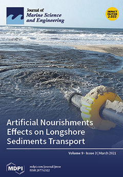
Cover Story (view full-size image): Artificial nourishments are a coastal erosion mitigation strategy that aims to decrease the negative sediment budgets in the coastal system. It is essential to understand and adequately model the shoreline response after a nourishment operation to achieve the best performance scenarios. A shoreline evolution numerical model was applied to evaluate the spatial and temporal distribution of the nourished sediments along the coast, considering different beaches and incident wave climates. It is highlighted that higher longshore sediment transport rates are associated with more energetic wave climates, but not necessarily with incident waves more oblique to the shoreline. View this paper
  • Issues are regarded as officially published after their release is announced to the table of contents alert mailing list.
  • You may sign up for e-mail alerts to receive table of contents of newly released issues.
  • PDF is the official format for papers published in both, html and pdf forms. To view the papers in pdf format, click on the "PDF Full-text" link, and use the free Adobe Reader to open them.
Order results
Result details
Section
Select all
Export citation of selected articles as:
20 pages, 13651 KiB  
Article
Mooring-Configurations Induced Decay Motions of a Buoy
by Changqing Jiang, Ould el Moctar and Thomas E. Schellin
J. Mar. Sci. Eng. 2021, 9(3), 350; https://doi.org/10.3390/jmse9030350 - 23 Mar 2021
Cited by 11 | Viewed by 2824
Abstract
The hydrodynamic damping of a buoy stationed with three different mooring configurations was estimated using a Navier-Stokes (NS) equations solver coupled with a dynamic mooring model. The mooring configurations comprised a catenary system, a catenary system with sub floaters, and a catenary system [...] Read more.
The hydrodynamic damping of a buoy stationed with three different mooring configurations was estimated using a Navier-Stokes (NS) equations solver coupled with a dynamic mooring model. The mooring configurations comprised a catenary system, a catenary system with sub floaters, and a catenary system with sub floaters and clump weights. Systematic simulations were achieved by adopting the overset grid scheme instead of the conventional morphing grid scheme, which required regenerating the entire mesh when the buoy’s initial position changed, thereby avoiding mesh distortions and numerical instabilities. Motion decay simulations in heave, pitch, and surge were conducted with and without various mooring systems. The analyzed results comprised decaying oscillating motions, natural periods, and associated amounts of damping. The mooring systems influenced not only restoring force characteristics, but also total damping of the moored buoy, which demonstrated the importance of considering mooring-induced damping when investigating moored offshore structures. Full article
(This article belongs to the Special Issue Mooring of Floating Offshore Structures)
Show Figures

Graphical abstract

18 pages, 6509 KiB  
Article
Aspects of Strength Testing of Tank Containers in Compliance with the Requirements of the UN Navigation Rules and Regulations
by Andrii Sulym, Pavlo Khozia, Eduard Tretiak, Václav Píštěk, Oleksij Fomin and Pavel Kučera
J. Mar. Sci. Eng. 2021, 9(3), 349; https://doi.org/10.3390/jmse9030349 - 23 Mar 2021
Cited by 3 | Viewed by 3113
Abstract
This article deals with the method of computer-aided studies of the results of tank container impact tests to confirm the ability of portable tanks and multi-element gas containers to withstand the impact in the longitudinal direction on a specially equipped test rig or [...] Read more.
This article deals with the method of computer-aided studies of the results of tank container impact tests to confirm the ability of portable tanks and multi-element gas containers to withstand the impact in the longitudinal direction on a specially equipped test rig or using a railway flat car by impacting a flat car with a striking car, in compliance with the requirements of the UN Navigation Rules and Regulations. It is shown that the main assessed characteristic of the UN requirements is the spectrum of the shock response (accelerations) for the interval natural frequencies of the shock pulse. The calculation of the points of the shock response spectrum curve based on the test results is reproduced in four stages. A test configuration of the impact testing of the railway flat car with a tank container is presented, and the impact is performed in such a way that, under a single impact, the shock spectrum curve obtained during the tests for both fittings subjected to impact repeats or exceeds the minimum shock spectrum curve for all frequencies in the range of 2 Hz to 100 Hz. Formulas for determining the relative displacements and accelerations for the interval natural frequencies of the shock wave are given. The research results are presented in graphical form, indicating that the experimental values of the shock response spectrum exceed the minimum permissible values; the equation of the experimental curve of the shock response spectrum in the frequency range 0–100 Hz is described by power-law dependence. The coefficients of the equation were determined by the statistical method of maximum likelihood with the determination factor being 0.897, which is a satisfactory value; a comparative analysis showed that the experimental curve of the impact response spectrum in the frequency range 0–100 Hz exceeds the normalized curve, which confirms compliance with regulatory requirements. A new test configuration is proposed using a tank car with a bulk liquid, the processes in which upon impact differ significantly from other freight wagons under longitudinal impact loads of the tank container. The hydraulic impact resulting from the impact on the tank container and the platform creates an overturning moment that causes the rear fittings to be unloaded. Full article
(This article belongs to the Special Issue Dynamic Load of Shipping)
Show Figures

Figure 1

14 pages, 9275 KiB  
Article
Discrete Element Analysis of High-Pressure Zones of Sea Ice on Vertical Structures
by Xue Long, Lu Liu, Shewen Liu and Shunying Ji
J. Mar. Sci. Eng. 2021, 9(3), 348; https://doi.org/10.3390/jmse9030348 - 23 Mar 2021
Cited by 17 | Viewed by 2614
Abstract
In cold regions, ice pressure poses a serious threat to the safe operation of ship hulls and fixed offshore platforms. In this study, a discrete element method (DEM) with bonded particles was adapted to simulate the generation and distribution of local ice pressures [...] Read more.
In cold regions, ice pressure poses a serious threat to the safe operation of ship hulls and fixed offshore platforms. In this study, a discrete element method (DEM) with bonded particles was adapted to simulate the generation and distribution of local ice pressures during the interaction between level ice and vertical structures. The strength and failure mode of simulated sea ice under uniaxial compression were consistent with the experimental results, which verifies the accuracy of the discrete element parameters. The crushing process of sea ice acting on the vertical structure simulated by the DEM was compared with the field test. The distribution of ice pressure on the contact surface was calculated, and it was found that the local ice pressure was much greater than the global ice pressure. The high-pressure zones in sea ice are mainly caused by its simultaneous destruction, and these zones are primarily distributed near the midline of the contact area of sea ice and the structure. The contact area and loading rate are the two main factors affecting the high-pressure zones. The maximum local and global ice pressures decrease with an increase in the contact area. The influence of the loading rate on the local ice pressure is caused by the change in the sea ice failure mode. When the loading rate is low, ductile failure of sea ice occurs, and the ice pressure increases with the increase in the loading rate. When the loading rate is high, brittle failure of sea ice occurs, and the ice pressure decreases with an increase in the loading rate. This DEM study of sea ice can reasonably predict the distribution of high-pressure zones on marine structures and provide a reference for the anti-ice performance design of marine structures. Full article
Show Figures

Figure 1

20 pages, 12280 KiB  
Article
Sediment Characteristics and Intertidal Beach Slopes along the Jiangsu Coast, China
by Yu Kuai, Jianfeng Tao, Zaiyang Zhou, Stefan Aarninkhof and Zheng Bing Wang
J. Mar. Sci. Eng. 2021, 9(3), 347; https://doi.org/10.3390/jmse9030347 - 22 Mar 2021
Cited by 7 | Viewed by 4213
Abstract
Tidal flats play an important role in promoting coastal biodiversity, defense against flooding, land reclamation and recreation. Many coastal tidal flats, especially the tide-dominant ones, are muddy. However, the number of studies on the profile shape and surficial sediment distribution of muddy tidal [...] Read more.
Tidal flats play an important role in promoting coastal biodiversity, defense against flooding, land reclamation and recreation. Many coastal tidal flats, especially the tide-dominant ones, are muddy. However, the number of studies on the profile shape and surficial sediment distribution of muddy tidal flats is small compared to sandy beaches. Based on high spatial-resolution measurements along the tide-dominant Jiangsu Coast, China, we analyzed the morphology and sediment characteristics of the unvegetated intertidal flats along the Jiangsu Coast. The Jiangsu Coast can be divided into an eroding northern part (north coast) and an accreting southern part (south coast). The beach slope of the north coast shows a southward flattening trend, apart from some outliers related to rocky parts of the coastline. We found alternating very fine and coarse sediment (depending on the local clay content) for different locations along the north coast, which can be explained from consolidation and armoring-induced erosion resistance. In the south coast, we found gradual coarsening of bed surface sediment and gradual flattening of beach slopes to the south. This seemingly unexpected pattern is explained by the flood-dominant current causing landward sediment transport, larger tidal range in the south part, sheltering effect of the Radial Sand Ridges, and contribution of different sediment sources, viz. the Abandoned Yellow River Delta and the Radial Sand Ridges. In the cross-shore direction, the sediment grain size decreases landward. Waves are only of secondary importance for the sediment dynamics at the unvegetated tidal flats along the Jiangsu Coast. Full article
(This article belongs to the Section Geological Oceanography)
Show Figures

Figure 1

22 pages, 7947 KiB  
Article
Study of the Operating Characteristics for the High-Speed Water Jet Pump Installed on the Underwater Vehicle with Different Cruising Speeds
by Yeming Lu, Haoran Liu, Xiaofang Wang and Hui Wang
J. Mar. Sci. Eng. 2021, 9(3), 346; https://doi.org/10.3390/jmse9030346 - 22 Mar 2021
Cited by 11 | Viewed by 2780
Abstract
Due to the higher propulsive efficiency, lesser vibration, and better maneuverability, the water jet pump is widely applied to high-speed underwater vehicles. By taking a newly developed water jet pump system as the object, the corresponding underwater vehicle’s operating characteristics affected by different [...] Read more.
Due to the higher propulsive efficiency, lesser vibration, and better maneuverability, the water jet pump is widely applied to high-speed underwater vehicles. By taking a newly developed water jet pump system as the object, the corresponding underwater vehicle’s operating characteristics affected by different cruising speeds (15.43, 30.86, and 52.47 m/s) were investigated. The steady results reply that the cruising speed increase will result in the decline of the overall performances comprised of the head, the efficiency, the thrust, and the power. While, by using different analyzing methods, the unsteady results are listed as follows: (1) The energy loss theory denotes that the increasing cruising speed promoted the kinetic energy diffusion from the Reynolds stress and viscous stress and depress the turbulent kinetic energy production and the viscous dissipation. (2) The statistical PLS method reveals that the tip load effect on the leakage flow becomes weaker when the cruising speed becomes larger, while the effect from the scraping pressure has a completely opposite trend. (3) Further unsteady analysis implies that the increasing cruising speed makes the pressure pulsation larger and makes the radial force, the axial force, and the cloudy cavity size smaller. Full article
(This article belongs to the Section Ocean Engineering)
Show Figures

Figure 1

29 pages, 5693 KiB  
Article
Response of Point-Absorbing Wave Energy Conversion System in 50-Years Return Period Extreme Focused Waves
by Eirini Katsidoniotaki, Erik Nilsson, Anna Rutgersson, Jens Engström and Malin Göteman
J. Mar. Sci. Eng. 2021, 9(3), 345; https://doi.org/10.3390/jmse9030345 - 22 Mar 2021
Cited by 19 | Viewed by 3930
Abstract
This work evaluates the survivability of a point-absorbing wave energy converter at sea states along and inside the 50-year environmental contour for a selected-site in North Sea, by utilizing CFD simulations. Focused wave groups based on NewWave theory are used to model the [...] Read more.
This work evaluates the survivability of a point-absorbing wave energy converter at sea states along and inside the 50-year environmental contour for a selected-site in North Sea, by utilizing CFD simulations. Focused wave groups based on NewWave theory are used to model the extreme waves. The numerical breaking waves have been previously predicted by the analytical breaking criterion, showing that the latter provides an accurate estimate for the breaking state. The forces on key components of the device and the system’s dynamics are studied and compared. Slamming loads are identified in the interaction with extreme waves, particularly with breaking waves, and compared with the analytical formulas for slamming estimation as suggested by industrial standards. Considering the extreme wave characteristics, the accompanied phenomena and the resulting WEC’s response, this work contributes to the identification of the design-waves given the environmental contour of the selected site. The top-left side of the contour is identified as the more critical area as it consists of steep and high waves inducing significant nonlinear phenomena, resulting in high loads. Full article
(This article belongs to the Section Ocean Engineering)
Show Figures

Figure 1

19 pages, 10055 KiB  
Technical Note
Experimental Study on Development of Mooring Simulator for Multi Floating Cranes
by Junhyeok Bae, Juhwan Cha, Min-Guk Seo, Kangsu Lee, Jaeyong Lee and Namkug Ku
J. Mar. Sci. Eng. 2021, 9(3), 344; https://doi.org/10.3390/jmse9030344 - 20 Mar 2021
Cited by 5 | Viewed by 2716
Abstract
In this study, the coupled motion of a mooring system and multifloating cranes were analyzed. For the motion analysis, the combined equations of motions of the mooring line and multifloating cranes were introduced. The multibody equations for floating cranes were derived from the [...] Read more.
In this study, the coupled motion of a mooring system and multifloating cranes were analyzed. For the motion analysis, the combined equations of motions of the mooring line and multifloating cranes were introduced. The multibody equations for floating cranes were derived from the equations of motion. The finite element method (FEM) was used to derive equations to solve the stretchable catenary problem of the mooring line. To verify the function of mooring simulator, calculation results were compared with commercial mooring software. To validate the analysis results, we conducted an experimental test for offshore operation using two floating crane models scaled to 1:40. Two floating crane models and a pile model were established for operation of uprighting flare towers. During the model test, the motion of the floating cranes and tensions of the mooring lines were measured. Through the model test, the accuracy of the mooring analysis program developed in this study was verified. Therefore, if this mooring analysis program is used, it will be possible to perform a mooring analysis simulation at the same time as a maritime work simulation. Full article
(This article belongs to the Special Issue Simulation Based Maritime Design)
Show Figures

Figure 1

15 pages, 6188 KiB  
Article
Influence of Wind on Suspended Matter in the Water of the Albufera of Valencia (Spain)
by Juan Soria, Miguel Jover and José Antonio Domínguez-Gómez
J. Mar. Sci. Eng. 2021, 9(3), 343; https://doi.org/10.3390/jmse9030343 - 20 Mar 2021
Cited by 11 | Viewed by 2421
Abstract
Wind significantly influences suspended matter in lakes, especially in shallow lagoons. To know how wind affects the water in Albufera of Valencia, a shallow coastal lagoon, the measured variables of turbidity and transparency have been correlated with the estimates by processing Sentinel-2 satellite [...] Read more.
Wind significantly influences suspended matter in lakes, especially in shallow lagoons. To know how wind affects the water in Albufera of Valencia, a shallow coastal lagoon, the measured variables of turbidity and transparency have been correlated with the estimates by processing Sentinel-2 satellite images with the Sen2Cor processor. Data from four years of study of winds show that most of them are light to gentle easterly breezes and moderate to fresh westerly breezes. The obtained results show significant correlations between the measured variables and those obtained from the satellite images for total suspended matter and water transparency, as well as with the average daily wind speed. There is no significant correlation between wind and chlorophyll a. Moderate to fresh breezes resuspend the fine sediment reaching concentration values from 100 to 300 mg L−1 according to satellite data. However, it is necessary to obtain field data for the values of moderate and fresh winds, as for now, there are no experimental data to verify the validity of the satellite estimates. Full article
(This article belongs to the Special Issue Coastal Lagoon Ecology)
Show Figures

Figure 1

20 pages, 7884 KiB  
Article
The Influence of Port Tugs on Improving the Navigational Safety of the Port
by Vytautas Paulauskas, Martynas Simutis, Birute Plačiene, Raimondas Barzdžiukas, Martynas Jonkus and Donatas Paulauskas
J. Mar. Sci. Eng. 2021, 9(3), 342; https://doi.org/10.3390/jmse9030342 - 20 Mar 2021
Cited by 18 | Viewed by 5099
Abstract
Port tugs are an important element in port activity and navigational safety issues. Port tugs ensure the safety of big ships while they are entering, manoeuvring, mooring and unmooring, and are of huge importance during other port operations. At the same time, optimizing [...] Read more.
Port tugs are an important element in port activity and navigational safety issues. Port tugs ensure the safety of big ships while they are entering, manoeuvring, mooring and unmooring, and are of huge importance during other port operations. At the same time, optimizing the number of port tugs and tug bollard pull is also important from a port navigational safety and economic point of view. Calculation and evaluation methods of the optimal request for tugs bollard pull, in particular, port operations, are very important in order to guarantee the navigational safety of the port and ships during the main ship operations in the port. This article provides the number of requested port tugs and bollard pull calculation and evaluation methods on the basis of forces and moments acting on ships. On the basis of real ship voyages and manoeuvring at ports data as well as high accuracy simulators, theoretical methods were used, which were followed by our conclusions and recommendations, which can be used by port harbour masters and tug companies. Modern tugs have become an important element and integral part of modern port navigational safety. Such modern port tugs are also used for navigational safety and other important port functions and activities, such as fire protection and search and rescue operations. The optimal number and capacity evaluation of port tugs depending on port capacity and conditions are studied in this article. Full article
(This article belongs to the Special Issue Decarbonization of Ship Power Plants)
Show Figures

Figure 1

15 pages, 3650 KiB  
Article
L2-Gain-Based Practical Stabilization of an Underactuated Surface Vessel
by Weilin Luo and Xin Qi
J. Mar. Sci. Eng. 2021, 9(3), 341; https://doi.org/10.3390/jmse9030341 - 19 Mar 2021
Cited by 7 | Viewed by 2111
Abstract
To obtain a stabilizer for an underactuated surface vessel with disturbances, an L2-gain design is proposed. Surge, sway, and yaw motions are considered in the dynamics of a surface ship. To ob-tain a robust adaptive controller, a diffeomorphism transformation and the Lyapunov function [...] Read more.
To obtain a stabilizer for an underactuated surface vessel with disturbances, an L2-gain design is proposed. Surge, sway, and yaw motions are considered in the dynamics of a surface ship. To ob-tain a robust adaptive controller, a diffeomorphism transformation and the Lyapunov function are employed in controller design. Two auxiliary controllers are introduced for an equivalent sys-tem after the diffeomorphism transformation. Different from the commonly used disturbance ob-server-based approach, the L2-gain design is used to suppress random uncertain disturbances in ship dynamics. To evaluate the controller performance in suppressing disturbances, two error sig-nals are defined in which the variables to be stabilized are incorporated. Both time-invariant dis-continuous and continuous feedback laws are proposed to obtain the control system. Stability analysis and simulation results demonstrate the validity of the controllers proposed. A comparison with a sliding mode controller is performed, and the results prove the advantage of the proposed controller in terms of faster convergence rate and chattering avoidance. Full article
(This article belongs to the Special Issue Manoeuvring and Control of Ships and Other Marine Vehicles)
Show Figures

Figure 1

15 pages, 4021 KiB  
Article
Marine Acoustic Zones of Australia
by Christine Erbe, David Peel, Joshua N. Smith and Renee P. Schoeman
J. Mar. Sci. Eng. 2021, 9(3), 340; https://doi.org/10.3390/jmse9030340 - 19 Mar 2021
Cited by 8 | Viewed by 3566
Abstract
Underwater sound is modelled and mapped for purposes ranging from localised environmental impact assessments of individual offshore developments to large-scale marine spatial planning. As the area to be modelled increases, so does the computational effort. The effort is more easily handled if broken [...] Read more.
Underwater sound is modelled and mapped for purposes ranging from localised environmental impact assessments of individual offshore developments to large-scale marine spatial planning. As the area to be modelled increases, so does the computational effort. The effort is more easily handled if broken down into smaller regions that could be modelled separately and their results merged. The goal of our study was to split the Australian maritime Exclusive Economic Zone (EEZ) into a set of smaller acoustic zones, whereby each zone is characterised by a set of environmental parameters that vary more across than within zones. The environmental parameters chosen reflect the hydroacoustic (e.g., water column sound speed profile), geoacoustic (e.g., sound speeds and absorption coefficients for compressional and shear waves), and bathymetric (i.e., seafloor depth and slope) parameters that directly affect the way in which sound propagates. We present a multivariate Gaussian mixture model, modified to handle input vectors (sound speed profiles) of variable length, and fitted by an expectation-maximization algorithm, that clustered the environmental parameters into 20 maritime acoustic zones corresponding to 28 geographically separated locations. Mean zone parameters and shape files are available for download. The zones may be used to map, for example, underwater sound from commercial shipping within the entire Australian EEZ. Full article
(This article belongs to the Special Issue Ocean Noise: From Science to Management)
Show Figures

Figure 1

10 pages, 3235 KiB  
Article
Thermogravimetric Analysis of Marine Gas Oil in Lubricating Oil
by Suhyun Ahn, Jeong Mog Seo and Heejin Lee
J. Mar. Sci. Eng. 2021, 9(3), 339; https://doi.org/10.3390/jmse9030339 - 19 Mar 2021
Cited by 2 | Viewed by 2787
Abstract
Marine lubricating oil (LO) is deteriorated by contaminants—especially marine gas oil (MGO), which is invariably mixed during its usage—that can damage engine performance. This study investigates a method for determining the content of MGO in lubricating oil. Weight loss from MGO-containing lubricant was [...] Read more.
Marine lubricating oil (LO) is deteriorated by contaminants—especially marine gas oil (MGO), which is invariably mixed during its usage—that can damage engine performance. This study investigates a method for determining the content of MGO in lubricating oil. Weight loss from MGO-containing lubricant was evaluated through thermogravimetric analysis (TGA), and a standard calibration curve was plotted to establish a correlation with MGO content. A comparison of the commonly used ASTM–based gas chromatography (GC) analysis, and this TGA approach revealed that the former was more accurate when the lubricant contained ≤1% MGO; however, TGA afforded higher accuracy when the MGO content was between 0.5% and 15%. Hence, TGA can be used as a simple, reliable, and rapid method to analyze the contents of a lubricant contaminant such as MGO. Full article
(This article belongs to the Section Ocean Engineering)
Show Figures

Figure 1

20 pages, 4560 KiB  
Article
Application Research of Digital Twin-Driven Ship Intelligent Manufacturing System: Pipe Machining Production Line
by Qingcai Wu, Yunsheng Mao, Jianxun Chen and Chong Wang
J. Mar. Sci. Eng. 2021, 9(3), 338; https://doi.org/10.3390/jmse9030338 - 19 Mar 2021
Cited by 48 | Viewed by 5436
Abstract
Digital twin has aroused extensive attention of international academia and industry to support future interaction with the physical and virtual world. Although the research and application of digital twin spring up continuously, the concept in the manufacturing domain remains in its infancy. In [...] Read more.
Digital twin has aroused extensive attention of international academia and industry to support future interaction with the physical and virtual world. Although the research and application of digital twin spring up continuously, the concept in the manufacturing domain remains in its infancy. In this context, this paper first reviews the applications of digital twins for intelligent manufacturing. Then it presents an innovative application framework of a digital twin-driven ship intelligent manufacturing system and analyzes its operation mechanism. The application framework of a digital twin-driven ship intelligent manufacturing system mainly includes five parts: the physical layer, model layer, data layer, system layer, and application layer. Finally, key enabling techniques, as well as a case study in a pipe machining production line, are constructed and studied to validate the proposed approach. Meanwhile, system design and implementation, the twin modeling construction, application process, and implementation effect of the pipe machining production line are described in detail to provide a reference for enterprises. Full article
(This article belongs to the Special Issue Smart Technologies for Shipbuilding)
Show Figures

Figure 1

15 pages, 1936 KiB  
Article
Quantification of Microplastics in North-Western Mediterranean Harbors: Seasonality and Biofilm-Related Metallic Contaminants
by Javier A. Tesán Onrubia, Kahina Djaoudi, Franco Borgogno, Susanna Canuto, Bernard Angeletti, Giovanni Besio, Marco Capello, Laura Cutroneo, Alessandro Stocchino, Stéphane Mounier and Véronique Lenoble
J. Mar. Sci. Eng. 2021, 9(3), 337; https://doi.org/10.3390/jmse9030337 - 19 Mar 2021
Cited by 19 | Viewed by 4262
Abstract
The Mediterranean Sea is one of the most impacted basins in terms of microplastics pollution. Land-based activities are the major sources of plastic litter to the ocean, with harbors probably representing significant hotspots. In the framework of the SPlasH! project (Stop alle Plastiche [...] Read more.
The Mediterranean Sea is one of the most impacted basins in terms of microplastics pollution. Land-based activities are the major sources of plastic litter to the ocean, with harbors probably representing significant hotspots. In the framework of the SPlasH! project (Stop alle Plastiche in H2O, Interreg Marittimo project), microplastics were sampled in three north-western Mediterranean harbors during summer and winter. In this study, the areal concentrations of microplastics ranged from 5576 to 379,965 items·km−2. A decreasing gradient was observed from the inner to the outer zones of the studied harbors, pointing out these enclosed systems as hotspots regarding microplastic pollution. During summer, the areal concentrations of microplastics were higher than in winter, which could be explained by an enhancement of port activities leading to MPs production. The investigation of microplastics size classes distribution in the surface waters revealed that microplastics within the size range between 300 µm and 500 µm were the least represented. In this study, we assessed trace metal (Pb, Fe, Cu, V, Cd and As) bioaccumulation by the biofilm which developed on the surface of microplastics. The results highlighted that concentrations within the biofilm were higher than those in the surrounding waters. This result strongly suggested trace metal bioaccumulation on microplastics through biofilm formation. When trace metal concentrations were normalized over the corresponding surface of microplastics and macroplastics, higher values were obtained for microplastics, evidencing their enhanced capacities to bioaccumulate contaminants when compared to macroplastics. Full article
(This article belongs to the Special Issue Marine Plastics)
Show Figures

Figure 1

29 pages, 10426 KiB  
Article
An Autonomous Platform for Near Real-Time Surveillance of Harmful Algae and Their Toxins in Dynamic Coastal Shelf Environments
by Stephanie K. Moore, John B. Mickett, Gregory J. Doucette, Nicolaus G. Adams, Christina M. Mikulski, James M. Birch, Brent Roman, Nicolas Michel-Hart and Jan A. Newton
J. Mar. Sci. Eng. 2021, 9(3), 336; https://doi.org/10.3390/jmse9030336 - 18 Mar 2021
Cited by 13 | Viewed by 4524
Abstract
Efforts to identify in situ the mechanisms underpinning the response of harmful algae to climate change demand frequent observations in dynamic and often difficult to access marine and freshwater environments. Increasingly, resource managers and researchers are looking to fill this data gap using [...] Read more.
Efforts to identify in situ the mechanisms underpinning the response of harmful algae to climate change demand frequent observations in dynamic and often difficult to access marine and freshwater environments. Increasingly, resource managers and researchers are looking to fill this data gap using unmanned systems. In this study we integrated the Environmental Sample Processor (ESP) into an autonomous platform to provide near real-time surveillance of harmful algae and the toxin domoic acid on the Washington State continental shelf over a three-year period (2016–2018). The ESP mooring design accommodated the necessary subsystems to sustain ESP operations, supporting deployment durations of up to 7.5 weeks. The combination of ESP observations and a suite of contextual measurements from the ESP mooring and a nearby surface buoy permitted an investigation into toxic Pseudo-nitzschia spp. bloom dynamics. Preliminary findings suggest a connection between bloom formation and nutrient availability that is modulated by wind-forced coastal-trapped waves. In addition, high concentrations of Pseudo-nitzschia spp. and elevated levels of domoic acid observed at the ESP mooring location were not necessarily associated with the advection of water from known bloom initiation sites. Such insights, made possible by this autonomous technology, enable the formulation of testable hypotheses on climate-driven changes in HAB dynamics that can be investigated during future deployments. Full article
(This article belongs to the Special Issue Climate Change and Harmful Algal Blooms)
Show Figures

Figure 1

25 pages, 6953 KiB  
Article
A Two-Way Nesting Unstructured Quadrilateral Grid, Finite-Differencing, Estuarine and Coastal Ocean Model with High-Order Interpolation Schemes
by Zhangliang Ding, Jianrong Zhu, Bingrui Chen and Daoyang Bao
J. Mar. Sci. Eng. 2021, 9(3), 335; https://doi.org/10.3390/jmse9030335 - 18 Mar 2021
Cited by 5 | Viewed by 3067
Abstract
The balance between the need of improving horizontal resolution in simulating local small-scale ocean processes and computational costs makes it desirable to refine model mesh locally. A three-dimensional, two-way nesting unstructured quadrilateral grid, primitive equations, finite-differencing, estuarine and coastal ocean model is developed [...] Read more.
The balance between the need of improving horizontal resolution in simulating local small-scale ocean processes and computational costs makes it desirable to refine model mesh locally. A three-dimensional, two-way nesting unstructured quadrilateral grid, primitive equations, finite-differencing, estuarine and coastal ocean model is developed for multi-scale modeling. Because the model grid is capable of multi-area nesting and multi-level refinement at each subdomain, the model is highly compatible with simulations involved in complex topography and studies of local small-scale ocean processes. The two-way information exchange is achieved by a virtual grid method, and its basic idea is to implement numerical integrations of variables at nesting interfaces with the support of virtual grid variables, which are interpolated or updated from actual grid variables. The model is novel for two interpolation schemes: the high-order spatial interpolation at the middle temporal level (HSIMT) parabolic interpolation scheme and HSIMT advection-equivalent interpolation scheme, and they have high-order accuracy and good consistency with the advection scheme applied to solving the tracer equations. The conservation of both volume and tracer contents is ensured via a flux correction algorithm. The two original interpolation schemes are examined in an ideal salinity advection experiment in the peak preservation skill, stability, and conservation properties. A realistic application to the Deep Waterway Project area in the Changjiang Estuary showed that the nested grid model can reproduce the hydrodynamic processes at the observed sites successfully while it failed to maintain the performance with the structured grid model in simulating the variance of salinity, for which the enforced conservation had primary responsibility. The HSIMT parabolic interpolation scheme was distinguished from other schemes for its outstanding performances in simulating salinity. Full article
(This article belongs to the Section Physical Oceanography)
Show Figures

Figure 1

13 pages, 3730 KiB  
Article
Numerical Simulation of a Multi-Body System Mimicking Coupled Active and Passive Movements of Fish Swimming
by Jianxin Hu, Qing Xiao and Ruoxin Li
J. Mar. Sci. Eng. 2021, 9(3), 334; https://doi.org/10.3390/jmse9030334 - 17 Mar 2021
Cited by 1 | Viewed by 2476
Abstract
A multi-body system model is proposed for the mimicking of swimming fish with coupled active and passive movements. The relevant algorithms of the kinematics and dynamics of the multi-body system and coupled fluid solver are developed and fully validated. A simplified three-body model [...] Read more.
A multi-body system model is proposed for the mimicking of swimming fish with coupled active and passive movements. The relevant algorithms of the kinematics and dynamics of the multi-body system and coupled fluid solver are developed and fully validated. A simplified three-body model is applied for the investigation of the hydrodynamic performance of both an active pitch motion and passive movement. In general, there is an optimal stiffness, under which the model swims with the fastest velocity. The effect of the damper can be drawn only when the stiffness is small. Comparing with the rigid tail, the flexible tail leads to a faster speed when the stiffness and damping coefficients are in a suitable range. Full article
(This article belongs to the Section Ocean Engineering)
Show Figures

Figure 1

18 pages, 6023 KiB  
Article
The Effect of Wave-Induced Current and Coastal Structure on Sediment Transport at the Zengwen River Mouth
by Chun-Hung Pao, Jia-Lin Chen, Shih-Feng Su, Yu-Ching Huang, Wen-Hsin Huang and Chien-Hung Kuo
J. Mar. Sci. Eng. 2021, 9(3), 333; https://doi.org/10.3390/jmse9030333 - 17 Mar 2021
Cited by 5 | Viewed by 3769
Abstract
The mechanisms that control estuarine sediment transport are complicated due to the interaction between riverine flows, tidal currents, waves, and wave-driven currents. In the past decade, severe seabed erosion and shoreline retreat along the sandy coast of western Taiwan have raised concerns regarding [...] Read more.
The mechanisms that control estuarine sediment transport are complicated due to the interaction between riverine flows, tidal currents, waves, and wave-driven currents. In the past decade, severe seabed erosion and shoreline retreat along the sandy coast of western Taiwan have raised concerns regarding the sustainability of coastal structures. In this study, ADCPs (Acoustic Doppler Current Profiler) and turbidity meters were deployed at the mouth of the Zengwen river to obtain the time series and the spatial distribution of flow velocities and turbidity during the base flow and flood conditions. A nearshore circulation model, SHORECIRC, has been adapted into a hybrid finite-difference/finite-volume, TVD (Total Variation Diminishing)-type scheme and coupled with the wave-spectrum model Simulating Waves Nearshore (SWAN). Conventional finite-difference schemes often produce unphysical oscillations when modeling coastal processes with abrupt bathymetric changes at river mouths. In contrast, the TVD-type finite volume scheme allows for robust treatment of discontinuities through the shock-capturing mechanism. The model reproduces water levels, waves, currents observed at the mouth of the Zengwen River reasonably well. The simulated residual sediment transport patterns demonstrate that the transport process at the river mouth is dominated by the interaction of the bathymetry and wave-induced currents when the riverine discharge was kept in reservoirs. The offshore residual transport causes erosion at the northern part of the river mouth, and the onshore residual transport causes accretion in the ebb tidal shoals around the center of the river mouth. The simulated morphological evolution displays significant changes on shallower deltas. The location with significant sea bed changes is consistent with the spot in which severe erosion occurred in recent years. Further analysis of morphological evolution is also discussed to identify the role of coastal structures, for example, the extension of the newly constructed groins near the river mouth. Full article
(This article belongs to the Special Issue Waves and Ocean Structures II)
Show Figures

Figure 1

11 pages, 9019 KiB  
Article
Visible Fidelity Collector of a Zooplankton Sample from the Near-Bottom of the Deep Sea
by Jing Xiao, Jiawang Chen, Zhenwei Tian, Hai Zhu, Chunsheng Wang, Junyi Yang, Qinghua Sheng, Dahai Zhang and Jiasong Fang
J. Mar. Sci. Eng. 2021, 9(3), 332; https://doi.org/10.3390/jmse9030332 - 17 Mar 2021
Cited by 1 | Viewed by 2395
Abstract
The multi-net visible fidelity zooplankton collector is designed to obtain near-bottom fidelity zooplankton. The collector is sent to the designated sampling location based on the information provided by the camera and altimeter. The host computer sends instructions to control the opening of the [...] Read more.
The multi-net visible fidelity zooplankton collector is designed to obtain near-bottom fidelity zooplankton. The collector is sent to the designated sampling location based on the information provided by the camera and altimeter. The host computer sends instructions to control the opening of the net port for sample collection and closing of the sampling cylinder cover after sampling. The collector contains three trawls so that three samples can be collected for each test, and environmental parameters can be collected simultaneously. After sampling, The sample maintains its fidelity, that is, maintaining the temperature and pressure of the seabed sample after sampling. Two experiments were carried out in the Western Pacific, and six bottles of zooplankton samples were successfully obtained. The development of a multi-net visible zooplankton collector is of great significance for the collection of near-bottom zooplankton. Full article
Show Figures

Figure 1

11 pages, 5100 KiB  
Technical Note
Offshore Oil and Gas Safety: Protection against Explosions
by Dejan Brkić and Zoran Stajić
J. Mar. Sci. Eng. 2021, 9(3), 331; https://doi.org/10.3390/jmse9030331 - 16 Mar 2021
Cited by 13 | Viewed by 6308
Abstract
Offshore oil and gas operations carry a high risk of explosions, which can be efficiently prevented in many cases. The two most used approaches for prevention are: (1) the “International Electrotechnical Commission System for Certification to Standards Relating to Equipment for Use in [...] Read more.
Offshore oil and gas operations carry a high risk of explosions, which can be efficiently prevented in many cases. The two most used approaches for prevention are: (1) the “International Electrotechnical Commission System for Certification to Standards Relating to Equipment for Use in Explosive Atmospheres” (IECEx) and (2) European “Atmosphere Explosible” (ATEX) schemes. The main shortcoming for the IECEx scheme is in the fact that it does not cover nonelectrical equipment, while for the ATEX scheme, it is due to the allowed self-certification for a certain category of equipment in areas with a low probability of explosions, as well as the fact that it explicitly excludes mobile offshore drilling units from its scope. An advantage of the IECEx scheme is that it is prescribed by the US Coast Guard for protection against explosions on foreign mobile offshore drilling units, which intend to work on the US continental shelf but have never operated there before, with an additional requirement that the certificates should be obtained through a US-based Certified Body (ExCB). Therefore, to avoid bureaucratic obstacles and to be allowed to operate with minimized additional costs both in the US and the EU/EEA’s offshore jurisdictions (and very possibly worldwide), all mobile offshore drilling units should be certified preferably as required by the US Coast Guard. Full article
Show Figures

Figure 1

20 pages, 17132 KiB  
Article
Daily Prediction of the Arctic Sea Ice Concentration Using Reanalysis Data Based on a Convolutional LSTM Network
by Quanhong Liu, Ren Zhang, Yangjun Wang, Hengqian Yan and Mei Hong
J. Mar. Sci. Eng. 2021, 9(3), 330; https://doi.org/10.3390/jmse9030330 - 16 Mar 2021
Cited by 38 | Viewed by 6272
Abstract
To meet the increasing sailing demand of the Northeast Passage of the Arctic, a daily prediction model of sea ice concentration (SIC) based on the convolutional long short-term memory network (ConvLSTM) algorithm was proposed in this study. Previously, similar deep learning algorithms (such [...] Read more.
To meet the increasing sailing demand of the Northeast Passage of the Arctic, a daily prediction model of sea ice concentration (SIC) based on the convolutional long short-term memory network (ConvLSTM) algorithm was proposed in this study. Previously, similar deep learning algorithms (such as convolutional neural networks; CNNs) were frequently used to predict monthly changes in sea ice. To verify the validity of the model, the ConvLSTM and CNNs models were compared based on their spatiotemporal scale by calculating the spatial structure similarity, root-mean-square-error, and correlation coefficient. The results show that in the entire test set, the single prediction effect of ConvLSTM was better than that of CNNs. Taking 15 December 2018 as an example, ConvLSTM was superior to CNNs in simulating the local variations in the sea ice concentration in the Northeast Passage, particularly in the vicinity of the East Siberian Sea. Finally, the predictability of ConvLSTM and CNNs was analysed following the iteration prediction method, demonstrating that the predictability of ConvLSTM was better than that of CNNs. Full article
(This article belongs to the Section Physical Oceanography)
Show Figures

Figure 1

15 pages, 616 KiB  
Article
Preferential Treatment as a Tool for Managing the Coastal Area Sustainable Development: The Case of the Vladivostok Free Port
by Roman Vladimirovich Fedorenko and Galina Anatolievna Khmeleva
J. Mar. Sci. Eng. 2021, 9(3), 329; https://doi.org/10.3390/jmse9030329 - 16 Mar 2021
Cited by 6 | Viewed by 2862
Abstract
With the adoption of the sustainable development goals (SDGs), the world has recognized the need to move to responsible governance in many areas of life, including seaports, which are at the forefront of economic activity and environmental safety. The present paper examines the [...] Read more.
With the adoption of the sustainable development goals (SDGs), the world has recognized the need to move to responsible governance in many areas of life, including seaports, which are at the forefront of economic activity and environmental safety. The present paper examines the challenges and opportunities associated with the implementation of sustainable development principles under the free port scheme. The authors analyzed the Russian Audit Chamber report on the activities of the free port of Vladivostok and compared it with the pioneer experience of the sustainable development of the port of Antwerp. The results show that focusing only on the economic and social objectives of preferential treatment is not sufficient for the effective management of coastal areas, such as ports. To improve management efficiency and fully integrate the coastal area with preferential treatment in the world economic relations, the authors consider it necessary to ensure commitment to the goals of sustainable development and propose a model for the implementation of the sustainable development principles, as exemplified by the free port of Vladivostok. Full article
(This article belongs to the Special Issue Integrated Coastal Zone Management)
Show Figures

Figure 1

12 pages, 3122 KiB  
Article
Variation of Semidiurnal Internal Tides along the Southeastern Coast of Korea Induced by Typhoons
by Jeong-Yeob Chae, Chanhyung Jeon, Pyeongjoong Kim, Naoki Hirose, Ahyoung Ku and Jae-Hun Park
J. Mar. Sci. Eng. 2021, 9(3), 328; https://doi.org/10.3390/jmse9030328 - 16 Mar 2021
Cited by 2 | Viewed by 2573
Abstract
Typhoon-induced strong winds can dramatically change the oceanic environment, occasionally resulting in sudden stratification changes. In July 2015, two consecutive typhoons, Chanhom and Nangka, passed over the Yellow and East/Japan Seas within a week. Remarkable temperature variations were observed near the southeastern coast [...] Read more.
Typhoon-induced strong winds can dramatically change the oceanic environment, occasionally resulting in sudden stratification changes. In July 2015, two consecutive typhoons, Chanhom and Nangka, passed over the Yellow and East/Japan Seas within a week. Remarkable temperature variations were observed near the southeastern coast of Korea, caused by typhoon-induced upwelling and downwelling events, which altered the energy of semidiurnal internal tides. During the typhoon-induced downwelling event, the energy of semidiurnal internal tides near the southeastern coast of Korea varied independently from the barotropic tidal forcing. Data-assimilated numerical simulation results reveal that the pycnocline, which is typically tilted toward the coast, enables the semidiurnal internal tidal energy to propagate toward shallow regions after being generated off the coast. Meanwhile, the downwelling event deepens the pycnocline near the coast and reflects and concentrates the semidiurnal internal tide energy near the bottom off the coast. A simple mechanism using the ratio between the wave characteristic slope and the bottom slope is proposed to explain the observed variations of semidiurnal internal tide energy near the coast. This paper demonstrates a case study showing that typhoon passage can modify the energetics of internal tides, which has the potential to cause unusual short-term coastal environmental changes. Full article
(This article belongs to the Section Physical Oceanography)
Show Figures

Figure 1

18 pages, 4369 KiB  
Article
Motion Pattern Optimization and Energy Analysis for Underwater Glider Based on the Multi-Objective Artificial Bee Colony Method
by Weicheng Sun, Wenchuan Zang, Chao Liu, Tingting Guo, Yunli Nie and Dalei Song
J. Mar. Sci. Eng. 2021, 9(3), 327; https://doi.org/10.3390/jmse9030327 - 16 Mar 2021
Cited by 7 | Viewed by 2773
Abstract
Underwater gliders are prevailing in oceanic observation nowadays for their flexible deployment and low cost. However, the limited onboard energy constrains their application, hence the motion pattern optimization and energy analysis are the key to maximizing the range of the glider while maintaining [...] Read more.
Underwater gliders are prevailing in oceanic observation nowadays for their flexible deployment and low cost. However, the limited onboard energy constrains their application, hence the motion pattern optimization and energy analysis are the key to maximizing the range of the glider while maintaining the acceptable navigation preciseness of the glider. In this work, a Multi-Objective Artificial Bee Colony (MOABC) algorithm is used to solve the constrained hybrid non-convex multi-objective optimization problem about range and accuracy of gliders in combination with specific glider dynamics models. The motion parameters Pareto front that balances the navigational index referring to range and preciseness are obtained, relevant gliding profile motion results are simulated simultaneously, and the results are compared with the conventional gliding patterns to examine the quality of the solution. Comparison shows that, with the utilization of the algorithm, glider voyage performance with respect to endurance and preciseness can be effectively improved. Full article
(This article belongs to the Section Ocean Engineering)
Show Figures

Figure 1

20 pages, 5963 KiB  
Article
Numerical Analysis of Storm Surges on Canada’s Western Arctic Coastline
by Joseph Kim, Enda Murphy, Ioan Nistor, Sean Ferguson and Mitchel Provan
J. Mar. Sci. Eng. 2021, 9(3), 326; https://doi.org/10.3390/jmse9030326 - 16 Mar 2021
Cited by 16 | Viewed by 4053
Abstract
A numerical study was conducted to characterize the probability and intensity of storm surge hazards in Canada’s western Arctic. The utility of the European Centre for Medium-Range Weather Forecasts Reanalysis 5th Generation (ERA5) dataset to force numerical simulations of storm surges was explored. [...] Read more.
A numerical study was conducted to characterize the probability and intensity of storm surge hazards in Canada’s western Arctic. The utility of the European Centre for Medium-Range Weather Forecasts Reanalysis 5th Generation (ERA5) dataset to force numerical simulations of storm surges was explored. Fifty historical storm surge events that were captured on a tide gauge near Tuktoyaktuk, Northwest Territories, were simulated using a two-dimensional (depth-averaged) hydrodynamic model accounting for the influence of sea ice on air-sea momentum transfer. The extent of sea ice and the duration of the ice season has been reducing in the Arctic region, which may contribute to increasing risk from storm surge-driven hazards. Comparisons between winter storm events under present-day ice concentrations and future open-water scenarios revealed that the decline in ice cover has potential to result in storm surges that are up to three times higher. The numerical model was also used to hindcast a significant surge event that was not recorded by the tide gauge, but for which driftwood lines along the coast provided insights to the high-water marks. Compared to measurements at proximate meteorological stations, the ERA5 reanalysis dataset provided reasonable estimates of atmospheric pressure but did not accurately capture peak wind speeds during storm surge events. By adjusting the wind drag coefficients to compensate, reasonably accurate predictions of storm surges were attained for most of the simulated events. The extreme value probability distributions (i.e., return periods and values) of the storm surges were significantly altered when events absent from the tide gauge record were included in the frequency analysis, demonstrating the value of non-conventional data sources, such as driftwood line surveys, in supporting coastal hazard assessments in remote regions. Full article
(This article belongs to the Special Issue Coastal Hazards Assessment in Cold Regions)
Show Figures

Figure 1

16 pages, 2919 KiB  
Article
The Case of Lionfish (Pterois miles) in the Mediterranean Sea Demonstrates Limitations in EU Legislation to Address Marine Biological Invasions
by Periklis Kleitou, Jason M. Hall-Spencer, Ioannis Savva, Demetris Kletou, Margarita Hadjistylli, Ernesto Azzurro, Stelios Katsanevakis, Charalampos Antoniou, Louis Hadjioannou, Niki Chartosia, Maria Christou, Yiannis Christodoulides, Ioannis Giovos, Carlos Jimenez, Sonia Smeraldo and Siân E. Rees
J. Mar. Sci. Eng. 2021, 9(3), 325; https://doi.org/10.3390/jmse9030325 - 15 Mar 2021
Cited by 33 | Viewed by 11124
Abstract
The European Regulation (EU) 1143/2014 on Invasive Alien Species entered into force in 2015, with the aim to fulfill regional and international biodiversity goals in a concerted manner. To date, the Regulation listed 66 Invasive Alien Species (IAS) that are subject to legal [...] Read more.
The European Regulation (EU) 1143/2014 on Invasive Alien Species entered into force in 2015, with the aim to fulfill regional and international biodiversity goals in a concerted manner. To date, the Regulation listed 66 Invasive Alien Species (IAS) that are subject to legal controls. Only one of these is marine. A recent lionfish (Pterois miles) invasion has been closely monitored in the Mediterranean and a detailed risk assessment was made about the profound impacts that this invasive fish is likely to have on the fisheries and biodiversity of the region. In 2016–21, lionfish rapidly became dominant predators along Eastern Mediterranean coasts, yet the process for their inclusion on the EU IAS list has been lengthy and is ongoing. There is an urgent need to learn from this experience. Here, we recommend improvements to the Regulation 1143/2014 and the risk assessment process to protect marine ecosystems and secure the jobs of people that rely on coastal resources. Full article
(This article belongs to the Special Issue Marine Bio-Invasions)
Show Figures

Figure 1

21 pages, 58071 KiB  
Article
Volume and Nutrient Transports Disturbed by the Typhoon Chebi (2013) in the Upwelling Zone East of Hainan Island, China
by Manli Zheng, Lingling Xie, Quanan Zheng, Mingming Li, Fajin Chen and Junyi Li
J. Mar. Sci. Eng. 2021, 9(3), 324; https://doi.org/10.3390/jmse9030324 - 15 Mar 2021
Cited by 3 | Viewed by 2152
Abstract
Using cruise observations before and after the typhoon Chebi in August 2013 and those without the typhoon in July 2012, this study investigates variations in current structure, nutrient distribution, and transports disturbed by a typhoon in a typical coastal upwelling zone east of [...] Read more.
Using cruise observations before and after the typhoon Chebi in August 2013 and those without the typhoon in July 2012, this study investigates variations in current structure, nutrient distribution, and transports disturbed by a typhoon in a typical coastal upwelling zone east of Hainan Island in the northwestern South China Sea. The results show that along-shore northeastward flow dominates the coastal ocean with a volume transport of 0.64 × 10⁶ m3/s in the case without the typhoon. The flow reversed southwestward, with its volume transport halved before the typhoon passage. After the typhoon passage, the flow returned back northeastward except the upper layer in waters deeper than 50 m and the total volume transport decreased to 0.10 × 10⁶ m3/s. For the cross-shelf component, the flow kept shoreward, while transports crossing the 50 m isobath decreased from 0.25, 0.12 to 0.06 × 10⁶ m3/s in the case without the typhoon as well as before and after typhoon passage, respectively. For the along-shore/cross-shelf nutrient transports, SiO32− has the largest value of 866.13/632.74 μmol/s per unit area, NO3 half of that, and PO43− and NO2 one order smaller in the offshore water without the typhoon. The values dramatically decreased to about one-third for SiO32−, NO3, and PO43− after the typhoon, but changed little for NO2. The disturbed wind field and associated Ekman flow and upwelling process may explain the variations in the current and nutrient transports after the typhoon. Full article
(This article belongs to the Section Physical Oceanography)
Show Figures

Figure 1

14 pages, 3265 KiB  
Article
X-ray Computed Tomography as a Tool for Screening Sediment Cores: An Application to the Lagoons of the Po River Delta (Italy)
by Roberto Zonta, Giorgio Fontolan, Daniele Cassin and Janusz Dominik
J. Mar. Sci. Eng. 2021, 9(3), 323; https://doi.org/10.3390/jmse9030323 - 15 Mar 2021
Cited by 4 | Viewed by 2904
Abstract
Lagoon sediments have heterogeneous structure and texture, contain shells and plants and are often highly bioturbated and disturbed by human activities. In such sediments, the selection of representative cores and the choice of a subsampling strategy are important but difficult. In this study, [...] Read more.
Lagoon sediments have heterogeneous structure and texture, contain shells and plants and are often highly bioturbated and disturbed by human activities. In such sediments, the selection of representative cores and the choice of a subsampling strategy are important but difficult. In this study, we examine the usefulness of X-ray computed tomography (CT) for inferring sediment features that will help in making optimal decisions prior to core opening (24 cores from seven lagoons). Various algorithms (intensity projections, slice thickness, axial and sagittal images, CT number profiles and volumetric region of interest) are tested to visualise low- and high-density volumes or objects and to quantify the relations between the average volumetric CT number and the bulk density of the sediment matrix. The CT number is related mainly to water content and indirectly to total nitrogen and <16-μm grain-size fraction (model R2 = 0.94). The outliers are attributed to a weak correspondence between the fraction of sediment sampled for water content determination and the volume of sediment matrix used for CT number measurements in highly heterogeneous sediment slices. In conclusion, CT is a powerful tool for the initial screening of cores recovered from heterogeneous lagoon sediments. The adequate use of available algorithms may provide quantitative information on various sediment features, allowing the purposeful selection of cores and subsamples for further investigation. Full article
Show Figures

Figure 1

19 pages, 5109 KiB  
Article
Spatial Analysis of the Fishing Behaviour of Tuna Purse Seiners in the Western and Central Pacific Based on Vessel Trajectory Data
by Han Zhang, Sheng-Long Yang, Wei Fan, Hui-Min Shi and San-Ling Yuan
J. Mar. Sci. Eng. 2021, 9(3), 322; https://doi.org/10.3390/jmse9030322 - 15 Mar 2021
Cited by 18 | Viewed by 3513
Abstract
The Western and Central Pacific Oceans are the primary operational areas of tuna purse seiners worldwide. Describing and analysing the fishing behaviour of vessels is highly significant for the protection of sustainable tuna resources. This study uses Automatic Identification System (AIS) data of [...] Read more.
The Western and Central Pacific Oceans are the primary operational areas of tuna purse seiners worldwide. Describing and analysing the fishing behaviour of vessels is highly significant for the protection of sustainable tuna resources. This study uses Automatic Identification System (AIS) data of 130 tuna purse seiners from July 2017 to May 2018 and uses data mining methods to identify the operating status of tuna purse seiners; describes the spatial characteristics of fishing intensity and the distribution of hot spots; and analyses vessel spatial characteristics to describe their fishing behaviour. The results show that the tuna purse seiner speed has a marked bimodal distribution, which corresponds to high-speed transiting and low-speed seine operation. Additionally, from July to September 2017, the amount of fishing effort invested by tuna purse seiners was lower than that in other months. The tuna purse seiner activity range includes 120° E–60° W, 30° S–30° N, and the activities for fish and seine operations are primarily concentrated at 140° E–150° W, 15° S–15° N. There are differences between the space for fishing search operations and space where fishing events took place in each month. Spatial analysis shows that the high-speed transiting fishing effort map covers a large area, while seine fishing covers a small area. The global spatial autocorrelation analysis shows that the fishing effort devoted to searching for fish stocks has a spatial distribution pattern of aggregation and close aggregation. The results of a hot-spot analysis show that the hot spots on a heat map for finding fish, which are closely spatially clustered, correspond to vessels searching for fish concentration areas and seine operation areas. Correlation testing shows that under a 5° × 5° grid, there is a high positive correlation between the fishing effort invested in finding fish stocks and the yield data, nets (r > 0.8), and a moderate correlation with catch per unit of effort(CPUE) (r > 0.3). Based on vessel behaviour, the location of the fish school can be directly determined, and the distribution of fish clusters and fishing grounds can be predicted. This study can aid in managing tuna purse seiners in the Western and Central Pacific Oceans and analysing changes in fishery resources. Full article
(This article belongs to the Section Marine Biology)
Show Figures

Figure 1

13 pages, 3653 KiB  
Article
Acoustic Method for Estimation of Marine Low-Speed Engine Turbocharger Parameters
by Roman Varbanets, Oleksij Fomin, Václav Píštěk, Valentyn Klymenko, Dmytro Minchev, Alexander Khrulev, Vitalii Zalozh and Pavel Kučera
J. Mar. Sci. Eng. 2021, 9(3), 321; https://doi.org/10.3390/jmse9030321 - 14 Mar 2021
Cited by 38 | Viewed by 5942
Abstract
The article presents the acoustic method of marine low-speed engine turbocharger parameter estimation under operating conditions when a prompt assessment of instantaneous turbocharger speed and rotor vibration level is required. The method lies in the analysis of the acoustic signal that is generated [...] Read more.
The article presents the acoustic method of marine low-speed engine turbocharger parameter estimation under operating conditions when a prompt assessment of instantaneous turbocharger speed and rotor vibration level is required. The method lies in the analysis of the acoustic signal that is generated by the compressor of the turbocharger with the diesel engine running under load. The spectral analysis reveals that the compressor blades generate acoustic oscillations that are always present in the overall acoustic spectrum of the turbocharger regardless of its technical condition. The harmonic components corresponding to the blades can be detected in the spectrum using the limit method. The calculated instantaneous turbocharger speed makes it possible to analyze the main harmonic amplitude in the spectrum. The method presented in this paper helps eliminate discrete Fourier transform (DFT) spectral leakage so that the amplitude of the main harmonic can be estimated. Further analysis of the amplitude of the main harmonic allows for efficient estimation of the turbocharger rotor vibration level when in operation. The method can be practically applied by means of a smartphone or a computer that has the dedicated software installed. The proposed method lays the foundations for a permanent monitoring system of turbocharger speed and vibration in industrial and marine diesel engines. Full article
(This article belongs to the Special Issue Marine Engines Performance and Emissions II)
Show Figures

Figure 1

Previous Issue
Next Issue
Back to TopTop