Next Issue
Volume 10, December
Previous Issue
Volume 10, October


Hydrology, Volume 10, Issue 11 (November 2023) – 10 articles

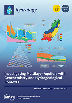
Cover Story (view full-size image): In Southern Ontario, the increasing frequency of droughts due to climate change poses a threat to water security. This is particularly important in the Innisfil Creek watershed, where experts recommend transitioning from surface water to groundwater sources. Due to the complex geological context, this requires a thorough understanding of groundwater dynamics, including aquifer structures, recharge conditions, flow patterns, and geochemical interactions. The paper introduces an approach combining geochemical and isotopic tracers with a 3D geological framework. Existing hydrogeochemical data are supplemented with new surveys. The research aims to establish a framework for anticipating changes in groundwater quantity and quality, facilitating evidence-based decision making and water resource management strategies. View this paper
  • Issues are regarded as officially published after their release is announced to the table of contents alert mailing list.
  • You may sign up for e-mail alerts to receive table of contents of newly released issues.
  • PDF is the official format for papers published in both, html and pdf forms. To view the papers in pdf format, click on the "PDF Full-text" link, and use the free Adobe Reader to open them.
Order results
Result details
Section
Select all
Export citation of selected articles as:
13 pages, 1283 KiB  
Article
Analysis of Water Volume Required to Reach Steady Flow in the Constant Head Well Permeameter Method
by Aziz Amoozegar and Joshua L. Heitman
Hydrology 2023, 10(11), 214; https://doi.org/10.3390/hydrology10110214 - 18 Nov 2023
Viewed by 2077
Abstract
The most common method for in situ measurement of saturated hydraulic conductivity (Ksat) of the vadose zone is the constant head well permeameter method. Our general objective is to provide an empirical method for determining volume of water required for [...] Read more.
The most common method for in situ measurement of saturated hydraulic conductivity (Ksat) of the vadose zone is the constant head well permeameter method. Our general objective is to provide an empirical method for determining volume of water required for measuring Ksat using this procedure. For one-dimensional infiltration, steady state reaches as time (t) → ∞. For three-dimensional water flow from a cylindrical hole under a constant depth of water, however, steady state reaches rather quickly when a saturated bulb forms around the hole. To reach a quasi-steady state for measuring Ksat, we assume an adequate volume of water is needed to form the saturated bulb around the hole and increase the water content outside of the saturated bulb within a bulb-shaped volume of soil, hereafter, referred to as wetted soil volume. We determined the dimensions of the saturated bulb using the Glover model that is used for calculating Ksat. We then used the values to determine the volume of the saturated and wetted bulbs around the hole. The volume of water needed to reach a quasi-steady state depends on the difference between the soil saturated and antecedent water content (Δθ). Based on our analysis, between 2 and 5 L of water is needed to measure Ksat when Δθ varies between 0.1 and 0.4 m3 m−3, respectively. Full article
(This article belongs to the Section Soil and Hydrology)
Show Figures

Figure 1

15 pages, 4545 KiB  
Article
Groundwater Bodies Subdivision in Corsica: A Critical Approach Based on Multivariate Water Quality Criteria Using Large Database
by Hajar Lazar, Meryem Ayach, Abdoul-Azize Barry, Ismail Mohsine, Abdessamad Touiouine, Frédéric Huneau, Christophe Mori, Émilie Garel, Ilias Kacimi, Vincent Valles and Laurent Barbiero
Hydrology 2023, 10(11), 213; https://doi.org/10.3390/hydrology10110213 - 15 Nov 2023
Cited by 4 | Viewed by 1931
Abstract
The cross-referencing of two databases, namely the compartmentalization into groundwater bodies (GWB) and the quality monitoring (2830 observations including 15 physico-chemical and bacteriological parameters, on 662 collection points and over a period of 27 years) is applied to better understand the diversity of [...] Read more.
The cross-referencing of two databases, namely the compartmentalization into groundwater bodies (GWB) and the quality monitoring (2830 observations including 15 physico-chemical and bacteriological parameters, on 662 collection points and over a period of 27 years) is applied to better understand the diversity of the waters of the island of Corsica (France) and to facilitate the surveillance and quality monitoring of the groundwater resource. Data conditioning (log-transformation), dimensional reduction (PCA), classification (AHC) and then quantification of the information lost during grouping (ANOVA), highlight the need to sub-divide the groundwater bodies in the crystalline part of the island in order to take better account of lithological diversity and other environmental factors (slope, altitude, soil thickness, etc.). The compartmentalization into 15 units, mainly based on structural geology, provides less information than the grouping into 12 units after subdivision of the crystalline region. The diversity of the waters in terms of chemical and bacteriological composition is discussed, and the results encourage a review of the compartmentalization of the island’s GWBs, with a view to more targeted monitoring based on this diversity. Full article
Show Figures

Figure 1

23 pages, 10308 KiB  
Article
An Open-Source Cross-Section Tool for Hydrodynamic Model Geometric Input Development
by Bradley Tom, Minxue He and Prabhjot Sandhu
Hydrology 2023, 10(11), 212; https://doi.org/10.3390/hydrology10110212 - 14 Nov 2023
Viewed by 2340
Abstract
Hydrodynamic models are widely used in simulating water dynamics in riverine and estuarine systems. A reasonably realistic representation of the geometry (e.g., channel length, junctions, cross-sections, etc.) of the study area is imperative for any successful hydrodynamic modeling application. Typically, hydrodynamic models do [...] Read more.
Hydrodynamic models are widely used in simulating water dynamics in riverine and estuarine systems. A reasonably realistic representation of the geometry (e.g., channel length, junctions, cross-sections, etc.) of the study area is imperative for any successful hydrodynamic modeling application. Typically, hydrodynamic models do not digest these data directly but rely on pre-processing tools to convert the data to a readable format. This study presents a parsimonious open-source and user-friendly Java software tool, the Cross-Section Development Program (CSDP), that is developed by the authors to prepare geometric inputs for hydrodynamic models. The CSDP allows the user to select bathymetry data collected in different years by different agencies and create cross-sections and computational points in a channel automatically. This study further illustrates the application of this tool to the Delta Simulation Model II, which is the operational forecasting and planning hydrodynamic and water quality model developed for the Sacramento–San Joaquin Delta in California, United States. Model simulations on water levels and flow rates at key stations are evaluated against corresponding observations. The simulations mimic the patterns of the corresponding observations very well. The square of the correlation coefficient is generally over 0.95 during the calibration period and over 0.80 during the validation period. The absolute bias is generally less than 5% and 10% during the calibration and validation periods, respectively. The Kling–Gupta efficiency index is generally over 0.70 during both calibration and validation periods. The results illustrate that CSDP can be efficiently applied to generate geometric inputs for hydrodynamic models. Full article
Show Figures

Figure 1

18 pages, 8318 KiB  
Article
Investigating Multilayer Aquifer Dynamics by Combining Geochemistry, Isotopes and Hydrogeological Context Analysis
by Francis Proteau-Bedard, Paul Baudron, Nicolas Benoit, Miroslav Nastev, Ryan Post and Janie Masse-Dufresne
Hydrology 2023, 10(11), 211; https://doi.org/10.3390/hydrology10110211 - 13 Nov 2023
Cited by 1 | Viewed by 3223
Abstract
Geochemical tracers have the potential to provide valuable insights for constructing conceptual models of groundwater flow, especially in complex geological contexts. Nevertheless, the reliability of tracer interpretation hinges on its integration into a robust geological framework. In our research, we concentrated on delineating [...] Read more.
Geochemical tracers have the potential to provide valuable insights for constructing conceptual models of groundwater flow, especially in complex geological contexts. Nevertheless, the reliability of tracer interpretation hinges on its integration into a robust geological framework. In our research, we concentrated on delineating the groundwater flow dynamics in the Innisfil Creek watershed, located in Ontario, Canada. We amalgamated extensive hydrogeological data derived from a comprehensive 3D geological model with the analysis of 61 groundwater samples, encompassing major ions, stable water isotopes, tritium, and radiocarbon. By seamlessly incorporating regional physiographic characteristics, flow pathways, and confinement attributes, we bolstered the efficiency of these tracers, resulting in several notable findings. Firstly, we identified prominent recharge and discharge zones within the watershed. Secondly, we observed the coexistence of relatively shallow and fast-flowing paths with deeper, slower-flowing channels, responsible for transporting groundwater from ancient glacial events. Thirdly, we determined that cation exchange stands as the predominant mechanism governing the geochemical evolution of contemporary water as it migrates toward confined aquifers situated at the base of the Quaternary sequence. Fourthly, we provided evidence of the mixing of modern, low-mineralized water originating from unconfined aquifer units with deep, highly mineralized water within soil–bedrock interface aquifers. These findings not only contribute significantly to the development a conceptual flow model for the sustainable management of groundwater in the Innisfil watershed, but also offer practical insights that hold relevance for analogous geological complexities encountered in other regions. Full article
Show Figures

Figure 1

21 pages, 8909 KiB  
Article
Source Attribution of Atmospheric Dust Deposition to Utah Lake
by Justin T. Telfer, Mitchell M. Brown, Gustavious P. Williams, Kaylee B. Tanner, A. Woodruff Miller, Robert B. Sowby and Theron G. Miller
Hydrology 2023, 10(11), 210; https://doi.org/10.3390/hydrology10110210 - 9 Nov 2023
Cited by 2 | Viewed by 2039
Abstract
Atmospheric deposition (AD) is a significant source of nutrient loading to waterbodies around the world. However, the sources and loading rates are poorly understood for major waterbodies and even less understood for local waterbodies. Utah Lake is a eutrophic lake located in central [...] Read more.
Atmospheric deposition (AD) is a significant source of nutrient loading to waterbodies around the world. However, the sources and loading rates are poorly understood for major waterbodies and even less understood for local waterbodies. Utah Lake is a eutrophic lake located in central Utah, USA, and has high-nutrient levels. Recent research has identified AD as a significant source of nutrient loading to the lake, though contributions from dust particles make up 10% of total AD. To better understand the dust AD sources, we sampled suspected source locations and collected deposition samples around the lake. We analyzed these samples using Inductively Coupled Plasma (ICP) for 25 metals to characterize their elemental fingerprints. We then compared the lake samples to the source samples to determine likely source locations. We computed spectral angle, coefficient of determination, multi-dimensional scaling, and radar plots to characterize the similarity of the samples. We found that samples from local dust sources were more similar to dust in lake AD samples than samples from distant sources. This suggests that the major source of the dust portion of AD onto Utah Lake is the local empty fields south and west of the lake, and not the farther playa and desert sources as previously suggested. Preliminary data suggest that dust AD is associated with dry, windy conditions and is episodic in nature. We show that AD from dust particles is likely a small portion of the overall AD nutrient loading on Utah Lake, with the dry and precipitation sources contributing most of the load. This case identifies AD sources to Utah Lake and provides an example of data and methods that can be used to assess similarity or perform attribution for dust, soil, and other environmental data. While we use ICP metals, any number of features can be used with these methods if normalized. Full article
(This article belongs to the Section Surface Waters and Groundwaters)
Show Figures

Figure 1

22 pages, 3798 KiB  
Article
Assessment of Nitrate in Groundwater from Diffuse Sources Considering Spatiotemporal Patterns of Hydrological Systems Using a Coupled SWAT/MODFLOW/MT3DMS Model
by Alejandra Correa-González, Joel Hernández-Bedolla, Marco Antonio Martínez-Cinco, Sonia Tatiana Sánchez-Quispe and Mario Alberto Hernández-Hernández
Hydrology 2023, 10(11), 209; https://doi.org/10.3390/hydrology10110209 - 9 Nov 2023
Cited by 4 | Viewed by 2534
Abstract
In recent years, due to various anthropogenic activities, such as agriculture and livestock, the presence of nitrogen-associated contaminants has been increasing in surface- and groundwater resources. Among these, the main compounds present in groundwater are ammonia, nitrite, and nitrate. However, it is sometimes [...] Read more.
In recent years, due to various anthropogenic activities, such as agriculture and livestock, the presence of nitrogen-associated contaminants has been increasing in surface- and groundwater resources. Among these, the main compounds present in groundwater are ammonia, nitrite, and nitrate. However, it is sometimes difficult to assess such effects given the scarcity or lack of information and the complexity of the system. In the current study, a methodology is proposed to assess nitrate in groundwater from diffuse sources considering spatiotemporal patterns of hydrological systems using a coupled SWAT/MODFLOW/MT3DMS model. The application of the model is carried out using a simplified simulation scheme of hydrological and agricultural systems because of the limited spatial and temporal data. The study area includes the Cuitzeo Lake basin in superficial flow form and the Morelia–Querendaro aquifer in groundwater flow form. The results within the methodology are surface runoff, groundwater levels, and nitrate concentrations present in surface- and groundwater systems. The results indicate that the historical and simulated nitrate concentrations were obtained within acceptable values of the statistical parameters and, therefore, are considered adequate. Full article
(This article belongs to the Special Issue Groundwater Pollution: Sources, Mechanisms, and Prevention)
Show Figures

Figure 1

20 pages, 6233 KiB  
Article
Assessment of Time Series Models for Mean Discharge Modeling and Forecasting in a Sub-Basin of the Paranaíba River, Brazil
by Gabriela Emiliana de Melo e Costa, Frederico Carlos M. de Menezes Filho, Fausto A. Canales, Maria Clara Fava, Abderraman R. Amorim Brandão and Rafael Pedrollo de Paes
Hydrology 2023, 10(11), 208; https://doi.org/10.3390/hydrology10110208 - 8 Nov 2023
Cited by 5 | Viewed by 2520
Abstract
Stochastic modeling to forecast hydrological variables under changing climatic conditions is essential for water resource management and adaptation planning. This study explores the applicability of stochastic models, specifically SARIMA and SARIMAX, to forecast monthly average river discharge in a sub-basin of the Paranaíba [...] Read more.
Stochastic modeling to forecast hydrological variables under changing climatic conditions is essential for water resource management and adaptation planning. This study explores the applicability of stochastic models, specifically SARIMA and SARIMAX, to forecast monthly average river discharge in a sub-basin of the Paranaíba River near Patos de Minas, MG, Brazil. The Paranaíba River is a vital water source for the Alto Paranaíba region, serving industrial supply, drinking water effluent dilution for urban communities, agriculture, fishing, and tourism. The study evaluates the performance of SARIMA and SARIMAX models in long-term discharge modeling and forecasting, demonstrating the SARIMAX model’s superior performance in various metrics, including the Nash–Sutcliffe coefficient (NSE), the root mean square error (RMSE), and the mean absolute percentage error (MAPE). The inclusion of precipitation as a regressor variable considerably improves the forecasting accuracy, and can be attributed to the multivariate structure of the SARIMAX model. While stochastic models like SARIMAX offer valuable decision-making tools for water resource management, the study underscores the significance of employing long-term time series encompassing flood and drought periods and including model uncertainty analysis to enhance the robustness of forecasts. In this study, the SARIMAX model provides a better fit for extreme values, overestimating peaks by around 11.6% and troughs by about 5.0%, compared with the SARIMA model, which tends to underestimate peaks by an average of 6.5% and overestimate troughs by approximately 76.0%. The findings contribute to the literature on water management strategies and mitigating risks associated with extreme hydrological events. Full article
Show Figures

Figure 1

15 pages, 3865 KiB  
Article
Machine-Learning-Based Precipitation Reconstructions: A Study on Slovenia’s Sava River Basin
by Abel Andrés Ramírez Molina, Nejc Bezak, Glenn Tootle, Chen Wang and Jiaqi Gong
Hydrology 2023, 10(11), 207; https://doi.org/10.3390/hydrology10110207 - 8 Nov 2023
Cited by 1 | Viewed by 2217
Abstract
The Sava River Basin (SRB) includes six countries (Slovenia, Croatia, Bosnia and Herzegovina, Serbia, Albania, and Montenegro), with the Sava River (SR) being a major tributary of the Danube River. The SR originates in the mountains (European Alps) of Slovenia and, because of [...] Read more.
The Sava River Basin (SRB) includes six countries (Slovenia, Croatia, Bosnia and Herzegovina, Serbia, Albania, and Montenegro), with the Sava River (SR) being a major tributary of the Danube River. The SR originates in the mountains (European Alps) of Slovenia and, because of a recent Slovenian government initiative to increase clean, sustainable energy, multiple hydropower facilities have been constructed within the past ~20 years. Given the importance of this river system for varying demands, including hydropower (energy production), information about past (paleo) dry (drought) and wet (pluvial) periods would provide important information to water managers and planners. Recent research applying traditional regression techniques and methods developed skillful reconstructions of seasonal (April–May–June–July–August–September or AMJJAS) streamflow using tree-ring-based proxies. The current research intends to expand upon these recent research efforts and investigate developing reconstructions of seasonal (AMJJAS) precipitation applying novel Artificial Intelligence (AI), Machine Learning (ML), and Deep Learning (DL) techniques. When comparing the reconstructed AMJJAS precipitation datasets, the AI/ML/DL techniques statistically outperformed traditional regression techniques. When comparing the SRB AMJJAS precipitation reconstruction developed in this research to the SRB AMJJAS streamflow reconstruction developed in previous research, the temporal variability of the two reconstructions compared favorably. However, pluvial magnitudes of extreme periods differed, while drought magnitudes of extreme periods were similar, confirming drought is likely better captured in tree-ring-based proxy reconstructions of hydrologic variables. Full article
Show Figures

Figure 1

17 pages, 10228 KiB  
Article
Locating Potential Groundwater Pathways in a Fringing Reef Using Continuous Electrical Resistivity Profiling
by Matthew W. Becker, Francine M. Cason and Benjamin Hagedorn
Hydrology 2023, 10(11), 206; https://doi.org/10.3390/hydrology10110206 - 25 Oct 2023
Cited by 2 | Viewed by 2175
Abstract
Groundwater discharge from high tropical islands can have a significant influence on the biochemistry of reef ecosystems. Recent studies have suggested that a portion of groundwater may underflow the reefs to be discharged, either through the reef flat or toward the periphery of [...] Read more.
Groundwater discharge from high tropical islands can have a significant influence on the biochemistry of reef ecosystems. Recent studies have suggested that a portion of groundwater may underflow the reefs to be discharged, either through the reef flat or toward the periphery of the reef system. Understanding of this potential discharge process is limited by the characterization of subsurface reef structures in these environments. A geophysical method was used in this study to profile the reef surrounding the high volcanic island of Mo’orea, French Polynesia. Boat-towed continuous resistivity profiling (CRP) revealed electrically resistive features at about 10–15 m depth, ranging in width from 30 to 200 m. These features were repeatable in duplicate survey lines, but resolution was limited by current-channeling through the seawater column. Anomalous resistivity could represent the occurrence of freshened porewater confined within the reef, but a change in porosity due to secondary cementation cannot be ruled out. Groundwater-freshened reef porewater has been observed near-shore on Mo’orea and suggested elsewhere using similar geophysical surveys, but synthetic models conducted as part of this study demonstrate that CRP alone is insufficient to draw these conclusions. These CRP surveys suggest reefs surrounding high islands may harbor pathways for terrestrial groundwater flow, but invasive sampling is required to demonstrate the role of groundwater in terrestrial runoff. Full article
(This article belongs to the Topic Monitoring Inland Water Quality and Ecological Status)
Show Figures

Figure 1

19 pages, 3509 KiB  
Perspective
Sea-Level Rise in Pakistan: Recommendations for Strengthening Evidence-Based Coastal Decision-Making
by Jennifer H. Weeks, Syeda Nadra Ahmed, Joseph D. Daron, Benjamin J. Harrison, Peter Hogarth, Tariq Ibrahim, Asif Inam, Arshi Khan, Faisal Ahmed Khan, Tariq Masood Ali Khan, Ghulam Rasul, Nadia Rehman, Akhlaque A. Qureshi and Sardar Sarfaraz
Hydrology 2023, 10(11), 205; https://doi.org/10.3390/hydrology10110205 - 25 Oct 2023
Cited by 5 | Viewed by 7197
Abstract
Pakistan is vulnerable to a range of climate hazards, including sea-level rise. The Indus Delta region, situated in the coastal Sindh province, is particularly at risk of sea-level rise due to low-lying land and fragile ecosystems. In this article, expertise is drawn together [...] Read more.
Pakistan is vulnerable to a range of climate hazards, including sea-level rise. The Indus Delta region, situated in the coastal Sindh province, is particularly at risk of sea-level rise due to low-lying land and fragile ecosystems. In this article, expertise is drawn together from the newly established Pakistan Sea-Level Working Group, consisting of policy experts, scientists, and practitioners, to provide recommendations for future research, investment, and coastal risk management. An assessment of the current scientific understanding of sea-level change and coastal climate risks in Pakistan highlights an urgent need to improve the availability and access to sea-level data and other coastal measurements. In addition, reflecting on the policy environment and the enablers needed to facilitate effective responses to future sea-level change, recommendations are made to integrate coastal climate services into the National Adaptation Plan and develop a National Framework for Climate Services. Such a framework, alongside collaboration, co-production, and capacity development, could help support required improvements in coastal observations and monitoring and continuously deliver useful, usable, and accessible sea-level information for use by practitioners and decision-makers. Full article
(This article belongs to the Special Issue Climate Change Effects on Coastal Management)
Show Figures

Figure 1

Previous Issue
Next Issue
Back to TopTop