Next Issue
Volume 9, April
Previous Issue
Volume 9, February


Hydrology, Volume 9, Issue 3 (March 2022) – 10 articles

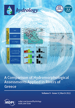
Cover Story (view full-size image): Numerous methods have been developed and adopted by EU members for the hydromorphological assessment of rivers. With this study, we compared three such methods, the river habitat survey (RHS), morphological quality index (MQI), and river hydromorphology assessment technique (RHAT), which were applied in 122 river reaches in Greece. Our results showed that the RHAT and the MQI resulted in the same classification for 58% of the reaches, whereas 34% differed by only one quality class. We also found strong correlations between the MQI and the RHAT, particularly at lowland courses. Because RHS requires an extended national hydromorphological database for the proper estimation of habitat quality assessment, we propose the complementary use of the RHAT and MQI as a quick and effective assessment of the hydromophological status of Greek rivers. View this paper
  • Issues are regarded as officially published after their release is announced to the table of contents alert mailing list.
  • You may sign up for e-mail alerts to receive table of contents of newly released issues.
  • PDF is the official format for papers published in both, html and pdf forms. To view the papers in pdf format, click on the "PDF Full-text" link, and use the free Adobe Reader to open them.
Order results
Result details
Section
Select all
Export citation of selected articles as:
19 pages, 4437 KiB  
Article
Quantification of Precipitation and Evapotranspiration Uncertainty in Rainfall-Runoff Modeling
by Faisal Baig, Mohsen Sherif and Muhammad Abrar Faiz
Hydrology 2022, 9(3), 51; https://doi.org/10.3390/hydrology9030051 - 21 Mar 2022
Cited by 4 | Viewed by 2678
Abstract
Mountainous watersheds have always been a challenge for modelers due to large variability and insufficient ground observations, which cause forcing data, model structure, and parameter uncertainty. This study employed Differential Evolution Adaptive Metropolis (DREAM) algorithm which utilizes Markov Chain Monte Carlo (MCMC) approach [...] Read more.
Mountainous watersheds have always been a challenge for modelers due to large variability and insufficient ground observations, which cause forcing data, model structure, and parameter uncertainty. This study employed Differential Evolution Adaptive Metropolis (DREAM) algorithm which utilizes Markov Chain Monte Carlo (MCMC) approach to account for forcing data uncertainty. A conceptual degree day snowmelt model, MIKE 11 NAM (Nedbor Afstromnings Model), was used to simulate snowmelt runoff from Ilgaz basin, with an area of 28.4 km2 area, located in the northern part of Turkey. The mean elevation is around 1700 m and the basin is covered with broadleaf forest and has mainly brown soil with a high water holding capacity. Precipitation and evapotranspiration (ET) values were optimized in combination with model parameters conditioned on observed discharges and corrected values of input data were utilized for calibration and validation. Results showed that the observed precipitation was over-estimated by almost 10%, while evapotranspiration calculated by Penman–Monteith method was underestimated. The mean values of storm and ET multipliers were obtained as 1.14 and 0.84, respectively. When only parameter uncertainty was considered, calibration did not yield Nash–Sutcliffe Efficiency (NSE) greater than 0.64. However, when forcing data uncertainty was incorporated in the DREAM approach, an improved value of NSE (0.84) was obtained. After calibration and treatment of forcing data errors, the model yielded reasonable prediction uncertainty bounds and well-defined posterior distributions of NAM model parameters. Main objectives of the study are to assess the applicability of MIKE 11 NAM model to the selected catchment. In addition, the importance of errors in the input forcing variables to the model is demonstrated. Full article
Show Figures

Figure 1

35 pages, 3891 KiB  
Review
Flood Risk in Urban Areas: Modelling, Management and Adaptation to Climate Change. A Review
by Luís Cea and Pierfranco Costabile
Hydrology 2022, 9(3), 50; https://doi.org/10.3390/hydrology9030050 - 18 Mar 2022
Cited by 94 | Viewed by 28099
Abstract
The modelling and management of flood risk in urban areas are increasingly recognized as global challenges. The complexity of these issues is a consequence of the existence of several distinct sources of risk, including not only fluvial, tidal and coastal flooding, but also [...] Read more.
The modelling and management of flood risk in urban areas are increasingly recognized as global challenges. The complexity of these issues is a consequence of the existence of several distinct sources of risk, including not only fluvial, tidal and coastal flooding, but also exposure to urban runoff and local drainage failure, and the various management strategies that can be proposed. The high degree of vulnerability that characterizes such areas is expected to increase in the future due to the effects of climate change, the growth of the population living in cities, and urban densification. An increasing awareness of the socio-economic losses and environmental impact of urban flooding is clearly reflected in the recent expansion of the number of studies related to the modelling and management of urban flooding, sometimes within the framework of adaptation to climate change. The goal of the current paper is to provide a general review of the recent advances in flood-risk modelling and management, while also exploring future perspectives in these fields of research. Full article
Show Figures

Figure 1

27 pages, 43456 KiB  
Article
Participatory and Integrated Modelling under Contentious Water Use in Semiarid Basins
by Rodrigo Rojas, Juan Castilla-Rho, Gabriella Bennison, Robert Bridgart, Camilo Prats and Edmundo Claro
Hydrology 2022, 9(3), 49; https://doi.org/10.3390/hydrology9030049 - 16 Mar 2022
Cited by 9 | Viewed by 3508
Abstract
Addressing modern water management challenges requires the integration of physical, environmental and socio-economic aspects, including diverse stakeholders’ values, interests and goals. Early stakeholder involvement increases the likelihood of acceptance and legitimacy of potential solutions to these challenges. Participatory modelling allows stakeholders to co-design [...] Read more.
Addressing modern water management challenges requires the integration of physical, environmental and socio-economic aspects, including diverse stakeholders’ values, interests and goals. Early stakeholder involvement increases the likelihood of acceptance and legitimacy of potential solutions to these challenges. Participatory modelling allows stakeholders to co-design solutions, thus facilitating knowledge co-construction/social learning. In this work, we combine integrated modelling and participatory modelling to develop and deploy a digital platform supporting decision-making for water management in a semiarid basin under contentious water use. The purpose of this tool is exploring “on-the-fly” alternative water management strategies and potential policy pathways with stakeholders. We first co-designed specific water management strategies/impact indicators and collected local knowledge about farmers’ behaviour regarding groundwater regulation. Second, we coupled a node–link water balance model, a groundwater model and an agent-based model in a digital platform (SimCopiapo) for scenario exploration. This was done with constant input from key stakeholders through a participatory process. Our results suggest that reductions of groundwater demand (40%) alone are not sufficient to capture stakeholders’ interests and steer the system towards sustainable water use, and thus a portfolio of management strategies including exchanges of water rights, improvements to hydraulic infrastructure and robust enforcement policies is required. The establishment of an efficient enforcement policy to monitor compliance on caps imposed on groundwater use and sanction those breaching this regulation is required to trigger the minimum momentum for policy acceptance. Finally, the participatory modelling process led to the definition of a diverse collection of strategies/impact indicators, which are reflections of the stakeholders’ interests. This indicates that not only the final product—i.e., SimCopiapo—is of value but also the process leading to its creation. Full article
(This article belongs to the Special Issue Integrated Surface Water and Groundwater Analysis)
Show Figures

Figure 1

22 pages, 3913 KiB  
Article
Evaluation of Future Streamflow in the Upper Part of the Nilwala River Basin (Sri Lanka) under Climate Change
by Imiya M. Chathuranika, Miyuru B. Gunathilake, Hazi Md. Azamathulla and Upaka Rathnayake
Hydrology 2022, 9(3), 48; https://doi.org/10.3390/hydrology9030048 - 16 Mar 2022
Cited by 25 | Viewed by 5092
Abstract
Climate change is a serious and complex crisis that impacts humankind in different ways. It affects the availability of water resources, especially in the tropical regions of South Asia to a greater extent. However, the impact of climate change on water resources in [...] Read more.
Climate change is a serious and complex crisis that impacts humankind in different ways. It affects the availability of water resources, especially in the tropical regions of South Asia to a greater extent. However, the impact of climate change on water resources in Sri Lanka has been the least explored. Noteworthy, this is the first study in Sri Lanka that attempts to evaluate the impact of climate change in streamflow in a watershed located in the southern coastal belt of the island. The objective of this paper is to evaluate the climate change impact on streamflow of the Upper Nilwala River Basin (UNRB), Sri Lanka. In this study, the bias-corrected rainfall data from three Regional Climate Models (RCMs) under two Representative Concentration Pathways (RCPs): RCP4.5 and RCP8.5 were fed into the Hydrologic Engineering Center-Hydrologic Modeling System (HEC-HMS) model to obtain future streamflow. Bias correction of future rainfall data in the Nilwala River Basin (NRB) was conducted using the Linear Scaling Method (LSM). Future precipitation was projected under three timelines: 2020s (2021–2047), 2050s (2048–2073), and 2080s (2074–2099) and was compared against the baseline period from 1980 to 2020. The ensemble mean annual precipitation in the NRB is expected to rise by 3.63%, 16.49%, and 12.82% under the RCP 4.5 emission scenario during the 2020s, 2050s, and 2080s, and 4.26%, 8.94%, and 18.04% under RCP 8.5 emission scenario during 2020s, 2050s and 2080s, respectively. The future annual streamflow of the UNRB is projected to increase by 59.30% and 65.79% under the ensemble RCP4.5 and RCP8.5 climate scenarios, respectively, when compared to the baseline scenario. In addition, the seasonal flows are also expected to increase for both RCPs for all seasons with an exception during the southwest monsoon season in the 2015–2042 period under the RCP4.5 emission scenario. In general, the results of the present study demonstrate that climate and streamflow of the NRB are expected to experience changes when compared to current climatic conditions. The results of the present study will be of major importance for river basin planners and government agencies to develop sustainable water management strategies and adaptation options to offset the negative impacts of future changes in climate. Full article
(This article belongs to the Section Hydrology–Climate Interactions)
Show Figures

Figure 1

26 pages, 53478 KiB  
Article
Drivers of Dust-Enhanced Snowpack Melt-Out and Streamflow Timing
by Steven R. Fassnacht, Caroline R. Duncan, Anna K. D. Pfohl, Ryan W. Webb, Jeffrey E. Derry, William E. Sanford, Danielle C. Reimanis and Lenka G. Doskocil
Hydrology 2022, 9(3), 47; https://doi.org/10.3390/hydrology9030047 - 14 Mar 2022
Cited by 5 | Viewed by 3006
Abstract
The presence of dust on the snowpack accelerates snowmelt. This has been observed through snowpack and hydrometeorological measurements at a small study watershed in southwestern Colorado. For a 13-year period, we quantified the annual dust-enhanced energy absorption (DEAE) and used this information to [...] Read more.
The presence of dust on the snowpack accelerates snowmelt. This has been observed through snowpack and hydrometeorological measurements at a small study watershed in southwestern Colorado. For a 13-year period, we quantified the annual dust-enhanced energy absorption (DEAE) and used this information to model the snowpack melt-out under observed (with dust present) and clean conditions (no dust). We determine the difference in snow cover duration between actual (dust present) and simulated ideal (clean) snowpack (ΔSAG) to characterize the shifts in melt timing for each year. We compute the center of mass of runoff (tQ50) as a characteristic of snowmelt. DEAE, ΔSAG and tQ50 vary from year to year, and are dictated by the quantity of snow accumulation, and to a lesser extent the number of dust events, the annual dust loading, and springtime snowfall. Full article
Show Figures

Figure 1

14 pages, 3425 KiB  
Article
Investigating the Performance of Green Roof for Effective Runoff Reduction Corresponding to Different Weather Patterns: A Case Study in Dublin, Ireland
by Arunima Sarkar Basu, Bidroha Basu, Francesco Pilla and Srikanta Sannigrahi
Hydrology 2022, 9(3), 46; https://doi.org/10.3390/hydrology9030046 - 9 Mar 2022
Cited by 4 | Viewed by 3364
Abstract
This article aims to analyse the performance of green roof in runoff reduction. A case study has been conducted through a deployed green roof at the custom house quay building in Dublin, Ireland. Modular green roofs have been deployed which have IoT scales [...] Read more.
This article aims to analyse the performance of green roof in runoff reduction. A case study has been conducted through a deployed green roof at the custom house quay building in Dublin, Ireland. Modular green roofs have been deployed which have IoT scales associated to it for measuring the effective reduction in runoff. Hydro-meteorological variables such as rainfall, temperature, relative humidity and wind speed values were corresponded to the amount of runoff reduction by means of a regression-based relationship. Comparison of the observed runoff reduction from a modular green roof and that estimated based on the developed regression relationship yielded a R2 value of 0.874. Through this research, a pattern was identified which established that longer records and better weather variables data have the potential to improve the performance of the regression model in predicting the amount of runoff reduction corresponding to different rainfall and weather patterns. In general, performance of green roof was found to be highly positively correlated to the amount of rainfall received; however, low correlation between rainfall and the percentage of runoff reduction indicate that saturated soil in green roofs considerably deteriorates the performance in runoff reduction. Overall, this study can help in identification of locations where installation of green roofs can help mitigate floods at a city scale. Full article
(This article belongs to the Section Hydrological and Hydrodynamic Processes and Modelling)
Show Figures

Figure 1

17 pages, 13986 KiB  
Article
An Analysis of the Effects of Large Wildfires on the Hydrology of Three Small Catchments in Central Chile Using Tritium-Based Measurements and Hydrological Metrics
by Francisco Balocchi, Diego Rivera, José Luis Arumi, Uwe Morgenstern, Donald A. White, Richard P. Silberstein and Pablo Ramírez de Arellano
Hydrology 2022, 9(3), 45; https://doi.org/10.3390/hydrology9030045 - 9 Mar 2022
Cited by 7 | Viewed by 3044
Abstract
Wildfires are an important disturbance affecting catchments’ soil and hydrological processes within. Wildfires are predicted to increase in both frequency and severity under climate change. Here, we present measurements of tritium (3H) in surface water of three streams before and after [...] Read more.
Wildfires are an important disturbance affecting catchments’ soil and hydrological processes within. Wildfires are predicted to increase in both frequency and severity under climate change. Here, we present measurements of tritium (3H) in surface water of three streams before and after the ‘las Máquinas’ megafire of January 2017 in central Chile and streamflow metrics. Mean transit times (MTTs) of water were calculated in three coastal catchments with the Mediterranean climate type, covered by native forest, a mixture of native forest and Pinus radiata D. Don, and P. radiata. Lumped parameter models (LPMs) were used to obtain MTTs. Tritium activities from 2012 to 2018 ranged from 0.597 to 0.927 Tritium Units (TU), with the lowest TU activity in 2018. These 3H concentrations indicated water ages from 5 to 30 years. Following the fire, peak flows and baseflow have increased in two catchments but decreased in the third. Even though we have seen changes in the hydrological responses within the three catchments, pre- and post-fire MTT values were not significantly different. Therefore, there is no conclusive evidence of hydrological changes at the groundwater level due to wildfire at this early stage. However, since the MTT ranges from 5 to 30 years, it is likely that more time is required for the changes in the hydrograph to be clearly reflected in the tritium signal even though there are noticeable changes in streamflow metrics such as runoff and baseflow. Within the following years from this study, a sampling schedule to continue to investigate both the long-term drought and the effect of wildfire on these catchments will be maintained. Full article
(This article belongs to the Section Hydrological Measurements and Instrumentation)
Show Figures

Figure 1

20 pages, 5106 KiB  
Article
Short-Term Effects of the EU Nitrate Directive Reintroduction: Reduced N Loads to River from an Alluvial Aquifer in Northern Italy
by Edoardo Severini, Marco Bartoli, Monica Pinardi and Fulvio Celico
Hydrology 2022, 9(3), 44; https://doi.org/10.3390/hydrology9030044 - 25 Feb 2022
Cited by 9 | Viewed by 2747
Abstract
The Po Plain (northern Italy) is one of the largest aquifers in Europe, and 67% of the utilized agricultural land in this area is classified as a nitrate vulnerable zone (NVZ). However, it hosts intensive agriculture and livestock farming. In a stretch of [...] Read more.
The Po Plain (northern Italy) is one of the largest aquifers in Europe, and 67% of the utilized agricultural land in this area is classified as a nitrate vulnerable zone (NVZ). However, it hosts intensive agriculture and livestock farming. In a stretch of the Mincio River (a tributary of the Po River), hydraulic heads and physico-chemical parameters of river and groundwater were monitored for a hydrologic year (2020–2021), to evaluate the effects of manure fertilization and flooding irrigation on surface- and groundwater chemistry. From 2020 the Nitrate Directive’s fertilization limit was reintroduced and a comparison has been performed comparing surface- and groundwater data from the 2019 fertilization period (before limit reintroduction) and 2020 (after). Results suggest that in 2021 the phreatic aquifer displayed elevated nitrate (NO3) concentrations, exceeding 50 mg L−1, although average values were lower than those of 2019. Nitrate loads in the Mincio River reached 6670 kg NO3 d−1 and resulted from the overfertilization in the surrounding area and the quick transfer of nitrogen from groundwater to the river. As compared to 2019, the river loads decreased by 59%, suggesting that the introduction of fertilization limits can produce measurable, short-term responses in alluvial aquifers. Full article
Show Figures

Figure 1

14 pages, 2459 KiB  
Article
A Comparative Evaluation of Hydromorphological Assessment Methods Applied in Rivers of Greece
by Konstantinos Stefanidis, Theodora Kouvarda, Anna Latsiou, George Papaioannou, Konstantinos Gritzalis and Elias Dimitriou
Hydrology 2022, 9(3), 43; https://doi.org/10.3390/hydrology9030043 - 24 Feb 2022
Cited by 6 | Viewed by 3948
Abstract
The ecological assessment of all surface water bodies in Europe according to the Water Framework Directive involves the monitoring of biological, physicochemical and hydromorphological quality elements. For the hydromorphological assessment in particular, there are numerous methods that have been developed and adopted by [...] Read more.
The ecological assessment of all surface water bodies in Europe according to the Water Framework Directive involves the monitoring of biological, physicochemical and hydromorphological quality elements. For the hydromorphological assessment in particular, there are numerous methods that have been developed and adopted by EU member countries. With this study, we compared three different methods (River Habitat Survey, Morphological Quality Index and River Hydromorphology Assessment Technique) applied in 122 river reaches that are part of the National Monitoring Network of Greece. The main objectives were (a) to identify whether different assessment systems provide similar classifications of hydromorphological status and (b) to distinguish strengths and weaknesses associated with the implementation of each method. Our results show that the River Hydromorphology Assessment Technique (RHAT) and the Morphological Quality Index (MQI) resulted in the same classification for 58% of the studied reaches, while 34% of the remaining cases differed by only one quality class. Correlations between the two indices per river type (ICT) showed that the two indices were strongly correlated for water courses located at low altitudes. Concerning the HMS index of the River Habitat Survey (RHS), which is an index that reflects the overall hydromorphological pressure, it showed larger differences with the other two indices, mainly because it classified more sites as “Poor” and “Bad” quality classes. Based on our results, we recommend that the two indices, RHAT and MQI, can be implemented complementary to the RHS for providing a rather easy and quick assessment of the overall hydromorphological status, at least until a national hydromorphological database is compiled that will allow for the proper adaptation of the Habitat Quality Assessment (HQA) index. Full article
Show Figures

Figure 1

26 pages, 8285 KiB  
Article
Determinants of Evapotranspiration in Urban Rain Gardens: A Case Study with Lysimeters under Temperate Climate
by Ahmeda Assann Ouédraogo, Emmanuel Berthier, Brigitte Durand and Marie-Christine Gromaire
Hydrology 2022, 9(3), 42; https://doi.org/10.3390/hydrology9030042 - 23 Feb 2022
Cited by 6 | Viewed by 3863
Abstract
Accurate evaluation of evapotranspiration (ET) flux is an important issue in sustainable urban drainage systems that target not only flow rate limitations, but also aim at the restoration of natural water balances. This is especially true in context where infiltration possibilities are limited. [...] Read more.
Accurate evaluation of evapotranspiration (ET) flux is an important issue in sustainable urban drainage systems that target not only flow rate limitations, but also aim at the restoration of natural water balances. This is especially true in context where infiltration possibilities are limited. However, its assessment suffers from insufficient understanding. In this study, ET in 1 m3 pilot rain gardens were studied from eight lysimeters monitored for three years in Paris (France). Daily ET was calculated for each lysimeter based on a mass balance approach and the related uncertainties were assessed at ±0.42 to 0.58 mm. Results showed that for these lysimeters, ET is the major term in water budget (61 to 90% of the precipitations) with maximum values reaching 8–12 mm. Furthermore, the major determinants of ET are the existence or not of an internal water storage and the atmospheric factors. The vegetation type is a secondary determinant, with little difference between herbaceous and shrub configurations, maximum ET for spontaneous vegetation, and minimal values when vegetation was regularly removed. Shading of lysimeters by surroundings buildings is also important, leading to lower values. Finally, ET of lysimeters is higher than tested reference values (evaporimeter, FAO-56, and local Météo-France equations). Full article
(This article belongs to the Special Issue Advances in Evaporation and Evaporative Demand)
Show Figures

Figure 1

Previous Issue
Next Issue
Back to TopTop