Next Issue
Volume 6, December
Previous Issue
Volume 6, October


Heritage, Volume 6, Issue 11 (November 2023) – 18 articles

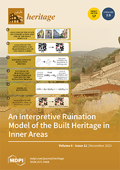
Cover Story (view full-size image): In Italy, the support measures envisaged by the National Strategy for Inner Areas could contribute to the protection and enhancement of historical centres in inner areas. From this perspective, a cognitive process aimed at identifying the risks and benefits of conservation works should drive the efforts undertaken to preserve historical sites. This research proposes a ruination model highlighting the risks to which built heritage in inner areas is exposed. The model was developed based on a qualitative–quantitative approach and was implemented to study the historic neighbourhood of Granfonte in Leonforte, Sicily, Italy. This study can support decision-makers in selecting actions to protect and preserve built heritage located in marginalised areas. View this paper
  • Issues are regarded as officially published after their release is announced to the table of contents alert mailing list.
  • You may sign up for e-mail alerts to receive table of contents of newly released issues.
  • PDF is the official format for papers published in both, html and pdf forms. To view the papers in pdf format, click on the "PDF Full-text" link, and use the free Adobe Reader to open them.
Order results
Result details
Section
Select all
Export citation of selected articles as:
17 pages, 10582 KiB  
Article
Linking Cultural and Postindustrial Heritage with Potential Economic Activities—A Proposal to Revitalize a Demographically Degraded Area in Spain
by Dolores Pereira Gómez and Sergio Hernández Gutiérrez
Heritage 2023, 6(11), 7244-7260; https://doi.org/10.3390/heritage6110380 - 20 Nov 2023
Cited by 1 | Viewed by 1645
Abstract
Mining and quarrying were important economic activities in Europe in past centuries, but during the 20th century, raw materials became vital to societal development. Mining has been subject to fluctuations related to wars, economic crises, and advances in environmental rights. A series of [...] Read more.
Mining and quarrying were important economic activities in Europe in past centuries, but during the 20th century, raw materials became vital to societal development. Mining has been subject to fluctuations related to wars, economic crises, and advances in environmental rights. A series of events led some European countries, such as Spain, to assume a leading position in the market for certain raw materials, such as tungsten. However, most of Europe’s mines have been abandoned. This paper considers several postindustrial heritage sites that can used to illustrate how metal and stone were extracted in past centuries. Such sites have become a tourist attraction in the context of heritage in some countries. This area in western Spain, which contains ancestral quarries that helped build the architectural heritage of UNESCO World Heritage Cities and artisanal mines that contributed to building the economy of an extremely poor population, has a story to tell. All these mines and quarries can be used to explain the cultural heritage of the area as part of a postindustrial heritage landscape. Full article
(This article belongs to the Section Geoheritage and Geo-Conservation)
Show Figures

Figure 1

14 pages, 5102 KiB  
Article
Pluvial Flood Risk Assessment in Urban Areas: A Case Study for the Archaeological Site of the Roman Agora, Athens
by Theano Iliopoulou, Panayiotis Dimitriadis and Demetris Koutsoyiannis
Heritage 2023, 6(11), 7230-7243; https://doi.org/10.3390/heritage6110379 - 20 Nov 2023
Cited by 2 | Viewed by 1705
Abstract
Ancient monuments located in urbanized areas are subject to numerous short- and long-term environmental hazards with flooding being among the most critical ones. Flood hazards in the complex urban environment are subject to large spatial and temporal variability and, thus, require location-specific risk [...] Read more.
Ancient monuments located in urbanized areas are subject to numerous short- and long-term environmental hazards with flooding being among the most critical ones. Flood hazards in the complex urban environment are subject to large spatial and temporal variability and, thus, require location-specific risk assessment and mitigation. We devise a methodological scheme for assessing flood hazard in urban areas, at the monument’s scale, by directly routing rainfall events over a fine-resolution digital terrain model at the region of interest. This is achieved using an open-source 2D hydraulic modelling software under unsteady flow conditions, employing a scheme known as ‘direct rainfall modelling’ or ‘rain-on-grid’. The method allows for the realistic representation of buildings and, thus, is appropriate for detailed storm-induced (pluvial) flood modelling in urbanized regions, within which a major stream is usually not present and conventional hydrological methodologies do not apply. As a case study, we perform a pilot assessment of the flood hazard in the Roman Agora, a major archaeological site of Greece located in the center of Athens. The scheme is incorporated within an intelligent decision-support system for the protection of monumental structures (ARCHYTAS), allowing for a fast and informative assessment of the flood risk within the monument’s region for different scenarios that account for rainfall’s return period and duration as well as uncertainty in antecedent wetness conditions. Full article
(This article belongs to the Special Issue Protection of Cultural Heritage from Natural and Manmade Hazards)
Show Figures

Figure 1

15 pages, 1923 KiB  
Article
Local History and the Development of Heritage Bonds: A Primary Education Intervention
by Sara I’Anson Gutiérrez, Miguel Ángel Suárez Suárez and Roser Calaf Masachs
Heritage 2023, 6(11), 7215-7229; https://doi.org/10.3390/heritage6110378 - 18 Nov 2023
Cited by 2 | Viewed by 1957
Abstract
The Roman Baths of Valduno (Spain) possess significant educational potential, as recognized by visitors in a previous study, even though the facilities have not been maintained properly or have not been given enough publicity , which has resulted in their neglect. Through participation [...] Read more.
The Roman Baths of Valduno (Spain) possess significant educational potential, as recognized by visitors in a previous study, even though the facilities have not been maintained properly or have not been given enough publicity , which has resulted in their neglect. Through participation in a school project, a specific intervention is planned, following the ideas of community archaeology, regarding the study and dissemination of the Baths by following the ideas of community archaeology throughout. This study aims to analyse the impact this intervention has on 16 students regarding their knowledge of heritage and the bonds forged and reinforced concerning the site, as well as to identify the difference in historical knowledge acquired after a classroom explanation of the Baths and an open guided tour focused on the interests of the students. A case study was designed following the educational ethnography method, as it facilitates daily attendance as well as close observation of the case in question. The instruments developed (a register for participant observation and a semi-structured interview) reveal that symbolic appropriation of the site occurs as interaction and related knowledge increase. Furthermore, open guided tours facilitate greater significant learning in contrast to a classroom explanation on a heritage site. Educational experiences that embrace experimental, transdisciplinary, and participative methodologies contribute to a holistic understanding of heritage. Full article
(This article belongs to the Special Issue Research in Heritage Education: Transdisciplinary Approaches)
Show Figures

Figure 1

13 pages, 1286 KiB  
Article
The Holy Chalice of the Last Supper Venerated in Valencia, Spain: Answering Historic Questions to Pilgrims as a Basis of Fostering Cultural Tourism
by Manuel Zarzo
Heritage 2023, 6(11), 7202-7214; https://doi.org/10.3390/heritage6110377 - 18 Nov 2023
Cited by 2 | Viewed by 2171
Abstract
The Cathedral of Valencia has kept an important relic since 1437: the Holy Chalice of the Last Supper. It consists of an agate cup, a gold stem, and a gemstone foot. According to a pious tradition, this cup is the one used by [...] Read more.
The Cathedral of Valencia has kept an important relic since 1437: the Holy Chalice of the Last Supper. It consists of an agate cup, a gold stem, and a gemstone foot. According to a pious tradition, this cup is the one used by Jesus of Nazareth to institute the Eucharist. Tourists visiting Valencia Cathedral often doubt its authenticity. There are certain queries that pilgrims wonder about, some of which have not been studied in depth. For example: What is known about the family who owned the chalice? Why would Jesus use a gemstone cup instead of one made of glass, silver, or gold? Aimed at clarifying these concerns, the research methodology was essentially centered on a review of the literature. The main conclusions are the following: (i) The Cenacle belonged to a rich disciple of Jesus, who would have lent him a valuable cup of blessing. Quite likely, it was the family of Saint Mark, who had a close link with Saint Peter. (ii) It is unlikely that Jesus used a cup made of glass because this material was relatively affordable. By contrast, gemstone vessels were highly appreciated. This case study highlights the importance of promoting historic and scientific studies about Christian artworks as a pre-requisite to foster heritage tourism. Full article
Show Figures

Figure 1

21 pages, 30447 KiB  
Article
Paul Delvaux: The Study of Nine Paintings by Non-Invasive Methods
by Edène Derzelle, David Strivay, Antoine Defeyt, Sarah-Jane Klein, Francisca Vandepitte and Catherine Defeyt
Heritage 2023, 6(11), 7181-7201; https://doi.org/10.3390/heritage6110376 - 17 Nov 2023
Cited by 1 | Viewed by 2789
Abstract
Paul Delvaux (1897–1994) was a Belgian Surrealist painter known for his dreamlike and enigmatic compositions. His works often featured nude or semi-nude women and deserted urban landscapes, evoking a sense of mystery and intrigue. Delvaux’s meticulous attention to detail and masterful use of [...] Read more.
Paul Delvaux (1897–1994) was a Belgian Surrealist painter known for his dreamlike and enigmatic compositions. His works often featured nude or semi-nude women and deserted urban landscapes, evoking a sense of mystery and intrigue. Delvaux’s meticulous attention to detail and masterful use of light and shadow added depth and realism to his surrealistic style, making him one of the leading figures of the Belgian Surrealist movement. Although writings about Paul Delvaux’s work are not lacking, the literature mainly deals with the stylistic and iconographic aspects of his work. Taking an interest in painting materials and the painter’s technique allows us to understand his personality and to apprehend his work in a different way. In order to collect such information, the early painted production of Delvaux was studied in situ with imaging methods (high-resolution photography, infrared reflectography and X-ray radiography) and non-invasive analytical techniques (MA-XRF and Raman spectroscopy). The results obtained for nine oil paintings produced from 1928 to 1958 are discussed in terms of the support, the preparatory layer, the preparatory drawing, the changes in composition and reuse of paintings, the pictorial layer and the dripping phenomenon. Full article
(This article belongs to the Special Issue Pigment Identification of Cultural Heritage Materials)
Show Figures

Figure 1

11 pages, 2180 KiB  
Article
The High Potential of Micro-Magnetic Resonance Imaging for the Identification of Archaeological Reeds: The Case Study of Tutankhamun
by Claudia Moricca, Valeria Stagno, Nagmeldeen Morshed Hamza, Gabriele Favero, Laura Sadori and Silvia Capuani
Heritage 2023, 6(11), 7170-7180; https://doi.org/10.3390/heritage6110375 - 16 Nov 2023
Cited by 1 | Viewed by 2040
Abstract
This study explores the potential of micro-magnetic resonance imaging (μ-MRI) for identifying archaeological reeds found in the tomb of Tutankhamun. Reed plants had various historical uses in the past, with ancient Egyptians extensively employing them for crafting a wide range of items. The [...] Read more.
This study explores the potential of micro-magnetic resonance imaging (μ-MRI) for identifying archaeological reeds found in the tomb of Tutankhamun. Reed plants had various historical uses in the past, with ancient Egyptians extensively employing them for crafting a wide range of items. The distinct cross-sectional characteristics of Arundo donax (giant reed) and Phragmites australis (common reed) are observed and described via optical microscopy and μ-MRI in this study. While optical microscopy offers higher resolution, μ-MRI provides advantages for studying archaeobotanical specimens, as it eliminates the need for mechanical sectioning and potentially damaging fragile samples. The application of μ-MRI on a selected archaeological reed allowed us to identify it as Phragmites australis, showing that μ-MRI can yield clear images, maintaining the integrity of the sample. In contrast, diagnostic features appeared greatly deformed on the thin section observed via optical microscopy. Despite the limitations related to the sample size and the need for sample soaking, μ-MRI presents a valuable tool for analyzing archaeological remains in the field of cultural heritage, with the potential for broader applications. Overall, this study contributes to expanding the toolkit available to researchers studying plant remains, providing insights into reed identification and preservation in archaeological contexts. Full article
(This article belongs to the Special Issue Non-invasive Technologies Applied in Cultural Heritage)
Show Figures

Figure 1

14 pages, 10166 KiB  
Article
Satellite-Aided Analysis of the Position of the Sun Temples and the Dynastic History of the Vth Egyptian Dynasty
by Giulio Magli
Heritage 2023, 6(11), 7156-7169; https://doi.org/10.3390/heritage6110374 - 16 Nov 2023
Viewed by 2095
Abstract
The Sun Temples of the Vth dynasty are the most elusive Egyptian monuments of the Old Kingdom. Textual sources seem to refer to a different temple for each different pharaoh of the dynasty, but only two have been discovered at Abu Gurab, a [...] Read more.
The Sun Temples of the Vth dynasty are the most elusive Egyptian monuments of the Old Kingdom. Textual sources seem to refer to a different temple for each different pharaoh of the dynasty, but only two have been discovered at Abu Gurab, a few hundred meters north of the dynastic necropolis of Abusir. Previously, the author has proposed a cognitive–topographical framework that strongly supports the idea, originally formulated by Stadelmann, that only these two already known temples actually existed, while the others—with the possible exception of the last one—mentioned in the sources refer to renovations carried out by subsequent pharaohs on existing monuments. This paper aims to give a complete reassessment of this question using satellite imagery. Together with recently disclosed archaeological excavations at Abu Gurab, which have direct relevance for the history of the Sun Temples, the analysis provided here adds new, surprising aspects to the dynastic scenario, bringing in the meantime, further support to the above-mentioned framework. A proposal for the location of the last temple is also highlighted in the same analysis. Full article
Show Figures

Figure 1

16 pages, 1477 KiB  
Article
Becoming a Developed and Sustainable Destination: La Siberia Biosphere Reserve in Spain
by M. Isabel Sánchez-Hernández and Juan José Maldonado-Briegas
Heritage 2023, 6(11), 7140-7155; https://doi.org/10.3390/heritage6110373 - 14 Nov 2023
Cited by 2 | Viewed by 1613
Abstract
This paper reflects on the controversies to protect, and develop rural areas presenting the current situation, and the future, of the La Siberia Biosphere Reserve, located in the Extremadura region of Spain. Adopting a qualitative research design, we have gathered and examined the [...] Read more.
This paper reflects on the controversies to protect, and develop rural areas presenting the current situation, and the future, of the La Siberia Biosphere Reserve, located in the Extremadura region of Spain. Adopting a qualitative research design, we have gathered and examined the primary initiatives implemented for the Tourism Sustainability Plan of the reserve spanning from 2021 to 2023 and engaged in discussions regarding the potential of this region with the manager of the current Regional Development Centre, and a selection of key informants. In addition, opportunities and threats have been gathered from media. We employed the qualitative method and the content analysis, with ATLASti software (ATLAS.ti.7). We have noticed that soon, this region will develop new proposals by fostering private-public collaboration. The findings indicate that the preservation of natural resources, that has emerged as a pivotal source of innovation, must deal with new entrepreneurial activities that can put the sustainability of the territory at risk. What sets this work apart is its portrayal of Extremadura as a benchmark for sustainable social and economic development fostered by regional public policies. It is our conclusion that both academia and society should establish collaborative spaces that facilitate the formation of entrepreneurial ecosystems, fostering the cultivation of talent and effectively addressing the new regional challenges in Europe. Full article
Show Figures

Figure 1

14 pages, 1065 KiB  
Article
The Educational Dimension as an Emergent Topic in the Management of Heritage: Mapping Scientific Production, 1991–2022
by Olaia Fontal, Marta Martínez-Rodríguez and Silvia García-Ceballos
Heritage 2023, 6(11), 7126-7139; https://doi.org/10.3390/heritage6110372 - 10 Nov 2023
Cited by 1 | Viewed by 2358
Abstract
Heritage is increasingly present in educational discourses, yet research on heritage education still lacks literature overviews that identify trends in its scientific production worldwide in order to get to know the discipline’s advances, evolution, and impact. This article collected a bibliographic review of [...] Read more.
Heritage is increasingly present in educational discourses, yet research on heritage education still lacks literature overviews that identify trends in its scientific production worldwide in order to get to know the discipline’s advances, evolution, and impact. This article collected a bibliographic review of n = 223 documents indexed in Scopus and the Web of Science between 1991 and 2022. The analysis was carried out in two phases. During the first phase, distance-based maps were constructed using the VOSviewer 1.6.16 software. During the second phase, a systematic review was carried out based on methodological classification and a content analysis. The study identified thematic networks of (C1) heritage education in formal education, (C2) heritage education, cultural heritage, and educational innovation, (C3) archaeological heritage education, (C4) heritage education, case studies, and historical awareness, and (C5) heritage education, and classified research genealogies and methodologies, which, in turn, led to the definition of two emerging genealogies: teacher training and instrumental, which were added to re-conceptualizing, contextual didactic, and evaluative, and ultimately identified a predominantly qualitative methodology. A classification of the methodologies, methods, and techniques of heritage education research was also made. This study constitutes a clear and pioneering contribution to our understanding of this discipline. Full article
(This article belongs to the Special Issue Research in Heritage Education: Transdisciplinary Approaches)
Show Figures

Figure 1

11 pages, 290 KiB  
Article
The Challenge of Accessibility to Heritage around the Via Francigena: The Potential of Thermal Heritage for Accessible Tourism
by Miguel Gomez-Heras, Silvia González Soutelo, Raquel Castelo Ruano and Laura García Juan
Heritage 2023, 6(11), 7115-7125; https://doi.org/10.3390/heritage6110371 - 6 Nov 2023
Cited by 2 | Viewed by 2244
Abstract
The Via Francigena stands as a European Cultural Route recognized by the Council of Europe, serving as a link between Northern and Southern Europe, extending from Canterbury through France and Switzerland to Rome in Italy. The Universal Declaration of Human Rights underscores the [...] Read more.
The Via Francigena stands as a European Cultural Route recognized by the Council of Europe, serving as a link between Northern and Southern Europe, extending from Canterbury through France and Switzerland to Rome in Italy. The Universal Declaration of Human Rights underscores the right of all individuals to partake in the cultural life of their communities, which entails ensuring that heritage sites remain accessible to everyone, regardless of their physical, cognitive or sensory abilities. To achieve this, the ‘rurAllure’ project has been initiated to promote and disseminate the cultural and natural heritage along this pilgrimage route in an inclusive manner. This paper reviews the existing resources regarding accessibility in the Italian segment of the Via Francigena, comparing them to initiatives undertaken on other European Cultural Routes. This serves as an initial step to comprehend the measures required to guarantee that everyone can fully engage with and comprehend these cultural experiences. The analysis revealed that most of the limited accessibility efforts along this route have primarily focused on physical accessibility. Regrettably, cognitive and sensory accessibility has received considerably less attention. In this context, this paper proposes the thermal heritage located along the Val d’Orcia section in Tuscany, Italy, as particularly promising for the development of accessible experiences due to its tactile characteristics. The future efforts to enhance accessibility along this route should consider approaches like Universal Design for Learning and the geography of perception to create resources and new experiences that cater to a wide range of individuals. Full article
(This article belongs to the Section Cultural Heritage)
15 pages, 10667 KiB  
Article
Geospatial Tools for Determining Visitor Carrying Capacity in Tourist Streets and Public Spaces of Historic Centres
by Patricio R. Orozco Carpio, María José Viñals, Pablo A. Escudero and Renan C. V. S. Rolim
Heritage 2023, 6(11), 7100-7114; https://doi.org/10.3390/heritage6110370 - 6 Nov 2023
Cited by 2 | Viewed by 2005
Abstract
This paper presents a methodology for using geospatial tools to enact efficient tourism planning and management in streets and other public spaces in historic centres. The study uses 3D laser scanning, GIS, and spatial data processing techniques to analyse the visitor carrying capacity [...] Read more.
This paper presents a methodology for using geospatial tools to enact efficient tourism planning and management in streets and other public spaces in historic centres. The study uses 3D laser scanning, GIS, and spatial data processing techniques to analyse the visitor carrying capacity of streets near cultural attractions. The methodology was tested on Miguelete Street in València (Spain), next to the Cathedral. The results show that these digital tools are efficient and accurate for the spatial analysis of visitor carrying capacity studies. Full article
Show Figures

Figure 1

17 pages, 10711 KiB  
Communication
The Hosta’s Labyrinth on the Black Sea Shore: A Case Study of “Selling” Geosites to the Lay Public
by Natalia N. Yashalova, Vladimir A. Ermolaev and Dmitry A. Ruban
Heritage 2023, 6(11), 7083-7099; https://doi.org/10.3390/heritage6110369 - 1 Nov 2023
Viewed by 1427
Abstract
Geoheritage sites are important resources due to the diverse ways in which they can be utilized. There are small, low-ranked geosites that have attracted significant attention from the lay public. This study reports on one such geosite from the Hosta area of the [...] Read more.
Geoheritage sites are important resources due to the diverse ways in which they can be utilized. There are small, low-ranked geosites that have attracted significant attention from the lay public. This study reports on one such geosite from the Hosta area of the Western Caucasus. Field observations allowed us to make judgments related to its geoheritage properties and establish the factors for its successful touristic exploitation. This geosite represents a furrow in the Upper Cretaceous limestones in the area, which inherited the former weak zone or minor fault and grew due to landslides. The degree of uniqueness of this geosite is low; it is curvilinear in space; it boasts perfect accessibility, including from a nearby resort, and its landscape context is scenic. The Labyrinth geosite is located in a yew–boxwood grove in the natural reserve, and it is visited by crowds of tourists. Three direct factors in its exploitation success are proposed as follows: story (popular explanation of the geosite’s origin), route (inclusion into a popular touristic route through the grove), and cultural appeal (analogy to man-made labyrinths). Applying these factors to another geoheritage-rich area of the Western Caucasus implied that some of them may not be meaningful according to objective reasons, but that there are other important factors such as geoproduct (particularly geofood) selling. It is also noted that the small size and relatively low value of geosites do not necessarily limit their geotouristic potential. Overall, this case study suggests that “selling” geosites successfully requires advanced, innovative solutions and significant creativity. Full article
(This article belongs to the Section Geoheritage and Geo-Conservation)
Show Figures

Figure 1

16 pages, 2313 KiB  
Essay
Edu-Communication from Museums to Formal Education: Cases around Intangible Cultural Heritage and the Co-Creative Paradigm
by Pilar Rivero, Gloria Jové-Monclús and Alodia Rubio-Navarro
Heritage 2023, 6(11), 7067-7082; https://doi.org/10.3390/heritage6110368 - 1 Nov 2023
Cited by 3 | Viewed by 3253
Abstract
The COVID-19 pandemic forced museums to rethink their activity in the context of social media, thus generating new ways of communicating and educating about the heritage they preserve. This article explores the indissoluble relationship established between these emerging edu-communication models and the spaces [...] Read more.
The COVID-19 pandemic forced museums to rethink their activity in the context of social media, thus generating new ways of communicating and educating about the heritage they preserve. This article explores the indissoluble relationship established between these emerging edu-communication models and the spaces destined to safeguard the intangible cultural heritage (ICH), since the latter is a sociocultural phenomenon whose museumization requires education and civic participation. In order to determine to what extent museum edu-communication inspired by the co-creative paradigm can be extended into formal teaching contexts for the generation of heritage bonds and communities around ICH, two cases produced at the J. Trepat Factory Museum in Tàrrega (Spain) are analyzed through an autoethnographic approach. Both examples encourage a reflection on how the co-creative paradigm makes it possible to raise awareness and involve the entire community in the safeguarding of heritage, while at the same time promoting the expansion and reformulation of the institution’s proposals. We conclude that the integration of this approach into formal pedagogical practices contributes to overcoming some of the limitations of non-formal and informal edu-communication, as well as to generating a rhizomatic identization around ICH. Full article
(This article belongs to the Special Issue Research in Heritage Education: Transdisciplinary Approaches)
Show Figures

Figure 1

36 pages, 4666 KiB  
Review
Condition Assessment of Heritage Buildings via Photogrammetry: A Scoping Review from the Perspective of Decision Makers
by Mariella De Fino, Rosella Alessia Galantucci and Fabio Fatiguso
Heritage 2023, 6(11), 7031-7066; https://doi.org/10.3390/heritage6110367 - 30 Oct 2023
Cited by 21 | Viewed by 4256
Abstract
In recent years, advanced digital technologies have driven an outstanding paradigm shift in the field of architectural heritage, particularly for building modelling, historical documentation and touristic promotion. Nonetheless, they show great potentialities in the field of assessment and control of the state of [...] Read more.
In recent years, advanced digital technologies have driven an outstanding paradigm shift in the field of architectural heritage, particularly for building modelling, historical documentation and touristic promotion. Nonetheless, they show great potentialities in the field of assessment and control of the state of conservation of heritage buildings. In particular, close-range and aerial photogrammetry have increasingly relied on low-cost and user-friendly tools and procedures, with a high degree of automation that makes them accessible to specialists who are foremost involved in architectural diagnosis and conservation, rather than in remote sensing sciences. In this framework, this paper provides a scoping review of 117 publications, based on the PRISMA protocol, from Scopus and Web of Science databases, related to the employment of photogrammetric models and methods, with specific focus on the targets and purposes of the diagnostic process, including decay mapping, structural monitoring and modelling, non-destructive investigation and multi-source documentation. In detail, the results point out that current studies mainly support robust processing of large amounts of information from direct observation of surface alterations, systematic correlation between materials, construction characteristics, visible anomalies and experimental measurements, as well as multi-disciplinary collaborative workflows through remote inspection and harmonized data management. Further improvements were identified, including standardization of acquisition procedures, automatization of elaboration pipelines, integration of real-time data, validation of diagnosis decision-making support tools and scalability to networks of assets. Full article
(This article belongs to the Special Issue Photogrammetry, Remote Sensing and GIS for Built Heritage)
Show Figures

Figure 1

22 pages, 6963 KiB  
Article
A Quantitative Social Network Analysis of the Character Relationships in the Mahabharata
by Eren Gultepe and Vivek Mathangi
Heritage 2023, 6(11), 7009-7030; https://doi.org/10.3390/heritage6110366 - 29 Oct 2023
Viewed by 1996
Abstract
Despite the advances in computational literary analysis of Western literature, in-depth analysis of the South Asian literature has been lacking. Thus, social network analysis of the main characters in the Indian epic Mahabharata was performed, in which it was prepossessed into verses, followed [...] Read more.
Despite the advances in computational literary analysis of Western literature, in-depth analysis of the South Asian literature has been lacking. Thus, social network analysis of the main characters in the Indian epic Mahabharata was performed, in which it was prepossessed into verses, followed by a term frequency–inverse document frequency (TF-IDF) transformation. Then, Latent Semantic Analysis (LSA) word vectors were obtained by applying compact Singular Value Decomposition (SVD) on the term–document matrix. As a novel innovation to this study, these word vectors were adaptively converted into a fully connected similarity matrix and transformed, using a novel locally weighted K-Nearest Neighbors (KNN) algorithm, into a social network. The viability of the social networks was assessed by their ability to (i) recover individual character-to-character relationships; (ii) embed the overall network structure (verified with centrality measures and correlations); and (iii) detect communities of the Pandavas (protagonist) and Kauravas (antagonist) using spectral clustering. Thus, the proposed scheme successfully (i) predicted the character-to-character connections of the most important and second most important characters at an F-score of 0.812 and 0.785, respectively, (ii) recovered the overall structure of the ground-truth networks by matching the original centralities (corr. > 0.5, p < 0.05), and (iii) differentiated the Pandavas from the Kauravas with an F-score of 0.749. Full article
(This article belongs to the Special Issue XR and Artificial Intelligence for Heritage)
Show Figures

Figure 1

16 pages, 7830 KiB  
Article
Evaluation of the Suitability of Electrokinetic Treatment to Desalinate the Limestone of the Tomb of Cyrus, a UNESCO World Heritage Site in Iran
by Nasser Eslami, Jorge Feijoo and Nevin Aly
Heritage 2023, 6(11), 6993-7008; https://doi.org/10.3390/heritage6110365 - 28 Oct 2023
Viewed by 1764
Abstract
The tomb of Cyrus the Great, founder of the Persian Empire, is considered one of the most important monuments of Iran. Its advanced state of deterioration motivated the need to carry out a study focused on analyzing the possible damage caused by the [...] Read more.
The tomb of Cyrus the Great, founder of the Persian Empire, is considered one of the most important monuments of Iran. Its advanced state of deterioration motivated the need to carry out a study focused on analyzing the possible damage caused by the presence of soluble salts, and to assess the suitability of an electrokinetic treatment for their extraction. Preliminary diagnostics carried out on stone samples taken from the tomb confirmed that it is affected by the action of soluble salts, and especially by the presence of nitrates and sulfates. The effectiveness and possible harmful effects caused by electrokinetic treatment were evaluated, under laboratory conditions, using the same limestone that makes up the tomb. The obtained results show that this treatment, in a short period of time, reduces the ionic content, reaching high percentages of anion extraction, without causing any damage, which indicates that it is suitable for this type of stone. Full article
Show Figures

Figure 1

28 pages, 10823 KiB  
Article
An Interpretive Ruination Model of the Built Heritage in Inner Areas: The Case Study of the Neighbourhood Granfonte in Leonforte
by Deborah Sanzaro, Maria Rosa Trovato and Chiara Circo
Heritage 2023, 6(11), 6965-6992; https://doi.org/10.3390/heritage6110364 - 27 Oct 2023
Cited by 3 | Viewed by 1883
Abstract
In Italy, the current geography of abandonment is defined by the classification of the National Strategy of Inner Areas (NSIA). The support measures envisaged by the NSIA could contribute to reducing the marginality of inner areas and promote the protection, conservation, and enhancement [...] Read more.
In Italy, the current geography of abandonment is defined by the classification of the National Strategy of Inner Areas (NSIA). The support measures envisaged by the NSIA could contribute to reducing the marginality of inner areas and promote the protection, conservation, and enhancement of historic centres. In this perspective, actions on historical buildings should be selected based on a cognitive process aimed at specifying the phenomena that have led to the progressive abandonment of historical centres and a process aimed at identifying the values and dis-values. This research proposes a ruination model aimed at highlighting the risks that the built heritage of the inner areas are exposed to. This model was implemented for the case of the historic neighbourhood of Granfonte in Leonforte. The model was developed based on a qualitative–quantitative approach aimed at detecting the preservation state and built heritage use; analysing the building fabric development; identifying the ruination drivers; building a building units database; defining a ruination pattern of the building units based on a multivariate regression model; and analysing the predicted ruination scenario. The model can support decision-making processes aimed at the selection of actions to protect and preserve heritage built in marginal areas. Full article
Show Figures

Figure 1

16 pages, 7559 KiB  
Article
Insight on HBIM for Conservation of Cultural Heritage: The Galleria dell’Accademia di Firenze
by Silvia Monchetti, Michele Betti, Claudio Borri, Claudia Gerola, Carlotta Matta and Barbara Francalanci
Heritage 2023, 6(11), 6949-6964; https://doi.org/10.3390/heritage6110363 - 25 Oct 2023
Cited by 7 | Viewed by 2299
Abstract
The application of Building Information Modeling (BIM) on historic constructions is investigated in this paper by discussing, as a representative case study, the Galleria dell’Accademia di Firenze (Italy), thus showing as this tool can be used effectively for the management and maintenance activities [...] Read more.
The application of Building Information Modeling (BIM) on historic constructions is investigated in this paper by discussing, as a representative case study, the Galleria dell’Accademia di Firenze (Italy), thus showing as this tool can be used effectively for the management and maintenance activities of a historic museum. In fact, while BIM is already well-known as a powerful tool for the design and management of new buildings, its development in the field of historical construction is currently growing and attracting increasing interest in the scientific community. This paper proposes, in particular, an Information Model (IM) aimed to collect the structural information to be subsequently employed for numerical modeling of the building, thus representing the link between the real world and the computational models. The possibility to handle different types of information to be used for the management, maintenance, and modeling of existing constructions, as shown in this paper, encourages the popularization of this approach as an effective method to support cultural heritage (CH) conservation. Full article
(This article belongs to the Special Issue Architectural Heritage Management in Earthquake-Prone Areas)
Show Figures

Figure 1

Previous Issue
Next Issue
Back to TopTop