
Land–Lake Linkage and Remote Sensing Application in Water Quality Monitoring in Lake Okeechobee, Florida, USA


Abstract
:1. Introduction
2. Materials and Methods
2.1. Study Area
2.2. Datasets
2.2.1. Limnological Data
2.2.2. Satellite Data
2.3. Methodology
2.3.1. Data Preprocessing: Landsat-5/TM
2.3.2. Data Preprocessing: Landsat-8/OLI
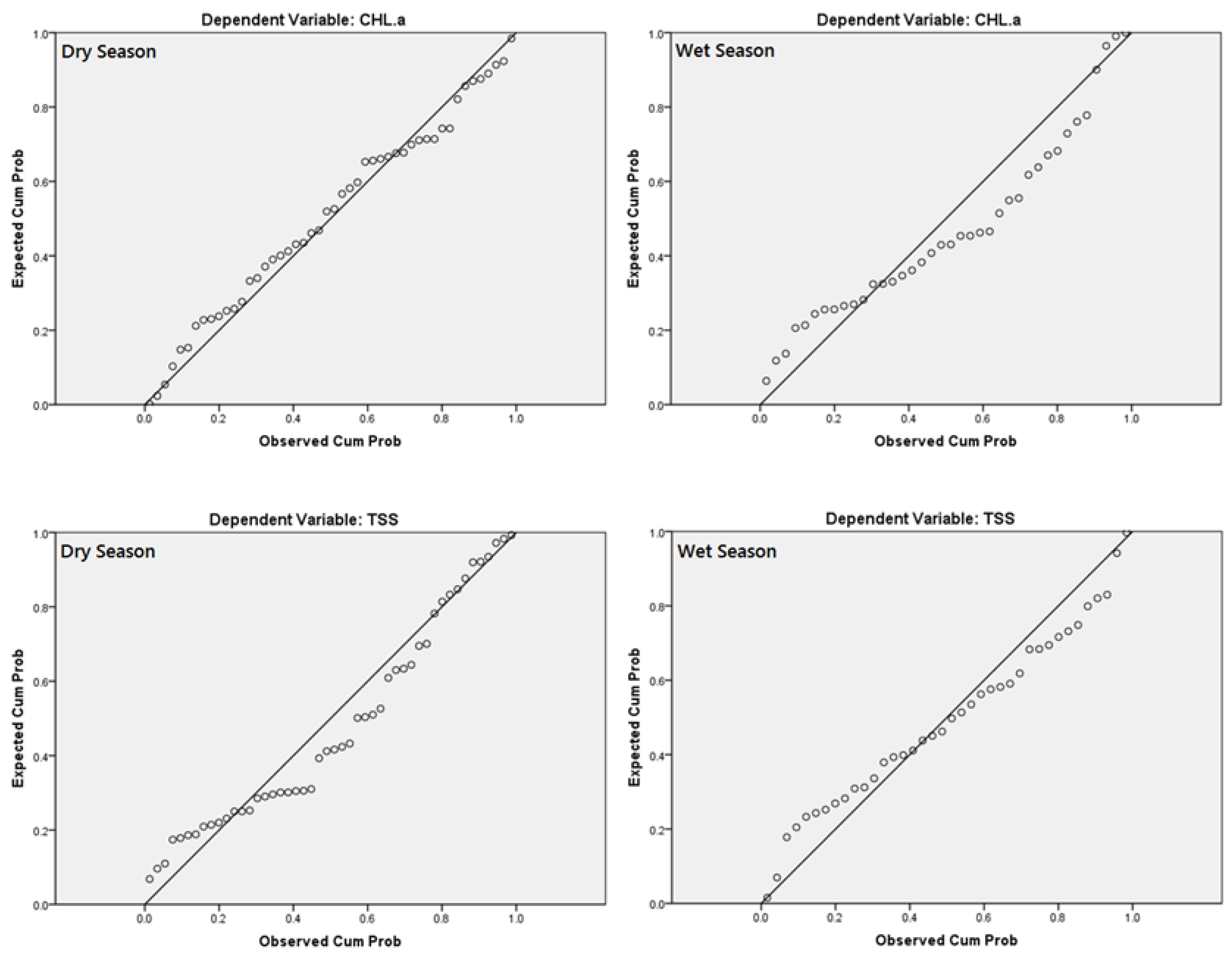
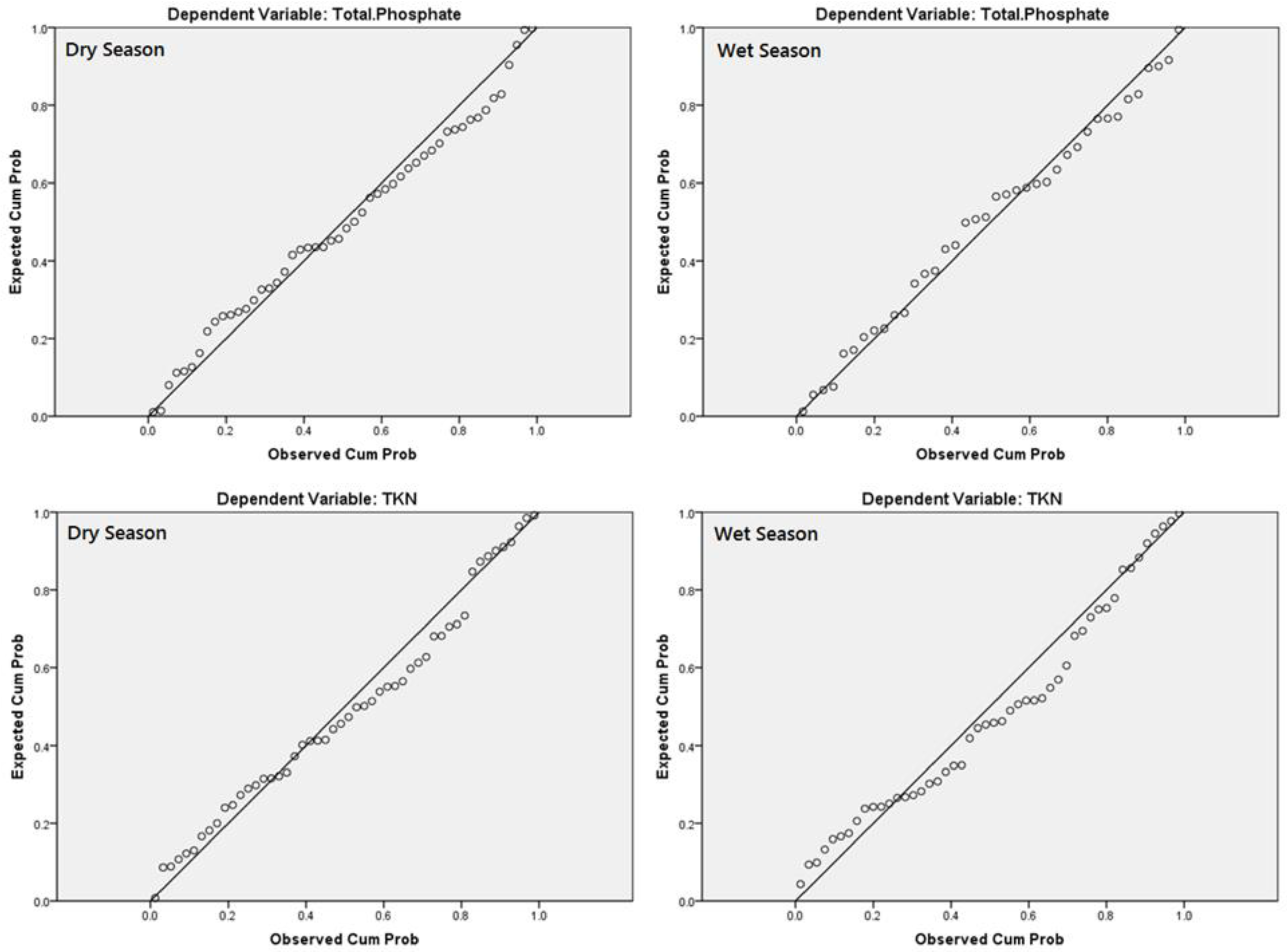
2.3.3. Statistical Analyses
3. Results and Discussion
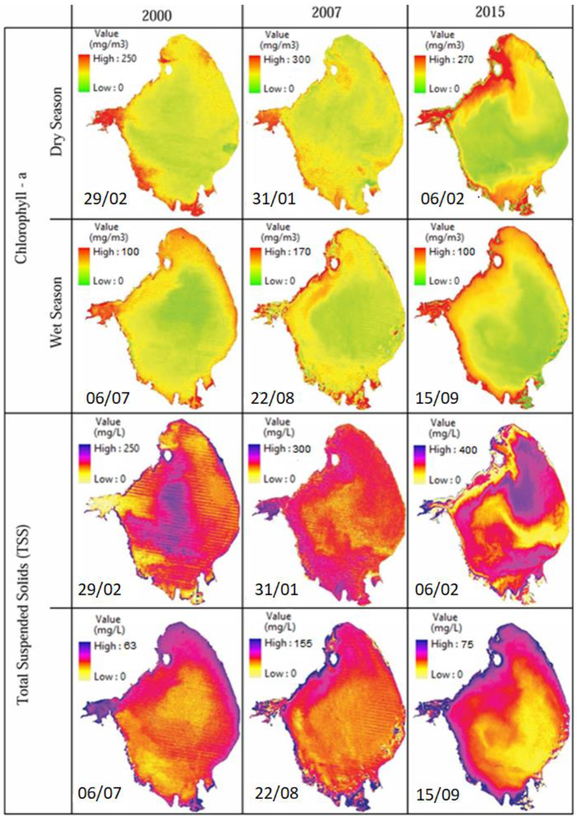
3.1. Chlorophyll-a and TSS
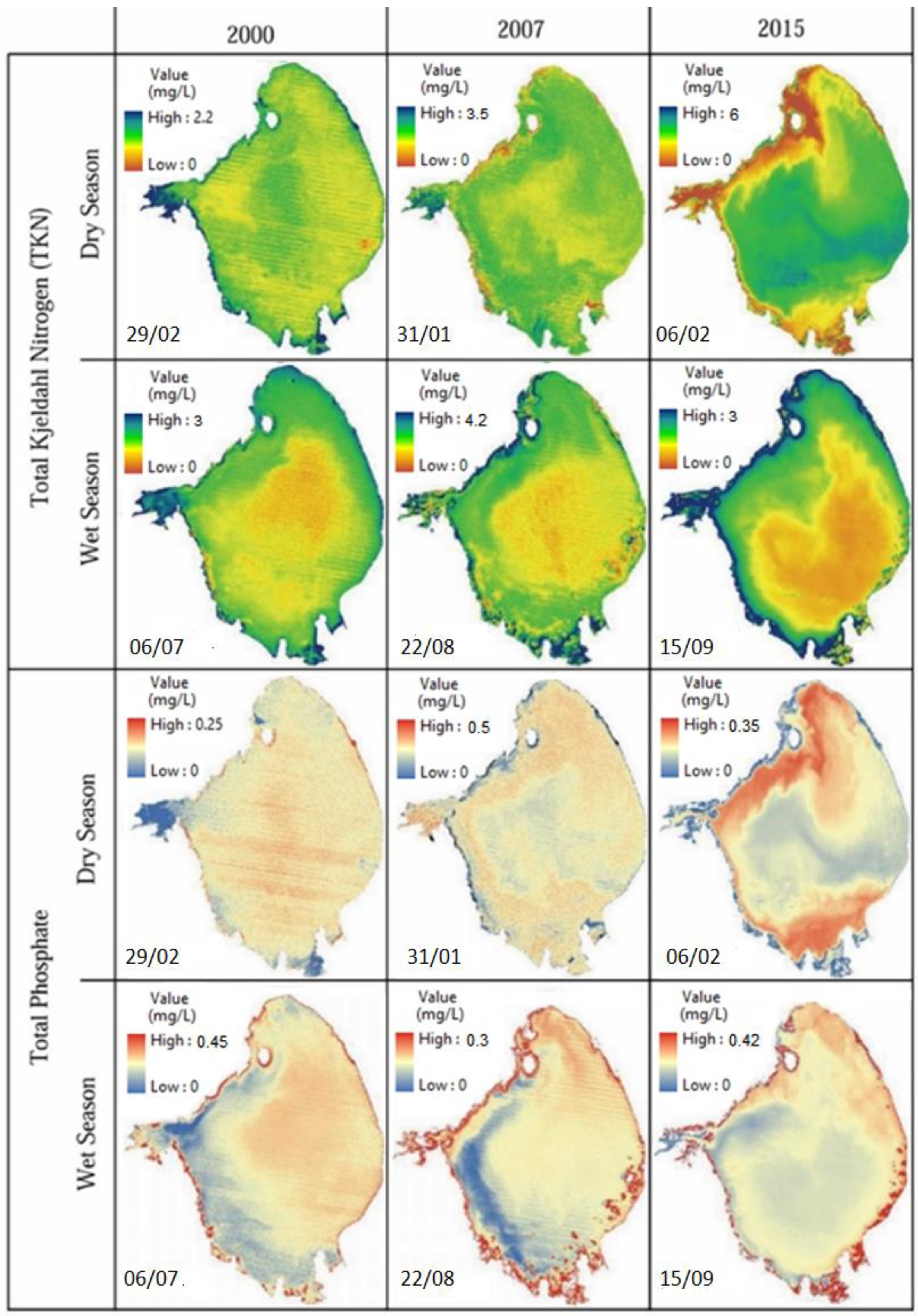
3.2. Nutrients
4. Conclusions
Author Contributions
Funding
Data Availability Statement
Acknowledgments
Conflicts of Interest
References
- Alparslan, E.; Aydöner, C.; Tüfekçi, V.; Tüfekci, H. Water quality assessment at Ömerli Dam using remote sensing techniques. Environ. Monit. Assess. 2007, 135, 391–398. [Google Scholar] [CrossRef] [PubMed]
- Anding, D.; Kauth, R. Estimation of sea surface temperature from space. Remote. Sens. Environ. 1970, 1, 217–220. [Google Scholar] [CrossRef] [Green Version]
- Brando, V.; Dekker, A. Satellite hyperspectral remote sensing for estimating estuarine and coastal water quality. IEEE Trans. Geosci. Remote. Sens. 2003, 41, 1378–1387. [Google Scholar] [CrossRef]
- El-Din, M.S.; Gaber, A.; Koch, M.; Ahmed, R.S.; Bahgat, I. Remote Sensing Application for Water Quality As-sessment in Lake Timsah, Suez Canal, Egypt. J. Remote Sens. Technol. 2013, 1, 61. [Google Scholar] [CrossRef]
- Giardino, C.; Bresciani, M.; Cazzaniga, I.; Schenk, K.; Rieger, P.; Braga, F.; Matta, E.; Brando, V.E. Evaluation of Multi-Resolution Satellite Sensors for Assessing Water Quality and Bottom Depth of Lake Garda. Sensors 2014, 14, 24116–24131. [Google Scholar] [CrossRef] [PubMed] [Green Version]
- Hadjimitsis, D.; Clayton, C.R. Assessment of temporal variations of water quality in inland water bodies using atmospheric corrected satellite remotely sensed image data. Environ. Monit. Assess. 2008, 159, 281–292. [Google Scholar] [CrossRef]
- Hellweger, F.; Schlosser, P.; Lall, U.; Weissel, J. Use of satellite imagery for water quality studies in New York Harbor. Estuar. Coast. Shelf Sci. 2004, 61, 437–448. [Google Scholar] [CrossRef]
- Kondratyev, K.Y.; Pozdnyakov, D.V.; Pettersson, L.H. Water quality remote sensing in the visible spectrum. Int. J. Remote Sens. 1998, 19, 957–979. [Google Scholar] [CrossRef]
- Koponen, S.; Pulliainen, J.; Kallio, K.; Hallikainen, M. Lake water quality classification with airborne hyper-spectral spectrometer and simulated MERIS data. Remote Sens. Environ. 2002, 79, 51–59. [Google Scholar] [CrossRef]
- Maillard, P.; Santos, N.A.P. A spatial-statistical approach for modeling the effect of non-point source pollu-tion on different water quality parameters in the Velhas river watershed–Brazil. J. Environ. Manag. 2008, 86, 158–170. [Google Scholar] [CrossRef]
- Morel, A.; Prieur, L. Analysis of variations in ocean color1. Limnol. Oceanogr. 1977, 22, 709–722. [Google Scholar] [CrossRef]
- Pozdnyakov, D.; Shuchman, R.; Korosov, A.; Hatt, C. Operational algorithm for the retrieval of water quality in the Great Lakes. Remote Sens. Environ. 2005, 97, 352–370. [Google Scholar] [CrossRef]
- Abbas, M.M.; Melesse, A.M.; Scinto, L.J.; Rehage, J.S. Satellite Estimation of Chlorophyll-a Using Moderate Resolution Imaging Spectroradiometer (MODIS) Sensor in Shallow Coastal Water Bodies: Validation and Improvement. Water 2019, 11, 1621. [Google Scholar] [CrossRef] [Green Version]
- Seyhan, E.; Dekker, A. Application of remote sensing techniques for water quality monitoring. Aquat. Ecol. 1986, 20, 41–50. [Google Scholar] [CrossRef]
- Usali, N.; Ismail, M.H. Use of Remote Sensing and GIS in Monitoring Water Quality. J. Sustain. Dev. 2010, 3, 228. [Google Scholar] [CrossRef]
- Wang, X.; Ma, T. Application of remote sensing techniques in monitoring and assessing the water quality of Taihu Lake. Bull. Environ. Contam. Toxicol. 2001, 67, 863–870. [Google Scholar] [CrossRef]
- Lillesand, T.; Kiefer, R.W.; Chipman, J. Remote Sensing and Image Interpretation; John Wiley and Sons: Hoboken, NJ, USA, 2014. [Google Scholar]
- Dekker, A.; Peters, S.W.M. The use of the Thematic Mapper for the analysis of eutrophic lakes: A case study in The Netherlands. Int. J. Remote Sens. 1993, 14, 799–821. [Google Scholar] [CrossRef]
- Alparslan, E.; Coskun, H.G.; Alganci, U. Water quality determination of Küçükçekmece Lake, Turkey by using multispectral satellite data. Sci. World J. 2009, 9, 1215–1229. [Google Scholar] [CrossRef] [Green Version]
- Lim, J.; Choi, M. Assessment of water quality based on Landsat 8 operational land imager associated with hu-man activities in Korea. Environ. Monit. Assess. 2015, 187, 1–17. [Google Scholar] [CrossRef]
- Zhang, C.; Han, M. Mapping Chlorophyll-a Concentration in Laizhou Bay Using Landsat 8 OLI data. In Proceedings of the 36th IAHR World Congress (Hague), The Hague, The Netherlands, 28 June–3 July 2015. [Google Scholar]
- Kim, S.-I.; Kim, H.-C.; Hyun, C.-U. High Resolution Ocean Color Products Estimation in Fjord of Svalbard, Arctic Sea using Landsat-8 OLI. Korean J. Remote Sens. 2014, 30, 809–816. [Google Scholar] [CrossRef] [Green Version]
- Myint, S.; Walker, N. Quantification of surface suspended sediments along a river dominated coast with NO-AA AVHRR and SeaWiFS measurements: Louisiana, USA. Int. J. Remote Sens. 2002, 23, 3229–3249. [Google Scholar] [CrossRef]
- Nechad, B.; Ruddick, K.G.; Park, Y. Calibration and validation of a generic multisensor algorithm for mapping of total suspended matter in turbid waters. Remote Sens. Environ. 2010, 114, 854–866. [Google Scholar] [CrossRef]
- Curran, P.; Hansom, J.; Plummer, S.; Pedley, M. Multispectral remote sensing of nearshore suspended sedi-ments: A pilot study. Int. J. Remote Sens. 1987, 8, 103–112. [Google Scholar] [CrossRef]
- Novo, E.; Hansom, J.; Curran, P. The effect of viewing geometry and wavelength on the relationship between reflectance and suspended sediment concentration. Int. J. Remote Sens. 1989, 10, 1357–1372. [Google Scholar] [CrossRef]
- Feng, L.; Hu, C.; Chen, X.; Song, Q. Influence of the Three Gorges Dam on total suspended matters in the Yangtze Estuary and its adjacent coastal waters: Observations from MODIS. Remote Sens. Environ. 2014, 140, 779–788. [Google Scholar] [CrossRef]
- Doxaran, D.; Froidefond, J.-M.; Lavender, S.; Castaing, P. Spectral signature of highly turbid waters: Applica-tion with SPOT data to quantify suspended particulate matter concentrations. Remote Sens. Environ. 2002, 81, 149–161. [Google Scholar] [CrossRef]
- Ritchie, J.C.; Zimba, P.V.; Everitt, J.H. Remote Sensing Techniques to Assess Water Quality. Photogramm. Eng. Remote Sens. 2003, 69, 695–704. [Google Scholar] [CrossRef] [Green Version]
- Kutser, T.; Arst, H.; Miller, T.; Käärmann, L.; Milius, A. Telespectrometrical estimation of water transparency, chlorophyll-a and total phosphorus concentration of Lake Peipsi. Int. J. Remote Sens. 1995, 16, 3069–3085. [Google Scholar] [CrossRef]
- Wang, Y.; Xia, H.; Fu, J.; Sheng, G. Water quality change in reservoirs of Shenzhen, China: Detection using LANDSAT/TM data. Sci. Total Environ. 2004, 328, 195–206. [Google Scholar] [CrossRef]
- Wu, C.; Wu, J.; Qi, J.; Zhang, L.; Huang, H.; Lou, L.; Chen, Y. Empirical estimation of total phosphorus concentration in the mainstream of the Qiantang River in China using Landsat TM data. Int. J. Remote Sens. 2010, 31, 2309–2324. [Google Scholar] [CrossRef]
- Song, K.; Wang, Z.; Blackwell, J.; Zhang, B.; Li, F.; Jiang, G. Water quality monitoring using Landsat Themate Mapper data with empirical algorithms in Chagan Lake, China. J. Appl. Remote Sens. 2011, 5, 53506. [Google Scholar] [CrossRef]
- Patton, C.J.; Kryskalla, J.R. Methods of Analysis by the U.S. Geological Survey National Water Quality Laboratory: Evaluation of Alkaline Persulfate Digestion as an Alternative to Kjeldahl Digestion for Determination of Total and Dissolved Nitrogen and Phosphorus in Water; U.S. Geological Survey: Reston, Virginia, 2003. [CrossRef] [Green Version]
- Mikkelsen, R. Ammonia emissions from agricultural operations: Fertilizer. Better Crop. 2009, 93, 9–11. [Google Scholar]
- Gholizadeh, M.H.; Melesse, A.M.; Reddi, L. Water quality assessment and apportionment of pollution sources using APCS-MLR and PMF receptor modeling techniques in three major rivers of South Florida. Sci. Total Environ. 2016, 566, 1552–1567. [Google Scholar] [CrossRef] [PubMed]
- Hood, R.R.; Subramaniam, A.; May, L.R.; Carpenter, E.J.; Capone, D.G. Remote estimation of nitrogen fixa-tion by Trichodesmium. Deep Sea Res. Part II Top. Stud. Oceanogr. 2001, 49, 123–147. [Google Scholar] [CrossRef]
- Hanson, C.E.; Waite, A.M.; Thompson, P.A.; Pattiaratchi, C.B. Phytoplankton community structure and ni-trogen nutrition in Leeuwin Current and coastal waters off the Gascoyne region of Western Australia. Deep Sea Res. Part II Top. Stud. Oceanogr. 2007, 54, 902–924. [Google Scholar] [CrossRef]
- Edwards, V.; Icely, J.; Newton, A.; Webster, R. The yield of chlorophyll from nitrogen: A comparison between the shallow Ria Formosa lagoon and the deep oceanic conditions at Sagres along the southern coast of Portugal. Estuar. Coast. Shelf Sci. 2005, 62, 391–403. [Google Scholar] [CrossRef]
- Gong, S.; Huang, J.-Z.; Li, Y.-M.; Lu, W.-N.; Wang, H.-J.; Wang, G.-X. Preliminary exploring of hyperspectral remote sensing experiment for nitrogen and phosphorus in water. Guang Pu Xue Yu Guang Pu Fen Xi Guang Pu 2008, 28, 839–842. [Google Scholar]
- Karakaya, N.; Evrendilek, F. Monitoring and validating spatio-temporal dynamics of biogeochemical proper-ties in Mersin Bay (Turkey) using Landsat ETM+. Environ. Monit. Assess. 2011, 181, 457–464. [Google Scholar] [CrossRef]
- Busse, L.B.; Simpson, J.C.; Cooper, S.D. Relationships among nutrients, algae, and land use in urbanized southern California streams. Can. J. Fish. Aquat. Sci. 2006, 63, 2621–2638. [Google Scholar] [CrossRef]
- Carlson, R.E. A trophic state index for lakes1. Limnol. Oceanogr. 1977, 22, 361–369. [Google Scholar] [CrossRef] [Green Version]
- Uusitalo, R.; Yli-Halla, M.; Turtola, E. Suspended soil as a source of potentially bioavailable phosphorus in surface runoff waters from clay soils. Water Res. 2000, 34, 2477–2482. [Google Scholar] [CrossRef]
- Hoyer, M.V.; Frazer, T.K.; Notestein, S.K.; Canfield, J.; Daniel, E. Nutrient, chlorophyll, and water clarity rela-tionships in Florida’s nearshore coastal waters with comparisons to freshwater lakes. Can. J. Fish. Aquat. Sci. 2002, 59, 1024–1031. [Google Scholar] [CrossRef] [Green Version]
- Gordon, H.R. Calibration requirements and methodology for remote sensors viewing the ocean in the visible. Remote Sens. Environ. 1987, 22, 103–126. [Google Scholar] [CrossRef]
- Teillet, P.; Horler, D.; O’Neill, N. Calibration, validation, and quality assurance in remote sensing: A new par-adigm. Can. J. Remote Sens. 1997, 23, 401–414. [Google Scholar] [CrossRef]
- Maul, G.A. Introduction to Satellite Oceanography; Springer: Dordrecht, The Netherlands, 1985; Volume 3. [Google Scholar] [CrossRef]
- Moran, M.; Jackson, R.D.; Slater, P.N.; Teillet, P.M. Evaluation of simplified procedures for retrieval of land surface reflectance factors from satellite sensor output. Remote Sens. Environ. 1992, 41, 169–184. [Google Scholar] [CrossRef]
- Chavez, P.S. Image-based atmospheric corrections-revisited and improved. Photogramm. Eng. Remote Sens. 1996, 62, 1025–1035. [Google Scholar]
- Kloiber, S.M.; Brezonik, P.L.; E Bauer, M. Application of Landsat imagery to regional-scale assessments of lake clarity. Water Res. 2002, 36, 4330–4340. [Google Scholar] [CrossRef]
- Kloiber, S.M.; Brezonik, P.L.; Olmanson, L.G.; Bauer, M.E. A procedure for regional lake water clarity as-sessment using Landsat multispectral data. Remote Sens. Environ. 2002, 82, 38–47. [Google Scholar] [CrossRef]
- Lathrop, R.G. Use of Thematic Mapper data to assess water quality in Green Bay and central Lake Michigan. Photogramm. Eng. Remote Sens. 1986, 52, 671–680. [Google Scholar]
- Mancino, G.; Nolè, A.; Urbano, V.; Amato, M.; Ferrara, A. Assessing water quality by remote sensing in small lakes: The case study of Monticchio lakes in southern Italy. Iforest Biogeosci. For. 2009, 2, 154–161. [Google Scholar] [CrossRef] [Green Version]
- Mayo, M.; Gitelson, A.; Yacobi, Y.Z.; Ben-Avraham, Z. Chlorophyll distribution in Lake Kinneret determined from Landsat Thematic Mapper data. Int. J. Remote Sens. 1995, 16, 175–182. [Google Scholar] [CrossRef]
- Lavery, P.; Pattiaratchi, C.; Wyllie, A.; Hick, P. Water quality monitoring in estuarine waters using the landsat thematic mapper. Remote Sens. Environ. 1993, 46, 268–280. [Google Scholar] [CrossRef]
- Cox, R.M.; Forsythe, R.; Vaughan, G. Assessing water quality in Catawba River reservoirs using Landsat thematic mapper satellite data. Lake Reserv. Manag. 1998, 14, 405–416. [Google Scholar] [CrossRef]
- Giardino, C.; Pepe, M.; Brivio, P.A.; Ghezzi, P.; Zilioli, E. Detecting chlorophyll, Secchi disk depth and surface temperature in a sub-alpine lake using Landsat imagery. Sci. Total. Environ. 2001, 268, 19–29. [Google Scholar] [CrossRef]
- Dekker, A.; Vos, R.J.; Peters, S.W.M. Analytical algorithms for lake water TSM estimation for retrospective analyses of TM and SPOT sensor data. Int. J. Remote Sens. 2002, 23, 15–35. [Google Scholar] [CrossRef]
- Akbar, T.A.; Hassan, Q.K.; Achari, G. A remote sensing based framework for predicting water quality of dif-ferent source waters. Int. Arch. Photogramm. Remote Sens. Spat. Inf. Sci. 2010, 38, 1–4. [Google Scholar]
- Brezonik, P.; Menken, K.D.; Bauer, M. Landsat-based remote Sensing of Lake Water Quality characteris-tics, Including Chlorophyll and Colored Dissolved Organic Matter (CDOM). Lake Reserv. Manag. 2005, 21, 373–382. [Google Scholar] [CrossRef]


| Chl-a (mg/m3) | TSS (mg/L) | TP (mg/L) | TKN (mg/L) | |||
|---|---|---|---|---|---|---|
| Dry Season | 29/02/2000 | Min | 3.30 | 8.0 | 0.107 | 1.03 |
| Max | 67.7 | 53.0 | 0.192 | 1.96 | ||
| Mean | 17.8 | 29.5 | 0.156 | 1.31 | ||
| STD | 14.8 | 13.0 | 0.021 | 0.21 | ||
| 31/01/2007 | Min | 1.0 | 8.0 | 0.085 | 0.88 | |
| Max | 27.5 | 162.0 | 0.299 | 2.04 | ||
| Mean | 12.9 | 41.2 | 0.158 | 1.22 | ||
| STD | 7.1 | 36.0 | 0.050 | 0.30 | ||
| 06/02/2015 | Min | 1.86 | 5.0 | 0.0821 | 0.821 | |
| Max | 43.2 | 92.0 | 0.203 | 1.85 | ||
| Mean | 14.08 | 31.04 | 0.143 | 1.09 | ||
| STD | 8.38 | 21.54 | 0.033 | 0.22 | ||
| Wet Season | 06/07/2000 | Min | 6.20 | 3.0 | 0.036 | 0.95 |
| Max | 106.5 | 70.0 | 0.238 | 2.89 | ||
| Mean | 27.7 | 20.6 | 0.101 | 1.38 | ||
| STD | 23.4 | 15.3 | 0.044 | 0.48 | ||
| 22/08/2007 | Min | 3.50 | 4.0 | 0.016 | 0.87 | |
| Max | 76.5 | 22.0 | 0.280 | 2.61 | ||
| Mean | 16.1 | 11.3 | 0.092 | 1.35 | ||
| STD | 16.0 | 7.0 | 0.064 | 0.37 | ||
| 15/09/2015 | Min | 4.80 | 3.0 | 0.023 | 0.77 | |
| Max | 76.0 | 39.0 | 0.295 | 2.93 | ||
| Mean | 18.4 | 13.7 | 0.084 | 1.57 | ||
| STD | 16.8 | 9.3 | 0.047 | 0.34 | ||
| Bands/Band Ratios | Dry Season | Wet Season | ||
|---|---|---|---|---|
| Chl-a (mg/m3) | TSS (mg/L) | Chl-a (mg/m3) | TSS (mg/L) | |
| Blue (B) | −0.70 ** | −0.29 | −0.45 ** | −0.55 ** |
| Green (G) | −0.60 ** | −0.27 | −0.31 ** | −0.35 ** |
| Red (R) | −0.80 ** | −0.07 | −0.42 ** | −0.41 ** |
| Near Infrared (NIR) | −0.63 ** | 0.20 | −0.24 | −0.32 ** |
| B/G | 0.26 | −0.27 | −0.23 | −0.15 |
| B/R | 0.78 ** | −0.36 ** | 0.20 | 0.05 |
| B/NIR | 0.60 | −0.47 ** | −0.30 ** | −0.36 ** |
| G/B | −0.25 | 0.25 | 0.14 | 0.06 |
| G/R | 0.82 ** | −0.22 | 0.76 ** | 0.64 ** |
| G/NIR | 0.54 | −0.46 ** | −0.12 | 0.49 ** |
| R/B | −0.76 ** | 0.32 | −0.28 | −0.29 |
| R/G | −0.81 ** | 0.22 | −0.76 ** | −0.68 ** |
| R/NIR | −0.06 | −0.49 ** | −0.43 ** | −0.62 ** |
| NIR/B | −0.56 | 0.43 ** | −0.01 | −0.06 |
| NIR/G | −0.51 | 0.46 ** | −0.01 | −0.01 |
| NIR/R | 0.08 | 0.50 ** | 0.29 | 0.08 |
| Season | Parameter | R2 | Standard Error | p Value | Durbin-Watson | Observations |
|---|---|---|---|---|---|---|
| Dry | Chl-a | 0.84 | 8.84 | 0 | 1.797 | 48 |
| TSS | 0.67 | 6.07 | 0 | 2.249 | 48 | |
| Wet | Chl-a | 0.48 | 20.88 | 0.005 | 2.103 | 38 |
| TSS | 0.6 | 12.77 | 0.002 | 1.65 | 38 |
| Season | Water Quality Parameters | Regression Equations Derived |
|---|---|---|
| Dry | Chl-a (mg/m3) | = 881.1 × (B/R) − 1784.7 × (G/R) +5331.5 × (R/B) − 3096.2 × (R/G) × 1167 × (B) + 525.5 |
| TSS (mg/L) | = 517.91 × (R/NIR) − 8.86 × (G/NIR) − 799.23 × (NIR/B) + 127.76 × (NIR/G) + 1100.92 × (NIR/R) − 74.63 × (B/NIR) − 1037.79 | |
| Wet | Chl-a (mg/m3) | = −1067.77 × (G/R) − 2144.45 × (R/G) − 35.04 × (R/NIR) + 297.75 × (R) + 3095.6 |
| TSS (mg/L) | = 361.89 × (R) − 1018.25 × (G/R) − 1919.21 × (R/G) − 26.15 × (R/NIR) − 182.90 × (B) + 2855.76 |
| Bands | Season | Season | ||
|---|---|---|---|---|
| Dry | Wet | Dry | Wet | |
| TP (mg/L) | TKN (mg/L) | |||
| B | 0.34 ** | 0.59 ** | −0.36 ** | 0.01 |
| G | 0.35 ** | 0.55 ** | −0.12 | 0.03 |
| R | 0.50 ** | 0.59 ** | −0.31 ** | 0 |
| NIR | 0.31 ** | 0.61 ** | 0.03 | 0.08 |
| B/G | −0.21 | −0.17 | 0.19 | −0.05 |
| B/R | −0.52 ** | −0.40 ** | 0.19 | 0.05 |
| B/NIR | −0.28 | −0.54 ** | 0.07 | −0.29 ** |
| G/B | 0.21 | 0.2 | −0.19 | 0.07 |
| G/R | −0.53 ** | −0.58 ** | 0.03 | 0.29 ** |
| G/NIR | −0.21 | −0.62 ** | −0.1 | −0.32 ** |
| R/B | 0.52 ** | 0.47 ** | −0.17 | −0.08 |
| R/G | 0.52 ** | 0.60 ** | −0.04 | −0.29 ** |
| R/NIR | 0.19 | −0.52 ** | −0.15 | −0.49 ** |
| NIR/B | 0.27 | 0.62 ** | −0.06 | 0.21 |
| NIR/G | 0.21 | 0.66 ** | 0.07 | 0.25 |
| NIR/R | −0.2 | 0.59 ** | 0.14 | 0.42 ** |
| Chl-a (mg/m3) | −0.02 | 0.47 ** | 0.51 ** | 0.91 ** |
| TSS (mg/L) | 0.90 ** | 0.57 ** | 0.79 ** | 0.73 ** |
| Season | Parameter | R2 | Standard Error | Durbin-Watson | Observations |
|---|---|---|---|---|---|
| Dry | TP | 0.92 | 0.015 | 1.974 | 50 |
| TKN | 0.94 | 0.097 | 2.027 | 50 | |
| Wet | TP | 0.89 | 0.025 | 2.488 | 38 |
| TKN | 0.93 | 0.166 | 1.627 | 48 |
| Season | Water Quality (mg/L) | Regression Equations Derived |
|---|---|---|
| Dry | TP | = 0.001(TSS) − 0.202(G/R) − 2.56(NIR) + 0.468 |
| TKN | = 0.008(TSS) + 0.009 (Chl-a) + 3.91(B) − 4.35(R) + 0.641 | |
| Wet | TP | = 0.002(TSS) + 0.154(B/R) + 1.66(NIR/G) − 1.23(NIR/R) − 0.232 |
| TKN | = 0.017(Chl-a) + 0.001(TSS) − 0.057(B/NIR) + 0.345(G/NIR) − 1.09(R/NIR) − 0.249(NIR/R) + 2.21 |
| Dry Season | Wet Season | ||||||||||||
|---|---|---|---|---|---|---|---|---|---|---|---|---|---|
| Chl-a (mg/m3) | Year | 0–50 | 50–100 | 100–150 | 150–200 | >200 | 0–20 | 20–40 | 40–60 | 60–80 | 80–100 | >100 | |
| 2000 | 51.6 | 287.3 | 722.9 | 175.2 | 93.1 | 514.7 | 842.9 | 50.5 | 7 | 0.1 | 0 | ||
| 2007 | 96.2 | 334.1 | 451 | 317.9 | 170.2 | 616.7 | 687.8 | 63.8 | 37.9 | 3.6 | 5.4 | ||
| 2015 | 117.4 | 226.6 | 767.3 | 247.9 | 8 | 913.5 | 346.2 | 80.6 | 66.1 | 8.8 | 0 | ||
| TSS (mg/L) | Year | 0–40 | 40–80 | 80–120 | 120–160 | >160 | 0–15 | 15–30 | 30–45 | 45–60 | 60–75 | >75 | |
| 2000 | 31.9 | 17.9 | 543.9 | 735.8 | 85.4 | 605.4 | 772.2 | 31.5 | 6 | 0.1 | 0 | ||
| 2007 | 46.9 | 74.2 | 389.9 | 845.2 | 58.5 | 555.8 | 739.8 | 67.1 | 42.4 | 3.5 | 6.3 | ||
| 2015 | 149.8 | 154.2 | 222.2 | 253.3 | 637 | 932.7 | 359.2 | 75.8 | 45.4 | 2.4 | 0 | ||
| Total Phosphate (mg/L) | Year | 0–0.07 | 0.07–0.15 | 0.15–0.20 | 0.20–0.25 | 0.25–0.30 | >0.30 | 0–0.07 | 0.07–0.15 | 0.15–0.20 | 0.20–0.25 | 0.25–0.30 | >0.30 |
| 2000 | 5.9 | 431.3 | 968 | 6.8 | 0.6 | 2 | 211.5 | 1166 | 22.3 | 5.9 | 3.5 | 6 | |
| 2007 | 57.4 | 530.5 | 627.4 | 178.1 | 18.5 | 3 | 209.8 | 997 | 45.9 | 23.3 | 20.7 | 117.8 | |
| 2015 | 71.7 | 15.8 | 885.3 | 442.5 | 0.01 | 0 | 104.5 | 1244 | 9.6 | 6.1 | 5.9 | 45.2 | |
| TKN (mg/L) | Year | 0–1.0 | 1–1.5 | 1.5–2.0 | 2.0–2.7 | 2.7–3.5 | >3.5 | 0–1.0 | 1–1.5 | 1.5–2.0 | 2.0–2.7 | 2.7–3.5 | >3.5 |
| 2000 | 6.7 | 1336 | 58.4 | 10.2 | 2.2 | 2 | 280.1 | 794 | 313 | 23.8 | 3.6 | 0 | |
| 2007 | 264.7 | 963.4 | 138.1 | 11.2 | 0.3 | 0 | 300.8 | 683 | 339 | 86.6 | 1.2 | 4.7 | |
| 2015 | 0.1 | 0.2 | 110.7 | 697.7 | 510.6 | 5 | 709.4 | 432 | 152 | 103 | 18.6 | 0 | |
Publisher’s Note: MDPI stays neutral with regard to jurisdictional claims in published maps and institutional affiliations. |
© 2021 by the authors. Licensee MDPI, Basel, Switzerland. This article is an open access article distributed under the terms and conditions of the Creative Commons Attribution (CC BY) license (http://creativecommons.org/licenses/by/4.0/).
Share and Cite
Hajigholizadeh, M.; Moncada, A.; Kent, S.; Melesse, A.M. Land–Lake Linkage and Remote Sensing Application in Water Quality Monitoring in Lake Okeechobee, Florida, USA. Land 2021, 10, 147. https://doi.org/10.3390/land10020147
Hajigholizadeh M, Moncada A, Kent S, Melesse AM. Land–Lake Linkage and Remote Sensing Application in Water Quality Monitoring in Lake Okeechobee, Florida, USA. Land. 2021; 10(2):147. https://doi.org/10.3390/land10020147
Chicago/Turabian StyleHajigholizadeh, Mohammad, Angelica Moncada, Samuel Kent, and Assefa M. Melesse. 2021. "Land–Lake Linkage and Remote Sensing Application in Water Quality Monitoring in Lake Okeechobee, Florida, USA" Land 10, no. 2: 147. https://doi.org/10.3390/land10020147
APA StyleHajigholizadeh, M., Moncada, A., Kent, S., & Melesse, A. M. (2021). Land–Lake Linkage and Remote Sensing Application in Water Quality Monitoring in Lake Okeechobee, Florida, USA. Land, 10(2), 147. https://doi.org/10.3390/land10020147