Next Issue
Volume 4, March
Previous Issue
Volume 3, September


Urban Sci., Volume 3, Issue 4 (December 2019) – 14 articles

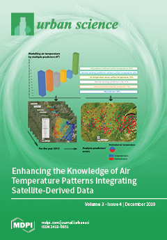
Cover Story (view full-size image): The urban heat island phenomenon and the thermal discomfort felt in urban areas, exacerbated by climate change, make it necessary to accurately estimate the air temperature in every part of an area. Thus, this study proposes to estimate air temperature using 28 explanatory variables and multiple linear regressions. This innovative study integrates remote sensing variables into the model in addition to the variables traditionally used. The contribution of spectral indices is significant because it makes it possible to improve the quality of the prediction model. The methodology presented is applicable to any territory and does not requiring specific computer resources, making it highly useful in many fields, particularly in urban planning. View this paper
  • Issues are regarded as officially published after their release is announced to the table of contents alert mailing list.
  • You may sign up for e-mail alerts to receive table of contents of newly released issues.
  • PDF is the official format for papers published in both, html and pdf forms. To view the papers in pdf format, click on the "PDF Full-text" link, and use the free Adobe Reader to open them.
Order results
Result details
Select all
Export citation of selected articles as:
16 pages, 1340 KiB  
Article
Promoting and Demoting Factors of Ecodesign Methodologies for The Application of Recycled Construction Waste: A Case Study of a Composite Product
by Petri Sormunen and Timo Kärki
Urban Sci. 2019, 3(4), 114; https://doi.org/10.3390/urbansci3040114 - 15 Dec 2019
Cited by 2 | Viewed by 2914
Abstract
Thermoplastic composites manufacturing could be a potential end-of-life option for separated construction and demolition waste. This study aims to find out how well the established ecodesign methodologies support the choice of recycled composite materials in new product design, and what challenges these materials [...] Read more.
Thermoplastic composites manufacturing could be a potential end-of-life option for separated construction and demolition waste. This study aims to find out how well the established ecodesign methodologies support the choice of recycled composite materials in new product design, and what challenges these materials offer to the designer. A product design case study was conducted by applying the ecodesign methodologies Environmental Quality Function Deployment and Technique for Order of Preference by Similarity to Ideal Solution, to identify the main promoting and demoting factors from the designer’s point of view. The rate of recycled material is the main promoting factor, but biodegradability, recyclability, and the mixing of materials are usually demoting the composite use. The use of multiple criteria analysis techniques can work in favor of the composite, as the mechanical and physical properties are taken into consideration. The paper discusses the potential challenges the designer faces when evaluating the feasibility of using recycled material composites. The design suggests that new uses for waste that previously went to landfill, such as mineral wool, can be found with composite solutions. Full article
Show Figures

Figure 1

16 pages, 2101 KiB  
Review
Seeing the Forest for the Trees: A Review-Based Framework for Better Harmonization of Timber Production, Biodiversity, and Recreation in Boreal Urban Forests
by Vegard Gundersen, Berit Köhler and Knut Marius Myrvold
Urban Sci. 2019, 3(4), 113; https://doi.org/10.3390/urbansci3040113 - 13 Dec 2019
Cited by 9 | Viewed by 3554
Abstract
Forested lands serve multiple needs, and the priorities that go into balancing the competing demands can vary over time. In addition to being the source of timber and other natural resources, forested lands provide a number of other services such as biodiversity conservation [...] Read more.
Forested lands serve multiple needs, and the priorities that go into balancing the competing demands can vary over time. In addition to being the source of timber and other natural resources, forested lands provide a number of other services such as biodiversity conservation and opportunities for outdoor recreation. While allocations that enhance conservation and recreation can involve expenses and lost revenue, mechanisms exist to provide landowners with incentives to make such contributions. Here, we review the literature and present a conceptual framework that can help landowners envision possible contributions towards bolstering outdoor recreation opportunities on their lands. The framework classifies forests within a simple conceptual space defined by two axes: (1) the spectrum of intensity of recreational use, and (2) the level of economic contribution required by landowners to meet recreational demands of visitors to their lands. The resulting matrix consists of four broad categories that can be used in forest management zoning as seen from an outdoor recreation perspective: general and special considerations for recreational opportunities and biodiversity, wilderness and nature reserves, and service areas. These categories have different tolerances for active silviculture and require shifting harvest practices spatially within the forest property. While timber revenues may decrease with shifting allocations, other sources of revenue may open up. With an increasingly urban population and rising demands for natural resources, it is prudent for landowners and land use planners to consider zoning their properties to better handle potential conflicts. The framework presented here provides a simple, structured approach to visualize future challenges and opportunities. Full article
(This article belongs to the Special Issue Nature & Culture for Cities and Territories)
Show Figures

Figure 1

32 pages, 12582 KiB  
Article
Place-Making through the Creation of Common Spaces in Lima’s Self-Built Settlements: El Ermitaño and Pampa de Cueva as Case Studies for a Regional Urbanization Strategy
by Samar Almaaroufi, Kathrin Golda-Pongratz, Franco Jauregui-Fung, Sara Pereira, Natalia Pulido-Castro and Jeffrey Kenworthy
Urban Sci. 2019, 3(4), 112; https://doi.org/10.3390/urbansci3040112 - 10 Dec 2019
Cited by 6 | Viewed by 9391
Abstract
Lima has become the first Peruvian megacity with more than 10 million people, resulting from the migration waves from the countryside throughout the 20th century, which have also contributed to the diverse ethnic background of today’s city. The paper analyzes two neighborhoods located [...] Read more.
Lima has become the first Peruvian megacity with more than 10 million people, resulting from the migration waves from the countryside throughout the 20th century, which have also contributed to the diverse ethnic background of today’s city. The paper analyzes two neighborhoods located in the inter-district area of Northern Lima: Pampa de Cueva and El Ermitaño as paradigmatic cases of the city’s expansion through non-formal settlements during the 1960s. They represent a relevant case study because of their complex urbanization process, the presence of pre-Hispanic heritage, their location in vulnerable hillside areas in the fringe with a protected natural landscape, and their potential for sustainable local economic development. The article traces back the consolidation process of these self-built neighborhoods or barriadas within the context of Northern Lima as a new centrality for the metropolitan area. The analysis of urban form and mobility, heritage and environmental challenges, governance, and social integration leads to a proposal for neighborhood upgrading, capacity building with participatory processes, and a vision for future local development to decentralize the traditional metropolitan centers, which can be scaled to other peripheral neighborhoods. Full article
(This article belongs to the Special Issue Regional Urbanization)
Show Figures

Figure 1

16 pages, 3536 KiB  
Case Report
Use of Mobile Devices with Multifunctional Sound Level Measurement Applications: Some Experiences for Urban Acoustics Education in Primary and Secondary Schools
by Kimihiro Sakagami, Fumiaki Satoh and Akira Omoto
Urban Sci. 2019, 3(4), 111; https://doi.org/10.3390/urbansci3040111 - 9 Dec 2019
Cited by 7 | Viewed by 4729
Abstract
Geo-referenced sound data are often used in the field of acoustics education to learn about the urban acoustic environment. Simple soundwalks and sound collections are also employed, in which acquiring additional information such as visual data, recorded sound data, and GPS location data [...] Read more.
Geo-referenced sound data are often used in the field of acoustics education to learn about the urban acoustic environment. Simple soundwalks and sound collections are also employed, in which acquiring additional information such as visual data, recorded sound data, and GPS location data are helpful to produce a map with sound data and sound collection and to carry out more profound discussions in educational activities. In order to enrich these acoustic educational and environmental survey activities with a simple tool, the use of multifunctional sound-pressure level (SPL) measurement applications with mobile devices are proposed. Some experiences of combined activities of the above methods using the applications and mobile devices are reported in this paper. In this study, applications for SPL measurements, which record GPS location data, sound, photo, and video during measurements, were used to produce geo-referenced sound data. First, the accuracy of the applications was checked and we found them to have reasonable accuracy when used with iOS devices; for example, the averaged error was less than 1.5 dB(A) with iPhone XS. Next, they were actually used in a simple soundwalk-like field survey and the resulting geo-referenced sound data were presented to discuss the merits and demerits of each application. Overall, the applications used in this work were found to be useful; for example, recorded sound allowed us to check the main sound source and to carry out discussions using collected sound samples later, and photos and videos allowed us to grasp the impressions and situations around the measuring points. Therefore, these multifunctional sound level meter (SLM) applications can be effectively used for various purposes, including acoustics education for learning about urban acoustic environments. Full article
(This article belongs to the Collection Urban Acoustic Environments)
Show Figures

Figure 1

14 pages, 469 KiB  
Article
Revitalizing the Successful Past in the North: Narratives of Change in the Peripheral Post-Industrial City of Kajaani, Finland
by Simo Häyrynen and Jussi Semi
Urban Sci. 2019, 3(4), 110; https://doi.org/10.3390/urbansci3040110 - 8 Dec 2019
Cited by 4 | Viewed by 3454
Abstract
Finding a new destination for declining industrial communities is a common European trend, wherein local, national and EU interests are intertwined and sometimes contested. New meaning is sought, among other things, in economics, political activity, and images of the past. This article analyzes [...] Read more.
Finding a new destination for declining industrial communities is a common European trend, wherein local, national and EU interests are intertwined and sometimes contested. New meaning is sought, among other things, in economics, political activity, and images of the past. This article analyzes local development narratives in the case of the “northern periphery”. This paper highlights how the shrinking town of Kajaani, Finland, reacts to the state’s changing role in regional industrial strategies by comparing different local interpretations of future expectations. The research material comprises interviews, city strategies, and editorials from a local newspaper. This paper suggests that the previously dominant narrative of decentralization still holds sway in the minds of the local advocates. However, it is flavored by the narrative of the knowledge-based economy forming three interrelated local narratives: the narrative of the small town; the narrative of closure; and the narrative of traction. The analysis shows that a northern model city of former industrial policy is seeking to reform and develop its original strengths. However, strong links to previous doctrines of state regional policy still frame the potential of local interpretations and make them specifically Nordic development narratives. Full article
(This article belongs to the Special Issue Alternative Futures of Small Industrial Towns)
Show Figures

Figure 1

17 pages, 389 KiB  
Article
Adapting Urban Light-Rail Transport to the African Context: A Process Conducted by Transport Authorities and Chinese Rail Corporations in Addis-Ababa, Abuja, and Lagos
by Taslim Alade, Jurian Edelenbos and Alberto Gianoli
Urban Sci. 2019, 3(4), 109; https://doi.org/10.3390/urbansci3040109 - 3 Dec 2019
Cited by 3 | Viewed by 5207
Abstract
A contextual approach to Light-Rail Transport (LRT) needs to be tailored towards specific contexts, in terms of situations or contingencies, such as socio-economic and environmental factors. This research intends to discuss the societal benefits comprised of well-informed contextual factors for policymakers and urban [...] Read more.
A contextual approach to Light-Rail Transport (LRT) needs to be tailored towards specific contexts, in terms of situations or contingencies, such as socio-economic and environmental factors. This research intends to discuss the societal benefits comprised of well-informed contextual factors for policymakers and urban transport authorities, to enable them to be able to formulate objective policies for a city’s socio-economic development. The aim of this article is to analyze the contextual factors in three cities which are responsible for the contextualization of infrastructural innovations of urban light-rail transport from China. The methodology that has been used is a qualitative method using multiple case studies, which includes a pilot and semi-structured interview. The analysis compares the similarities and differences within Nigeria, and between Nigeria and Ethiopia. The most perceptible contextual factors which influence infrastructural innovations in Nigeria include an electric energy supply, modernization of LRT and their stations, Transit-Oriented Development (TOD), and seamless integration of LRT with other transport modes. The most conspicuous factors in Ethiopia are emergency ticket shops, seamless integration of LRT with other transport modes, and Non-Motorized Transport (NMT). Nigeria and Ethiopia both share the seamless integration of LRT with other transport modes. Therefore, academically analyzing contextual factors helps to unravel the poly-contextualization and context-specific decision-making processes in LRT implementation. Full article
Show Figures

Figure 1

21 pages, 7014 KiB  
Article
The TRAX Light-Rail Train Air Quality Observation Project
by Daniel L. Mendoza, Erik T. Crosman, Logan E. Mitchell, Alexander A. Jacques, Benjamin Fasoli, Andrew M. Park, John C. Lin and John D. Horel
Urban Sci. 2019, 3(4), 108; https://doi.org/10.3390/urbansci3040108 - 1 Dec 2019
Cited by 21 | Viewed by 8789
Abstract
Observing air quality from sensors onboard light rail cars in Salt Lake County, Utah began as a pilot study in 2014 and has now evolved into a five-year, state-funded program. This metropolitan region suffers from both elevated ozone levels during summer and high [...] Read more.
Observing air quality from sensors onboard light rail cars in Salt Lake County, Utah began as a pilot study in 2014 and has now evolved into a five-year, state-funded program. This metropolitan region suffers from both elevated ozone levels during summer and high PM2.5 events during winter. Pollution episodes result predominantly from local anthropogenic emissions but are also impacted by regional transport of dust, chemical precursors to ozone, and wildfire smoke, as well as being exacerbated by the topographical features surrounding the city. Two electric light-rail train cars from the Utah Transit Authority light-rail Transit Express (“TRAX”) system were outfitted with PM2.5 and ozone sensors to measure air quality at high spatial and temporal resolutions in this region. Pollutant concentration data underwent quality control procedures to determine whether the train motion affected the readings and how the sensors compared against regulatory sensors. Quality assurance results from data obtained over the past year show that TRAX Observation Project sensors are reliable, which corroborates earlier preliminary validation work. Three case studies from summer 2019 are presented to illustrate the strength of the finely-resolved air quality observations: (1) an elevated ozone event, (2) elevated particulate pollution resulting from 4th of July fireworks, and (3) elevated particle pollution during a winter time inversion event. The mobile observations were able to capture spatial gradients, as well as pollutant hotspots, during both of these episodes. Sensors have been recently added to a third light rail train car, which travels on a north–south oriented rail line, where air quality was unable to be monitored previously. The TRAX Observation Project is currently being used to provide reliable pollutant data for health studies and inform urban planning efforts. Links to real-time data displays and updated information on the quality-controlled data from this study are available on the webpage for the Department of Atmospheric Sciences at the University of Utah. Full article
(This article belongs to the Special Issue Technologies and Humanities for Smart Cities)
Show Figures

Graphical abstract

22 pages, 24331 KiB  
Article
Conceptualizing Public Space Using a Multiple Sorting Task–Exploring the Links between Loneliness and Public Space
by Jing Jing, David Canter and Tigran Haas
Urban Sci. 2019, 3(4), 107; https://doi.org/10.3390/urbansci3040107 - 26 Nov 2019
Cited by 4 | Viewed by 5513
Abstract
This study tests the viability of multiple sorting tasks (MST) as a method to explore perceptions of public space and its potential for people that are vulnerable to loneliness. The procedure integrates qualitative and quantitative aspects and obviates the challenge of people articulating [...] Read more.
This study tests the viability of multiple sorting tasks (MST) as a method to explore perceptions of public space and its potential for people that are vulnerable to loneliness. The procedure integrates qualitative and quantitative aspects and obviates the challenge of people articulating how they interact with their surroundings, especially being aware of what features of their environment are influencing them. Two samples, each with six participants of varying ages and backgrounds, viewed 20 photographs of public spaces in Stockholm. They sorted these into categories based upon the activities they anticipated would occur there. Within each sample, a multidimensional scaling procedure was used to reveal the underlying structure across the combination of the six responses. The results showed coherent structures with interesting variations between people. A set of general multi-purpose places are identified, with others being differentiated in terms of whether they were ‘hard’ or ‘soft’ and ‘open’ or ‘enclosed’. The study also found that people conceptualized public space differently when loneliness was the focus during the sorting process. An assemblage of public spaces relevant for loneliness is also illustrated. This demonstrates the utility of the MST and provides theoretical and practical implications for urban planning and design that addresses loneliness. Full article
Show Figures

Figure 1

16 pages, 1358 KiB  
Article
Path Renewal or Path Dependence? The Role of Industrial Culture in Regional Restructuring
by Franziska Görmar and Jörn Harfst
Urban Sci. 2019, 3(4), 106; https://doi.org/10.3390/urbansci3040106 - 26 Nov 2019
Cited by 26 | Viewed by 3683
Abstract
In recent decades, manufacturing industries in Europe have undergone a deep transformation due to global market competition, automation, and adaptation to globalized production patterns. The impact of deindustrialization and regional restructuring has been particularly strong on regions outside of metropolitan areas, which may [...] Read more.
In recent decades, manufacturing industries in Europe have undergone a deep transformation due to global market competition, automation, and adaptation to globalized production patterns. The impact of deindustrialization and regional restructuring has been particularly strong on regions outside of metropolitan areas, which may be locked in their specific development path and cannot benefit from agglomeration effects. However, scholars are increasingly shifting their attention to processes of regional renewal, emphasizing the strengths and potentials of such regions. Such potentials holds the concept of Industrial Culture which is defined as a particular cultural setting made up of certain intangible assets, such as skills, attitudes, traditions, tangible monuments, and artefacts. Based on the case study of the district of Zwickau, the authors identify three dimensions of Industrial Culture. These cultural, social, and economic aspects can be underscored by different—albeit often overlapping—actions, opening up new development options for the region if embedded in a broad network of regional actors. Industrial Culture can thus be perceived as a strategic concept to form a coherent approach of regional development by integrating various existing activities in a region. Full article
(This article belongs to the Special Issue Alternative Futures of Small Industrial Towns)
Show Figures

Figure 1

21 pages, 5707 KiB  
Article
The Character of Urban Japan: Overview of Osaka-Kobe’s Cityscapes
by Joan Perez, Alessandro Araldi, Giovanni Fusco and Takashi Fuse
Urban Sci. 2019, 3(4), 105; https://doi.org/10.3390/urbansci3040105 - 21 Nov 2019
Cited by 7 | Viewed by 11514
Abstract
The Japanese city presents a certain number of peculiarities in the organization of its physical space (weak zoning regulations, fast piecemeal destruction/reconstruction of buildings and blocks, high compacity, incremental reorganization). Compared to countries where urban fabrics are more perennial and easily distinguishable (old [...] Read more.
The Japanese city presents a certain number of peculiarities in the organization of its physical space (weak zoning regulations, fast piecemeal destruction/reconstruction of buildings and blocks, high compacity, incremental reorganization). Compared to countries where urban fabrics are more perennial and easily distinguishable (old centers, modern planned projects, residential areas, etc.), in Japanese metropolitan areas we often observe higher heterogeneity and more complex spatial patterns. Even within such a model, it should be possible to recognize the internal organization of the physical city. The aim of this paper is thus to study the spatial structure of the contemporary Japanese city, generalizing on the case study of Osaka and Kobe. In order to achieve this goal, we will need to identify urban forms at different local scales (building types, urban fabrics) and to analyze them at a wider scale to delineate morphological regions and their structuring of the overall layout of the contemporary Japanese city. Several analytical protocols are used together with field observations and literature. The results, and more particularly the building and urban fabric types and their location within the Osaka-Kobe metropolitan area, are interpreted in the light of Japanese history and model of urbanization. A synoptic graphical model of an urban morphological structure based upon Osaka is produced and proposed as an interpretative pattern for the Japanese metropolitan city in general. Full article
Show Figures

Figure 1

32 pages, 13456 KiB  
Article
Prioritizing Sustainable City Indicators for Cambodia
by Puthearath Chan and Myeong-Hun Lee
Urban Sci. 2019, 3(4), 104; https://doi.org/10.3390/urbansci3040104 - 22 Oct 2019
Cited by 15 | Viewed by 9546
Abstract
This research is based on our previous research that developed consensus sustainable city indicators for Cambodia through three-round Delphi panel surveys. That research developed indicators in the first round based on UN sustainable development goal 11, ASEAN environmentally sustainable city, Korean case study, [...] Read more.
This research is based on our previous research that developed consensus sustainable city indicators for Cambodia through three-round Delphi panel surveys. That research developed indicators in the first round based on UN sustainable development goal 11, ASEAN environmentally sustainable city, Korean case study, and domestic green and clean city indicators, and validated the developed indicators in the last two rounds. After consensus analysis, that research obtained 32 assessment indicators categorized by nine criteria. However, these indicators are not prioritized yet due to the limitation of the Delphi technique. Hence, this research aims to prioritize these indicators by applying the Analytic Hierarchy Process (AHP) technique and to confirm whether the levels of importance verified by Delphi can be used for prioritizing or ranking the indicators. This research surveyed potential respondents experienced and working in relevant fields both offline and online. Online surveys were processed through E-mail, Facebook, and LinkedIn. A total of 118 questionnaires were gathered from the surveys, and 16 were inconsistent (consistency ratio > 0.1). The results showed that the highest and lowest weights are 0.0557 and 0.086. The top ten indicators are slum population (0.0557), unemployment (0.0516), crime prevention (0.0470), water supply (0.0469), city’s migration (0.0462), low-income housing (0.0445), solid waste collection (0.0437), labor-force (0.0421), construction safety (0.0400), and traffic congestion (0.0398). The rank of all indicators based on their levels of importance is completely different from the rank of their weights. Therefore, this research confirms that the levels of importance verified by Delphi cannot be used for ranking or prioritizing the consensus indicators. The priority weights in this research would be useful to policymaking, strategic direction, and budget allocation for the development and management of sustainable cities in Cambodia. Full article
Show Figures

Graphical abstract

11 pages, 809 KiB  
Article
Enhancing Biodiversity in Urban Green Space; An Exploration of the IAD Framework Applied to Ecologically Mature Trees
by Andrew MacKenzie and Philip Gibbons
Urban Sci. 2019, 3(4), 103; https://doi.org/10.3390/urbansci3040103 - 22 Oct 2019
Cited by 7 | Viewed by 4254
Abstract
This paper investigates how institutions in urban settings potentially identify, frame, and operationalise biodiversity conservation policies. It adopts the Institutional Analysis and Development Framework (IAD) to analyse a case study regarding the retention of ecologically mature trees in urban green space in Canberra, [...] Read more.
This paper investigates how institutions in urban settings potentially identify, frame, and operationalise biodiversity conservation policies. It adopts the Institutional Analysis and Development Framework (IAD) to analyse a case study regarding the retention of ecologically mature trees in urban green space in Canberra, Australia. The research investigates; what are the structural and institutional arrangements that catalyze or inhibit biodiversity conservation in urban green space? Specifically, the IAD framework is applied to explore the institutional structures and the role of key decision-makers in the conservation and management of ecologically mature trees in urban green space. Ecologically mature trees represent an exclusive habitat for many species and are key structures for conserving biodiversity in urban settings. The results suggest the application of the IAD ‘rules-in-use’ analysis reveals that ecologically mature trees are inconsistently managed in Canberra, leading to conflicting approaches between institutions in managing urban biodiversity. It suggests that a more structured and replicable institutional analysis will help practitioners to empirically derive a more comprehensive understanding of the roles of institutions in supporting or inhibiting biodiversity conservation in urban settings. The research finds that developers, asset managers, and other stakeholders could benefit from explicitly mapping out the defined rules, norms and strategies required to negotiate economically, socially and environmentally achievable outcomes for biodiversity conservation in urban green space. Full article
Show Figures

Figure 1

16 pages, 252 KiB  
Article
Issues of Strategic Digital City
by Sergio Silva Ribeiro
Urban Sci. 2019, 3(4), 102; https://doi.org/10.3390/urbansci3040102 - 3 Oct 2019
Cited by 3 | Viewed by 3623
Abstract
In the contemporary era of information, it is a critical challenge for city managers to meet the demands of their citizens at the same pace as the development of its information technology resources. Guarapuava is an example of a centennial town that has [...] Read more.
In the contemporary era of information, it is a critical challenge for city managers to meet the demands of their citizens at the same pace as the development of its information technology resources. Guarapuava is an example of a centennial town that has been predominantly agricultural and now seeks to adjust to the population density and the new information age. Much like Guarapuava, many cities in Brazil and around the world are in a similar condition. The new reality of many towns is challenging for municipal managers. Strategic digital city is the application of information technology resources in the management of the city. The objective of this paper is to analyse the decision-making processes, strategies, public services, information technologies, and relationships with strategic digital city issues in the city of Guarapuava, Parana, Brazil. Using a survey methodology based on the research variables, we showed that the municipality has informal characteristics of the concept of a strategic digital city. Based on the results, the evidence domain types in the city are predominant for internet and colleagues inside the organization on a daily base. Google scholar is the most consulted research source of evidence. Respondents well know the term methodology. Their attitudes towards scientific research show that it is essential for managers and that managers are aware of how to use that technology. Related to evidence-based management the respondents, in general, agreed that using by evidence-based practices, managers can improve the quality of their work, and that this should be part of their formal education. Citizens should be utilised more as a source of evidence as well, as they are the users of the institutions. The strategies are more focused on the government and its administration, however, these strategies could include areas like science and technology. The city offers electronic public services to improve citizens lives, and to be more transparent in sharing information through these alternative channels. The analysis revealed the effort of the town to include citizens in the digital era, and its attempt to connect with them. The research serves as a reference for other municipalities with an interest in analysing projects related to the decision-making process, strategies, information, public services, and use of its IT resources. The study is also a contribution to academic knowledge in relation to the study of public policies related to urban management. Finally, the study contributes to the field of research related to the study of strategic digital city, serving as a basis for future studies in this discipline. Full article
22 pages, 32041 KiB  
Article
Integrating Satellite-Derived Data as Spatial Predictors in Multiple Regression Models to Enhance the Knowledge of Air Temperature Patterns
by Lucille Alonso and Florent Renard
Urban Sci. 2019, 3(4), 101; https://doi.org/10.3390/urbansci3040101 - 21 Sep 2019
Cited by 11 | Viewed by 4807
Abstract
With the phenomenon of urban heat island and thermal discomfort felt in urban areas, exacerbated by climate change, it is necessary to best estimate the air temperature in every part of an area, especially in the context of the on-going rationalization weather stations [...] Read more.
With the phenomenon of urban heat island and thermal discomfort felt in urban areas, exacerbated by climate change, it is necessary to best estimate the air temperature in every part of an area, especially in the context of the on-going rationalization weather stations network. In addition, the comprehension of air temperature patterns is essential for multiple applications in the fields of agriculture, hydrology, land development or public health. Thus, this study proposes to estimate the air temperature from 28 explanatory variables, using multiple linear regressions. The innovation of this study is to integrate variables from remote sensing into the model in addition to the variables traditionally used like the ones from the Land Use Land Cover. The contribution of spectral indices is significant and makes it possible to improve the quality of the prediction model. However, modeling errors are still present. Their locations and magnitudes are analyzed. However, although the results provided by modelling are of good quality in most cases, particularly thanks to the introduction of explanatory variables from remote sensing, this can never replace dense networks of ground-based measurements. Nevertheless, the methodology presented, applicable to any territory and not requiring specific computer resources, can be highly useful in many fields, particularly for urban planners. Full article
Show Figures

Graphical abstract

Previous Issue
Next Issue
Back to TopTop