Next Issue
Volume 5, December
Previous Issue
Volume 5, June


Urban Sci., Volume 5, Issue 3 (September 2021) – 20 articles

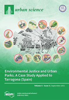
Cover Story (view full-size image): Urban green areas contribute to the quality of life of their inhabitants. For this reason, among other issues, efficient management of these environments must assess whether the population has equitable access to urban parks in relation to their quality. The objective of the work is, in the first place, to propose a methodology to calculate an urban park quality index (PQI) through a multi-criteria evaluation system (MCE). Once the valuation of each green area has been obtained, the PQI has been correlated with the sociodemographic characteristics of the closest population to determine the existence and degree of environmental justice. The case study focuses on the city of Tarragona (Spain). View this paper
  • Issues are regarded as officially published after their release is announced to the table of contents alert mailing list.
  • You may sign up for e-mail alerts to receive table of contents of newly released issues.
  • PDF is the official format for papers published in both, html and pdf forms. To view the papers in pdf format, click on the "PDF Full-text" link, and use the free Adobe Reader to open them.
Order results
Result details
Select all
Export citation of selected articles as:
13 pages, 257 KiB  
Article
Relationships between Density and per Capita Municipal Spending in the United States
by Jeremy Mattson
Urban Sci. 2021, 5(3), 69; https://doi.org/10.3390/urbansci5030069 - 15 Sep 2021
Cited by 5 | Viewed by 5778
Abstract
The objective of this research is to determine the relationship between land use, particularly density, and per capita spending levels in cities across the United States. A model was developed using data from the U.S. Census Bureau’s Annual Survey of State and Local [...] Read more.
The objective of this research is to determine the relationship between land use, particularly density, and per capita spending levels in cities across the United States. A model was developed using data from the U.S. Census Bureau’s Annual Survey of State and Local Government Finances to estimate the impacts of population-weighted density and other factors on per capita municipal spending. This study focused on municipal spending for eight categories that theoretically could be influenced by land use development: fire protection, streets and highways, libraries, parks and recreation, police, sewer, solid waste management, and water. Density was found to be negatively associated with per capita municipal expenditures for the following cost categories: operational costs for fire protection, streets and highways, parks and recreation, sewer, solid waste management, and water; construction costs for streets and highways, parks and recreation, sewer, and water; and land and existing facility costs for police, sewer, and water. Results were insignificant for other cost categories, and a positive relationship was found for police operations costs. In general, results support the conclusion that increased density is associated with reduced per capita municipal spending for several cost categories. Full article
(This article belongs to the Special Issue The Study of Urban Geography and City Planning)
16 pages, 570 KiB  
Review
Machine Learning Algorithms for Urban Land Use Planning: A Review
by Vineet Chaturvedi and Walter T. de Vries
Urban Sci. 2021, 5(3), 68; https://doi.org/10.3390/urbansci5030068 - 14 Sep 2021
Cited by 65 | Viewed by 12540
Abstract
Urbanization is persistent globally and has increasingly significant spatial and environmental consequences. It is especially challenging in developing countries due to the increasing pressure on the limited resources, and damage to the bio-physical environment. Traditional analytical methods of studying the urban land use [...] Read more.
Urbanization is persistent globally and has increasingly significant spatial and environmental consequences. It is especially challenging in developing countries due to the increasing pressure on the limited resources, and damage to the bio-physical environment. Traditional analytical methods of studying the urban land use dynamics associated with urbanization are static and tend to rely on top-down approaches, such as linear and mathematical modeling. These traditional approaches do not capture the nonlinear properties of land use change. New technologies, such as artificial intelligence (AI) and machine learning (ML) have made it possible to model and predict the nonlinear aspects of urban land dynamics. AI and ML are programmed to recognize patterns and carry out predictions, decision making and perform operations with speed and accuracy. Classification, analysis and modeling using earth observation-based data forms the basis for the geospatial support for land use planning. In the process of achieving higher accuracies in the classification of spatial data, ML algorithms are being developed and being improved to enhance the decision-making process. The purpose of the research is to bring out the various ML algorithms and statistical models that have been applied to study aspects of land use planning using earth observation-based data (EO). It intends to review their performance, functional requirements, interoperability requirements and for which research problems can they be applied best. The literature review revealed that random forest (RF), deep learning like convolutional neural network (CNN) and support vector machine (SVM) algorithms are best suited for classification and pattern analysis of earth observation-based data. GANs (generative adversarial networks) have been used to simulate urban patterns. Algorithms like cellular automata, spatial logistic regression and agent-based modeling have been used for studying urban growth, land use change and settlement pattern analysis. Most of the papers reviewed applied ML algorithms for classification of EO data and to study urban growth and land use change. It is observed that hybrid approaches have better performance in terms of accuracies, efficiency and computational cost. Full article
Show Figures

Figure 1

20 pages, 7121 KiB  
Article
Combining Satellite Data and Spatial Analysis to Assess the UHI Amplitude and Structure within Urban Areas: The Case of Moroccan Cities
by Laila El Ghazouani, Lahouari Bounoua, Joseph Nigro, Majid Mansour, Hassan Radoine and Hanane Souidi
Urban Sci. 2021, 5(3), 67; https://doi.org/10.3390/urbansci5030067 - 14 Sep 2021
Cited by 3 | Viewed by 2957
Abstract
Landsat-8 surface temperature and the European Space Agency land cover are used to assess the impact of land cover on the Urban Heat Island (UHI) and Urban Heat Sink (UHS). We analyzed five Moroccan cities selected for their different local climate, size, and [...] Read more.
Landsat-8 surface temperature and the European Space Agency land cover are used to assess the impact of land cover on the Urban Heat Island (UHI) and Urban Heat Sink (UHS). We analyzed five Moroccan cities selected for their different local climate, size, and typology during summer at three different spatial scales. The results show multiple causes defining the different forms and amplitudes of the UHI, namely: the ambient climate, the proximity to the sea, the presence of landscaped areas, and the color of building roofs and walls. Contrary to what was expected, the vegetation was not systematically an island of coolness, either because of its typology or its irrigation status. In the coastal cities of Tangier and Casablanca, UHIs around 20 °C are observed on the seaside, whereas a UHS of up to 11 °C is observed between the city center and the southern periphery of Casablanca. A moderate amplitude UHI of 7 °C is formed in the mountainous city of Ifrane. For cities built in desert-like environments, well-defined UHSs between 9 °C and 12 °C are observed in Smara and Marrakech, respectively. At a finer scale, towns recorded lower temperatures than their immediate surroundings, which are attributed to evaporation from irrigated plants. Full article
Show Figures

Figure 1

19 pages, 3266 KiB  
Article
Study on the Evolution of the Source-Flow-Sink Pattern of China’s Chunyun Population Migration Network: Evidence from Tencent Big Data
by Zeping Xiao, Manyu Bi, Yexi Zhong, Xinghua Feng and Hongzhi Ma
Urban Sci. 2021, 5(3), 66; https://doi.org/10.3390/urbansci5030066 - 6 Sep 2021
Cited by 4 | Viewed by 3089
Abstract
We construct a comprehensive analysis framework of population flow in China. To do so, we take prefecture-level administrative regions as the basic research unit of population flow and use source-sink theory and flow space theory. Additionally, we reveal the dynamic differentiation of population [...] Read more.
We construct a comprehensive analysis framework of population flow in China. To do so, we take prefecture-level administrative regions as the basic research unit of population flow and use source-sink theory and flow space theory. Additionally, we reveal the dynamic differentiation of population flow patterns and the evolution of population source-flow-sink systems. We try to provide a theoretical basis for the formulation of population development policies and regional spatial governance. The results show the following: (1) The Hu Huanyong Line has a strong spatial lock-in effect on population flow. Additionally, provincial capital cities, headed by Hangzhou, Nanjing, and Hefei, have played an increasingly prominent role in population flow. (2) The developed eastern coastal areas have undertaken China’s main population outflow. The net population flow is spatially high in the middle of the region and low on the two sides, exhibiting an “inverted U-shaped” pattern. Furthermore, the borders of the central provinces form a continuous population inflow area. (3) The hierarchical characteristics of the population flow network are obvious. Strong connections occur between developed cities, and the effect of distance attenuation is weakened. The medium connection network is consistent with the traffic skeleton, and population flow exhibits a strong “bypass effect”. (4) The source and sink areas are divided into four regions similar to China’s three major economic belts. The 10 regions can be refined to identify the main population source and sink regions, and the 18 regions can basically reflect China’s level of urbanization. The network of the population flow source-flow-sink system exhibits notable nesting characteristics. As a result, it creates a situation in which the source areas on both sides of the east and the west are convective to the middle. The hierarchical differentiation of the source-flow sink system is related to the differences between the east and the west and between the north and the south, as well as local differences in China. Full article
Show Figures

Figure 1

19 pages, 11082 KiB  
Article
Geographical Information System (GIS) Based Multi-Criteria Decision Analysis for Categorization of the Villages: In the Case of Kabul New City Villages
by Said Mustafa Habibi, Hiroko Ono and Ashutosh Shukla
Urban Sci. 2021, 5(3), 65; https://doi.org/10.3390/urbansci5030065 - 6 Sep 2021
Cited by 8 | Viewed by 4153
Abstract
Kabul is experiencing the most powerful wave of urbanization in its history. With the rapid increase of population, typical urban problems such as lowering of the groundwater table, an influx of returnees, traffic jams, deterioration of sanitation, etc., are becoming critical. In 2006, [...] Read more.
Kabul is experiencing the most powerful wave of urbanization in its history. With the rapid increase of population, typical urban problems such as lowering of the groundwater table, an influx of returnees, traffic jams, deterioration of sanitation, etc., are becoming critical. In 2006, to decrease the pressure from existing Kabul and take measurements for future urbanization process, an independent board was established for the development of a new city adjacent to the existing Kabul by the name of Kabul New City (KNC). There were already 54 villages that existed there. Due to smoothly implementing the master plan and supporting the existing villages, it was necessary to prepare village development plans. As each village has its own characteristics from the urban planning perspective, therefore this research explains a method for categorization of villages through multi-criteria decision analysis; seven potential criteria were identified and rated in collaboration with experts, and Super Decision software was used as an Analytic Hierarchy Process (AHP) tool to weight the criteria. The final output is a map showing different categories of villages. It will assist the government and urban planners in choosing a clear strategy and platform for developing each individual village to be sustainable and applicable. Full article
Show Figures

Figure 1

14 pages, 2783 KiB  
Article
Biological Effects of Air Pollution on Sensitive Bioindicators: A Case Study from Milan, Italy
by Tania Contardo, Stefano Gazzotti, Marco Aldo Ortenzi, Andrea Vannini and Stefano Loppi
Urban Sci. 2021, 5(3), 64; https://doi.org/10.3390/urbansci5030064 - 26 Aug 2021
Cited by 2 | Viewed by 3722
Abstract
In this study, the physiological response of a sensitive lichen species (Evernia prunastri) exposed for three months in a complex urban area (Milan, Italy) was evaluated in order to verify if the air pollution abatement measures adopted over the years resulted [...] Read more.
In this study, the physiological response of a sensitive lichen species (Evernia prunastri) exposed for three months in a complex urban area (Milan, Italy) was evaluated in order to verify if the air pollution abatement measures adopted over the years resulted in a suitable air quality for the survival of this sensitive species. Parameters investigated rely on the photosynthetic activity of the photobiont (Fv/Fm, PIabs, and OJIP curves), damage to mycobiont (membrane damage and antiradical activity), and the production of secondary metabolites involved in the protective functions of the organisms. Results showed that although air quality in Milan still suffers from heavy pollution from PM and NOx, the overall situation is not as severe as to induce the death of this sensitive biomonitor, at least in the short term. Nevertheless, the vital status of the samples exposed in the study area showed a significant impairment compared to that of samples exposed in a control area, indicating that the current air quality in Milan still prevents the optimal survival of E. prunastri. Full article
Show Figures

Figure 1

14 pages, 256 KiB  
Article
Accessibility Barriers and Perceived Accessibility: Implications for Public Transport
by Lars E. Olsson, Margareta Friman and Katrin Lättman
Urban Sci. 2021, 5(3), 63; https://doi.org/10.3390/urbansci5030063 - 25 Aug 2021
Cited by 14 | Viewed by 8306
Abstract
The ability to live the life one wants with public transport is one of the key factors of sustainable and inclusive societies. Given the current trend in the transport domain, providing accessible public transport is necessary in order to allow people to participate [...] Read more.
The ability to live the life one wants with public transport is one of the key factors of sustainable and inclusive societies. Given the current trend in the transport domain, providing accessible public transport is necessary in order to allow people to participate in their day-to-day activities without using a car. Using survey data obtained from Sweden, this study investigates factors that may have a negative effect on the perceived accessibility of public transportation in major city areas and other areas. Overall, regression analyses show that time and economic resources, organizational and temporal functions, frequent travel by public transport, and geographical context all act as accessibility barriers. These findings highlight the need not only to target increased mobility in urban environments, but also to turn the focus to the citizenry’s perceived accessibility. These findings point to implications for policies, planning and interventions targeted at accessible public transport. Adopting an accessibility-oriented approach to urban development, including the individual perspective, could be a pathway for creating a socially sustainable transport system. Full article
18 pages, 5005 KiB  
Article
Environmental Justice and Urban Parks. A Case Study Applied to Tarragona (Spain)
by Joan Alberich, Yolanda Pérez-Albert, José Ignacio Muro Morales and Edgar Bustamante Picón
Urban Sci. 2021, 5(3), 62; https://doi.org/10.3390/urbansci5030062 - 19 Aug 2021
Cited by 5 | Viewed by 4852
Abstract
There is consensus regarding the fact that urban green areas contribute to the quality of life of their inhabitants. Therefore, efficient city management must assess whether the population has access to green areas and the areas’ quality in relation to, for example, vegetation, [...] Read more.
There is consensus regarding the fact that urban green areas contribute to the quality of life of their inhabitants. Therefore, efficient city management must assess whether the population has access to green areas and the areas’ quality in relation to, for example, vegetation, facilities or furnishings. Therefore, the objective is to establish environmental justice of urban parks in Tarragona (Spain) by developing a Park Quality Index (PQI) and the sociodemographic characteristics (level of studies, Human Development Index –HDI–, home sale and rental prices) of the population living within 300 m of a park. To prepare this, a GIS-integrated Multi-Criteria Evaluation (MCE) was produced. The results show that the green areas have low accessibility and availability and that most parks obtain an average-low PQI, with the best-valued aspect being the vegetation and the worst being the facilities. Regarding the degree of environmental justice, a causal relationship between the PQI and the indicators used emerges. The average value of the home sale prices is the one that shows the greatest correlation. These results can be used together with participatory procedures as a basis for identifying places with greater inequality, and for selecting the more effective actions that enable increasing environmental justice with respect to green areas. Full article
(This article belongs to the Special Issue Fragmented City: International Mobility and Housing in Spain)
Show Figures

Figure 1

25 pages, 620 KiB  
Review
Organizing Theories for Disasters into a Complex Adaptive System Framework
by Annetta Burger, William G. Kennedy and Andrew Crooks
Urban Sci. 2021, 5(3), 61; https://doi.org/10.3390/urbansci5030061 - 16 Aug 2021
Cited by 8 | Viewed by 12642
Abstract
Increasingly urbanized populations and climate change have shifted the focus of decision makers from economic growth to the sustainability and resilience of urban infrastructure and communities, especially when communities face multiple hazards and need to recover from recurring disasters. Understanding human behavior and [...] Read more.
Increasingly urbanized populations and climate change have shifted the focus of decision makers from economic growth to the sustainability and resilience of urban infrastructure and communities, especially when communities face multiple hazards and need to recover from recurring disasters. Understanding human behavior and its interactions with built environments in disasters requires disciplinary crossover to explain its complexity, therefore we apply the lens of complex adaptive systems (CAS) to review disaster studies across disciplines. Disasters can be understood to consist of three interacting systems: (1) the physical system, consisting of geological, ecological, and human-built systems; (2) the social system, consisting of informal and formal human collective behavior; and (3) the individual actor system. Exploration of human behavior in these systems shows that CAS properties of heterogeneity, interacting subsystems, emergence, adaptation, and learning are integral, not just to cities, but to disaster studies and connecting them in the CAS framework provides us with a new lens to study disasters across disciplines. This paper explores the theories and models used in disaster studies, provides a framework to study and explain disasters, and discusses how complex adaptive systems can support theory building in disaster science for promoting more sustainable and resilient cities. Full article
Show Figures

Figure 1

12 pages, 230 KiB  
Article
5G and 6G Broadband Cellular Network Technologies as Enablers of New Avenues for Behavioral Influence with Examples from Reduced Rural-Urban Digital Divide
by Harri Oinas-Kukkonen, Pasi Karppinen and Markku Kekkonen
Urban Sci. 2021, 5(3), 60; https://doi.org/10.3390/urbansci5030060 - 12 Aug 2021
Cited by 15 | Viewed by 4374
Abstract
Two of the key information technologies with very high expectations to change our contemporary society are the fifth generation broadband cellular network technologies, which are already emerging to markets, and the foreseen sixth generation broadband cellular network technologies currently under research and development. [...] Read more.
Two of the key information technologies with very high expectations to change our contemporary society are the fifth generation broadband cellular network technologies, which are already emerging to markets, and the foreseen sixth generation broadband cellular network technologies currently under research and development. The core promise of these next generation technologies lies especially in lower latency for providing users feedback on their behavior; thus, growing opportunities for influencing users in their everyday contexts. This viewpoint article seeks to discuss how these opportunities may impact future information technology in general and especially persuasive design and research before 2030. In addition, we will address challenges regarding the promise of 5G and 6G technologies. Information and communication technology can support individuals’ behavioral change only if they can access the technology. In this article, we will exemplify this by presenting possible ways to minimize the digital divide between rural and urban areas, wherein lies a general danger that the divide would increase further. Full article
8 pages, 1026 KiB  
Article
The Impact of Textile Waste on the Features of High-Density Polyethylene (HDPE) Composites
by Ville Lahtela, Anil Kumar and Timo Kärki
Urban Sci. 2021, 5(3), 59; https://doi.org/10.3390/urbansci5030059 - 12 Aug 2021
Cited by 2 | Viewed by 2785
Abstract
An increased amount of textile waste will be available in the future, and its utilization requires attention from various perspectives. The re-utilization of textile waste in a second material cycle is an option for dealing with a global problem that puts stress on [...] Read more.
An increased amount of textile waste will be available in the future, and its utilization requires attention from various perspectives. The re-utilization of textile waste in a second material cycle is an option for dealing with a global problem that puts stress on the urban environment. In this study, almost 30 kg of clothing were recycled as a raw material in the structure of a composite, whose structural properties were analyzed. The studied materials were made from high-density polyethylene (HDPE), anhydride modified polyethylene, lubricant, and either polyethylene terephthalate (PET) or rayon fibers from recycled clothes. The recycled clothes were identified by a near-infrared (NIR) analyzer, followed by treatment of size reduction and materials compounding by agglomeration and compression molding technologies. The material properties were characterized by thickness swelling, water absorption, impact, and tensile testing. The recycled clothes fibers, acting as a filler component in the structure of the composite, could maintain the properties of the material at the same level as the reference material. PET fibers being used as a component resulted in a significant improvement in impact strength. The study showed that recycled clothes can be re-utilized as a substitute for raw materials, and can be part of a solution for future challenges involving textile waste, following the principles of the circular economy. Textile recycling create opportunities to improve the quality of urban life. Full article
Show Figures

Figure 1

15 pages, 2260 KiB  
Article
Promoting Bicycling in Car-Oriented Cities: Lessons from Washington, DC and Frankfurt Am Main, Germany
by Ralph Buehler, Denis Teoman and Brian Shelton
Urban Sci. 2021, 5(3), 58; https://doi.org/10.3390/urbansci5030058 - 11 Aug 2021
Cited by 7 | Viewed by 5493
Abstract
This paper compares bicycling in Washington, DC and Frankfurt am Main, Germany, two car-oriented cities that had adapted their urban transport system to car travel during the 20th century. Our comparative case study shows that both cities have been successful in increasing the [...] Read more.
This paper compares bicycling in Washington, DC and Frankfurt am Main, Germany, two car-oriented cities that had adapted their urban transport system to car travel during the 20th century. Our comparative case study shows that both cities have been successful in increasing the percentage of trips made by bicycle between the late 1990s and 2018: Washington, DC from 1% to 5% and Frankfurt from 6% to 20% of trips. Both cities had detailed bike plans and specific mode share goals for bicycling. However, those plans were only used as guideposts for a step-by-step approach to bicycle promotion that focused on integrating bicycling into everyday decision making in transport, traffic engineering, and urban development. This step-by-step approach successfully garnered political, public, and administrative support over time. The downside of this incrementalist approach is that bike route networks in both cities still have many gaps because bikeway infrastructure was built when individual opportunities arose and not as part of an integrated network. Bicycle promotion in both cities used a combination of bikeway infrastructure and soft policy, including marketing measures. In both cities, the quality of newly installed bikeway infrastructure increased over time from simple bike lanes to protected bike lanes separating cyclists from traffic. In contrast to Washington, DC, Frankfurt has a longer history of car-restrictive policies and overall has been more strict in limiting car use. Full article
Show Figures

Figure 1

20 pages, 3414 KiB  
Article
Spatial Analysis of Intra-Urban Land Use Dynamics in Sub-Saharan Africa: The Case of Addis Ababa (Ethiopia)
by Amanuel Weldegebriel, Engdawork Assefa, Katarzyna Janusz, Meron Tekalign and Anton Van Rompaey
Urban Sci. 2021, 5(3), 57; https://doi.org/10.3390/urbansci5030057 - 6 Aug 2021
Cited by 4 | Viewed by 4456
Abstract
Currently, circa 30% of the population in sub-Saharan Africa resides in cities, and this figure is expected to double in 2040. The recent literature describes the urban expansion processes of African cities in much detail. However, the urbanization wave in Africa also leads [...] Read more.
Currently, circa 30% of the population in sub-Saharan Africa resides in cities, and this figure is expected to double in 2040. The recent literature describes the urban expansion processes of African cities in much detail. However, the urbanization wave in Africa also leads to important intra-urban land use dynamics, which have important consequences on the quality of life within existing cities, which has received less attention. This study aims to contribute to these information gaps by (1) analyzing the extent of the urban land use conversion in contrasting urban locations using satellite images for physical criteria-based classifications and (2) assessing the potential consequences of these intra-urban conversions on the quality of life. Intra-urban land use changes were documented based on satellite imagery for the period 2002–2020. Based on some representative attributes, Addis Ababa city was selected for the case study. Urban land use dynamics and population density changes were examined based on the selected case study neighborhoods and randomly identified land parcels in the city, respectively. Urban development strategies and programs that emerged over recent decades had caused intra-urban land use dynamics, which brought significant population density changes. Moreover, these changes have caused an unbalanced distribution of socio-economic amenities across the city. Full article
Show Figures

Figure 1

23 pages, 2015 KiB  
Review
Street Trees for Bicyclists, Pedestrians, and Vehicle Drivers: A Systematic Multimodal Review
by Theodore S. Eisenman, Alicia F. Coleman and Gregory LaBombard
Urban Sci. 2021, 5(3), 56; https://doi.org/10.3390/urbansci5030056 - 2 Aug 2021
Cited by 9 | Viewed by 5962
Abstract
Multimodal Complete Streets have emerged as a prominent aspiration of urban planning to ensure safe access for all users of streets including pedestrians, bicyclists, motorists, and transit users. Concurrently, municipal leaders are pursuing ambitious tree planting initiatives. These co-arising trends are potentially good [...] Read more.
Multimodal Complete Streets have emerged as a prominent aspiration of urban planning to ensure safe access for all users of streets including pedestrians, bicyclists, motorists, and transit users. Concurrently, municipal leaders are pursuing ambitious tree planting initiatives. These co-arising trends are potentially good news, as trees are important elements of livable cities and Complete Streets. Yet, street trees may have different health and safety benefits and disbenefits for various circulation modes. To advance a multimodal approach to research and practice, we undertook a systematic literature review with goals to (1) identify the scholarly literature addressing links between street trees, human health, and safety for pedestrians, bicyclists, and vehicle drivers; (2) depict the principal disciplines, themes, and conceptual scope of this research; and (3) discuss the implications for urban planning and design practice and research. This review drew upon 13 scholarly databases and yielded 63 relevant articles spanning 15 countries, of which 49 constituted original research. The systematic analysis covers eight research categories. Findings show exponential growth in related scholarship over the past two decades, especially for pedestrians. Journals oriented toward interdisciplinary planning and public health and safety are leading this rise, and benefits far outweigh disbenefits. Yet, there are multimodal tensions especially as it relates to the role of street trees in relationship to drivers and pedestrians. Implications for research and practice are discussed, with an eye towards governance, design, and equity. Full article
Show Figures

Figure 1

22 pages, 6602 KiB  
Article
Urban Connectivity: Elements for an Identification of Bir El Bey’s Preferential Landscapes
by Asma Rejeb Bouzgarrou, Yasmine Attia Ben Cherifa, Christophe Claramunt and Hichem Rejeb
Urban Sci. 2021, 5(3), 55; https://doi.org/10.3390/urbansci5030055 - 19 Jul 2021
Cited by 2 | Viewed by 4769
Abstract
An urban landscape can be considered as a background environment that influences humans’ movements at various scales in the city. This research is oriented to the study of the interactions between urban forest patches and their degree of influence and attractions on humans’ [...] Read more.
An urban landscape can be considered as a background environment that influences humans’ movements at various scales in the city. This research is oriented to the study of the interactions between urban forest patches and their degree of influence and attractions on humans’ behaviors and interactions. The objective is to evaluate the relations between individuals’ movements and the city space nearby natural landscapes, and also to question spatial practices in the city. Forest patches are modelled according to a structural approach at the city level, while Space syntax principles have been applied and compared to in situ movements as experimentally observed. A statistical analysis complements the configurational analysis by highlighting correlations between structural properties and human movements. The whole approach is applied to the Bir El Bey Forest of the Tunisian city of Hammam Chatt in order to explore the interaction between the built and natural landscapes at different levels of scale. The findings exhibit the respective effects of the urban network and natural landscape on the urban space, and how such spaces are appropriated by Hammam Chatt inhabitants and users. Finally, the results propose a generic framework analysis for the study of the relations between humans and urban structure and landscape preferences and that offers novel perspectives for urban planning. Full article
Show Figures

Figure 1

16 pages, 4534 KiB  
Article
Effects of Urbanization on Ecosystem Services in the Shandong Peninsula Urban Agglomeration, in China: The Case of Weifang City
by Yuejuan Yang, Hao Zhang, Xinquan Zhao, Zhizhang Chen, Aiguo Wang, Enlai Zhao and Hui Cao
Urban Sci. 2021, 5(3), 54; https://doi.org/10.3390/urbansci5030054 - 19 Jul 2021
Cited by 11 | Viewed by 3907
Abstract
Ecosystem services are the material basis of economic and social development, and play essential roles in the sustainable development of ecosystems. Urbanization can remarkably alter the provision of ecosystem services. Most studies in this area have focused on densely populated metropolises with poor [...] Read more.
Ecosystem services are the material basis of economic and social development, and play essential roles in the sustainable development of ecosystems. Urbanization can remarkably alter the provision of ecosystem services. Most studies in this area have focused on densely populated metropolises with poor ecological environments, while comparatively few studies have focused on cities with low ecological pressures. Therefore, to avoid continuing to engage in the repetitive pattern of destroying first and rehabilitating later, quantitative analyses of urbanization and ecosystem services should be carried out in representative cities. In this study, based on partial least squares-discriminant analysis, kernel density estimation, and correlation analysis, we quantitatively evaluated the impact of urbanization on ecosystem services in Weifang city. The Data Center for Resources and Environmental Sciences at the Chinese Academy of Sciences and the Institute of Geographic Sciences and Natural Resources Research provided remote sensing data on land use, the gross domestic production (GDP), population data, and ecosystem services. The results were as follows: (1) The variation in population, GDP, and built-up areas consistently increased throughout the study period, whereas the ecosystem service values (ESVs) decreased; (2) food production, raw material production, nutrient cycle maintenance, and soil conservation were decisive ecosystem services that led to vast reductions in ESVs during the process of urbanization; and (3) the negative correlation coefficient between built-up areas and ecosystem services was greater than that between the population or GDP and ecosystem services, which indicated that the impacts of population and economic urbanization on ecosystem services lagged behind the impact of land urbanization. This study provides references for fully recognizing the ecological effects of urbanization, and make suggestions regarding the application of ecosystem services in sustainable development. Full article
Show Figures

Figure 1

35 pages, 15926 KiB  
Article
Indoor Thermal Comfort Analysis: A Case Study of Modern and Traditional Buildings in Hot-Arid Climatic Region of Ethiopia
by Haven Hailu, Eshetu Gelan and Yared Girma
Urban Sci. 2021, 5(3), 53; https://doi.org/10.3390/urbansci5030053 - 15 Jul 2021
Cited by 16 | Viewed by 13218
Abstract
Indoor thermal comfort is an essential aspect of sustainable architecture and it is critical in maintaining a safe indoor environment. Expectations, acceptability, and preferences of traditional and modern buildings are different in terms of thermal comfort. This study, therefore, attempts to evaluate the [...] Read more.
Indoor thermal comfort is an essential aspect of sustainable architecture and it is critical in maintaining a safe indoor environment. Expectations, acceptability, and preferences of traditional and modern buildings are different in terms of thermal comfort. This study, therefore, attempts to evaluate the indoor thermal comforts of modern and traditional buildings and identify the contributing factors that impede or facilitate indoor thermal comfort in Semera city, Ethiopia. This study employed subjective and objective measurements. The subjective measurement is based on the ASHRAE seven-point thermal sensation scale. An adaptive comfort model was employed according to the ASHRAE standard to evaluate indoor thermal comfort. The results revealed that with regards to thermal sensational votes between −1 and +1, 88% of the respondents are satisfied with the indoor environment in traditional houses, while in modern houses this figure is 22%. Likewise, 83% of occupants in traditional houses expressed a preference for their homes to remain the same or be only slightly cooler or warmer. Traditional houses were, on average, in compliance with the 80% acceptability band of the adaptive comfort standard. The study investigated that traditional building techniques and materials, in combination with consideration of microclimate, were found to play a significant role in regulating the indoor environment. Full article
(This article belongs to the Special Issue Net Zero Energy Settlements)
Show Figures

Figure 1

18 pages, 1129 KiB  
Article
From TOD to TAC: Why and How Transport and Urban Policy Needs to Shift to Regenerating Main Road Corridors with New Transit Systems
by Peter Newman, Sebastian Davies-Slate, Daniel Conley, Karlson Hargroves and Mike Mouritz
Urban Sci. 2021, 5(3), 52; https://doi.org/10.3390/urbansci5030052 - 7 Jul 2021
Cited by 10 | Viewed by 4740
Abstract
The need for transit oriented development (TOD) around railway stations has been well accepted and continues to be needed in cities looking to regenerate both transit and urban development. Large parts of suburban areas remain without quality transit down main roads that are [...] Read more.
The need for transit oriented development (TOD) around railway stations has been well accepted and continues to be needed in cities looking to regenerate both transit and urban development. Large parts of suburban areas remain without quality transit down main roads that are usually filled with traffic resulting in reduced urban value. The need to regenerate both the mobility and land development along such roads will likely be the next big agenda in transport and urban policy. This paper learns from century-old experiences in public–private approaches to railway-based urban development from around the world, along with innovative insights from the novel integration of historical perspectives, entrepreneurship theory and urban planning to create the notion of a “Transit Activated Corridor” (TAC). TACs prioritize fast transit and a string of station precincts along urban main roads. The core policy processes for a TAC are outlined with some early case studies. Five design principles for delivering a TAC are presented in this paper, three principles from entrepreneurship theory and two from urban planning. The potential for new mid-tier transit like trackless trams to enable TACs is used to illustrate how these design processes can be an effective approach for designing, financing and delivering a “Transit Activated Corridor”. Full article
Show Figures

Figure 1

21 pages, 1062 KiB  
Article
Regional Policy and Greenfield Investments in German Districts
by Martijn J. Burger, Jelmer Schalk, Daniel Schiller and Spyridon Stavropoulos
Urban Sci. 2021, 5(3), 51; https://doi.org/10.3390/urbansci5030051 - 28 Jun 2021
Viewed by 2720
Abstract
Using data on greenfield investment in German districts from 2003 to 2010, we examine how regional development policies affect the decision of multinational corporations to locate facilities in Germany. We are interested in whether regional development policies accumulate to increase the attractiveness of [...] Read more.
Using data on greenfield investment in German districts from 2003 to 2010, we examine how regional development policies affect the decision of multinational corporations to locate facilities in Germany. We are interested in whether regional development policies accumulate to increase the attractiveness of a region and whether some policies are necessary to attract foreign investors. Applying count data models and geographic weighted regression, the results indicate that, on average, regional development policies increase the attractiveness of German districts for multinational firms. We find that place-based policies have the strongest effect on investments in the East German lagging regions. However, policies predominantly attract standardised types of investments that require considerable capital investments but not specialised location advantages. Full article
Show Figures

Figure 1

23 pages, 2674 KiB  
Article
Planning for Informal Urban Green Spaces in African Cities: Children’s Perception and Use in Peri-Urban Areas of Luanda, Angola
by Eurídice Lurdes Jorge Pedrosa, Seth Asare Okyere, Louis Kusi Frimpong, Stephen Kofi Diko, Tracy Sidney Commodore and Michihiro Kita
Urban Sci. 2021, 5(3), 50; https://doi.org/10.3390/urbansci5030050 - 25 Jun 2021
Cited by 28 | Viewed by 5885
Abstract
Urbanization has placed considerable constraints on the preservation and maintenance of formal green spaces in African cities. This situation has given attention to the potentials of informal green spaces (IGS). While studies on IGS in African cities is only emerging, scholarly and policy [...] Read more.
Urbanization has placed considerable constraints on the preservation and maintenance of formal green spaces in African cities. This situation has given attention to the potentials of informal green spaces (IGS). While studies on IGS in African cities is only emerging, scholarly and policy attention to children’s perceptions and use of IGS within Africa’s spatially expansive urbanism is limited. This study explores children’s perceptions, use, barriers, willingness, and suggestions for improving IGS in the peri-urban area of Funda in Luanda. Based on semi-structured interviews and focused-group discussions, the study revealed that, while IGS offered different ecosystem services, not all IGS were accessible to children, due to safety concerns, maintenance conditions, and parental restrictions. Children’s interest in maintenance activities and suggestions for improving IGS reflected their independent identities, sense of place, and cognitive capacity to contribute to planning their community. The paper submits that the potential role of IGS in Africa’s peri-urban areas can be improved by taking into account children’s agency and experiential knowledge of community spaces. For this reason, there is a need to recognize and engage children as co-producers of community knowledge and interventions. Full article
Show Figures

Figure 1

Previous Issue
Next Issue
Back to TopTop