Next Issue
Volume 5, September
Previous Issue
Volume 5, March


Urban Sci., Volume 5, Issue 2 (June 2021) – 16 articles

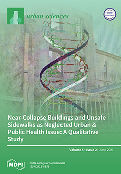
Cover Story (view full-size image): Injuries, including those that impact pedestrians, constitute a major threat to global health. Our >15-year-long field study in Athens, based on the inspection of several hazardous places and analysis of photographical material, provides insight into two major, yet significantly neglected, risk factors for pedestrian injuries: (a) hazardous sidewalks and (b) near-collapse buildings, which are pertinent to the following disease categories: (a) falls-on-the-same-level and (b) struck by building collapse or objects detached from buildings, respectively. Moreover, we provide a narrative comprehensive review of this neglected field. By paralleling a building’s structure with the DNA double-helix, we address a call-for-action advocating that these urban places represent a previously underappreciated determinant of urban and public health (as DNA had been for genetics before the initial description of its [...] Read more.
  • Issues are regarded as officially published after their release is announced to the table of contents alert mailing list.
  • You may sign up for e-mail alerts to receive table of contents of newly released issues.
  • PDF is the official format for papers published in both, html and pdf forms. To view the papers in pdf format, click on the "PDF Full-text" link, and use the free Adobe Reader to open them.
Order results
Result details
Select all
Export citation of selected articles as:
27 pages, 12827 KiB  
Article
Placemaking in Informal Settlements: The Case of France Colony, Islamabad, Pakistan
by Ramisa Shafqat, Dora Marinova and Shahed Khan
Urban Sci. 2021, 5(2), 49; https://doi.org/10.3390/urbansci5020049 - 20 Jun 2021
Cited by 6 | Viewed by 8652
Abstract
This paper provides an alternative perspective on urban informal settlements by analysing them as places of rural remnants, reservoirs of regional cultural heritage, and spaces entailing traditional sustainable elements that are brought to the urban realm by rural migrants. These socio-cultural and spatial [...] Read more.
This paper provides an alternative perspective on urban informal settlements by analysing them as places of rural remnants, reservoirs of regional cultural heritage, and spaces entailing traditional sustainable elements that are brought to the urban realm by rural migrants. These socio-cultural and spatial attributes of a settlement converge under the notion of a “place.” Placemaking analysis is thus contended to be appropriate for comprehensive understanding of an informal settlement. The selected case study of France Colony, Islamabad, employs the placemaking methodology framework to investigate sustainability values and practices from the day-to-day living of its inhabitants. Data collected through on-site interviews during transect walks in France Colony are then translated into four maps as a spatio-cultural documentation of the sustainable elements found in the informal settlement. The four maps relate to form and users, activities and amenities, image and characteristics, and access and linkages. This systematic analysis assisted in categorising the sustainability characteristics of the informal settlements according to the three pillars (social, economic, and environmental) of sustainability. The findings show that the organic placemaking, originating from everyday life, values, behaviour, and lifestyle of the informal dwellers, allows for a strong and vibrant resilient community to emerge. Full article
Show Figures

Figure 1

32 pages, 24723 KiB  
Article
Evaluating the Accuracy of Gridded Population Estimates in Slums: A Case Study in Nigeria and Kenya
by Dana R. Thomson, Andrea E. Gaughan, Forrest R. Stevens, Gregory Yetman, Peter Elias and Robert Chen
Urban Sci. 2021, 5(2), 48; https://doi.org/10.3390/urbansci5020048 - 20 Jun 2021
Cited by 33 | Viewed by 6712
Abstract
Low- and middle-income country cities face unprecedented urbanization and growth in slums. Gridded population data (e.g., ~100 × 100 m) derived from demographic and spatial data are a promising source of population estimates, but face limitations in slums due to the dynamic nature [...] Read more.
Low- and middle-income country cities face unprecedented urbanization and growth in slums. Gridded population data (e.g., ~100 × 100 m) derived from demographic and spatial data are a promising source of population estimates, but face limitations in slums due to the dynamic nature of this population as well as modelling assumptions. In this study, we compared field-referenced boundaries and population counts from Slum Dwellers International in Lagos (Nigeria), Port Harcourt (Nigeria), and Nairobi (Kenya) with nine gridded population datasets to assess their statistical accuracy in slums. We found that all gridded population estimates vastly underestimated population in slums (RMSE: 4958 to 14,422, Bias: −2853 to −7638), with the most accurate dataset (HRSL) estimating just 39 per cent of slum residents. Using a modelled map of all slums in Lagos to compare gridded population datasets in terms of SDG 11.1.1 (percent of population living in deprived areas), all gridded population datasets estimated this indicator at just 1–3 per cent compared to 56 per cent using UN-Habitat’s approach. We outline steps that might improve that accuracy of each gridded population dataset in deprived urban areas. While gridded population estimates are not yet sufficiently accurate to estimate SDG 11.1.1, we are optimistic that some could be used in the future following updates to their modelling approaches. Full article
Show Figures

Graphical abstract

16 pages, 2453 KiB  
Article
Near-Collapse Buildings and Unsafe Sidewalks as Neglected Urban & Public Health Issue: A Qualitative Study
by Alexios-Fotios A. Mentis and Jannis S. Papadopulos
Urban Sci. 2021, 5(2), 47; https://doi.org/10.3390/urbansci5020047 - 7 Jun 2021
Cited by 4 | Viewed by 5665
Abstract
Public health and city planning are highly interconnected; however, the nexus between the urban state of buildings and sidewalks and corresponding public and urban health issues is lacking in Greece. In a case study in Athens, Greece, we evaluated unsafe buildings, facades, balconies, [...] Read more.
Public health and city planning are highly interconnected; however, the nexus between the urban state of buildings and sidewalks and corresponding public and urban health issues is lacking in Greece. In a case study in Athens, Greece, we evaluated unsafe buildings, facades, balconies, and sidewalks during a 15-year follow-up. We manually inspected (a) if the building/location’s condition had worsened and (b) any effective intervention by the state. Of the 400 initially selected buildings, 251 nonoverlapping buildings were analyzed. Overall, ~20% of the buildings posed a subjectively perceived severe risk for collapse, 35% had near-to-fall objects, and 45% had other minor issues. Fifteen years later, ~85% of the buildings were at the same or higher risk of complete or partial fall, and in only 15% had the risk of collapse been reduced or removed by private or public intervention. We detected uneven and dangerous parts of sidewalks hindering walkability and increasing the risk of falling or tipping. Our assessment revealed that Athens’ historical center harbors plausible safety and health risks for pedestrians and dwellers due to entire or partial building collapse and poor-condition sidewalks, which can potentially act as stress factors. Collectively, the issue of near-collapse buildings and risky sidewalks as an urban health determinant appears neglected by municipal authorities in their urban planning priorities; thus, future studies are needed in the field. Full article
(This article belongs to the Special Issue Healthy City Science: Citizens, Experts and Urban Governance)
Show Figures

Figure 1

19 pages, 2318 KiB  
Article
Parents’ Perceived Neighborhood Safety and Children’s Cognitive Performance: Complexities by Race, Ethnicity, and Cognitive Domain
by Shervin Assari, Shanika Boyce, Ritesh Mistry, Alvin Thomas, Harvey L. Nicholson, Jr., Ryon J. Cobb, Adolfo G. Cuevas, Daniel B. Lee, Mohsen Bazargan, Cleopatra H. Caldwell, Tommy J. Curry and Marc A. Zimmerman
Urban Sci. 2021, 5(2), 46; https://doi.org/10.3390/urbansci5020046 - 1 Jun 2021
Cited by 4 | Viewed by 4365
Abstract
Background:Aim: To examine racial/ethnic variations in the effect of parents’ subjective neighborhood safety on children’s cognitive performance. Methods: This cross-sectional study included 10,027 children from the Adolescent Brain Cognitive Development (ABCD) study. The exposure variable was parents’ subjective neighborhood safety. The outcomes [...] Read more.
Background:Aim: To examine racial/ethnic variations in the effect of parents’ subjective neighborhood safety on children’s cognitive performance. Methods: This cross-sectional study included 10,027 children from the Adolescent Brain Cognitive Development (ABCD) study. The exposure variable was parents’ subjective neighborhood safety. The outcomes were three domains of children’s cognitive performance: general cognitive performance, executive functioning, and learning/memory. We used mixed-effects regression models for data analysis. Results: Overall, parents’ subjective neighborhood safety was positively associated with children’s executive functioning, but not general cognitive performance or learning/memory. Higher parents’ subjective neighborhood safety had a more positive influence on the executive functioning of non-Hispanic White than Asian American children. Higher parents’ subjective neighborhood safety was associated with higher general cognitive performance and learning/memory for non-White children relative to non-Hispanic White children. Conclusion: The race/ethnicity of children moderates the association between neighborhood safety and cognitive performance. This becomes more complicated, as the patterns seem to differ across ethnicity and cognitive domains. It is unknown whether the observed racial/ethnic variations in the effect of neighborhood safety on cognitive performance are neighborhood characteristics such as residential segregation. Addressing neighborhood inequalities is needed if we wish to reduce racial/ethnic inequities in the cognitive development of children. Full article
Show Figures

Figure 1

18 pages, 1833 KiB  
Article
Residential Segregation and Living Conditions. An Analysis of Social Inequalities in Catalonia from Four Spatial Perspectives
by Joan Checa and Oriol Nel·lo
Urban Sci. 2021, 5(2), 45; https://doi.org/10.3390/urbansci5020045 - 31 May 2021
Cited by 13 | Viewed by 5227
Abstract
Spatial inequalities in living conditions have traditionally been attributed to geographical location, the opposition between urban and rural settings or the size of settlements. Accordingly, the geographical literature has used these oppositions to explain not only differences in access to education, work and [...] Read more.
Spatial inequalities in living conditions have traditionally been attributed to geographical location, the opposition between urban and rural settings or the size of settlements. Accordingly, the geographical literature has used these oppositions to explain not only differences in access to education, work and services but also diversity of lifestyles, beliefs and even political attitudes. In recent decades, however, urban areas have extended their scope, urbanization has become more dispersed, territories have become more interdependent and spatial hierarchies have tended to weaken. At the same time, social inequalities have become more marked, as manifested spatially by residential segregation. This article puts forward the thesis that residential segregation constitutes a considerably better explanatory factor currently for the elucidation of social inequalities and differences in living conditions in regional spaces than geographical location, the urban/rural divide or the size of settlements. A set of key indicators in the population of residents in Catalonia (level of education, socio-economic position, risk of poverty, self-perceived health and life satisfaction) are therefore analyzed from various spatial perspectives to explore this argument and evaluate each indicator’s explanatory potential. The main results seem to confirm the hypothesis that the most striking spatial inequalities are associated with residential segregation. Full article
(This article belongs to the Special Issue Fragmented City: International Mobility and Housing in Spain)
Show Figures

Figure 1

20 pages, 22741 KiB  
Article
Using Fuzzy Cognitive Maps to Assess Liveability in Slum Upgrading Schemes: Case of Pune, India
by Subhashree Nath and Raphael Karutz
Urban Sci. 2021, 5(2), 44; https://doi.org/10.3390/urbansci5020044 - 26 May 2021
Cited by 1 | Viewed by 4235
Abstract
Liveability assessments of informal urban settlements are scarce. In India, a number of slum upgrading schemes have been implemented over the last decades aiming at better living conditions. However, these schemes rarely consider improvement in liveability as an explicit criterion, assuming that better [...] Read more.
Liveability assessments of informal urban settlements are scarce. In India, a number of slum upgrading schemes have been implemented over the last decades aiming at better living conditions. However, these schemes rarely consider improvement in liveability as an explicit criterion, assuming that better physical conditions and the provision of basic services inevitably lead to better liveability. We use Fuzzy Cognitive Maps (FCMs) to analyse liveability in four different informal settlements in Pune (India). We compare the liveability by conducting semi-structured interviews with residents and by analysing them in individual and aggregated FCMs. Each settlement represents an archetypical form of the upgradation process: non-upgraded (base case), in-situ upgraded, relocated, and temporary resettlement. The FCMs show that the liveability indicators availability of community space, proximity to public transportation, feeling of belonging, and good relationship with neighbours and community are central elements of these neighbourhoods’ liveability. The results suggest that upgradation may lead to an improved overall liveability but can also reduce it if not designed properly. The fostering of community agency, an integration of the neighbourhood into the formal city fabric, and the maintaining of cohesion during the shift from horizontal to vertical living emerged as critical factors. To ensure sustainable integration of liveability considerations in slum upgrading schemes, we suggest using indicators well-adapted to the local context, co-created with local experts and stakeholders, as well as periodic post-occupancy liveability evaluations. Full article
Show Figures

Figure 1

10 pages, 1766 KiB  
Perspective
Advancing Behavioural Theories in Sustainable Mobility: A Research Agenda
by Samuel Chng
Urban Sci. 2021, 5(2), 43; https://doi.org/10.3390/urbansci5020043 - 26 May 2021
Cited by 6 | Viewed by 4194
Abstract
Ensuring that the growing mobility demand is met in a sustainable manner is important for our climate goals, and this would require changes to our current mobility behaviours. Behaviour and behaviour change theories have an important role in informing the mobility behaviour research [...] Read more.
Ensuring that the growing mobility demand is met in a sustainable manner is important for our climate goals, and this would require changes to our current mobility behaviours. Behaviour and behaviour change theories have an important role in informing the mobility behaviour research and practices that seek to achieve these changes, and this paper discusses the application of these theories in both research and practice. Newer and more comprehensive theories have been developed in this area in the last decade, improving the quality of theories available. However, two key challenges of using theories are identified. The great number of theories today makes it challenging when deciding what and when to use them, and the appropriateness of many theories are either too simplistic or too complex. Thus, there is a need to critically review the state of theories in this area and identify ways to advance our application and development of behavioural theories. Here, two suggestions are put forward on how we can address these challenges while advancing the use of theories in mobility behaviour research and practice. First, integrate and summarise multiple, individual theories into a comprehensive and accessible framework for researchers and practitioners. Second, expand this framework beyond behaviour and behaviour-change theories by mapping out their interconnections with theories from other paradigms and disciplines using a systems approach to facilitate a more holistic theorisation. Full article
Show Figures

Figure 1

17 pages, 6690 KiB  
Article
Urban Policies and Large Projects in Central City Areas: The Example of Madrid (Spain)
by Dolores Brandis García
Urban Sci. 2021, 5(2), 42; https://doi.org/10.3390/urbansci5020042 - 20 May 2021
Cited by 5 | Viewed by 4102
Abstract
Since the late 20th century major, European cities have exhibited large projects driven by neoliberal urban planning policies whose aim is to enhance their position on the global market. By locating these projects in central city areas, they also heighten and reinforce their [...] Read more.
Since the late 20th century major, European cities have exhibited large projects driven by neoliberal urban planning policies whose aim is to enhance their position on the global market. By locating these projects in central city areas, they also heighten and reinforce their privileged situation within the city as a whole, thus contributing to deepening the centre–periphery rift. The starting point for this study is the significance and scope of large projects in metropolitan cities’ urban planning agendas since the final decade of the 20th century. The aim of this article is to demonstrate the correlation between the various opposing conservative and progressive urban policies, and the projects put forward, for the city of Madrid. A study of documentary sources and the strategies deployed by public and private agents are interpreted in the light of a process during which the city has had a succession of alternating governments defending opposing urban development models. This analysis allows us to conclude that the predominant large-scale projects proposed under conservative policies have contributed to deepening the centre–periphery rift appreciated in the city. Full article
(This article belongs to the Special Issue Fragmented City: International Mobility and Housing in Spain)
Show Figures

Figure 1

19 pages, 4386 KiB  
Article
Towards an Even More Spatially Diversified City? New Metropolitan Population Trends in the Post-Economic Crisis Period
by Fernando Gil-Alonso, Cristina López-Villanueva, Jordi Bayona-i-Carrasco and Isabel Pujadas
Urban Sci. 2021, 5(2), 41; https://doi.org/10.3390/urbansci5020041 - 14 May 2021
Cited by 13 | Viewed by 3975
Abstract
After the deep economic crisis that began in 2008, in 2014, Spain started to show signs of recovery, entering the so-called “post-crisis” period. Though it has not yet reached the entire population, economic improvement has had a positive impact on the real estate [...] Read more.
After the deep economic crisis that began in 2008, in 2014, Spain started to show signs of recovery, entering the so-called “post-crisis” period. Though it has not yet reached the entire population, economic improvement has had a positive impact on the real estate market, economic activity, and employment. Residential mobility has also increased, but flows have become more unstable and complex. The direction of these flows, the reasons for moving, and the ages and socioeconomic categories of migrants have diversified. These complex “new mobility” patterns are reconfiguring the spatial distribution of the population in Spanish urban areas. On the basis of Continuous Register (Padrón Continuo) microdata, this paper primarily aims to study population changes in the 69 Spanish functional urban areas (FUAs) defined by the National Institute of Statistics (INE)/Eurostat, focusing on their population growth or decline in their centers and peripheries during the crisis (2011–2015) and post-crisis (2015–2019) phases. Then, the paper analyzes the five major Spanish metropolises (Madrid, Barcelona, Valencia, Seville, and Bilbao) in greater depth. The findings confirm the hypothesis that, during the post-crisis period, the population growth of cores and rings and thus the spatial distribution of urban inhabitants have been changing, resulting in the growing demographic heterogeneity of Spanish urban areas that are diversifying both internally and compared to each other. Full article
(This article belongs to the Special Issue Fragmented City: International Mobility and Housing in Spain)
Show Figures

Figure 1

11 pages, 645 KiB  
Article
Gentrification and Touristification in the Central Urban Areas of Seville and Cádiz
by Julio-José Parralejo and Ibán Díaz-Parra
Urban Sci. 2021, 5(2), 40; https://doi.org/10.3390/urbansci5020040 - 2 May 2021
Cited by 17 | Viewed by 4355
Abstract
Intensive tourism in historic city centers is causing socio-spatial effects that are already visible to society. This has led politicians and academics to focus on the issue, creating a debate about gentrification in certain central urban areas which overlaps with studies on touristification, [...] Read more.
Intensive tourism in historic city centers is causing socio-spatial effects that are already visible to society. This has led politicians and academics to focus on the issue, creating a debate about gentrification in certain central urban areas which overlaps with studies on touristification, understood by some authors as tourism gentrification. This article aims to identify whether socio-demographic changes identifiable as touristification have occurred in the historic centers of two Andalusian cities, Seville and Cádiz, and which we interpret as the replacement of residents with visitors. The work is based primarily on the exploratory analysis of socio-demographic data from the Population Register and data on housing and rentals provided by different sources. The work shows strong indications of a relationship between the increase of tourist apartments and losses of residents in both historic centers. The paper concludes by pointing to the need for further research on this relationship in public statistics that can guide future policy action. Full article
(This article belongs to the Special Issue Fragmented City: International Mobility and Housing in Spain)
Show Figures

Figure 1

17 pages, 296 KiB  
Article
Can Deliberative Democracy Work in Urban India?
by Sanskriti Menon, Janette Hartz-Karp and Dora Marinova
Urban Sci. 2021, 5(2), 39; https://doi.org/10.3390/urbansci5020039 - 26 Apr 2021
Cited by 1 | Viewed by 3941
Abstract
India faces extensive challenges of rapid urbanization and deficits in human well-being and environmental sustainability. Democratic governance is expected to strengthen public policies and efforts towards sustainability. This article presents a study in Pune, India, which aimed at exploring perceptions about public participation [...] Read more.
India faces extensive challenges of rapid urbanization and deficits in human well-being and environmental sustainability. Democratic governance is expected to strengthen public policies and efforts towards sustainability. This article presents a study in Pune, India, which aimed at exploring perceptions about public participation in urban governance and the potential of high-quality public deliberation to meet deficits. The research reveals disaffection of the public with government decision-making and government-led participation. Further, it shows that people are interested in participating in community life and seek to be partners in civic decision-making, but find themselves unable to do so. The study illustrates that high-quality public deliberations facilitated by an independent third party can provide a satisfactory space of participation, learning, and developing balanced outcomes. Citizens expressed readiness for partnership, third-party facilitation, and support from civic advocacy groups. Challenges with regard to government commitment to deliberative democracy will need to be overcome for a purposeful shift from conventional weak to empowered participation of ordinary citizens in civic decision-making. We anticipate that while institutionalization of high-quality public deliberations may take time, civil society-led public deliberations may help raise community expectations and demand for induced deliberative democracy. Full article
12 pages, 5045 KiB  
Article
Modelling Urban Tourism in Historic Southeast Asian Cities
by Jackie Lei Tin Ong and Russell Arthur Smith
Urban Sci. 2021, 5(2), 38; https://doi.org/10.3390/urbansci5020038 - 16 Apr 2021
Cited by 3 | Viewed by 3640
Abstract
Older cities with significant physical historic resources have become increasingly important centers for urban tourism, though contemporary attractions and events are often important in their own right. It is acknowledged that urban areas are multifaceted agglomerations where tourism complements other economic sectors and [...] Read more.
Older cities with significant physical historic resources have become increasingly important centers for urban tourism, though contemporary attractions and events are often important in their own right. It is acknowledged that urban areas are multifaceted agglomerations where tourism complements other economic sectors and competes with them for limited resources. A limited investigation of the temporal dynamics of change of tourism in cities has been undertaken in the several countries in Europe and North America. Much less has been studied for the countries of Southeast Asia where tourism has expanded rapidly over the past several decades, a trend that is projected to continue. Urban tourism has and will continue to be important in Southeast Asia. This paper reports on the spatial modeling of the evolution of tourism in two historic cities in Southeast Asia that seeks to better understand the dynamics of temporal change of tourism within their respective urban contexts. The cases of Bangkok and Jakarta have been compared with the Ashworth and Tunbridge model to identify conformity and otherwise of Asian cases with the European theory. Full article
Show Figures

Figure 1

22 pages, 9378 KiB  
Article
The Contribution of Urban Morphology to the Formation of the Microclimate in Compact Urban Cores: A Study in the City Center of Thessaloniki
by Georgios-Rafail Kouklis and Athena Yiannakou
Urban Sci. 2021, 5(2), 37; https://doi.org/10.3390/urbansci5020037 - 16 Apr 2021
Cited by 18 | Viewed by 5061
Abstract
The purpose of this paper is to investigate the contribution of urban morphology to the formation of microclimatic conditions prevailing within urban outdoor spaces. We studied the compact form of a city and examined, at a detailed, street plan level, elements related to [...] Read more.
The purpose of this paper is to investigate the contribution of urban morphology to the formation of microclimatic conditions prevailing within urban outdoor spaces. We studied the compact form of a city and examined, at a detailed, street plan level, elements related to air temperature, urban ventilation, and the individual’s thermal comfort. All elements examined are directly affected by both the urban form and the availability of open and green spaces. The field study took place in a typical compact urban fabric of an old city center, the city center of Thessaloniki, where we investigated the relationship between urban morphology and microclimate. Urban morphology was gauged by examining the detailed street plan, along with the local building patterns. We used a simulation method based on the ENVI-met© software. The findings of the field study highlight the fact that the street layout, the urban canyon, and the open and green spaces in a compact urban form contribute decisively both to the creation of the microclimatic conditions and to the influence of the bioclimatic parameters. Full article
Show Figures

Figure 1

16 pages, 52539 KiB  
Article
The Evolution of Urban Planning in Medium-Sized Catalan Cities (1979–2019)
by Carme Bellet Sanfeliu
Urban Sci. 2021, 5(2), 36; https://doi.org/10.3390/urbansci5020036 - 13 Apr 2021
Cited by 3 | Viewed by 3347
Abstract
Urban planning, as well as the type of city in which it takes place and is promoted, has changed a lot in Spanish cities since the return to democratically elected municipal governments in 1979. This work seeks to characterise the transformation that urban [...] Read more.
Urban planning, as well as the type of city in which it takes place and is promoted, has changed a lot in Spanish cities since the return to democratically elected municipal governments in 1979. This work seeks to characterise the transformation that urban planning has undergone over the last 40 years. It sets out to do this by studying the cases of two medium-sized Catalan cities, their underlying city models, and the ways in which planning has been defined and managed in Catalonia. All of this was undertaken through a bibliographic and documentary analysis of the approved planning documents, which was accompanied by a study of the population dynamics and building cycles. In Spain, urban planning has been one of the instruments used to catalyse expectations for economic growth based on land consumption through urbanisation. Within this context, planning has progressed from fulfilling an initial requirement to regulate activities and urban growth (1979–1991) to facilitating urban development through a clearly expansive and speculative form of neoliberal urbanism (1993–2007) and, finally, to assuming a form in which these previous tendencies coexist with certain new orientations. Full article
(This article belongs to the Special Issue Fragmented City: International Mobility and Housing in Spain)
Show Figures

Figure 1

22 pages, 10448 KiB  
Article
Socio-Spatial Changes in Danwei Neighbourhoods: A Case Study of the AMS Danwei Compound in Hefei, China
by Nanqi Ye, Michihiro Kita, Shigeki Matsubara, Seth Asare Okyere and Motoki Shimoda
Urban Sci. 2021, 5(2), 35; https://doi.org/10.3390/urbansci5020035 - 12 Apr 2021
Cited by 6 | Viewed by 3558
Abstract
This paper analysed socio-spatial changes in old urban neighbourhoods (Danwei compounds) in Chinese cities as a result of two major national level reforms: the Reform and Opening Up and the Urban Housing reform in 1978 and 1997, respectively. Existing research indicates fundamental changes [...] Read more.
This paper analysed socio-spatial changes in old urban neighbourhoods (Danwei compounds) in Chinese cities as a result of two major national level reforms: the Reform and Opening Up and the Urban Housing reform in 1978 and 1997, respectively. Existing research indicates fundamental changes have taken place in the political, economic and social aspects of Danwei compounds. However, there is a paucity of research on micro-level changes. To understand how these reforms have affected the social-spatial schema of Danwei Compounds, the study utilised mapping, key person interviews and field observation in AMS compound, Hefei city of Anhui province. This paper compared the AMS Danwei Compound before and after the reforms in terms of public spaces, building features and compound management. The study found that the AMS Danwei Compound has experienced a significant reduction in public space, an increase in building density and a reconfiguration of compound management actors. The study suggests the need for local planning authorities and government to pay attention to planning and design of the old city core by emphasising improvement in public spaces, attention to compact design principles for urban neighbourhood planning, and establishment of local community management body. Full article
Show Figures

Figure 1

24 pages, 18711 KiB  
Article
A Comparative Study of Urban Spatial Characteristics of the Capitals of Tang and Song Dynasties Based on Space Syntax
by Liran Yin, Tao Wang and Kemi Adeyeye
Urban Sci. 2021, 5(2), 34; https://doi.org/10.3390/urbansci5020034 - 2 Apr 2021
Cited by 9 | Viewed by 5831
Abstract
Space syntax has been widely used in studies with historical components to developing a common analytical language for the comparative study of urban morphology across time and space by visual diagrams. This paper uses space syntax to analyse the inner and outer city [...] Read more.
Space syntax has been widely used in studies with historical components to developing a common analytical language for the comparative study of urban morphology across time and space by visual diagrams. This paper uses space syntax to analyse the inner and outer city parts of the daily life of residents in the capital cities of two dynasties, Tang and Song, to reveal the impact of changes in urban planning on the overall spatial structure of the city, the structure of commercial space, and the role of urban squares in the two dynasties under centralised rule. Based on the quantitative analysis, the results show significant differences between the Tang and Song dynasties in all three aspects of comparison. The changes in the Tang and Song dynasties’ capital cities result from the interaction between the materiality of the ancient Chinese capital city form and the spatial function of the city, and the analysis of space syntax is useful for interpreting their relevance. Full article
Show Figures

Figure 1

Previous Issue
Next Issue
Back to TopTop