ijerph-logo

Journal Browser

Journal Browser

Ecosystem Services (Closed)

Editor


E-Mail Website
Collection Editor
U.S. EPA - Gulf Ecology Division, Gulf Breeze, FL 32561, USA
Interests: Indicators; Indices; Well-Being; Ecosystems; Resilience; Natural Hazards; Ecosystem Services; Coastal Ecosystems
Special Issues, Collections and Topics in MDPI journals

Topical Collection Information

Dear Colleagues,

Natural ecosystems perform fundamental life-support services upon which human civilization depends. However, many people believe that nature provides these services for free and therefore, they are of little or no value. While we do not pay for them, we pay significantly for their loss in terms of wastewater treatment facilities, moratoriums on greenhouse gases, increased illnesses, reduced soil fertility and losses in those images of nature that contribute to our basic happiness. Little is understood about the well-being benefits of the natural environment and its ecosystem services. The interwoven relationship of ecosystems and human well-being is insufficiently acknowledged in the wider philosophical, social, and economic well-being literature.

Life itself, as well as the entire human economy, depends on goods and services provided by earth’s natural systems. The processes of cleansing, recycling, and renewal, along with goods such as seafood, forage, and timber, are worth many trillions of dollars annually, and nothing could live without them. Yet growing human pressures on the environment profoundly disrupt the functioning of natural systems and significantly reduce the delivery of these services. Humans have changed ecosystems more rapidly and extensively in the last 50 years than in any comparable period of human history. We have done this to meet the growing demands for food, freshwater, timber, fiber, and fuel. While a cursory evaluation of these changes to ecosystems have appeared to enhance the well-being of billions of people, they have also caused a substantial and largely irreversible loss in diversity of life on Earth, have strained the capacity of ecosystems to continue providing critical services, altered our perception of place and our comfort level with nature and, in the long-term, significantly will reduce human well-being.

Humans interact with the ecosystem in two ways: (1) they benefit from services ecosystems provide and (2) they create pressures on those ecosystems. Ecosystems provide numerous benefits to humans, widely termed in environmental science as “ecosystem services,” which include provisioning of food, fuel, and fresh water; regulation of climate and flooding; and cultural value through recreational opportunities. However, ecosystems can be stressed because they are rarely considered to an appropriate degree by individuals, businesses, or regulatory agencies while making economic and social decisions. Much still needs to be known about the qualitative and quantitative aspects of ecosystem services, their utility, and importance for public policy. Even more important is to find implementable solutions to conserve, maximize, and protect ecosystem services as a mechanism to protect the environment.

This Special Issue seeks research papers on various aspects of ecosystem services, their assessment and utility in the environment research and policy and their role in protecting the environment. Especially, we encourage the submission of interdisciplinary work and multi-country collaborative research. We also encourage the submission of ecosystems and environmental policy-related manuscripts that focus on issues related to ecosystem services and their utility in everyday understanding of the importance of ecosystem protection. We welcome original research papers using different study designs as well as systematic reviews and meta-analysis.

Dr. James Kevin Summers
Collection Editor

Manuscript Submission Information

Manuscripts should be submitted online at www.mdpi.com by registering and logging in to this website. Once you are registered, click here to go to the submission form. Manuscripts can be submitted until the deadline. All submissions that pass pre-check are peer-reviewed. Accepted papers will be published continuously in the journal (as soon as accepted) and will be listed together on the collection website. Research articles, review articles as well as short communications are invited. For planned papers, a title and short abstract (about 100 words) can be sent to the Editorial Office for announcement on this website.

Submitted manuscripts should not have been published previously, nor be under consideration for publication elsewhere (except conference proceedings papers). All manuscripts are thoroughly refereed through a single-blind peer-review process. A guide for authors and other relevant information for submission of manuscripts is available on the Instructions for Authors page. International Journal of Environmental Research and Public Health is an international peer-reviewed open access monthly journal published by MDPI.

Please visit the Instructions for Authors page before submitting a manuscript. The Article Processing Charge (APC) for publication in this open access journal is 2500 CHF (Swiss Francs). Submitted papers should be well formatted and use good English. Authors may use MDPI's English editing service prior to publication or during author revisions.

Keywords

  • Ecosystem Services
  • Goods and Services
  • Ecological Function
  • Ecosystem Structure
  • Biodiversity
  • Water Quality
  • Value of Ecosystems

Published Papers (26 papers)

2022

Jump to: 2021, 2020, 2019

22 pages, 1988 KiB  
Article
Transformation Path of Ecological Product Value and Efficiency Evaluation: The Case of the Qilihai Wetland in Tianjin
by Hang Yu, Chaofeng Shao, Xiaojun Wang and Chunxu Hao
Int. J. Environ. Res. Public Health 2022, 19(21), 14575; https://doi.org/10.3390/ijerph192114575 - 6 Nov 2022
Cited by 11 | Viewed by 2832
Abstract
In order to protect wetland resources, China has developed wetland conservation policies and has made significant conservation investments, but there is still a lack of pathways for the conversion to economic value, making it difficult to meet the demand for continuous investment. We [...] Read more.
In order to protect wetland resources, China has developed wetland conservation policies and has made significant conservation investments, but there is still a lack of pathways for the conversion to economic value, making it difficult to meet the demand for continuous investment. We have explored a sustainable ecological conservation mechanism using the Seven Mile Sea as a case study, so that ecological conservation costs can be transformed into economic development behaviors and ecological benefits and socio-economic development can be integrated. This paper assesses the ecological product value of the Qilihai Wetland based on the ecosystem service function value assessment method, which designs the realization path of ecological product value and predicts the value transformation efficiency. The results show the following: (1) The total value of ecological products in the study area is CNY 569.06 million (USD 78.36 million), and the main sources of value are plant products in the supply service and water purification functions in the regulation service, accounting for 54.05% and 26.10% of the total, respectively. (2) The predicted value realization of ecological products, ideally, is CNY 689.65 million (USD 94.96 million), with a value realization rate of 111.60%. Considering the management policy restrictions in different areas of the Qilihai Wetland, the actual value realization volume is CNY 391.94 million (USD 53.97 million), with a value realization rate of 63.42%. (3) Owing to the restriction of the development policy of supply services and cultural services, the value realization path mainly contains two types: one is to drive the development of supply services and cultural services in the surrounding areas, along with product premiums, to realize value transformation. This path is mainly aimed at the supply of local characteristic products and the development of tourism. The second is to realize the value of regulating services through ecological compensation and ecological equity trading. This path is mainly for the adjustment and support services in the core area and buffer area. According to the pre-accounting results, the contribution rates of the two paths are 62.25% and 37.75%, respectively. The second path should be further effectively developed to improve the contribution rate. This study helps assess the ecological value and important ecological elements of the Qilihai Wetland to ensure effective protection and development of important ecological resources and to achieve the sustainable development of wetland resources. It provides a reference for exploring feasible paths to realize the value of ecological goods. Full article
Show Figures

Figure 1

20 pages, 7198 KiB  
Article
Scales and Historical Evolution: Methods to Reveal the Relationships between Ecosystem Service Bundles and Socio-Ecological Drivers—A Case Study of Dalian City, China
by Xiaolu Yan, Xinyuan Li, Chenghao Liu, Jiawei Li and Jingqiu Zhong
Int. J. Environ. Res. Public Health 2022, 19(18), 11766; https://doi.org/10.3390/ijerph191811766 - 18 Sep 2022
Cited by 6 | Viewed by 2158
Abstract
Ecosystem service (ES) bundles can be defined as the temporal and spatial co-occurrence of ESs. ES bundles are jointly driven by socio-ecological factors and form at different scales. However, in recent research, a few studies have analyzed the dynamic evolution and driving mechanisms [...] Read more.
Ecosystem service (ES) bundles can be defined as the temporal and spatial co-occurrence of ESs. ES bundles are jointly driven by socio-ecological factors and form at different scales. However, in recent research, a few studies have analyzed the dynamic evolution and driving mechanisms of ES bundles at different scales. Therefore, this study explored the spatial patterns of six ESs supplied in Dalian (China) from 2005 to 2015 at three spatial scales, determining the distribution and evolution patterns of ES bundles and their responses to socio-ecological driving factors. Our results are as follows: (1) We identified four ES bundles representing ecological conservation, water conservation, ecological depletion, and food supply. The developmental trajectory of each ES bundle could be attributed to the combined effects of environmental conditions and urban expansion. In particular, the water conservation bundle and food supply bundle were changed to the ecological depletion bundle. Given the ongoing urbanization, the conflict between ESs has intensified. (2) The impact of socio-ecological driving factors on ES bundles vary with scale. At three spatial scales, the digital elevation model (DEM) and normalized difference vegetation index (NDVI) had a great impact on ES bundles. Urbanization indicators also strongly explain the spatial distribution of ES bundles at the county and grid scales. The interaction factor detector shows that there is no combination of mutual weakening, indicating that the formation of ES bundles is driven by multiple factors in Dalian. Overall, this study used a more holistic approach to manage the ecosystem by studying the temporal-spatial dynamics of the multiple ESs. Full article
Show Figures

Figure 1

2021

Jump to: 2022, 2020, 2019

18 pages, 4947 KiB  
Article
Coordination Study on Ecological and Economic Coupling of the Yellow River Basin
by Yanhong Zhao, Peng Hou, Jinbao Jiang, Jun Zhai, Yan Chen, Yongcai Wang, Junjun Bai, Bing Zhang and Haitao Xu
Int. J. Environ. Res. Public Health 2021, 18(20), 10664; https://doi.org/10.3390/ijerph182010664 - 12 Oct 2021
Cited by 46 | Viewed by 3058
Abstract
The coupling and coordination relationship between ecology and the economy in the Yellow River Basin is a hot topic in sustainable development research. Said research has important guiding significance for the ecological security and comprehensive development of the Yellow River Basin. Taking the [...] Read more.
The coupling and coordination relationship between ecology and the economy in the Yellow River Basin is a hot topic in sustainable development research. Said research has important guiding significance for the ecological security and comprehensive development of the Yellow River Basin. Taking the Yellow River Basin as the object of our study, based on the data of the economy, energy consumption data, ecology data and water resources data, we construct an indicator system of the economic development and ecological status of the Yellow River Basin and use the principal component analysis method to calculate the economic development and ecological status index. Then, we use the evaluation method, the coupling degree model and the coupling coordination degree model to analyze the time and space evolution trends of economic development and ecological state, coupling degree and coupling coordination degree. The results show that: (1) From 2000 to 2018, the economic development index of the Yellow River Basin rose steadily; the ecological status index showed a slow rise and then a downward trend. (2) The degree of coupling between economic development and ecological state has been considered as intensity coupling after 2005. The coupling trend slowly increased and then decreased, indicating that the interaction effect between the economy and ecology was first significantly enhanced and then slowly weakened. (3) The degree of coupling coordination increased from 0.2994 to 0.6266 and then decreased to 0.5917, reflecting the continuous improvement of the relationship between the regional economy and the ecological environment and the trend toward coordination. From 2015 to 2018, due to the gradual increase in the difference between economic development and ecological conditions, the coupling and coordination between the two decreased. Studies have shown that ecological construction and protection should be strengthened to ease the contradiction between the economy and ecology and achieve coordinated development. Full article
Show Figures

Figure 1

23 pages, 9974 KiB  
Article
Trade-Off and Projecting Effects of Land Use Change on Ecosystem Services under Different Policies Scenarios: A Case Study in Central China
by Zhengxin Ji, Hejie Wei, Dong Xue, Mengxue Liu, Enxiang Cai, Weiqiang Chen, Xinwei Feng, Jiwei Li, Jie Lu and Yulong Guo
Int. J. Environ. Res. Public Health 2021, 18(7), 3552; https://doi.org/10.3390/ijerph18073552 - 29 Mar 2021
Cited by 24 | Viewed by 3596
Abstract
Predicting the spatio-temporal evolution characteristics and trade-off/synergy relationships of ecosystem service value (ESV) under different policy scenarios is of great significance for realizing regional sustainable development. This study established a framework and used the geographical simulation and optimization systems-future land use simulation (GeoSOS-FLUS) [...] Read more.
Predicting the spatio-temporal evolution characteristics and trade-off/synergy relationships of ecosystem service value (ESV) under different policy scenarios is of great significance for realizing regional sustainable development. This study established a framework and used the geographical simulation and optimization systems-future land use simulation (GeoSOS-FLUS) model and bivariate local autocorrelation analysis to stimulate and predict the impact of land use change on the ESV of Anyang City from 1995 to 2025. We also explored the trade-offs and synergy among ecosystem services under three policy scenarios (natural evolution, cultivated land protection, and ecological protection) in 2025. Results show that (1) the land use change in Anyang from 1995 to 2025 was significant, and the degree of land use change under the cultivated land and ecological protection scenarios was more moderate than that under the natural evolution scenario; (2) The total ESV decreased between 1995 and 2015, amounting to losses of 1126 million yuan, and the decline from 2015 to 2025 under the natural evolution scenario was more significant than those under the cultivated land protection and ecological protection scenarios; and (3) an obvious synergy was observed between various ecosystem services in Anyang City under different scenarios in 2025, and the most significant synergy was observed under the natural evolution scenario. In terms of spatial distribution, the agglomeration of “high–high” synergy in the west and “low–low” synergy in the central region was significant. Local areas showed “high–low” and “low–high” trade-off relationships scattered between their built land and woodland or cultivated land. The proposed framework can provide certain scientific support for regulating land use and ecosystem services in rapidly urbanized areas. Full article
Show Figures

Figure 1

20 pages, 8520 KiB  
Article
Vegetation Dynamic Assessment by NDVI and Field Observations for Sustainability of China’s Wulagai River Basin
by Panpan Chen, Huamin Liu, Zongming Wang, Dehua Mao, Cunzhu Liang, Lu Wen, Zhiyong Li, Jinghui Zhang, Dongwei Liu, Yi Zhuo and Lixin Wang
Int. J. Environ. Res. Public Health 2021, 18(5), 2528; https://doi.org/10.3390/ijerph18052528 - 4 Mar 2021
Cited by 12 | Viewed by 3056
Abstract
Accurate monitoring of grassland vegetation dynamics is essential for ecosystem restoration and the implementation of integrated management policies. A lack of information on vegetation changes in the Wulagai River Basin restricts regional development. Therefore, in this study, we integrated remote sensing, meteorological, and [...] Read more.
Accurate monitoring of grassland vegetation dynamics is essential for ecosystem restoration and the implementation of integrated management policies. A lack of information on vegetation changes in the Wulagai River Basin restricts regional development. Therefore, in this study, we integrated remote sensing, meteorological, and field plant community survey data in order to characterize vegetation and ecosystem changes from 1997 to 2018. The residual trend (RESTREND) method was utilized to detect vegetation changes caused by human factors, as well as to evaluate the impact of the management of pastures. Our results reveal that the normalized difference vegetation index (NDVI) of each examined ecosystem type showed an increasing trend, in which anthropogenic impact was the primary driving force of vegetation change. Our field survey confirmed that the meadow steppe ecosystem increased in species diversity and aboveground biomass; however, the typical steppe and riparian wet meadow ecosystems experienced species diversity and biomass degradation, therefore suggesting that an increase in NDVI may not directly reflect ecosystem improvement. Selecting an optimal indicator or indicator system is necessary in order to formulate reasonable grassland management policies for increasing the sustainability of grassland ecosystems. Full article
Show Figures

Figure 1

2020

Jump to: 2022, 2021, 2019

26 pages, 4093 KiB  
Article
Simulating the Impact of Future Climate Change and Ecological Restoration on Trade-Offs and Synergies of Ecosystem Services in Two Ecological Shelters and Three Belts in China
by Liang-Jie Wang, Shuai Ma, Yong-Peng Qiao and Jin-Chi Zhang
Int. J. Environ. Res. Public Health 2020, 17(21), 7849; https://doi.org/10.3390/ijerph17217849 - 26 Oct 2020
Cited by 23 | Viewed by 3547
Abstract
Development of suitable ecological protection and restoration policies for sustainable management needs to assess the potential impacts of future land use and climate change on ecosystem services. The two ecological shelters and three belts (TSTB) are significant for improving ecosystem services and ensuring [...] Read more.
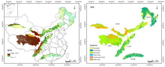
Development of suitable ecological protection and restoration policies for sustainable management needs to assess the potential impacts of future land use and climate change on ecosystem services. The two ecological shelters and three belts (TSTB) are significant for improving ecosystem services and ensuring China’s and global ecological security. In this study, we simulated land use in 2050 and estimated the spatial distribution pattern of net primary productivity (NPP), water yield, and soil conservation from 2010 to 2050 under future climate change. The results showed that water yield, NPP, and soil conservation exhibited a spatial pattern of decreasing from southeast to northwest, while in terms of the temporal pattern, water yield and NPP increased, but soil conservation decreased. Water yield was mainly influenced by precipitation, NPP was affected by temperature and implementation of ecological restoration, and soil conservation was controlled by precipitation and slope. There was a strong spatial heterogeneity between trade-offs and synergies. In terms of the temporal, with the combination of climate change and ecological restoration, there was a synergistic relationship between water yield and NPP. However, the relationships between water yield and soil conservation, and between NPP and soil conservation were characterized by trade-offs. In the process of ecological construction, it is necessary to consider the differences between overall and local trade-offs and synergies, as well as formulate sustainable ecological management policies according to local conditions. Understanding the response of ecosystem services to future climate change and land use policies can help address the challenges posed by climate change and achieve sustainable management of natural resources. Full article
Show Figures

Figure 1

25 pages, 17259 KiB  
Article
Regional Spatial Management Based on Supply–Demand Risk of Ecosystem Services—A Case Study of the Fenghe River Watershed
by Hongjuan Zhang, Juan Feng, Zhicheng Zhang, Kang Liu, Xin Gao and Zidong Wang
Int. J. Environ. Res. Public Health 2020, 17(11), 4112; https://doi.org/10.3390/ijerph17114112 - 9 Jun 2020
Cited by 19 | Viewed by 3016
Abstract
The supply–demand risk assessment of ecosystem services (ES) can identify the supply–demand risk level, which is very important for the sustainable management of regional ES. In this study, taking the Fenghe River watershed (FRW) as a case, based on the status and the [...] Read more.
The supply–demand risk assessment of ecosystem services (ES) can identify the supply–demand risk level, which is very important for the sustainable management of regional ES. In this study, taking the Fenghe River watershed (FRW) as a case, based on the status and the change trend of the supply–demand ratio of ES, and the ES supply change trend, the supply–demand risk level of food provision (FP), water yield (WY), soil retention (SR), and climate regulation (CR) are evaluated, and the risk management zones of the FRW are divided using spatial superposition. The results show that: (1) The supply and demand of SR are spatially matched, while the other three ES are spatially mismatched. (2) From 2000 to 2015, the supply amount of FP, WY, and SR increases by 11.59%, 1.25% and 55%, respectively, while the supply amount of CR decreases by 5.15%. At the same time, the demand amount of FP, WY, SR and CR increases by 39.97%, 53.88%, 36.3% and 215.5%, respectively. (3) The supply–demand ratio means of four ES in the FRW are all greater than 0, but there are some areas within that are less than 0. (4) In terms of sub-watershed scale, except for SR, there are critically endangered areas for the other three ES. Moreover, the FRW is divided into 11 supply–demand risk management zones, such as FS-WY-CR critically endangered zone, WY-CR critically endangered and FS vulnerable zone. The supply–demand risk management zones based on multiple ES can identify the risk level of each ES in each zone. These results and conclusions can provide the basis for rational allocation of resources and sustainable management of ES. Full article
Show Figures

Figure 1

11 pages, 2245 KiB  
Article
Spatial Variation Characteristics of Soil Erodibility in the Yingwugou Watershed of the Middle Dan River, China
by Xiaojun Liu, Yi Zhang and Peng Li
Int. J. Environ. Res. Public Health 2020, 17(10), 3568; https://doi.org/10.3390/ijerph17103568 - 20 May 2020
Cited by 10 | Viewed by 3075
Abstract
Knowledge of soil erodibility (k-value) is vital for measuring soil erosion and conservation planning. Through field sampling, laboratory analysis, and geostatistical analysis, the effects of land use type and soil depth on soil erodibility were studied in a typical watershed of China. The [...] Read more.
Knowledge of soil erodibility (k-value) is vital for measuring soil erosion and conservation planning. Through field sampling, laboratory analysis, and geostatistical analysis, the effects of land use type and soil depth on soil erodibility were studied in a typical watershed of China. The spatial distribution of k-value was determined by Kriging interpolation. Results showed that: (1) soil organic carbon (SOC) content in the study aera is 0.09–150.00 g/kg, and the soil is dominated by silt. The soil erodibility k-values obeyed normal distribution, with an average value of 0.032 t·hm2·h/(MJ·mm·hm2) and a medium degree variation. (2) k-values increased with soil depth. The k-values of surface soil (0–10 cm) for the six different vegetation types ranked in the following order: oak forest > peanut field > grassland > pine forest > tea field > corn field. (3) The theoretical semivariogram model of k-values was a spherical model; k-values in the study area gradually decreased from south to north and east to west, with an obvious banding distribution. Human activities have the greatest effect on k-value such that specific corresponding managements are needed. This could provide scientific and technological support for soil and water conservation measures and comprehensive utilization of the resources. Full article
Show Figures

Figure 1

20 pages, 9683 KiB  
Article
Recent Evolution of Coastal Tidal Flats and the Impacts of Intensified Human Activities in the Modern Radial Sand Ridges, East China
by Yifei Zhao, Qing Liu, Runqiu Huang, Haichen Pan and Min Xu
Int. J. Environ. Res. Public Health 2020, 17(9), 3191; https://doi.org/10.3390/ijerph17093191 - 4 May 2020
Cited by 25 | Viewed by 3897
Abstract
The coastal tidal flats of the modern Radial Sand Ridges (RSRs) are typical silt-muddy tidal flats in Central Jiangsu Province. These tidal flats play a critical role in coastline protection and biodiversity conservation, and against storm surges, but have recently been displaying drastic [...] Read more.
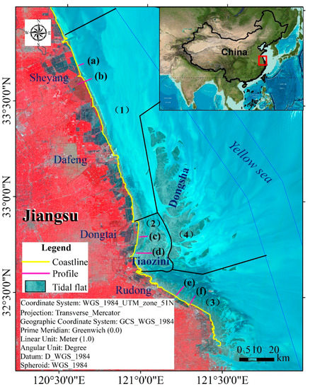
The coastal tidal flats of the modern Radial Sand Ridges (RSRs) are typical silt-muddy tidal flats in Central Jiangsu Province. These tidal flats play a critical role in coastline protection and biodiversity conservation, and against storm surges, but have recently been displaying drastic changes in geomorphic dynamics because of human activities. However, a comprehensive understanding of spatiotemporal changes in tidal flats in RSRs remains lacking. Hence, we employed a novel remote sensing method by obtaining the instantaneous high/low tide line positions from over 112 scenes of Landsat satellite images of the study area from 1975 to 2017, which were used to track the recent evolution of the coastal tidal flats in the modern RSRs over the past four decades. We found that the shoreline of the tidal flats showed an advanced seaward trend, and the waterline of the tidal flat presented a gradual process during different periods. The total tidal flat area in the study area showed an obviously decreasing trend overall, and approximately 992 km2 of the tidal flat was lost. We also found that the coastal tidal flats in the modern RSRs were generally undergoing erosion in the low tidal flats, especially in the Northern Swing and Southern Swing areas, while the high tidal flats showed a slowed accretionary change. Land reclamation was the main factor affecting the reduction in the tidal flat area, as the reclamation area has increased by 1300 km2, with an average of 35.14 km2/year. In addition, the erosion of the tidal flats was associated with a reduced sediment supply. Our findings will provide useful information for local managers and researchers to support future environmental management because increasing demand for land and rising sea levels are expected in the future. Full article
Show Figures

Figure 1

17 pages, 1943 KiB  
Article
Do Herbaceous Species Functional Groups Have a Uniform Pattern along an Elevation Gradient? The Case of a Semi-Arid Savanna Grasslands in Southern Ethiopia
by Zinabu Bora, Xinwen Xu, Ayana Angassa, Yongdong Wang and Yongcheng Zhao
Int. J. Environ. Res. Public Health 2020, 17(8), 2817; https://doi.org/10.3390/ijerph17082817 - 19 Apr 2020
Cited by 8 | Viewed by 3098
Abstract
Knowledge of the total (overall) and individual herbaceous vegetation species relating to a distinctive site might help in the development of management strategies for a large number of threatened herbaceous species. This paper assesses the total and functional group herbaceous biomass, species richness, [...] Read more.
Knowledge of the total (overall) and individual herbaceous vegetation species relating to a distinctive site might help in the development of management strategies for a large number of threatened herbaceous species. This paper assesses the total and functional group herbaceous biomass, species richness, evenness, and diversity at four elevation classes in Borana rangelands of arid thorn bush savanna grasslands in Southern Ethiopia. At each elevation class, a grid of 20 × 20 m main plot was placed, and individual herbaceous species samples were collected randomly from five 1 m2 quadrants within the main plot. Using a single-factor analysis of variance (ANOVA), the effects of four elevation classes were considered on whole-vegetation, grasses, graminoid, and forb species diversity, evenness, richness, and biomass. A total of 49 herbaceous species were recorded. Of the total identified herbaceous species, three grass species and two graminoid species were found across all studied elevation classes, but the forb species did not overlap along the studied elevation classes. The total richness, diversity, and evenness of herbaceous species were considerable and significant along elevation classes. The grass, graminoid, and forb species richness, diversity, and evenness responded differently, and the functional group of species may be a good indicator of the community processes of grassland across elevation classes. The contribution of forb richness to the total richness was more pronounced than grass and graminoid, which indicates the shift of savanna grassland to grazing tolerant herbaceous species. The results suggest that the pooled data analysis of herbaceous vegetation community structure and biomass could obscure complicate trends of the functional group at elevation classes and for managing herbaceous species in savanna grasslands, the management models should focus on the functional group species composition, community structure, and biomass. Full article
Show Figures

Figure 1

17 pages, 1940 KiB  
Article
Evolutionary Characteristics and Trade-Offs’ Development of Social–Ecological Production Landscapes in the Loess Plateau Region from a Resilience Point of View: A Case Study in Mizhi County, China
by Hang Zhang, Hai Chen, Tianwei Geng, Di Liu and Qinqin Shi
Int. J. Environ. Res. Public Health 2020, 17(4), 1308; https://doi.org/10.3390/ijerph17041308 - 18 Feb 2020
Cited by 8 | Viewed by 2641
Abstract
Social-ecological production landscape resilience (SELPR) is a significant representation of the continuous supply capacity of landscape services. It is a quantitative assessment of the spatial-temporal evolution of SELPR under internal and external disturbances that provides a scientific basis for regional ecological environments and [...] Read more.
Social-ecological production landscape resilience (SELPR) is a significant representation of the continuous supply capacity of landscape services. It is a quantitative assessment of the spatial-temporal evolution of SELPR under internal and external disturbances that provides a scientific basis for regional ecological environments and socio–economic development. Taking Mizhi County for the study of the Loess Plateau region, a three-dimensional (social system, ecosystem, and production system) SELPR evaluation framework was constructed. Data integration was performed using the watershed as the evaluation unit. This study quantitatively evaluated the spatial–temporal differentiation of the social–ecological production landscape (SELPs) subsystem’s resilience and the total SELPR in the study area and classified the areas from the three-system resilience combination level to achieve regional development trade-offs. The results were as follows: (1) In 2009–2018, the change in the social–ecological production landscapes pattern in Mizhi County showed a significant reduction in agricultural production landscapes, relatively stable social living landscapes, and an increase in ecological landscapes; (2) in 2009–2018, the SELPR increased by 12.38%. The spatial distribution of resilience was significantly different, showing a distribution pattern of high central and low surrounding areas; (3) the county’s watershed development zones were divided into five partitions: synergistic promotion areas, ecological restoration areas, social development areas, production optimization areas, and comprehensive remediation areas. The five types of zones have a certain agglomeration effect. In addition, the main obstacle factors affecting the SELPR of each zone are quite different. The key issues and development directions of different types of watersheds are also proposed in this paper. Full article
Show Figures

Figure 1

2019

Jump to: 2022, 2021, 2020

15 pages, 1481 KiB  
Article
Ecosystem Service Values Changes in Response to Land-Use/Land-Cover Dynamics in Dry Afromontane Forest in Northern Ethiopia
by Negasi Solomon, Alcade C. Segnon and Emiru Birhane
Int. J. Environ. Res. Public Health 2019, 16(23), 4653; https://doi.org/10.3390/ijerph16234653 - 22 Nov 2019
Cited by 62 | Viewed by 5192
Abstract
Despite their importance as sources of ecosystem services supporting the livelihoods of millions of people, forest ecosystems have been changing into other land use systems over the past decades across the world. While forest cover change dynamics have been widely documented in various [...] Read more.
Despite their importance as sources of ecosystem services supporting the livelihoods of millions of people, forest ecosystems have been changing into other land use systems over the past decades across the world. While forest cover change dynamics have been widely documented in various ecological systems, how these changes affect ecosystem service values has received limited attention. In this study we assessed the impact of land-use/land-cover dynamics on ecosystem service values in dry Afromontane forest in Northern Ethiopia. We estimated ecosystem service values and their changes based on the benefit transfer method using land cover data of the years 1985, 2000, and 2016 with their corresponding locally valid value coefficients and from the Ecosystem service valuation database. The total ecosystem service values of the whole study area were about USD 16.6, 19.0, and 18.1 million in 1985, 2000, and 2016, respectively. The analyses indicated an increase in ecosystem service values from 1985 to 2000 and a decrease in ecosystem service values from 2000 to 2016. Similarly, the contribution of specific ecosystem services increased in the first study period and decreased in the second study period. The findings highlight how forest cover dynamics can be translated into changes in ecosystem service values in dry Afromontane forest ecosystems in Northern Ethiopia and showed how specific ecosystem services contributed to the observed trends. The findings also illustrated the temporal heterogeneity in the impacts of land-use/land-cover dynamics on values of ecosystem services. The findings can serve as crucial inputs for policy and strategy formulations for the sustainable use and management of forest resources and can also guide the allocation of limited resources among competing demands to safeguard the ecosystems that offer the best-valued services. Full article
Show Figures

Figure 1

21 pages, 6986 KiB  
Article
Ecosystem-Based Adaptation Projects, More than just Adaptation: Analysis of Social Benefits and Costs in Colombia
by Carmen Richerzhagen, Jean Carlo Rodríguez de Francisco, Felix Weinsheimer, Alessandro Döhnert, Lukas Kleiner, Marjam Mayer, Julia Morawietz and Eric Philipp
Int. J. Environ. Res. Public Health 2019, 16(21), 4248; https://doi.org/10.3390/ijerph16214248 - 1 Nov 2019
Cited by 12 | Viewed by 6036
Abstract
Ecosystem-based Adaptation (EbA) projects are increasingly flourishing throughout the globe on the grounds that EbA constitutes a particularly community-friendly solution for adaptation to climate change as it brings about an array of co-benefits. However, the promotion of EbA projects, by development agencies and [...] Read more.
Ecosystem-based Adaptation (EbA) projects are increasingly flourishing throughout the globe on the grounds that EbA constitutes a particularly community-friendly solution for adaptation to climate change as it brings about an array of co-benefits. However, the promotion of EbA projects, by development agencies and conservation NGOs, remains blurry as it has not yet been contrasted against evidence on its effectiveness in delivering these benefits. Employing a political ecology perspective, the applied conceptual framework allows for the assessment of the social benefits and costs that EbA projects generate or reinforce and factors that influence the distribution of these social benefits or costs. This research is done in regards to two EbA projects in Colombia: one in the Andes focusing on water provision services from páramos, and the other in a coastal mangrove focusing on regulation services of extreme coastal events. Based on data collected by a qualitative multi-method approach, we find evidence that the assessed EbA projects generate a wide range of perceived social benefits and costs for the local communities living in the vicinity of the project sites. Furthermore, we identify agent-level (i.e., capitals and preferences) as well as structural factors (communication, participation, local and institutional context) that influence the generation and distribution of those social benefits and costs. Finally, this paper illustrates some of the contradictions and tensions in which EbA projects are implemented and how they may end up affecting the adaptive capacity of the communities involved in EbA projects. Full article
Show Figures

Figure 1

17 pages, 1694 KiB  
Article
Public Attitudes, Preferences and Willingness to Pay for River Ecosystem Services
by Imran Khan, Hongdou Lei, Gaffar Ali, Shahid Ali and Minjuan Zhao
Int. J. Environ. Res. Public Health 2019, 16(19), 3707; https://doi.org/10.3390/ijerph16193707 - 1 Oct 2019
Cited by 33 | Viewed by 4702
Abstract
River basins are key sources of ecosystem services, with a wide range of social and economic benefits and many effects on human well-being. However, intensified land use and other dramatic variations in river ecosystems can alter ecosystem functions and services. In this study, [...] Read more.
River basins are key sources of ecosystem services, with a wide range of social and economic benefits and many effects on human well-being. However, intensified land use and other dramatic variations in river ecosystems can alter ecosystem functions and services. In this study, we explored the public awareness, attitude and perception regarding environmental and water resource issues and assessed the willingness to pay (WTP) for improving selected attributes of the Wei River basin. Various rankings, Likert scales and random parameter logit (RPL) models were used to analyze data obtained from 900 surveyed respondents. Most respondents were more concerned about environmental and water resource management issues rather than socioeconomic attributes. From a policy perspective, 83.32% and 50.50% of the residents ranked “improvement in water quality” and “improving irrigation conditions,” respectively, as their main priorities regarding ecological restoration. Moreover, the results obtained using RPL models showed that the coefficients were significant for all ecological attributes and monetary attributes, as expected. The positive and significant coefficient for the alternative specific constant demonstrated that the respondents preferred restoration alternatives to the status quo. Furthermore, the highest WTP was found for water quality (91.99 RMB), followed by erosion intensity (23.59 RMB) and water quantity (11.79 RMB). Our results are relevant to policy development and they indicate that ecological restoration is the favored option. Full article
Show Figures

Figure 1

19 pages, 2874 KiB  
Article
Local Residents’ Perceptions for Ecosystem Services: A Case Study of Fenghe River Watershed
by Hongjuan Zhang, Qian Pang, Huan Long, Haochen Zhu, Xin Gao, Xiuqing Li, Xiaohui Jiang and Kang Liu
Int. J. Environ. Res. Public Health 2019, 16(19), 3602; https://doi.org/10.3390/ijerph16193602 - 26 Sep 2019
Cited by 15 | Viewed by 3575
Abstract
To make environmental management decisions more executive and targeted, it is essential for decision-making to include local residents’ perceptions and preferences for ecosystem services (ES) and biodiversity (BD). This study conducted a questionnaire survey with 386 local residents to explore social perceptions for [...] Read more.
To make environmental management decisions more executive and targeted, it is essential for decision-making to include local residents’ perceptions and preferences for ecosystem services (ES) and biodiversity (BD). This study conducted a questionnaire survey with 386 local residents to explore social perceptions for ES and BD in the Fenghe River watershed. ES contain food from agriculture (AGR), food from livestock (LIV), fresh water (FW), air purification (AP), water purification (WP), water retention (WR), soil retention (SR), aesthetics (AES), recreation (RE), and spirit (SP) in this study. Ranking and Likert scales are combined to identify residents’ preferences for ES and BD. The hypothetical market method is used to identify the willingness to pay for BD and ES. Independent sample T-test, one-way ANOVA, and Spearman correlation are used to analyze preference heterogeneity. The results show that: (1) residents prefer WP, AP, AGR, and FW; (2) 51.3% of respondents are willing to pay a fee for improving ES while 48.7% of respondents are unwilling to pay; (3) residents’ personal and residential factors affect preference heterogeneity. Last, we put forward three management suggestions on controlling environmental pollution, improving residents’ awareness of ES, and establishing a multi-channel fund based on government financial resources for improving ES in the Fenghe River watershed. Integrating stakeholders’ perceptions for ES into decision-making can promote the sustainable development in Fenghe River watershed. Full article
Show Figures

Figure 1

30 pages, 2313 KiB  
Article
Changes in Ecosystem Services Value and Establishment of Watershed Ecological Compensation Standards
by Xin Gao, Juqin Shen, Weijun He, Fuhua Sun, Zhaofang Zhang, Xin Zhang, Chengcai Zhang, Yang Kong, Min An, Liang Yuan and Xiaocang Xu
Int. J. Environ. Res. Public Health 2019, 16(16), 2951; https://doi.org/10.3390/ijerph16162951 - 16 Aug 2019
Cited by 53 | Viewed by 4675
Abstract
Ecological compensation standards and the allocation of compensation funds have always been the core issues of watershed ecological compensation. Due to the construction of the Eastern Route of the South-to-North Water Transfer Project (SNWTP), Jiangsu Province has paid a huge cost for the [...] Read more.
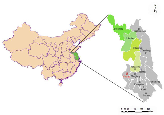
Ecological compensation standards and the allocation of compensation funds have always been the core issues of watershed ecological compensation. Due to the construction of the Eastern Route of the South-to-North Water Transfer Project (SNWTP), Jiangsu Province has paid a huge cost for the protection of water resources, and local economic development has been greatly affected. Therefore, this paper takes Jiangsu Province, the water source area of the Eastern Route of the SNWTP as an example, and combines a geographic information system (GIS) and remote sensing technology, using the ecosystem services value method to calculate the ecosystem services value of Jiangsu Province from 2005 to 2018. Then the change of this ecosystem services value in Jiangsu Province from 2015 to 2018 is taken as the basis for watershed ecological compensation standards of the Eastern Route. Through a compensation fund allocation model, watershed ecological compensation funds are allocated to four cities, Yangzhou, Huai’an, Suqian and Xuzhou, which are located along the Eastern Route of this SNWTP in Jiangsu Province. The results show that: (1) The ecosystem services value of Jiangsu Province has changed greatly. Urbanization and market environment of grain crops are the main reasons for this change; (2) the relationship between ecosystem services in Jiangsu Province is mainly synergistic; (3) Suqian receives US$24.73 million; Huai’an receives US$16.49 million; Yangzhou receives US$54.88 million and Xuzhou receives US$0.95 million in watershed ecological compensation, respectively. Watershed ecological compensation standards based upon the value of ecosystem services, and the allocation of compensation funds at the municipal level, are conducive to the improvement in efficiency of watershed ecological compensation in mainland China. Full article
Show Figures

Figure 1

22 pages, 6637 KiB  
Article
A Community EcoHealth Index from EnviroAtlas Ecosystem Services Metrics
by Ferdouz Cochran, Laura Jackson, Anne Neale, John Lovette and Liem Tran
Int. J. Environ. Res. Public Health 2019, 16(15), 2760; https://doi.org/10.3390/ijerph16152760 - 2 Aug 2019
Cited by 7 | Viewed by 3870
Abstract
Human health is inextricably tied to ecosystem services (ES), including those associated with greenspace in urban communities. EnviroAtlas provides close to 100 maps of ES metrics based on high-resolution land cover data in featured communities across the contiguous United States. Using selected EnviroAtlas [...] Read more.
Human health is inextricably tied to ecosystem services (ES), including those associated with greenspace in urban communities. EnviroAtlas provides close to 100 maps of ES metrics based on high-resolution land cover data in featured communities across the contiguous United States. Using selected EnviroAtlas ES metrics, a Community EcoHealth Index (CEHI) was created based on an ecohealth framework including health promotion and hazard buffering domains. Aggregation of eight selected ES metrics in these domains entailed a weighted distance measure, where objective, data-driven weights were generated. CEHI was calculated by Census Block Group (CBG) at both the local level and the national level for 22 EnviroAtlas communities. Results were mapped to show one- to five-star CBGs or neighborhoods within and across all 22 featured communities. At the national level, CEHI favors communities in forested ecoregions. The local version of CEHI is more appropriate to inform social, economic, and environmental decision-making for improving community ES associated with human health. Full article
Show Figures

Figure 1

16 pages, 2925 KiB  
Article
Relevance of Intermittent Rivers and Streams in Agricultural Landscape and Their Impact on Provided Ecosystem Services—A Mediterranean Case Study
by Tatiana Kaletová, Luis Loures, Rui Alexandre Castanho, Elena Aydin, José Telo da Gama, Ana Loures and Amélie Truchy
Int. J. Environ. Res. Public Health 2019, 16(15), 2693; https://doi.org/10.3390/ijerph16152693 - 28 Jul 2019
Cited by 29 | Viewed by 6639
Abstract
Ecosystem services (ES), as an interconnection of the landscape mosaic pieces, along with temporal rivers (IRES) are an object of research for environmental planners and ecological economists, among other specialists. This study presents (i) a review on the importance of IRES and the [...] Read more.
Ecosystem services (ES), as an interconnection of the landscape mosaic pieces, along with temporal rivers (IRES) are an object of research for environmental planners and ecological economists, among other specialists. This study presents (i) a review on the importance of IRES and the services they can provide to agricultural landscapes; (ii) a classification tool to assess the impact of IRES to provide ES by agricultural landscapes; (iii) the application of the proposed classification to the Caia River in order to identify the importance of this intermittent river for its surrounding agricultural landscape. The classification of the ES follows the Common International Classification of Ecosystem (CICES) classification that was adapted for the purposes of this study. Firstly, the list of ES provided by agricultural landscape was elaborated. In the next step, we assessed the potential of IRES to provide ES. Next, IRES impacts to ES within the agricultural landscape were evaluated according to observations from the conducted field monitoring in the study area. This study focuses on the relevance of the intermittent Caia River—a transboundary river in Spain and Portugal—and its ephemeral tributaries in the agricultural landscape. Our study estimates that each hydrological phase of IRES increases the ES provided by the agricultural landscape. However, the dry phase can potentially have negative impacts on several services. The intensification of the agricultural sector is the main provision of the water resource within the Caia River basin, but we were able to identify several other ES that were positively impacted. The present study is in line with the conclusions of other authors who state that IRES constitute a valuable resource which should not be underestimated by society. Full article
Show Figures

Figure 1

22 pages, 1426 KiB  
Article
Who Benefits from National Estuaries? Applying the FEGS Classification System to Identify Ecosystem Services and their Beneficiaries
by Susan Harrell Yee, Angelica Sullivan, Kathleen C. Williams and Kirsten Winters
Int. J. Environ. Res. Public Health 2019, 16(13), 2351; https://doi.org/10.3390/ijerph16132351 - 3 Jul 2019
Cited by 11 | Viewed by 3779
Abstract
In spite of their perceived value, the widespread implementation of ecosystem services assessments has been limited because of perceptions of being too technical, too expensive, or requiring special expertise. For example, federal estuary management programs have widely used ecosystem services concepts to frame [...] Read more.
In spite of their perceived value, the widespread implementation of ecosystem services assessments has been limited because of perceptions of being too technical, too expensive, or requiring special expertise. For example, federal estuary management programs have widely used ecosystem services concepts to frame management issues and communicate with stakeholders. Yet, indicators assessed, monitored, and reported in estuarine management still have traditionally focused on ecological conditions, with weak connections, if any, to social or economic outcomes. Approaches are needed which expand the range of ecosystem services that can be considered, link ecosystem services explicitly to different stakeholder groups, facilitate effective communication with economists and other social scientists, and expand the array of available valuation techniques. We applied the concept of final ecosystem goods and services to review the broad suite of ecosystem services and their beneficiaries relevant to the management of two federal programs for estuary management, the National Estuary Program (NEP) and the National Estuarine Research Reserve System (NERRS). The Final Ecosystem Goods and Services Classification System provided a structured framework for connecting ecosystem services to their beneficiaries and the environments providing them. Document analysis of management plans assessed the degree to which these programs consider ecosystem services, their beneficiaries, and habitats within the estuarine watershed. The hierarchical list of final ecosystem goods and services generated from document analysis serves as a tool for defining management goals, identifying stakeholders, developing meaningful indicators, and conducting valuation studies in estuarine management planning efforts. Though developed here for estuarine management, the keyword hierarchy and final ecosystem goods and services approach have broad applicability and transferability to other environmental management scenarios. Full article
Show Figures

Figure 1

17 pages, 2294 KiB  
Article
Quantifying the Impact of Grain for Green Program on Ecosystem Service Management: A Case Study of Exibei Region, China
by Qianru Yu, Chen-Chieh Feng, NuanYin Xu, Luo Guo and Dan Wang
Int. J. Environ. Res. Public Health 2019, 16(13), 2311; https://doi.org/10.3390/ijerph16132311 - 29 Jun 2019
Cited by 10 | Viewed by 3601
Abstract
Evaluating the impact of an ecological restoration program on ecosystem services is crucial, given the role of such a program in boosting sustainable ecosystem management. This study examines the impact of one of the large-scale ecological restoration programs in China, the Grain for [...] Read more.
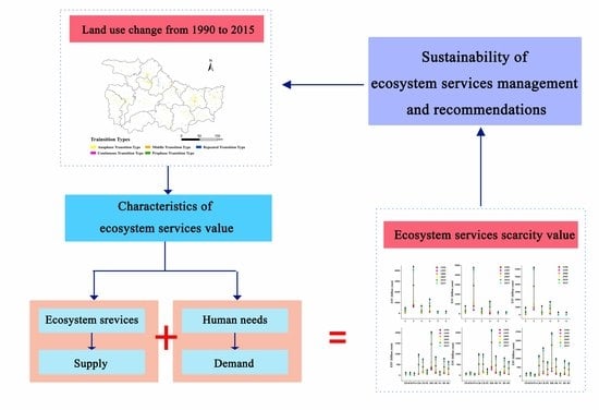
Evaluating the impact of an ecological restoration program on ecosystem services is crucial, given the role of such a program in boosting sustainable ecosystem management. This study examines the impact of one of the large-scale ecological restoration programs in China, the Grain for Green Program (GGP), on ecosystem service management in the Exibei region of China. This region is studied, as it is a key source water area with rich biodiversity and has been experiencing GGP for 20 years. To achieve the stated goal the changes of land use and ecosystem services value (ESV) and the ecosystem services scarcity value (ESSV) in the Exibei region were quantified and assessed based on remote sensing images from 1990, 1995, 2000, 2005, 2010, 2015 and field survey data. The results indicated that the expansion of construction land and the increase of water body were the dominant land use changes throughout the study period. Farmland, forestland and grassland decreased by 2.61%, 0.47% and 1.41% after the GGP, respectively. The ESV of the entire Exibei region increased slightly in response to land use change during 1990–2015, with an annual loss of 0.08% before the implementation of GGP and an annual growth of 0.03% after the implementation of GGP. Moreover, forestland was the dominant contributor to ESSV after the implementation of the GGP. Its annual growth rate was four times higher than before the commencement of GGP. The results of this study contribute to the protection of the Exibei region ecosystem, and more importantly, the future management of the ecosystem service in the hilly regions of southern China. Full article
Show Figures

Graphical abstract

20 pages, 3007 KiB  
Article
Multi-Indicator Approach for Characterising Urban Green Space Provision at City and City-District Level in Germany
by Karsten Grunewald, Benjamin Richter and Martin Behnisch
Int. J. Environ. Res. Public Health 2019, 16(13), 2300; https://doi.org/10.3390/ijerph16132300 - 28 Jun 2019
Cited by 16 | Viewed by 6019
Abstract
This paper addresses the question of how a sustainable urban development can be supported through simple measured quantities in the context of the specific provision of green space and open space. The specific provision of green space is analysed based on a combination [...] Read more.
This paper addresses the question of how a sustainable urban development can be supported through simple measured quantities in the context of the specific provision of green space and open space. The specific provision of green space is analysed based on a combination of six indicators that describe, on the one hand, the access of inhabitants to green spaces and on the other hand, the settlement character as well as the strong anthropogenic imprint on the urban landscape. The indicators were calculated and combined in a 9-cell matrix for classifying the areas studied. The implementation was carried out at two scales for all German cities with at least 50,000 inhabitants as well as exemplarily for city districts of eight big cities. The calculated indicator values for representing green characteristics decrease with increasing number of inhabitants, whereas the opposite relationship was obtained for the indicators of the grey characteristics. We show how the approach provides an in-depth morphological assessment of German cities ranking their scores from low to the high presence of grey/green characteristics. Full article
Show Figures

Figure 1

13 pages, 2092 KiB  
Article
The Influence of Land Use Change on Ecosystem Service Value in Shangzhou District
by Keyue Yuan, Fei Li, Haijuan Yang and Yiming Wang
Int. J. Environ. Res. Public Health 2019, 16(8), 1321; https://doi.org/10.3390/ijerph16081321 - 12 Apr 2019
Cited by 50 | Viewed by 4257
Abstract
Land use change has an impact on the ecosystem service value because it changes the structure and function of ecosystems. This paper analyzed the changes in land use during the period from 2000 to 2015 in Shangzhou district, and used the equivalent value [...] Read more.
Land use change has an impact on the ecosystem service value because it changes the structure and function of ecosystems. This paper analyzed the changes in land use during the period from 2000 to 2015 in Shangzhou district, and used the equivalent value of ecological services per unit area of land ecosystem combining the natural and economic conditions of Shangzhou district. Based on this method, the ecological service value of Shangzhou district was estimated, and the impact of land use change on the ecological service value was analyzed. The results showed that: (1) the main types of land use in Shangzhou district were grassland, woodland and farmland, among which the contribution rate of woodland to the value of local ecosystem services was the highest; (2) the overall trend in the ecosystem service value in Shangzhou district increased between 2000 and 2015, from 10.74 × 10⁸ yuan in 2000 to 20.32 × 10⁸ yuan in 2015, which is the result of the combined effects of regional economic development and changes in the natural environment and land use patterns; and (3) the main reason for the value increase of ecosystem services in Shangzhou district between 2000 and 2015 was that the grain-for-green policy transformed a considerable amount of farmland into woodland, while the main reasons for a decline in value was the expansion of built-up land that occupied other types of land. Full article
Show Figures

Figure 1

34 pages, 11318 KiB  
Article
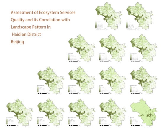
Assessment of Ecosystem Service Quality and Its Correlation with Landscape Patterns in Haidian District, Beijing
by Boya Wang, Zhicheng Liu, Yuting Mei and Wenjie Li
Int. J. Environ. Res. Public Health 2019, 16(7), 1248; https://doi.org/10.3390/ijerph16071248 - 8 Apr 2019
Cited by 19 | Viewed by 4521
Abstract
Landscape architecture with urban green space as the main research object is an evidence-based science. It is an important issue to optimize green space systems from the point of view of ecosystem services. In this paper, high-resolution (1.5 m resolution) remote sensing images [...] Read more.
Landscape architecture with urban green space as the main research object is an evidence-based science. It is an important issue to optimize green space systems from the point of view of ecosystem services. In this paper, high-resolution (1.5 m resolution) remote sensing images are combined with data-processing software, such as ENVI, ArcGIS, and Fragstats, to evaluate ecosystem service quality and compute the landscape pattern in the Haidian District (Beijing, China), so that the relationship between the ecosystem service quality and landscape pattern can be quantitatively studied and a strategy can be provided for green space optimization in cities. The following conclusions are drawn: (1) for the evaluated quality of 14 ecosystem services in Haidian District (refer to Section Analysis of the Association of the Percentage of Patches (PLAND) Index of Forest Land and Quality of Ecosystem Service in Haidian District). Forest land is the main provider of the ecosystem service in Haidian District, while construction land only provides cultural services; (2) on the whole, the spatial distribution of the ecosystem services in Haidian District gradually decreases from the west to the east, which basically matches with the spatial distribution of the forest land. The regulating service and supporting service are matched with the distribution of the urban green space. The cultural service is closely associated with history resource points; and (3) the analysis results of the association between landscape pattern and ecosystem service quality show that the percentage of patches (PLAND) index for forest land has a significant logarithmic relationship with the regulating service and supporting service. The critical value of the PLAND index is 30. Besides the Xishan area with the most coverage of forest land, the landscape shape index (LSI) of the brushwood has a logarithmic relationship with the ecosystem service quality. The critical value of the LSI value is 50. Finally, this paper proposes an area optimization strategy of green space in Haidian District from the view of the ecosystem system service. The Xishan area is classified into the ecosystem red line to control city expansion. The regulating and supporting services can be enhanced in the north flat area by improving the patch shape index. The ecosystem service capabilities can be improved by adding the forest land in the existing green space for the southeast urban areas. Full article
Show Figures

Graphical abstract

18 pages, 4176 KiB  
Article
Do Protected Areas Contribute to Health and Well-Being? A Cross-Cultural Comparison
by Alexandra Jiricka-Pürrer, Valeria Tadini, Boris Salak, Karolina Taczanowska, Andrzej Tucki and Giulio Senes
Int. J. Environ. Res. Public Health 2019, 16(7), 1172; https://doi.org/10.3390/ijerph16071172 - 1 Apr 2019
Cited by 26 | Viewed by 4264
Abstract
Due to their valuable landscape and natural characteristics, protected areas (PAs) distinguish themselves from other green spaces. Studies that survey individuals on the perceived capacity of PAs to provide health benefits are very limited. However, the importance of PAs for societal health could [...] Read more.
Due to their valuable landscape and natural characteristics, protected areas (PAs) distinguish themselves from other green spaces. Studies that survey individuals on the perceived capacity of PAs to provide health benefits are very limited. However, the importance of PAs for societal health could emphasize the necessity to preserve them. In addition, studies of cross-country comparisons of nature-based activities show strong cultural differences with regard to the importance of wild nature and landscape preferences. Cross-country comparisons of the perception of PAs as a resource for personal well-being and health are lacking. An extensive survey with face-to-face questionnaires was conducted in PAs in Poland, Austria, and Italy with an overall sample size of 1390 people. It examined both emotional and physical personal well-being in the context of a stay in a PA. In general, the results showed that between the three countries, different perceptions of the capacity of PAs to contribute to personal health and well-being exist. Both diverse emotional and physical benefits were associated with a stay in a PA. Moreover, respondents from the three countries assessed the perceived capacity of a PA to reduce negative physical symptoms, such as muscular pain or tension, and negative emotional symptoms, such as depression or stress. Full article
Show Figures

Figure 1

13 pages, 1768 KiB  
Article
Harvested Wood Products as a Carbon Sink in China, 1900–2016
by Luyang Zhang, Yankun Sun, Tianyuan Song and Jiaqi Xu
Int. J. Environ. Res. Public Health 2019, 16(3), 445; https://doi.org/10.3390/ijerph16030445 - 2 Feb 2019
Cited by 18 | Viewed by 4603
Abstract
The use of harvested wood products (HWPs) influences the carbon flux. China is both the major producer and trader of HWP, so estimating the carbon stock change of China’s HWP is important to help curb climate change. Accurate reporting and accounting of carbon [...] Read more.
The use of harvested wood products (HWPs) influences the carbon flux. China is both the major producer and trader of HWP, so estimating the carbon stock change of China’s HWP is important to help curb climate change. Accurate reporting and accounting of carbon flows in the HWP pool is needed to meet greenhouse gas monitoring and climate change mitigation objectives under the United Nations Framework Convention on Climate Change (UNFCCC) and the Paris Agreement. This study applied production approach (PA) to estimate the carbon stock change of China’s HWP from 1900 to 2016. During the estimating period, the carbon stock of HWP in use and deposed at solid waste disposal sites (SWDS) were 649.2 Teragrams Carbon (TgC) (346.8 TgC in wood-based panels, 216.7 TgC in sawnwood and 85.7 TgC in paper & paperboard) and 72.6 TgC, respectively. The carbon amount of annual domestic harvest HWP varied between 87.6 and 118.7 TgC. However, the imported carbon inflow increased significantly after the 1990s and reached 47.6 TgC in 2016, accounting for 46% of the domestic harvest of that year. China has great mitigation potential from HWP and use of this resource should be considered in future strategies to address climate change. Full article
Show Figures

Figure 1

24 pages, 11646 KiB  
Article
Urban Growth-Oriented Green Accumulation: Ecological Conservation Planning in the Shenzhen DaPeng Peninsula in Southern China
by Dan Lin
Int. J. Environ. Res. Public Health 2019, 16(1), 104; https://doi.org/10.3390/ijerph16010104 - 2 Jan 2019
Cited by 5 | Viewed by 4924
Abstract
Neoliberal conservation has recently become a topic of academic research and a method of practice within the context of globalization. Less attention has been given to how neoliberal conservation has been practiced at the urban scale. This paper draws on the concept of [...] Read more.
Neoliberal conservation has recently become a topic of academic research and a method of practice within the context of globalization. Less attention has been given to how neoliberal conservation has been practiced at the urban scale. This paper draws on the concept of ‘urban-growth-oriented green grabbing’ to capture the multidimensionality of the reasoning and process of ecological conservation in an urban growth context. It focuses on two ecological spatial protection plans for the DaPeng Peninsula in the city of Shenzhen, China. Through empirical investigation, this article traces the political economy of these plans and draws out the insights they offer regarding theories of urban environmentalism. The empirical results show that the ecological conservation plans are best understood as ‘green grabbing’ that has been achieved by land transfer and spatial interest redistribution. Conceptually, the paper provides further evidence of the process of neoliberal conservation within the urban context. Full article
Show Figures

Figure 1

Back to TopTop