Next Issue
Volume 8, March
Previous Issue
Volume 8, January


Land, Volume 8, Issue 2 (February 2019) – 17 articles

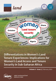
Cover Story (view full-size image): There are circumstances that influence how women benefit from land resources. This study argues that assuming that women are a homogeneous group fails to address women’s land tenure problems. It highlights an important issue in land tenure—the place of women in society and literature on land tenure issues—throughout the African continent. It uses evidence from Ghana, Nigeria, and Zimbabwe to produce a matrix of women’s differentiated problems, needs, and statuses regarding land tenure security. It recommends an adaptable approach for operationalising women’s differentiation in land tenure. View this paper.
  • Issues are regarded as officially published after their release is announced to the table of contents alert mailing list.
  • You may sign up for e-mail alerts to receive table of contents of newly released issues.
  • PDF is the official format for papers published in both, html and pdf forms. To view the papers in pdf format, click on the "PDF Full-text" link, and use the free Adobe Reader to open them.
Order results
Result details
Section
Select all
Export citation of selected articles as:
11 pages, 1343 KiB  
Article
Making It Spatial Makes It Personal: Engaging Stakeholders with Geospatial Participatory Modeling
by Jelena Vukomanovic, Megan M. Skrip and Ross K. Meentemeyer
Land 2019, 8(2), 38; https://doi.org/10.3390/land8020038 - 22 Feb 2019
Cited by 25 | Viewed by 4899
Abstract
Participatory research methods are increasingly used to collectively understand complex social-environmental problems and to design solutions through diverse and inclusive stakeholder engagement. But participatory research rarely engages stakeholders to co-develop and co-interpret models that conceptualize and quantify system dynamics for comparing scenarios of [...] Read more.
Participatory research methods are increasingly used to collectively understand complex social-environmental problems and to design solutions through diverse and inclusive stakeholder engagement. But participatory research rarely engages stakeholders to co-develop and co-interpret models that conceptualize and quantify system dynamics for comparing scenarios of alternate action. Even fewer participatory projects have engaged people using geospatial simulations of dynamic landscape processes and spatially explicit planning scenarios. We contend that geospatial participatory modeling (GPM) can confer multiple benefits over non-spatial approaches for participatory research processes, by (a) personalizing connections to problems and their solutions through visualizations of place, (b) resolving abstract notions of landscape connectivity, and (c) clarifying the spatial scales of drivers, data, and decision-making authority. We illustrate through a case study how GPM is bringing stakeholders together to balance population growth and conservation in a coastal region facing dramatic landscape change due to urbanization and sea level rise. We find that an adaptive, iterative process of model development, sharing, and revision drive innovation of methods and ultimately improve the realism of land change models. This co-production of knowledge enables all participants to fully understand problems, evaluate the acceptability of trade-offs, and build buy-in for management actions in the places where they live and work. Full article
Show Figures

Figure 1

19 pages, 1672 KiB  
Article
Who Controls the City in the Global Urban Era? Mapping the Dimensions of Urban Geopolitics in Beira City, Mozambique
by Murtah Shannon
Land 2019, 8(2), 37; https://doi.org/10.3390/land8020037 - 21 Feb 2019
Cited by 10 | Viewed by 5481
Abstract
In recent years, a new era of interventionism has emerged targeting the development of African cities, manifested in ‘fantasy’ urban plans, surging infrastructure investments and global policy agendas. What the implications of this new era will be for specific urban contexts is still [...] Read more.
In recent years, a new era of interventionism has emerged targeting the development of African cities, manifested in ‘fantasy’ urban plans, surging infrastructure investments and global policy agendas. What the implications of this new era will be for specific urban contexts is still poorly understood however. Taking this research agenda as a starting point, this article presents findings of in-depth empirical research on urban development in Beira city, Mozambique, which has recently become the recipient of massive donor investments targeting the built environment. Informed by current debates on urban geopolitics, the article unpacks these mounting global flows while locating them alongside pre-existing struggles over urban space. By doing so three distinct yet inter-related dimensions of urban geopolitics are identified, relating to the workings of the state, so-called ‘informality’ and international donors. Far from representing homogeneous categories, these dimensions each represent contradictory practices and interests which are shaping Beira’s urban trajectory. The article concludes by arguing that the inflow of donor resources has exacerbated pre-existing struggles over urban space while contributing to new contentions in ways which have undermined social equity targets of contemporary global development agendas. In doing so it provides important contributions to current debates on urban development in Africa Full article
Show Figures

Figure 1

21 pages, 303 KiB  
Editorial
Central Place Theory Reloaded and Revised: Political Economy and Landscape Dynamics in the Longue Durée
by Athanasios K. Vionis and Giorgos Papantoniou
Land 2019, 8(2), 36; https://doi.org/10.3390/land8020036 - 21 Feb 2019
Cited by 25 | Viewed by 8504
Abstract
The aim of this contribution is to introduce the topic of this volume and briefly measure the evolution and applicability of central place theory in previous and contemporary archaeological practice and thought [...] Full article
8 pages, 596 KiB  
Perspective
Globalization and Biodiversity Conservation Problems: Polycentric REDD+ Solutions
by Mwangi Githiru and Josephine W. Njambuya
Land 2019, 8(2), 35; https://doi.org/10.3390/land8020035 - 19 Feb 2019
Cited by 13 | Viewed by 7843
Abstract
Protected areas are considered the cornerstone of biodiversity conservation, but face multiple problems in delivering this core objective. The growing trend of framing biodiversity and protected area values in terms of ecosystem services and human well-being may not always lead to biodiversity conservation. [...] Read more.
Protected areas are considered the cornerstone of biodiversity conservation, but face multiple problems in delivering this core objective. The growing trend of framing biodiversity and protected area values in terms of ecosystem services and human well-being may not always lead to biodiversity conservation. Although globalization is often spoken about in terms of its adverse effects to the environment and biodiversity, it also heralds unprecedented and previously inaccessible opportunities linked to ecosystem services. Biodiversity and related ecosystem services are amongst the common goods hardest hit by globalization. Yet, interconnectedness between people, institutions, and governments offers a great chance for globalization to play a role in ameliorating some of the negative impacts. Employing a polycentric governance approach to overcome the free-rider problem of unsustainable use of common goods, we argue here that REDD+, the United Nations Framework Convention on Climate Change (UNFCCC) climate change mitigation scheme, could be harnessed to boost biodiversity conservation in the face of increasing globalization, both within classic and novel protected areas. We believe this offers a timely example of how an increasingly globalized world connects hitherto isolated peoples, with the ability to channel feelings and forces for biodiversity conservation. Through the global voluntary carbon market, REDD+ can enable and empower, on the one hand, rural communities in developing countries contribute to mitigation of a global problem, and on the other, individuals or societies in the West to help save species they may never see, yet feel emotionally connected to. Full article
(This article belongs to the Special Issue Biodiversity and Protected Areas)
Show Figures

Figure 1

14 pages, 10396 KiB  
Article
One City for All? The Characteristics of Residential Displacement in Southwest Washington, DC
by Flora Lindsay-Herrera
Land 2019, 8(2), 34; https://doi.org/10.3390/land8020034 - 14 Feb 2019
Cited by 1 | Viewed by 5752
Abstract
This paper examines two periods of renewal in Washington, DC, USA’s southwest quadrant and their relationship with displacement. The paper situates this discussion within both the local historical continuum and globally-recognized paradigms, such as “the right to the city”. This article primarily serves [...] Read more.
This paper examines two periods of renewal in Washington, DC, USA’s southwest quadrant and their relationship with displacement. The paper situates this discussion within both the local historical continuum and globally-recognized paradigms, such as “the right to the city”. This article primarily serves as an overview of urban planning consequences in Southwest Washington DC based on extant academic literature and policy briefs. Compared with the abrupt physical displacement in the 1950s and 1960s precipitated by a large-scale federally funded urban raze and rebuild project, urban planning in present-day DC includes mechanisms for public engagement and provisions for housing security. However, countervailing economic incentives and rapid demographic changes have introduced anxieties about involuntary mobility that the literature suggests may be born out of forced or responsive displacement. Two potential case studies in the area warrant future study to understand present-day mobilities in the context of the economic and socio-cultural factors shaping the actions of present and prospective residents and decision-makers. Full article
Show Figures

Figure 1

25 pages, 3235 KiB  
Article
Monitoring Effects of Land Cover Change on Biophysical Drivers in Rangelands Using Albedo
by Zahn Münch, Lesley Gibson and Anthony Palmer
Land 2019, 8(2), 33; https://doi.org/10.3390/land8020033 - 9 Feb 2019
Cited by 23 | Viewed by 4626
Abstract
This paper explores the relationship between land cover change and albedo, recognized as a regulating ecosystems service. Trends and relationships between land cover change and surface albedo were quantified to characterise catchment water and carbon fluxes, through respectively evapotranspiration (ET) and net primary [...] Read more.
This paper explores the relationship between land cover change and albedo, recognized as a regulating ecosystems service. Trends and relationships between land cover change and surface albedo were quantified to characterise catchment water and carbon fluxes, through respectively evapotranspiration (ET) and net primary production (NPP). Moderate resolution imaging spectroradiometer (MODIS) and Landsat satellite data were used to describe trends at catchment and land cover change trajectory level. Peak season albedo was computed to reduce seasonal effects. Different trends were found depending on catchment land management practices, and satellite data used. Although not statistically significant, albedo, NPP, ET and normalised difference vegetation index (NDVI) were all correlated with rainfall. In both catchments, NPP, ET and NDVI showed a weak negative trend, while albedo showed a weak positive trend. Modelled land cover change was used to calculate future carbon storage and water use, with a decrease in catchment carbon storage and water use computed. Grassland, a dominant dormant land cover class, was targeted for land cover change by woody encroachment and afforestation, causing a decrease in albedo, while urbanisation and cultivation caused an increase in albedo. Land cover map error of fragmented transition classes and the mixed pixel effect, affected results, suggesting use of higher-resolution imagery for NPP and ET and albedo as a proxy for land cover. Full article
Show Figures

Figure 1

19 pages, 3768 KiB  
Article
Net Global Warming Potential of Spring Wheat Cropping Systems in a Semiarid Region
by Mark A. Liebig, David W. Archer, Jonathan J. Halvorson, Holly A. Johnson, Nicanor Z. Saliendra, Jason R. Gross and Donald L. Tanaka
Land 2019, 8(2), 32; https://doi.org/10.3390/land8020032 - 8 Feb 2019
Cited by 7 | Viewed by 4087
Abstract
Investigations of global warming potential (GWP) of semiarid cropping systems are needed to ascertain agriculture’s contributions to climate regulation services. This study sought to determine net GWP for three semiarid cropping systems under no-tillage management in the northern Great Plains of North America: [...] Read more.
Investigations of global warming potential (GWP) of semiarid cropping systems are needed to ascertain agriculture’s contributions to climate regulation services. This study sought to determine net GWP for three semiarid cropping systems under no-tillage management in the northern Great Plains of North America: spring wheat (Triticum aestivum L.)—fallow (SW-F), continuous spring wheat (CSW) and spring wheat—safflower (Carthamus tinctorius L.)—rye (Secale cereale L.) (SW-S-R). Management records, coupled with published carbon dioxide (CO2) emission estimates, were used to determine emissions from production inputs and field operations. Static chamber methodology was used to measure soil-atmosphere methane (CH4) and nitrous oxide (N2O) fluxes over a 3-year period and changes in profile soil organic carbon (SOC) stocks were determined over 18 years. Carbon dioxide emissions associated with production inputs and field operations were greatest for CSW, intermediate for SW-S-R and lowest for SW-F. All cropping systems were minor CH4 sinks (≤0.5 kg CH4-C ha−1 yr−1) and moderate N2O sources (1.0 to 2.8 kg N2O-N ha−1 yr−1). No differences in SOC stocks were observed among cropping systems (P = 0.78), nor did SOC stocks change significantly from baseline conditions (P = 0.82). Summing across factors, net GWP was positive for SW-F and CSW, implying net greenhouse gas (GHG) emission to the atmosphere, while net GWP for SW-S-R was negative, implying net GHG uptake. Net GWP, however, did not differ among cropping systems (P = 0.17). Management practices that concurrently improve N use efficiency and increase SOC stocks are needed for semiarid cropping systems to be net GHG sinks. Full article
Show Figures

Figure 1

15 pages, 607 KiB  
Article
Land Governance in Post-Conflict Settings: Interrogating Decision-Making by International Actors
by David Betge
Land 2019, 8(2), 31; https://doi.org/10.3390/land8020031 - 7 Feb 2019
Cited by 9 | Viewed by 5426
Abstract
Humanitarian and development organizations working in conflict-affected settings have a particular responsibility to do no harm and contribute to the wellbeing of the population without bias. The highly complex, politicized realities of work in conflict- and post-conflict settings often require quick, pragmatic and [...] Read more.
Humanitarian and development organizations working in conflict-affected settings have a particular responsibility to do no harm and contribute to the wellbeing of the population without bias. The highly complex, politicized realities of work in conflict- and post-conflict settings often require quick, pragmatic and results-oriented decisions, the foundations of which remain frequently implicit. Such decisions might follow an intrinsic logic or situational pragmatism rather than intensive deliberation. This paper reflects on the realities of working on land governance in post-conflict settings shaped by migration, ethnic division, power struggles and limited statehood. Using case examples from the Democratic Republic of Congo (DRC) and Burundi, this paper reflects on the drivers of decisions around land governance in such contexts in a structured, theoretically informed way. Drawing on the author’s own experience with supporting land rights work and utilizing Giddens’ concept of the Duality of Structure, this article provides an analysis of actors and structures that sheds light on the factors that affect the decision-making of practitioners relating to land rights in post-conflict areas of limited statehood. Full article
Show Figures

Figure 1

19 pages, 5700 KiB  
Article
Analysis of High Temporal Resolution Land Use/Land Cover Trajectories
by Jean-François Mas, Rodrigo Nogueira de Vasconcelos and Washington Franca-Rocha
Land 2019, 8(2), 30; https://doi.org/10.3390/land8020030 - 6 Feb 2019
Cited by 21 | Viewed by 6343
Abstract
In this study, methods, originally developed to assess life course trajectories, are explored in order to evaluate land change through the analysis of sequences of land use/cover. Annual land cover maps which describe land use/land cover change for the 1985–2017 period for a [...] Read more.
In this study, methods, originally developed to assess life course trajectories, are explored in order to evaluate land change through the analysis of sequences of land use/cover. Annual land cover maps which describe land use/land cover change for the 1985–2017 period for a large region in Northeast Brazil were analyzed. The most frequent sequences, the entropy and the turbulence of the land trajectories, and the average time of permanence were computed. Clusters of similar sequences were determined using different dissimilarity measures. The effect of some covariates such as slope and distance from roads on land trajectories was also evaluated. The obtained results show the potential of these techniques to analyze land cover sequences since the availability of multidate land cover data with both, high temporal and thematic resolutions, is continuously increasing and poses significant challenges to data analysis. Full article
Show Figures

Graphical abstract

23 pages, 1234 KiB  
Article
What Awaits Myanmar’s Uplands Farmers? Lessons Learned from Mainland Southeast Asia
by Martin Rudbeck Jepsen, Matilda Palm and Thilde Bech Bruun
Land 2019, 8(2), 29; https://doi.org/10.3390/land8020029 - 2 Feb 2019
Cited by 18 | Viewed by 8121
Abstract
Mainland Southeast Asia (MSA) has seen sweeping upland land use changes in the past decades, with transition from primarily subsistence shifting cultivation to annual commodity cropping. This transition holds implications for local upland communities and ecosystems. Due to its particular political regime, Myanmar [...] Read more.
Mainland Southeast Asia (MSA) has seen sweeping upland land use changes in the past decades, with transition from primarily subsistence shifting cultivation to annual commodity cropping. This transition holds implications for local upland communities and ecosystems. Due to its particular political regime, Myanmar is at the tail of this development. However, with Myanmar’s official strategy of agricultural commercialization and intensification, recent liberalization of the national economy, and influx of multinational agricultural companies, the effects on upland land transitions could come fast. We analyze the current state of upland land use in Myanmar in a socio-economic and political context, identify the dynamics in three indicator commodity crops (maize, cassava, and rubber), and discuss the state driven economic, tenurial and policy reforms that have occurred in upland areas of mainland Southeast Asian countries in past decades. We draw on these insights to contextualize our study and hypothesize about possible transition pathways for Myanmar. The transition to annual commodity cropping is generally driven by a range of socio-economic and technical factors. We find that land use dynamics for the three indicator crops are associated with market demand and thus the opening of national Southeast-Asian economies, research and development of locally suitable high yielding varieties (HYVs), and subsidies for the promotion of seeds and inputs. In contrast, promotion of HYVs in marginal areas and without adequate agricultural extension services may results in agricultural contraction and yield dis-intensification. The environmental impacts of the transition depend on the transition pathway, e.g., through large-scale plantation projects or smallholder initiatives. The agricultural development in upland MSA follows a clear diffusion pattern with transition occurring first in Thailand, spreading to Vietnam, Cambodia and Laos. While these countries point to prospects for Myanmar, we hypothesize that changes will come slow due to Myanmar’s sparse rural infrastructure, with uncertainty about tenure, in particular in areas still troubled by armed conflicts, and unwillingness of international investors to approach Myanmar given the recent setbacks to the democratization process. Full article
(This article belongs to the Special Issue Land Cover/Land-Use Changes in South and Southeast Asia)
Show Figures

Figure 1

19 pages, 5625 KiB  
Article
Predicting Land Use Changes in Philadelphia Following Green Infrastructure Policies
by Charlotte Shade and Peleg Kremer
Land 2019, 8(2), 28; https://doi.org/10.3390/land8020028 - 1 Feb 2019
Cited by 51 | Viewed by 10102
Abstract
Urbanization is a rapid global trend, leading to consequences such as urban heat islands and local flooding. Imminent climate change is predicted to intensify these consequences, forcing cities to rethink common infrastructure practices. One popular method of adaptation is green infrastructure implementation, which [...] Read more.
Urbanization is a rapid global trend, leading to consequences such as urban heat islands and local flooding. Imminent climate change is predicted to intensify these consequences, forcing cities to rethink common infrastructure practices. One popular method of adaptation is green infrastructure implementation, which has been found to reduce local temperatures and alleviate excess runoff when installed effectively. As cities continue to change and adapt, land use/landcover modeling becomes an important tool for city officials in planning future land usage. This study uses a combination of cellular automata, machine learning, and Markov chain analysis to predict high resolution land use/landcover changes in Philadelphia, PA, USA for the year 2036. The 2036 landcover model assumes full implementation of Philadelphia’s green infrastructure program and past temporal trends of urbanization. The methodology used to create the 2036 model was validated by creating an intermediate prediction of a 2015 landcover that was then compared to an existing 2015 landcover. The accuracy of the validation was determined using Kappa statistics and disagreement scores. The 2036 model successfully met Philadelphia’s green infrastructure goals. A variety of landscape metrics demonstrated an overall decrease in fragmentation throughout the landscape due to increases in urban landcover. Full article
Show Figures

Figure 1

26 pages, 1421 KiB  
Article
Combating Land Degradation and Desertification: The Land-Use Planning Quandary
by Helen Briassoulis
Land 2019, 8(2), 27; https://doi.org/10.3390/land8020027 - 1 Feb 2019
Cited by 88 | Viewed by 15342
Abstract
Land-use planning (LUP), an instrument of land governance, is often employed to protect land and humans against natural and human-induced hazards, strengthen the resilience of land systems, and secure their sustainability. The United Nations Convention to Combat Desertification (UNCCD) underlines the critical role [...] Read more.
Land-use planning (LUP), an instrument of land governance, is often employed to protect land and humans against natural and human-induced hazards, strengthen the resilience of land systems, and secure their sustainability. The United Nations Convention to Combat Desertification (UNCCD) underlines the critical role of appropriate local action to address the global threat of land degradation and desertification (LDD) and calls for the use of local and regional LUP to combat LDD and achieve land degradation neutrality. The paper explores the challenges of putting this call into practice. After presenting desertification and the pertinent institutional context, the paper examines whether and how LDD concerns enter the stages of the LUP process and the issues arising at each stage. LDD problem complexity, the prevailing mode of governance, and the planning style endorsed, combined with LDD awareness, knowledge and perception, value priorities, geographic particularities and historical circumstances, underlie the main challenges confronting LUP; namely, adequate representation of LDD at each stage of LUP, conflict resolution between LDD-related and development goals, need for cooperation, collaboration and coordination of numerous and diverse actors, sectors, institutions and policy domains from multiple spatial/organizational levels and uncertainty regarding present and future environmental and socio-economic change. In order to realize the integrative potential of LUP and foster its effectiveness in combating LDD at the local and regional levels, the provision of an enabling, higher-level institutional environment should be prioritized to support phrοnetic-strategic integrated LUP at lower levels, which future research should explore theoretically, methodologically and empirically. Full article
(This article belongs to the Special Issue Land Use Planning for Natural Hazards)
Show Figures

Figure 1

17 pages, 1299 KiB  
Article
Deforestation and Forest Degradation as an Environmental Behavior: Unpacking Realities Shaping Community Actions
by Lalisa A. Duguma, Joanes Atela, Peter A. Minang, Alemayehu N. Ayana, Belachew Gizachew, Judith M. Nzyoka and Florence Bernard
Land 2019, 8(2), 26; https://doi.org/10.3390/land8020026 - 29 Jan 2019
Cited by 64 | Viewed by 18130
Abstract
Deforestation and forest degradation (D&D) in the tropics have continued unabated and are posing serious threats to forests and the livelihoods of those who depend on forests and forest resources. Smallholder farmers are often implicated in scientific literature and policy documents as important [...] Read more.
Deforestation and forest degradation (D&D) in the tropics have continued unabated and are posing serious threats to forests and the livelihoods of those who depend on forests and forest resources. Smallholder farmers are often implicated in scientific literature and policy documents as important agents of D&D. However, there is scanty information on why smallholders exploit forests and what the key drivers are. We employed behavioral sciences approaches that capture contextual factors, attitudinal factors, and routine practices that shape decisions by smallholder farmers. Data was collected using household surveys and focus group discussions in two case study forests—Menagesha Suba Forest in Ethiopia and Maasai Mau Forest in Kenya. Our findings indicate that factors that forced farmers to engage in D&D were largely contextual, i.e., sociodemographic, production factors constraint, as well as policies and governance issues with some influences of routine practices such as wood extraction for fuelwood and construction. Those factors can be broadly aggregated as necessity-driven, market-driven, and governance-driven. In the forests studied, D&D are largely due to necessity needs and governance challenges. Though most factors are intrinsic to smallholders’ context, the extent and impact on D&D were largely aggravated by factors outside the forest landscape. Therefore, policy efforts to reduce D&D should carefully scrutinize the context, the factors, and the associated enablers to reduce forest losses under varying socioeconomic, biophysical, and resource governance conditions. Full article
Show Figures

Figure 1

19 pages, 3540 KiB  
Article
A Citizen-Contributed GIS Approach for Evaluating the Impacts of Land Use on Hurricane-Harvey-Induced Flooding in Houston Area
by Di Yang, Anni Yang, Han Qiu, Yao Zhou, Hannah Herrero, Chiung-Shiuan Fu, Qiang Yu and Jingyin Tang
Land 2019, 8(2), 25; https://doi.org/10.3390/land8020025 - 28 Jan 2019
Cited by 13 | Viewed by 7945
Abstract
Hurricane Harvey (2017) caused widespread flash flooding by extremely heavy rainfall and resulted in tremendous damage, including 82 fatalities and huge economic loss in the Houston, Texas area. To reduce hazards, loss, and to improve urban resilience, it is important to understand the [...] Read more.
Hurricane Harvey (2017) caused widespread flash flooding by extremely heavy rainfall and resulted in tremendous damage, including 82 fatalities and huge economic loss in the Houston, Texas area. To reduce hazards, loss, and to improve urban resilience, it is important to understand the factors that influence the occurrence of flooding events. People rely on natural resources and different land uses to reduce the severity of flood impacts and mitigate the risk. In this study, we focused the impacts of land use on Hurricane-Harvey-induced flooding inside and outside the Houston city center. With the recent trend that more citizen scientists serve in delivering information about natural disaster response, local residents in Houston areas participated in delineating the flooded areas in Hurricane Harvey. The flooding information used here generated a published map with citizen-contributed flooding data. A regional model framework with spatial autocovariates was employed to understand those interactions. Different land use patterns and types affected the potential of flooding events differently inside and outside Houston’s city center. Explicitly, we found agricultural and open space were associated with high risk of flooding outside the city center, industrial lands increased the high risk of flooding in city center, and residential areas reduced the potential of flooding both inside and outside the city center. The results can assist with future land use strategy in Houston and other areas, and mitigate potential flash flooding. This study also highlighted the contribution of citizen science to responses to natural hazards. Full article
Show Figures

Figure 1

16 pages, 5012 KiB  
Article
Agroforestry Systems of the Tehuacán-Cuicatlán Valley: Land Use for Biocultural Diversity Conservation
by Mariana Vallejo, M. Isabel Ramírez, Alejandro Reyes-González, Jairo G. López-Sánchez and Alejandro Casas
Land 2019, 8(2), 24; https://doi.org/10.3390/land8020024 - 23 Jan 2019
Cited by 15 | Viewed by 4054
Abstract
The Tehuacán-Cuicatlán Valley, Mexico, is the semiarid region with the richest biodiversity of North America and was recently recognized as a UNESCO’s World Heritage site. Original agricultural practices remain to this day in agroforestry systems (AFS), which are expressions of high biocultural diversity. [...] Read more.
The Tehuacán-Cuicatlán Valley, Mexico, is the semiarid region with the richest biodiversity of North America and was recently recognized as a UNESCO’s World Heritage site. Original agricultural practices remain to this day in agroforestry systems (AFS), which are expressions of high biocultural diversity. However, local people and researchers perceive a progressive decline both in natural ecosystems and AFS. To assess changes in location and extent of agricultural land use, we carried out a visual interpretation of very-high resolution imagery and field work, through which we identified AFS and conventional agricultural systems (CAS) from 1995 to 2003 and 2012. We analyzed five communities, representative of three main ecological and agricultural zones of the region. We assessed agricultural land use changes in relation to conspicuous landscape features (relief, rivers, roads, and human settlements). We found that natural ecosystems cover more than 85% of the territory in each community, and AFS represent 51% of all agricultural land. Establishment and permanence of agricultural lands were strongly influenced by gentle slopes and the existence of roads. Contrary to what we expected, we recorded agricultural areas being abandoned, thus favoring the regeneration of natural ecosystems, as well as a 9% increase of AFS over CAS. Agriculture is concentrated near human settlements. Most of the studied territories are meant to preserve natural ecosystems, and traditional AFS practices are being recovered for biocultural conservation. Full article
Show Figures

Graphical abstract

29 pages, 74189 KiB  
Article
Expropriation of Real Property in Kigali City: Scoping the Patterns of Spatial Justice
by Ernest Uwayezu and Walter T. de Vries
Land 2019, 8(2), 23; https://doi.org/10.3390/land8020023 - 22 Jan 2019
Cited by 19 | Viewed by 8039
Abstract
The key question in this article is the extent to which current real property expropriation practices in Kigali city promote spatial justice. Current studies focus on the ambiguous manner in which real property valuation had been regulated by the expropriation law of 2007, [...] Read more.
The key question in this article is the extent to which current real property expropriation practices in Kigali city promote spatial justice. Current studies focus on the ambiguous manner in which real property valuation had been regulated by the expropriation law of 2007, leading to unfair compensation and various conflicts between expropriating agencies and expropriated people. Following its amendment in 2015, the law currently provides clearer procedures for valuation and fair compensation, based on the market prices. Using indicators that measure spatial justice, this study evaluates if the current expropriation processes result in spatial justice, consisting of procedural, recognitional and redistributive justice. These indicators are described using three dimensions of spatial justice: rules, processes and outcomes. Data were collected through household surveys, focus group discussions, stakeholders’ interviews and observations in four urban neighbourhoods where expropriation has taken place in Kigali city. Interpretative and statistical analysis of the data reveals some patterns of procedural, recognitional and redistributive justice in the rules dimension. There is no indication of any pattern for other dimensions. This relates to limited budgets of expropriating agencies which insufficiently follow the law. The consequence is the decreased redistributive justice in the compensation and the increase in the displacement effect of expropriation. Although, counter-valuations result in fair compensation, there is limited evidence for good trends of spatial justice in the whole process of expropriation. Full article
Show Figures

Figure 1

21 pages, 1462 KiB  
Article
Differentiations in Women’s Land Tenure Experiences: Implications for Women’s Land Access and Tenure Security in Sub-Saharan Africa
by Uchendu Eugene Chigbu, Gaynor Paradza and Walter Dachaga
Land 2019, 8(2), 22; https://doi.org/10.3390/land8020022 - 22 Jan 2019
Cited by 52 | Viewed by 10662
Abstract
Most literature on land tenure in sub-Saharan Africa has presented women as a homogenous group. This study uses evidence from Ghana, Nigeria, and Zimbabwe to show that women have differentiated problems, needs, and statuses in their quest for land access and tenure security. [...] Read more.
Most literature on land tenure in sub-Saharan Africa has presented women as a homogenous group. This study uses evidence from Ghana, Nigeria, and Zimbabwe to show that women have differentiated problems, needs, and statuses in their quest for land access and tenure security. It illustrates how women-to-women differences influence women’s access to land. By investigating differentiations in women’s land tenure in the three countries, the study identifies multiple and somewhat interlinked ways in which differentiations exist in women’s land tenure. It achieved some key outcomes. The findings include a matrix of factors that differentiate women’s land access and tenure security, a visualisation of women’s differentiation in land tenure showing possible modes for actions, and an adaptable approach for operationalising women’s differentiation in land tenure policies (among others). Using these as evidence, it argues that women are a highly differentiated gender group, and the only thing homogenous in the three cases is that women are heterogeneous in their land tenure experiences. It concludes that an emphasis on how the differentiation among women allows for significant insight to emerge into how they experience tenure access differently is essential in improving the tenure security of women. Finally, it makes policy recommendations. Full article
(This article belongs to the Special Issue Land, Land Use and Social Issues)
Show Figures

Figure 1

Previous Issue
Next Issue
Back to TopTop