Next Issue
Volume 6, March
Previous Issue
Volume 5, September


Quaternary, Volume 5, Issue 4 (December 2022) – 16 articles

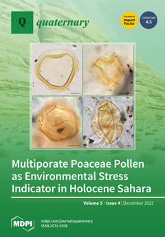
Cover Story (view full-size image): During the early and mid-Holocene, climate changes that occurred between ~10,200 and ~4650 cal BP in the Central Sahara determined the adaptive responses of polyploid grasses in the form of multiporate pollen. For the first time, the Poaceae pollen preserved in the archaeological record of the Takarkori rockshelter offers the possibility of obtaining palaeoecological information from an anomaly rather than from the normal morphology of the identified pollen. Multiporate pollen was found in organic sands and coprolites of ovicaprines. The supernumerary pores were primarily an effect of climatic/hydrological changes, and, in the most recent phases, continued plant harvesting was a further anthropogenic pressure on the wild grasses living in the region. View this paper
  • Issues are regarded as officially published after their release is announced to the table of contents alert mailing list.
  • You may sign up for e-mail alerts to receive table of contents of newly released issues.
  • PDF is the official format for papers published in both, html and pdf forms. To view the papers in pdf format, click on the "PDF Full-text" link, and use the free Adobe Reader to open them.
Order results
Result details
Select all
Export citation of selected articles as:
24 pages, 3521 KiB  
Article
Landscape Response to Dynamic Human Pressure in the Paliouras Lagoon, Halkidiki Peninsula, Macedonia, Greece
by Lucrezia Masci, Cristiano Vignola, Georgios C. Liakopoulos, Katerina Kouli, Olga Koukousioura, Elina Aidona, Matthias Moros, Konstantinos Vouvalidis, Adam Izdebski and Alessia Masi
Quaternary 2022, 5(4), 54; https://doi.org/10.3390/quat5040054 - 16 Dec 2022
Cited by 2 | Viewed by 2629
Abstract
High-resolution pollen analysis of a sediment core recovered from Paliouras lagoon (Greece) allowed us to reconstruct the environmental dynamics of the Halkidiki peninsula during the last 4000 years. Palynological results have been interpreted and compared with detailed historical data, showing distinct phases of [...] Read more.
High-resolution pollen analysis of a sediment core recovered from Paliouras lagoon (Greece) allowed us to reconstruct the environmental dynamics of the Halkidiki peninsula during the last 4000 years. Palynological results have been interpreted and compared with detailed historical data, showing distinct phases of human-landscape interactions from the Bronze Age until recent times. Pollen spectra revealed an environment characterized by Mediterranean vegetation, mixed deciduous forest, and pine stands from the Late Bronze Age until the 11th century CE. The first signs of human impact were attested during the Archaic period with the cultivation of Olea, Castanea, and Vitis in the inland of the study area. An intensive land management was highlighted by arboriculture and cereal cultivation (Secale and Hordeum group) in Roman times. Late Antique-Early Medieval times coincided with less human pressure due to warfare-related crises, leading to the expansion of the forest and the abandonment of fields colonized by Amaranthaceae. A massive increase in pastoral activities, suggested by the high percentages of Cichorieae during the Ottoman period, is possibly linked to the significant demographic growth of the nearby city of Thessaloniki in the 16th century CE. Full article
Show Figures

Figure 1

18 pages, 4068 KiB  
Article
Hyperspectral Core-Logging for Past Primary Productivity Assessment
by Antonin Van Exem, Maxime Debret, Yoann Copard, Kévin Jacq, Charles Verpoorter, Stéphane Marcotte, Benoit Laignel and Boris Vannière
Quaternary 2022, 5(4), 53; https://doi.org/10.3390/quat5040053 - 12 Dec 2022
Cited by 2 | Viewed by 2413
Abstract
Past primary productivity is tracked in lake sediments to reconstruct environmental changes. However, the resolution of the routinely used destructive techniques is not suitable for the analysis of a large number of samples due to cost. Non-destructive analysis of chlorophyll-a performed by [...] Read more.
Past primary productivity is tracked in lake sediments to reconstruct environmental changes. However, the resolution of the routinely used destructive techniques is not suitable for the analysis of a large number of samples due to cost. Non-destructive analysis of chlorophyll-a performed by hyperspectral imagery enables the quick determination of indices of past primary productivity. Eighteen indices used in paleo-environmental reconstruction were inventoried to define the best index capable of tracking chlorophyll-a by this technique. All the indices were applied to hyperspectral data measured on the sediment of Lake Bresson, in which detrital organic matter input is likely to skew chlorophyll-a identification, and the results were compared with concentrations measured by a routinely used destructive analysis. The 18 indices all produced a different result and only three indices were positively correlated with chlorophyll-a concentrations (n = 28, p < 0.0001). The detrital organic matter impacts chlorophyll-a characterization and shows the bias produced by the sediment matrix variations. Moreover, artificial modification of the sediment matrix revealed an impact of the mineral phase. To tackle this issue, the indices are normalized by two proxies of the sediment components. This new approach reduces the impact of detrital organic matter, hence the sediment matrix variations also reduce the normalization of the chlorophyll-a indices by a specific proxy of the mineral phase. These results identify the impact of local geochemical features that limit past primary productivity assessment and show the necessity of characterizing the sediment composition prior to tracking the chlorophyll-a by hyperspectral imaging. Full article
Show Figures

Figure 1

43 pages, 6263 KiB  
Article
Lateglacial to Mid-Holocene Vegetation History in the Eastern Vale of Pickering, Northeast Yorkshire, UK: Pollen Diagrams from Palaeolake Flixton
by Ian G. Simmons, Gaynor E. Cummins, Barry Taylor and James B. Innes
Quaternary 2022, 5(4), 52; https://doi.org/10.3390/quat5040052 - 8 Dec 2022
Cited by 2 | Viewed by 3704
Abstract
Palaeolake Flixton, in the eastern Vale of Pickering in northeast Yorkshire, UK, existed as open water during the Lateglacial and early to mid-Holocene, until hydroseral succession and gradual terrestrialisation changed it to an area of fen and basin peatland by the later mid-Holocene. [...] Read more.
Palaeolake Flixton, in the eastern Vale of Pickering in northeast Yorkshire, UK, existed as open water during the Lateglacial and early to mid-Holocene, until hydroseral succession and gradual terrestrialisation changed it to an area of fen and basin peatland by the later mid-Holocene. The environs of the lake were occupied by Late Palaeolithic and Mesolithic people over thousands of years and many Early Mesolithic sites, in particular, have been found located along the ancient lake edge, including the paradigm site for the British Early Mesolithic at Star Carr, where occupation occurred over several centuries. We have analysed eleven sediment cores, distributed in most parts of the palaeolake area, for pollen and stratigraphic data with which to reconstruct lake development and vegetation history. These new diagrams augment earlier pollen studies from the western part of the lake, particularly in the Star Carr area and near other major Mesolithic sites around Seamer Carr. Especially informative are a long core from the deepest part of the lake; cores that document the Lateglacial as well as early Holocene times, and evidence for the later Mesolithic that helps to balance the high density of Late Mesolithic sites known from research in the adjacent uplands of the North York Moors. There are many records of charcoal in the deposits but, especially for the earliest examples, it is not always possible to tie them firmly to either human activity or natural causes. Overall, the new and previously existing diagrams provide evidence for the spatial reconstruction of vegetation history across this important wetland system, including (a) for the progression of natural community successions within the wetland and on the surrounding dryland (b) the influence of climate change in bringing about changes in woodland composition and (c) for discussion of the possibility of human manipulation of the vegetation in the Late Upper Palaeolithic, Early and Late Mesolithic. Results show that climate was the main driver of longer-term vegetation change. Centennial-scale, abrupt climate events caused significant vegetation reversals in the Lateglacial Interstadial. The Lateglacial vegetation was very similar throughout the lake hinterland, although some areas supported some scrubby shrub rather than being completely open. Immigration and spread of Holocene woodland taxa comprised the familiar tree succession common in northern England but the timings of the establishment and the abundance of some individual tree types varied considerably around the lake margins because of edaphic factors and the effects of fire, probably of human origin. Woodland successions away from proximity to the lake were similar to those recorded in the wider landscape of northern England and produced a dense, homogenous forest cover occasionally affected by fire. Full article
(This article belongs to the Special Issue Climate Change and Vegetation Evolution during the Holocene)
Show Figures

Figure 1

20 pages, 4572 KiB  
Article
Preservation of Mammalian Teeth and Bones Influences Identification of Terminal Pleistocene to Middle Holocene Hunter-Gatherer Subsistence at Ban Rai Rockshelter, Northwest Thailand
by Athiwat Wattanapituksakul, Rasmi Shoocongdej and Cyler Conrad
Quaternary 2022, 5(4), 51; https://doi.org/10.3390/quat5040051 - 6 Dec 2022
Cited by 3 | Viewed by 2492
Abstract
Ban Rai Rockshelter in northwest Thailand, dating to the Terminal Pleistocene and Middle Holocene, includes evidence for hunter-gatherer exploitation of mammals, birds, reptiles, fish, and arthropods. Abundant faunal remains, identified throughout site deposits, include macaques (Macaca sp.) and Sambar deer (Rusa [...] Read more.
Ban Rai Rockshelter in northwest Thailand, dating to the Terminal Pleistocene and Middle Holocene, includes evidence for hunter-gatherer exploitation of mammals, birds, reptiles, fish, and arthropods. Abundant faunal remains, identified throughout site deposits, include macaques (Macaca sp.) and Sambar deer (Rusa unicolor), but these identifications are influenced by an assemblage largely comprised of preserved tooth elements and fragmented bone. Area 3 at Ban Rai has the largest abundance and diversity of faunal remains recovered and identified in this study. Here, we examine the zooarchaeological assemblage from Ban Rai Rockshelter, to understand long-term hunter-gatherer subsistence change, influenced by site preservation, during and after the Pleistocene–Holocene transition. Our results support the presence of the exploitation of arboreal taxa during the Early and Middle Holocene in northwest Thailand. Full article
Show Figures

Figure 1

17 pages, 4008 KiB  
Article
Palaeoenvironment, Settlement, and Land Use in the Late Neolithic—Bronze Age Site of Colombare di Negrar di Valpolicella (N Italy, On-Site)
by Umberto Tecchiati, Paola Salzani, Fiorenza Gulino, Barbara Proserpio, Chiara Reggio, Cristiano Putzolu, Eleonora Rattighieri, Eleonora Clò, Anna Maria Mercuri and Assunta Florenzano
Quaternary 2022, 5(4), 50; https://doi.org/10.3390/quat5040050 - 5 Dec 2022
Viewed by 2095
Abstract
Palynological and archaeobotanical analyses have been carried out as part of the interdisciplinary project of Colombare di Negrar, a prehistoric site in the Lessini Mountains (northern Italy). The palaeoenvironmental and economic reconstruction from the Late Neolithic to the beginning of the Early Bronze [...] Read more.
Palynological and archaeobotanical analyses have been carried out as part of the interdisciplinary project of Colombare di Negrar, a prehistoric site in the Lessini Mountains (northern Italy). The palaeoenvironmental and economic reconstruction from the Late Neolithic to the beginning of the Early Bronze Age was based on 16 pollen samples and three samples of macroremains taken from two contiguous trenches. The landscape reconstruction shows the presence of natural clearings in the wood. Forest cover was characterised by oak wood, with Ulmus and Tilia. The intermediate morphology of size and exine of Tilia cordata/platyphyllos pollen may be regarded as the first palynological evidence of lime hybrids in palaeorecords. Hygrophilous trees and Vitis vinifera testify to the presence of riparian forests and moist soils. Among trees supplying fruits, in addition to the grapevine, hazelnut (Corylus avellana) and walnut (Juglans regia) were present. A mixed economy based on animal breeding and cultivation of cereals (Hordeum vulgare, Triticum monococcum, T. dicoccum, T. timopheevii) emerged from the data. The combined analysis of pollen and plant macroremains suggests that different activities were carried out simultaneously in Colombare and a relationship between natural resources and the socio-economic and cultural evolution of the territory. Full article
Show Figures

Figure 1

18 pages, 3208 KiB  
Article
Paleoenvironmental Changes for the Last 3000 Cal Years BP in the Pueyrredón Lake Basin, Southern Patagonia, Argentina
by Maria A. Marcos, Florencia P. Bamonte, Marcos E. Echeverria, Gonzalo D. Sottile and Maria V. Mancini
Quaternary 2022, 5(4), 49; https://doi.org/10.3390/quat5040049 - 1 Dec 2022
Cited by 1 | Viewed by 1891
Abstract
Patagonian shrub and ecotonal communities were sensitive to past environmental changes and thus may also be affected by future ones. Therefore, their paleoecological study constitutes a valuable tool to understand the way in which these plant communities respond to the forcings responsible for [...] Read more.
Patagonian shrub and ecotonal communities were sensitive to past environmental changes and thus may also be affected by future ones. Therefore, their paleoecological study constitutes a valuable tool to understand the way in which these plant communities respond to the forcings responsible for environmental variability. The aim of this paper is to reconstruct the vegetation dynamics of the Pueyrredón Lake area (47°25′55′′ S; 72°0.7′7′′ W) for the last 3000 cal yr BP and to contextualize these changes in a regional paleoclimatic framework. The results indicate that at the beginning of the 2900 cal yr BP, the vegetation in the northwest of Santa Cruz, Argentinian Patagonia, was represented by a grass-shrub steppe associated with forest–shrub steppe ecotonal elements. This information correlates with the larger-scale environmental inferences described for the period, which indicate an increase in moisture availability due to the weakening of the westerly winds. A marked change to arid conditions is indicated in the last 1050 cal yr BP, with the establishment and development of different shrub steppe communities and the lack of ecotonal elements. Although vegetation was sensitive to changes in moisture conditions related to the variability of the westerly winds, there is evidence of differences in the composition of shrub vegetation regarding the sequences analyzed. Variations in pollen proportions of the shrub steppes in the Pueyrredón Lake area suggest that changes in vegetation are not only due to climate variability but also local factors in the areas where shrub communities grow. The integration of the information with other Patagonian sequences allowed to frame these changes in a regional context. The results obtained provide useful information to understand the way vegetation changed in the past and the manner in which it may respond to future changes. Full article
(This article belongs to the Special Issue Climate Change and Vegetation Evolution during the Holocene)
Show Figures

Figure 1

15 pages, 2559 KiB  
Communication
Geochemistry and Sedimentology of a Minerotrophic Peat in a Western Mediterranean Mountain Wilderness Area
by Vladimir Goutiers and Christopher Carcaillet
Quaternary 2022, 5(4), 48; https://doi.org/10.3390/quat5040048 - 21 Nov 2022
Cited by 1 | Viewed by 1830
Abstract
Sedimentological and biogeochemical measurements were conducted on minerotrophic peat in a wilderness area on a granitic plateau to reconstruct the local ecosystem’s history and clarify the peat’s response to local and global changes. The peat is less than 1900 years old. Its clay [...] Read more.
Sedimentological and biogeochemical measurements were conducted on minerotrophic peat in a wilderness area on a granitic plateau to reconstruct the local ecosystem’s history and clarify the peat’s response to local and global changes. The peat is less than 1900 years old. Its clay and iron (Fe) concentration profiles revealed an increasing atmospheric influx over time, whereas the levels of its nutrients (P, K, Ca, Mg) have increased since the 19th century. Additionally, changes in the relative abundance of amorphous aluminium indicated a gradual decrease in soil weathering. The dominant metallic trace elements were cadmium during the Roman epoch and early Middle Ages, then lead and mercury during the modern and the industrial eras. Unexpectedly, the peat proved to be sub-modern and lacks wildfire proxies, probably indicating an absence of nearby woodlands over the last 1900 years. Its concentrations of Ca and Mg indicate that airborne transport of particles released by soil erosion in lowland agricultural plains has strongly affected the peat’s composition since the 18th–19th century. The site has also been heavily influenced by metallic contamination due to regional metallurgy and agriculture, producing a peat that has been modified by social imprints over several centuries. Full article
(This article belongs to the Special Issue Climate Change and Vegetation Evolution during the Holocene)
Show Figures

Graphical abstract

19 pages, 5831 KiB  
Article
Comparison of High-Resolution 14C and Luminescence-Based Chronologies of the MIS 2 Madaras Loess/Paleosol Sequence, Hungary: Implications for Chronological Studies
by Pál Sümegi, Dávid Molnár, Sándor Gulyás, Thomas Stevens, László Makó, Péter Cseh, Mihály Molnár, Kathryn Fitzsimmons, Janina J. Nett, Dmytro Hlavatskyi and Frank Lehmkuhl
Quaternary 2022, 5(4), 47; https://doi.org/10.3390/quat5040047 - 10 Nov 2022
Cited by 3 | Viewed by 2564
Abstract
Numerous loess/paleosol sequences (LPS) in the Carpathian Basin span the period of Marine Isotope Stage (MIS) 2 and the last glacial maximum (LGM). Nevertheless, only two known records—Madaras and Dunaszekcső—preserve highly resolved records with absolute chronologies with minimal uncertainties, which enable the meaningful [...] Read more.
Numerous loess/paleosol sequences (LPS) in the Carpathian Basin span the period of Marine Isotope Stage (MIS) 2 and the last glacial maximum (LGM). Nevertheless, only two known records—Madaras and Dunaszekcső—preserve highly resolved records with absolute chronologies with minimal uncertainties, which enable the meaningful assessment of feedbacks and short-term climatic fluctuations over this period. The Madaras profile is located at the northern margin fringe of the Bácska loess plateau; Dunaszekcső, located on the Danube to its west, yields a chronology built on over 100 14C dates yet spans only part of MIS 2, missing half of the LGM including its peak. Here, we add to the previously published 14C chronology for Madaras (15 dates) with an additional 17 14C and luminescence ages. Resulting age models built solely on quartz OSL and feldspar pIRIRSL data underestimate the 14C based chronology, which is likely based on inaccuracies related to luminescence signal behavior; we observe age underestimations associated with unusual quartz behavior and significant signal loss, a phenomenon also observed in Serbian and Romanian loess, which may relate to non-sensitized grains from proximal sources. Our new chronology provides higher resolution than hitherto possible, yielding consistent 2 sigma uncertainties of ~150–200 years throughout the entire sequence. Our study indicates that the addition of further dates may not increase the chronological precision significantly. Additionally, the new age model is suitable for tackling centennial-scale changes. The mean sedimentation rate based on our new age-depth model (10.78 ± 2.34 years/cm) is the highest yet recorded in the Carpathian Basin for MIS 2. The resolution of our age model is higher than that for the Greenland NGRIP ice core record. The referred horizons in our profile are all characterized by a drop in accumulation and a higher sand input, the latter most likely deriving from nearby re-exposed sand dunes. Full article
(This article belongs to the Special Issue Climate Change and Reconstruction of the Palaeoecological Changes)
Show Figures

Figure 1

22 pages, 7182 KiB  
Article
Late-Holocene Sediment Storage in Upland Valley Systems in the Gamo Highlands of Southern Ethiopia
by Alemayehu Kasaye Tilahun, Gert Verstraeten, Margaret Chen, Guchie Gulie, Femke Augustijns and Ward Swinnen
Quaternary 2022, 5(4), 46; https://doi.org/10.3390/quat5040046 - 4 Nov 2022
Viewed by 1774
Abstract
Part of the eroded soil material from the hillslopes is temporarily stored on hillslopes and in river valleys as colluvial and alluvial storage, respectively. This storage component of a catchment’s sediment budget is an important archive reflecting past erosion and sediment delivery processes [...] Read more.
Part of the eroded soil material from the hillslopes is temporarily stored on hillslopes and in river valleys as colluvial and alluvial storage, respectively. This storage component of a catchment’s sediment budget is an important archive reflecting past erosion and sediment delivery processes in relation to both natural and anthropogenic environmental changes. Information on long-term sediment dynamics (i.e., centennial to millennial timescales) is generally lacking for tropical mountain environments. Here, we quantify long-term floodplain sediment storage and sedimentation dynamics in the Gamo highlands of the southern Ethiopia Rift Valley. In two upstream catchments (Chencha and Dembelle), a detailed survey of the floodplain sediment archive was conducted through hand augering of 37 cross-valley transects. Sediment thicknesses vary between 4 and 8 m and total storage equals 0.03 Mt ha−1 floodplain area for the Chencha area and 0.05 Mt ha−1 floodplain area for the Dembelle area. Radiocarbon dating of organic material retrieved from the sediment archives provided a temporal framework for interpretation of sedimentation processes dynamic. The mean sedimentation rate in the Chencha floodplain is ~3.22 ± 0.33 kt ha−1 catchment area, whereas it is ~3.76 ± 0.22 kt ha−1 catchment area for the Dembelle floodplain. Up to 70% of the total sediment mass is stored in the floodplains within the most recent 2000 years. Cumulative probability function plots of radiocarbon dates show that sedimentation started to increase from ca 2000 to ca 1600 cal BP, roughly coincident with an increase in human presence, as is indicated through archaeological data. Full article
Show Figures

Figure 1

19 pages, 16148 KiB  
Article
The 2022 Mw 6.1 Pasaman Barat, Indonesia Earthquake, Confirmed the Existence of the Talamau Segment Fault Based on Teleseismic and Satellite Gravity Data
by Bondan Galih Dewanto, Ramadhan Priadi, Leni Sophia Heliani, Al Shida Natul, Muhammad Yanis, Indranova Suhendro and Admiral Musa Julius
Quaternary 2022, 5(4), 45; https://doi.org/10.3390/quat5040045 - 2 Nov 2022
Cited by 6 | Viewed by 3660
Abstract
A Mw 6.1 earthquake on 25 February 2022, at around 8:39 a.m. local time, struck Pasaman Barat Regency, West Sumatra, Indonesia, and was felt in Singapore and Malaysia. The hypocenter of this earthquake was 12 km deep and preceded by an Mw 4.9 [...] Read more.
A Mw 6.1 earthquake on 25 February 2022, at around 8:39 a.m. local time, struck Pasaman Barat Regency, West Sumatra, Indonesia, and was felt in Singapore and Malaysia. The hypocenter of this earthquake was 12 km deep and preceded by an Mw 4.9 foreshock a few minutes earlier. The earthquakes originated on a blind fault and triggered a landslide at Mount Talamau. Herein, the slip distribution and asperities along the plane fault during the earthquake were examined by teleseismic inversion and the fault location was identified by Global Gravity Model plus (GGMPlus) satellite gravity data. The slip distribution was calculated from the source parameters (strike: 136°; dip: 70°; rake: 174°) by inversion techniques based on teleseismic data. Based on the slip distribution, the earthquake was generated by stress from the Sianok fault that spread to the north and reached the uncertain fault segment in the Talamau area. In addition, the results of the First Horizontal Derivative and Second Vertical Derivative from the GGMplus data revealed a straight Simple Bouguer Anomaly pattern, confirming the existence of the uncertain Talamau fault as part of the Great Sumatra Fault. This work shows the potential application of the combination of teleseismic and gravity observation for delineating the fault structure that caused the 2022 Mw 6.1 Pasaman earthquake, which can also be applied to other locations of similar geological backgrounds. Full article
Show Figures

Figure 1

14 pages, 4800 KiB  
Article
Application of Parameterized Grain-Size Endmember Modeling in the Study of Quaternary Oxbow Lake Sedimentation: A Case Study of Tövises Bed Sediments in the Eastern Great Hungarian Plain
by Abdelrhim Eltijani, Dávid Molnár, László Makó, János Geiger and Pál Sümegi
Quaternary 2022, 5(4), 44; https://doi.org/10.3390/quat5040044 - 25 Oct 2022
Cited by 6 | Viewed by 2145
Abstract
Abandoned channels are essential in the Quaternary floodplains, and their infill contains different paleoenvironment recorders. Grain-size distribution (GSD) is one proxy that helps characterize the alluviation and associated sedimentological processes of the abandoned channels. The classic statistical methods of the grain-size analysis provide [...] Read more.
Abandoned channels are essential in the Quaternary floodplains, and their infill contains different paleoenvironment recorders. Grain-size distribution (GSD) is one proxy that helps characterize the alluviation and associated sedimentological processes of the abandoned channels. The classic statistical methods of the grain-size analysis provide insufficient information on the whole distribution; this necessitates a more comprehensive approach. Grain-size endmember modeling (EMM) is one approach beyond the traditional procedures that helps unmix the GSDs. This study describes the changes in the depositional process by unmixing the GSDs of a Holocene abandoned channel through parameterized EMM integrated with lithofacies, age–depth model, loss-on-ignition (LOI), and magnetic susceptibility (MS). This approach effectively enabled the quantification and characterization of up to four endmembers (EM1-4); the characteristics of grain-size endmembers imply changes in sedimentary environments since 8000 BP. EM1 is mainly clay and very fine silt, representing the fine component of the distribution corresponding to the background of quiet water sedimentation of the lacustrine phase. EM2 and EM3 are the intermediate components representing the distal overbank deposits of the flood. EM4 is dominated by coarse silt and very fine sand, representing deposition of overbank flow during the flood periods. This paper demonstrates that the parametrized grain-size EMM is reasonable in characterizing abandoned channel infill sedimentary depositional and sedimentation history. Full article
(This article belongs to the Special Issue Climate Change and Reconstruction of the Palaeoecological Changes)
Show Figures

Figure 1

29 pages, 21673 KiB  
Article
Climate and Vegetation Change, Hillslope Soil Erosion, and the Complex Nature of Late Quaternary Environmental Transitions, Eastern Mojave Desert, USA
by Joseph R. McAuliffe, Leslie D. McFadden, Lyman P. Persico and Tammy M. Rittenour
Quaternary 2022, 5(4), 43; https://doi.org/10.3390/quat5040043 - 14 Oct 2022
Cited by 4 | Viewed by 2727
Abstract
In what are now the warm deserts of the American Southwest, direct effects of changing climate on plant distributions are typically viewed as the principal driver of vegetation changes that followed the late Pleistocene–Holocene transition (LPH). However, at a semi-arid site in the [...] Read more.
In what are now the warm deserts of the American Southwest, direct effects of changing climate on plant distributions are typically viewed as the principal driver of vegetation changes that followed the late Pleistocene–Holocene transition (LPH). However, at a semi-arid site in the eastern Mojave Desert, the transition to modern, shrub-dominated desert scrub on xeric, south-aspect hillslopes occurred only after the erosion of relatively thick soils toward the end of the mid-Holocene. Soils with well-developed Bt horizons began to form in the late Pleistocene on both north- and south-aspect hillslopes through the entrapment and accumulation of aeolian sediments in coarse colluvium. Those soils are capable of absorbing and retaining substantial moisture and support relatively dense stands of perennial C4 grasses that have diffuse, fibrous root systems. The age of alluvial deposits on the basin floor indicates a surge in sediment production through the erosion of some of those hillslope soils toward the end of the mid-Holocene. However, that erosion was largely limited to the more xeric, more sparsely vegetated, south-aspect hillslopes. The soils formed on mesic north-aspect hillslopes remain largely non-eroded to the present day, demonstrating the central role of vegetation in modulating erosion and sediment supply. The loss of soils from south-aspect hillslopes fundamentally changed the capacity of those environments to absorb and store moisture, and altered the depth and temporal durations of plant-available moisture. Those hydrological changes drove a loss of perennial C4 grasses and a transition to dominance by xerophytic plants—shrubs with deeper taproots capable of extracting moisture stored within bedrock joints and fractures, and shallow-rooted succulent plants that store moisture internally. Following the LPH, vegetation change at the site apparently occurred in two distinct phases separated in time: (1) initial vegetation changes driven directly by increasing climatic aridity and (2) subsequent changes linked to the later episode of soil erosion. Although climate shifts ultimately generate vegetation changes, the proximate mechanisms to which plants directly respond can lag far behind climatic transitions and involve complex relationships of vegetation, soils, and changing soil hydrologic conditions. Full article
(This article belongs to the Special Issue Climate Change and Vegetation Evolution during the Holocene)
Show Figures

Figure 1

20 pages, 4930 KiB  
Article
Tracing Raw Material Sources of Prehistoric Stone Artefacts by Non-Invasive Techniques: The Case of the Early Bronze Age (3rd Mill. BCE) Site of Vathy, Astypalaia, Greece
by Maria Kokkaliari, Eugenia Adam, Andreas Vlachopoulos and Ioannis Iliopoulos
Quaternary 2022, 5(4), 42; https://doi.org/10.3390/quat5040042 - 9 Oct 2022
Viewed by 2314
Abstract
Recent findings of archaeological research in the Vathy gulf area, Astypalaia Island, indicate its continuous habitation since prehistoric times, most importantly in the transitional period from the Final Neolithic to the Early Bronze Age (late 4th/early 3rd millennium BC). The evaluation of the [...] Read more.
Recent findings of archaeological research in the Vathy gulf area, Astypalaia Island, indicate its continuous habitation since prehistoric times, most importantly in the transitional period from the Final Neolithic to the Early Bronze Age (late 4th/early 3rd millennium BC). The evaluation of the prehistoric stone artefacts from Vathy using non-invasive analytical methods (Near Infrared Spectroscopy—NIR), in combination with the mineral-petrographic characterization of the main lithological formations of the island, is expected to provide important information about raw material procurement and possible exchange networks. The geological study of the island combined with the analytical methods applied to the archaeological artefacts and the geological samples led to the identification of both local and allogenic materials. The possible locations of raw material sources were established and the origin of allogenic materials was estimated. The stone artefacts made of local geo-materials consist mainly of calcitic sandstone, shale, marl, and limestone/marble, comprising the largest part of the lithological formations of the island, as well as pumice and volcanic rocks of varying chemical composition. By means of a portable microscope and NIR spectroscopy, we were further able to identify allogenic geo-materials including chalcedony, mica schist, bauxite and meta-bauxite, steatite, and paragonite. Based on the mineralogical and petrographic characterization of the stone artefacts, a first attempt is made to evaluate the possible raw material sources and to identify potential intra-island modes of stone exploitation. Full article
(This article belongs to the Special Issue Advances in Geoarchaeology and Cultural Heritage)
Show Figures

Figure 1

16 pages, 2304 KiB  
Article
Multiporate Pollen of Poaceae as Bioindicator of Environmental Stress: First Archaeobotanical Evidence from the Early–Middle Holocene Site of Takarkori in the Central Sahara
by Anna Maria Mercuri, Eleonora Clò and Assunta Florenzano
Quaternary 2022, 5(4), 41; https://doi.org/10.3390/quat5040041 - 1 Oct 2022
Cited by 7 | Viewed by 2800
Abstract
This paper reports on the most ancient unusual morphological trait of the apertures of Poaceae pollen found in archaeological layers. In Poaceae, high levels of hybridization, polyploidy, apomixis, and multiporate pollen are often related. Multiple genomes in polyploids are critical for the adaptation [...] Read more.
This paper reports on the most ancient unusual morphological trait of the apertures of Poaceae pollen found in archaeological layers. In Poaceae, high levels of hybridization, polyploidy, apomixis, and multiporate pollen are often related. Multiple genomes in polyploids are critical for the adaptation of plant species to stresses and could be revealed by anomalies in pollen development. Therefore, the paleoenvironmental research can gain great benefits from identifying polyploids in past contexts by observing anomalous pollen morphology during pollen counts. The occurrence of multiporate pollen in Poaceae has also been related to special features of the ecology of the species showing this anomaly, as well as to climatic and environmental stresses experienced by Poaceae living in a given region. Multiporate and bi- or tri-porate instead of monoporate pollen grains have been observed in samples taken from Takarkori rockshelter, an archaeological site in southwestern Libya (central Sahara) that has been occupied between ~10,200 and ~4650 cal BP. Multiporate pollen was found in organic sands and coprolites of ovicaprines. On the basis of archaeobotanical research, this work aims to investigate whether the presence of supernumerary pores in Poaceae pollen may be an effect of both climatic/hydrological changes and continued anthropogenic pressure on the wild grasses living in the region. The presence of multiporate pollen reveals that Poaceae that lived in central Sahara tackled several kinds of stress during the early and middle Holocene. The Takarkori pollen record suggests that climate change could have played a major role in the early Holocene, while human pressure became stronger during the middle Holocene. The change in environmental conditions determined adaptive responses of polyploid grasses even in the form of multiporate pollen. Full article
Show Figures

Figure 1

2 pages, 194 KiB  
Editorial
Quaternary Loess Deposition and Climate Change in Europe—Recent Progress
by Dávid Molnár
Quaternary 2022, 5(4), 40; https://doi.org/10.3390/quat5040040 - 25 Sep 2022
Viewed by 1417
Abstract
The current climate changes are not unique in Earth’s history [...] Full article
(This article belongs to the Special Issue Quaternary Loess Deposition and Climate Change)
19 pages, 2991 KiB  
Article
Erosion Risk Assessment for Prioritization of Conservation Measures in the Watershed of Genale Dawa-3 Hydropower Dam, Ethiopia
by Ashenafi Dechasa, Alemu O. Aga and Takele Dufera
Quaternary 2022, 5(4), 39; https://doi.org/10.3390/quat5040039 - 23 Sep 2022
Cited by 5 | Viewed by 2829
Abstract
Sedimentation is a leading global problem that affects the environment and dams by reducing the live storage capacity of reservoirs and the life expectance of dams. Hence, prioritizing watersheds according to the risk of soil loss is crucial for extending the useful life [...] Read more.
Sedimentation is a leading global problem that affects the environment and dams by reducing the live storage capacity of reservoirs and the life expectance of dams. Hence, prioritizing watersheds according to the risk of soil loss is crucial for extending the useful life of dams and reservoirs. The objectives of this study were to assess sediment flow in the Genale Dawa-3 reservoir, identify subbasins that are prone to soil erosion, and evaluate the impact of different management practices on minimizing sediment yields by using the Soil and Water Assessment Tool (SWAT) model. The SWAT model was calibrated and validated by observed streamflow and sediment data based on the SUFI-2 algorithm by SWAT-CUP, and its performance was assessed. The model simulated the average annual sediment yield; the input to the reservoir was 16.83 ton/ha/yr for the period of 1990–2015. From a total of 31 subbasins, 12 were categorized from high to very severe (11–60 ton/ha/yr) sediment-yielding subbasins and selected for sediment management. The simulated scenarios showed that the average annual sediment reductions at critical erosion hot spots in subbasins after the application of filter strips, soil/stone bund, terracing, and contour farming were 35.03%, 66.54%, 80.88%, and 53.11%, respectively. Therefore, this study concluded that reducing sediment yield by implementing terracing in critical areas at risk of soil erosion was more effective than other soil conservation measures. Overall, this research can help planners and decision-makers to implement appropriate soil conservation measures in the most erosive subwatersheds in order to extend the useful life of the Genale Dawa-3 hydropower dam and reservoir. Full article
Show Figures

Figure 1

Previous Issue
Next Issue
Back to TopTop