Next Issue
Volume 12, October
Previous Issue
Volume 12, August


Geosciences, Volume 12, Issue 9 (September 2022) – 38 articles

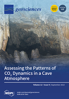
Cover Story (view full-size image): The carbon balance in karst ecosystems or cave conservation requires a comprehensive understanding of the drivers and mechanisms involved in CO2 dynamics. This study focuses on diphasic infiltration in the double-membrane formed by soil and rock as the key factor controlling the thermal response and the gaseous transfer in a cave atmosphere. The study was conducted in a rock-art cave (Ardales, south Spain) and illustrates how the local topography of the karstified outcrop in relation to the cave geomorphology determines its seasonal functionality as an emitter or store of gases, in addition to the prominent gas entrapment in some galleries that is crucial to the protection of the subterranean cultural heritage. View this paper
  • Issues are regarded as officially published after their release is announced to the table of contents alert mailing list.
  • You may sign up for e-mail alerts to receive table of contents of newly released issues.
  • PDF is the official format for papers published in both, html and pdf forms. To view the papers in pdf format, click on the "PDF Full-text" link, and use the free Adobe Reader to open them.
Order results
Result details
Section
Select all
Export citation of selected articles as:
19 pages, 9375 KiB  
Article
Hazard and Risk-Based Tsunami Early Warning Algorithms for Ocean Bottom Sensor S-Net System in Tohoku, Japan, Using Sequential Multiple Linear Regression
by Yao Li and Katsuichiro Goda
Geosciences 2022, 12(9), 350; https://doi.org/10.3390/geosciences12090350 - 19 Sep 2022
Cited by 8 | Viewed by 2931
Abstract
This study presents robust algorithms for tsunami early warning using synthetic tsunami wave data at ocean bottom sensor (OBS) arrays with sequential multiple linear regression. The study focuses on the Tohoku region of Japan, where an S-net OBS system (150 pressure sensors) has [...] Read more.
This study presents robust algorithms for tsunami early warning using synthetic tsunami wave data at ocean bottom sensor (OBS) arrays with sequential multiple linear regression. The study focuses on the Tohoku region of Japan, where an S-net OBS system (150 pressure sensors) has been deployed. To calibrate the tsunami early warning system using realistic tsunami wave profiles at the S-net stations, 4000 stochastic tsunami simulations are employed. Forecasting models are built using multiple linear regression together with sequential feature selection based on Akaike Information Criterion and knee-point method to identify sensors that improve the accuracy most significantly. The study considers tsunami wave amplitude at a nearshore location and regional tsunami loss for buildings to develop hazard-based and risk-based tsunami warning algorithms. The models identify an optimal configuration of OBS stations and waiting time for issuing tsunami warnings. The model performance is compared against a base model, which only uses the earthquake magnitude and epicenter location. The result indicates that estimating the tsunami amplitude and loss via S-net improves accuracy. For the hazard-based forecasting, adding six sensors from the S-net improves the accuracy of the estimation most significantly with an optimal waiting time of 3 min. For the risk-based forecasting, a longer waiting time between 5 and 10 min is suitable. Full article
(This article belongs to the Special Issue Interdisciplinary Geosciences Perspectives of Tsunami Volume 4)
Show Figures

Figure 1

26 pages, 6608 KiB  
Review
A 20-Year Journey of Forecasting with the “Every Earthquake a Precursor According to Scale” Model
by David A. Rhoades, Sepideh J. Rastin and Annemarie Christophersen
Geosciences 2022, 12(9), 349; https://doi.org/10.3390/geosciences12090349 - 19 Sep 2022
Cited by 5 | Viewed by 2203
Abstract
Nearly 20 years ago, the observation that major earthquakes are generally preceded by an increase in the seismicity rate on a timescale from months to decades was embedded in the “Every Earthquake a Precursor According to Scale” (EEPAS) model. EEPAS has since been [...] Read more.
Nearly 20 years ago, the observation that major earthquakes are generally preceded by an increase in the seismicity rate on a timescale from months to decades was embedded in the “Every Earthquake a Precursor According to Scale” (EEPAS) model. EEPAS has since been successfully applied to regional real-world and synthetic earthquake catalogues to forecast future earthquake occurrence rates with time horizons up to a few decades. When combined with aftershock models, its forecasting performance is improved for short time horizons. As a result, EEPAS has been included as the medium-term component in public earthquake forecasts in New Zealand. EEPAS has been modified to advance its forecasting performance despite data limitations. One modification is to compensate for missing precursory earthquakes. Precursory earthquakes can be missing because of the time-lag between the end of a catalogue and the time at which a forecast applies or the limited lead time from the start of the catalogue to a target earthquake. An observed space-time trade-off in precursory seismicity, which affects the EEPAS scaling parameters for area and time, also can be used to improve forecasting performance. Systematic analysis of EEPAS performance on synthetic catalogues suggests that regional variations in EEPAS parameters can be explained by regional variations in the long-term earthquake rate. Integration of all these developments is needed to meet the challenge of producing a global EEPAS model. Full article
(This article belongs to the Collection Advances in Statistical Seismology)
Show Figures

Figure 1

17 pages, 10177 KiB  
Article
Fault-Block Platform Evolution between Late Cretaceous and Early Miocene along the Margin of the Latium-Abruzzi Carbonate Platform (Southern Prenestini Mountains, Central Apennines, Italy)
by Marco Brandano, Irene Cornacchia and Rita Catanzariti
Geosciences 2022, 12(9), 348; https://doi.org/10.3390/geosciences12090348 - 19 Sep 2022
Cited by 1 | Viewed by 2098
Abstract
Since the origin of the carbonate platform concept, the reconstruction of the geometry and the evolution of the margin has been an intriguing topic. The Latium-Abruzzi platform is one of the largest shallow water domains of the Central Apennines, however, the reconstruction of [...] Read more.
Since the origin of the carbonate platform concept, the reconstruction of the geometry and the evolution of the margin has been an intriguing topic. The Latium-Abruzzi platform is one of the largest shallow water domains of the Central Apennines, however, the reconstruction of the geometry and evolution of its margin has been classically problematic because the latter has been erased by the out-of-sequence Olevano-Antrodoco thrust system. The investigated area is placed in the Prenestini Mountains, the southernmost portion of the Sabina Domain, where a Cretaceous to Neogene carbonate succession, ascribed the Latium-Abruzzi platform margin, crops out. Stratigraphic and facies analyses showed a Late Cretaceous extensional stage that produced two main fault-block platforms, respectively, South Eastern Prenestini and South Western Prenestini platforms, developed westward of the large Latium-Abruzzi Platform domain. In these platforms, during the Paleocene–Eocene interval, pelagite deposition coincides with the main relative sea-level rise. Instead, during the following falling stage, the seafloor, consisting of the Cretaceous carbonate, was in the wave abrasion zone and the pelagic carbonate mud was swept away or trapped in local depressions or fractures (neptunian dykes), whereas the coarse sediment produced by the erosion of indented and fractured substrate formed polygenic conglomerate accumulation on the Cretaceuos carbonate platform substrate. Successively, an isolated homoclinal ramp, the Guadagnolo Fm, Aquitanian to Serravallian in age, developed on the drowned fault-block platforms, suggesting that during Neogene the articulation of the substrate of the two fault-block platforms had to be limited to host the bioclastic sedimentation of the Guadagnolo Fm and to allow the development of a carbonate ramp depositional profile. Full article
(This article belongs to the Section Sedimentology, Stratigraphy and Palaeontology)
Show Figures

Figure 1

23 pages, 5556 KiB  
Article
Is It Worth Assessing Geodiversity Numerically? A Comparative Analysis between Quantitative and Qualitative Approaches in Miguel Pereira Municipality, Rio de Janeiro, Brazil
by Jéssica Gonçalves, Kátia Mansur, Daniel Santos, Renato Henriques and Paulo Pereira
Geosciences 2022, 12(9), 347; https://doi.org/10.3390/geosciences12090347 - 18 Sep 2022
Cited by 6 | Viewed by 2291
Abstract
The interest in the cartographic representation of geodiversity has grown in recent years. However, the application of geodiversity maps in nature conservation and territorial management policies is still under study, especially concerning quantitative methodologies and geodiversity indices. Aiming to contribute to this topic, [...] Read more.
The interest in the cartographic representation of geodiversity has grown in recent years. However, the application of geodiversity maps in nature conservation and territorial management policies is still under study, especially concerning quantitative methodologies and geodiversity indices. Aiming to contribute to this topic, a set of correlation analyses were performed between quantitative and qualitative maps, as well as correlations between these and sites of geological interest, land-use, and vegetation maps using Miguel Pereira municipality, Rio de Janeiro, Brazil, as a study area. A geodiversity index map (quantitative approach) was used, and a geodiversity map (qualitative approach) was produced based on GIS procedures and tools through a counting technique and the association between landforms and, geology, soils, and hydrology, respectively. The geodiversity map showed a better correlation between geodiversity and the other nature and anthropic elements, while the quantitative assessment, although having a positive correlation with those elements, showed a weak or very weak correlation. The cartographic outputs in geodiversity units (qualitative approach) best supported this correlative analysis highlighting its use in land-use and nature conservation management. In contrast, the geodiversity index map showed complementary information and could be combined with the qualitative approach for more sustained results. Full article
(This article belongs to the Special Issue Featured Papers in Geoheritage, Geoparks and Geotourism)
Show Figures

Figure 1

24 pages, 4685 KiB  
Article
U–Pb Geochronology and Stable Isotope Geochemistry of Terrestrial Carbonates, Lower Cretaceous Cedar Mountain Formation, Utah: Implications for Synchronicity of Terrestrial and Marine Carbon Isotope Excursions
by Erik L. Gulbranson, E. Troy Rasbury, Greg A. Ludvigson, Andreas Möller, Gregory A. Henkes, Marina B. Suarez, Paul Northrup, Ryan V. Tappero, Julie A. Maxson, Russell S. Shapiro and Kathleen M. Wooton
Geosciences 2022, 12(9), 346; https://doi.org/10.3390/geosciences12090346 - 17 Sep 2022
Cited by 4 | Viewed by 2920
Abstract
The terrestrial Lower Cretaceous Cedar Mountain Formation, Utah, is a critical archive of paleoclimate, tectonics, and vertebrate ecology and evolution. Early Cretaceous carbon cycle perturbations associated with ocean anoxia have been interpreted from this succession, as expressed in stable carbon isotopes. However, refining [...] Read more.
The terrestrial Lower Cretaceous Cedar Mountain Formation, Utah, is a critical archive of paleoclimate, tectonics, and vertebrate ecology and evolution. Early Cretaceous carbon cycle perturbations associated with ocean anoxia have been interpreted from this succession, as expressed in stable carbon isotopes. However, refining the timing of the observed stable isotope excursions remains a key challenge in understanding how marine anoxia affects the Earth system, and is ultimately recorded in the terrestrial realm. The geochronology and geochemistry of a terrestrial carbonate near the base of this succession, which potentially records the Ap7 global carbon isotope excursion, is studied here. Petrographic and geochemical analyses are used to test plausible mechanisms for U incorporation into the calcite lattice in this sample. Using these methods, the hypothesis that the incorporation of U was at or close to the timing of carbonate precipitation is evaluated. U–Pb geochronology of calcite indicates a plausible Early Cretaceous age. However, comparison of the new U–Pb ages of calcite with detrital zircon maximum depositional ages immediately beneath the studied sample indicates a disparity in the apparent sedimentation rates if both types of geochronologic information are interpreted as reflecting the timing of sediment deposition. The totality of data supports an early, and high-temperature, diagenetic timing of U incorporation, with potential for minor leaching of U in subsequent fluid–rock interaction. The most likely mechanism for U transport and immobilization in these samples is hydrothermal fluid–rock interaction. Therefore, the radiometric ages, and corresponding stable isotope composition of U-bearing carbonate domains in this sample, indicate early subsurface fluid–rock interactions and not a record of atmosphere–soil geochemical reactions. Full article
Show Figures

Figure 1

18 pages, 2856 KiB  
Article
Mathematical Model of the Decomposition of Unstable Gas Hydrate Accumulations in the Cryolithozone
by Leopold I. Lobkovsky, Mukamay M. Ramazanov, Igor P. Semiletov and Dmitry A. Alekseev
Geosciences 2022, 12(9), 345; https://doi.org/10.3390/geosciences12090345 - 16 Sep 2022
Cited by 3 | Viewed by 1747
Abstract
We present a generalization of the mathematical model of gas discharge from frozen rocks containing gas-saturated ice and gas hydrates in a metastable state (due to the self-preservation effect) caused by the drop in external stress associated with various geodynamic factors. These factors [...] Read more.
We present a generalization of the mathematical model of gas discharge from frozen rocks containing gas-saturated ice and gas hydrates in a metastable state (due to the self-preservation effect) caused by the drop in external stress associated with various geodynamic factors. These factors can be attributed, for example, to a decrease in hydrostatic pressure on a gas-bearing formation due to glacier melting, causing an isostatic rise, or to the formation of linear depressions in the bottom topography on the shelf due to iceberg ploughing. A change in external pressure can also be associated with seismic and tectonic deformation waves propagating in the lithosphere as a result of ongoing strong earthquakes. Starting from the existing hydrate destruction model, operating at the scale of individual granules, we consider a low-permeable hydrate and ice-saturated horizontal reservoir. Generalization is associated with the introduction of a finite threshold for the external pressure drop, which causes the destruction of the gas hydrate and gas-saturated microcavities of supramolecular size. This makes it possible to take into account the effect of anomalously high pressures occurring in the released gas as a result of partial hydrate dissociation. Numerical and approximate analytical solutions to the problem were found in the self-similar formulation. A parametric study of the solution was carried out, and regularities of the hydrate decomposition process were revealed. Full article
(This article belongs to the Special Issue Permafrost and Gas Hydrate Response to Ground Temperature Rising)
Show Figures

Figure 1

12 pages, 4600 KiB  
Article
Decadal Scale Variability of Larsen Ice Shelf Melt Captured by Antarctic Peninsula Ice Core
by B. Daniel Emanuelsson, Elizabeth R. Thomas, Jack D. Humby and Diana O. Vladimirova
Geosciences 2022, 12(9), 344; https://doi.org/10.3390/geosciences12090344 - 16 Sep 2022
Cited by 1 | Viewed by 1721
Abstract
In this study, we used the stable water isotope record (δ18O) from an ice core drilled in Palmer Land, southern Antarctic Peninsula (AP). Utilizing δ18O we identified two climate regimes during the satellite era. During the 1979–1998 positive interdecadal [...] Read more.
In this study, we used the stable water isotope record (δ18O) from an ice core drilled in Palmer Land, southern Antarctic Peninsula (AP). Utilizing δ18O we identified two climate regimes during the satellite era. During the 1979–1998 positive interdecadal Pacific oscillation (IPO) phase, a low-pressure system north of the Weddell Sea drove southeasterly winds that are associated with an increase in warm air mass intrusion onto the Larsen shelves, which melted and a decreased sea ice concentration in the Weddell Sea/increase in the Bellingshausen Sea. This climate setting is associated with anomaly low δ18O values (compared with the latter IPO period). There is significantly more melt along the northern AP ice shelf margins and on the Larsen D and southern Larsen C during the 1979–1998 IPO positive phase. The IPO positive climatic setting was coincidental with the Larsen A ice shelf collapse. In contrast, during the IPO negative phase (1999–2011), northerly winds caused a reduction in sea ice in the Bellingshausen Sea/Drake Passage region. Moreover, a Southern Ocean north of the Weddell Sea high-pressure system caused low-latitude warm humid air over the tip and east of the AP, a setting that is associated with increased northern AP snowfall, a high δ18O anomaly, and less prone to Larsen ice shelf melt. Full article
(This article belongs to the Special Issue Water Stable Isotope Signatures in the Ice of Antarctica)
Show Figures

Figure 1

20 pages, 5752 KiB  
Article
Upscaling the Mechanical Properties of a Fractured Rock Mass Using the Lattice-Spring-Based Synthetic Rock Mass (LS-SRM) Modeling Approach—Comparison of Discontinuum, Continuum and Empirical Approaches
by Dominik Gottron and Andreas Henk
Geosciences 2022, 12(9), 343; https://doi.org/10.3390/geosciences12090343 - 15 Sep 2022
Cited by 3 | Viewed by 2179
Abstract
A numerical characterization of a fractured rock mass and its mechanical behavior using a discontinuum approach was carried out utilizing lattice-spring-based synthetic rock mass (LS-SRM) models. First, LS-SRM models on a laboratory scale were created to reproduce standard rock mechanical tests on Triassic [...] Read more.
A numerical characterization of a fractured rock mass and its mechanical behavior using a discontinuum approach was carried out utilizing lattice-spring-based synthetic rock mass (LS-SRM) models. First, LS-SRM models on a laboratory scale were created to reproduce standard rock mechanical tests on Triassic sandstone samples from a quarry in Germany. Subsequently, the intact rock properties were upscaled to an element volume representative for geotechnical applications, recalibrated and combined with a Discrete Fracture Network (DFN) model. The resulting fractured rock mass properties are compared to predictions from empirical relationships based on rock mass classification schemes and the DFN-Oda-Geomechanics approach. Modeling results reveal a significant reduction in the strength of the fractured rock mass compared to the intact rock, showing a high agreement with empirically calculated values. Results for the deformation modulus reveal a significant reduction induced by the fracture network and a good agreement compared to the results obtained by other approaches. It is shown that the LS-SRM allows analyzing the complex mechanical behavior during failure of rock masses, including crack initiation, propagation and coalescence. The resulting rock mass properties are key parameters for a wide range of geotechnical applications and can be used for large-scale numerical modeling as well. Full article
(This article belongs to the Collection New Advances in Geotechnical Engineering)
Show Figures

Figure 1

16 pages, 11091 KiB  
Article
Evolution of the Po–Alpine River System during the Last 45 Ky Inferred from Stratigraphic and Compositional Evidence (Ostiglia, Northern Italy)
by Luca Demurtas, Luigi Bruno, Stefano Lugli and Daniela Fontana
Geosciences 2022, 12(9), 342; https://doi.org/10.3390/geosciences12090342 - 13 Sep 2022
Cited by 5 | Viewed by 2023
Abstract
The stratigraphic and compositional study of three sediment cores recovered close to the Po River near Ostiglia provides clues on changes in fluvial dynamics at the transition from the last glacial to the present interglacial. Upper Pleistocene units are dominated by sands with [...] Read more.
The stratigraphic and compositional study of three sediment cores recovered close to the Po River near Ostiglia provides clues on changes in fluvial dynamics at the transition from the last glacial to the present interglacial. Upper Pleistocene units are dominated by sands with high content in volcanic lithics, denoting high sediment supply from the south-Alpine fluvio-glacial tributary system. The Early–Mid Holocene unit, peat-rich and barren in fluvial sands, results from low sediment supply and waterlogging, encompassing the maximum marine ingression. The Late Holocene unit, characterized by fluvial-channel sands with lower content in volcanics and relatively abundant metamorphic lithics, records the Po River sedimentation since the Late Bronze Age. Late Holocene sands show a lower content in siliciclastic lithic fragments (supplied mainly by Apennine tributaries) compared to modern Po River sands. This distinctive composition could reflect the diversion of Apennine sediments into a southern Po River branch during the Late Bronze Age and into an Apennine collector flowing south of Ostiglia during Roman times and the Middle Ages. The integrated stratigraphic-compositional methods used in this study permitted to reconstruct the major climate-related changes in sediment dispersal and may be potentially applied to other alluvial and coastal settings. Full article
Show Figures

Figure 1

9 pages, 1010 KiB  
Editorial
Editorial of Special Issue “Enhanced Geothermal Systems and Other Deep Geothermal Applications throughout Europe: The MEET Project”
by Béatrice A. Ledésert, Ronan L. Hébert, Ghislain Trullenque, Albert Genter, Eléonore Dalmais and Jean Herisson
Geosciences 2022, 12(9), 341; https://doi.org/10.3390/geosciences12090341 - 13 Sep 2022
Cited by 4 | Viewed by 1721
Abstract
The MEET project is a Multidisciplinary and multi-context demonstration of Enhanced Geothermal Systems exploration and Exploitation Techniques and potentials, which received funding from the European Commission in the framework of the Horizon 2020 program [...] Full article
Show Figures

Figure 1

35 pages, 6045 KiB  
Review
The Geoscience of In-Situ Combustion and High-Pressure Air Injection
by Benjamin M. Storey, Richard H. Worden and David D. McNamara
Geosciences 2022, 12(9), 340; https://doi.org/10.3390/geosciences12090340 - 13 Sep 2022
Cited by 11 | Viewed by 3940
Abstract
Considering the global drive toward net-zero carbon emissions in the near future, the need to find clean sources of energy has never been more important. It is estimated that globally there are tens of thousands of depleted and abandoned oil fields that may [...] Read more.
Considering the global drive toward net-zero carbon emissions in the near future, the need to find clean sources of energy has never been more important. It is estimated that globally there are tens of thousands of depleted and abandoned oil fields that may be adapted to produce green energy. These may be re-cycled with the help of air injection, either from the production of hydrogen, as a direct result of oxidation of oil, or the exploitation of the inherent increase in heat flow and pressure via enhanced geothermal systems. In the past, the use of in-situ combustion (ISC) and high-pressure air injection (HPAI) have experienced many failures, largely due to poor project design and inappropriate reservoir selection. Here, we review data from field applications, experimental studies, and numerical modelling to define the roles of sub-surface sedimentology and petrophysics, structural geology, geomechanics, mineralogy, diagenesis, and petroleum geology on the success of ISC and HPAI. We show how current knowledge can help mitigate project failure via improved project design and initial reservoir selection. Improvements to the design and implementation of ISC and HPAI projects promise to allow the utilisation of the many abandoned oil fields, to produce green energy with the added benefit of the cost-effective, and materials and energy efficient, re-use of existing oil field infrastructure. We conclude that the integration of field data, laboratory experiments, and numerical modelling methods previously studied can be used to help develop ISC and minimize risk of failure. Full article
Show Figures

Figure 1

28 pages, 11800 KiB  
Article
Unraveling Crimes with Geology: As Geological and Geographical Evidence Related to Clandestine Graves May Assist the Judicial System
by Roberta Somma and Nunzio Costa
Geosciences 2022, 12(9), 339; https://doi.org/10.3390/geosciences12090339 - 12 Sep 2022
Cited by 19 | Viewed by 2868
Abstract
The geological and geographical evidence related to crime scenes involving clandestine graves is valuable data to consider during judicial investigations because it can provide useful criminological and criminalistic information. Research results on the nature and main features of historical cases and thirty criminal [...] Read more.
The geological and geographical evidence related to crime scenes involving clandestine graves is valuable data to consider during judicial investigations because it can provide useful criminological and criminalistic information. Research results on the nature and main features of historical cases and thirty criminal burials are reported. Among the studied cases, a recent homicide clandestine grave was analyzed through remote sensing. This latter allowed the definition of GIS-based RAG maps and search priority scenarios and ascertain that the study grave fell in a high priority Red coded area, validating a method previously based only on simulated crime scenes. Full article
(This article belongs to the Special Issue The State-of-Art Methods and Case Studies in Geoforensics)
Show Figures

Figure 1

12 pages, 1950 KiB  
Article
Revisiting Svenskby, Southeastern Finland: Communications Regarding Low-Magnitude Earthquakes in 1751–1752
by Päivi B. Mäntyniemi
Geosciences 2022, 12(9), 338; https://doi.org/10.3390/geosciences12090338 - 12 Sep 2022
Cited by 1 | Viewed by 2028
Abstract
This investigation examines the contemporary documentation of a sequence of low-magnitude earthquakes at the fringes of the Kingdom of Sweden, today Southeastern Finland, in 1751–1752. A total of 11 pages of original correspondence sent from the target village of Svenskby to the Swedish [...] Read more.
This investigation examines the contemporary documentation of a sequence of low-magnitude earthquakes at the fringes of the Kingdom of Sweden, today Southeastern Finland, in 1751–1752. A total of 11 pages of original correspondence sent from the target village of Svenskby to the Swedish capital Stockholm are reviewed. Newspaper accounts from Sweden and Russia are included in the analysis, and a timeline of the reporting is constructed. A newly created catalog shows over 30 distinct events between the end of October and December 1751 (Julian calendar). The assignment of macroseismic intensity to the earthquakes is hampered by loud acoustic effects that accompany and/or constitute the observations. Maximum intensities are assessed at IV–V (European Macroseismic Scale 1998), and maximum macroseismic magnitudes in the range of MM1.9–2.4, and were probably observed at short epicentral distances close to the ground surface. Comparisons to macroseismic data related to instrumentally recorded earthquakes in the region support the notion of low magnitudes. The data from 1751 provide an analog to modern macroseismic observations from geothermal stimulation experiments. Such experiments have acted as a spur for considering seismic risk from low-magnitude earthquakes whose consequences have seldom previously been a matter for concern. Full article
(This article belongs to the Special Issue Modern Perspectives in Historical Seismology)
Show Figures

Figure 1

14 pages, 3112 KiB  
Article
Scale-Dependent Transport of Saharan Dust by African Easterly Waves
by Terrence R. Nathan and Dustin F. P. Grogan
Geosciences 2022, 12(9), 337; https://doi.org/10.3390/geosciences12090337 - 11 Sep 2022
Viewed by 1527
Abstract
The scale-dependent transport of Saharan dust aerosols by African easterly waves (AEWs) is examined analytically and numerically. The analytical analysis shows that the meridional and vertical wave transports of dust are modulated by the Doppler-shifted frequency, ωd, and the wave growth [...] Read more.
The scale-dependent transport of Saharan dust aerosols by African easterly waves (AEWs) is examined analytically and numerically. The analytical analysis shows that the meridional and vertical wave transports of dust are modulated by the Doppler-shifted frequency, ωd, and the wave growth rate, ωi, both of which are functions of the zonal wave scale. The analytical analysis predicts that the AEW dust transports, which are driven by the Reynolds stresses acting on the mean dust gradients, are largest for the twin limits: ωd0, which corresponds to flow near a critical surface, a local effect; and ωi0, which corresponds to the slowest growing waves, a global effect. The numerical analysis is carried out with the Weather Research and Forecasting (WRF) model, which is radiatively coupled to the dust field. The model simulations are based on an AEW spectrum consistent with observations. The simulations agree with the theoretical predictions: the slowest growing waves have the strongest transports, which are as much as ~40% larger than the transports of the fastest growing wave. Although the transports are highly scale-dependent, largely due to the scale dependence of ωi, the location of the critical surface and thus the location of the maximum dust transports are not. Full article
Show Figures

Figure 1

26 pages, 15649 KiB  
Article
The GOGIRA System: An Innovative Method for Landslides Digital Mapping
by Michele Licata and Giandomenico Fubelli
Geosciences 2022, 12(9), 336; https://doi.org/10.3390/geosciences12090336 - 8 Sep 2022
Cited by 2 | Viewed by 1886
Abstract
Landslide mapping techniques have had many improvements in recent decades, the main field of development has been on traditional cartographic techniques and to a lesser extent on indirect numerical cartography. As for Direct Numerical Cartography (DNC), only a few improvements have been made [...] Read more.
Landslide mapping techniques have had many improvements in recent decades, the main field of development has been on traditional cartographic techniques and to a lesser extent on indirect numerical cartography. As for Direct Numerical Cartography (DNC), only a few improvements have been made due to the complexity and economic cost of the new technologies. To meet this lack in DNC techniques GOGIRA (Ground Operative-system for GIS Input Remote-data Acquisition), a new system following the GIS (Geographic Information System) scheme, was developed. It is a suite of hardware and software tools, algorithms, and procedures for easier and cheaper DNC. Initial tests conducted on the Quincinetto landslide system (north-western Italy) demonstrated good results in terms of morphometric coherence and precision. A geomorphological map made with GOGIRA was compared with a highly detailed geomorphological map developed with modern tested methods. In conclusion GOGIRA proved to be a valid system for geomorphological DNC when applied to a complex landslide system, considering the early stage of developing results for linear and point mapping was excellent, as for polygonal elements more studies must be conducted to improve accuracy and precision. Full article
(This article belongs to the Section Natural Hazards)
Show Figures

Graphical abstract

15 pages, 3639 KiB  
Article
Unraveling the Drivers Controlling the Transient and Seasonal CO2 Dynamic in a Shallow Temperate Cave
by Angel Fernandez-Cortes, Tamara Martin-Pozas, Soledad Cuezva, Juan Carlos Cañaveras, Cesareo Saiz-Jimenez and Sergio Sanchez-Moral
Geosciences 2022, 12(9), 335; https://doi.org/10.3390/geosciences12090335 - 7 Sep 2022
Cited by 1 | Viewed by 2146
Abstract
Understanding the dynamics and spatial distribution of gases in the subterranean atmospheres is essential to increase the reliability of carbon balances in karst ecosystems or the paleoclimate reconstructions based on cave deposits. This scientific information is also very valuable for cave managers to [...] Read more.
Understanding the dynamics and spatial distribution of gases in the subterranean atmospheres is essential to increase the reliability of carbon balances in karst ecosystems or the paleoclimate reconstructions based on cave deposits. This scientific information is also very valuable for cave managers to ensure the safety of visitors and the conservation of the subterranean heritage. Through a comprehensive monitoring of the main air parameters in a shallow temperate cave, we decipher the physical drivers and mechanisms involved in the CO2 and radon exchange between the cave and the outer atmosphere, and how this process is triggered by the changes of local weather. Our results reveal that the biphasic infiltration (water plus air) in the network of penetrative structures from the overlying soil and host rock exercise remarkable control over the cave environment, delaying the thermal response of the cave air to the outer climate-driven changes and also the gaseous transfer between the cave atmosphere and the exterior. The cave location concerning the karstified outcrop determines that this subterranean site acts as a gas emitter during summer, which is contrary to what happens in many other caves. Prominent gas entrapment at a micro-local level is also registered in some upper galleries. Full article
(This article belongs to the Section Climate)
Show Figures

Figure 1

17 pages, 4470 KiB  
Article
Consistency Check of ITACAext, the Flatfile of the Italian Accelerometric Archive
by Claudia Mascandola, Giovanni Lanzano and Francesca Pacor
Geosciences 2022, 12(9), 334; https://doi.org/10.3390/geosciences12090334 - 6 Sep 2022
Cited by 3 | Viewed by 1749
Abstract
We present the results of a consistency check performed over a flatfile of accelerometric data extracted from the ITalian ACcelerometric Archive (ITACA), enriched with velocimetric records of events with magnitude M < 4.0. The flatfile, called ITACAext, includes 31,967 waveforms from 1709 shallow [...] Read more.
We present the results of a consistency check performed over a flatfile of accelerometric data extracted from the ITalian ACcelerometric Archive (ITACA), enriched with velocimetric records of events with magnitude M < 4.0. The flatfile, called ITACAext, includes 31,967 waveforms from 1709 shallow crustal earthquakes, in the magnitude range from 3.0 to 6.9, and occurred in the period of 1972–2019 in Italy. The consistency check is carried out by decomposing the residuals obtained from a reference ground motion model, for the ordinates of the 5% damped acceleration response spectra. The residual components are subsequently analyzed to identify a list of events, stations, and records that significantly deviate from the median trends predicted by the model. The results indicate that about 10% of events and stations are outliers, while only 1% of the waveforms present anomalous amplitudes. The asymmetrical azimuthal coverage of seismic stations around the epicenter is the most common issue that can affect the estimates of the repeatable event residual term. On the other hand, peculiarities in the site-response or wrong estimates of the soil parameters (i.e., the average shear-wave velocity in the first 30 m of the subsoil) are the main issues related to the repeatable station residuals. Finally, single records can show large residuals because of issues related to signal acquisition (e.g., multiple events, noisy records) or possible near-source effects (e.g., rupture directivity). Full article
(This article belongs to the Special Issue Advances and Frontiers in Modelling of Earthquake Ground Motion)
Show Figures

Figure 1

17 pages, 4913 KiB  
Article
Microstructure Development in Artificially Cemented, Fine-Grained Soils
by Simon Oberhollenzer, Andre Baldermann, Roman Marte, Djemil Mahamat Moussa Tahir, Franz Tschuchnigg, Martin Dietzel and Manfred Nachtnebel
Geosciences 2022, 12(9), 333; https://doi.org/10.3390/geosciences12090333 - 5 Sep 2022
Cited by 7 | Viewed by 2048
Abstract
Fine-grained sedimentary deposits can bear an increased risk for building settlements due to their moderate stiffness and strength properties, as well as high groundwater tables. However, some buildings, e.g., situated on shallow foundations in Alpine basins, show only relatively small settlements because the [...] Read more.
Fine-grained sedimentary deposits can bear an increased risk for building settlements due to their moderate stiffness and strength properties, as well as high groundwater tables. However, some buildings, e.g., situated on shallow foundations in Alpine basins, show only relatively small settlements because the formation of carbonate cement can create bridging bonds between the detrital soil particles, leading to increased stiffness. These weak bonds can be damaged through dynamic loads and high static loads, causing a weakening of the soil’s microstructure and resulting in large settlements in several cases. However, the environmental controls and mechanistic processes underlying the formation versus damaging of microstructure in fine-grained, postglacial sediments are, to date, poorly understood. In the present study, fine-grained sediments are artificially cemented by calcium carbonates (CaCO3) to investigate (i) the influence of a mild and sustainable cementation process on the stress–strain behavior of silicate- and carbonate-rich soils and (ii) the possibilities and limitations of artificial microstructure development for soil stabilization. Incremental load oedometer testing (IL), bender element testing (BE), X-ray diffraction (XRD), scanning electron microscopy (SEM) and Brunauer–Emmett–Teller (BET) specific surface area (SSA) measurements are used to characterize the development of cementation and to elucidate the improvements in the soil mechanical properties. It is shown that cementation induced by CaCO3 mineralization (by 5–15% replacement) leads to an increased stiffness (factor ≈ 5–7) and shear wave velocity (factor ≈ 1.1), caused by the formation of nanocrystalline, particle-binding CaCO3 cements. The improvement of soil stiffness is dependent on the CaCO3 replacement level, reaction time and primary soil mineralogical composition. Full article
(This article belongs to the Collection New Advances in Geotechnical Engineering)
Show Figures

Figure 1

10 pages, 3849 KiB  
Article
Augmented Reality in Seismic Risk Management: A Contribution to the Reduction of Non-Structural Damage
by Susanna Falsaperla, Danilo Reitano and Gemma Musacchio
Geosciences 2022, 12(9), 332; https://doi.org/10.3390/geosciences12090332 - 3 Sep 2022
Cited by 5 | Viewed by 3077
Abstract
To increase seismic resilience is one of the challenges the developers of new technologies face to reduce seismic risk. We set up an augmented reality (AR) exhibition with which users’ curiosity was confronted with the opportunity to have a wealth of information on [...] Read more.
To increase seismic resilience is one of the challenges the developers of new technologies face to reduce seismic risk. We set up an augmented reality (AR) exhibition with which users’ curiosity was confronted with the opportunity to have a wealth of information on damaging earthquakes that could be a multimedia add-on to the plain “single-layer exhibit”. AR is an emergent technology developed to “augment” reality through various devices; it combines the real world with virtual items, such as images and videos. Our AR exhibition aims to: (i) show the effects of earthquakes even in cases of moderate magnitude; and (ii) promote preventive actions to reduce non-structural damage. It can be customized for different seismic scenarios. In addition, it offers a holistic approach to communicate problems and solutions—with the cost and degree of ease of execution for each solution—to reduce non-structural damage at home, school, and office. Our AR exhibition can do more than just a plain text or a preconceived video: it can trigger fruitful interaction between the presenters, or even the stand-alone poster, and the public. Such interactivity offers an easy engagement to people of all ages and cultural backgrounds. AR is, indeed, extremely flexible in raising recipients’ interest; moreover, it is an appealing tool for the digital native generations. The positive feedback received led us to conclude that this is an effective way to raise awareness and individual preparedness to seismic risk. Full article
(This article belongs to the Section Natural Hazards)
Show Figures

Figure 1

32 pages, 29862 KiB  
Article
A New Alpine Metallogenic Model for the Pb-Ag Orogenic Deposits of Macôt-la Plagne and Peisey-Nancroix (Western Alps, France)
by Maxime Bertauts, Emilie Janots, Magali Rossi, Isabelle Duhamel-Achin, Marie-Christine Boiron, Laura Airaghi, Pierre Lanari, Philippe Lach, Chantal Peiffert and Valérie Magnin
Geosciences 2022, 12(9), 331; https://doi.org/10.3390/geosciences12090331 - 31 Aug 2022
Cited by 4 | Viewed by 3393
Abstract
Understanding mass transfer associated with fluids circulation and deformation in the Alpine orogeny is often complex due to common multistage crystallization. For example, in two emblematic and historic Pb-Ag deposits of the French Alps, Macôt-la Plagne (MP) and Peisey-Nancroix (PN), a sedimentary or [...] Read more.
Understanding mass transfer associated with fluids circulation and deformation in the Alpine orogeny is often complex due to common multistage crystallization. For example, in two emblematic and historic Pb-Ag deposits of the French Alps, Macôt-la Plagne (MP) and Peisey-Nancroix (PN), a sedimentary or orogenic origin is still debated. To discriminate between the metallogenic models of the two deposits, an integrative methodology combining field, microstructural, mineralogical, thermobarometrical, and geochronological data was here applied for establishing detailed Pressure–Temperature–Time–Deformation (P-T-t-d) mineralization conditions. Both deposits are located in Permo-Triassic quartzite of the External Briançonnais domain along the Internal Briançonnais Front (Internal Western Alps). The ore mainly occurs as veins and disseminated textures containing galena, pyrite, and variable content of tetrahedrite–tennantite and chalcopyrite. Quartz porphyroclasts and sulfide microstructures indicate a dynamic recrystallization of the quartzite during the main fluid mineralization episode. Chlorites and K-white micas (phengite) chemical analysis and thermodynamic modeling from compositional maps indicate an onset of the mineralization at 280 °C, with a main precipitation stage at 315 ± 35 °C and 6.25 ± 0.75 kbar. In situ U-Pb dating on monazite, cogenetic with sulfides, gives ages around 35 Ma for both deposits. The integrative dataset converges for a cogenetic MP-PN Alpine Pb-Ag mineralization during deformation in relation to the thrusting of the “Nappe des Gypses” and the Internal Briançonnais at the metamorphic peak. Full article
(This article belongs to the Special Issue The Making of the Alps)
Show Figures

Figure 1

25 pages, 4285 KiB  
Article
The Geosites of the Sacred Rock of Acropolis (UNESCO World Heritage, Athens, Greece): Cultural and Geological Heritage Integrated
by Hara Drinia, Fani Tripolitsiotou, Theodora Cheila and George Zafeiropoulos
Geosciences 2022, 12(9), 330; https://doi.org/10.3390/geosciences12090330 - 30 Aug 2022
Cited by 10 | Viewed by 6420
Abstract
Athens, the capital of Greece, is notable for its distinctive environment. Numerous archaeological and historical monuments contribute to the city’s cultural wealth. These cultural monuments should include geological monuments, which are part of Athens’ natural heritage. The Acropolis of Athens is one of [...] Read more.
Athens, the capital of Greece, is notable for its distinctive environment. Numerous archaeological and historical monuments contribute to the city’s cultural wealth. These cultural monuments should include geological monuments, which are part of Athens’ natural heritage. The Acropolis of Athens is one of the world’s most recognizable and admired monuments, renowned for its archaeological, historical, and touristic significance. The Acropolis Rock is also a spectacular geological heritage monument. This article is about the Acropolis monuments, which are of great geological interest in addition to their cultural value. In recognizing each monument’s unique geological features and quantitatively evaluating them, in terms of educational, touristic, cultural, and accessibility value, we document their special value in geoeducation and geotourism, not only for the public, but also for the scientific community. The potential for exploiting these geosites, in terms of geotourism, is very high and important not only for strengthening the local economy, but also for raising visitor awareness of environmental, geological, and geoconservation issues. However, the lack of understanding of geological heritage in relation to cultural heritage is underlined. The need for strategic educational planning and integration of geo-environmental education into school practice is evident. Full article
Show Figures

Figure 1

14 pages, 5374 KiB  
Article
Parametric Study of Lateral Loaded Blade Pile in Clay
by Lin Li, Guowei Sui, Jialin Zhou and Erwin Oh
Geosciences 2022, 12(9), 329; https://doi.org/10.3390/geosciences12090329 - 30 Aug 2022
Cited by 2 | Viewed by 1933
Abstract
The study of the mechanical properties between the pile and soil is limited when an enlarged head is added at the bottom of the pile foundation, which acts as anchor stabilization. This study investigates the blade pile foundation used in a solar panel [...] Read more.
The study of the mechanical properties between the pile and soil is limited when an enlarged head is added at the bottom of the pile foundation, which acts as anchor stabilization. This study investigates the blade pile foundation used in a solar panel project, which is subjected to lateral wind load action. The parametrical study is performed through the numerical simulation of the blade pile that is embedded in clay soil. The study considers both the soil modulus and the strength parameter of cohesion and concludes that the blade pile foundation capacity has a positive correlation with both. Moreover, when adding blades to a normal circular hollow section (CHS) pile, if the clay cohesion is less than 35 MPa, the capacity improvement rate will be greater. It analyzes the simulated load versus the soil displacement by considering clay in the soil states of very soft, soft, firm, stiff, very stiff and hard. This study finds that the blade application increases the lateral capacity of the pile foundation. In addition, when the soil is very soft to firm, adding blades results in a higher percentage of capacity improvement, which is up to 14.8% for the standard 1.5-m CHS pile with an outside diameter of 76.1 mm. Full article
(This article belongs to the Collection New Advances in Geotechnical Engineering)
Show Figures

Figure 1

20 pages, 3804 KiB  
Article
Investigation of the Factors Controlling the Duration and Productivity of Aftershocks Following Strong Earthquakes in Greece
by Pavlos Bonatis, Vasileios G. Karakostas, Eleftheria E. Papadimitriou and George Kaviris
Geosciences 2022, 12(9), 328; https://doi.org/10.3390/geosciences12090328 - 30 Aug 2022
Cited by 6 | Viewed by 2558
Abstract
Strong crustal earthquakes in Greece are typically followed by aftershocks, the properties of which are important factors in seismic hazard assessment. In order to examine the properties of earthquake sequences, we prepared an earthquake catalog comprising aftershock sequences with mainshocks of Mw [...] Read more.
Strong crustal earthquakes in Greece are typically followed by aftershocks, the properties of which are important factors in seismic hazard assessment. In order to examine the properties of earthquake sequences, we prepared an earthquake catalog comprising aftershock sequences with mainshocks of Mw ≥ 5.5 from 1995 to 2021. Regional aftershock parameters were estimated to highlight variations in aftershock decay and productivity among regions with similar seismotectonic characteristics. A statistically based method of estimating aftershock duration and a metric of relative aftershock productivity to examine the variations among the different cases were employed. From the detailed analysis of the selected seismic sequences, we attempt to unravel the physical mechanisms behind deviations in aftershock duration and productivity and resolve the relative contribution of background seismicity, the Omori–Utsu law parameters and the mainshock faulting properties. From our analysis, the duration of aftershock sequences depends upon the rupture process of the mainshock, independently of its magnitude. The same applies to aftershock productivity, however, other tectonic setting (e.g., seismic coupling) or source-related (e.g., focal depth, stress drop) parameters also contribute. The estimated regional parameters of the aftershock rate models could be utilized as initial ones to forecast the aftershock occurrence rates at the early stage following a mainshock. Full article
(This article belongs to the Special Issue Seismic Hazard Assessment and Earthquake Risk Mitigation)
Show Figures

Figure 1

13 pages, 60590 KiB  
Article
GIS-Based Virtual Field Trip as a Tool for Remote Education
by Niki Evelpidou, Anna Karkani, Apostolia Komi, Aikaterini Giannikopoulou, Maria Tzouxanioti, Giannis Saitis, Evangelos Spyrou and Maria-Anna Gatou
Geosciences 2022, 12(9), 327; https://doi.org/10.3390/geosciences12090327 - 30 Aug 2022
Cited by 7 | Viewed by 2629
Abstract
Geoscience courses, such as geology and geomorphology, require not only classroom lessons and laboratory exercises, but field trips as well. However, the COVID-19 restrictions did not allow the execution of most planned field trips, and an alternative needed to be developed. The use [...] Read more.
Geoscience courses, such as geology and geomorphology, require not only classroom lessons and laboratory exercises, but field trips as well. However, the COVID-19 restrictions did not allow the execution of most planned field trips, and an alternative needed to be developed. The use of virtual field trips is one such alternative. Through this research, we evaluate the usefulness of virtual field trips as tools for preparatory activities before an actual field trip takes place in the same area, and their contribution in providing a better understanding of geomorphological processes and landscape evolution. We performed a virtual navigation on the island of Naxos, Cyclades (Aegean Sea, Greece) for a series of virtual field trips, which took place during webinars in the framework of Erasmus+ CIVIS. The virtual field trip was also presented to the third-year students of the Faculty of Geology and Geoenvironment, National and Kapodistrian University of Athens, in the framework of the obligatory course of Geomorphology. Upon completion, all participating students were asked to fill in a questionnaire in order to evaluate the contribution of virtual field trips to their education regarding geomorphology and state their opinion as to whether they can supplement and/or substitute actual field trips. According to the results, virtual field trips can aid, but not substitute, the actual field trip. Most students mentioned that they would attend another virtual field trip in the future, both as an alternative to classroom lessons and as a means of preparation for an actual field trip, but not in order replace the actual one. Virtual field trips can significantly support the realization of actual ones, by introducing the necessary tectonic, geological and geomorphological background of a particular study area and offering more time for practical activities or field methodologies during the actual field trip. Full article
(This article belongs to the Collection Education in Geosciences)
Show Figures

Figure 1

28 pages, 5672 KiB  
Article
Provenance Response to Rifting and Separation at the Jan Mayen Microcontinent Margin
by Andrew Morton, David W. Jolley, Adam G. Szulc, Andrew G. Whitham, Dominic P. Strogen, C. Mark Fanning and Sidney R. Hemming
Geosciences 2022, 12(9), 326; https://doi.org/10.3390/geosciences12090326 - 29 Aug 2022
Viewed by 2054
Abstract
The Eocene-Miocene successions recovered at DSDP sites on the Jan Mayen Ridge (NE Atlantic) and on the adjacent East Greenland margin provide a sedimentary record of the rifting and separation of the Jan Mayen Microcontinent from East Greenland. A combination of palynology, conventional [...] Read more.
The Eocene-Miocene successions recovered at DSDP sites on the Jan Mayen Ridge (NE Atlantic) and on the adjacent East Greenland margin provide a sedimentary record of the rifting and separation of the Jan Mayen Microcontinent from East Greenland. A combination of palynology, conventional heavy mineral analysis, single-grain major and trace element geochemistry and radiometric dating of amphibole and zircon has revealed a major change in sediment provenance took place at the Early/Late Oligocene boundary corresponding to a prominent seismic reflector termed JA. During the Eocene and Early Oligocene, lateral variations in provenance character indicate multiple, small-scale transport systems. Site 349 and Kap Brewster were predominantly supplied from magmatic sources (Kap Brewster having a stronger subalkaline signature compared with Site 349), whereas Site 346 received almost exclusively metasedimentary detritus. By contrast, Late Oligocene provenance characteristics are closely comparable at the two Jan Mayen sites, the most distinctive feature being the abundance of reworked Carboniferous, Jurassic, Cretaceous and Eocene palynomorphs. The Site 349 succession documents an evolution in the nature of the magmatic provenance component. Supply from evolved alkaline magmatic rocks, such as syenites, was important in the Middle Eocene and lower part of the Early Oligocene, but was superseded in the later Early Oligocene by mafic magmatic sources. In the latest Early Oligocene, the presence of evolved clinopyroxenes provides evidence for prolonged magmatic fractionation. Initial low degrees of partial melting led to generation of alkaline (syenitic) magmas. The extent of partial melting increased during the Early Oligocene, generating basaltic rocks with both subalkaline and alkaline compositions. Towards the end of the Early Oligocene, the amount of partial melting and magma supply rates decreased. In the Late Oligocene, there is no evidence for contemporaneous igneous activity, with scarce magmatic indicator minerals. The provenance change suggests that the hiatus at the Early/Late Oligocene boundary represents the initiation of the proto-Kolbeinsey Ridge and separation of the Jan Mayen Microcontinent from East Greenland. Full article
(This article belongs to the Collection Detrital Minerals: Their Application in Palaeo-Reconstruction)
Show Figures

Figure 1

16 pages, 5212 KiB  
Article
Air Quality Monitoring for Preventive Conservation of the Built Heritage Deteriorated by Salt Crystallization
by David Benavente, Concepción Pla, Sara Gil-Oncina, Maria Candela Ruiz, Idael Francisco Blanco-Quintero, Jose Antonio Huesca-Tortosa, Yolanda Spairani-Berrio and Sergio Sanchez-Moral
Geosciences 2022, 12(9), 325; https://doi.org/10.3390/geosciences12090325 - 29 Aug 2022
Cited by 2 | Viewed by 2060
Abstract
The Santo Domingo Diocesan School (Orihuela, SE Spain) is a singular case study that relates air quality monitoring and stone conservation. The monument suffers severe damage due to salt crystallization by rising damp, which is related to the indoor environment dynamics, high groundwater [...] Read more.
The Santo Domingo Diocesan School (Orihuela, SE Spain) is a singular case study that relates air quality monitoring and stone conservation. The monument suffers severe damage due to salt crystallization by rising damp, which is related to the indoor environment dynamics, high groundwater salt content, and microstructure, the building’s porous stone (biocalcarenite). Results revealed that 222Rn concentration in indoor air is low due to the building’s high ventilation rate, despite the medium-low geogenic radon potential in the area. Wavelets analysis showed that ventilation is caused by outdoor and indoor temperature variations and directly affects the 222Rn and CO2 dynamics inside the church. CO2, as well as relative humidity (RH), presented periodicities with intermediate frequencies (5–8 days) related to visits. These RH and temperature (T) variations intensified the salt damage by increasing the frequency of dissolution-crystallization cycles. The mineralogical characterization and geochemical calculations concluded that chlorides (halite and sylvite), sulfates (thenardite, epsomite, hexahydrite and aphthitalite) and nitrates (niter) present from dissolution forms to whiskers and hopper-type morphologies. This indicates high saturation values and, therefore, higher crystallization pressure values within the porous media of the biocalcarenite. On the contrary, the near-equilibrium crystal shape and incongruent precipitation reaction for humberstonite suggest a lower alteration for this salt on the building stone. Full article
(This article belongs to the Special Issue Featured Papers in Geoheritage, Geoparks and Geotourism)
Show Figures

Figure 1

20 pages, 10372 KiB  
Article
Geomorphological and Morphometric Analyses of the Catanzaro Trough (Central Calabrian Arc, Southern Italy): Seismotectonic Implications
by Claudia Pirrotta, Nicolò Parrino, Fabrizio Pepe, Carlo Tansi and Carmelo Monaco
Geosciences 2022, 12(9), 324; https://doi.org/10.3390/geosciences12090324 - 29 Aug 2022
Cited by 11 | Viewed by 3051
Abstract
In this work, we investigated the landscape response to the recent activity of the faults affecting the Catanzaro Trough, a seismically active structural basin that developed transversally to the Calabrian Arc (Southern Italy) during the Neogene–Quaternary. We carried out a geomorphological and morphometric [...] Read more.
In this work, we investigated the landscape response to the recent activity of the faults affecting the Catanzaro Trough, a seismically active structural basin that developed transversally to the Calabrian Arc (Southern Italy) during the Neogene–Quaternary. We carried out a geomorphological and morphometric study of the drainage networks and basins intercepted by the Quaternary faults that were previously mapped through remote and field analyses. The study confirms the occurrence north of the Catanzaro Trough of a WNW–ESE-oriented left-lateral strike-slip fault system (here named the South Sila Piccola Fault System), which accommodates the differential SE-ward migration of the upper crustal sectors of the Calabrian Arc, and of a south-dipping WNW–ESE-oriented oblique fault system (the Lamezia-Catanzaro Fault System), characterized by a predominant normal component of movement. The latter delimits the Catanzaro Trough and accommodates the transition from a strike-slip regime to an extensional regime in the south. Inside the Catanzaro Trough, we detected for the first time a NNE–SSW-trending, WNW-dipping fault system (here named the Caraffa Fault System). This system contributes to accommodate the extension that occurs orthogonally to the southern sector of the Calabrian Arc. The geomorphological and morphometric analysis revealed the recent activity of these fault systems. In particular, the activity of the Caraffa Fault System is evidenced by the differential uplift and tilting of discrete areas inside the basin. Given its location, geometry, and kinematics, the Caraffa Fault System could be responsible for the occurrence of large historical earthquakes. Full article
(This article belongs to the Special Issue Tectonic Geomorphology in Modern Orogenic Zones)
Show Figures

Figure 1

22 pages, 17214 KiB  
Article
The Lyavaraka Ultrabasic Complex, Serpentinite Belt, Kola Peninsula, Russia
by Andrei Y. Barkov, Andrey A. Nikiforov, Vladimir N. Korolyuk and Robert F. Martin
Geosciences 2022, 12(9), 323; https://doi.org/10.3390/geosciences12090323 - 29 Aug 2022
Cited by 6 | Viewed by 2517
Abstract
The Paleoproterozoic Lyavaraka ultrabasic complex is one of several dunite–harzburgite–orthopyroxenite bodies exposed as shallow plutonic complexes in the Serpentinite Belt, Kola Peninsula, Russia. Lyavaraka and the other complexes are anorogenic, formed in a stable within-plate environment in the interval 2.5–2.4 Ga as members [...] Read more.
The Paleoproterozoic Lyavaraka ultrabasic complex is one of several dunite–harzburgite–orthopyroxenite bodies exposed as shallow plutonic complexes in the Serpentinite Belt, Kola Peninsula, Russia. Lyavaraka and the other complexes are anorogenic, formed in a stable within-plate environment in the interval 2.5–2.4 Ga as members of a large igneous province formed in the Sumian cycle of igneous activity. This geotectonic setting accounts for the shallow emplacement of the strongly magnesian komatiitic magma in the Fennoscandian Shield. We recognize three stages of crystallization of the Al-undepleted magma, present as dislocated blocks. Zone I is the ultrabasic core-like zone in which olivine predominates. Orthopyroxene is the major mineral in Zone II, and Zone III contains the most evolved ultrabasic rocks in which recurrent olivine coexists with Cpx + Pl. Primocrysts of hypermagnesian Opx (Mg# 91–93) nucleated in central areas of Zone II as olivine (Mg# 89.1–90.3) was forming in Zone I. In Zone III, olivine grains of a second generation (Mg# 74.5–75.8) formed after the primocrystic Cpx (Mg# up to 88.0) appeared. The recurrence of olivine is attributed to the progressive buildup in fO2 as a result of degassing and conversion of Fe2+ to Fe3+, well documented in our earlier studies of oxide parageneses. Full article
(This article belongs to the Section Geochemistry)
Show Figures

Figure 1

19 pages, 1261 KiB  
Article
Perception of the Geological-Mining Heritage to Promote Geotourism in Guayaquil, Ecuador
by Gricelda Herrera-Franco, Boris Apolo-Masache, Paulo Escandón-Panchana, Kelly Jácome-Francis, Fernando Morante-Carballo, Josep Mata-Perelló and Paúl Carrión-Mero
Geosciences 2022, 12(9), 322; https://doi.org/10.3390/geosciences12090322 - 29 Aug 2022
Cited by 7 | Viewed by 3006
Abstract
Biodiversity is an essential component of nature, relegating the aspects of geodiversity, which provides geological and landscape variety to a territory. However, the importance of geodiversity and its social, economic, educational, scientific, and technological impact on a region, are not well understood. This [...] Read more.
Biodiversity is an essential component of nature, relegating the aspects of geodiversity, which provides geological and landscape variety to a territory. However, the importance of geodiversity and its social, economic, educational, scientific, and technological impact on a region, are not well understood. This article measures the geoheritage values of Guayaquil, a port city in Ecuador, via surveys and analyses of variables, with the aim of proposing guidelines or strategies that promote the knowledge and diffusion of that geoheritage. Our methodology included (i) a review of historical landmarks of Guayaquil and their relationship with geodiversity, (ii) a survey and data tabulation, (iii) an analysis of the local population’s perception of the city’s geoheritage, and (iv) the development of geodiversity strategies using computer tools. Our results determined that people approach areas of interest because of each site’s biodiversity and the available information about the site. Once there, they can obtain knowledge about the city’s geology, geodiversity, and urban geotourism. Therefore, geoheritage is an essential consideration in establishing educational plans, initiatives, and promotion strategies. Furthermore, the identification of a city’s heritage values following geoeducation, and the recognition by society of the city’s geosites and their historical–scientific significance, will provide a basis for using geotourism in a context of sustainability. Full article
Show Figures

Figure 1

14 pages, 2502 KiB  
Article
Gas Permeability Behavior in Frozen Sand Controlled by Formation and Dissociation of Pore Gas Hydrates
by Evgeny Chuvilin, Maksim Zhmaev and Sergey Grebenkin
Geosciences 2022, 12(9), 321; https://doi.org/10.3390/geosciences12090321 - 28 Aug 2022
Cited by 3 | Viewed by 2257
Abstract
Formation and dissociation of pore gas hydrates in permafrost can change its properties, including fluid flow capacity. Permeability is one of the most significant parameters in the study of hydrate-containing rocks, especially in the case of gas burial or extraction. Gas permeability variations [...] Read more.
Formation and dissociation of pore gas hydrates in permafrost can change its properties, including fluid flow capacity. Permeability is one of the most significant parameters in the study of hydrate-containing rocks, especially in the case of gas burial or extraction. Gas permeability variations in frozen sand partially saturated with CO2 or CH4 hydrates are studied experimentally at a constant negative temperature of −5 °C, as well as during freezing–thawing cycles. The gas permeability behavior is controlled by the formation and dissociation of pore gas hydrates in frozen sand samples. The samples with an initial ice saturation of 40 to 60% become at least half as permeable, as 40% of pore ice converts to hydrate. The dissociation process of accumulated hydrates was modeled by both depressurizing methane or CO2 to atmospheric pressure and by stepwise injection of gaseous nitrogen up to 3 MPa into a frozen sample. In sand samples, with a decrease in gas pressure and without subsequent injection of nitrogen, a decrease in pore hydrate dissociation due to self-preservation was noted, which is reflected by a deceleration of gas permeability. Nitrogen injection did not lead to a decrease in the rate of dissociation in the frozen hydrate-containing sample, respectively, as there was no decrease in the rate of gas permeability. Full article
(This article belongs to the Special Issue Permafrost and Gas Hydrate Response to Ground Temperature Rising)
Show Figures

Figure 1

Previous Issue
Next Issue
Back to TopTop