Next Issue
Volume 10, March
Previous Issue
Volume 10, January


Climate, Volume 10, Issue 2 (February 2022) – 19 articles

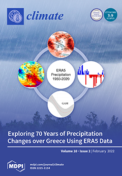
Cover Story (view full-size image): This study aims to shed new light on the climatic characteristics and inter-annual trends of precipitation over Greece and surrounding areas using ERA5 precipitation data (1950–2020). We estimated annual Theil–Sen trends and Mann–Kendall significance. We also used generalized additive models (GAMs) to estimate non-linear variabilities. The results indicated significant declining inter-annual trends of areal precipitation. Declining trends were more pronounced in winter over western and eastern Greece. GAMs highlighted that precipitation presented high inter-decadal variability. We concluded that precipitation increased from the 1950s to the late 1960s, consequently decreased until the early 1990s, and afterwards presented an increase until 2020 with a smaller rate than the 1950–1960s. View this paper
  • Issues are regarded as officially published after their release is announced to the table of contents alert mailing list.
  • You may sign up for e-mail alerts to receive table of contents of newly released issues.
  • PDF is the official format for papers published in both, html and pdf forms. To view the papers in pdf format, click on the "PDF Full-text" link, and use the free Adobe Reader to open them.
Order results
Result details
Section
Select all
Export citation of selected articles as:
22 pages, 10697 KiB  
Article
Sub-Hourly Precipitation Extremes in Mainland Portugal and Their Driving Mechanisms
by João A. Santos and Margarida Belo-Pereira
Climate 2022, 10(2), 28; https://doi.org/10.3390/cli10020028 - 19 Feb 2022
Cited by 4 | Viewed by 3580
Abstract
Sub-hourly heavy precipitation events (SHHPs) frequently underlie major meteorological hazards, but their comprehensive analysis is still lacking in Portugal. A 71-weather-station dataset for 2000–2020 is used in this article to (1) diagnose SHHPs corresponding to a 10-min precipitation event of at least 5.0 [...] Read more.
Sub-hourly heavy precipitation events (SHHPs) frequently underlie major meteorological hazards, but their comprehensive analysis is still lacking in Portugal. A 71-weather-station dataset for 2000–2020 is used in this article to (1) diagnose SHHPs corresponding to a 10-min precipitation event of at least 5.0 mm, (2) characterize their spatial-temporal distribution, and (3) identify their associated synoptic-scale conditions. Two synoptic types are associated with SHHPs: remote (RemL) and regional (RegL) low-pressure systems. RegL SHHPs display two marked maxima in spring and autumn, while RemL SHHPs show a single maximum in autumn. Most RegL events occur in the afternoon/evening, while RemL events show a slight bias toward midday occurrences. In the case of RemL, the wind is stronger for 2 to 3 h before and during SHHPs, veers from 180° to 210° near the event, the pressure decreases until 20 min before the event, and the wet-bulb temperature decreases around the time of the event and remains low, thus reflecting cold-front passages. For RegL, maximum winds coincide with precipitation peaks, and the wet-bulb temperature briefly decreases in association with downdrafts. A preliminary relationship between the SHHPs and mesoscale convective systems is established by detecting sudden surface-pressure surges, which are indicative of mesohighs caused by evaporatively cooled downdrafts. A calendar of mesohigh episodes linked to SHHPs is provided herein and their signatures are illustrated for the “Pedrógão-Grande” fires. Indicators of several downbursts, cold pools, and mesohighs were identified by the AROME forecast. This first, systematized analysis paves the way to identifying dynamic precursors, enabling their integration into early warning systems and climate projections. Full article
(This article belongs to the Special Issue Extreme Weather Events)
Show Figures

Figure 1

17 pages, 1912 KiB  
Article
Expectations of Future Natural Hazards in Human Adaptation to Concurrent Extreme Events in the Colorado River Basin
by Riccardo Boero, Carl James Talsma, Julia Andre Oliveto and Katrina Eleanor Bennett
Climate 2022, 10(2), 27; https://doi.org/10.3390/cli10020027 - 18 Feb 2022
Viewed by 2848
Abstract
Human adaptation to climate change is the outcome of long-term decisions continuously made and revised by local communities. Adaptation choices can be represented by economic investment models in which the often large upfront cost of adaptation is offset by the future benefits of [...] Read more.
Human adaptation to climate change is the outcome of long-term decisions continuously made and revised by local communities. Adaptation choices can be represented by economic investment models in which the often large upfront cost of adaptation is offset by the future benefits of avoiding losses due to future natural hazards. In this context, we investigate the role that expectations of future natural hazards have on adaptation in the Colorado River basin of the USA. We apply an innovative approach that quantifies the impacts of changes in concurrent climate extremes, with a focus on flooding events. By including the expectation of future natural hazards in adaptation models, we examine how public policies can focus on this component to support local community adaptation efforts. Findings indicate that considering the concurrent distribution of several variables makes quantification and prediction of extremes easier, more realistic, and consequently improves our capability to model human systems adaptation. Hazard expectation is a leading force in adaptation. Even without assuming increases in exposure, the Colorado River basin is expected to face harsh increases in damage from flooding events unless local communities are able to incorporate climate change and expected increases in extremes in their adaptation planning and decision making. Full article
Show Figures

Figure 1

12 pages, 4412 KiB  
Article
Air Pollution within Different Urban Forms in Manchester, UK
by Mohammad Taleghani
Climate 2022, 10(2), 26; https://doi.org/10.3390/cli10020026 - 16 Feb 2022
Cited by 6 | Viewed by 4661
Abstract
Air pollution causes millions of mortalities and morbidities in large cities. Different mitigation strategies are being investigated to alleviate the negative impacts of different pollutants on people. Designing proper urban forms is one of the least studied strategies. In this paper, we modelled [...] Read more.
Air pollution causes millions of mortalities and morbidities in large cities. Different mitigation strategies are being investigated to alleviate the negative impacts of different pollutants on people. Designing proper urban forms is one of the least studied strategies. In this paper, we modelled air pollution (NO2 concentration) within four hypothetical neighbourhoods with different urban forms: single, courtyard, linear east-west, and linear north-south scenarios. We used weather and air pollution data of Manchester as one of the cities with high NO2 levels in the UK. Results show that the pollution level is highly dependent on the air temperature and wind speed. Annually, air pollution is higher in cold months (45% more) compared to summer. Likewise, the results show that during a winter day, the concentration of air pollution reduces during the warm hours. Within the four modelled scenarios, the air pollution level in the centre of the linear north-south model is the lowest. The linear building blocks in this scenario reduce the concentration of the polluted air and keep a large area within the domain cleaner than the other scenarios. Understanding the location of air pollution (sources) and the direction of prevailing wind is key to design/plan for a neighbourhood with cleaner air for pedestrians. Full article
(This article belongs to the Special Issue Air and Water Quality in a Changing World)
Show Figures

Figure 1

11 pages, 1777 KiB  
Communication
Ecology and Climate of the Earth—The Same Biogeophysical System
by Roger A. Pielke, Sr., Debra P.C. Peters and Dev Niyogi
Climate 2022, 10(2), 25; https://doi.org/10.3390/cli10020025 - 14 Feb 2022
Cited by 2 | Viewed by 6094
Abstract
Ecology and the climate provide two perspectives of the same biogeophysical system at all spatiotemporal scales More effectively embracing this congruence is an opportunity to improve scientific understanding and predictions as well as for a more effective policy that integrates both the bottom-up [...] Read more.
Ecology and the climate provide two perspectives of the same biogeophysical system at all spatiotemporal scales More effectively embracing this congruence is an opportunity to improve scientific understanding and predictions as well as for a more effective policy that integrates both the bottom-up community, business-driven framework, and the popular, top-down impact assessment framework. The objective of this paper is, therefore, to more closely integrate the diverse spectrum of scientists, engineers and policymakers into finding optimal solutions to reduce the risk to environmental and social threats by considering the ecology and climate as an integrated system. Assessments such as performed towards the 2030 Plan for Sustainable Development, with its 17 Sustainable Development Goals and its Goal 13 in particular, can achieve more progress by accounting for the intimate connection of all aspects of the Earth’s biogeophysical system. Full article
(This article belongs to the Special Issue Climate Ecosystems Nexus)
Show Figures

Figure 1

23 pages, 4939 KiB  
Article
Bioaerosols as Evidence of Atmospheric Circulation Anomalies over the Okhotsk Sea and Shantar Islands in the Late Glacial–Holocene
by Nadezhda Razjigaeva, Larisa Ganzey, Tatiana Grebennikova, Vladimir Ponomarev, Ludmila Mokhova, Vladimir Chakov and Mikhail Klimin
Climate 2022, 10(2), 24; https://doi.org/10.3390/cli10020024 - 9 Feb 2022
Cited by 5 | Viewed by 3208
Abstract
Allochthonous biofossil distribution in the blanket peat bog of Bolshoy Shantar Island was used to analyze atmospheric circulation anomalies in the north-western Okhotsk Sea over the last 12.6 ka. The main aim of this study was to determine periods of intensification of deep [...] Read more.
Allochthonous biofossil distribution in the blanket peat bog of Bolshoy Shantar Island was used to analyze atmospheric circulation anomalies in the north-western Okhotsk Sea over the last 12.6 ka. The main aim of this study was to determine periods of intensification of deep cyclones and extreme storms. The composition of bioaerosols is significantly influenced by atmospheric zonal and meridional transport anomalies associated with anomalies of the monsoon system of Northeast Asia, atmospheric fronts and cyclone trajectories. Marine diatoms enter the peatland from the sea during extreme storms and record the passage of sea cyclones in the autumn-winter, whereas the distribution of allochthonous pollen indicates the intensity of continental cyclones. We used Pinus pumila pollen as an indicator of heavy snowfalls and winter cyclone activity. Fifteen phases of extreme storms were identified. Changes in ice coverage also played an important role in bioaerosol emission. During cold periods, emissions of bioaerosols mainly occurred in the open sea, whereas during warm periods, emissions occurred near the coast. The recurrence and intensity of cyclones during the cold seasons depends on displacement of the Siberian High and Aleutian Low. Periods of continental cyclones intensified in spring-summer and coincided with periods of active winter cyclogenesis. Full article
Show Figures

Figure 1

17 pages, 2619 KiB  
Article
Modeling Soil Organic Carbon Changes under Alternative Climatic Scenarios and Soil Properties Using DNDC Model at a Semi-Arid Mediterranean Environment
by Ibtissame Lembaid, Rachid Moussadek, Rachid Mrabet and Ahmed Bouhaouss
Climate 2022, 10(2), 23; https://doi.org/10.3390/cli10020023 - 9 Feb 2022
Cited by 9 | Viewed by 5079
Abstract
Soil organic carbon (SOC) is one of the central issues in dealing with soil fertility as well as environmental and food safety. Due to the lack of relevant data sources and methodologies, analyzing SOC dynamics has been a challenge in Morocco. During the [...] Read more.
Soil organic carbon (SOC) is one of the central issues in dealing with soil fertility as well as environmental and food safety. Due to the lack of relevant data sources and methodologies, analyzing SOC dynamics has been a challenge in Morocco. During the last two decades, process-based models have been adopted as alternative and powerful tools for modeling SOC dynamics; whereas, information and knowledge on the most sensitive model inputs under different climate, and soil conditions are still very limited. For this purpose, a sensitivity analysis was conducted in the present work, using the DeNitrification-DeComposition (DNDC) model based on the data collected at a semi-arid region (Merchouch station, Morocco). The objective is to identify the most influential factors affecting the DNDC-modeled SOC dynamics in a semi-arid region across different climatic and soil conditions. The results of sensitivity analysis highlighted air temperature as the main determinant of SOC. A decrease in air temperature of 4 °C results in an almost 161 kg C ha−1 yr−1 increase in C sequestration rate. Initial SOC was also confirmed to be one of the most sensitive parameters for SOC. There was a 96 kg C ha−1 yr−1 increase in C sequestration rate under low initial SOC (0.005 kg C ha−1). In the DNDC, air temperature in climatic factors and initial SOC in variable soil properties had the largest impacts on SOC accumulation in Merchouch station. We can conclude that the sensitivity analysis conducted in this study within the DNDC can contribute to provide a scientific evidence of uncertainties of the selected inputs variables who can lead to uncertainties on the SOC in the study site. The information in this paper can be helpful for scientists and policy makers, who are dealing with regions of similar environmental conditions as Merchouch Station, by identifying alternative scenarios of soil carbon sequestration. Full article
(This article belongs to the Special Issue Climate Variability in the Mediterranean Region)
Show Figures

Figure 1

5 pages, 230 KiB  
Editorial
Acknowledgment to Reviewers of Climate in 2021
by Climate Editorial Office
Climate 2022, 10(2), 22; https://doi.org/10.3390/cli10020022 - 9 Feb 2022
Viewed by 1730
Abstract
Rigorous peer-reviews are the basis of high-quality academic publishing [...] Full article
15 pages, 1751 KiB  
Article
Study of Turbulence Associated with the Faraji Cyclone
by Giuseppe Ciardullo, Leonardo Primavera, Fabrizio Ferrucci, Vincenzo Carbone and Fabio Lepreti
Climate 2022, 10(2), 21; https://doi.org/10.3390/cli10020021 - 6 Feb 2022
Cited by 2 | Viewed by 2461
Abstract
The formation of a cyclonic region in which nonlinear interactions generate turbulence in the form of small-scale vortices can be observed because of the different rotating air masses. Turbulence dynamics in cyclones (specifically hurricanes) has been under-researched; therefore, assessing the shear term is [...] Read more.
The formation of a cyclonic region in which nonlinear interactions generate turbulence in the form of small-scale vortices can be observed because of the different rotating air masses. Turbulence dynamics in cyclones (specifically hurricanes) has been under-researched; therefore, assessing the shear term is crucial to identify the onset of cyclonic formation within a region of the atmosphere. Earth observation techniques are able to provide relevant information on this physical process. In this article, we propose a new framework that is useful for connecting the study of the dynamics of a cyclonic system with the observations generated by geostationary satellite facilities. In particular, we applied the proper orthogonal decomposition (POD), a technique widely used in turbulent analysis to decompose a generic scalar or vector field in empirical eigenfunction, to investigate a tropical cyclone, the Faraji hurricane, from a dynamic point of view, beginning from the temporal evolution of its temperature field. The latter was obtained by elaborating on data and images collected by the SEVIRI radiometer, installed on the Meteosat Second Generation-8 (IODC) satellite. Using the POD, the energy spectra of both the spatial and temporal components of the temperature field obtained through remote sensing techniques were studied separately. Important information was then extracted and used for an in-depth characterization of the properties of the turbulence in the non-linear evolution of this phenomenon. Full article
(This article belongs to the Special Issue Cyclones, Hurricanes, Medicanes and Impacts)
Show Figures

Figure 1

21 pages, 1606 KiB  
Article
Implications of Flood Risk Reduction Interventions on Community Resilience: An Assessment of Community Perception in Bangladesh
by Md. Sazzad Ansari, Jeroen Warner, Vibhas Sukhwani and Rajib Shaw
Climate 2022, 10(2), 20; https://doi.org/10.3390/cli10020020 - 6 Feb 2022
Cited by 10 | Viewed by 5408
Abstract
Bangladesh, a flat densely populated country in a dynamic delta, is vulnerable to recurring flood disasters. Various types of structural and non-structural flood risk reduction interventions have been implemented over the years to safeguard the people and assets. In that context, the present [...] Read more.
Bangladesh, a flat densely populated country in a dynamic delta, is vulnerable to recurring flood disasters. Various types of structural and non-structural flood risk reduction interventions have been implemented over the years to safeguard the people and assets. In that context, the present study assesses the community perception about the implications of such diverse interventions on community resilience, in three reasonably proximate settlements, with varying characteristics: the Type 1 settlement has a flood protection embankment; the Type 2 settlement has no flood risk reduction intervention, and the Type 3 settlement has non-structural interventions. Through a mixed-method assessment in selected settlements, the study results reveal both positive and negative implications of these interventions on local communities. While the embankment has contributed towards enhancing infrastructural resilience in the Type 1 settlement, it still reportedly does not provide complete flood safety. On the other hand, the non-structural measures are reported to have increased community competencies in the Type 3 settlement, but the long-term sustainability of these traits is uncertain. Furthermore, the study results uncover “connectedness among local communities” as an inherent characteristic in all three locations, whereas flood risk reduction interventions are stated to be partly associated with social tension and the marginalization of certain socio-economic groups. Full article
(This article belongs to the Special Issue Climate Change, Sustainable Development and Disaster Risks)
Show Figures

Figure 1

15 pages, 2721 KiB  
Article
Combined Effect of High-Resolution Land Cover and Grid Resolution on Surface NO2 Concentrations
by Carlos Silveira, Joana Ferreira, Paolo Tuccella, Gabriele Curci and Ana I. Miranda
Climate 2022, 10(2), 19; https://doi.org/10.3390/cli10020019 - 5 Feb 2022
Cited by 5 | Viewed by 2560
Abstract
High-resolution air quality simulations are often performed using different nested domains and resolutions. In this study, the variability of nitrogen dioxide (NO2) concentrations estimated from two nested domains focused on Portugal (D2 and D3), with 5 and 1 km horizontal grid [...] Read more.
High-resolution air quality simulations are often performed using different nested domains and resolutions. In this study, the variability of nitrogen dioxide (NO2) concentrations estimated from two nested domains focused on Portugal (D2 and D3), with 5 and 1 km horizontal grid resolutions, respectively, was investigated by applying the WRF-Chem model for the year 2015. The main goal and innovative aspect of this study is the simulation of a whole year with high resolutions to analyse the spatial variability under the simulation grids in conjunction with detailed land cover (LC) data specifically processed for these high-resolution domains. The model evaluation was focused on Portuguese air quality monitoring stations taking into consideration the station typology. As main results, it should be noted that (i) D3 urban LC categories enhanced pollution hotspots; (ii) generally, modelled NO2 was underestimated, except for rural stations; (iii) differences between D2 and D3 estimates were small; (iv) higher resolution did not impact model performance; and (v) hourly D2 estimates presented an acceptable quality level for policy support. These modelled values are based on a detailed LC classification (100 m horizontal resolution) and coarse spatial resolution (approximately 10 km) emission inventory, the latter suitable for portraying background air pollution problems. Thus, if the goal is to characterise urban/local-scale pollution patterns, the use of high grid resolution could be advantageous, as long as the input data are properly represented. Full article
(This article belongs to the Special Issue Air and Water Quality in a Changing World)
Show Figures

Figure 1

19 pages, 6214 KiB  
Article
Evaluation of the Urban Microclimate in Catania Using Multispectral Remote Sensing and GIS Technology
by Michele Mangiameli, Giuseppe Mussumeci and Antonio Gagliano
Climate 2022, 10(2), 18; https://doi.org/10.3390/cli10020018 - 5 Feb 2022
Cited by 5 | Viewed by 3307
Abstract
This study focuses on the determination and examination of both the Land Surface Temperature (LST) and the atmospheric temperature in the city of Catania Sicily (Italy), through freely available satellite remote sensing images from the Sentinel-2 and MODIS missions. Satellite images were processed [...] Read more.
This study focuses on the determination and examination of both the Land Surface Temperature (LST) and the atmospheric temperature in the city of Catania Sicily (Italy), through freely available satellite remote sensing images from the Sentinel-2 and MODIS missions. Satellite images were processed as raster data in free and open-source GIS environments. The GIS software allows the retrieval, processing of the satellite images for the estimation of the LST and the atmospheric temperature with a very coarse spatial resolution. In particular, the proposed procedure allows increasing the spatial resolution of satellite images, from 250 m (LRES) to 10 m (HRES) through the principle of “Disaggregation of thermal images”. The analysis provided georeferenced maps which show the LST, as well as the atmospheric temperature within the investigated area with a very fine resolution, 10 m. Such spatial resolution reveals evident correlations between areas with different urban densities and their microclimate. An important result of this study is that significant LST differences can be observed during both day (15–17 °C) and night (2–3 °C) between green and built-up areas. The outcomes of this study highlight the effectiveness of the combined use of satellite remote sensing and GIS for analyzing the thermal response of urbanized areas with different built density. Full article
Show Figures

Figure 1

14 pages, 2614 KiB  
Article
Water Profitability Analysis to Improve Food Security and Climate Resilience: A Case Study in the Egyptian Nile Delta
by Adham Badawy, Amgad Elmahdi, Sayed Abd El-Hafez and Ali Ibrahim
Climate 2022, 10(2), 17; https://doi.org/10.3390/cli10020017 - 30 Jan 2022
Cited by 3 | Viewed by 4293
Abstract
The food self-sufficiency policy has always featured as an unquestionable policy objective for Egypt. This is understandable when one considers both the high population growth and the social and political vulnerability associated with a dependence on food imports and world market food prices [...] Read more.
The food self-sufficiency policy has always featured as an unquestionable policy objective for Egypt. This is understandable when one considers both the high population growth and the social and political vulnerability associated with a dependence on food imports and world market food prices such as wheat. Intensive agriculture has led to a growing subsidy burden for the Egyptian government. In addition, the agricultural fields in Egypt are commonly distributed with relatively small sizes parcels that usually reduce the reliability of the agricultural sector, particularly in the delta region, to meet the national food policy. On top of that, climate change, through changing weather patterns and increased temperatures, is affecting agricultural yields and thus farmers’ livelihoods. A water profitability analysis was conducted for three governorates in the Nile Delta in Egypt to establish a baseline and assess the net return per unit of water of the main crops in each of these governorates; this can act as a reference of the water profitability of different crops before they are affected by climate change and other internal and external factors. The analysis was based on extensive in-person surveys in each governorate in addition to workshop discussions with farmers. The study has highlighted the impact of a lack of extension services, which limits farmers’ ability to increase their land and water productivity. Farmers with more access to subsidized production inputs managed to achieve higher levels of water profitability even on smaller lands. Finally, we drew from our findings key policy actions to improve water profitability and land productivity for farmers in the Nile Delta to achieve higher levels of food security. This will help build resilient food production systems that are reliable in the face of climate change and other drivers. In addition, an integrated nexus strategy and plan for the inter- and intra-country is recommended to address the challenges related to food and climate security. Full article
(This article belongs to the Special Issue Climate Change and Food Insecurity)
Show Figures

Figure 1

32 pages, 6344 KiB  
Article
Assessing Changes in 21st Century Mean and Extreme Climate of the Sacramento–San Joaquin Delta in California
by Minxue He
Climate 2022, 10(2), 16; https://doi.org/10.3390/cli10020016 - 29 Jan 2022
Cited by 6 | Viewed by 3474
Abstract
This work aims to assess potential changes in the mean and extreme precipitation and temperature across the Sacramento–San Joaquin Delta (Delta) in California in the 21st century. The study employs operative climate model projections from the Coupled Model Inter-comparison Project Phase 5 (CMIP5). [...] Read more.
This work aims to assess potential changes in the mean and extreme precipitation and temperature across the Sacramento–San Joaquin Delta (Delta) in California in the 21st century. The study employs operative climate model projections from the Coupled Model Inter-comparison Project Phase 5 (CMIP5). Specifically, 64 individual downscaled daily projections (1/16 degree, approximately 6 by 6 km) on precipitation and temperature from 32 Global Circulation Models (GCMs) under two emission scenarios (RCP 4.5 and RCP 8.5) from 2020–2099 are utilized for the analysis. The results indicate increasing warming (in mean, minimum, and maximum temperature) further into the future under both emission scenarios. Warming also exhibits a strong seasonality, with winters expecting lower and summers expecting higher increases in temperature. In contrast, for mean annual total precipitation, there is no consistent wetter or drier signal. On average, the changes in annual total precipitation are minimal. However, dry season precipitation is projected to decline. The study also shows that the number of wet days is projected to decrease while the number of very wet (daily precipitation over 10 mm) and extremely wet (daily precipitation over 20 mm) days is projected to increase. Moreover, the study illustrates that only about half of the changes in total annual precipitation are projected to come from changes in the wettest 10% of wet days. In contrast, a majority of changes in variance of the annual precipitation comes from changes in variance of the wettest 10% of the wet days. This suggests that fluctuations in large storms are projected to dictate the variability of precipitation in the Delta. Additionally, a general upward trend in dry conditions measured by the Standardized Precipitation-Evapotranspiration Index is expected during the projection period. The trending signal is stronger at multi-year temporal scales (one to four years) and under the higher emission scenario. These change patterns are generally similar across three sub-regions of the Delta (i.e., North, South, and West), even though some changes in the South Delta are the most pronounced. This study further discusses challenges posed by these changes to the Delta’s water supply and ecosystems, along with the Delta’s resiliency and potential ways to address these challenges. Full article
Show Figures

Figure 1

15 pages, 3831 KiB  
Article
Possibilities of Sustainable Development including Improvement in Air Quality for the City of Murmansk-Examples of Best Practice from Scandinavia
by Miłosz Huber, Adrianna Rusek, Marija Menshakova, Galina Zhigunova, Stanisław Chmiel and Olga Iakovleva
Climate 2022, 10(2), 15; https://doi.org/10.3390/cli10020015 - 28 Jan 2022
Cited by 6 | Viewed by 3339
Abstract
The Russian city of Murmansk has about 300,000 inhabitants and is located inside the Arctic Circle in NE Scandinavia (Russia). It has one of the largest such concentrations of people in the Arctic. The city is a scientific, industrial, cultural, and transportation centre [...] Read more.
The Russian city of Murmansk has about 300,000 inhabitants and is located inside the Arctic Circle in NE Scandinavia (Russia). It has one of the largest such concentrations of people in the Arctic. The city is a scientific, industrial, cultural, and transportation centre (an ice-free port in the so-called Northern Sea Route, connecting Europe with Asia). Currently, air pollution in the city is associated with outdated city heating technology, coal dust from the port and vehicular traffic, and so-called “small emissions”. The authors propose practical solutions based on known examples of Scandinavian cities with similar climatic conditions such as: the modernisation of heat energy acquisition; diversification of energy acquisition including renewable sources; thermal insulation of buildings; arrangement of urban greenery with dust-catching plants, and proposals for changing the habits within the population by promoting the use of public transport. Full article
(This article belongs to the Special Issue Air and Water Quality in a Changing World)
Show Figures

Figure 1

17 pages, 3158 KiB  
Article
The Potential Global Climate Suitability of Kiwifruit Bacterial Canker Disease (Pseudomonas syringae pv. actinidiae (Psa)) Using Three Modelling Approaches: CLIMEX, Maxent and Multimodel Framework
by Hossein A. Narouei-Khandan, Susan P. Worner, Suvi L. H. Viljanen, Ariena H. C. van Bruggen, Giorgio M. Balestra and Eirian Jones
Climate 2022, 10(2), 14; https://doi.org/10.3390/cli10020014 - 28 Jan 2022
Cited by 8 | Viewed by 4688
Abstract
In recent years, outbreaks of kiwifruit bacterial canker (Pseudomonas syringae pv. actinidiae, Psa) have caused huge economic losses to two major global kiwifruit producers, Italy and New Zealand. To evaluate the potential global risk areas of Psa, three modelling methods (MaxEnt, [...] Read more.
In recent years, outbreaks of kiwifruit bacterial canker (Pseudomonas syringae pv. actinidiae, Psa) have caused huge economic losses to two major global kiwifruit producers, Italy and New Zealand. To evaluate the potential global risk areas of Psa, three modelling methods (MaxEnt, CLIMEX and a Multi-Model Framework, including Support Vector Machine or SVM) were used. Current global occurrence data for Psa were collected from different sources. The long-term climate data were sourced from WorldClim and CliMond websites. The model results were combined into a consensus model to identify the hotspots. The consensus model highlighted the areas where two or three models agreed on climate suitability for Psa. All three models agreed with respect to the climate suitability of areas where Psa is currently present and identified novel areas where Psa has not established yet. The SVM model predicted large areas in Central Asia, Australia, and Europe as more highly suitable compared to MaxEnt and CLIMEX. Annual mean temperature and annual precipitation contributed most to the MaxEnt prediction. Both MaxEnt and CLIMEX showed the probability of Psa establishment increased above 5 °C and decreased above 20 °C. The annual precipitation response curve showed that excessive rain (>1200 mm/y) constrains Psa establishment. Our modelling results will provide useful information for Psa management by highlighting the climatically susceptible areas where Psa has not established, such as the USA, Iran, Denmark, Belgium and especially South Africa, where kiwifruit has been planted commercially in recent years. Full article
Show Figures

Figure 1

28 pages, 5479 KiB  
Review
Using the Conservation Standards Framework to Address the Effects of Climate Change on Biodiversity and Ecosystem Services
by Marcia B. Brown, John C. Morrison, Terri T. Schulz, Molly S. Cross, Nicole Püschel-Hoeneisen, Varsha Suresh and Antonieta Eguren
Climate 2022, 10(2), 13; https://doi.org/10.3390/cli10020013 - 22 Jan 2022
Cited by 9 | Viewed by 10138
Abstract
Climate change has challenged biodiversity conservation practitioners and planners. In this paper, we provide scalable guidance on integrating climate change into conservation planning and adaptive management that results in the most appropriate conservation strategies. This integrated “Climate-Smart Conservation Practice” focuses on analyzing the [...] Read more.
Climate change has challenged biodiversity conservation practitioners and planners. In this paper, we provide scalable guidance on integrating climate change into conservation planning and adaptive management that results in the most appropriate conservation strategies. This integrated “Climate-Smart Conservation Practice” focuses on analyzing the potential impact of climate change on species, ecosystems, and ecosystem services, combined with “conventional” (non-climate) threats, and incorporating this knowledge into projects. The guidance is based on the already widely-used “Open Standards for the Practice of Conservation”, an application of systems thinking and adaptive management, which has been successfully applied to thousands of conservation projects. Our framework emphasizes a methodical analysis of climate change impacts for projects to support more productive goals and strategy development. We provide two case studies showing the applicability and flexibility of this framework. An initial key element is developing “situation models” that document both current and future threats affecting biodiversity while showing the interactions between climate and conventional threats. Guidance is also provided on how to design integrated, climate-smart goals and strategies, and detailed theories of change for selected strategies. The information and suggestions presented are intended to break down the steps to make the process more approachable, provide guidance to teams using climate change information within a systematic conservation planning process, and demonstrate how climate scientists can provide appropriate information to conservation planners. Full article
(This article belongs to the Special Issue Climate System Uncertainty and Biodiversity Conservation)
Show Figures

Figure 1

19 pages, 7864 KiB  
Article
Unravelling Precipitation Trends in Greece since 1950s Using ERA5 Climate Reanalysis Data
by George Varlas, Konstantinos Stefanidis, George Papaioannou, Yiannis Panagopoulos, Ioannis Pytharoulis, Petros Katsafados, Anastasios Papadopoulos and Elias Dimitriou
Climate 2022, 10(2), 12; https://doi.org/10.3390/cli10020012 - 18 Jan 2022
Cited by 23 | Viewed by 6580
Abstract
Precipitation is one of the most variable climatic parameters, as it is determined by many physical processes. The spatiotemporal characteristics of precipitation have been significantly affected by climate change during the past decades. Analysis of precipitation trends is challenging, especially in regions such [...] Read more.
Precipitation is one of the most variable climatic parameters, as it is determined by many physical processes. The spatiotemporal characteristics of precipitation have been significantly affected by climate change during the past decades. Analysis of precipitation trends is challenging, especially in regions such as Greece, which is characterized by complex topography and includes several ungauged areas. With this study, we aim to shed new light on the climatic characteristics and inter-annual trends of precipitation over Greece. For this purpose, we used ERA5 monthly precipitation data from 1950 to 2020 to estimate annual Theil–Sen trends and Mann–Kendall significance over Greece and surrounding areas. Additionally, in order to analyze and model the nonlinear relationships of monthly precipitation time series, we used generalized additive models (GAMs). The results indicated significant declining inter-annual trends of areal precipitation over the study area. Declining trends were more pronounced in winter over western and eastern Greece, but trends in spring, summer and autumn were mostly not significant. GAMs showcased that the trends were generally characterized by nonlinearity and precipitation over the study area presented high inter-decadal variability. Combining the results, we concluded that precipitation did not linearly change during the past 7 decades, but it first increased from the 1950s to the late 1960s, consequently decreased until the early 1990s and, afterwards, presented an increase until 2020 with a smaller rate than the 1950–1960s. Full article
(This article belongs to the Special Issue Climate Change Impacts at Various Geographical Scales)
Show Figures

Figure 1

13 pages, 70212 KiB  
Article
Peaches Detection Using a Deep Learning Technique—A Contribution to Yield Estimation, Resources Management, and Circular Economy
by Eduardo T. Assunção, Pedro D. Gaspar, Ricardo J. M. Mesquita, Maria P. Simões, António Ramos, Hugo Proença and Pedro R. M. Inacio
Climate 2022, 10(2), 11; https://doi.org/10.3390/cli10020011 - 18 Jan 2022
Cited by 13 | Viewed by 3806
Abstract
Fruit detection is crucial for yield estimation and fruit picking system performance. Many state-of-the-art methods for fruit detection use convolutional neural networks (CNNs). This paper presents the results for peach detection by applying a faster R-CNN framework in images captured from an outdoor [...] Read more.
Fruit detection is crucial for yield estimation and fruit picking system performance. Many state-of-the-art methods for fruit detection use convolutional neural networks (CNNs). This paper presents the results for peach detection by applying a faster R-CNN framework in images captured from an outdoor orchard. Although this method has been used in other studies to detect fruits, there is no research on peaches. Since the fruit colors, sizes, shapes, tree branches, fruit bunches, and distributions in trees are particular, the development of a fruit detection procedure is specific. The results show great potential in using this method to detect this type of fruit. A detection accuracy of 0.90 using the metric average precision (AP) was achieved for fruit detection. Precision agriculture applications, such as deep neural networks (DNNs), as proposed in this paper, can help to mitigate climate change, due to horticultural activities by accurate product prediction, leading to improved resource management (e.g., irrigation water, nutrients, herbicides, pesticides), and helping to reduce food loss and waste via improved agricultural activity scheduling. Full article
Show Figures

Figure 1

18 pages, 5574 KiB  
Article
Suitability Assessment of Weather Networks for Wind Data Measurements in the Athabasca Oil Sands Area
by Dhananjay Deshmukh, M. Razu Ahmed, John Albino Dominic, Anil Gupta, Gopal Achari and Quazi K. Hassan
Climate 2022, 10(2), 10; https://doi.org/10.3390/cli10020010 - 18 Jan 2022
Cited by 4 | Viewed by 4048
Abstract
The Athabasca Oil Sands Area (AOSA) in Alberta, Canada, is considered to have a high density of weather stations. Therefore, our objective was to determine an optimal network for the wind data measurement that could sufficiently represent the wind variability in the area. [...] Read more.
The Athabasca Oil Sands Area (AOSA) in Alberta, Canada, is considered to have a high density of weather stations. Therefore, our objective was to determine an optimal network for the wind data measurement that could sufficiently represent the wind variability in the area. We used available historical data records of the weather stations in the three networks in AOSA, i.e., oil sands monitoring (OSM) water quantity program (WQP) and Wood Buffalo Environmental Association (WBEA) edge sites (ES) and meteorological towers (MT) of the air program. Both graphical and quantitative methods were implemented to find the correlations and similarities in the measurements between weather stations in each network. The graphical method (wind rose diagram) was found as a functional tool to understand the patterns of wind directions, but it was not appropriate to quantify and compare between wind speed data of weather stations. Therefore, we applied the quantitative method of the Pearson correlation coefficient (r) and absolute average error (AAE) in finding a relationship between the wind data of station pairs and the percentage of similarity (PS) method in quantifying the closeness/similarity. In the correlation analyses, we found weak to strong correlations in the wind data of OSM WQP (r = 0.04–0.69) and WBEA ES (r = 0.32–0.77), and a strong correlation (r = 0.33–0.86) in most of the station pairs of the WBEA MT network. In the case of AAE, we did not find any acceptable value within the standard operating procedure (SOP) threshold when logically combining the values of the u and v components together. In the similarity analysis, minor similarities were identified between the stations in the three networks. Hence, we presumed that all weather stations would be required to measure wind data in the AOSA. Full article
(This article belongs to the Special Issue Climate Change Dynamics and Modeling: Future Perspectives)
Show Figures

Figure 1

Previous Issue
Next Issue
Back to TopTop