Next Issue
Volume 9, January
Previous Issue
Volume 8, November


Land, Volume 8, Issue 12 (December 2019) – 20 articles

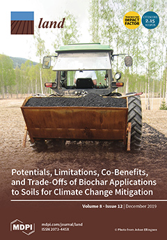
Cover Story (view full-size image): Biochar—charcoal produced from biomass and applied to agricultural soils—is attracting attention from research and policymakers as a strategy for long-term sequestration of carbon in soils while improving soil quality. We reviewed the environmental implications of biochar deployment around three main aspects: climate, food security, and ecosystem quality. Biochar can deliver negative emissions at scale and contributes to the carbon removal required by the Paris agreements. Biochar application to soils has multiple environmental co-benefits and some trade-offs, which are dependent on production conditions, soil conditions, and management. Compared to other negative emission technologies, biochar is technologically mature and a cost-effective option with relatively low environmental risks.View this paper.
  • Issues are regarded as officially published after their release is announced to the table of contents alert mailing list.
  • You may sign up for e-mail alerts to receive table of contents of newly released issues.
  • PDF is the official format for papers published in both, html and pdf forms. To view the papers in pdf format, click on the "PDF Full-text" link, and use the free Adobe Reader to open them.
Order results
Result details
Section
Select all
Export citation of selected articles as:
21 pages, 8592 KiB  
Article
Simulation of an Urban-Rural Spatial Structure on the Basis of Green Infrastructure Assessment: The Case of Harbin, China
by Rong Guo and Yujing Bai
Land 2019, 8(12), 196; https://doi.org/10.3390/land8120196 - 15 Dec 2019
Cited by 12 | Viewed by 4681
Abstract
Due to their long-term dual structures and rapid urbanization, cities and villages in developing countries are undergoing the challenges of urban-rural integration and ecological security. This study aims to determine the pattern of urban-rural spatial structures under the circumstances of ecological security in [...] Read more.
Due to their long-term dual structures and rapid urbanization, cities and villages in developing countries are undergoing the challenges of urban-rural integration and ecological security. This study aims to determine the pattern of urban-rural spatial structures under the circumstances of ecological security in the future to promote the integrated, coordinated, green, and sustainable development of urban-rural spaces. Using a quantitative evaluation method, the logistic-CA model, the LCP (least cost path) model, and a classification of ecological importance, this study constructed an integrated simulation model based on a green infrastructure assessment and applied the model to simulate and predict the urban-rural spatial structure of the Harbin city territory (Harbin) in 2035. The results indicate that the urban-rural hierarchical scale structure of Harbin comprises a central city, sub-central city, central town, major town, common town, central village, and general village. The urban-rural traffic network structure forms a pattern of “radiation + grid”, with Harbin city at the center of the structure. The urban-rural land use zoning structure consists of eco-spaces, agricultural spaces, and construction spaces. It can be concluded that in 2035, the urban-rural spatial structure of Harbin will show an increasing development tendency, where single-center, medium, and small cities in will Harbin develop, and traffic systems above the county level will also improve. Full article
(This article belongs to the Special Issue Land Change Modelling)
Show Figures

Figure 1

25 pages, 4328 KiB  
Article
Amman (City of Waters); Policy, Land Use, and Character Changes
by Anne A. Gharaibeh, Esra’a M. Al.Zu’bi and Lama B. Abuhassan
Land 2019, 8(12), 195; https://doi.org/10.3390/land8120195 - 15 Dec 2019
Cited by 14 | Viewed by 8702
Abstract
The character of Amman, Jordan, as the "City of Waters"—referring to the abundance of water flowing in its known stream—has faded away because of the municipal policy to cover the stream in the 1960s which gradually changed the ecological character. This paper [...] Read more.
The character of Amman, Jordan, as the "City of Waters"—referring to the abundance of water flowing in its known stream—has faded away because of the municipal policy to cover the stream in the 1960s which gradually changed the ecological character. This paper traces and explores the impacts of stream-coverage policy on the city character, morphology and land use changes. The purpose is to understand how an engineered problem-solving policy changed physical and perceptive factors and affected the character of the city. It also explores future attitudes towards reversing the non-nature-friendly conditions. The methods depend upon monitoring morphological changes in aerial photographs and in land use maps from municipality archives, conducting interviews with the elderly who witnessed change, one-to-one questionnaires with stakeholders and online questionnaires with residents and visitors. The results show that covering the stream is depriving the city of its historical/ecological character. The policy failed to promote affluent business, to mitigate flood impacts, or to decrease traffic congestion in the Central Business District (CBD). Most age groups believe the stream can improve the image and economy, despite the fact of their unawareness of its historical presence. In conclusion, engineered problem-solving should not stay in the hands of decision makers (technocrats) alone, but rather be considered with the public, sustainable character experts, and ecologists. Full article
Show Figures

Figure 1

20 pages, 1137 KiB  
Article
Economic Value of Cultural Ecosystem Services from Recreation in Popa Mountain National Park, Myanmar: A Comparison of Two Rapid Valuation Techniques
by Wai Soe Zin, Aya Suzuki, Kelvin S.-H. Peh and Alexandros Gasparatos
Land 2019, 8(12), 194; https://doi.org/10.3390/land8120194 - 14 Dec 2019
Cited by 15 | Viewed by 6853
Abstract
Protected areas offer diverse ecosystem services, including cultural services related to recreation, which contribute manifold to human wellbeing and the economy. However, multiple pressures from other human activities often compromise ecosystem service delivery from protected areas. It is thus fundamental for effective management [...] Read more.
Protected areas offer diverse ecosystem services, including cultural services related to recreation, which contribute manifold to human wellbeing and the economy. However, multiple pressures from other human activities often compromise ecosystem service delivery from protected areas. It is thus fundamental for effective management to understand the recreational values and visitor behaviors in such areas. This paper undertakes a rapid assessment of the economic value of cultural ecosystem services related to recreation in a national park in Myanmar using two valuation techniques, the individual travel cost method (TCM) and the Toolkit for Ecosystem Service Site-based Assessment (TESSA v.1.2). We focus on the Popa Mountain National Park, a protected area visited by approximately 800,000 domestic and 25,000 international tourists annually. Individual TCM estimates that each domestic visitor spent USD 20–24 per trip, and the total annual recreational value contributed by these visitors was estimated at USD 16.1–19.6 million (USD 916–1111 ha−1). TESSA estimated the annual recreational expenditure from domestic and international visitors at USD 15.1 million (USD 858 ha−1) and USD 5.04 million (USD 286 ha−1), respectively. Both methods may be employed as practical approaches to assess the recreational values of protected areas (and other land uses with recreational value), and they have rather complementary approaches. We recommend that both techniques be combined into a single survey protocol. Full article
(This article belongs to the Special Issue Exploring the Relationships between Land Use and Ecosystem Services)
Show Figures

Figure 1

16 pages, 12859 KiB  
Article
Assessing Riyadh’s Urban Change Utilizing High-Resolution Imagery
by Ali Alghamdi and Anthony R. Cummings
Land 2019, 8(12), 193; https://doi.org/10.3390/land8120193 - 13 Dec 2019
Cited by 7 | Viewed by 4544
Abstract
The implications of change on local processes have attracted significant research interest in recent times. In urban settings, green spaces and forests have attracted much attention. Here, we present an assessment of change within the predominantly desert Middle Eastern city of Riyadh, an [...] Read more.
The implications of change on local processes have attracted significant research interest in recent times. In urban settings, green spaces and forests have attracted much attention. Here, we present an assessment of change within the predominantly desert Middle Eastern city of Riyadh, an understudied setting. We utilized high-resolution SPOT 5 data and two classification techniques—maximum likelihood classification and object-oriented classification—to study the changes in Riyadh between 2004 and 2014. Imagery classification was completed with training data obtained from the SPOT 5 dataset, and an accuracy assessment was completed through a combination of field surveys and an application developed in ESRI Survey 123 tool. The Survey 123 tool allowed residents of Riyadh to present their views on land cover for the 2004 and 2014 imagery. Our analysis showed that soil or ‘desert’ areas were converted to roads and buildings to accommodate for Riyadh’s rapidly growing population. The object-oriented classifier provided higher overall accuracy than the maximum likelihood classifier (74.71% and 73.79% vs. 92.36% and 90.77% for 2004 and 2014). Our work provides insights into the changes within a desert environment and establishes a foundation for understanding change in this understudied setting. Full article
Show Figures

Figure 1

20 pages, 8762 KiB  
Article
Research-Based Design Approaches in Historic Garden Renovation
by Albert Fekete and László Kollányi
Land 2019, 8(12), 192; https://doi.org/10.3390/land8120192 - 12 Dec 2019
Cited by 10 | Viewed by 6347
Abstract
The renewal of historic gardens, landscapes, and sites has grown to be a current issue in Central and Eastern Europe. Based on scientific research, the Department of Garden Art of the Szent István University, Faculty of Landscape Architecture and Urbanism has been dealing [...] Read more.
The renewal of historic gardens, landscapes, and sites has grown to be a current issue in Central and Eastern Europe. Based on scientific research, the Department of Garden Art of the Szent István University, Faculty of Landscape Architecture and Urbanism has been dealing with landscape renewal since 1963 on regional, settlement, and garden scales, too. More than 50 years of experience has already proved the advantage of such a research-based design approach in garden and landscape renewal processes, Landscape Architecture has developed from a very practical basis. The purpose of this paper is to show the most significant conclusions of our historic garden research of castle gardens from the Carpathian Basin, focusing on the importance of visual connections designed initially on the sites. Using case studies, the paper intends to explore how proper landscape design in historic environments is achieved. The historical value cannot be simplified or understood as the notion of “old”, the heritage being represented by the all-time valuable garden features and elements, independent from their formation in time. In addition to the historical authenticity of the actual use, the social needs and sustainability are important aspects, which must be integrated into heritage protection and reclamation. Full article
Show Figures

Figure 1

16 pages, 12151 KiB  
Commentary
Desertification Risk and Rural Development in Southern Europe: Permanent Assessment and Implications for Sustainable Land Management and Mitigation Policies
by Rosanna Salvia, Gianluca Egidi, Sabato Vinci and Luca Salvati
Land 2019, 8(12), 191; https://doi.org/10.3390/land8120191 - 11 Dec 2019
Cited by 24 | Viewed by 6757
Abstract
The United Nations Convention to Combat Desertification defines ‘land degradation’ as a reduction or loss of the biological and economic productivity resulting from land-use mismanagement, or a combination of processes, such as soil erosion, deterioration of soil properties, and loss of natural vegetation [...] Read more.
The United Nations Convention to Combat Desertification defines ‘land degradation’ as a reduction or loss of the biological and economic productivity resulting from land-use mismanagement, or a combination of processes, such as soil erosion, deterioration of soil properties, and loss of natural vegetation and biodiversity. Land degradation is hence an interactive process involving multiple factors, among which climate, land-use, economic dynamics and socio-demographic forces play a key role. Especially in the Mediterranean basin, joint biophysical and socioeconomic factors shape the intrinsic level of vulnerability of both natural and agricultural land to degradation. The interplay between biophysical and socioeconomic factors may become extremely complex over time and space, resulting in specific patterns of landscape deterioration. This paper summarizes theoretical expectations and empirical knowledge in the field of soil and landscape degradation in Mediterranean Europe, evidencing the intimate relationship between agriculture and socio-demographic factors of growth (or decline) of rural areas. Understanding spatio-temporal trends of each factor underlying land degradation and the related background context is a key tool in the assessment of the spatial distribution of vulnerable and critical land to degradation. Empirical results of a permanent monitoring of land degradation contributes to delineate more effective conservation policies through identification of target areas requiring specific actions for biodiversity and landscape protection. With increasing human pressure on rural environments, a diachronic evaluation of patterns and processes of land degradation reveals particularly appropriate in a both positive and normative perspective, prefiguring new actions for soil conservation and landscape valorization under global change. Full article
Show Figures

Figure 1

18 pages, 3364 KiB  
Article
Farmers’ Perspective on Agriculture and Environmental Change in the Circumpolar North of Europe and America
by Christopher Poeplau, Julia Schroeder, Ed Gregorich and Irina Kurganova
Land 2019, 8(12), 190; https://doi.org/10.3390/land8120190 - 9 Dec 2019
Cited by 18 | Viewed by 4809
Abstract
Climate change may increase the importance of agriculture in the global Circumpolar North with potentially critical implications for pristine northern ecosystems and global biogeochemical cycles. With this in mind, a global online survey was conducted to understand northern agriculture and farmers’ perspective on [...] Read more.
Climate change may increase the importance of agriculture in the global Circumpolar North with potentially critical implications for pristine northern ecosystems and global biogeochemical cycles. With this in mind, a global online survey was conducted to understand northern agriculture and farmers’ perspective on environmental change north of 60° N. In the obtained dataset with 67 valid answers, Alaska and the Canadian territories were dominated by small-scale vegetable, herbs, hay, and flower farms; the Atlantic Islands were dominated by sheep farms; and Fennoscandia was dominated by cereal farming. In Alaska and Canada, farmers had mostly immigrated with hardly any background in farming, while farmers in Fennoscandia and on the Atlantic Islands mostly continued family traditions. Accordingly, the average time since conversion from native land was 28 ± 28 and 25 ± 12 years in Alaska and Canada, respectively, but 301 ± 291 and 255 ± 155 years on the Atlantic Islands and in Fennoscandia, respectively, revealing that American northern agriculture is expanding. Climate change was observed by 84% of all farmers, of which 67% have already started adapting their farming practices, by introducing new varieties or altering timings. Fourteen farmers reported permafrost on their land, with 50% observing more shallow permafrost on uncultivated land than on cultivated land. Cultivation might thus accelerate permafrost thawing, potentially with associated consequences for biogeochemical cycles and greenhouse gas emissions. About 87% of the surveyed farmers produced for the local market, reducing emissions of food transport. The dynamics of northern land-use change and agriculture with associated environmental changes should be closely monitored. The dataset is available for further investigations. Full article
Show Figures

Figure 1

18 pages, 15146 KiB  
Article
Innovating Along the Continuum of Land Rights Recognition: Meridia’s “Documentation Packages” for Ghana
by Fuseini Waah Salifu, Zaid Abubakari and Christine Richter
Land 2019, 8(12), 189; https://doi.org/10.3390/land8120189 - 9 Dec 2019
Cited by 4 | Viewed by 4615
Abstract
Documentation of land rights can ensure tenure security and facilitate smooth land transactions, but in most countries of the global south this has been difficult to achieve. These difficulties are related to the high transaction cost, long transaction times, and procedural rigidity of [...] Read more.
Documentation of land rights can ensure tenure security and facilitate smooth land transactions, but in most countries of the global south this has been difficult to achieve. These difficulties are related to the high transaction cost, long transaction times, and procedural rigidity of land registration processes. In response to these problems, innovative approaches of tenure documentation have been conceived at a global level and are being promoted in many countries of the global south. Little is known yet about how such innovative land tenure documentation approaches unfold in various contexts and to what effect. The implementation of innovative approaches is challenging, due to the legal pluralistic nature of land governance and administrative hybridity in many countries of the global south, including the West African region. This qualitative study explores how Meridia, a small for-profit company, develops innovative approaches to register land rights in the form of “documentation packages” within the existing institutional setting of Ghana. In the paper, we describe both the processes of preparing the documentation packages and respective actors involved, as well as the nature of encounters between innovative interventions and existing institutions. Meridia develops specific products in response to both the regional diversity of land tenure, uses, and market demands, as well as in response to the challenges that the institutional context poses to the process of land tenure registration. As such, the case illustrates how innovation evolves in step-by-step fashion through negotiations with existing land institutions. The various documentation packages developed in this manner differ in terms of cost and complexity of preparation, in terms of recognition by customary and statutory institutions, as well as in the usability of the issued certificates and the extent of exchangeability of associated land parcels. Therefore, Meridia’s product innovation reflects the continuum of land rights, but it also poses questions for future research regarding the political economy of land tenure certification and regarding the actual uses and benefits of issued certificates. Full article
(This article belongs to the Special Issue Land, Innovation, and Social Good)
Show Figures

Figure 1

19 pages, 3720 KiB  
Article
The Use of Community Greenways: A Case Study on A Linear Greenway Space in High Dense Residential Areas, Guangzhou
by Wenxiu Chi and Guangsi Lin
Land 2019, 8(12), 188; https://doi.org/10.3390/land8120188 - 8 Dec 2019
Cited by 10 | Viewed by 4840
Abstract
The community greenway is a kind of greenway that goes through high-density residential areas in the city and is closely related to residents’ life. However, few scholars focus on how this type of greenways serves the everyday life of the community as an [...] Read more.
The community greenway is a kind of greenway that goes through high-density residential areas in the city and is closely related to residents’ life. However, few scholars focus on how this type of greenways serves the everyday life of the community as an integrated resource. This aspect is important because the everyday life in the public space involves multiple activities. How to coordinate and satisfy these activities relates to the benefits of community greenways. Therefore, this paper takes a representative community greenway in Haizhu District of Guangzhou as an example, to study whether community greenways match the needs of necessary activities, optional activities and social activities. The usage patterns, the evaluation of the current status, the impact on everyday activities, and the importance of different construction factors were surveyed. The applied methods include site observation, questionnaires and interviews. The results show that more than 90% of users are from communities within 1 mile from the community greenway. More than half of the users (55%) are satisfied with the community greenways. Furthermore, the community greenways benefit the everyday activities of residents, such as transportation, recreation, social interaction and also other minor but important everyday activities. However, from the perspective of residents’ requirements for construction factors, the status of service facilities needs to be improved. The characteristics, overall benefits, and construction implications of community greenways are therefore discussed. Community greenways can be important open space for residents and this paper is significant on community greenways meeting the needs of residents’ everyday activities, thus, to provide a better community living environment and to build a better urban open space system. Full article
Show Figures

Graphical abstract

16 pages, 685 KiB  
Article
A Displaced Community’s Perspective on Land-Grabbing in Africa: The Case of the Kalimkhola Community in Dwangwa, Malawi
by Yuh Jin Bae
Land 2019, 8(12), 187; https://doi.org/10.3390/land8120187 - 8 Dec 2019
Cited by 6 | Viewed by 5863
Abstract
In recent years, the sugar industry in Malawi has been criticized for its connections to land-grabbing. The general trend in the current literature has been the attempt to identify the main actors and factors that were instrumental in the displacement of local communities. [...] Read more.
In recent years, the sugar industry in Malawi has been criticized for its connections to land-grabbing. The general trend in the current literature has been the attempt to identify the main actors and factors that were instrumental in the displacement of local communities. These studies often neglect the importance of each community’s in-depth perspectives on land-grabbing, which is essential in obtaining a comprehensive understanding of land-grabbing. By conducting field research based on in-depth interviews with the Kalimkhola community, this study had two main objectives: (1) to analyze the wider implications and effects of land-grabbing and displacement, other than its often-cited economic aspects; and (2) to analyze more specific reasons behind the community’s complaints and strong resistance to land-grabbing. The main findings of this research are that (1) land-grabbing leads to a loss of traditional cultural practices, and (2) the main reason for discontentment amongst community members is not the process of displacement, per se, but the worsening of their living and working environments. For those who were forcibly moved twice, their environmental change for the worse contributed to community resistance. These findings, along with the others in this paper, show that land-grabbing studies have the potential to broaden the research area. This can only be achieved by engaging in close interactions and in-depth interviews with specific local communities, which will lead to a more comprehensive understanding of land-grabbing in Dwangwa. Full article
Show Figures

Figure 1

16 pages, 7255 KiB  
Article
Temporal Variation in Preferential Water Flow during Natural Vegetation Restoration on Abandoned Farmland in the Loess Plateau of China
by Rui Wang, Zhibao Dong, Zhengchao Zhou and Peipei Wang
Land 2019, 8(12), 186; https://doi.org/10.3390/land8120186 - 6 Dec 2019
Cited by 11 | Viewed by 2916
Abstract
The restoration of vegetation in abandoned farmlands is an effective approach to control soil erosion on the Chinese Loess Plateau. However, few studies have investigated the effect of natural restoration age on the infiltration patterns and preferential flow in soil layers. This study [...] Read more.
The restoration of vegetation in abandoned farmlands is an effective approach to control soil erosion on the Chinese Loess Plateau. However, few studies have investigated the effect of natural restoration age on the infiltration patterns and preferential flow in soil layers. This study examined the effect of the temporal variations in the degree of preferential flow and their contribution on the total infiltration in abandoned farmlands restored with different vegetation communities. In total, four sites were investigated, namely site AF3, AF12, AF18 and AF25 of restoration age of 3, 12, 18 and 25 years, respectively. A traditional dye tracer experiment was adopted to visualize the water flow behavior in the four sites. A semi-variance analysis was conducted to interpret the spatial variability of the soil water induced by infiltration. The results showed that both the soil properties and the root systems improved with the increased natural restoration ages combined with the effect of the plant species. The degree of preferential flow from the lowest to the highest occurred in AF3, AF12, AF18 and AF25, which was mainly affected by the development of root systems. Also, the abundant lateral root and steeper slope may have caused the presence of lateral flow in AF18 and AF25. Meanwhile, the spatial variability of the soil water in the infiltration patterns through vertical soil profiles increased from AF3 to AF25. Compared to AF3, the infiltration volume through preferential pathways in AF12, AF18 and AF25 increased by 1.73 times, 1.94 times and 4.09 times, respectively. Therefore, the preferential flow was improved in abandoned farmland in the presence of natural vegetation restoration that can increase water storage in the deep soil layer and reduce surface runoff and erosion. Full article
(This article belongs to the Special Issue Soil Erosion Processes and Rates in Arid and Semiarid Ecosystems)
Show Figures

Figure 1

19 pages, 1873 KiB  
Article
Household Land Allocations and the Youth Land Access Nexus: Evidence from the Techiman Area of Ghana
by Joseph Kwaku Kidido and Monica Lengoiboni
Land 2019, 8(12), 185; https://doi.org/10.3390/land8120185 - 5 Dec 2019
Cited by 6 | Viewed by 5013
Abstract
Building inclusive societies that reflect the needs of all categories of people within the social spectrum is critical to achieving sustainable development. This is reflected in the Sustainable Development Goals (SDGs) which among things seek to ‘by 2030, empower and promote the social, [...] Read more.
Building inclusive societies that reflect the needs of all categories of people within the social spectrum is critical to achieving sustainable development. This is reflected in the Sustainable Development Goals (SDGs) which among things seek to ‘by 2030, empower and promote the social, economic and political inclusion of all, irrespective of age, sex. This places enormous tasks on all governments especially in developing countries like Ghana to ensure that the youth are not left behind in access and control over land as a building block for economic empowerment. This task is particularly critical in view of the sheer numbers of the youth and yet economically marginalized underpinned by high levels of unemployment and underemployment. This case study investigates the youth land rights within the context of household landholdings and allocations dynamics. The study took place in the Techiman area in Ghana. The study sampled 455 youth and 138 household heads. The study revealed that household lands are important building block for majority of the youth in the Techiman area. It gives them a sense of security in the usage. However, the youth’s ability to depend on this source to kick start independence economic life is beset with land scarcity, non-allocation and accumulation by the lineage heads who have prerogative over household lands. The study underscores the need for social welfare scheme for the aged farmers so that they can timely release land to the younger ones without fearing for what to sustain them. There is also the need for government to create land banks to support the willing youth to engage in agriculture. Full article
(This article belongs to the Special Issue Land, Women, Youths, and Land Tools or Methods)
Show Figures

Figure 1

14 pages, 1037 KiB  
Article
Power of Agricultural Credit in Farmland Abandonment: Evidence from Rural China
by Jiang Du, Miao Zeng, Zhengjuan Xie and Shikun Wang
Land 2019, 8(12), 184; https://doi.org/10.3390/land8120184 - 4 Dec 2019
Cited by 33 | Viewed by 4714
Abstract
Labor, land, and funds are keys to revitalizing rural areas around the world. Previous studies have focused on the impacts of funds on agricultural production, but placed little emphasis on its role in agricultural land-use transformation. Thus, this study explores the quantitative relationship [...] Read more.
Labor, land, and funds are keys to revitalizing rural areas around the world. Previous studies have focused on the impacts of funds on agricultural production, but placed little emphasis on its role in agricultural land-use transformation. Thus, this study explores the quantitative relationship between agricultural credit and farmland abandonment from the perspective of rural revitalization. Using data on 8031 households from 27 provinces obtained from China’s Labor Force Dynamics Survey (CLDS), this study uses a Tobit model to examine the quantitative impacts of informal and formal agricultural credit on farmland abandonment. The results indicate that: (1) Access to agricultural credit helps to reduce farmland abandonment. (2) Compared with formal agricultural credit (provided by institutions), informal agricultural credit (provided by family and friends) is more significant in reducing farmland abandonment. Thus, this study enhances our understanding of the relationship between agricultural credit and farmland use. It will also prompt policymakers to improve rural financial markets in order to reduce the misallocation of farmland resources, thereby improving food security and rural economies. Full article
(This article belongs to the Special Issue Agricultural Land Abandonment: Patterns, Drivers and Consequences)
Show Figures

Figure 1

15 pages, 5417 KiB  
Article
The Ecosystem Effects of Sand-Binding Shrub Hippophae rhamnoides in Alpine Semi-Arid Desert in the Northeastern Qinghai–Tibet Plateau
by Lihui Tian, Wangyang Wu, Xin Zhou, Dengshan Zhang, Yang Yu, Haijiao Wang and Qiaoyu Wang
Land 2019, 8(12), 183; https://doi.org/10.3390/land8120183 - 29 Nov 2019
Cited by 12 | Viewed by 3013
Abstract
The planting of sand-binding vegetation in the Qinghai Lake watershed at the northeastern edge of the Qinghai–Tibet Plateau began in 1980. For this paper, we took the desert on the eastern shore of Qinghai Lake as the study area. We analyzed a variety [...] Read more.
The planting of sand-binding vegetation in the Qinghai Lake watershed at the northeastern edge of the Qinghai–Tibet Plateau began in 1980. For this paper, we took the desert on the eastern shore of Qinghai Lake as the study area. We analyzed a variety of aged Hippophae rhamnoides communities and aeolian activities, and we discuss the relationship between them. The main conclusions are as follows: (1) With an increasing number of binding years, the species composition became more abundant, natural vegetation began to recover, and biodiversity increased year by year. At the same time, plant height, canopy width, and community coverage increased, but H. rhamnoides coverage was reduced to 36.70% as coverage of Artemisia desertorum increased to 25.67% after 10 years of fixing. The biomass of H. rhamnoides increased significantly, especially the underground biomass. For example, the biomass of area 15a was about 10 to 30 times that of area 1a. (2) Plants are a useful obstacle to aeolian activity. The presence of plants reduced the wind flow in the upper parts of the plants, but it did not have obvious regular characteristics. The longer the fixation term, the lower the surface sediment transport. It is significant that the sediment transport amount in winter was four times that in the summer. After 15 years of binding, H. rhamnoides grows well, and the community is still stable in the study area. Full article
(This article belongs to the Special Issue Soil Erosion Processes and Rates in Arid and Semiarid Ecosystems)
Show Figures

Figure 1

17 pages, 2249 KiB  
Article
Institutional Change on a Conservationist Frontier: Local Responses to a Grabbing Process in the Name of Environmental Protection
by Lisa Alvarado
Land 2019, 8(12), 182; https://doi.org/10.3390/land8120182 - 28 Nov 2019
Cited by 5 | Viewed by 3156
Abstract
In a wave of global conservationism, Ecuador established two large protected areas in its Amazon region in 1979. One of these is the Reserva de Producción Faunística Cuyabeno (RPFC), located in the northeastern corner of the country. Given that this land was previously [...] Read more.
In a wave of global conservationism, Ecuador established two large protected areas in its Amazon region in 1979. One of these is the Reserva de Producción Faunística Cuyabeno (RPFC), located in the northeastern corner of the country. Given that this land was previously managed as commons by local indigenous groups, the establishment of protected areas has had numerous consequences for these people. The research conducted comprised three months’ fieldwork in three of the affected Siona communities, primarily through the use of participant observation. Based on the framework developed by Ensminger, this paper demonstrates how institutional change has occurred in the last few centuries with the arrival of various frontiers overriding the region. This has led to the almost total eradication of traditional institutions and the introduction of a new ideology, namely conservationism. In order to legitimize their existence in the Reserve, indigenous groups are compelled to argue in a conservationist discourse if they want to stay in their ancestral territory. The article discusses tourism as one key impact on the lives of the local Siona, alongside their response to the grabbing process, which takes the form of a re-creation of their identity, including institution shopping from below. This article contributes to the debate on commons grabbing from the perspective of local actors by arguing that institution shopping from below does not necessarily mean a loss of authenticity, considering different ontological perspectives in the process of identity construction. Full article
Show Figures

Figure 1

15 pages, 1317 KiB  
Article
Applying Text Mining for Identifying Future Signals of Land Administration
by Pauliina Krigsholm and Kirsikka Riekkinen
Land 2019, 8(12), 181; https://doi.org/10.3390/land8120181 - 27 Nov 2019
Cited by 14 | Viewed by 4364
Abstract
Companies and governmental agencies are increasingly seeking ways to explore emerging trends and issues that have the potential to shape up their future operational environments. This paper exploits text mining techniques for investigating future signals of the land administration sector. After a careful [...] Read more.
Companies and governmental agencies are increasingly seeking ways to explore emerging trends and issues that have the potential to shape up their future operational environments. This paper exploits text mining techniques for investigating future signals of the land administration sector. After a careful review of previous literature on the detection of future signals through text mining, we propose the use of topic models to enhance the interpretation of future signals. Findings of the study highlight the large spectrum of issues related to land interests and their recording, as nineteen future signal topics ranging from climate change mitigation and the use of satellite imagery for data collection to flexible standardization and participatory land consolidations are identified. Our analysis also shows that distinguishing weak signals from latent, well-known, and strong signals is challenging when using a predominantly automated process. Overall, this study summarizes the current discourses of the land administration domain and gives an indication of which topics are gaining momentum at present. Full article
Show Figures

Figure 1

12 pages, 2755 KiB  
Article
Influence of Landscape Pattern Changes on Runoff and Sediment in the Dali River Watershed on the Loess Plateau of China
by Yan Zhang, Zhilei Bi, Xin Zhang and Yang Yu
Land 2019, 8(12), 180; https://doi.org/10.3390/land8120180 - 24 Nov 2019
Cited by 28 | Viewed by 4316
Abstract
The large-scale Grain for Green project on the Loess Plateau of China significantly changes the regional landscape pattern, which has a profound impact on runoff and sediment process. The relationship between landscape pattern and runoff and sediment in the Dali River watershed is [...] Read more.
The large-scale Grain for Green project on the Loess Plateau of China significantly changes the regional landscape pattern, which has a profound impact on runoff and sediment process. The relationship between landscape pattern and runoff and sediment in the Dali River watershed is established. Cropland and grassland areas in the watershed show a downward trend, whereas the woodland and building land increases continuously. The Number of Patches (NP), Patch Density (PD) and Landscape Diversity (SHDI), Landscape Division Index (DIVISION) increase significantly. The Largest Patch Index (LPI) and Landscape Shape Index (LSI) show overall change in the rising and falling rule. The Contagion Index (CONTAG) and Cohesion Index (COHESION) first increase, then decrease. A decreasing trend is shown by runoff and sediment. The annual runoff in 2010 was 29.76% less than in 1960, and the annual sediment load was 84.87% less. NP, PD, COHESION, DIVISION and SHDI have a significant negative correlation with runoff and sediment, and CONTAG and runoff sediment are positively related. This study could provide theoretical support for guiding watershed land use and landscape planning to effectively reduce runoff and sediment transport. Full article
(This article belongs to the Special Issue Soil Erosion Processes and Rates in Arid and Semiarid Ecosystems)
Show Figures

Figure 1

34 pages, 5858 KiB  
Review
Potentials, Limitations, Co-Benefits, and Trade-Offs of Biochar Applications to Soils for Climate Change Mitigation
by Alexandre Tisserant and Francesco Cherubini
Land 2019, 8(12), 179; https://doi.org/10.3390/land8120179 - 23 Nov 2019
Cited by 96 | Viewed by 16949
Abstract
Biochar is one of the most affordable negative emission technologies (NET) at hand for future large-scale deployment of carbon dioxide removal (CDR), which is typically found essential to stabilizing global temperature rise at relatively low levels. Biochar has also attracted attention as a [...] Read more.
Biochar is one of the most affordable negative emission technologies (NET) at hand for future large-scale deployment of carbon dioxide removal (CDR), which is typically found essential to stabilizing global temperature rise at relatively low levels. Biochar has also attracted attention as a soil amendment capable of improving yield and soil quality and of reducing soil greenhouse gas (GHG) emissions. In this work, we review the literature on biochar production potential and its effects on climate, food security, ecosystems, and toxicity. We identify three key factors that are largely affecting the environmental performance of biochar application to agricultural soils: (1) production condition during pyrolysis, (2) soil conditions and background climate, and (3) field management of biochar. Biochar production using only forest or crop residues can achieve up to 10% of the required CDR for 1.5 ° C pathways and about 25% for 2 ° C pathways; the consideration of dedicated crops as biochar feedstocks increases the CDR potential up to 15–35% and 35–50%, respectively. A quantitative review of life-cycle assessment (LCA) studies of biochar systems shows that the total climate change assessment of biochar ranges between a net emission of 0.04 tCO 2 eq and a net reduction of 1.67 tCO 2 eq per tonnes feedstock. The wide range of values is due to different assumptions in the LCA studies, such as type of feedstock, biochar stability in soils, soil emissions, substitution effects, and methodological issues. Potential trade-offs between climate mitigation and other environmental impact categories include particulate matter, acidification, and eutrophication and mostly depend on the background energy system considered and on whether residues or dedicated feedstocks are used for biochar production. Overall, our review finds that biochar in soils presents relatively low risks in terms of negative environmental impacts and can improve soil quality and that decisions regarding feedstock mix and pyrolysis conditions can be optimized to maximize climate benefits and to reduce trade-offs under different soil conditions. However, more knowledge on the fate of biochar in freshwater systems and as black carbon emissions is required, as they represent potential negative consequences for climate and toxicity. Biochar systems also interact with the climate through many complex mechanisms (i.e., surface albedo, black carbon emissions from soils, etc.) or with water bodies through leaching of nutrients. These effects are complex and the lack of simplified metrics and approaches prevents their routine inclusion in environmental assessment studies. Specific emission factors produced from more sophisticated climate and ecosystem models are instrumental to increasing the resolution and accuracy of environmental sustainability analysis of biochar systems and can ultimately improve the characterization of the heterogeneities of varying local conditions and combinations of type feedstock, conversion process, soil conditions, and application practice. Full article
Show Figures

Figure 1

17 pages, 1457 KiB  
Article
Coupling Coordinated Development and Exploring Its Influencing Factors in Nanchang, China: From the Perspectives of Land Urbanization and Population Urbanization
by Tiangui Lv, Li Wang, Xinmin Zhang, Hualin Xie, Hua Lu, Hongyi Li, Wangda Liu and Yanwei Zhang
Land 2019, 8(12), 178; https://doi.org/10.3390/land8120178 - 21 Nov 2019
Cited by 45 | Viewed by 4487
Abstract
The coordination relationship between land urbanization and population urbanization is crucial for achieving sustainable development under economic transition. Moreover, the balance between land urbanization and population urbanization is essential to guarantee the urbanization process of an entire city. This paper empirically analyzes the [...] Read more.
The coordination relationship between land urbanization and population urbanization is crucial for achieving sustainable development under economic transition. Moreover, the balance between land urbanization and population urbanization is essential to guarantee the urbanization process of an entire city. This paper empirically analyzes the interaction between land urbanization and population urbanization in Nanchang from 2002 to 2017 based on the coupling coordination model (CCM). The impacts of the coordination degree on coordinated development are quantified by multivariate linear regression (MLR). The results show the following: (1) The indices of land urbanization and population urbanization in Nanchang showed an upward trend, and therefore the coordination degree in Nanchang increased significantly from 2002 to 2017. (2) The coordinated development of urbanization underwent two stages: disordered and moderately disordered. (3) The urban population proportion and the supporting capability of agricultural production had a positive impact on coordinated development. Meanwhile, the results also show that per capita education expenditures and the per capita public green area had negative impacts on the coordination degree, while economic development and the urban industrial structure were positive contributors to the coordination degree. Finally, this paper proposes that policies should be formulated to achieve coordinated development of urbanization. It can be concluded that the results regarding coordinated development of urbanization can help decision makers formulate effective measures to achieve coordinated development in the future. Full article
Show Figures

Figure 1

18 pages, 4074 KiB  
Article
Village Level Provisioning Ecosystem Services and Their Values to Local Communities in the Peri-Urban Areas of Manila, The Philippines
by Shamik Chakraborty, Ram Avtar, Raveena Raj and Huynh Vuong Thu Minh
Land 2019, 8(12), 177; https://doi.org/10.3390/land8120177 - 20 Nov 2019
Cited by 11 | Viewed by 5456
Abstract
This study investigates different provisioning services in the peri-urban landscapes of Manila conurbation through a case study of two villages in the Jala-Jala municipality of the Laguna de Bay area in the Philippines. Laguna de Bay is an ecologically productive and important watershed [...] Read more.
This study investigates different provisioning services in the peri-urban landscapes of Manila conurbation through a case study of two villages in the Jala-Jala municipality of the Laguna de Bay area in the Philippines. Laguna de Bay is an ecologically productive and important watershed for the urban and peri-urban areas of Manila for the provision of food, freshwater, and other materials. However, the lake and its ecosystem are under threat because of rapid urbanization and associated land-use changes. This study is based on a semi-quantitative survey conducted with 90 households in two villages: Special District and Paalaman. It was aimed to capture how provisioning services in the locality are connected with local livelihoods. The results obtained from the study suggest that landscapes in this peri-urban area still has considerable provisioning ecosystem services associated with local biodiversity and that this dependence on provisioning services and their relationship to peri-urban landscapes and biodiversity should be addressed for sustainable landscape management. The results have important implications for the conservation potential of biodiversity on which local livelihoods depend, in urban and peri-urban ecosystems. Full article
Show Figures

Figure 1

Previous Issue
Next Issue
Back to TopTop