Next Issue
Volume 5, September
Previous Issue
Volume 5, March


Climate, Volume 5, Issue 2 (June 2017) – 19 articles

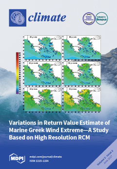
Cover Story (view full-size image): A climatic study of the marine surface wind field over the Greek seas is investigated and discussed. We compare a high resolution (10 km) regional climate model (RegCM3) against real observational data in order to assess the marine surface wind over the Greeks seas. Extreme wind thresholds and the windiest regions of the Greek seas are identified. Projected changes in regional seasonal wind speed due to climate change is also estimated. The extreme wind values for different return periods is simulated. View the paper
  • Issues are regarded as officially published after their release is announced to the table of contents alert mailing list.
  • You may sign up for e-mail alerts to receive table of contents of newly released issues.
  • PDF is the official format for papers published in both, html and pdf forms. To view the papers in pdf format, click on the "PDF Full-text" link, and use the free Adobe Reader to open them.
Order results
Result details
Section
Select all
Export citation of selected articles as:
750 KiB  
Article
Effects of Local Greenhouse Gas Abatement Strategies on Air Pollutant Emissions and on Health in Kuopio, Finland
by Arja Asikainen, Erkki Pärjälä, Matti Jantunen, Jouni T. Tuomisto and And Clive E. Sabel
Climate 2017, 5(2), 43; https://doi.org/10.3390/cli5020043 - 19 Jun 2017
Cited by 8 | Viewed by 5905
Abstract
Implementation of greenhouse gas (GHG) abatement strategies often ends up as the responsibility of municipal action rather than national policies. Impacts of local GHG reduction measures were investigated in the EU FP7 funded project Urban Reduction of Greenhouse Gas Emissions in China and [...] Read more.
Implementation of greenhouse gas (GHG) abatement strategies often ends up as the responsibility of municipal action rather than national policies. Impacts of local GHG reduction measures were investigated in the EU FP7 funded project Urban Reduction of Greenhouse Gas Emissions in China and Europe (URGENCHE). Kuopio in Finland was one of the case study cities. The assessed reduction measures were (1) increased use of biomass in local heat and power cogeneration plant, (2) energy efficiency improvements of residences, (3) increased biofuel use in traffic, and (4) increased small scale combustion of wood for residential heating. Impact assessment compared the 2010 baseline with a 2020 BAU (business as usual) scenario and a 2020 CO2 interventions scenario. Changes in emissions were assessed for CO2, particulate matter (PM2.5 and PM10), NOx, and SO2, and respective impacts were assessed for PM2.5 ambient concentrations and health effects. The assessed measures would reduce the local CO2 emissions in the Kuopio urban area by over 50% and local emissions of PM2.5 would clearly decrease. However, the annual average ambient PM2.5 concentration would decrease by just 4%. Thus, only marginal population level health benefits would be achieved with these assumed local CO2 abatement actions. Full article
(This article belongs to the Special Issue Urban Climate, Air Pollution, and Public Health)
Show Figures

Figure 1

2786 KiB  
Article
Spatial Pattern of the Seasonal Drought/Burned Area Relationship across Brazilian Biomes: Sensitivity to Drought Metrics and Global Remote-Sensing Fire Products
by Joana M. P. Nogueira, Serge Rambal, João Paulo R. A. D. Barbosa and Florent Mouillot
Climate 2017, 5(2), 42; https://doi.org/10.3390/cli5020042 - 16 Jun 2017
Cited by 38 | Viewed by 7962
Abstract
Fires are complex processes having important impacts on biosphere/atmosphere interactions. The spatial and temporal pattern of fire activity is determined by complex feedbacks between climate and plant functioning through and biomass desiccation, usually estimated by fire danger indices (FDI) in official fire risk [...] Read more.
Fires are complex processes having important impacts on biosphere/atmosphere interactions. The spatial and temporal pattern of fire activity is determined by complex feedbacks between climate and plant functioning through and biomass desiccation, usually estimated by fire danger indices (FDI) in official fire risk prevention services. Contrasted vegetation types from fire-prone Brazilian biomes may respond differently to soil water deficit during the fire season. Then, we propose to evaluate the burned area (BA)/FDI relationship across Brazil using most common FDIs and the main BA products from global remote sensing. We computed 12 standard FDIs- at 0.5° resolution from 2002 to 2011 and used the monthly BA from four BA datasets—from the MODIS sensor (MCD45A1), the MERIS sensor (MERIS FIRE_CCI), the Global Fire Emission Database version 4 (GFED4) and version 4s including small fires (GFED4s). We performed a Principal Component Analysis (PCA) on the coefficients of determination (R2) of the FDI/BA relationship to investigate the biome specificities of Brazilian biomes and the sensitivity to BA datasets. Good relationships (R2 > 0.8) were observed for all BA datasets, except SPEI (R2 < 0.2). We showed that FDIs computed from empirical water balances considering a lower soil capacity are more correlated to the seasonal pattern of fire occurrence in the Cerrado biome with contrasted adjustments between the western (early drying) and eastern part (late drying), while the fine fuel moisture index is more correlated to the fire seasonal pattern in Amazonia. The biome specificities of the FDI/BA relationship was evaluated with a general linear model. High accuracies in the biome distribution according to the FDI/BA relationship (>50%, p < 0.001) was observed in Amazonia and Cerrado, with lower accuracy (<32%, p < 0.001) in the Atlantic Forest and Caatinga. These results suggest that the FDI/BA relationship are biome-specific to explain the seasonal course of burned in Brazilian biomes, independently of the global BA product used. Selected FDIs should be used for fire danger forecast in each Brazilian biome. Full article
(This article belongs to the Special Issue Studies and Perspectives of Climatology in Brazil)
Show Figures

Graphical abstract

2757 KiB  
Article
Towards Systematic Prediction of Urban Heat Islands: Grounding Measurements, Assessing Modeling Techniques
by Jackson Voelkel and Vivek Shandas
Climate 2017, 5(2), 41; https://doi.org/10.3390/cli5020041 - 10 Jun 2017
Cited by 47 | Viewed by 17113
Abstract
While there exists extensive assessment of urban heat, we observe myriad methods for describing thermal distribution, factors that mediate temperatures, and potential impacts on urban populations. In addition, the limited spatial and temporal resolution of satellite-derived heat measurements may limit the capacity of [...] Read more.
While there exists extensive assessment of urban heat, we observe myriad methods for describing thermal distribution, factors that mediate temperatures, and potential impacts on urban populations. In addition, the limited spatial and temporal resolution of satellite-derived heat measurements may limit the capacity of decision makers to take effective actions for reducing mortalities in vulnerable populations whose locations require highly-refined measurements. Needed are high resolution spatial and temporal information for urban heat. In this study, we ask three questions: (1) how do urban heat islands vary throughout the day? (2) what statistical methods best explain the presence of temperatures at sub-meter spatial scales; and (3) what landscape features help to explain variation in urban heat islands? Using vehicle-based temperature measurements at three periods of the day in the Pacific Northwest city of Portland, Oregon (USA), we incorporate LiDAR-derived datasets, and evaluate three statistical techniques for modeling and predicting variation in temperatures during a heat wave. Our results indicate that the random forest technique best predicts temperatures, and that the evening model best explains the variation in temperature. The results suggest that ground-based measurements provide high levels of accuracy for describing the distribution of urban heat, its temporal variation, and specific locations where targeted interventions with communities can reduce mortalities from heat events. Full article
Show Figures

Graphical abstract

1008 KiB  
Article
Elevational Trends in Usnic Acid Concentration of Lichen Parmelia flexilis in Relation to Temperature and Precipitation
by Bishnu Prasad Neupane, Komal Prasad Malla, Anil Gautam, Dinesh Chaudhary, Sanjita Paudel, Sangita Timsina and Nirmala Jamarkattel
Climate 2017, 5(2), 40; https://doi.org/10.3390/cli5020040 - 27 May 2017
Cited by 12 | Viewed by 5394
Abstract
Usnic acid contents in acetone extracts of 31 samples of lichen Parmelia flexilis collected from different altitudes were identified using thin layer chromatography (TLC) and determined by high performance liquid chromatography (HPLC). The usnic acid content varied in between highest 5.13% to lowest [...] Read more.
Usnic acid contents in acetone extracts of 31 samples of lichen Parmelia flexilis collected from different altitudes were identified using thin layer chromatography (TLC) and determined by high performance liquid chromatography (HPLC). The usnic acid content varied in between highest 5.13% to lowest 1.66% in oven dried (80 °C) lichen samples. The species collected from lower altitudes all show high levels of usnic acid. The negative relationship between usnic acid and altitude was obtained. Statistically, it is revealed that there is a significant difference between average percentages of usnic acid in lichen samples with varying altitudes (p < 0.05). Beside these, the precipitation averages of the regions where the species have been collected were linked with the content of usnic acid. It is clear that lichens from the regions receiving the highest precipitation produced lower amounts of usnic acid. The results suggest that the production of secondary metabolite in lichens is altered due to the climatic variables like temperature and precipitation at different altitude gradients. Full article
Show Figures

Figure 1

1655 KiB  
Article
Water Budget in a Tile Drained Watershed under Future Climate Change Using SWATDRAIN Model
by Golmar Golmohammadi, Ramesh Rudra, Shiv Prasher, Ali Madani, Kourosh Mohammadi, Pradeep Goel and Prasad Daggupatti
Climate 2017, 5(2), 39; https://doi.org/10.3390/cli5020039 - 25 May 2017
Cited by 12 | Viewed by 4767
Abstract
The SWATDRAIN model was developed by incorporating the subsurface flow model, DRAINMOD, into a watershed scale surface flow model, SWAT (Soil and Water Assessment tool), to simulate the hydrology and water quality of agricultural watersheds. The model is capable of simulating hydrology under [...] Read more.
The SWATDRAIN model was developed by incorporating the subsurface flow model, DRAINMOD, into a watershed scale surface flow model, SWAT (Soil and Water Assessment tool), to simulate the hydrology and water quality of agricultural watersheds. The model is capable of simulating hydrology under different agricultural management and climate scenarios. As an application of the SWATDRAIN model, the impact of climate change on surface/subsurface flow was evaluated in the Canagagigue Creek watershed in southern Ontario, Canada. Using the assumption that there has been no change in land cover and land management, the model was applied to simulate annual, seasonal, and monthly changes in surface and subsurface flows at the outlet of the watershed under current and future climate conditions. The climate scenario under consideration in this study for 2015–2044 was derived from CGCM2 (Canadian Global Circulation Model 2), with A2 scenario for future climatic simulation. The SWATDRAIN model’s ability to predict the impacts of future climate change scenarios in agricultural watersheds due to monthly NSE (Nash Sutcliffe Efficiency), PBIAS (Percent Bias), and RSR (Root Mean Square Error) values of 0.74, 3.67, and 0.37, respectively, for the validation phase. The results showed that general climate change effects more spring and winter hydrology than summer hydrology. The results show that the annual flow is expected to increase in future, which will lead to an increase in the sediment loads in the stream. Full article
Show Figures

Graphical abstract

4829 KiB  
Article
Climate Change in Afghanistan Deduced from Reanalysis and Coordinated Regional Climate Downscaling Experiment (CORDEX)—South Asia Simulations
by Valentin Aich, Noor Ahmad Akhundzadah, Alec Knuerr, Ahmad Jamshed Khoshbeen, Fred Hattermann, Heiko Paeth, Andrew Scanlon and Eva Nora Paton
Climate 2017, 5(2), 38; https://doi.org/10.3390/cli5020038 - 23 May 2017
Cited by 67 | Viewed by 23079
Abstract
Past and the projected future climate change in Afghanistan has been analyzed systematically and differentiated with respect to its different climate regions to gain some first quantitative insights into Afghanistan’s vulnerability to ongoing and future climate changes. For this purpose, temperature, precipitation and [...] Read more.
Past and the projected future climate change in Afghanistan has been analyzed systematically and differentiated with respect to its different climate regions to gain some first quantitative insights into Afghanistan’s vulnerability to ongoing and future climate changes. For this purpose, temperature, precipitation and five additional climate indices for extremes and agriculture assessments (heavy precipitation; spring precipitation; growing season length (GSL), the Heat Wave Magnitude Index (HWMI); and the Standardized Precipitation Evapotranspiration Index (SPEI)) from the reanalysis data were examined for their consistency to identify changes in the past (data since 1950). For future changes (up to the year 2100), the same parameters were extracted from an ensemble of 12 downscaled regional climate models (RCM) of the Coordinated Regional Climate Downscaling Experiment (CORDEX)-South Asia simulations for low and high emission scenarios (Representative Concentration Pathways 4.5 and 8.5). In the past, the climatic changes were mainly characterized by a mean temperature increase above global level of 1.8 °C from 1950 to 2010; uncertainty with regard to reanalyzed rainfall data limited a thorough analysis of past changes. Climate models projected the temperature trend to accelerate in the future, depending strongly on the global carbon emissions (2006–2050 Representative Concentration Pathways 4.5/8.5: 1.7/2.3 °C; 2006–2099: 2.7/6.4 °C, respectively). Despite the high uncertainty with regard to precipitation projections, it became apparent that the increasing evapotranspiration is likely to exacerbate Afghanistan’s already existing water stress, including a very strong increase of frequency and magnitude of heat waves. Overall, the results show that in addition to the already extensive deficiency in adaptation to current climate conditions, the situation will be aggravated in the future, particularly in regard to water management and agriculture. Thus, the results of this study underline the importance of adequate adaptation to climate change in Afghanistan. This is even truer taking into account that GSL is projected to increase substantially by around 20 days on average until 2050, which might open the opportunity for extended agricultural husbandry or even additional harvests when water resources are properly managed. Full article
Show Figures

Figure 1

1736 KiB  
Article
Evaluating Vegetation Growing Season Changes in Northeastern China by Using GIMMS LAI3g Data
by Xiliang Ni, Jianfeng Xie, Yuke Zhou, Xizhang Gao and Lin Ding
Climate 2017, 5(2), 37; https://doi.org/10.3390/cli5020037 - 22 May 2017
Cited by 3 | Viewed by 5067
Abstract
Accurate understanding and detecting of vegetation growth change is essential for providing suitable management strategies for ecosystems. Several studies using satellite based vegetation indices have demonstrated changes of vegetation growth and phenology. Temperature is considered a major determinant of vegetation phenology. To accurately [...] Read more.
Accurate understanding and detecting of vegetation growth change is essential for providing suitable management strategies for ecosystems. Several studies using satellite based vegetation indices have demonstrated changes of vegetation growth and phenology. Temperature is considered a major determinant of vegetation phenology. To accurately detect the response of vegetation to climate variations, this study investigated the vegetation phenology in the northeast (NE) region of China by using in-situ temperature observations and satellite-based leaf area index estimates (LAI3g) for the period 1982–2011. Firstly, a spatial distribution of the averaged phenology over the 30 years was obtained. This distribution showed that a tendency for an early start of the growing season (SoS) and late end of the growing season (EoS) was observed towards of the southeastern part of NE China, with the late SoS and early EoS occurring at higher latitudes. Secondly, the temperature-based and satellite-based phenological trends were analyzed. Then the significant advanced trend (SAT), significant delayed trend (SDT), and nonsignificant trend (NT) of SOS and EOS in NE region of China were detected by using the Mann-Kendall trend test approach. Finally, changes in phenological trends were investigated by using the temperature-based and satellite-based phenology method. A comparison of the phenological trend shows that there are some significant advanced trends of SOS and significant delayed trends of EOS in the NE region of China over 30 years. The results of this study can provide important support of the view that a lengthening of growing season duration occurred at the northern high latitudes in recent decades. Full article
(This article belongs to the Special Issue Dynamics of Land-Use/Cover Change under a Changing Climate)
Show Figures

Figure 1

1127 KiB  
Article
A Climate Change Assessment via Trend Estimation of Certain Climate Parameters with In Situ Measurement at the Coasts and Islands of Viet Nam
by Vu Thanh Ca
Climate 2017, 5(2), 36; https://doi.org/10.3390/cli5020036 - 20 May 2017
Cited by 7 | Viewed by 3166
Abstract
This study presents results on an assessment of climate change in the nearshore and coastal areas of Viet Nam through an evaluation of trends of certain climatic parameters (air temperature, sea water temperature, sea level, and number of typhoons landed at the Vietnamese [...] Read more.
This study presents results on an assessment of climate change in the nearshore and coastal areas of Viet Nam through an evaluation of trends of certain climatic parameters (air temperature, sea water temperature, sea level, and number of typhoons landed at the Vietnamese coast by year) using time series data of hydro-meteorological records at the coasts and islands of Viet Nam. The method used for the trend evaluation is the Mann–Kendall test ran at the 5% significance level and Spearman rank correlation coefficient. It was found that there is an extremely likely increasing trend of air temperature for almost all observation stations at the coasts and islands of Viet Nam. However, it was unable to confirm a general trend for sea surface water temperature; except for very few stations in semi-closed waters, there is no clear trend in annual average sea water temperature at a majority of stations. Additionally, there is an extremely likely rising trend of sea level at a majority of stations with reliable data, but the rates of increase are very different for different stations. The reasons for discrepancies in the trend of annual average sea water temperature and sea level at different stations are still not understood, but it seems that an assessment of the vertical movement of the ground surface at the stations is necessary to have an accurate assessment of the rate of sea level rise due to climate change and of the influence of general circulation in the East Viet Nam Sea on the trend of sea water temperature in that location. It is also found that there is a likely decreasing trend in the frequency of typhoons landed at the Vietnamese coast; however, this trend might not be due to climate change, but to climate variability. Full article
Show Figures

Figure 1

24149 KiB  
Article
The Relationship between the Geoecological and Anthropic Aspects for the Conformation of the Urban Climate of Viçosa-MG in the Synotic Situation of Stability in 2015
by Ludmilla Alves Fernandes, Leonardo Brandão do Prado and Edson Soares Fialho
Climate 2017, 5(2), 35; https://doi.org/10.3390/cli5020035 - 25 Apr 2017
Cited by 1 | Viewed by 5108
Abstract
The intense process of urbanization and the expansion of the urban area in the last few decades has led to contrasting settings in the urban area of Viçosa (MG), which undoubtedly reverberate differently in the thermal field. In order to understand the nature [...] Read more.
The intense process of urbanization and the expansion of the urban area in the last few decades has led to contrasting settings in the urban area of Viçosa (MG), which undoubtedly reverberate differently in the thermal field. In order to understand the nature and behavior of climatic elements and their relationship with the factors of natural and human order in the city, nine data collection points were installed in its central area, equipped with HOBO data loggers of the model U10-003. In addition to these data, the sky view factor (SVF), and the geoecological aspects and anthropic landscape elements of the analyzed area, are observed. Full article
(This article belongs to the Special Issue Studies and Perspectives of Climatology in Brazil)
Show Figures

Figure 1

8536 KiB  
Article
Projections of Future Suitable Bioclimatic Conditions of Parthenogenetic Whiptails
by Guillermo Alvarez, Eric Ariel L. Salas, Nicole M. Harings and Kenneth G. Boykin
Climate 2017, 5(2), 34; https://doi.org/10.3390/cli5020034 - 22 Apr 2017
Cited by 6 | Viewed by 7047
Abstract
This paper highlights the results of bioclimatic-envelope modeling of whiptail lizards belonging to the Aspidoscelis tesselata species group and related species. We utilized five species distribution models (SDM) including Generalized Linear Model, Random Forest, Boosted Regression Tree, Maxent and Multivariate Adaptive Regression Splines [...] Read more.
This paper highlights the results of bioclimatic-envelope modeling of whiptail lizards belonging to the Aspidoscelis tesselata species group and related species. We utilized five species distribution models (SDM) including Generalized Linear Model, Random Forest, Boosted Regression Tree, Maxent and Multivariate Adaptive Regression Splines to develop the present day distributions of the species based on climate-driven models alone. We then projected future distributions of whiptails using data from four climate models run according to two greenhouse gas concentration scenarios (RCP 4.5 and RCP 8.5). Results of A. tesselata species group suggested that climate change will negatively affect the bioclimatic habitat and distribution of some species, while projecting gains in suitability for others. Furthermore, when the species group was analyzed together, climate projections changed for some species compared to when they were analyzed alone, suggesting significant loss of syntopic areas where suitable climatic conditions for more than two species would persist. In other words, syntopy within members of the species group will be drastically reduced according to future bioclimatic suitability projections in this study. Full article
Show Figures

Figure 1

2404 KiB  
Article
Classification of Rainfall Warnings Based on the TOPSIS Method
by Sadegh Zeyaeyan, Ebrahim Fattahi, Abbas Ranjbar and Majid Vazifedoust
Climate 2017, 5(2), 33; https://doi.org/10.3390/cli5020033 - 17 Apr 2017
Cited by 14 | Viewed by 5521
Abstract
Extreme weather, by definition, is any unexpected, unusual, unpredictable, severe or unseasonal weather condition. A rainfall event that is considered normal in one region may be considered a torrent in a dry region and may cause flash flooding. Therefore, appropriate weather warnings need [...] Read more.
Extreme weather, by definition, is any unexpected, unusual, unpredictable, severe or unseasonal weather condition. A rainfall event that is considered normal in one region may be considered a torrent in a dry region and may cause flash flooding. Therefore, appropriate weather warnings need to be issued with respect to areas with different climates. Additionally, these alerts should be easy to understand—by clear classification—in order to apply reinforcements. Early warning levels not only depend on the intensity and duration of rainfall events, but also on the initial water stress conditions, land cover situations and degree of urbanization. This research has focused on defining different warning levels in northwest Iran using long-term precipitation data from 87 weather stations well distributed across the study area. Here, in order to determine alert levels, TOPSIS (The Order of Preference by Similarity to Ideal Solution), as one of the most common methods in multi-criteria decision making, has been used. Results show that five main levels of alerts can be derived, leading to the provision of spatial maps. Further, it can be deduced that these levels are highly associated to the location of a region at different times: months/seasons. It has been observed that the issuance of a warning for precipitation should correspond with the location and time. At one location during different seasons, different alert levels would be raised corresponding to the rainfall. It was also concluded that using of fixed alert levels and extending them to larger areas without considering the seasons could be grossly misleading. Full article
(This article belongs to the Special Issue Climate Extremes, the Past and the Future)
Show Figures

Figure 1

2912 KiB  
Article
Application of Satellite-Based Precipitation Estimates to Rainfall-Runoff Modelling in a Data-Scarce Semi-Arid Catchment
by Peshawa M. Najmaddin, Mick J. Whelan and Heiko Balzter
Climate 2017, 5(2), 32; https://doi.org/10.3390/cli5020032 - 11 Apr 2017
Cited by 24 | Viewed by 6874
Abstract
Rainfall-runoff modelling is a useful tool for water resources management. This study presents a simple daily rainfall-runoff model, based on the water balance equation, which we apply to the 11,630 km2 Lesser Zab catchment in northeast Iraq. The model was forced by [...] Read more.
Rainfall-runoff modelling is a useful tool for water resources management. This study presents a simple daily rainfall-runoff model, based on the water balance equation, which we apply to the 11,630 km2 Lesser Zab catchment in northeast Iraq. The model was forced by either observed daily rain gauge data from four stations in the catchment or satellite-derived rainfall estimates from two TRMM Multi-satellite Precipitation Analysis (TMPA) data products (TMPA-3B42 and 3B42RT) based on the Tropical Rainfall Measuring Mission (TRMM) from 2003 to 2014. As well as using raw TMPA data, we used a bias-correction method to adjust TMPA values based on rain gauge data. The uncorrected TMPA data products underestimated observed mean catchment rainfall by −10.1% and −10.7%. Corrected data also slightly underestimated gauged rainfall by −0.7% and −1.6%, respectively. Nash-Sutcliffe Efficiency (NSE) and Pearson’s Correlation Coefficient (r) for the model fit with the observed hydrograph were 0.75 and 0.87, respectively, for a calibration period (2010–2011) using gauged rainfall data. Model validation performance (2012–2014) was best (highest NSE and r; lowest RMSE and bias) using the corrected 3B42 data product and poorest when driven by uncorrected 3B42RT data. Uncertainty and equifinality were also explored. Our results suggest that TRMM data can be used to drive rainfall-runoff modelling in semi-arid catchments, particularly when corrected using rain gauge data. Full article
Show Figures

Figure 1

223 KiB  
Article
Cities’ Greenhouse Gas Accounting Methods: A Study of Helsinki, Stockholm, and Copenhagen
by Karna Dahal and Jari Niemelä
Climate 2017, 5(2), 31; https://doi.org/10.3390/cli5020031 - 3 Apr 2017
Cited by 29 | Viewed by 7139
Abstract
Cities generally adopt territorial- or production-based rather than consumption-based emissions accounting systems but they find difficult to adopt a specific emissions standard. Due to the diverse calculation methodologies cities use, inter-city emission reductions and climate action comparisons remain challenging. It is crucial to [...] Read more.
Cities generally adopt territorial- or production-based rather than consumption-based emissions accounting systems but they find difficult to adopt a specific emissions standard. Due to the diverse calculation methodologies cities use, inter-city emission reductions and climate action comparisons remain challenging. It is crucial to learn how cities address climate change mitigation and adaptation in terms of the emissions accounting methodologies they use, their links to existing city-level international emission standards, and the consistency of those methods used by cities to improve the quality of emissions standards. Normative case study method was applied to explore these issues in three different case cities: Helsinki (Finland), Stockholm (Sweden), and Copenhagen (Denmark). The current calculation methods used in these cities exclude many indirect emissions, and these cities have not adopted consumption-based emissions. Cities also face several dilemmas in system boundaries and baseline year setting, emissions factors calculations, and data collection methods using current calculation methods. All three case cities have adopted amendable emissions accounting systems which exclude certain amounts of emissions from several sectors. Therefore, emission calculation methods must be improved to include all possible sectors and to produce more robust and transparent calculation methods. Full article
2375 KiB  
Article
Assessment of Long-Term Spatio-Temporal Rainfall Variability over Ghana using Wavelet Analysis
by Michael Baidu, Leonard K. Amekudzi, Jeffery N. A. Aryee and Thompson Annor
Climate 2017, 5(2), 30; https://doi.org/10.3390/cli5020030 - 31 Mar 2017
Cited by 48 | Viewed by 10265
Abstract
Rainfall variability has strong impact on food security, livelihood and socio-economic activities as farming in West Africa is mainly rain-fed. The annual, seasonal and decadal rainfall variability over Ghana has been studied and their periodicities analysed using wavelet analysis. A rainfall time series [...] Read more.
Rainfall variability has strong impact on food security, livelihood and socio-economic activities as farming in West Africa is mainly rain-fed. The annual, seasonal and decadal rainfall variability over Ghana has been studied and their periodicities analysed using wavelet analysis. A rainfall time series from 1901–2010 from the Global Precipitation Climatology Center (GPCC) was used in this analysis. It was observed that high mean annual rainfall totals ranging from 900–1900mm are recorded over the entire country. In addition, very high totals between 1500–1900mmare recorded at the South-Western part of the country whereas low totals (900–1200 mm) are recorded in the Savannah and East coast of the country. In general, a decreasing trend was observed for the annual rainfall over all the agro-ecological zones except for the coastal zone, where a slight increasing trend of 0.1600mm per year was seen. The seasonal trend analysis revealed a significant decreasing trend at 0.01 significance level in all the agro-ecological zones except for the Savannah during the DJF season indicating an intensification of the Harmattan. The Coastal zone recorded the lowest mean rainfall values for all seasons with the highest of about 150 mm in MAM. The Forest zone on the other hand recorded very high rainfall values for all seasons with the maximum of about 200 mm in JJA. The Transition zone, however, recorded almost quite stable rainfall amount for all seasons except for DJF. On the decadal time scale, below normal rainfall values were observed between the 1901–1920 and 1980–2010 periods for almost all the agro-ecological zones except for the Savannah which showed above normal rainfall values within the 1901–1940 period. Indicating that, the decreasing trend observed in recent years is not solely due to antropogenic factors but have a strong contribution from a natural climate variability. The wavelet analysis also revealed a strong annual periodicity over all the agro-ecological zones except for the Coastal and Forest zones where the annual periodicity was accompanied by 4–8 months signal. The results of both the 5 year moving average and the decadal anomaly confirm a significant decrease in rainfall amount. This will have negative consequences on agricultural practices, water resource management and food security. Full article
Show Figures

Figure 1

4876 KiB  
Article
Climatic Study of the Marine Surface Wind Field over the Greek Seas with the Use of a High Resolution RCM Focusing on Extreme Winds
by Christos Vagenas, Christina Anagnostopoulou and Konstantia Tolika
Climate 2017, 5(2), 29; https://doi.org/10.3390/cli5020029 - 31 Mar 2017
Cited by 12 | Viewed by 7077
Abstract
The marine surface wind field (10 m) over the Greek seas is analyzed in this study using The RegCM. The model’s spatial resolution is dynamically downscaled to 10 km × 10 km, in order to simulate more efficiently the complex coastlines and the [...] Read more.
The marine surface wind field (10 m) over the Greek seas is analyzed in this study using The RegCM. The model’s spatial resolution is dynamically downscaled to 10 km × 10 km, in order to simulate more efficiently the complex coastlines and the numerous islands of Greece. Wind data for the 1980–2000 and 2080–2100 periods are produced and evaluated against real observational data from 15 island and coastal meteorological stations in order to assess the model’s ability to reproduce the main characteristics of the surface wind fields. RegCM model shows a higher simulating skill to project seasonal wind speeds and direction during summer and the lowest simulating skill in the cold period of the year. Extreme wind speed thresholds were estimated using percentiles indices and three Peak Over Threshold (POT) techniques. The mean threshold values of the three POT methods are used to examine the inter-annual distribution of extreme winds in the study region. The highest thresholds were observed in three poles; the northeast, the southeast, and the southwest of Aegean Sea. Future changes in extreme speeds show a general increase in the Aegean Sea, while lower thresholds are expected in the Ionian Sea. Return levels for periods of 20, 50, 100, and 200 years are estimated. Full article
(This article belongs to the Special Issue Climate Extremes, the Past and the Future)
Show Figures

Figure 1

1680 KiB  
Article
Effect of Climatic and Non-Climatic Factors on Cassava Yields in Togo: Agricultural Policy Implications
by David Boansi
Climate 2017, 5(2), 28; https://doi.org/10.3390/cli5020028 - 29 Mar 2017
Cited by 27 | Viewed by 10385
Abstract
This paper examines the effects of climatic and non-climatic factors on cassava yields in Togo using an Autoregressive Distributed Lag (ARDL) modelling approach and pairwise Granger Causality tests. Secondary data on production statistics, rural population, climate variables, prices and nominal exchange rate for [...] Read more.
This paper examines the effects of climatic and non-climatic factors on cassava yields in Togo using an Autoregressive Distributed Lag (ARDL) modelling approach and pairwise Granger Causality tests. Secondary data on production statistics, rural population, climate variables, prices and nominal exchange rate for the period 1978–2009 are used. Results for estimated short- and long-run models indicate that cassava yield is affected by both ‘normal’ climate variables and within-season rainfall variability. An inverse relationship is found between area harvested and yield of cassava, but a significant positive and elastic effect of labour availability on yield in the long run. Increasing within-lean-season rainfall variability and high lean-season mean temperature are detrimental to cassava yields, while increasing main-season rainfall and mean-temperature enhance cassava yields. Through Granger Causality tests, a bilateral causality is found between area harvested and yield of cassava, and four unidirectional causalities from labour availability, real producer price ratio between yam and cassava, main-season rainfall and lean-season mean temperature to cassava yields. Based on the findings from this study, investment in low-cost irrigation facilities and water harvesting is recommended to enhance the practice of supplemental irrigation. Research efforts should as well be made to breed for drought, heat and flood tolerance in cassava. In addition, coupling area expansion with increasing availability of labour is advised, through the implementation of measures to minimize rural–urban migration. Full article
Show Figures

Figure 1

253 KiB  
Article
Effect of Global-GAP Policy on Climate Change Perceptions of Smallholder French Beans Farmers in Central and Eastern Regions, Kenya
by Peter Shimon Otieno, Chris Ackello Ogutu, John Mburu and Rose Adhiambo Nyikal
Climate 2017, 5(2), 27; https://doi.org/10.3390/cli5020027 - 26 Mar 2017
Cited by 9 | Viewed by 5738
Abstract
The risks posed by climate change to Sub Saharan Africa’s (SSA) smallholder fresh export fruit and vegetables production are amplifying the significance of farmers’ climate change perceptions in enhancing adoption of suitable adaptation strategies. Production of fresh export fruit and vegetables in Kenya [...] Read more.
The risks posed by climate change to Sub Saharan Africa’s (SSA) smallholder fresh export fruit and vegetables production are amplifying the significance of farmers’ climate change perceptions in enhancing adoption of suitable adaptation strategies. Production of fresh export fruit and vegetables in Kenya has increasingly been done under the Global-GAP standard scheme by smallholder farmers to improve both environmental conservation and market access. The objective of this study was to determine the effect of Global-GAP policy on climate change perceptions of smallholder French beans farmers. The analysis was based on data collected from a random sample of 616 households interviewed in the Central and Eastern regions of Kenya. The study used principal component analysis (PCA) to extract farmers’ key prevailing climate change perceptions and logit regression model to examine the effect of Global-GAP policy on climate change perceptions among other socio-economic factors. The PCA analysis extracted three components proxying for ‘droughts’, ‘delay in rainy seasons’, ‘diseases and pests’ and three proxying for ‘hot days’, ‘floods’, and ‘diseases and pests’ as summarizing maximum variance in the perceptions in the Central and Eastern region respectively. The common, study area-wide climate change perception was identified as incidence of diseases and pest. Logit regression analysis found that Global-GAP policy significantly influenced and improved farmers’ probability of perceiving climate change. Other factors found to influence farmers’ probability of having the identified climate change perceptions included regional specificity, access to agricultural extension service, access to credit, plot size, and soil fertility. The policy implication of this study is that the government and service providers should mainstream factors like Global-GAP compliance and regional considerations found to improve probability of perceiving climate change in awareness creation extension strategies, towards enhancing adoption of adaptation measures in the smallholder fruits and vegetables farming sector. Full article
(This article belongs to the Special Issue Strategies for Climate Mitigation and Adaptation in Agriculture)
9596 KiB  
Article
Comparative Study of Different Stochastic Weather Generators for Long-Term Climate Data Simulation
by Sushant Mehan, Tian Guo, Margaret W. Gitau and Dennis C. Flanagan
Climate 2017, 5(2), 26; https://doi.org/10.3390/cli5020026 - 26 Mar 2017
Cited by 50 | Viewed by 11571
Abstract
Climate is one of the single most important factors affecting watershed ecosystems and water resources. The effect of climate variability and change has been studied extensively in some places; in many places, however, assessments are hampered by limited availability of long-term continuous climate [...] Read more.
Climate is one of the single most important factors affecting watershed ecosystems and water resources. The effect of climate variability and change has been studied extensively in some places; in many places, however, assessments are hampered by limited availability of long-term continuous climate data. Weather generators provide a means of synthesizing long-term climate data that can then be used in natural resource assessments. Given their potential, there is the need to evaluate the performance of the generators; in this study, three commonly used weather generators—CLImate GENerator (CLIGEN), Long Ashton Research Station Weather Generator (LARS-WG), and Weather Generators (WeaGETS) were compared with regard to their ability to capture the essential statistical characteristics of observed data (distribution, occurrence of wet and dry spells, number of snow days, growing season temperatures, and growing degree days). The study was based on observed 1966–2015 weather station data from the Western Lake Erie Basin (WLEB), from which 50 different realizations were generated, each spanning 50 years. Both CLIGEN and LARS-WG performed fairly well with respect to representing the statistical characteristics of observed precipitation and minimum and maximum temperatures, although CLIGEN tended to overestimate values at the extremes. This generator also overestimated dry sequences by 18%–30% and snow-day counts by 12%–19% when considered over the entire WLEB. It (CLIGEN) was, however, well able to simulate parameters specific to crop growth such as growing degree days and had an added advantage over the other generators in that it simulates a larger number of weather variables. LARS-WG overestimated wet sequence counts across the basin by 15%–38%. In addition, the optimal growth period simulated by LARS-WG also exceeded that obtained from observed data by 16%–29% basin-wide. Preliminary results with WeaGETS indicated that additional evaluation is needed to better define its parameters. Results provided insights into the suitability of both CLIGEN and LARS-WG for use with water resource applications. Full article
Show Figures

Figure 1

3980 KiB  
Article
Tailoring Climate Parameters to Information Needs for Local Adaptation to Climate Change
by Julia Hackenbruch, Tina Kunz-Plapp, Sebastian Müller and Janus Willem Schipper
Climate 2017, 5(2), 25; https://doi.org/10.3390/cli5020025 - 25 Mar 2017
Cited by 29 | Viewed by 11305
Abstract
Municipalities are important actors in the field of local climate change adaptation. Stakeholders need scientifically sound information tailored to their needs to make local assessment of climate change effects. To provide tailored data to support municipal decision-making, climate scientists must know the state [...] Read more.
Municipalities are important actors in the field of local climate change adaptation. Stakeholders need scientifically sound information tailored to their needs to make local assessment of climate change effects. To provide tailored data to support municipal decision-making, climate scientists must know the state of municipal climate change adaptation, and the climate parameters relevant to decisions about such adaptation. The results of an empirical study in municipalities in the state of Baden-Wuerttemberg in Southwestern Germany showed that adaptation is a relatively new topic, but one of increasing importance. Therefore, past weather events that caused problems in a municipality can be a starting point in adaptation considerations. Deduction of tailored climate parameters has shown that, for decisions on the implementation of specific adaptation measures, it also is necessary to have information on specific parameters not yet evaluated in climate model simulations. We recommend intensifying the professional exchange between climate scientists and stakeholders in collaborative projects with the dual goals of making practical adaptation experience and knowledge accessible to climate science, and providing municipalities with tailored information about climate change and its effects. Full article
Show Figures

Figure 1

Previous Issue
Next Issue
Back to TopTop