Next Issue
Volume 7, October
Previous Issue
Volume 7, August


Climate, Volume 7, Issue 9 (September 2019) – 15 articles

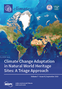
Cover Story (view full-size image): Natural World Heritage sites represent the best places on Earth; places that represent unique conditions to be sustained in perpetuity. Every site is subject to some degree of climate change influence. However, how that influence is expressed and the ways society addresses the influence are site-specific. Adaptation to sustain each site also must be specific. As such, climate change adaptation is a wicked problem with no clear action strategies. Wicked problems cause division among stakeholders. Further, adaptation resources are limited and each action is a tradeoff, requiring giving up an alternative. That requires each management team to implement strategies tailored to future conditions predicted at the site. That team has a responsibility to its local, regional, national, and global stakeholders to manage adaptation in a transparent and accountable way. View this paper.
  • Issues are regarded as officially published after their release is announced to the table of contents alert mailing list.
  • You may sign up for e-mail alerts to receive table of contents of newly released issues.
  • PDF is the official format for papers published in both, html and pdf forms. To view the papers in pdf format, click on the "PDF Full-text" link, and use the free Adobe Reader to open them.
Order results
Result details
Section
Select all
Export citation of selected articles as:
14 pages, 3392 KiB  
Article
Is Barocaloric an Eco-Friendly Technology? A TEWI Comparison with Vapor Compression under Different Operation Modes
by Ciro Aprea, Adriana Greco, Angelo Maiorino and Claudia Masselli
Climate 2019, 7(9), 115; https://doi.org/10.3390/cli7090115 - 18 Sep 2019
Cited by 6 | Viewed by 4602
Abstract
Barocaloric is a solid-state not-in-kind technology, for cooling and heat pumping, rising as an alternative to the vapor compression systems. The former is based on solid-state refrigerants and the latter on fluid ones. The reference thermodynamical cycle is called active barocaloric regenerative refrigeration [...] Read more.
Barocaloric is a solid-state not-in-kind technology, for cooling and heat pumping, rising as an alternative to the vapor compression systems. The former is based on solid-state refrigerants and the latter on fluid ones. The reference thermodynamical cycle is called active barocaloric regenerative refrigeration (or heat pumping cycle). The main advantage of this technology is to not employ greenhouse gases, which can be toxic or damaging for the environment and that can contribute to increasing global warming. In this paper, the environmental impact of barocaloric technology was evaluated through a Total Equivalent Warming Impact (TEWI) analysis carried out with the help of a numerical 2D model solved through a finite element method. Specifically, we propose a wide investigation on the environmental impact of barocaloric technology in terms of TEWI index, also making a comparison with a vapor compression plant. The analysis focuses on both the cooling and heat pump operation modes, under different working conditions and auxiliary fluids. The results revealed that a barocaloric system based on ABR cycle could provide a reduction of the environmental impact with respect to a vapor compression system. The addition of nanofluids contributes in reducing the environmental impact up to −62%. Full article
(This article belongs to the Special Issue Environment Pollution and Climate Change)
Show Figures

Figure 1

11 pages, 2424 KiB  
Article
A Two-Season Impact Study of Radiative Forced Tropospheric Response to Stratospheric Initial Conditions Inferred From Satellite Radiance Assimilation
by Min Shao, Yansong Bao, George P. Petropoulos and Hongfang Zhang
Climate 2019, 7(9), 114; https://doi.org/10.3390/cli7090114 - 18 Sep 2019
Cited by 1 | Viewed by 2499
Abstract
This study investigated the impacts of stratospheric temperatures and their variations on tropospheric short-term weather forecasting using the Advanced Research Weather Research and Forecasting (WRF-ARW) system with real satellite data assimilation. Satellite-borne microwave stratospheric temperature measurements up to 1 mb, from the Advanced [...] Read more.
This study investigated the impacts of stratospheric temperatures and their variations on tropospheric short-term weather forecasting using the Advanced Research Weather Research and Forecasting (WRF-ARW) system with real satellite data assimilation. Satellite-borne microwave stratospheric temperature measurements up to 1 mb, from the Advanced Microwave Sounding Unit-A (AMSU-A), the Advanced Technology Microwave Sounder (ATMS), and the Special Sensor microwave Imager/Sounder (SSMI/S), were assimilated into the WRF model over the continental U.S. during winter and summer 2015 using the community Gridpoint Statistical Interpolation (GSI) system. Adjusted stratospheric temperature related to upper stratospheric ozone absorption of short-wave (SW) radiation further lead to vibration in downward SW radiation in winter predictions and overall reduced with a maximum of 5.5% reduction of downward SW radiation in summer predictions. Stratospheric signals in winter need 48- to 72-h to propagate to the lower troposphere while near-instant tropospheric response to the stratospheric initial conditions are observed in summer predictions. A schematic plot illustrated the physical processes of the coupled stratosphere and troposphere related to radiative processes. Our results suggest that the inclusion of the entire stratosphere and better representation of the upper stratosphere are important in regional NWP systems in short-term forecasts. Full article
Show Figures

Figure 1

16 pages, 4779 KiB  
Article
Potential Transient Response of Terrestrial Vegetation and Carbon in Northern North America from Climate Change
by Steven A. Flanagan, George C. Hurtt, Justin P. Fisk, Ritvik Sahajpal, Maosheng Zhao, Ralph Dubayah, Matthew C. Hansen, Joe H. Sullivan and G. James Collatz
Climate 2019, 7(9), 113; https://doi.org/10.3390/cli7090113 - 18 Sep 2019
Cited by 5 | Viewed by 4181
Abstract
Terrestrial ecosystems and their vegetation are linked to climate. With the potential of accelerated climate change from anthropogenic forcing, there is a need to further evaluate the transient response of ecosystems, their vegetation, and their influence on the carbon balance, to this change. [...] Read more.
Terrestrial ecosystems and their vegetation are linked to climate. With the potential of accelerated climate change from anthropogenic forcing, there is a need to further evaluate the transient response of ecosystems, their vegetation, and their influence on the carbon balance, to this change. The equilibrium response of ecosystems to climate change has been estimated in previous studies in global domains. However, research on the transient response of terrestrial vegetation to climate change is often limited to domains at the sub-continent scale. Estimation of the transient response of vegetation requires the use of mechanistic models to predict the consequences of competition, dispersal, landscape heterogeneity, disturbance, and other factors, where it becomes computationally prohibitive at scales larger than sub-continental. Here, we used a pseudo-spatial ecosystem model with a vegetation migration sub-model that reduced computational intensity and predicted the transient response of vegetation and carbon to climate change in northern North America. The ecosystem model was first run with a current climatology at half-degree resolution for 1000 years to establish current vegetation and carbon distribution. From that distribution, climate was changed to a future climatology and the ecosystem model run for an additional 2000 simulation years. A model experimental design with different combinations of vegetation dispersal rates, dispersal modes, and disturbance rates produced 18 potential change scenarios. Results indicated that potential redistribution of terrestrial vegetation from climate change was strongly impacted by dispersal rates, moderately affected by disturbance rates, and marginally impacted by dispersal mode. For carbon, the sensitivities were opposite. A potential transient net carbon sink greater than that predicted by the equilibrium response was estimated on time scales of decades–centuries, but diminished over longer time scales. Continued research should further explore the interactions between competition, dispersal, and disturbance, particularly in regards to vegetation redistribution. Full article
(This article belongs to the Special Issue Climate Ecosystems Nexus)
Show Figures

Figure 1

52 pages, 17298 KiB  
Article
The Origin and Propagation of the Antarctic Centennial Oscillation
by W. Jackson Davis, Peter J. Taylor and W. Barton Davis
Climate 2019, 7(9), 112; https://doi.org/10.3390/cli7090112 - 17 Sep 2019
Cited by 5 | Viewed by 5345
Abstract
The Antarctic Centennial Oscillation (ACO) is a paleoclimate temperature cycle that originates in the Southern Hemisphere, is the presumptive evolutionary precursor of the contemporary Antarctic Oscillation (AAO), and teleconnects to the Northern Hemisphere to influence global temperature. In this study we investigate the [...] Read more.
The Antarctic Centennial Oscillation (ACO) is a paleoclimate temperature cycle that originates in the Southern Hemisphere, is the presumptive evolutionary precursor of the contemporary Antarctic Oscillation (AAO), and teleconnects to the Northern Hemisphere to influence global temperature. In this study we investigate the internal climate dynamics of the ACO over the last 21 millennia using stable water isotopes frozen in ice cores from 11 Antarctic drill sites as temperature proxies. Spectral and time series analyses reveal that ACOs occurred at all 11 sites over all time periods evaluated, suggesting that the ACO encompasses all of Antarctica. From the Last Glacial Maximum through the Last Glacial Termination (LGT), ACO cycles propagated on a multicentennial time scale from the East Antarctic coastline clockwise around Antarctica in the streamline of the Antarctic Circumpolar Current (ACC). The velocity of teleconnection (VT) is correlated with the geophysical characteristics of drill sites, including distance from the ocean and temperature. During the LGT, the VT to coastal sites doubled while the VT to inland sites decreased fourfold, correlated with increasing solar insolation at 65°N. These results implicate two interdependent mechanisms of teleconnection, oceanic and atmospheric, and suggest possible physical mechanisms for each. During the warmer Holocene, ACOs arrived synchronously at all drill sites examined, suggesting that the VT increased with temperature. Backward extrapolation of ACO propagation direction and velocity places its estimated geographic origin in the Southern Ocean east of Antarctica, in the region of the strongest sustained surface wind stress over any body of ocean water on Earth. ACO period is correlated with all major cycle parameters except cycle symmetry, consistent with a forced, undamped oscillation in which the driving energy affects all major cycle metrics. Cycle period and symmetry are not discernibly different for the ACO and AAO over the same time periods, suggesting that they are the same climate cycle. We postulate that the ACO/AAO is generated by relaxation oscillation of Westerly Wind velocity forced by the equator-to-pole temperature gradient and propagated regionally by identified air-sea-ice interactions. Full article
Show Figures

Graphical abstract

15 pages, 2895 KiB  
Article
Evaluation of Moisture Level Using Precipitation Indices as a Landslide Triggering Factor—A Study of Coonoor Hill Station
by C. R. Suribabu and Evangelin Ramani Sujatha
Climate 2019, 7(9), 111; https://doi.org/10.3390/cli7090111 - 13 Sep 2019
Cited by 10 | Viewed by 3286
Abstract
Extreme heavy rainfall events in the hilly region pose a great threat to public safety and causes dangerous landslides in the region. Several factors contribute to a landslide and, hence, it is essential to analyze the causes of such related incidents in all [...] Read more.
Extreme heavy rainfall events in the hilly region pose a great threat to public safety and causes dangerous landslides in the region. Several factors contribute to a landslide and, hence, it is essential to analyze the causes of such related incidents in all possible ways. Though rainfall is the major triggering factor for most of the landslides in the Western Ghats, the long period antecedent moisture level prevailing in the soil of a hilly terrain cannot be ignored. Few of the drought assessing and monitoring indices available in literature can be adopted to predict the degree of wetness from long-term precipitation data of the region. In the present work, three moisture level assessment indices, namely, standardized precipitation index (SPI), China Z-index (CZI), and statistical Z-Score (SZS) index are used to categorize the antecedent moisture level of Coonoor station. Monthly rainfall data for a period of 81 years is used for the study. It is evident from the study that higher level of moisture followed by heavy rainfall triggers medium- to large-scale landslides. Further, from the study it is inferred that an early warning for a landslide can be given once cumulative rainfall exceeds 300 mm during continuous storm periods. Full article
Show Figures

Figure 1

21 pages, 8816 KiB  
Article
Spatial Process of Surface Urban Heat Island in Rapidly Growing Seoul Metropolitan Area for Sustainable Urban Planning Using Landsat Data (1996–2017)
by Prabath Priyankara, Manjula Ranagalage, DMSLB Dissanayake, Takehiro Morimoto and Yuji Murayama
Climate 2019, 7(9), 110; https://doi.org/10.3390/cli7090110 - 11 Sep 2019
Cited by 39 | Viewed by 5794
Abstract
The urban heat island (UHI) phenomenon is an important research topic in the scholarly community. There are only few research studies related to the UHI in the Seoul metropolitan area (SMA). Therefore, this study examined the impact of urbanization on the formation of [...] Read more.
The urban heat island (UHI) phenomenon is an important research topic in the scholarly community. There are only few research studies related to the UHI in the Seoul metropolitan area (SMA). Therefore, this study examined the impact of urbanization on the formation of UHI in the SMA as a geospatial study by using Landsat data from 1996, 2006, and 2017. For this purpose, we analyzed the relative variation of land surface temperature (LST) with changes of land use/land cover (LULC) rather than absolute values of LST using gradient, intensity, and directional analyses. It was observed that the impervious surface (IS) has expanded, and the UHI effect was more penetrating in the study area, with considerable loss of other LULC including green surfaces along with the rapid urbanization of the study area. In this study, we divided the IS into persistent IS (PIS) and newly added IS (NAIS). The spatial distribution of the IS, forest surface (FS), PIS, and NAIS was observed based on gradient zones (GZs). The results show that GZ1 recorded a difference of 6.0 °C when compared with the GZ109 in 2017. The results also show that the city center was warmer than the surrounding areas during the period of study. Results reveal that the mean LST has a strong significant positive relationship with a fraction of IS and PIS in 2006 and 2017. On other hand, the mean LST has a strong negative relationship with a fraction of FS and NAIS in the same time points. Relatively low temperatures were recorded in FS and NAIS in both time points. Further, it was proved that the local climate of the SMA and its surroundings had been affected by the UHI effect. Therefore, urban planners of the SMA should seriously consider the issue and plan to mitigate the effect by improving the green surfaces of the city. More greening-oriented concepts are recommended in both horizontal and vertical directions of the SMA, that can be used to control the negative impact associated with UHI. The overall outputs of the study could be used as a proxy indicator for the sustainability of the SMA and its surroundings. Full article
(This article belongs to the Special Issue Urban Heat Islands)
Show Figures

Graphical abstract

14 pages, 4880 KiB  
Article
Validation and Improvement of the WRF Building Environment Parametrization (BEP) Urban Scheme
by Kanishk Gohil and Menglin S. Jin
Climate 2019, 7(9), 109; https://doi.org/10.3390/cli7090109 - 10 Sep 2019
Cited by 9 | Viewed by 5384
Abstract
The building environment parameterization scheme (BEP) is a built-in “urban physics” scheme in the weather research and forecasting (WRF) model. The urbanized College Park (CP) in Maryland state (MD) in the United States (US) covers an approximate land area of 14.8 km2 [...] Read more.
The building environment parameterization scheme (BEP) is a built-in “urban physics” scheme in the weather research and forecasting (WRF) model. The urbanized College Park (CP) in Maryland state (MD) in the United States (US) covers an approximate land area of 14.8 km2 and has a population of 32,000 (reported by The United States Census Bureau, as of 2017). This study was an effort to validate and improve the BEP urban physics scheme for a small urban setting, College Park, MD. Comparing the WRF/BEP-simulated two-meter air temperatures with the local rooftop WeatherBug® observations and with the airport observations, systemic deficiencies in BEP for urban heat island effect simulation are evident. Specifically, WRF/BEP overestimates the two-meter air temperature by about 10 °F during clear summer nights and slightly underestimates it during noon of the same days by about 1–3 °F. Similar deficiencies in skin temperature simulations are also evident in WRF/BEP. Modification by adding an anthropogenic heat flux term resulted in better estimates for both skin and two-meter air temperatures on diurnal and seasonal scales. Full article
Show Figures

Figure 1

17 pages, 2990 KiB  
Article
Achieving Food Security in a Climate Change Environment: Considerations for Environmental Kuznets Curve Use in the South African Agricultural Sector
by Saul Ngarava, Leocadia Zhou, James Ayuk and Simbarashe Tatsvarei
Climate 2019, 7(9), 108; https://doi.org/10.3390/cli7090108 - 3 Sep 2019
Cited by 20 | Viewed by 5013
Abstract
This study relates agricultural income and agricultural carbon dioxide (CO2) emissions in the context of environmental Kuznets curves for South Africa. We posit likely relationships between UN Sustainable Development Goals (SDG) 1, 2 and 13, relating food production to climate change [...] Read more.
This study relates agricultural income and agricultural carbon dioxide (CO2) emissions in the context of environmental Kuznets curves for South Africa. We posit likely relationships between UN Sustainable Development Goals (SDG) 1, 2 and 13, relating food production to climate change action. CO2 emissions, income, coal energy consumption and electricity energy consumption time series data from 1990 to 2012 within the South African agricultural sector were used. The autoregressive distributive lag bounds-test and the error correction model were used to analyse the data. The results show long-run relationships. However, agricultural income was only significant in the linear and squared models. Changes in agricultural CO2 emissions from the short run towards the long run are estimated at 71.9%, 124.7% and 125.3% every year by the linear, squared and cubic models, respectively. Exponentially increasing agricultural income did not result in a decrease in agricultural CO2 emissions, which is at odds with the Kuznets hypothesis. The study concludes that it will be difficult for South Africa to simultaneously achieve SDGs 1, 2 and 13, especially given that agriculture is reliant upon livestock production, the largest CO2 emitter in the sector. The sector needs to shift to renewable energy consumption with fewer CO2 emissions. Full article
Show Figures

Figure 1

18 pages, 5762 KiB  
Article
Determining the Most Sensitive Socioeconomic Parameters for Quantitative Risk Assessment
by Marin Akter, Rubaiya Kabir, Dewan Sadia Karim, Anisul Haque, Munsur Rahman, Mohammad Asif ul Haq, Momtaz Jahan and Tansir Zaman Asik
Climate 2019, 7(9), 107; https://doi.org/10.3390/cli7090107 - 3 Sep 2019
Cited by 5 | Viewed by 4446
Abstract
Risk assessment of climatic events and climate change is a globally challenging issue. For risk as well as vulnerability assessment, there can be a large number of socioeconomic indicators, from which it is difficult to identify the most sensitive ones. Many researchers have [...] Read more.
Risk assessment of climatic events and climate change is a globally challenging issue. For risk as well as vulnerability assessment, there can be a large number of socioeconomic indicators, from which it is difficult to identify the most sensitive ones. Many researchers have studied risk and vulnerability assessment through specific set of indicators. The set of selected indicators varies from expert to expert, which inherently results in a biased output. To avoid biased results in this study, the most sensitive indicators are selected through sensitivity analysis performed by applying a non-linear programming system, which is solved by Karush-Kuhn-Tucker conditions. Here, risk is assessed as a function of exposure, hazard, and vulnerability, which is defined in the Intergovernmental Panel on Climate Change (IPCC) Fifth Assessment Report (AR5), where, exposure and vulnerability are described via socioeconomic indicators. The Kolmogorov-Smirnov statistical test is applied to select the set of indicators that are the most sensitive for the system to assess risk. The method is applied to the Bangladesh coast to determine the most sensitive socioeconomic indicators in addition to assessing different climatic and climate change hazard risks. The methodology developed in this study can be a useful tool for risk-based planning. Full article
Show Figures

Graphical abstract

17 pages, 8038 KiB  
Article
Perception of Wind in Open Spaces
by Salman Shooshtarian and Priyadarsini Rajagopalan
Climate 2019, 7(9), 106; https://doi.org/10.3390/cli7090106 - 2 Sep 2019
Cited by 8 | Viewed by 3677
Abstract
Dense urbanization influences the livability of cities. Changes in local meteorological conditions can be adverse for human health and well-being. In urban open spaces, it is widely known that changes in building density and configuration in cities influence wind speed (Va [...] Read more.
Dense urbanization influences the livability of cities. Changes in local meteorological conditions can be adverse for human health and well-being. In urban open spaces, it is widely known that changes in building density and configuration in cities influence wind speed (Va). This influence modifies latent heat flux between the human body and surrounding environment and thereby affecting the thermal comfort conditions in open spaces between buildings. Several studies have demonstrated the significant effect of wind speed on outdoor thermal comfort. Melbourne’s Central Business District (CBD) has recently experienced dense urbanization and this pattern of development has instigated noticeable changes in meteorological conditions. Some evidence has suggested that the patterns of wind flow induce thermal discomfort during cool seasons. Conversely, the wind is most welcomed during warm seasons. This study was conducted to assess outdoor users’ responses to Va in three open spaces of an educational precinct in Melbourne’s CBD. The open spaces studied are different in terms of design and function. Users’ responses and meteorological conditions were examined through a series of field measurements and questionnaire surveys from November 2014 to May 2015. This study used three perceptual scales to analyze participants’ experience of Va during field surveys: “Bedford preference”, “thermal sensation” and “personal acceptability”. Analytical results yielded the wind perceptual comfort thresholds for different seasons as well as the entire study period. The results suggested that in addition to the geometry of the urban open space, the function of place could influence people’s perceptions of Va. The research findings contribute to developing thermally comfortable outdoor environments. Full article
Show Figures

Figure 1

10 pages, 1104 KiB  
Article
Climate Change Adaptation in Natural World Heritage Sites: A Triage Approach
by Jim Perry
Climate 2019, 7(9), 105; https://doi.org/10.3390/cli7090105 - 2 Sep 2019
Cited by 8 | Viewed by 5772
Abstract
Climate change is a certainty, but the degree and rate of change, as well as impacts of those changes are highly site-specific. Natural World Heritage sites represent a treasure to be managed and sustained for all humankind. Each World Heritage site is so [...] Read more.
Climate change is a certainty, but the degree and rate of change, as well as impacts of those changes are highly site-specific. Natural World Heritage sites represent a treasure to be managed and sustained for all humankind. Each World Heritage site is so designated on the basis of one or more Outstanding Universal Values. Because climate change impacts are site-specific, adaptation to sustain Universal Values also must be specific. As such, climate change adaptation is a wicked problem, with no clear action strategies available. Further, adaptation resources are limited at every site. Each site management team must decide which adaptations are appropriate investments. A triage approach guides that evaluation. Some impacts will be so large and/or uncertain that the highest probability of adaptation success comes from a series of uncertain actions that reduce investment risk. Others will be small, certain, comfortable and yet have low probable impact on the Universal Value. A triage approach guides the management team toward highest probable return on investment, involving stakeholders from the surrounding landscape, advancing engagement and communication, and increasing transparency and accountability. Full article
(This article belongs to the Special Issue World Heritage and Climate Change: Impacts and Adaptation)
Show Figures

Figure 1

20 pages, 3716 KiB  
Article
Retrospective Analysis of Summer Temperature Anomalies with the Use of Precipitation and Evapotranspiration Rates
by Andri Pyrgou, Mattheos Santamouris, Iro Livada and Constantinos Cartalis
Climate 2019, 7(9), 104; https://doi.org/10.3390/cli7090104 - 30 Aug 2019
Cited by 7 | Viewed by 4696
Abstract
Drought and extreme temperatures forecasting is important for water management and the prevention of health risks, especially in a period of observed climatic change. A large precipitation deficit together with increased evapotranspiration rates in the preceding days contribute to exceptionally high temperature anomalies [...] Read more.
Drought and extreme temperatures forecasting is important for water management and the prevention of health risks, especially in a period of observed climatic change. A large precipitation deficit together with increased evapotranspiration rates in the preceding days contribute to exceptionally high temperature anomalies in the summer above the average local maximum temperature for each month. Using a retrospective approach, this study investigated droughts and extreme temperatures in the greater area of Nicosia, Cyprus and suggests a different approach in determining the lag period of summer temperature anomalies and precipitation. In addition, dry conditions defined with the use of the Standardized Precipitation-Evapotranspiration Index (SPEI) were associated with positive temperature anomalies at a percentage up to 33.7%. The compound effect of precipitation levels and evapotranspiration rates of the preceding days for the period 1988–2017 to summer temperature anomalies was demonstrated with significantly statistical R squared values up to 0.57. Furthermore, the cooling effect of precipitation was higher and prolonged longer in rural and suburban than urban areas, a fact that is directly related to the evaporation potential of the area in concern. Our work demonstrates the compound effect of precipitation levels and evapotranspiration rates of the preceding days to summer temperature anomalies. Full article
Show Figures

Figure 1

13 pages, 259 KiB  
Article
The Impacts of Climate Change on Road Traffic Accidents in Saudi Arabia
by Md. Mazharul Islam, Majed Alharthi and Md. Mahmudul Alam
Climate 2019, 7(9), 103; https://doi.org/10.3390/cli7090103 - 30 Aug 2019
Cited by 34 | Viewed by 8423
Abstract
The potential costs of road traffic accidents (RTAs) to society are immense. Yet, no study has attempted to examine the impact of climate change on RTAs in Saudi Arabia, though RTA-leading deaths are very high, and the occurrence of climatic events is very [...] Read more.
The potential costs of road traffic accidents (RTAs) to society are immense. Yet, no study has attempted to examine the impact of climate change on RTAs in Saudi Arabia, though RTA-leading deaths are very high, and the occurrence of climatic events is very frequent. Therefore, this study aims to assess the impact of climate change on RTAs in Saudi Arabia and to recommend some climate change mitigation and adaptation policies to make roads safe for all. This study employed annual data from 13 regions of Saudi Arabia, from 2003 to 2013. The data were analyzed on the basis of panel regression models—fixed effect, random effect, and the pooled ordinary least square. The findings show that temperature, rainfall, sandstorms, and number of vehicles were statistically and significantly responsible for RTAs in Saudi Arabia in the study period. This study also found that RTAs both inside and outside cities significantly caused injuries, but only RTAs inside cities significantly caused death. Furthermore, the death from RTAs injuries was found to be statistically significant only for motor vehicle accidents. The findings will assist policymakers in taking the right courses of action to mitigate the negative impacts of climate change through understanding climate influence on RTAs. Full article
30 pages, 17695 KiB  
Article
Assessing Future Spatio-Temporal Changes in Crop Suitability and Planting Season over West Africa: Using the Concept of Crop-Climate Departure
by Temitope S. Egbebiyi, Chris Lennard, Olivier Crespo, Phillip Mukwenha, Shakirudeen Lawal and Kwesi Quagraine
Climate 2019, 7(9), 102; https://doi.org/10.3390/cli7090102 - 24 Aug 2019
Cited by 20 | Viewed by 6740
Abstract
The changing climate is posing significant threats to agriculture, the most vulnerable sector, and the main source of livelihood in West Africa. This study assesses the impact of the climate-departure on the crop suitability and planting month over West Africa. We used 10 [...] Read more.
The changing climate is posing significant threats to agriculture, the most vulnerable sector, and the main source of livelihood in West Africa. This study assesses the impact of the climate-departure on the crop suitability and planting month over West Africa. We used 10 CMIP5 Global climate models bias-corrected simulations downscaled by the CORDEX regional climate model, RCA4 to drive the crop suitability model, Ecocrop. We applied the concept of the crop-climate departure (CCD) to evaluate future changes in the crop suitability and planting month for five crop types, cereals, legumes, fruits, root and tuber and horticulture over the historical and future months. Our result shows a reduction (negative linear correlation) and an expansion (positive linear correlation) in the suitable area and crop suitability index value in the Guinea-Savanna and Sahel (southern Sahel) zone, respectively. The horticulture crop was the most negatively affected with a decrease in the suitable area while cereals and legumes benefited from the expansion in suitable areas into the Sahel zone. In general, CCD would likely lead to a delay in the planting season by 2–4 months except for the orange and early planting dates by about 2–3 months for cassava. No projected changes in the planting month are observed for the plantain and pineapple which are annual crops. The study is relevant for a short and long-term adaptation option and planning for future changes in the crop suitability and planting month to improve food security in the region. Full article
(This article belongs to the Special Issue Sustainable Agriculture for Climate Change Adaptation)
Show Figures

Figure 1

18 pages, 4731 KiB  
Article
Defining Crop–Climate Departure in West Africa: Improved Understanding of the Timing of Future Changes in Crop Suitability
by Temitope S. Egbebiyi, Olivier Crespo and Chris Lennard
Climate 2019, 7(9), 101; https://doi.org/10.3390/cli7090101 - 21 Aug 2019
Cited by 17 | Viewed by 7253
Abstract
The future climate is projected to change rapidly with potentially severe consequences for global food security. This study aims to improve the understanding of future changes in the suitability of crop growth conditions. It proposes a definition of crop realization, of the climate [...] Read more.
The future climate is projected to change rapidly with potentially severe consequences for global food security. This study aims to improve the understanding of future changes in the suitability of crop growth conditions. It proposes a definition of crop realization, of the climate departure from recent historical variability, or crop–climate departure. Four statistically downscaled and bias-corrected Global Climate Models (GCMs): CCCMA, CNRM5, NOAA-GFDL, and MIROC5 performed simulations for the period 1960–2100 under the Representative Concentration Pathway RCP8.5 scenario to compute 20 year moving averages at 5-year increments. These were used to drive a crop suitability model, Ecocrop, for eight different crops across the three Food and Agriculture Organizations (FAO) AgroEcological Zones (AEZs) of West Africa (Guinea, Sahel, and Savanna). Simulations using historical climate data found that all crops except maize had a suitability index value (SIV) ≥0.50 outside the Sahel region, equivalent to conditions being suitable or strongly suitable. Simulations of future climate reveal that warming is projected to constrain crop growth suitability for cassava and pineapple in the Guinea zone. A potential for the northward expansion of maize is projected by the end of the century, suggesting a future opportunity for its growth in the southern Sahel zone. Crop growth conditions for mango and pearl millet remain suitable across all three AEZs. In general, crops in the Savanna AEZ are the most sensitive to the projected changes in climate. The changes in the crop–climate relationship suggests a future constraint in crop suitability, which could be detrimental to future food security in West Africa. Further studies to explore associated short- and long-term adaptation options are recommended. Full article
(This article belongs to the Special Issue Sustainable Agriculture for Climate Change Adaptation)
Show Figures

Figure 1

Previous Issue
Next Issue
Back to TopTop