Next Issue
Volume 8, February
Previous Issue
Volume 7, December


Heritage, Volume 8, Issue 1 (January 2025) – 35 articles

Cover Story (view full-size image): 
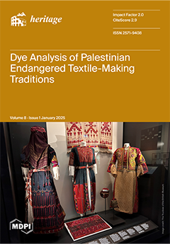
The art of Palestinian embroidery (tatreez) is recognised by UNESCO as part of the Intangible Cultural Heritage of Humanity and serves as powerful symbol of Palestinian national identity. Since the displacement of millions of Palestinians in 1948 and amid ongoing political challenges, studying and preserving Palestinian traditional knowledge and cultural heritage is extremely important. In this study, dye analysis of two Palestinian garments from the British Museum’s collection showcases how the identification of synthetic dyes can help refine the production dates of historical textiles. The continued use of local natural dyes long after the introduction of synthetic alternatives is testament to the complex dynamics behind the evolution of textile-making practices and the integration of imported materials in this region and beyond. View this paper
  • Issues are regarded as officially published after their release is announced to the table of contents alert mailing list.
  • You may sign up for e-mail alerts to receive table of contents of newly released issues.
  • PDF is the official format for papers published in both, html and pdf forms. To view the papers in pdf format, click on the "PDF Full-text" link, and use the free Adobe Reader to open them.
Order results
Result details
Section
Select all
Export citation of selected articles as:
21 pages, 2536 KiB  
Article
Phygital Experience Platform for Textile Exhibitions in Small Local Museums
by Supaporn Chai-Arayalert, Supattra Puttinaovarat and Wanida Saetang
Heritage 2025, 8(1), 35; https://doi.org/10.3390/heritage8010035 - 20 Jan 2025
Viewed by 519
Abstract
This study introduces a comprehensive phygital framework tailored for small local museums, addressing the unique challenges of textile exhibitions. By seamlessly integrating physical artifacts with advanced digital tools through a user-centered design–thinking approach, the platform transforms traditional museum visits into hybrid experiences. The [...] Read more.
This study introduces a comprehensive phygital framework tailored for small local museums, addressing the unique challenges of textile exhibitions. By seamlessly integrating physical artifacts with advanced digital tools through a user-centered design–thinking approach, the platform transforms traditional museum visits into hybrid experiences. The research addresses challenges faced by small museums, such as limited interactivity, static information presentation, and resource constraints. The findings demonstrate that the phygital platform significantly enhances visitor satisfaction, usability, and engagement. Features like mobile applications, chatbots, and gamification foster dynamic interactions, increasing interest in historical textile collections. The evaluation highlights positive impacts on visitor learning and accessibility, with high usability scores and favorable feedback confirming the platform’s success. By bridging physical and digital realms, the platform empowers small local museums to modernize their exhibition experience offerings while preserving their authenticity and cultural significance. This study contributes to the growing literature on phygital strategies in museum contexts, offering practical recommendations for implementing such platforms in resource-constrained settings. The findings underscore the potential of phygital approaches to foster deeper connections with cultural heritage, ensure broader accessibility, and support sustainable visitor engagement. Full article
Show Figures

Figure 1

15 pages, 9679 KiB  
Technical Note
Taphonomy as a Methodological Approach for the Study of Dog Domestication: Application to the Prehistoric Site of Peña Moñuz (Guadalajara, Spain)
by Idoia Claver, Verónica Estaca-Gómez, Gonzalo J. Linares-Matás, Jesús Alberto Arenas-Esteban and José Yravedra
Heritage 2025, 8(1), 34; https://doi.org/10.3390/heritage8010034 - 19 Jan 2025
Viewed by 449
Abstract
The study of early dog domestication has been the focus of considerable scholarly interest in recent years, prompting extensive research aimed at pinpointing the precise temporal and geographic origins of this process. However, a consensus among studies remains elusive, with various research efforts [...] Read more.
The study of early dog domestication has been the focus of considerable scholarly interest in recent years, prompting extensive research aimed at pinpointing the precise temporal and geographic origins of this process. However, a consensus among studies remains elusive, with various research efforts proposing differing timelines and locations for domestication. To address the questions related to the domestication process, researchers have employed a wide range of methodologies, including genetic, biomolecular, morphometric, paleontological, biometric, and isotopic analyses, as well as dental wear analysis to reconstruct paleodiets. Each of these approaches requires access to fossil canid specimens, given that they work directly with the skeletal remains of dogs or wolves. Alternatively, some methods can yield insights into the domestication process without necessitating the physical remains of these canids. Taphonomy, for instance, enables the study of bone surfaces for tooth marks, which may serve as indirect indicators of carnivore activity, potentially attributable to dogs or wolves. This study applies a high-resolution taphonomic analysis to bones modified by carnivores at the prehistoric site of Peña Moñuz. Our aim is to identify the specific carnivores responsible for the observed bone modifications. The findings demonstrate the efficacy of this technique in identifying the agents of bite marks, suggesting that taphonomy may complement the paleogenetic, paleontological, and isotopic methodologies traditionally used to explore the origins of dog domestication Full article
(This article belongs to the Section Archaeological Heritage)
Show Figures

Figure 1

32 pages, 16823 KiB  
Article
From Heritage Building Information Modelling Towards an ‘Echo-Based’ Heritage Digital Twin
by Hord Arsalan, David Heesom and Nigel Moore
Heritage 2025, 8(1), 33; https://doi.org/10.3390/heritage8010033 - 17 Jan 2025
Viewed by 667
Abstract
Since the late 2000s, numerous studies have focused on the application of Heritage Building Information Modelling (HBIM) processes and technologies for the documentation of the historic built environment. Many of these studies have focused on the use of BIM software tools to generate [...] Read more.
Since the late 2000s, numerous studies have focused on the application of Heritage Building Information Modelling (HBIM) processes and technologies for the documentation of the historic built environment. Many of these studies have focused on the use of BIM software tools to generate intelligent 3D models using information gathered from a range of data capture techniques including laser scanning and photogrammetry. While this approach effectively preserves existing or partially extant heritage, it faces limitations in reconstructing lost or poorly documented structures. The aim of this study is to develop a novel approach to complement the existing tangible-based HBIM methods, towards an ‘Echo-based’ Heritage Digital Twin (EH-DT) an early-stage digital representation that leverages intangible, memory-based oral descriptions (or echoes) and AI text-to-image generation techniques. The overall methodology for the research presented in this paper proposes a three-phase framework. Phase 1: engineering a standardised heritage prompt template, Phase 2: creation of the Architectural Heritage Transformer, and Phase 3: implementing an AI text-to-image generation toolkit. Within these phases, intangible data, including collective memories (or oral histories) of people who had first-hand experience with the building, provide ‘echoes’ of past form. These can then be converted using a novel ‘Architectural Heritage Transformer’ (AHT), which converts plain language descriptions into architectural terminology through a generated taxonomy. The output of the AHT forms input for a pre-created standardised heritage prompt template for use in AI diffusion models. While the current EH-DT framework focuses on producing 2D visual representations, it lays the foundation for potential future integration with HBIM models or digital twin systems. However, the reliance on generative AI introduces potential risks of inaccuracies due to speculative outputs, necessitating rigorous validation and iterative refinement to ensure historical and architectural credibility. The findings indicate the potential of AI to extend the current HBIM paradigm by generating images of ‘lost’ heritage buildings, which can then be used to enhance and augment the more ‘traditional’ HBIM process. Full article
Show Figures

Figure 1

31 pages, 31280 KiB  
Article
Three-Dimensional Digital Documentation for the Conservation of the Prambanan Temple Cluster Using Guided Multi-Sensor Techniques
by Anindya Sricandra Prasidya, Irwan Gumilar, Irwan Meilano, Ikaputra Ikaputra, Rochmad Muryamto and Erlyna Nour Arrofiqoh
Heritage 2025, 8(1), 32; https://doi.org/10.3390/heritage8010032 - 16 Jan 2025
Viewed by 547
Abstract
The Prambanan Temple cluster is a world heritage site that has significant value for humanity, a multiple zone cluster arrangement of highly ornamented towering temples, and a Hindu architectural pattern design. It lies near the Opak Fault, at the foothills of Mount Merapi, [...] Read more.
The Prambanan Temple cluster is a world heritage site that has significant value for humanity, a multiple zone cluster arrangement of highly ornamented towering temples, and a Hindu architectural pattern design. It lies near the Opak Fault, at the foothills of Mount Merapi, on an unstable ground layer, and is surrounded by human activities in Yogyakarta, Indonesia. The site’s vulnerability implies the necessity of 3D digital documentation for its conservation, but its complexity poses difficulties. This work aimed to address this challenge by introducing the utilization of architectural pattern design (APD) to guide multi-sensor line-ups for documentation. First, APDs were established from the literature to derive the associated multiple detail levels; then, multiple sensors and modes of light detection and ranging (Lidar) scanners and photogrammetry were utilized according to their detail requirements and, finally, point cloud data were processed, integrated, assessed, and validated by the proof of the existence of an APD. The internal and external qualities of each sensor result showed the millimeter- to centimeter-range root mean squared error, with the terrestrial laser scanner (TLS) having the best accuracy, followed by aerial close-range and terrestrial-mode photogrammetry and nadiral Lidar and photogrammetry. Two relative cloud distance analyses of every point cloud model to the reference model (TLS) returned the millimeter and centimeter ranges of the mean distance values. Furthermore, visually, every point cloud model from each sensor successfully complemented each other. Therefore, we can conclude that our approach is promising for complex heritage documentation. These results provide a solid foundation for future analyses, particularly in assessing structural vulnerabilities and informing conservation strategies. Full article
(This article belongs to the Special Issue 3D Reconstruction of Cultural Heritage and 3D Assets Utilisation)
Show Figures

Figure 1

29 pages, 65570 KiB  
Article
Parametric Modelling Techniques for Rhine Castle Models in Blender
by Etienne Sommer, Mathieu Koehl and Pierre Grussenmeyer
Heritage 2025, 8(1), 31; https://doi.org/10.3390/heritage8010031 - 16 Jan 2025
Viewed by 517
Abstract
Recent advances in 3D modelling have greatly improved the digital reconstruction of historic buildings. Traditional 3D modelling methods, while accurate, are very time-consuming and require a detailed focus on complex architectural features. The use of Building Information Modelling (BIM) technology, adapted [...] Read more.
Recent advances in 3D modelling have greatly improved the digital reconstruction of historic buildings. Traditional 3D modelling methods, while accurate, are very time-consuming and require a detailed focus on complex architectural features. The use of Building Information Modelling (BIM) technology, adapted to historic buildings as Historic Building Information Modelling (HBIM), has made the modelling process easier. However, HBIM still struggles with a lack of detailed object libraries that truly represent the diverse architectural heritage, due to the unique designs of these ancient structures. This article presents a new method using Blender software, focusing on Geometry Nodes and modifier tools for parametric modelling. This method aims to efficiently reconstruct the Rhine region’s castles, which are part of Europe’s most heavily fortified areas with a history that goes back to the XIth century. Many of these castles, over 500 years old, are now ruins. Our method allows for quick changes and detailed customization to meet the specific needs of archaeologists and heritage researchers. Developed as part of the Châteaux Rhénans-Burgen am Oberrhein project, funded by the European Interreg VI programme, this approach focuses on digitizing and promoting the Rhine castles’ heritage. The project aims to fill some gaps in parametric modelling by providing a flexible and dynamic toolset for heritage conservation. Full article
Show Figures

Figure 1

33 pages, 23289 KiB  
Article
Preserving the Past: A Dynamic Analysis of Heritage Tourism and Land Conservation in Mamluk Cairo
by Amany E. Salem, Ahmed Tawhid Eissa, Thowayeb H. Hassan and Mahmoud I. Saleh
Heritage 2025, 8(1), 30; https://doi.org/10.3390/heritage8010030 - 15 Jan 2025
Viewed by 1096
Abstract
Historic urban cities face increasing pressure from tourism, necessitating sophisticated approaches to visitor management that protect both heritage values and local communities. The current study develops new sustainable metrics—sustainable visitor capacity (SVC) and Sustainable Visitation Index (SVI)—to provide a multifaceted assessment of heritage [...] Read more.
Historic urban cities face increasing pressure from tourism, necessitating sophisticated approaches to visitor management that protect both heritage values and local communities. The current study develops new sustainable metrics—sustainable visitor capacity (SVC) and Sustainable Visitation Index (SVI)—to provide a multifaceted assessment of heritage destination management beyond simple visitor volume calculations. The SVC considers operating hours, site capacity, and walking time, while the SVI holistically evaluates time efficiency, spatial distribution, and physical comfort. Applying these metrics to seven routes through the historic Mamluk monuments revealed significant variations in sustainability performance, with SVI scores ranging from 48.9 at Al-Ṣalῑba/Al-Sayyida Zaynab Streets to 92.8 at Northern Al-Mu’izz Street. The findings demonstrate that while the recommended daily visitor capacity ranges from 1286 to 2182 visitors across different routes, actual visitation frequently exceeds these thresholds, particularly in commercial zones. Geographic analyses and on-site studies identified the integration of tourist activities with commercial, residential, and religious uses as a critical factor contributing to overcrowding, especially evident in areas like Al-Ṣalῑba Street, where low SVI scores reflect challenges with unorganized markets and local congestion. The study offers site-specific recommendations for heritage managers, focusing on dynamic visitor management systems and zoning strategies that consider the dual function of these historic corridors as both tourist attractions and vital local thoroughfares. This research provides heritage managers with practical tools to quantify and enhance the sustainability of visitor experiences while preserving site integrity within complex urban heritage contexts. Full article
Show Figures

Figure 1

26 pages, 12221 KiB  
Article
Databases and Information Models for Semantic and Evolutionary Analysis in Fortified Cultural Heritage
by Sandro Parrinello and Alberto Pettineo
Heritage 2025, 8(1), 29; https://doi.org/10.3390/heritage8010029 - 14 Jan 2025
Viewed by 714
Abstract
The paper explores two fortified systems, as case studies, to evaluate different modelling approaches, the parameterisation of architectural components, and semantic interpretation, to define a repeatable methodology for classifying, accessing, and sharing architectural information. The use of informational structures to categorise data and [...] Read more.
The paper explores two fortified systems, as case studies, to evaluate different modelling approaches, the parameterisation of architectural components, and semantic interpretation, to define a repeatable methodology for classifying, accessing, and sharing architectural information. The use of informational structures to categorise data and relations through semantic attributes addresses the need to make data queryable and interoperable. In architectural documentation, this practice opens up new perspectives for creating and sharing collaborative repositories, radically transforming the way of disseminating and accessing knowledge. Linking qualitative data information with 3D models enables the development of semantic structures that provide a deeper understanding of intrinsic characteristics, historical transformations of architectural complexes, and their cultural context. While databases effectively manage structured information and relationships between different signifiers, semantically enriched 3D modelling, through the management of surfaces or parameters, offers an accurate and flexible representation of each component. The evaluation of these case studies not only improves the ability to understand and appreciate built heritage but also provides new opportunities for researchers in architectural documentation and history. Semantic subdivision processes of built complexes into individual components facilitate the analysis and the digital preservation of heritage, enabling more precise interpretations and faithful reconstructions. Full article
Show Figures

Figure 1

20 pages, 17778 KiB  
Article
Refining the Production Date of Historical Palestinian Garments Through Dye Identification
by Diego Tamburini, Ludovic Durand and Zeina Klink-Hoppe
Heritage 2025, 8(1), 28; https://doi.org/10.3390/heritage8010028 - 14 Jan 2025
Viewed by 603
Abstract
The dyes used to produce two Palestinian garments from the British Museum’s collection attributed to the late 19th–early 20th century were investigated by high pressure liquid chromatography coupled with diode array detector and tandem mass spectrometry (HPLC-DAD-MS/MS). Palestinian embroidery is a symbol of [...] Read more.
The dyes used to produce two Palestinian garments from the British Museum’s collection attributed to the late 19th–early 20th century were investigated by high pressure liquid chromatography coupled with diode array detector and tandem mass spectrometry (HPLC-DAD-MS/MS). Palestinian embroidery is a symbol of national identity and the topic of scholarly research. However, little attention has been given to the dyes and how these changed with the introduction of new synthetic formulations in the second half of the 19th century. The results revealed the use of natural indigoid blue and red madder (Rubia tinctorum), in combination with tannins. Yellow from buckthorn (probably Rhamnus saxatilis) and red from cochineal (probably Dactylopius coccus) were found mixed with synthetic dyes in green and dark red embroidery threads, respectively. Early synthetic dyes were identified in all the other colours. These include Rhodamine B (C.I. 45170), Orange II (C.I. 15510), Orange IV (C.I. 13080), Metanil Yellow (C.I. 13065), Chrysoidine R (C.I. 11320), Methyl Violet (C.I. 42535), Malachite Green (C.I. 42000), Fuchsin (C.I. 42510), Auramine O (C.I. 41000) and Methyl Blue (C.I. 42780). As the date of the first synthesis of these dyes is known, the production date of the garments was refined, suggesting that these were likely to be produced towards the end of the 1880s/beginning of the 1890s. The continuous use of historical local sources of natural dyes, alongside new synthetic dyes, is of particular interest, adding rightful nuances to the development of textile-making practices in this region. Full article
(This article belongs to the Special Issue Dyes in History and Archaeology 43)
Show Figures

Figure 1

15 pages, 243 KiB  
Article
Species Knowledge About a UNESCO Natural World Heritage Site and the Importance of Connectedness with Nature
by Ricardo Puppe and Till Schmäing
Heritage 2025, 8(1), 27; https://doi.org/10.3390/heritage8010027 - 13 Jan 2025
Viewed by 843
Abstract
Species knowledge of local animal species is of great importance for one’s own environmental awareness and is a major component for managing present and future crises in education for sustainable development. For this reason, this study is the first to survey the species [...] Read more.
Species knowledge of local animal species is of great importance for one’s own environmental awareness and is a major component for managing present and future crises in education for sustainable development. For this reason, this study is the first to survey the species knowledge of visitors to the UNESCO Natural World Heritage Site the Wadden Sea of the North Sea, which is the largest mudflat area in the world. In this context, the self-assessment of the respondents and the extent of their connectedness with nature are also examined. To answer the research questions, a questionnaire survey was carried out to determine the species knowledge and degree of connectedness with nature. For data analysis, various statistical methods such as t-tests and correlation analyses were used. The results show that the 126 visitors to the Wadden Sea Visitor Centre have a rather low level of species knowledge. In this regard, the European Herring Gull is the only very well-known species among the respondents. In addition, a further construct was investigated in the form of connectedness with nature, between which a significant positive correlation was found with species knowledge. Full article
(This article belongs to the Special Issue Progress in Heritage Education: Evolving Techniques and Methods)
21 pages, 2083 KiB  
Article
The Investigation of Stefan Luchian Heritage Paintings—A Multi-Analytical Approach
by Andrei Victor Oancea, Bogdana Simionescu, Laura Elena Ursu, Mioara Murariu, Marius Dobromir, Maria Geba, Lacramioara Stratulat and Mihaela Olaru
Heritage 2025, 8(1), 26; https://doi.org/10.3390/heritage8010026 - 13 Jan 2025
Viewed by 433
Abstract
Based on a multi-analytical approach involving mobile techniques and lab-based devices (XPS, portable and micro-Raman spectroscopies, and ATR-FTIR spectroscopy, combined with SEM/EDS and optical microscopy), this study presents the first in-depth investigation of two cultural heritage artworks painted by the famous Romanian artist [...] Read more.
Based on a multi-analytical approach involving mobile techniques and lab-based devices (XPS, portable and micro-Raman spectroscopies, and ATR-FTIR spectroscopy, combined with SEM/EDS and optical microscopy), this study presents the first in-depth investigation of two cultural heritage artworks painted by the famous Romanian artist Ștefan Luchian. The research highlights the artist’s use of a wide range of colors, with his palette including classic pigments such as ochers, lead white, barium white, zinc white, and viridian, as well as contemporary colors such as cobalt purple, alizarin crimson, and the little-known indium yellow. Additionally, attempts are made to characterize the binders used in the paintings, which include linseed oil and animal glue. Beyond identifying the types of pigments and materials used by the artist and assessing the degradation stage of the paintings, this study is the first to provide information regarding the use of In2O3 as a yellow pigment in artwork. Full article
(This article belongs to the Special Issue Molecular Spectroscopy in Art and Archaeology)
Show Figures

Figure 1

24 pages, 8828 KiB  
Article
Contributions to Architectural and Urban Resilience Through Vulnerability Assessment: The Case of Mozambique Island’s World Heritage
by Susana Milão, Telma Ribeiro, Mariana Correia, Isabel Clara Neves, Joaquim Flores and Olga Alvarez
Heritage 2025, 8(1), 25; https://doi.org/10.3390/heritage8010025 - 11 Jan 2025
Viewed by 573
Abstract
Mozambique Island, a UNESCO World Heritage property, faces significant challenges due to climate change and extreme weather events. This study proposes a comprehensive framework for assessing morphological vulnerabilities and enhancing urban resilience in this unique historical urban landscape. The research methodology involves a [...] Read more.
Mozambique Island, a UNESCO World Heritage property, faces significant challenges due to climate change and extreme weather events. This study proposes a comprehensive framework for assessing morphological vulnerabilities and enhancing urban resilience in this unique historical urban landscape. The research methodology involves a thorough analysis of historical cartography, urban evolution, topography, and vernacular architecture, combined with recent conservation assessments and case studies from other climate-vulnerable regions. This study reveals the island’s dual urban structure, comprising the Stone and Lime town and the Macuti town, each with distinct morphological characteristics and vulnerabilities. Historical maps and topographical analysis demonstrate how the island’s geography has shaped its urban development, with the Stone and Lime town built on higher ground and the Macuti town situated at or below sea level, increasing its flood risk. The research highlights the importance of integrating traditional knowledge with resilience strategies while respecting the authenticity and integrity of the World Heritage property. Key findings include the need for a GIS-based management tool for continuous conservation assessment, and the crucial role of community engagement in implementing resilience mechanisms. This study contributes to the broader discourse on cultural heritage as a contributor to architectural and urban resilience, offering valuable insights for other World Heritage properties facing similar climate challenges. The proposed framework emphasizes the importance of balancing heritage preservation with adaptive strategies, while enhancing the island’s resilience facing climate-related threats. Full article
(This article belongs to the Special Issue Cultural Heritage as a Contributor to Territorial/Urban Resilience)
Show Figures

Figure 1

21 pages, 8676 KiB  
Article
Glazed Pottery Throughout the Middle and Modern Ages in Northern Spain
by Ainhoa Alonso-Olazabal, Juan Antonio Quirós Castillo, Maria Cruz Zuluaga and Luis Ángel Ortega
Heritage 2025, 8(1), 24; https://doi.org/10.3390/heritage8010024 - 10 Jan 2025
Viewed by 385
Abstract
A total of forty samples of medieval and modern glazed pottery from northern Spain were studied. Chemical and microstructural analyses of the glazes were performed by scanning electron microscopy coupled with electron dispersive spectroscopy (SEM-EDX), while the chemical composition of the pottery bodies [...] Read more.
A total of forty samples of medieval and modern glazed pottery from northern Spain were studied. Chemical and microstructural analyses of the glazes were performed by scanning electron microscopy coupled with electron dispersive spectroscopy (SEM-EDX), while the chemical composition of the pottery bodies and slips were determined by X-ray Fluorescence (XRF). The glazes studied come from the Santa Barbara Hill site (Tudela), the Treviño Castle site (Treviño), the Vega workshop (Burgos) and the Torrentejo village (Labastida) and correspond to transparent glazes and opaque white glazes. Transparent glazes were lead glazes with variable PbO content. Opaque white glazes were lead-tin and lead–alkaline–tin glazes. The glaze was mainly applied to a pre-fired body made of local clays, but the glazes of the Santa Barbara Hills pottery (Tudela) were applied to raw bodies. The microstructure of the interfaces indicates a single firing process for the glazed pottery from Tudela and a double firing process in the rest of the sites. Some correlation are identified between the use of specific clays to produce different glaze colours. White opaque glazes are applied to calcium-rich clays. Similarly, calcium-rich clays were used to produce dark green transparent glazes, while clays and slips aluminium–rich were used to produce light green and light honey glazes. Iron was also identified as the main colouring agent, although copper was also used. The white glazes were opacified by the addition of cassiterite and sometimes quartz and feldspar. The glazed pottery was mainly of local origin, but the identification of some non-local pottery at all sites suggests a pottery trade. Full article
Show Figures

Figure 1

19 pages, 3171 KiB  
Article
Design and Construction of the Real Felipe Fortress of Callao: Analysis of the Military Treatise and Layout Using Photogrammetry and GIS
by Diego Javier Celis-Estrada, Pablo Rodriguez-Navarro and Teresa Gil-Piqueras
Heritage 2025, 8(1), 23; https://doi.org/10.3390/heritage8010023 - 10 Jan 2025
Viewed by 636
Abstract
Peru constituted the most important Viceroyalty of the Spanish Empire in South America, with the Port of Callao controlling the South Pacific trade routes. Although it was safe in its infancy, Callao suffered coastal attacks leading to its fortification. However, on 28 October [...] Read more.
Peru constituted the most important Viceroyalty of the Spanish Empire in South America, with the Port of Callao controlling the South Pacific trade routes. Although it was safe in its infancy, Callao suffered coastal attacks leading to its fortification. However, on 28 October 1746, an earthquake and tidal wave devastated the port, leading to its relocation and the construction of the Real Felipe Fortress of Callao, the South Pacific’s most significant fortification. The fortress was based on 18th century military conceptions adapted to the specific conditions of the coastal lands of the Peruvian Viceroyalty, such as the lack of stone, the use of adobe, and the frequent earthquakes. This research sought to identify the architectural theories influencing its design, the adaptations necessary for its coastal location, and the underlying mathematical and military concepts. Photogrammetry based techniques and a geographic information system (GIS) were used for georeferencing historical planimetry, along with the analysis of historical documents. This allowed us to reconstruct the original design and make evident how European ideas were adjusted to the particularities of the American territory, thus contributing to the improvement of knowledge about Spanish military architecture in America. Full article
(This article belongs to the Special Issue 3D Reconstruction of Cultural Heritage and 3D Assets Utilisation)
Show Figures

Figure 1

20 pages, 10708 KiB  
Article
Evaluation of 3D Models of Archaeological Remains of Almenara Castle Using Two UAVs with Different Navigation Systems
by Juan López-Herrera, Serafín López-Cuervo, Enrique Pérez-Martín, Miguel Ángel Maté-González, Consuelo Vara Izquierdo, José Martínez Peñarroya and Tomás R. Herrero-Tejedor
Heritage 2025, 8(1), 22; https://doi.org/10.3390/heritage8010022 - 10 Jan 2025
Viewed by 573
Abstract
Improvements in the navigation systems incorporated into unmanned aerial vehicles (UAVs) and new sensors are improving the quality of 3D mapping results. In this study, two flights were compared over the archaeological remains of the castle of Almenara, situated in Cuenca, Spain. We [...] Read more.
Improvements in the navigation systems incorporated into unmanned aerial vehicles (UAVs) and new sensors are improving the quality of 3D mapping results. In this study, two flights were compared over the archaeological remains of the castle of Almenara, situated in Cuenca, Spain. We performed one with a DJI Phantom 4 (DJI Innovations Co., Ltd., Shenzhen, China) and the other with a Matrice 300 RTK (DJI Innovations Co., Ltd., Shenzhen, China) and the new Zenmuse P1 camera (45 mp, RGB sensor). With the help of the new software incorporated into the Zenmuse P1 camera gimbal, we could significantly reduce the flight time. We analysed the data obtained with these two UAVs and the built-in RGB sensors, comparing the flight time, the point cloud, and its resolution and obtaining a three-dimensional reconstruction of the castle. We describe the work and the flights carried out, depending on the type of UAV and its RTK positioning system. The improvement in the positioning system provides improvements in flight accuracy and data acquisition. We compared the results obtained in similar studies, and thanks to the advances in UAVs and their sensors with better resolution, we managed to reduce the data collection time and obtained 3D models with the same results as those from other types of sensors. The accuracies obtained with the RTK and the P1 camera are very high. The volumes calculated for a future archaeological excavation are precise, and the 3D models obtained by these means are excellent for the preservation of the cultural asset. These models can have various uses, such as the preservation of an asset of cultural interest, or even its dissemination and analysis in various studies. We propose to use this technology for similar studies of archaeological documentation and the three-dimensional reconstruction and visualisation of cultural heritage in virtual visits on the web. Full article
(This article belongs to the Special Issue 3D Reconstruction of Cultural Heritage and 3D Assets Utilisation)
Show Figures

Figure 1

43 pages, 3683 KiB  
Article
A Systems Thinking Approach to the Development of HBIM: Part 1—The Problematic Situation
by Lucy J. Lovell, Richard J. Davies and Dexter V. L. Hunt
Heritage 2025, 8(1), 21; https://doi.org/10.3390/heritage8010021 - 9 Jan 2025
Viewed by 588
Abstract
Building Information Modelling (BIM) is an information management and modelling technique frequently employed by the Architecture, Engineering, and Construction (AEC) sector. The application of BIM to Cultural Heritage (CH), otherwise known as Historic BIM (HBIM), will assist with the ongoing sustainable management of [...] Read more.
Building Information Modelling (BIM) is an information management and modelling technique frequently employed by the Architecture, Engineering, and Construction (AEC) sector. The application of BIM to Cultural Heritage (CH), otherwise known as Historic BIM (HBIM), will assist with the ongoing sustainable management of CH. However, the application of HBIM is currently limited by a lack of defined end-user requirements and standard methodology in its application. To address this, the authors propose a systems thinking approach, utilising both the Soft Systems Methodology (SSM) and hard Systems Engineering (SE), for the development of HBIM. Subsequently, this paper presents the results of an extensive survey undertaken with the United Kingdom (UK) Heritage Community to identify challenges faced by the CH sector and utilises the SSM to propose the core purpose of HBIM within the CH sector. The responses to the survey suggest that the development of HBIM should prioritise the promotion of structured information management instead of the generation of detailed geometric models, a key theme of much existing research. Future work by the authors (Part 2 of this work) will continue the analysis of the survey results and utilise SE processes to define end-user requirements for HBIM. Full article
Show Figures

Figure 1

20 pages, 691 KiB  
Article
Cultural Heritage in Education: Flamenco as a Pedagogical Tool for Future Teachers in Spain
by Jesús Heredia-Carroza, Laura Díaz-Reyes, Daniela-Tatiana Agheorghiesei and Raluca Stoica
Heritage 2025, 8(1), 20; https://doi.org/10.3390/heritage8010020 - 8 Jan 2025
Viewed by 934
Abstract
This study explores how future teachers in Spain perceive the incorporation of cultural heritage in education, with a specific focus on flamenco as a pedagogical tool. Using exploratory factor analysis and surveys from 301 participants, the research identified the key variables that influence [...] Read more.
This study explores how future teachers in Spain perceive the incorporation of cultural heritage in education, with a specific focus on flamenco as a pedagogical tool. Using exploratory factor analysis and surveys from 301 participants, the research identified the key variables that influence the valuation of cultural heritage through flamenco within educational settings. The findings revealed that social and cognitive skills, such as group cohesion, attention, and memory, are significant factors in appreciating flamenco as an educational resource. The study emphasizes flamenco’s potential to foster emotional, social, and cognitive development, positioning it as an effective means to integrate cultural heritage into teaching practices. This research contributes to understanding how flamenco as a pedagogical tool can enrich educational methodologies and enhance cultural heritage awareness among future educators. Full article
21 pages, 26780 KiB  
Article
Preserving the Past, Embracing the Future: Co-Design Strategies for Achieving Harmony Between Heritage Sites and Accessibility Needs
by Maryem Lakoud, Ernesto Morales, Alicia Ruiz-Rodrigo, Isabelle Feillou, Samuel Mathieu, Jonathan Riendeau and François Routhier
Heritage 2025, 8(1), 19; https://doi.org/10.3390/heritage8010019 - 8 Jan 2025
Viewed by 455
Abstract
Canada’s heritage sites, while fewer in number compared to Europe, face significant challenges in accessibility due to strict preservation laws. Many were built before social inclusion became a priority, making them difficult to navigate for individuals with disabilities. For example, cobbled streets with [...] Read more.
Canada’s heritage sites, while fewer in number compared to Europe, face significant challenges in accessibility due to strict preservation laws. Many were built before social inclusion became a priority, making them difficult to navigate for individuals with disabilities. For example, cobbled streets with uneven surfaces or significant level differences create obstacles for wheelchair users and others with mobility challenges. This qualitative action research aimed to develop guidelines for shared street designs and innovative solutions that balance heritage preservation with inclusive accessibility. The study involved go along interviews with 21 participants with disabilities in Quebec City’s Petit-Champlain and Place-Royale areas, as well as the Old-Seminary. Insights from these interviews informed a co-design methodology involving three sessions with participants with disabilities, family caregivers, and experts in accessibility and heritage. The co-design sessions generated practical solutions such as lift platforms, accessible signage, and guided handrails, addressing both outdoor and indoor accessibility barriers. For indoor spaces, solutions included integrating acoustic panels and foldable seating, while outdoor recommendations emphasized autonomous access solutions like non-slip coatings and accessible elevators for winter conditions. It was concluded that achieving a balance between preservation and accessibility requires collaboration among architects, designers, heritage experts, and individuals with disabilities. This research highlights the importance of co-design as a method to ensure heritage sites remain culturally significant and universally accessible. Full article
Show Figures

Figure 1

19 pages, 570 KiB  
Review
Types and Effectiveness of Public Policy Measures Combatting Graffiti Vandalism at Heritage Sites
by Marko Raič and Daniela Angelina Jelinčić
Heritage 2025, 8(1), 18; https://doi.org/10.3390/heritage8010018 - 6 Jan 2025
Viewed by 783
Abstract
Graffiti vandalism poses a major threat to cultural heritage. This review paper aims to identify and describe policy measures for combatting graffiti vandalism on heritage assets, which is a significant and complex problem in urban areas worldwide with considerable cultural and economic impacts. [...] Read more.
Graffiti vandalism poses a major threat to cultural heritage. This review paper aims to identify and describe policy measures for combatting graffiti vandalism on heritage assets, which is a significant and complex problem in urban areas worldwide with considerable cultural and economic impacts. Alongside, their effectiveness is assessed. Despite being recognized as a significant problem, research papers addressing graffiti vandalism policies are existent but not adequately systematized. In the first part of this article, a theoretical overview of graffiti vandalism is provided. This is followed by an outline of the research methodology, along with a presentation of results based on the analysis of the reviewed articles. Given the relatively small number of articles that directly address this topic, the review is supplemented with an analysis of best practices, specifically, examining municipal measures and strategies aimed at combating graffiti vandalism. Full article
Show Figures

Figure 1

19 pages, 19941 KiB  
Article
Unveiling the Original Polychromy of Archaic Architecture: The Gigantomachy on the West Pediment of the Temple of Apollo at Delphi (6th c. B.C.)
by Giasemi G. Frantzi, Georgios P. Mastrotheodoros, Panayiotis Theoulakis, Sotiria Kogou, Athanasia Psalti and Hariclia Brecoulaki
Heritage 2025, 8(1), 17; https://doi.org/10.3390/heritage8010017 - 6 Jan 2025
Viewed by 606
Abstract
The Gigantomachy depicted on the west pediment of the Late Archaic temple of Apollo at Delphi marks a significant milestone in early Greek architectural sculpture. Crafted from porous stone and enhanced with plaster and paint, the surviving fragments differ markedly from the marble [...] Read more.
The Gigantomachy depicted on the west pediment of the Late Archaic temple of Apollo at Delphi marks a significant milestone in early Greek architectural sculpture. Crafted from porous stone and enhanced with plaster and paint, the surviving fragments differ markedly from the marble figures of the east pediment of the same temple. Among the preserved figures of the Gigantomachy are a standing male figure, possibly representing Apollo or Dionysos, a warrior female identified as Athena, and a recumbent male, likely symbolizing the Giant Enkelados. This study aims to investigate the polychromy of the west pediment through a thorough investigation of the remnants of the original decoration. The adopted methodology includes exclusively non-destructive techniques and advanced imaging methods, such as portable X-ray fluorescence spectrometry, visible-induced luminescence (VIL), and 3D microscope observation. Analytical results confirmed the presence of extensive traces of once-vibrant colors on the plaster’s surface, which were often invisible to the naked eye. Specifically, our data support the employment of pigments like Egyptian blue, cinnabar, ochre-based reds and yellows, as well as copper-based green. Notably, these pigments were applied over a white calcium-rich layer, which served as a primer for the porous stone. Ongoing research on the Gigantomachy promises to deepen our understanding of color usage and painting techniques in Archaic Greek art. Full article
Show Figures

Figure 1

18 pages, 2880 KiB  
Article
RGB Approach for Pixel-Wise Identification of Cellulose Nitrate Photo Negative Yellowing
by Anastasia Povolotckaia, Svetlana Kaputkina, Irina Grigorieva, Dmitrii Pankin, Evgenii Borisov, Anna Vasileva, Valeria Lipovskaia and Maria Dynnikova
Heritage 2025, 8(1), 16; https://doi.org/10.3390/heritage8010016 - 3 Jan 2025
Viewed by 663
Abstract
Film-based cellulose nitrate negatives are a unique class of objects that contain important information about life, historical buildings, and the natural landscapes of past years. Increased sensitivity to storage conditions makes these objects highly flammable and can lead to irretrievable loss. In this [...] Read more.
Film-based cellulose nitrate negatives are a unique class of objects that contain important information about life, historical buildings, and the natural landscapes of past years. Increased sensitivity to storage conditions makes these objects highly flammable and can lead to irretrievable loss. In this regard, timely identification of the degradation process is a necessary step towards further conservation and restoration. This work studies the possibility of detecting the degradation process based on cellulose nitrate artifact yellowing. A total of 20 normal and 20 yellowed negatives from the collection of Karl Kosse (The State Museum and Exhibition Center ROSPHOTO) were selected as objects for statistical study. The novelty of this work is in its demonstration of the possibility to divide negatives into normal and yellowed areas with different shades based on different B/R and B/G ratios of both light and dark negatives, i.e., regardless of the distribution of RGB component values for the obtained digital photo from the negative. Moreover, the obtained differentiation result was demonstrated for individual image pixels, without the need for averaging over a certain area. Full article
(This article belongs to the Section Materials and Heritage)
Show Figures

Figure 1

16 pages, 3912 KiB  
Conference Report
Environmental Archaeology and Heritage in Dakhla Oasis, Egypt
by Karin Kindermann and Richard Bussmann
Heritage 2025, 8(1), 15; https://doi.org/10.3390/heritage8010015 - 3 Jan 2025
Viewed by 441
Abstract
Debates about archaeological heritage in Egypt are commonly focused on the spectacular monuments of the Pharaonic, Greek, and Roman periods. In contrast, landscapes and the long prehistory of Northeast Africa receive far more limited attention. The Cologne Summer School (CSS), ‘Environmental archaeology: dealing [...] Read more.
Debates about archaeological heritage in Egypt are commonly focused on the spectacular monuments of the Pharaonic, Greek, and Roman periods. In contrast, landscapes and the long prehistory of Northeast Africa receive far more limited attention. The Cologne Summer School (CSS), ‘Environmental archaeology: dealing with cultural and natural heritage’, organised in Dakhla Oasis (Egypt) in September 2023, brought Egyptian and German students, archaeologists and heritage professionals together to discuss how heritage management, the protection of the landscape and archaeological fieldwork can be integrated meaningfully in the region. This paper summarises the results of the discussions of the summer school, set against an outline of current site-based heritage practises in Egypt and archaeological research in and around Dakhla Oasis. A major outcome of the discussions is the realisation that a distinct narrative needs to be developed for Dakhla Oasis and the surrounding desert landscape to provide an encompassing strategy for the management and protection of its archaeological heritage, from prehistoric times through Pharaonic Egypt to the recent past. Full article
(This article belongs to the Section Archaeological Heritage)
Show Figures

Figure 1

19 pages, 12647 KiB  
Article
Non-Invasive Techniques for Monitoring Cultural Heritage: Change Detection in Dense Point Clouds at the San Pietro Barisano Bell Tower in Matera, Italy
by Carmen Fattore, Sara Porcari, Arcangelo Priore and Vito Domenico Porcari
Heritage 2025, 8(1), 14; https://doi.org/10.3390/heritage8010014 - 30 Dec 2024
Viewed by 597
Abstract
This study examines change detection techniques in dense point clouds for the purpose of cultural heritage preservation, with a particular focus on the San Pietro Barisano Bell Tower in Matera, Italy. Dense point clouds, obtained via laser scanning, offer detailed 3D representations of [...] Read more.
This study examines change detection techniques in dense point clouds for the purpose of cultural heritage preservation, with a particular focus on the San Pietro Barisano Bell Tower in Matera, Italy. Dense point clouds, obtained via laser scanning, offer detailed 3D representations of heritage structures, facilitating the precise monitoring of changes over time. The investigation uses a variety of change detection algorithms, including the Iterative Closest Point (ICP) algorithm, which is renowned for its robust registration capabilities in aligning point clouds with high accuracy. The combination of ICP with deviation analysis and feature-based methods allows for the effective identification of alterations, including deformations, material loss, and surface degradation. This methodology establishes a comprehensive framework for the monitoring of cultural heritage, thereby enabling timely and targeted preservation efforts. The results emphasise the substantial contribution of dense point cloud analysis to the enhancement of heritage management and the safeguarding of vulnerable architectural sites. Full article
Show Figures

Figure 1

32 pages, 24504 KiB  
Article
Archival Research, Underwater Optical Surveys, and 3D Modelling: Three Stages for Shaping the Wreck of the Steamship Bengala (Isola di Capo Rizzuto, Crotone, Italy)
by Salvatore Medaglia, Fabio Bruno, Ana Castelli, Matteo Collina, Barbara Davidde Petriaggi, Luca De Rosa, Julieta Frere, Fabrizio Fuoco, Guillermo Gutiérrez, Antonio Lagudi, Francesco Megna and Raffaele Peluso
Heritage 2025, 8(1), 13; https://doi.org/10.3390/heritage8010013 - 29 Dec 2024
Viewed by 816
Abstract
Bengala, a steamer that sank in 1889 near Capo Rizzuto, Italy, was a relatively new vessel for its time, with an unusually short 18-year service life, given that steamers of the period typically operated for 30 to 40 years. Despite its brief [...] Read more.
Bengala, a steamer that sank in 1889 near Capo Rizzuto, Italy, was a relatively new vessel for its time, with an unusually short 18-year service life, given that steamers of the period typically operated for 30 to 40 years. Despite its brief history, SS Bengala played a significant role in the development of Italy’s young merchant navy, undergoing multiple ownership changes and serving various Italian shipping companies. Employed mainly along the route to Southeast Asia, it transported Italian migrants overseas and also participated in troop raids during the Italian military expedition to Eritrea in 1887. Despite its historical significance, no iconographic material has yet been found to depict SS Bengala, and archival research conducted in Italy and England has not uncovered any naval plans, photographs, or drawings of the ship. To overcome this gap, the authors employed new technologies and historical information to create a virtual reconstruction. This research combined archival sources with underwater surveys, including a detailed 3D survey by divers and archaeologists. Archival research, including consultation of official documents, provided critical information on the ship’s dimensions, superstructure, rigging, materials, and construction methods. The 3D modelling of the ship’s external hull, based on precise geometric data from the wreck site, offers a first step towards virtual reconstruction. The modelling is grounded in photogrammetric surveying techniques, ensuring high accuracy in the reconstruction process. The model can be used in augmented reality (AR) applications to enhance underwater exploration, allowing divers to visualise the reconstructed ship in its original environment. Additionally, it supports museum exhibits, interactive visualisations, and educational games, making it a valuable resource for engaging the public with maritime history and archaeology. Full article
(This article belongs to the Topic 3D Documentation of Natural and Cultural Heritage)
Show Figures

Figure 1

18 pages, 2572 KiB  
Review
Deep Learning Approaches for 3D Model Generation from 2D Artworks to Aid Blind People with Tactile Exploration
by Rocco Furferi
Heritage 2025, 8(1), 12; https://doi.org/10.3390/heritage8010012 - 28 Dec 2024
Viewed by 793
Abstract
An effective method to enable the enjoyment of works of art by the blind is to reproduce tactile copies of the work, to facilitate tactile exploration. This is even more important when it comes to paintings, which are inherently not accessible to the [...] Read more.
An effective method to enable the enjoyment of works of art by the blind is to reproduce tactile copies of the work, to facilitate tactile exploration. This is even more important when it comes to paintings, which are inherently not accessible to the blind unless they are transformed into 3D models. Today, artificial intelligence techniques are rapidly growing and represent a paramount method for solving a variety of previously hard-to-solve tasks. It is, therefore, presumable that the translation from 2D images to 3D models using such methods will be also in continuous development. Unfortunately, reconstructing a 3D model from a single image, especially when it comes to painting-based images, is an ill-posed problem due to the depth ambiguity and the lack of a ground truth for the 3D model. To confront this issue, this paper proposes an overview of artificial intelligence-based methods for reconstructing 3D geometry from a single image is provided. The survey explores the potentiality of Convolutional Neural Networks, Generative Adversarial Networks, Variational Autoencoders, and zero-shot methods. Through a small set of case studies, the capabilities and limitations of CNNs in creating a 3D-scene model from artworks are also encompassed. The findings suggest that, while deep learning models demonstrate that they are effective for 3D retrieval from paintings, they also call for post-processing and user interaction to improve the accuracy of the 3D models. Full article
(This article belongs to the Special Issue AI and the Future of Cultural Heritage)
Show Figures

Figure 1

28 pages, 212841 KiB  
Article
The Ponte Delle Chianche on the Via Traiana in Buonalbergo (Benevento, Italy): New Data for an Integrated Study
by Ivan Ferrari
Heritage 2025, 8(1), 11; https://doi.org/10.3390/heritage8010011 - 28 Dec 2024
Viewed by 790
Abstract
This article illustrates a systematic and updated study of the Ponte delle Chianche, a Roman bridge on the ancient Via Traiana built at the beginning of the second century AD and located near Buonalbergo (Benevento, Italy). The study aimed to retrieve all information [...] Read more.
This article illustrates a systematic and updated study of the Ponte delle Chianche, a Roman bridge on the ancient Via Traiana built at the beginning of the second century AD and located near Buonalbergo (Benevento, Italy). The study aimed to retrieve all information contained in literary sources and to cross-reference them with new data from research conducted in recent years. Thanks to an instrumental metric survey of the structures, both the construction techniques used and the bridge construction process were better understood, elements that were then incorporated into the development of a 3D reconstruction proposal. At the same time, a close visual analysis of the structures led to the discovery of a large number of brick stamps, also unpublished, which is important for understanding the logistical aspects of the building materials. The results obtained will be used to implement a comprehensive project for the recovery and securing of the property. Full article
Show Figures

Figure 1

14 pages, 1839 KiB  
Article
Tourists’ Views on Sustainable Heritage Management in Porto, Portugal: Balancing Heritage Preservation and Tourism
by Makhabbat Ramazanova, Fátima Matos Silva and Isabel Vaz de Freitas
Heritage 2025, 8(1), 10; https://doi.org/10.3390/heritage8010010 - 28 Dec 2024
Viewed by 1022
Abstract
This research explores the perceptions of tourists regarding the state and sustainable management of tangible cultural heritage in the city of Porto (Portugal), the destination recognised for its historical and cultural heritage. Porto attracts a growing number of tourists due to its rich [...] Read more.
This research explores the perceptions of tourists regarding the state and sustainable management of tangible cultural heritage in the city of Porto (Portugal), the destination recognised for its historical and cultural heritage. Porto attracts a growing number of tourists due to its rich heritage, encompassing cultural, architectural, and scenic elements. This rising demand necessitates sustainable management practices to protect the city’s heritage and ensure long-term sustainability. With the increase in tourism and the need to preserve cultural and environmental resources, sustainable management becomes essential to balance economic development and heritage conservation. The study’s main objective is to analyse tourists’ perspectives on the sustainable management of the cultural heritage of the city of Porto. It focuses on analysing current tourism management practices and calls for new strategies to promote sustainability. Structured questionnaires were distributed to a random sample of tourists in strategic locations between January and April 2023, obtaining quantitative data. The sample consists of 264 respondents. The results revealed four main factors, showing that most respondents show a high level of awareness and appreciation of sustainability and its relevance for heritage conservation. Regarding tourism, the majority agree that it contributes positively to the conservation and restoration of the city’s heritage. Full article
(This article belongs to the Special Issue Heritage Tourism and Sustainable City Dynamics)
Show Figures

Figure 1

21 pages, 66390 KiB  
Article
Photorealistic Texture Contextual Fill-In
by Radek Richtr
Heritage 2025, 8(1), 9; https://doi.org/10.3390/heritage8010009 - 27 Dec 2024
Viewed by 472
Abstract
This paper presents a comprehensive study of the application of AI-driven inpainting techniques to the restoration of historical photographs of the Czech city Most, with a focus on restoration and reconstructing the lost architectural heritage. The project combines state-of-the-art methods, including generative adversarial [...] Read more.
This paper presents a comprehensive study of the application of AI-driven inpainting techniques to the restoration of historical photographs of the Czech city Most, with a focus on restoration and reconstructing the lost architectural heritage. The project combines state-of-the-art methods, including generative adversarial networks (GANs), patch-based inpainting, and manual retouching, to restore and enhance severely degraded images. The reconstructed/restored photographs of the city Most offer an invaluable visual representation of a city that was largely destroyed for industrial purposes in the 20th century. Through a series of blind and informed user tests, we assess the subjective quality of the restored images and examine how knowledge of edited areas influences user perception. Additionally, this study addresses the technical challenges of inpainting, including computational demands, interpretability, and bias in AI models. Ethical considerations, particularly regarding historical authenticity and speculative reconstruction, are also discussed. The findings demonstrate that AI techniques can significantly contribute to the preservation of cultural heritage, but must be applied with careful oversight to maintain transparency and cultural integrity. Future work will focus on improving the interpretability and efficiency of these methods, while ensuring that reconstructions remain historically and culturally sensitive. Full article
(This article belongs to the Section Cultural Heritage)
Show Figures

Figure 1

43 pages, 19726 KiB  
Article
Badges of (Dis-)Honour: Manifesting the ‘Conquest’ of Uluṟu via Wearable Material Culture
by Dirk H. R. Spennemann and Sharnie Hurford
Heritage 2025, 8(1), 8; https://doi.org/10.3390/heritage8010008 - 26 Dec 2024
Viewed by 590
Abstract
Set in a wide open plain, the monolith of Uluṟu (‘Ayers Rock’) has become an internationally recognizable symbol for the Australian outback, currently attracting hundreds of thousands of tourists each year. Promoted since the 1950s as an exotic tourist destination, one of the [...] Read more.
Set in a wide open plain, the monolith of Uluṟu (‘Ayers Rock’) has become an internationally recognizable symbol for the Australian outback, currently attracting hundreds of thousands of tourists each year. Promoted since the 1950s as an exotic tourist destination, one of the major activities has been the ‘conquest’ of Uluṟu by completing the steep climb to the top. Always disapproved by the Aṉangu, the Indigenous Australian community of the area, and actively discouraged since 1990, the climb became an extremely contentious issue in the final two years before it was permanently closed to tourists on 26 October 2019. Given that climbing Uluṟu as a tourist activity has become an event of the past, this paper will examine the nature, materiality, and potential heritage value of the portable material culture associated with the climb. The background to the history of climbing Uluṟu in the context of European invasion (‘exploration’), the nature of tourism at Uluṟu and the role climbing played in this, as well as the management decisions that led to the closure of the climb can be grouped into four thematic periods: the beginnings of settler colonialist ascents (1873–1950), the ‘heroic’ age of Uluṟu tourism (1950–1958), lodges in a National Park (1958–1985), and joint management and the eventual closure of the climb (1985–2019). Based on a description of the material culture associated with the climb, particularly badges, patches and certificates, and drawing on the methodologies of historic and material culture studies, this paper will discuss the various interpretations of climbing Uluṟu and how the portable material culture reflects or exemplifies climbing as a conquest and heroic deed, as a spiritual ritual, and as a violation of cultural rights. After examining the materiality of the wearable material culture, we conclude by exploring which of these portable items are culturally significant and which, if any, should be curated in public collections. Full article
(This article belongs to the Section Cultural Heritage)
Show Figures

Figure 1

18 pages, 19870 KiB  
Article
The Facial Approximation of the Skull Attributed to Jan Žižka (ca. AD 1360–1424)
by Cicero Moraes, Johari Yap Abdullah, Jiri Šindelář, Matěj Šindelář, Zuzana Thomová, Jakub Smrčka, Mauro Vaccarezza, Thiago Beaini and Francesco Maria Galassi
Heritage 2025, 8(1), 7; https://doi.org/10.3390/heritage8010007 - 26 Dec 2024
Viewed by 959
Abstract
The present study aims to approximate the face from the alleged skull of Jan Žižka (ca. AD 1360–1424), a military commander and national hero in the Czech Republic. Found in 1910, the skull has only a fraction of its original structure, which required [...] Read more.
The present study aims to approximate the face from the alleged skull of Jan Žižka (ca. AD 1360–1424), a military commander and national hero in the Czech Republic. Found in 1910, the skull has only a fraction of its original structure, which required an initial effort to reconstruct the missing regions from data collected in CT scans of living people’s heads. The forensic facial approximation consisted of projecting the skin boundaries with soft tissue markers and cross-referencing data from statistical projections from CT scans of living people and the use of the anatomical deformation technique, where the digital head of a virtual donor was adjusted until it matched the alleged skull of the Czech general. The final face was the result of the cross-referencing of all data and the completion of the structure respected the iconography attributed to Jan Žižka. Full article
(This article belongs to the Section Museum and Heritage)
Show Figures

Figure 1

20 pages, 9743 KiB  
Article
UAV-Based Survey of the Earth Pyramids at the Kuklica Geosite (North Macedonia)
by Ivica Milevski, Bojana Aleksova and Slavoljub Dragićević
Heritage 2025, 8(1), 6; https://doi.org/10.3390/heritage8010006 - 26 Dec 2024
Viewed by 914
Abstract
This paper presents methods for a UAV-based survey of the site “Kuklica” near Kratovo, North Macedonia. Kuklica is a rare natural complex with earth pyramids, and because of its exceptional scientific, educational, touristic, and cultural significance, it was proclaimed to be a Natural [...] Read more.
This paper presents methods for a UAV-based survey of the site “Kuklica” near Kratovo, North Macedonia. Kuklica is a rare natural complex with earth pyramids, and because of its exceptional scientific, educational, touristic, and cultural significance, it was proclaimed to be a Natural Monument in 2008. However, after the proclamation, the interest in visiting this site and the threats in terms of its potential degradation rapidly grew, increasing the need for a detailed survey of the site and monitoring. Given the site’s small size (0.5 km2), the freely available satellite images and digital elevation models are not suitable for comprehensive analysis and monitoring of the site, especially in terms of the individual forms within the site. Instead, new tools are increasingly being used for such tasks, including UAVs (unmanned aerial vehicles) and LiDAR (Light Detection and Ranging). Since professional LiDAR is very expensive and still not readily available, we used a low-cost UAV (DJI Mini 4 Pro) to carry out a detailed survey. First, the flight path, the altitude of the UAV, the camera angle, and the photo recording intervals were precisely planned and defined. Also, the ground markers (checkpoints) were carefully selected. Then, the photos taken by the drone were aligned and processed using Agisoft Metashape software (v. 2.1.4), producing a digital elevation model and orthophoto imagery with a very high (sub-decimeter) resolution. Following this procedure, more than 140 earth pyramids were delineated, ranging in height from 1 to 2 m and to 30 m at their highest. At this stage, a very accurate UAV-based 3D model of the most remarkable earth pyramids was developed (the accuracy was checked using the iPhone 14 Pro LiDAR module), and their morphometrical properties were calculated. Also, the site’s erosion rate and flash flood potential were calculated, showing high susceptibility to both. The final goal was to monitor the changes and to minimize the degradation of the unique landscape, thus better protecting the geosite and its value. Full article
(This article belongs to the Section Geoheritage and Geo-Conservation)
Show Figures

Figure 1

Previous Issue
Next Issue
Back to TopTop