Next Issue
Volume 6, December
Previous Issue
Volume 6, October


Drones, Volume 6, Issue 11 (November 2022) – 59 articles

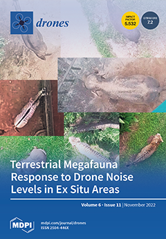
Cover Story (view full-size image): Drone use has significantly grown in recent years, but there is a knowledge gap regarding how the noise produced by these systems may affect animals. We investigated how 18 species of megafauna reacted to drone sound pressure levels at different frequencies in an ex situ environment. We found that the sound pressure level on the low frequency did not change the studied species’ behavior except for the Asian elephant. All other species showed higher noise sensitivity at medium and high frequencies. Our results suggest that drone sound pressure levels in different frequencies cause behavioral changes that differ among species, which is relevant to assessing drone disturbances. These findings can help to reduce drone impact for target species and serve as an experimental study for future drone use guidelines. View this paper
  • Issues are regarded as officially published after their release is announced to the table of contents alert mailing list.
  • You may sign up for e-mail alerts to receive table of contents of newly released issues.
  • PDF is the official format for papers published in both, html and pdf forms. To view the papers in pdf format, click on the "PDF Full-text" link, and use the free Adobe Reader to open them.
Order results
Result details
Section
Select all
Export citation of selected articles as:
14 pages, 2738 KiB  
Article
Vegetation Cover Estimation in Semi-Arid Shrublands after Prescribed Burning: Field-Ground and Drone Image Comparison
by Antonio J. Pérez-Luque, María Eugenia Ramos-Font, Mauro J. Tognetti Barbieri, Carlos Tarragona Pérez, Guillermo Calvo Renta and Ana Belén Robles Cruz
Drones 2022, 6(11), 370; https://doi.org/10.3390/drones6110370 - 21 Nov 2022
Cited by 4 | Viewed by 3699
Abstract
The use of drones for vegetation monitoring allows the acquisition of large amounts of high spatial resolution data in a simple and fast way. In this study, we evaluated the accuracy of vegetation cover estimation by drones in Mediterranean semi-arid shrublands (Sierra de [...] Read more.
The use of drones for vegetation monitoring allows the acquisition of large amounts of high spatial resolution data in a simple and fast way. In this study, we evaluated the accuracy of vegetation cover estimation by drones in Mediterranean semi-arid shrublands (Sierra de Filabres; Almería; southern Spain) after prescribed burns (2 years). We compared drone-based vegetation cover estimates with those based on traditional vegetation sampling in ninety-six 1 m2 plots. We explored how this accuracy varies in different types of coverage (low-, moderate- and high-cover shrublands, and high-cover alfa grass steppe); as well as with diversity, plant richness, and topographic slope. The coverage estimated using a drone was strongly correlated with that obtained by vegetation sampling (R2 = 0.81). This estimate varied between cover classes, with the error rate being higher in low-cover shrublands, and lower in high-cover alfa grass steppe (normalized RMSE 33% vs. 9%). Diversity and slope did not affect the accuracy of the cover estimates, while errors were larger in plots with greater richness. These results suggest that in semi-arid environments, the drone might underestimate vegetation cover in low-cover shrublands. Full article
(This article belongs to the Special Issue Drones for Biodiversity Conservation)
Show Figures

Figure 1

25 pages, 8470 KiB  
Article
A Middleware Infrastructure for Programming Vision-Based Applications in UAVs
by Pedro Arias-Perez, Jesús Fernández-Conde, David Martin Gomez, José M. Cañas and Pascual Campoy
Drones 2022, 6(11), 369; https://doi.org/10.3390/drones6110369 - 21 Nov 2022
Cited by 2 | Viewed by 2568
Abstract
Unmanned Aerial Vehicles (UAVs) are part of our daily lives with a number of applications in diverse fields. On many occasions, developing these applications can be an arduous or even impossible task for users with a limited knowledge of aerial robotics. This work [...] Read more.
Unmanned Aerial Vehicles (UAVs) are part of our daily lives with a number of applications in diverse fields. On many occasions, developing these applications can be an arduous or even impossible task for users with a limited knowledge of aerial robotics. This work seeks to provide a middleware programming infrastructure that facilitates this type of process. The presented infrastructure, named DroneWrapper, offers the user the possibility of developing applications abstracting the user from the complexities associated with the aircraft through a simple user programming interface. DroneWrapper is built upon the de facto standard in robot programming, Robot Operating System (ROS), and it has been implemented in Python, following a modular design that facilitates the coupling of various drivers and allows the extension of the functionalities. Along with the infrastructure, several drivers have been developed for different aerial platforms, real and simulated. Two applications have been developed in order to exemplify the use of the infrastructure created: follow-color and follow-person. Both applications use techniques of computer vision, classic (image filtering) or modern (deep learning), to follow a specific-colored object or to follow a person. These two applications have been tested on different aerial platforms, including real and simulated, to validate the scope of the offered solution. Full article
(This article belongs to the Section Drone Design and Development)
Show Figures

Figure 1

15 pages, 618 KiB  
Article
Real-Time Monitoring of Parameters and Diagnostics of the Technical Condition of Small Unmanned Aerial Vehicle’s (UAV) Units Based on Deep BiGRU-CNN Models
by Kamil Masalimov, Tagir Muslimov and Rustem Munasypov
Drones 2022, 6(11), 368; https://doi.org/10.3390/drones6110368 - 21 Nov 2022
Cited by 12 | Viewed by 2728
Abstract
The paper describes an original technique for the real-time monitoring of parameters and technical diagnostics of small unmanned aerial vehicle (UAV) units using neural network models with the proposed CompactNeuroUAV architecture. As input data, the operation parameter values for a certain period preceding [...] Read more.
The paper describes an original technique for the real-time monitoring of parameters and technical diagnostics of small unmanned aerial vehicle (UAV) units using neural network models with the proposed CompactNeuroUAV architecture. As input data, the operation parameter values for a certain period preceding the current and actual control actions on the UAV actuators are used. A reference parameter set model is trained based on historical data. CompactNeuroUAV is a combined neural network consisting of convolutional layers to compact data and recurrent layers with gated recurrent units to encode the time dependence of parameters. Processing provides the expected parameter value and estimates the deviation of the actual value of the parameter or a set of parameters from the reference model. Faults that have led to the deviation threshold crossing are then classified. A smart classifier is used here to detect the failed UAV unit and the fault or pre-failure condition cause and type. The paper also provides the results of experimental validation of the proposed approach to diagnosing faults and pre-failure conditions of fixed-wing type UAVs for the ALFA dataset. Models have been built to detect conditions such as engine thrust loss, full left or right rudder fault, elevator fault in a horizontal position, loss of control over left, right, or both ailerons in a horizontal position, loss of control over the rudder and ailerons stuck in a horizontal position. The results of estimating the developed model accuracy on a test dataset are also provided. Full article
(This article belongs to the Special Issue Advances in Deep Learning for Drones and Its Applications)
Show Figures

Figure 1

21 pages, 8548 KiB  
Article
LiDAR-Assisted UAV Stereo Vision Detection in Railway Freight Transport Measurement
by Jiale Li, Wei Zhou, Wei Gong, Zhaijun Lu, Hongkai Yan, Wanhui Wei, Zhixin Wang, Chao Shen and Jiahong Pang
Drones 2022, 6(11), 367; https://doi.org/10.3390/drones6110367 - 21 Nov 2022
Cited by 2 | Viewed by 2180
Abstract
Identifying and detecting the loading size of heavy-duty railway freight cars is crucial in modern railway freight transportation. Due to contactless and high-precision characteristics, light detection and ranging-assisted unmanned aerial vehicle stereo vision detection is significant for ensuring out-of-gauge freight transportation security. However, [...] Read more.
Identifying and detecting the loading size of heavy-duty railway freight cars is crucial in modern railway freight transportation. Due to contactless and high-precision characteristics, light detection and ranging-assisted unmanned aerial vehicle stereo vision detection is significant for ensuring out-of-gauge freight transportation security. However, the precision of unmanned aerial vehicle flight altitude control and feature point mismatch significantly impact stereo matching, thus affecting the accuracy of railway freight measurement. In this regard, the altitude holding control strategy equipped with a laser sensor and SURF_rBRIEF image feature extraction and matching algorithm are proposed in this article for railway freight car loading size measurement. Moreover, an image segmentation technique is used to quickly locate and dismantle critical parts of freight cars to achieve a rapid 2-dimension reconstruction of freight car contours and out-of-gauge detection. The robustness of stereo matching has been demonstrated by external field experiment. The precision analysis and fast out-of-gauge judgment confirm the measurement accuracy and applicability. Full article
Show Figures

Figure 1

23 pages, 7888 KiB  
Article
Synergistic Use of Sentinel-2 and UAV Multispectral Data to Improve and Optimize Viticulture Management
by Oiliam Stolarski, Hélder Fraga, Joaquim J. Sousa and Luís Pádua
Drones 2022, 6(11), 366; https://doi.org/10.3390/drones6110366 - 20 Nov 2022
Cited by 6 | Viewed by 3054
Abstract
The increasing use of geospatial information from satellites and unmanned aerial vehicles (UAVs) has been contributing to significant growth in the availability of instruments and methodologies for data acquisition and analysis. For better management of vineyards (and most crops), it is crucial to [...] Read more.
The increasing use of geospatial information from satellites and unmanned aerial vehicles (UAVs) has been contributing to significant growth in the availability of instruments and methodologies for data acquisition and analysis. For better management of vineyards (and most crops), it is crucial to access the spatial-temporal variability. This knowledge throughout the vegetative cycle of any crop is crucial for more efficient management, but in the specific case of viticulture, this knowledge is even more relevant. Some research studies have been carried out in recent years, exploiting the advantage of satellite and UAV data, used individually or in combination, for crop management purposes. However, only a few studies explore the multi-temporal use of these two types of data, isolated or synergistically. This research aims to clearly identify the most suitable data and strategies to be adopted in specific stages of the vineyard phenological cycle. Sentinel-2 data from two vineyard plots, located in the Douro Demarcated Region (Portugal), are compared with UAV multispectral data under three distinct conditions: considering the whole vineyard plot; considering only the grapevine canopy; and considering inter-row areas (excluding all grapevine vegetation). The results show that data from both platforms are able to describe the vineyards’ variability throughout the vegetative growth but at different levels of detail. Sentinel-2 data can be used to map vineyard soil variability, whilst the higher spatial resolution of UAV-based data allows diverse types of applications. In conclusion, it should be noted that, depending on the intended use, each type of data, individually, is capable of providing important information for vineyard management. Full article
(This article belongs to the Section Drones in Agriculture and Forestry)
Show Figures

Figure 1

17 pages, 551 KiB  
Article
Improved Dyna-Q: A Reinforcement Learning Method Focused via Heuristic Graph for AGV Path Planning in Dynamic Environments
by Yiyang Liu, Shuaihua Yan, Yang Zhao, Chunhe Song and Fei Li
Drones 2022, 6(11), 365; https://doi.org/10.3390/drones6110365 - 19 Nov 2022
Cited by 9 | Viewed by 3912
Abstract
Dyna-Q is a reinforcement learning method widely used in AGV path planning. However, in large complex dynamic environments, due to the sparse reward function of Dyna-Q and the large searching space, this method has the problems of low search efficiency, slow convergence speed, [...] Read more.
Dyna-Q is a reinforcement learning method widely used in AGV path planning. However, in large complex dynamic environments, due to the sparse reward function of Dyna-Q and the large searching space, this method has the problems of low search efficiency, slow convergence speed, and even inability to converge, which seriously reduces the performance and practicability of it. To solve these problems, this paper proposes an Improved Dyna-Q algorithm for AGV path planning in large complex dynamic environments. First, to solve the problem of the large search space, this paper proposes a global path guidance mechanism based on heuristic graph, which can effectively reduce the path search space and, thus, improve the efficiency of obtaining the optimal path. Second, to solve the problem of the sparse reward function in Dyna-Q, this paper proposes a novel dynamic reward function and an action selection method based on the heuristic graph, which can provide more intensive feedback and more efficient action decision for AGV path planning, effectively improving the convergence of the algorithm. We evaluated our approach in scenarios with static obstacles and dynamic obstacles. The experimental results show that the proposed algorithm can obtain better paths more efficiently than other reinforcement-learning-based methods including the classical Q-Learning and the Dyna-Q algorithms. Full article
Show Figures

Figure 1

28 pages, 3599 KiB  
Article
A Path Planning Model with a Genetic Algorithm for Stock Inventory Using a Swarm of Drones
by Miklós Gubán and József Udvaros
Drones 2022, 6(11), 364; https://doi.org/10.3390/drones6110364 - 19 Nov 2022
Cited by 16 | Viewed by 4539
Abstract
In this paper, a mathematical model and solution for performing the inventory tasks of a multi-user, mixed warehouse in which neither satellite positioning nor other IT solutions can be used was presented. After reviewing the literature on road planning and the use of [...] Read more.
In this paper, a mathematical model and solution for performing the inventory tasks of a multi-user, mixed warehouse in which neither satellite positioning nor other IT solutions can be used was presented. After reviewing the literature on road planning and the use of drones in warehouses, a method is presented that can be used to control drones that can be moved in all directions for imaging and transmission. The proposed method consists of three main steps. As a first step, we provide the mathematical model and solution method needed to determine the (optimal execution time) access routes required for processing the compartments of the warehouses. This is an initial step before starting the inventory. This considers the structure of the warehouse, its features, the number of drones, and the parameters of the drones. In the second step, based on the routes obtained in the first step, the real-time movement of the drones was controlled during processing, including camera movement and image recording. The third step is post-processing, i.e., processing the images for QR code identification, interpreting the QR code, and recognizing empty compartments for inventory control. A major advantage for users of the solution method is that the result can be achieved automatically without an external orientation device, relying solely on its own movement and the organization of a pre-planned route. The proposed model and solution method are suitable not only for inventory control, but also for solving other problems matching the model. Full article
(This article belongs to the Special Issue The Applications of Drones in Logistics)
Show Figures

Figure 1

21 pages, 1468 KiB  
Article
Wireless Communications for Data Security: Efficiency Assessment of Cybersecurity Industry—A Promising Application for UAVs
by Chia-Nan Wang, Fu-Chiang Yang, Nhut T. M. Vo and Van Thanh Tien Nguyen
Drones 2022, 6(11), 363; https://doi.org/10.3390/drones6110363 - 19 Nov 2022
Cited by 52 | Viewed by 4602
Abstract
The design of cooperative applications combining several unmanned aerial and aquatic vehicles is now possible thanks to the considerable advancements in wireless communication technology and the low production costs for small, unmanned vehicles. For example, the information delivered over the air instead of [...] Read more.
The design of cooperative applications combining several unmanned aerial and aquatic vehicles is now possible thanks to the considerable advancements in wireless communication technology and the low production costs for small, unmanned vehicles. For example, the information delivered over the air instead of inside an optical fiber causes it to be far simpler for an eavesdropper to intercept and improperly change the information. This article thoroughly analyzes the cybersecurity industry’s efficiency in addressing the rapidly expanding requirement to incorporate compelling security features into wireless communication systems. In this research, we used a combination of DEA window analysis with the Malmquist index approach to assess the efficiency of the cybersecurity industry. We used input and output factors utilizing financial data from 2017–2020 sources from a US market. It was found that U1—Synopsys and U9—Fortinet exhibited the best performances when relating Malmquist and DEA window analysis. By evaluating ten big companies in the cybersecurity industry, we indicate that U2—Palo Alto Networks and U6—BlackBerry Ltd. companies needed significant improvements and that four other companies were generally more efficient. The findings of this study provide decision-makers a clear image and it will be the first study to evaluate and predict the performance of cyber security organizations, providing a valuable reference for future research. Full article
(This article belongs to the Special Issue Cooperation of Drones and Other Manned/Unmanned Systems)
Show Figures

Figure 1

15 pages, 4363 KiB  
Article
A Novel UAV Visual Positioning Algorithm Based on A-YOLOX
by Ying Xu, Dongsheng Zhong, Jianhong Zhou, Ziyi Jiang, Yikui Zhai and Zilu Ying
Drones 2022, 6(11), 362; https://doi.org/10.3390/drones6110362 - 18 Nov 2022
Cited by 4 | Viewed by 2803
Abstract
The application of UAVs is becoming increasingly extensive. However, high-precision autonomous landing is still a major industry difficulty. The current algorithm is not well-adapted to light changes, scale transformations, complex backgrounds, etc. To address the above difficulties, a deep learning method was here [...] Read more.
The application of UAVs is becoming increasingly extensive. However, high-precision autonomous landing is still a major industry difficulty. The current algorithm is not well-adapted to light changes, scale transformations, complex backgrounds, etc. To address the above difficulties, a deep learning method was here introduced into target detection and an attention mechanism was incorporated into YOLOX; thus, a UAV positioning algorithm called attention-based YOLOX (A-YOLOX) is proposed. Firstly, a novel visual positioning pattern was designed to facilitate the algorithm’s use for detection and localization; then, a UAV visual positioning database (UAV-VPD) was built through actual data collection and data augmentation and the A-YOLOX model detector developed; finally, corresponding high- and low-altitude visual positioning algorithms were designed for high- and low-altitude positioning logics. The experimental results in the actual environment showed that the AP50 of the proposed algorithm could reach 95.5%, the detection speed was 53.7 frames per second, and the actual landing error was within 5 cm, which meets the practical application requirements for automatic UAV landing. Full article
(This article belongs to the Special Issue Intelligent Image Processing and Sensing for Drones)
Show Figures

Figure 1

16 pages, 11549 KiB  
Article
Fast Obstacle Detection System for UAS Based on Complementary Use of Radar and Stereoscopic Camera
by Luca Bigazzi, Lapo Miccinesi, Enrico Boni, Michele Basso, Tommaso Consumi and Massimiliano Pieraccini
Drones 2022, 6(11), 361; https://doi.org/10.3390/drones6110361 - 18 Nov 2022
Cited by 6 | Viewed by 5631
Abstract
Autonomous unmanned aerial systems (UAS) are having an increasing impact in the scientific community. One of the most challenging problems in this research area is the design of robust real-time obstacle detection and avoidance systems. In the automotive field, applications of obstacle detection [...] Read more.
Autonomous unmanned aerial systems (UAS) are having an increasing impact in the scientific community. One of the most challenging problems in this research area is the design of robust real-time obstacle detection and avoidance systems. In the automotive field, applications of obstacle detection systems combining radar and vision sensors are common and widely documented. However, these technologies are not currently employed in the UAS field due to the major complexity of the flight scenario, especially in urban environments. In this paper, a real-time obstacle-detection system based on the use of a 77 GHz radar and a stereoscopic camera is proposed for use in small UASs. The resulting system is capable of detecting obstacles in a broad spectrum of environmental conditions. In particular, the vision system guarantees a high resolution for short distances, while the radar has a lower resolution but can cover greater distances, being insensitive to poor lighting conditions. The developed hardware and software architecture and the related obstacle-detection algorithm are illustrated within the European project AURORA. Experimental results carried out employing a small UAS show the effectiveness of the obstacle detection system and of a simple avoidance strategy during several autonomous missions on a test site. Full article
(This article belongs to the Special Issue Urban Air Mobility (UAM))
Show Figures

Figure 1

23 pages, 4293 KiB  
Article
Trajectory Optimization of a Subsonic Unpowered Gliding Vehicle Using Control Vector Parameterization
by Ahmad Mahmood, Fazal ur Rehman and Aamer Iqbal Bhatti
Drones 2022, 6(11), 360; https://doi.org/10.3390/drones6110360 - 17 Nov 2022
Cited by 4 | Viewed by 2713
Abstract
In many aero gliding vehicles, achieving the maximum gliding range is a challenging task. A frequent example is the breakdown of an engine during flight or the use of unpowered stand-off weapons. When an unpowered stand-off weapon begins gliding at a given height, [...] Read more.
In many aero gliding vehicles, achieving the maximum gliding range is a challenging task. A frequent example is the breakdown of an engine during flight or the use of unpowered stand-off weapons. When an unpowered stand-off weapon begins gliding at a given height, it eventually strikes the ground after some distance, and height is considered a stopping constraint in this general condition. To avoid the time-scaling approach for the free time optimal problem, the maximum stoppable time with a stopping constraint is addressed to attain the maximum glide range. This problem can be chosen as an optimal gliding range problem which can be solved by direct or indirect methods. In this paper, the inverted Y-tail joint stand-off weapon is selected as the subsonic unpowered gliding vehicle (SUGV). After being released from dispersion points, the SUGV has to face fluctuating gliding flight because of flight phase transition that causes gliding range reduction. To achieve a damped and steady gliding flight while maximizing the gliding range, we propose a non-uniform control vector parameterization (CVP) approach that uses the notion of exponential spacing for the time vector. When compared with the maximum step input and conventional uniform CVP approach, simulations of the proposed non-uniform CVP approach demonstrate that the SUGV exhibits superior damping and steady gliding flight, with a maximum gliding range of 121.278 km and a maximum horizontal range of 120.856 km. Full article
Show Figures

Figure 1

22 pages, 17550 KiB  
Article
Enhancing Drones for Law Enforcement and Capacity Monitoring at Open Large Events
by Pablo Royo, Àlex Asenjo, Juan Trujillo, Ender Çetin and Cristina Barrado
Drones 2022, 6(11), 359; https://doi.org/10.3390/drones6110359 - 17 Nov 2022
Cited by 5 | Viewed by 3718
Abstract
Police tasks related with law enforcement and citizen protection have gained a very useful asset in drones. Crowded demonstrations, large sporting events, or summer festivals are typical situations when aerial surveillance is necessary. The eyes in the sky are moving from the use [...] Read more.
Police tasks related with law enforcement and citizen protection have gained a very useful asset in drones. Crowded demonstrations, large sporting events, or summer festivals are typical situations when aerial surveillance is necessary. The eyes in the sky are moving from the use of manned helicopters to drones due to costs, environmental impact, and discretion, resulting in local, regional, and national police forces possessing specific units equipped with drones. In this paper, we describe an artificial intelligence solution developed for the Castelldefels local police (Barcelona, Spain) to enhance the capabilities of drones used for the surveillance of large events. In particular, we propose a novel methodology for the efficient integration of deep learning algorithms in drone avionics. This integration improves the capabilities of the drone for tasks related with capacity control. These tasks have been very relevant during the pandemic and beyond. Controlling the number of persons in an open area is crucial when the expected crowd might exceed the capacity of the area and put humans in danger. The new methodology proposes an efficient and accurate execution of deep learning algorithms, which are usually highly demanding for computation resources. Results show that the state-of-the-art artificial intelligence models are too slow when utilised in the drone standard equipment. These models lose accuracy when images are taken at altitudes above 30 m. With our new methodology, these two drawbacks can be overcome and results with good accuracy (96% correct segmentation and between 20% and 35% mean average proportional error) can be obtained in less than 20 s. Full article
(This article belongs to the Special Issue Advances in Deep Learning for Drones and Its Applications)
Show Figures

Figure 1

16 pages, 3925 KiB  
Article
Enhanced Artificial Gorilla Troops Optimizer Based Clustering Protocol for UAV-Assisted Intelligent Vehicular Network
by Hadeel Alsolai, Jaber S. Alzahrani, Mohammed Maray, Mohammed Alghamdi, Ayman Qahmash, Mrim M. Alnfiai, Amira Sayed A. Aziz and Anwer Mustafa Hilal
Drones 2022, 6(11), 358; https://doi.org/10.3390/drones6110358 - 16 Nov 2022
Cited by 12 | Viewed by 2063
Abstract
The increasing demands of several emergent services brought new communication problems to vehicular networks (VNs). It is predicted that the transmission system assimilated with unmanned aerial vehicles (UAVs) fulfills the requirement of next-generation vehicular network. Because of its higher flexible mobility, the UAV-aided [...] Read more.
The increasing demands of several emergent services brought new communication problems to vehicular networks (VNs). It is predicted that the transmission system assimilated with unmanned aerial vehicles (UAVs) fulfills the requirement of next-generation vehicular network. Because of its higher flexible mobility, the UAV-aided vehicular network brings transformative and far-reaching benefits with extremely high data rates; considerably improved security and reliability; massive and hyper-fast wireless access; much greener, smarter, and longer 3D communications coverage. The clustering technique in UAV-aided VN is a difficult process because of the limited energy of UAVs, higher mobility, unstable links, and dynamic topology. Therefore, this study introduced an Enhanced Artificial Gorilla Troops Optimizer–based Clustering Protocol for a UAV-Assisted Intelligent Vehicular Network (EAGTOC-UIVN). The goal of the EAGTOC-UIVN technique lies in the clustering of the nodes in UAV-based VN to achieve maximum lifetime and energy efficiency. In the presented EAGTOC-UIVN technique, the EAGTO algorithm was primarily designed by the use of the circle chaotic mapping technique. Moreover, the EAGTOC-UIVN technique computes a fitness function with the inclusion of multiple parameters. To depict the improved performance of the EAGTOC-UIVN technique, a widespread simulation analysis was performed. The comparison study demonstrated the enhancements of the EAGTOC-UIVN technique over other recent approaches. Full article
(This article belongs to the Special Issue UAV-Assisted Intelligent Vehicular Networks)
Show Figures

Figure 1

27 pages, 5612 KiB  
Article
A Multi-Agent System Using Decentralized Decision-Making Techniques for Area Surveillance and Intruder Monitoring
by Niki Patrinopoulou, Ioannis Daramouskas, Dimitrios Meimetis, Vaios Lappas and Vassilios Kostopoulos
Drones 2022, 6(11), 357; https://doi.org/10.3390/drones6110357 - 16 Nov 2022
Cited by 4 | Viewed by 3371
Abstract
A decentralized swarm of quadcopters designed for monitoring an open area and detecting intruders is proposed. The system is designed to be scalable and robust. The most important aspect of the system is the swarm intelligent decision-making process that was developed. The rest [...] Read more.
A decentralized swarm of quadcopters designed for monitoring an open area and detecting intruders is proposed. The system is designed to be scalable and robust. The most important aspect of the system is the swarm intelligent decision-making process that was developed. The rest of the algorithms essential for the system to be completed are also described. The designed algorithms were developed using ROS and tested with SITL simulations in the GAZEBO environment. The proposed approach was tested against two other similar surveilling swarms and one approach using static cameras. The addition of the real-time decision-making capability offers the swarm a clear advantage over similar systems, as depicted in the simulation results. Full article
(This article belongs to the Special Issue Intelligent Coordination of UAV Swarm Systems)
Show Figures

Figure 1

17 pages, 1502 KiB  
Article
A Distributed Task Scheduling Method Based on Conflict Prediction for Ad Hoc UAV Swarms
by Jie Li and Runfeng Chen
Drones 2022, 6(11), 356; https://doi.org/10.3390/drones6110356 - 15 Nov 2022
Cited by 5 | Viewed by 2053
Abstract
UAV swarms have attracted great attention, and are expected to be used in scenarios, such as search and rescue, that require many urgent jobs to be completed in a minimum time by multiple vehicles. For complex missions with tight constraints, careful assigning tasks [...] Read more.
UAV swarms have attracted great attention, and are expected to be used in scenarios, such as search and rescue, that require many urgent jobs to be completed in a minimum time by multiple vehicles. For complex missions with tight constraints, careful assigning tasks is inseparable from the scheduling of these tasks, and multi-task distributed scheduling (MTDS) is required. The Performance Impact (PI) algorithm is an excellent solution for MTDS, but it suffers from the suboptimal solution caused by the heuristics for local task selection, and the deadlock problem that it may fall into an infinite cycle of exchanging the same task. In this paper, we improve the PI algorithm by integrating a new task-removal strategy and a conflict prediction mechanism into the task-removal phase and the task-inclusion phase, respectively. Specifically, the task-removal strategy results in better exploration of the inclusion of more tasks than the original PI by freeing up more space in the local scheduler, improving the suboptimal solution caused by the heuristics for local task selection, as done in PI. In addition, we design a conflict prediction mechanism that simulates adjacent vehicles performing inclusion operations as the criteria for local task inclusion. Therefore, it can reduce the deadlock ratio and iteration times of the MTDS algorithm. Furthermore, by combining the protocol stack with the physical transmission model, an ad-hoc network simulation platform is constructed, which is closer to the real-world network, and serves as the supporting environment for testing the MTDS algorithms. Based on the constructed ad-hoc network simulation platform, we demonstrate the advantage of the proposed algorithm over the original PI algorithm through Monte Carlo simulation of search and rescue tasks. The results show that the proposed algorithm can reduce the average time cost, increase the total allocation number under most random distributions of vehicles-tasks, and significantly reduce the deadlock ratio and the number of iteration rounds. Full article
Show Figures

Figure 1

18 pages, 2803 KiB  
Article
A Comparative Study of Bridge Inspection and Condition Assessment between Manpower and a UAS
by In-Ho Kim, Sungsik Yoon, Jin Hwan Lee, Sungwook Jung, Soojin Cho and Hyung-Jo Jung
Drones 2022, 6(11), 355; https://doi.org/10.3390/drones6110355 - 15 Nov 2022
Cited by 12 | Viewed by 3814
Abstract
As the number of old bridges increases, the number of bridges with structural defects is also increasing. Timely inspection and maintenance of bridges are required because structural degradation is accelerated after bridge damage. Recently, in the field of structural health monitoring, a bridge [...] Read more.
As the number of old bridges increases, the number of bridges with structural defects is also increasing. Timely inspection and maintenance of bridges are required because structural degradation is accelerated after bridge damage. Recently, in the field of structural health monitoring, a bridge inspection using an unmanned aerial vehicle system (UAS) is receiving a lot of attention. In this paper, UAS-based automatic damage detection and bridge condition evaluation were performed on existing bridges. From the process of preparing for inspection to the management of inspection data, the entire bridge inspection process was performed through field tests. The necessary element techniques for each stage were explained and the results were confirmed. Finally, UAS-based results were compared with conventional human-based visual inspection results. As a result, it was confirmed that the UAS-based bridge inspection is faster and more objective than the existing technology. Therefore, it was confirmed that the automatic bridge inspection method based on unmanned aerial vehicles can be applied to the field as a promising technology. Full article
(This article belongs to the Special Issue Advances of UAVs Assisted Mobile Robot Navigation System)
Show Figures

Figure 1

21 pages, 1079 KiB  
Review
Development Status and Key Technologies of Plant Protection UAVs in China: A Review
by Peng Hu, Ruirui Zhang, Jiaxuan Yang and Liping Chen
Drones 2022, 6(11), 354; https://doi.org/10.3390/drones6110354 - 15 Nov 2022
Cited by 37 | Viewed by 5427
Abstract
Plant protection unmanned aerial vehicles (UAVs) play a crucial role in agricultural aviation services. In recent years, plant protection UAVs, which improve the accuracy and eco-friendliness of agricultural techniques, have been used to overcome the shortcomings of traditional agricultural operations. First, this paper [...] Read more.
Plant protection unmanned aerial vehicles (UAVs) play a crucial role in agricultural aviation services. In recent years, plant protection UAVs, which improve the accuracy and eco-friendliness of agricultural techniques, have been used to overcome the shortcomings of traditional agricultural operations. First, this paper introduces the development scale, main types, and operation scenarios of China’s plant protection UAVs. Subsequently, the key technologies of plant protection UAVs, such as precision autonomous flight control, pesticide spraying, drift control, and spraying quality measurement technologies, are reviewed. Next, the emergent technologies of plant protection UAVs are studied and analyzed with a focus on better spray effects, calculation models of droplet drift, controllable droplet size atomization technology, droplet drift detection technology, and droplet deposition quality detection technology in the application of plant protection UAVs. Moreover, the technologies of plant protection UAV application are summarized and future research prospects are presented, offering ideas for follow-up research on the key technologies of plant protection UAVs and encouraging agricultural production management to move toward better efficiency, eco-friendliness, and accuracy. Full article
(This article belongs to the Special Issue Recent Advances in Crop Protection Using UAV and UGV)
Show Figures

Figure 1

16 pages, 2489 KiB  
Article
A Global Multi-Scale Channel Adaptation Network for Pine Wilt Disease Tree Detection on UAV Imagery by Circle Sampling
by Dong Ren, Yisheng Peng, Hang Sun, Mei Yu, Jie Yu and Ziwei Liu
Drones 2022, 6(11), 353; https://doi.org/10.3390/drones6110353 - 15 Nov 2022
Cited by 9 | Viewed by 2008
Abstract
Pine wilt disease is extremely ruinous to forests. It is an important to hold back the transmission of the disease in order to detect diseased trees on UAV imagery, by using a detection algorithm. However, most of the existing detection algorithms for diseased [...] Read more.
Pine wilt disease is extremely ruinous to forests. It is an important to hold back the transmission of the disease in order to detect diseased trees on UAV imagery, by using a detection algorithm. However, most of the existing detection algorithms for diseased trees ignore the interference of complex backgrounds to the diseased tree feature extraction in drone images. Moreover, the sampling range of the positive sample does not match the circular shape of the diseased tree in the existing sampling methods, resulting in a poor-quality positive sample of the sampled diseased tree. This paper proposes a Global Multi-Scale Channel Adaptation Network to solve these problems. Specifically, a global multi-scale channel attention module is developed, which alleviates the negative impact of background regions on the model. In addition, a center circle sampling method is proposed to make the sampling range of the positive sample fit the shape of a circular disease tree target, enhancing the positive sample’s sampling quality significantly. The experimental results show that our algorithm exceeds the seven mainstream algorithms on the diseased tree dataset, and achieves the best detection effect. The average precision (AP) and the recall are 79.8% and 86.6%, respectively. Full article
Show Figures

Figure 1

25 pages, 5120 KiB  
Article
Microdrone-Based Indoor Mapping with Graph SLAM
by Samer Karam, Francesco Nex, Bhanu Teja Chidura and Norman Kerle
Drones 2022, 6(11), 352; https://doi.org/10.3390/drones6110352 - 14 Nov 2022
Cited by 18 | Viewed by 6169
Abstract
Unmanned aerial vehicles offer a safe and fast approach to the production of three-dimensional spatial data on the surrounding space. In this article, we present a low-cost SLAM-based drone for creating exploration maps of building interiors. The focus is on emergency response mapping [...] Read more.
Unmanned aerial vehicles offer a safe and fast approach to the production of three-dimensional spatial data on the surrounding space. In this article, we present a low-cost SLAM-based drone for creating exploration maps of building interiors. The focus is on emergency response mapping in inaccessible or potentially dangerous places. For this purpose, we used a quadcopter microdrone equipped with six laser rangefinders (1D scanners) and an optical sensor for mapping and positioning. The employed SLAM is designed to map indoor spaces with planar structures through graph optimization. It performs loop-closure detection and correction to recognize previously visited places, and to correct the accumulated drift over time. The proposed methodology was validated for several indoor environments. We investigated the performance of our drone against a multilayer LiDAR-carrying macrodrone, a vision-aided navigation helmet, and ground truth obtained with a terrestrial laser scanner. The experimental results indicate that our SLAM system is capable of creating quality exploration maps of small indoor spaces, and handling the loop-closure problem. The accumulated drift without loop closure was on average 1.1% (0.35 m) over a 31-m-long acquisition trajectory. Moreover, the comparison results demonstrated that our flying microdrone provided a comparable performance to the multilayer LiDAR-based macrodrone, given the low deviation between the point clouds built by both drones. Approximately 85 % of the cloud-to-cloud distances were less than 10 cm. Full article
(This article belongs to the Special Issue Applications of UAVs in Civil Infrastructure)
Show Figures

Figure 1

18 pages, 4470 KiB  
Article
Ant Colony Optimization ACO Based Autonomous Secure Routing Protocol for Mobile Surveillance Systems
by Kashif Saleem and Iftikhar Ahmad
Drones 2022, 6(11), 351; https://doi.org/10.3390/drones6110351 - 14 Nov 2022
Cited by 11 | Viewed by 2270
Abstract
Sensing plays a vital role in enabling smart cities. The mobile surveillance of different sectors, the retransmission of radio signals, and package delivery are the main applications conducted by unmanned vehicles in smart cities. Multiple unmanned vehicles or miniaturized real-time flying machines with [...] Read more.
Sensing plays a vital role in enabling smart cities. The mobile surveillance of different sectors, the retransmission of radio signals, and package delivery are the main applications conducted by unmanned vehicles in smart cities. Multiple unmanned vehicles or miniaturized real-time flying machines with onboard sensors, whether land- or air-based, communicate with each other to form a flying sensor network. Almost all of these machines are battery-operated. Therefore, power preservation is an extremely important factor to be taken into consideration. This paper proposes a power-aware biologically inspired secure autonomous routing protocol (P-BIOSARP) that depends on enhanced ant colony optimization (eACO). eACO autonomously and securely routes the data packet, and the power awareness maintains the power consumption of the flying sensor network. The novel intelligent power-aware routing protocol was implemented in network simulator 2 to perform a number of experiments with different scenarios. The scenarios included varying numbers of total nodes and mobile nodes, different packet rates, mobile source nodes, multiple mobile routing nodes, and, on the side of security, the injection of malicious nodes. The proposed protocol is compared with BIOSARP, E-BIOSARP, and SRTLD in terms of energy consumption, the delivery ratio, and traffic overhead. The analysis shows that the P-BIOSARP remarkably reduces energy consumption compared to other well-known protocols implemented on real testbeds. Full article
Show Figures

Figure 1

21 pages, 16292 KiB  
Article
Trajectory Tracking of UAVs Using Sigmoid Tracking Differentiator and Variable Gain Finite-Time Extended State Observer
by Wenxing Zhu, Lihui Wang, Yuan Ren and Yong Li
Drones 2022, 6(11), 350; https://doi.org/10.3390/drones6110350 - 12 Nov 2022
Cited by 2 | Viewed by 2133
Abstract
The problem of quadrotor attitude and position control is considered in the presence of generally lumped disturbances: external disturbances and model uncertainty. The improved active disturbance rejection controller (ADRC) for quadrotor trajectory tracking is proposed for compensating the lumped disturbances. Firstly, the improved [...] Read more.
The problem of quadrotor attitude and position control is considered in the presence of generally lumped disturbances: external disturbances and model uncertainty. The improved active disturbance rejection controller (ADRC) for quadrotor trajectory tracking is proposed for compensating the lumped disturbances. Firstly, the improved sigmoid tracking differentiator (ISTD), combining improved Sigmoid function and sliding mode terminal attractor is proposed, which can accelerate the global convergence rate and effectively reduce the chattering. Secondly, a novel variable gain finite-time extended state observer (VGFESO) approach is proposed to effectively estimate the lumped disturbances, while the observation errors are convergent to zero in finite time. Then, a super-twisting sliding model controller (STWSMC) is utilized for tracking control of the desired position and attitude. Finally, the convergence of VGFESO and the closed-loop stability of the control system are proved. The results show that the convergence time of the proposed control scheme is the shortest, and the integral absolute error of improved ADRC is reduced from 2.64 to 0.91. The anti-disturbance capability of the proposed controller is fully illustrated when compared with ADRC and robust adaptive nonsingular fast terminal sliding-mode controller (RANFTSMC). Full article
Show Figures

Figure 1

21 pages, 9922 KiB  
Article
Research on the Vibration and Wave Propagation in Ship-Borne Tethered UAV Using Stress Wave Method
by Ye Tao and Suxia Zhang
Drones 2022, 6(11), 349; https://doi.org/10.3390/drones6110349 - 10 Nov 2022
Cited by 4 | Viewed by 2123
Abstract
To investigate the vibration behavior of ship-borne tethered UAVs under taut–slack conditions, the Hamilton principle is used to establish the three-dimensional dynamic equations of the ship-borne tethered UAVs while taking into account geometric nonlinearity and simplifying them into the corresponding stress wave equations. [...] Read more.
To investigate the vibration behavior of ship-borne tethered UAVs under taut–slack conditions, the Hamilton principle is used to establish the three-dimensional dynamic equations of the ship-borne tethered UAVs while taking into account geometric nonlinearity and simplifying them into the corresponding stress wave equations. By employing the characteristic line technique to solve the stress wave equation of ship-borne tethered UAVs, it is possible to numerically determine the effects of various factors on the vibration behavior of these drones. Dimensional analysis is then used to build the experimental model, ensuring that the numerical outcomes are accurate. The findings show that the impact of equilibrium curvature connects longitudinal and transverse waves and that the geometric dispersion of stress wave propagation in the tethered cable is caused by equilibrium curvature. The standing wave takes the lead and causes subharmonic and frequency doubling components in the top tension response when the end excitation frequency is near the tethered UAVs’ natural frequency. Additionally, the cable’s center as well as its end will display the highest dynamic tension value. Full article
Show Figures

Figure 1

18 pages, 1653 KiB  
Article
Prescribed Performance Rotating Formation Control of Multi-Spacecraft Systems with Uncertainties
by Yan Liu, Kaiyu Qin, Weihao Li, Mengji Shi, Boxian Lin and Lu Cao
Drones 2022, 6(11), 348; https://doi.org/10.3390/drones6110348 - 9 Nov 2022
Cited by 3 | Viewed by 1842
Abstract
This paper investigates the problem of rotating formation control for multi-spacecraft systems with prescribed performance in the presence of model uncertainties. Firstly, The spacecraft dynamics containing unmodelled parts is described in a polar coordinate system, which is to solve the problem of the [...] Read more.
This paper investigates the problem of rotating formation control for multi-spacecraft systems with prescribed performance in the presence of model uncertainties. Firstly, The spacecraft dynamics containing unmodelled parts is described in a polar coordinate system, which is to solve the problem of the controllable angular velocity of rotating formation. Then, the prescribed performance control method is improved by developing new prescribed performance functions. Based on the improved prescribed performance control method, the distributed controller is designed for multi-spacecraft systems to achieve rotating formations with prescribed performance, i.e., the formations error converges to a predefined arbitrarily small residual set, with convergence time no less than a prespecified value. And an RBF neural network is used to fit the unmodelled components of the spacecraft dynamics. Compared with the existing works of literature, this paper not only solves the robust prescribed performance rotating formation control of multi-spacecraft system, but also acheives rotating formation with adjustable angular velocity. Finally, the Lyapunov approach is employed for convergence analysis, and simulation results are provided to illustrate the effectiveness of the theoretical results. Full article
(This article belongs to the Special Issue Multi-UAVs Control)
Show Figures

Figure 1

32 pages, 23121 KiB  
Article
Thermal and Visual Tracking of Photovoltaic Plants for Autonomous UAV Inspection
by Luca Morando, Carmine Tommaso Recchiuto, Jacopo Calla, Paolo Scuteri and Antonio Sgorbissa
Drones 2022, 6(11), 347; https://doi.org/10.3390/drones6110347 - 9 Nov 2022
Cited by 23 | Viewed by 4007
Abstract
Because photovoltaic (PV) plants require periodic maintenance, using unmanned aerial vehicles (UAV) for inspections can help reduce costs. Usually, the thermal and visual inspection of PV installations works as follows. A UAV equipped with a global positioning system (GPS) receiver is assigned a [...] Read more.
Because photovoltaic (PV) plants require periodic maintenance, using unmanned aerial vehicles (UAV) for inspections can help reduce costs. Usually, the thermal and visual inspection of PV installations works as follows. A UAV equipped with a global positioning system (GPS) receiver is assigned a flight zone, which the UAV will cover back and forth to collect images to be subsequently composed in an orthomosaic. When doing this, the UAV typically flies at a height above the ground that is appropriate to ensure that images overlap even in the presence of GPS positioning errors. However, this approach has two limitations. First, it requires covering the whole flight zone, including “empty” areas between PV module rows. Second, flying high above the ground limits the resolution of the images to be subsequently inspected. The article proposes a novel approach using an autonomous UAV with an RGB and a thermal camera for PV module tracking through segmentation and visual servoing, which does not require a GPS except for measuring the “small” relative displacement between a PV module row and the next one. With this solution, the UAV moves along PV module rows at a lower height than usual and inspects them back and forth in a boustrophedon way by ignoring “empty” areas with no PV modules. Experimental tests performed in simulation and at an actual PV plant are reported, showing a tracking error lower than 0.2 m in most situations when moving at 1.2 m/s. Full article
Show Figures

Figure 1

28 pages, 12737 KiB  
Article
High Performance Convertible Coleopter Drones
by Ronald Barrett-Gonzalez
Drones 2022, 6(11), 346; https://doi.org/10.3390/drones6110346 - 8 Nov 2022
Viewed by 4281
Abstract
This paper opens with an historical overview of efforts to develop micro-, mini-, and organic aerial vehicles (MAVs and OAVs) in the 1990’s. Although conceived during WWII, coleopters would not see serial production for 60 years. The paper continues with programmatic aspects of [...] Read more.
This paper opens with an historical overview of efforts to develop micro-, mini-, and organic aerial vehicles (MAVs and OAVs) in the 1990’s. Although conceived during WWII, coleopters would not see serial production for 60 years. The paper continues with programmatic aspects of hovering coleopter development of the 1990’s and describes the technical motivations behind in-flight conversion from hover-mode to missile-mode flight and the record-setting XQ-138 family of convertible coleopters. As the first commercially successful family of such aircraft, the XQ-138 was taken from initial concept through configuration design, detailed design, patenting, prototyping, proof-of-concept, production, flight testing, qualification, and eventually high rate production, all with private funding. The paper lists basic engineering drivers, covers fundamental sizing methods, presents weight fraction data, and describes flight test procedures, locations, conditions, and results. High-speed flight test data show the stock aircraft achieving speeds in excess of 164 mph (263 kph) with endurances in excess of an hour at that speed with a special dash-optimized version reaching 288 mph (463 kph) for a few minutes. Videos from flight testing and live-fire exercises are shown at Redstone Arsenal, Eglin Air Force Base, and Fort Benning test ranges under extreme conditions. The paper concludes with an assessment of civil and military variants for a variety of military missions and commercial uses. Full article
(This article belongs to the Special Issue Conceptual Design, Modeling, and Control Strategies of Drones-II)
Show Figures

Figure 1

20 pages, 11792 KiB  
Article
Experimental Investigation of Icing Effects on a Hovering Drone Rotor Performance
by Eric Villeneuve, Abdallah Samad, Christophe Volat, Mathieu Béland and Maxime Lapalme
Drones 2022, 6(11), 345; https://doi.org/10.3390/drones6110345 - 4 Nov 2022
Cited by 16 | Viewed by 3532
Abstract
A scaled version of the APT70 drone rotor, typical of small to medium UAV rotors, was tested in a 9-meter-high cold chamber for a wide range of icing parameters. The drone rotor used has four blades with varying chord and twist settings. The [...] Read more.
A scaled version of the APT70 drone rotor, typical of small to medium UAV rotors, was tested in a 9-meter-high cold chamber for a wide range of icing parameters. The drone rotor used has four blades with varying chord and twist settings. The objective of this study was to investigate icing effects on the rotor aerodynamic performance, based on experimental data, for varying rotor speeds, precipitation rates, droplet sizes and air temperatures. Aerodynamic loads were measured using the built-in load cell, and data were compared to photographs taken during testing as well as ice thickness measurements at the end of tests. The impact of each test parameter and their variations on the degradation of the rotor’s performances was evaluated. The results show that larger droplets and lower RPMs and pitch angles generate a more rapid degradation of the performances due to the airflow around the blades and tip-vortex affecting the collection efficiency of the blades. With the smaller droplets, the air temperature did not affect the performance degradation, only the type of ice accumulation. However, with the larger droplets, degradation of the performances was less severe at warmer temperatures since almost no ice accumulated at the tip and droplets were expelled before freezing. Full article
Show Figures

Figure 1

18 pages, 18017 KiB  
Article
RREV: A Robust and Reliable End-to-End Visual Navigation
by Wenxiao Ou, Tao Wu, Junxiang Li, Jinjiang Xu and Bowen Li
Drones 2022, 6(11), 344; https://doi.org/10.3390/drones6110344 - 4 Nov 2022
Cited by 1 | Viewed by 1844
Abstract
With the development of deep learning, more and more attention has been paid to end-to-end autonomous driving. However, affected by the nature of deep learning, end-to-end autonomous driving is currently facing some problems. First, due to the imbalance between the “junctions” and “non-junctions” [...] Read more.
With the development of deep learning, more and more attention has been paid to end-to-end autonomous driving. However, affected by the nature of deep learning, end-to-end autonomous driving is currently facing some problems. First, due to the imbalance between the “junctions” and “non-junctions” samples of the road scene, the model is overfitted to a large class of samples during training, resulting in insufficient learning of the ability to turn at intersections; second, it is difficult to evaluate the confidence of the deep learning model, so it is impossible to determine whether the model output is reliable, and then make further decisions, which is an important reason why the end-to-end autonomous driving solution is not recognized; and third, the deep learning model is highly sensitive to disturbances, and the predicted results of the previous and subsequent frames are prone to jumping. To this end, a more robust and reliable end-to-end visual navigation scheme (RREV navigation) is proposed in this paper, which was used to predict a vehicle’s future waypoints from front-view RGB images. First, the scheme adopted a dual-model learning strategy, using two models to independently learn “junctions” and “non-junctions” to eliminate the influence of sample imbalance. Secondly, according to the smoothness and continuity of waypoints, a model confidence quantification method of “Independent Prediction-Fitting Error” (IPFE) was proposed. Finally, IPFE was applied to weight the multi-frame output to eliminate the influence of the prediction jump of the deep learning model and ensure the coherence and smoothness of the output. The experimental results show that the RREV navigation scheme in this paper was more reliable and robust, especially, the steering performance of the model intersection could be greatly improved. Full article
Show Figures

Figure 1

15 pages, 2408 KiB  
Article
Comparison between Field Measured and UAV-Derived Pistachio Tree Crown Characteristics throughout a Growing Season
by Ewelina Jacygrad, Maggi Kelly, Sean Hogan, John E. Preece, Deborah Golino and Richard Michelmore
Drones 2022, 6(11), 343; https://doi.org/10.3390/drones6110343 - 4 Nov 2022
Cited by 3 | Viewed by 2897
Abstract
Monitoring individual tree crown characteristics is an important component of smart agriculture and is crucial for orchard management. We focused on understanding how UAV imagery taken across one growing season can help understand and predict the growth and development of pistachio trees grown [...] Read more.
Monitoring individual tree crown characteristics is an important component of smart agriculture and is crucial for orchard management. We focused on understanding how UAV imagery taken across one growing season can help understand and predict the growth and development of pistachio trees grown from rootstock seedlings. Tree crown characteristics (i.e., height, size, shape, and mean normalized difference vegetation index (NDVI)) were derived using an object-based image analysis method with multispectral Uncrewed Aerial Vehicles (UAV) imagery flown seven times over 472 five-year-old pistachio trees in 2018. These imagery-derived metrics were compared with field-collected tree characteristics (tree height, trunk caliper, crown height, width and volume, and leaf development status) collected over two months in 2018. The UAV method captured seasonal development of tree crowns well. UAV-derived tree characteristics were better correlated with the field tree characteristics when recorded between May and November, with high overall correlations in November. The highest correlation (R2 = 0.774) was found between trunk caliper and June UAV crown size. The weakest correlations between UAV and field traits were found in March and December. Spring leaf development stage was most variable, and mean NDVI values were lowest in March, when leaf development starts. Mean NDVI increased orchard-wide by May, and was consistently high through November. This study showcased the benefits of timely, detailed drone imagery for orchard managers. Full article
(This article belongs to the Special Issue UAS in Smart Agriculture)
Show Figures

Figure 1

19 pages, 2017 KiB  
Article
An Intrusion Detection Model for Drone Communication Network in SDN Environment
by Liang Kou, Shanshuo Ding, Ting Wu, Wei Dong and Yuyu Yin
Drones 2022, 6(11), 342; https://doi.org/10.3390/drones6110342 - 4 Nov 2022
Cited by 23 | Viewed by 4288
Abstract
Drone communication is currently a hot topic of research, and the use of drones can easily set up communication networks in areas with complex terrain or areas subject to disasters and has broad application prospects. One of the many challenges currently facing drone [...] Read more.
Drone communication is currently a hot topic of research, and the use of drones can easily set up communication networks in areas with complex terrain or areas subject to disasters and has broad application prospects. One of the many challenges currently facing drone communication is the communication security issue. Drone communication networks generally use software defined network (SDN) architectures, and SDN controllers can provide reliable data forwarding control for drone communication networks, but they are also highly susceptible to attacks and pose serious security threats to drone networks. In order to solve the security problem, this paper proposes an intrusion detection model that can reach the convergence state quickly. The model consists of a deep auto-encoder (DAE), a convolutional neural network (CNN), and an attention mechanism. DAE is used to reduce the original data dimensionality and improve the training efficiency, CNN is used to extract the data features, the attention mechanism is used to enhance the important features of the data, and finally the traffic is detected and classified. We conduct tests using the InSDN dataset, which is collected from an SDN environment and is able to verify the effectiveness of the model on SDN traffic. The experiments utilize the Tensorflow framework to build a deep learning model structure, which is run on the Jupyter Notebook platform in the Anaconda environment. Compared with the CNN model, the LSTM model, and the CNN+LSTM hybrid model, the accuracy of this model in binary classification experiments is 99.7%, which is about 0.6% higher than other comparison models. The accuracy of the model in the multiclassification experiment is 95.5%, which is about 3% higher than other comparison models. Additionally, it only needs 20 to 30 iterations to converge, which is only one-third of other models. The experiment proves that the model has fast convergence speed and high precision and is an effective detection method. Full article
(This article belongs to the Special Issue Advances in Drone Communications, State-of-the-Art and Architectures)
Show Figures

Figure 1

24 pages, 845 KiB  
Article
Physical-Layer Security for UAV-Assisted Air-to-Underwater Communication Systems with Fixed-Gain Amplify-and-Forward Relaying
by Yi Lou, Ruofan Sun, Julian Cheng, Gang Qiao and Jinlong Wang
Drones 2022, 6(11), 341; https://doi.org/10.3390/drones6110341 - 3 Nov 2022
Cited by 8 | Viewed by 2411
Abstract
We analyze a secure unmanned aerial vehicle-assisted two-hop mixed radio frequency (RF) and underwater wireless optical communication (UWOC) system using a fixed-gain amplify-and-forward (AF) relay. The UWOC channel was modeled using a mixture exponential-generalized Gamma distribution to consider the combined effects of air [...] Read more.
We analyze a secure unmanned aerial vehicle-assisted two-hop mixed radio frequency (RF) and underwater wireless optical communication (UWOC) system using a fixed-gain amplify-and-forward (AF) relay. The UWOC channel was modeled using a mixture exponential-generalized Gamma distribution to consider the combined effects of air bubbles and temperature gradients on transmission characteristics. Both legitimate and eavesdropping RF channels were modeled using flexible α-μ distributions. Specifically, we first derived both the probability density function (PDF) and cumulative distribution function (CDF) of the received signal-to-noise ratio of the system. Based on the PDF and CDF expressions, we derived the closed-form expressions for the tight lower bound of the secrecy outage probability (SOP) and the probability of non-zero secrecy capacity (PNZ), which are both expressed in terms bivariate Fox’s H-function. To utilize these analytical expressions, we derived asymptotic expressions of SOP and PNZ using only well-known functions. We also used asymptotic expressions to determine the suboptimal transmitting power to maximize energy efficiency. Furthermore, we investigated the effect of levels of air bubbles and temperature gradients in the UWOC channel, and studied the nonlinear characteristics of the transmission medium and the number of multipath clusters of the RF channel on the secrecy performance. Finally, all analyses were validated using a simulation. Full article
(This article belongs to the Special Issue UAV-Assisted Intelligent Vehicular Networks)
Show Figures

Figure 1

Previous Issue
Next Issue
Back to TopTop