Next Issue
Volume 8, February
Previous Issue
Volume 7, December
 
 
remotesensing-logo

Journal Browser

Journal Browser

Remote Sens., Volume 8, Issue 1 (January 2016) – 80 articles

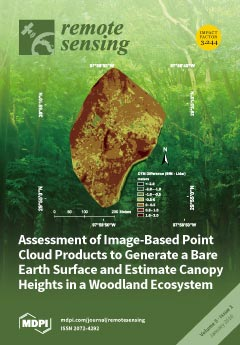
Cover Story (view full-size image): We used a very low-cost unmanned aerial system to collect images over an oak-juniper woodland ecosystem in the Texas Hill Country, USA. Images were processed in AgiSoft Photoscan to produce a dense, fully georeferenced 3D point cloud for the 15-ha site. Our study had two objectives: 1) compare digital terrain product accuracies between the SfM product and spatially coincident lidar data, and 2) use the SfM non-ground points to estimate tree canopy height. Our results demonstrate that image-based point cloud products obtained over our vegetated site can be used to provide a reasonably accurate terrain product and that non-ground SfM points serve as suitable predictors of tree canopy height when coupled with an accurate terrain model. In summary, although lidar data are increasingly available, SfM can serve as a suitable proxy under specific canopy conditions. View this paper
  • Issues are regarded as officially published after their release is announced to the table of contents alert mailing list.
  • You may sign up for e-mail alerts to receive table of contents of newly released issues.
  • PDF is the official format for papers published in both, html and pdf forms. To view the papers in pdf format, click on the "PDF Full-text" link, and use the free Adobe Reader to open them.
Order results
Result details
Section
Select all
Export citation of selected articles as:
749 KiB  
Editorial
Acknowledgement to Reviewers of Remote Sensing in 2015
by Remote Sensing Editorial Office
Remote Sens. 2016, 8(1), 81; https://doi.org/10.3390/rs8010081 - 21 Jan 2016
Viewed by 9678
Abstract
The editors of Remote Sensing would like to express their sincere gratitude to the following reviewers for assessing manuscripts in 2015. [...] Full article
7259 KiB  
Article
Multispectral Radiometric Analysis of Façades to Detect Pathologies from Active and Passive Remote Sensing
by Susana Del Pozo, Jesús Herrero-Pascual, Beatriz Felipe-García, David Hernández-López, Pablo Rodríguez-Gonzálvez and Diego González-Aguilera
Remote Sens. 2016, 8(1), 80; https://doi.org/10.3390/rs8010080 - 21 Jan 2016
Cited by 46 | Viewed by 8377
Abstract
This paper presents a radiometric study to recognize pathologies in façades of historical buildings by using two different remote sensing technologies covering part of the visible and very near infrared spectrum (530–905 nm). Building materials deteriorate over the years due to different extrinsic [...] Read more.
This paper presents a radiometric study to recognize pathologies in façades of historical buildings by using two different remote sensing technologies covering part of the visible and very near infrared spectrum (530–905 nm). Building materials deteriorate over the years due to different extrinsic and intrinsic agents, so assessing these affections in a non-invasive way is crucial to help preserve them since in many cases they are valuable and some have been declared monuments of cultural interest. For the investigation, passive and active remote acquisition systems were applied operating at different wavelengths. A 6-band Mini-MCA multispectral camera (530–801 nm) and a FARO Focus3D terrestrial laser scanner (905 nm) were used with the dual purpose of detecting different materials and damages on building façades as well as determining which acquisition system and spectral range is more suitable for this kind of studies. The laser scan points were used as base to create orthoimages, the input of the two different classification processes performed. The set of all orthoimages from both sensors was classified under supervision. Furthermore, orthoimages from each individual sensor were automatically classified to compare results from each sensor with the reference supervised classification. Higher overall accuracy with the FARO Focus3D, 74.39%, was obtained with respect to the Mini MCA6, 66.04%. Finally, after applying the radiometric calibration, a minimum improvement of 24% in the image classification results was obtained in terms of overall accuracy. Full article
Show Figures

Graphical abstract

5082 KiB  
Article
Improved VIIRS and MODIS SST Imagery
by Irina Gladkova, Alexander Ignatov, Fazlul Shahriar, Yury Kihai, Don Hillger and Boris Petrenko
Remote Sens. 2016, 8(1), 79; https://doi.org/10.3390/rs8010079 - 21 Jan 2016
Cited by 27 | Viewed by 10861
Abstract
Moderate Resolution Imaging Spectroradiometers (MODIS) and Visible Infrared Imaging Radiometer Suite (VIIRS) radiometers, flown onboard Terra/Aqua and Suomi National Polar-orbiting Partnership (S-NPP)/Joint Polar Satellite System (JPSS) satellites, are capable of providing superior sea surface temperature (SST) imagery. However, the swath data of these [...] Read more.
Moderate Resolution Imaging Spectroradiometers (MODIS) and Visible Infrared Imaging Radiometer Suite (VIIRS) radiometers, flown onboard Terra/Aqua and Suomi National Polar-orbiting Partnership (S-NPP)/Joint Polar Satellite System (JPSS) satellites, are capable of providing superior sea surface temperature (SST) imagery. However, the swath data of these multi-detector sensors are subject to several artifacts including bow-tie distortions and striping, and require special pre-processing steps. VIIRS additionally does two irreversible data reduction steps onboard: pixel aggregation (to reduce resolution changes across the swath) and pixel deletion, which complicate both bow-tie correction and destriping. While destriping was addressed elsewhere, this paper describes an algorithm, adopted in the National Oceanic and Atmospheric Administration (NOAA) Advanced Clear-Sky Processor for Oceans (ACSPO) SST system, to minimize the bow-tie artifacts in the SST imagery and facilitate application of the pattern recognition algorithms for improved separation of ocean from cloud and mapping fine SST structure, especially in the dynamic, coastal and high-latitude regions of the ocean. The algorithm is based on a computationally fast re-sampling procedure that ensures a continuity of corresponding latitude and longitude arrays. Potentially, Level 1.5 products may be generated to benefit a wide range of MODIS and VIIRS users in land, ocean, cryosphere, and atmosphere remote sensing. Full article
(This article belongs to the Collection Visible Infrared Imaging Radiometers and Applications)
Show Figures

Graphical abstract

3326 KiB  
Article
Multispectral and Texture Feature Application in Image-Object Analysis of Summer Vegetation in Eastern Tajikistan Pamirs
by Eric Ariel L. Salas, Kenneth G. Boykin and Raul Valdez
Remote Sens. 2016, 8(1), 78; https://doi.org/10.3390/rs8010078 - 21 Jan 2016
Cited by 42 | Viewed by 8758
Abstract
We tested the Moment Distance Index (MDI) in combination with texture features for the summer vegetation mapping in the eastern Pamir Mountains, Tajikistan using the 2014 Landsat OLI (Operational Land Imager) image. The five major classes identified were sparse vegetation, medium-dense vegetation, dense [...] Read more.
We tested the Moment Distance Index (MDI) in combination with texture features for the summer vegetation mapping in the eastern Pamir Mountains, Tajikistan using the 2014 Landsat OLI (Operational Land Imager) image. The five major classes identified were sparse vegetation, medium-dense vegetation, dense vegetation, barren land, and water bodies. By utilizing object features in a random forest (RF) classifier, the overall classification accuracy of the land cover maps were 92% using a set of variables including texture features and MDI, and 84% using a set of variables including texture but without MDI. A decrease of the Kappa statistics, from 0.89 to 0.79, was observed when MDI was removed from the set of predictor variables. McNemar’s test showed that the increase in the classification accuracy due to the addition of MDI was statistically significant (p < 0.05). The proposed method provides an effective way of discriminating sparse vegetation from barren land in an arid environment, such as the Pamir Mountains. Full article
Show Figures

Graphical abstract

2440 KiB  
Letter
An Investigation of a Novel Cross-Calibration Method of FY-3C/VIRR against NPP/VIIRS in the Dunhuang Test Site
by Caixia Gao, Yongguang Zhao, Chuanrong Li, Lingling Ma, Ning Wang, Yonggang Qian and Lu Ren
Remote Sens. 2016, 8(1), 77; https://doi.org/10.3390/rs8010077 - 21 Jan 2016
Cited by 12 | Viewed by 5874
Abstract
Radiometric cross-calibration of Earth observation sensors is an effective approach to evaluate instrument calibration performance, identify and diagnose calibration anomalies, and quantify the consistency of measurements from different sensors. In this study a novel cross-calibration method is proposed, taking into account the spectral [...] Read more.
Radiometric cross-calibration of Earth observation sensors is an effective approach to evaluate instrument calibration performance, identify and diagnose calibration anomalies, and quantify the consistency of measurements from different sensors. In this study a novel cross-calibration method is proposed, taking into account the spectral and viewing angle differences adequately; the method is applied to the FY-3C/Visible Infrared Radiometer (VIRR), taking the Suomi National Polar-Orbiting Partnership (NPP)/Visible Infrared Imaging Radiometer Suite (VIIRS) as a reference. The results show that the relative difference between the two sets increases from January to May 2014, and becomes lower for the data on 24 July, 11 September, and 16 September, within approximately 10%. This phenomenon is caused by the updating of the calibration coefficients in the VIRR datasets with results from a vicarious method on June 2014. After performing an approximate estimation of the uncertainty, it is demonstrated that this calibration has a total uncertainty of 5.5%–6.0%, which is mainly from the uncertainty of the Bidirectional Reflectance Distribution Function model. Full article
(This article belongs to the Collection Visible Infrared Imaging Radiometers and Applications)
Show Figures

Graphical abstract

3414 KiB  
Article
Fast and Accurate Collocation of the Visible Infrared Imaging Radiometer Suite Measurements with Cross-Track Infrared Sounder
by Likun Wang, Denis Tremblay, Bin Zhang and Yong Han
Remote Sens. 2016, 8(1), 76; https://doi.org/10.3390/rs8010076 - 21 Jan 2016
Cited by 46 | Viewed by 9620
Abstract
Given the fact that Cross-track Infrared Sounder (CrIS) and the Visible Infrared Imaging Radiometer Suite (VIIRS) are currently onboard the Suomi National Polar-orbiting Partnership (Suomi NPP) satellite and will continue to be carried on the same platform as future Joint Polar Satellite System [...] Read more.
Given the fact that Cross-track Infrared Sounder (CrIS) and the Visible Infrared Imaging Radiometer Suite (VIIRS) are currently onboard the Suomi National Polar-orbiting Partnership (Suomi NPP) satellite and will continue to be carried on the same platform as future Joint Polar Satellite System (JPSS) satellites for the next decade, it is desirable to develop a fast and accurate collocation scheme to collocate VIIRS products and measurements with CrIS for applications that rely on combining measurements from two sensors such as inter-calibration, geolocation assessment, and cloud detection. In this study, an accurate and fast collocation method to collocate VIIRS measurements within CrIS instantaneous field of view (IFOV) directly based on line-of-sight (LOS) pointing vectors is developed and discussed in detail. We demonstrate that this method is not only accurate and precise from a mathematical perspective, but also easy to implement computationally. More importantly, with optimization, this method is very fast and efficient and thus can meet operational requirements. Finally, this collocation method can be extended to a wide variety of sensors on different satellite platforms. Full article
(This article belongs to the Collection Visible Infrared Imaging Radiometers and Applications)
Show Figures

Graphical abstract

11521 KiB  
Article
Evaluation of ASTER-Like Daily Land Surface Temperature by Fusing ASTER and MODIS Data during the HiWATER-MUSOEXE
by Guijun Yang, Qihao Weng, Ruiliang Pu, Feng Gao, Chenhong Sun, Hua Li and Chunjiang Zhao
Remote Sens. 2016, 8(1), 75; https://doi.org/10.3390/rs8010075 - 21 Jan 2016
Cited by 41 | Viewed by 8309
Abstract
Land surface temperature (LST) is an important parameter that is highly responsive to surface energy fluxes and has become valuable to many disciplines. However, it is difficult to acquire satellite LSTs with both high spatial and temporal resolutions due to tradeoffs between them. [...] Read more.
Land surface temperature (LST) is an important parameter that is highly responsive to surface energy fluxes and has become valuable to many disciplines. However, it is difficult to acquire satellite LSTs with both high spatial and temporal resolutions due to tradeoffs between them. Thus, various algorithms/models have been developed to enhance the spatial or the temporal resolution of thermal infrared (TIR) data or LST, but rarely both. The Spatial and Temporal Adaptive Reflectance Fusion Model (STARFM) is the widely-used data fusion algorithm for Landsat and MODIS imagery to produce Landsat-like surface reflectance. In order to extend the STARFM application over heterogeneous areas, an enhanced STARFM (ESTARFM) approach was proposed by introducing a conversion coefficient and the spectral unmixing theory. The aim of this study is to conduct a comprehensive evaluation of the ESTARFM algorithm for generating ASTER-like daily LST by three approaches: simulated data, ground measurements and remote sensing products, respectively. The datasets of LST ground measurements, MODIS, and ASTER images were collected in an arid region of Northwest China during the first thematic HiWATER-Multi-Scale Observation Experiment on Evapotranspiration (MUSOEXE) over heterogeneous land surfaces in 2012 from May to September. Firstly, the results of the simulation test indicated that ESTARFM could accurately predict background with temperature variations, even coordinating with small ground objects and linear ground objects. Secondly, four temporal ASTER and MODIS data fusion LSTs (i.e., predicted ASTER-like LST products) were highly consistent with ASTER LST products. Here, the four correlation coefficients were greater than 0.92, root mean square error (RMSE) reached about 2 K and mean absolute error (MAE) ranged from 1.32 K to 1.73 K. Finally, the results of the ground measurement validation indicated that the overall accuracy was high (R2 = 0.92, RMSE = 0.77 K), and the ESTARFM algorithm is a highly recommended method to assemble time series images at ASTER spatial resolution and MODIS temporal resolution due to LST estimation error less than 1 K. However, the ESTARFM method is also limited in predicting LST changes that have not been recorded in MODIS and/or ASTER pixels. Full article
Show Figures

Graphical abstract

5407 KiB  
Article
On the Use of Cross-Correlation between Volume Scattering and Helix Scattering from Polarimetric SAR Data for the Improvement of Ship Detection
by Jujie Wei, Jixian Zhang, Guoman Huang and Zheng Zhao
Remote Sens. 2016, 8(1), 74; https://doi.org/10.3390/rs8010074 - 20 Jan 2016
Cited by 20 | Viewed by 6037
Abstract
Synthetic Aperture Radar (SAR) ship detection is an important maritime application. However, azimuth ambiguities caused by the finite sampling of the Doppler spectrum are often visible in SAR images and are always mistaken as ships by classic detection techniques, like the Constant False [...] Read more.
Synthetic Aperture Radar (SAR) ship detection is an important maritime application. However, azimuth ambiguities caused by the finite sampling of the Doppler spectrum are often visible in SAR images and are always mistaken as ships by classic detection techniques, like the Constant False Alarm Rate (CFAR). It is known that radar targets and azimuth ambiguities have different characteristics in polarimetric SAR (PolSAR) data, i.e., first ambiguities usually have strong odd- or double-bounce scattering and the maximum amplitude of the first ambiguity in SHV is always considerably smaller than that of the corresponding target for zero or high velocity. On the basis of this characteristics, this paper finds that first ambiguities usually have low volume scattering power relative to ships and almost have no helix scattering by Yamaguchi decomposition. But some residual ambiguities still exit in the volume scattering power and have similar scattering intensity to small ships, and some parts of a ship also have zero helix scattering owing to some physical factors (e.g., ship structure, radar incidence angle, etc.). Thus, for high-precision ship detection, a new ship detection method based on cross-correlation between the volume and helix scattering mechanisms derived from Yamaguchi decomposition is proposed to avoid false alarms caused by azimuth ambiguities and enhance Target-to-Clutter Ratio (TCR) for improving the miss detection rate of small ships. By experiments, it is proved that our method can work effectively and has high detection accuracy. Full article
Show Figures

Graphical abstract

6789 KiB  
Article
Post-Eruption Deformation Processes Measured Using ALOS-1 and UAVSAR InSAR at Pacaya Volcano, Guatemala
by Lauren N. Schaefer, Zhong Lu and Thomas Oommen
Remote Sens. 2016, 8(1), 73; https://doi.org/10.3390/rs8010073 - 19 Jan 2016
Cited by 36 | Viewed by 8206
Abstract
Pacaya volcano is a persistently active basaltic cone complex located in the Central American Volcanic Arc in Guatemala. In May of 2010, violent Volcanic Explosivity Index-3 (VEI-3) eruptions caused significant topographic changes to the edifice, including a linear collapse feature 600 m long [...] Read more.
Pacaya volcano is a persistently active basaltic cone complex located in the Central American Volcanic Arc in Guatemala. In May of 2010, violent Volcanic Explosivity Index-3 (VEI-3) eruptions caused significant topographic changes to the edifice, including a linear collapse feature 600 m long originating from the summit, the dispersion of ~20 cm of tephra and ash on the cone, the emplacement of a 5.4 km long lava flow, and ~3 m of co-eruptive movement of the southwest flank. For this study, Interferometric Synthetic Aperture Radar (InSAR) images (interferograms) processed from both spaceborne Advanced Land Observing Satellite-1 (ALOS-1) and aerial Uninhabited Aerial Vehicle Synthetic Aperture Radar (UAVSAR) data acquired between 31 May 2010 and 10 April 2014 were used to measure post-eruptive deformation events. Interferograms suggest three distinct deformation processes after the May 2010 eruptions, including: (1) subsidence of the area involved in the co-eruptive slope movement; (2) localized deformation near the summit; and (3) emplacement and subsequent subsidence of about a 5.4 km lava flow. The detection of several different geophysical signals emphasizes the utility of measuring volcanic deformation using remote sensing techniques with broad spatial coverage. Additionally, the high spatial resolution of UAVSAR has proven to be an excellent compliment to satellite data, particularly for constraining motion components. Measuring the rapid initiation and cessation of flank instability, followed by stabilization and subsequent influence on eruptive features, provides a rare glimpse into volcanic slope stability processes. Observing these and other deformation events contributes both to hazard assessment at Pacaya and to the study of the stability of stratovolcanoes. Full article
(This article belongs to the Special Issue Volcano Remote Sensing)
Show Figures

Graphical abstract

2010 KiB  
Article
Inter-Comparison of S-NPP VIIRS and Aqua MODIS Thermal Emissive Bands Using Hyperspectral Infrared Sounder Measurements as a Transfer Reference
by Yonghong Li, Aisheng Wu and Xiaoxiong Xiong
Remote Sens. 2016, 8(1), 72; https://doi.org/10.3390/rs8010072 - 19 Jan 2016
Cited by 16 | Viewed by 6466
Abstract
This paper compares the calibration consistency of the spectrally-matched thermal emissive bands (TEB) between the Suomi National Polar-orbiting Partnership (S-NPP) Visible Infrared Imaging Radiometer Suite (VIIRS) and the Aqua Moderate Resolution Imaging Spectroradiometer (MODIS), using observations from their simultaneous nadir overpasses (SNO). Nearly-simultaneous [...] Read more.
This paper compares the calibration consistency of the spectrally-matched thermal emissive bands (TEB) between the Suomi National Polar-orbiting Partnership (S-NPP) Visible Infrared Imaging Radiometer Suite (VIIRS) and the Aqua Moderate Resolution Imaging Spectroradiometer (MODIS), using observations from their simultaneous nadir overpasses (SNO). Nearly-simultaneous hyperspectral measurements from the Aqua Atmospheric Infrared Sounder(AIRS) and the S-NPP Cross-track Infrared Sounder (CrIS) are used to account for existing spectral response differences between MODIS and VIIRS TEB. The comparison uses VIIRS Sensor Data Records (SDR) in MODIS five-minute granule format provided by the NASA Land Product and Evaluation and Test Element (PEATE) and Aqua MODIS Collection 6 Level 1 B (L1B) products. Each AIRS footprint of 13.5 km (or CrIS field of view of 14 km) is co-located with multiple MODIS (or VIIRS) pixels. The corresponding AIRS- and CrIS-simulated MODIS and VIIRS radiances are derived by convolutions based on sensor-dependent relative spectral response (RSR) functions. The VIIRS and MODIS TEB calibration consistency is evaluated and the two sensors agreed within 0.2 K in brightness temperature. Additional factors affecting the comparison such as geolocation and atmospheric water vapor content are also discussed in this paper. Full article
(This article belongs to the Collection Visible Infrared Imaging Radiometers and Applications)
Show Figures

Graphical abstract

16780 KiB  
Article
A Point Cloud Filtering Approach to Generating DTMs for Steep Mountainous Areas and Adjacent Residential Areas
by Qi Chen, Huan Wang, Hanchao Zhang, Mingwei Sun and Xiuguo Liu
Remote Sens. 2016, 8(1), 71; https://doi.org/10.3390/rs8010071 - 19 Jan 2016
Cited by 48 | Viewed by 8224
Abstract
Digital terrain models (DTMs) are considered important basic geographic data. They are widely used in the fields of cartography, land utilization, urban planning, communications, and remote sensing. Digital photogrammetry mainly based on stereo image matching is a frequently applied technique to generate DTMs. [...] Read more.
Digital terrain models (DTMs) are considered important basic geographic data. They are widely used in the fields of cartography, land utilization, urban planning, communications, and remote sensing. Digital photogrammetry mainly based on stereo image matching is a frequently applied technique to generate DTMs. Generally, the process of ground filtering should be applied to the point cloud derived from image matching to separate terrain and off-terrain points before DTM generation. However, many of the existing filtering methods perform unsatisfactorily for steep mountainous areas, particularly when residential neighborhoods exist in the proximity of the test areas. In this study, an improved automated filtering method based on progressive TIN (triangulated irregular networks) densification (PTD) is proposed to generate DTMs for steep mountainous areas and adjacent residential areas. Our main improvement on the classic method is the acquisition of seed points with better distribution and reliability to enhance its adaptability to different types of terrain. A rule-based method for detecting ridge points is first applied. The detected points are used as additional seed points. Subsequently, a locally optimized seed point selection method based on confidence interval estimation theory is applied to remove the erroneous points. The experiments on two sets of stereo-matched point clouds indicate that the proposed method performs well for both residential and mountainous areas. The total accuracy values in the form of root-mean-square errors of the generated DTMs by the proposed method are 0.963 and 1.007 m; respectively; which are better than the 1.286 and 1.309 m achieved by the classic PTD method. Full article
Show Figures

Graphical abstract

29178 KiB  
Article
A Fast and Reliable Matching Method for Automated Georeferencing of Remotely-Sensed Imagery
by Tengfei Long, Weili Jiao, Guojin He and Zhaoming Zhang
Remote Sens. 2016, 8(1), 56; https://doi.org/10.3390/rs8010056 - 19 Jan 2016
Cited by 43 | Viewed by 8399
Abstract
Due to the limited accuracy of exterior orientation parameters, ground control points (GCPs) are commonly required to correct the geometric biases of remotely-sensed (RS) images. This paper focuses on an automatic matching technique for the specific task of georeferencing RS images and presents [...] Read more.
Due to the limited accuracy of exterior orientation parameters, ground control points (GCPs) are commonly required to correct the geometric biases of remotely-sensed (RS) images. This paper focuses on an automatic matching technique for the specific task of georeferencing RS images and presents a technical frame to match large RS images efficiently using the prior geometric information of the images. In addition, a novel matching approach using online aerial images, e.g., Google satellite images, Bing aerial maps, etc., is introduced based on the technical frame. Experimental results show that the proposed method can collect a sufficient number of well-distributed and reliable GCPs in tens of seconds for different kinds of large-sized RS images, whose spatial resolutions vary from 30 m to 2 m. It provides a convenient and efficient way to automatically georeference RS images, as there is no need to manually prepare reference images according to the location and spatial resolution of sensed images. Full article
Show Figures

Graphical abstract

2647 KiB  
Review
A Review of the Application of Optical and Radar Remote Sensing Data Fusion to Land Use Mapping and Monitoring
by Neha Joshi, Matthias Baumann, Andrea Ehammer, Rasmus Fensholt, Kenneth Grogan, Patrick Hostert, Martin Rudbeck Jepsen, Tobias Kuemmerle, Patrick Meyfroidt, Edward T. A. Mitchard, Johannes Reiche, Casey M. Ryan and Björn Waske
Remote Sens. 2016, 8(1), 70; https://doi.org/10.3390/rs8010070 - 16 Jan 2016
Cited by 526 | Viewed by 43508
Abstract
The wealth of complementary data available from remote sensing missions can hugely aid efforts towards accurately determining land use and quantifying subtle changes in land use management or intensity. This study reviewed 112 studies on fusing optical and radar data, which offer unique [...] Read more.
The wealth of complementary data available from remote sensing missions can hugely aid efforts towards accurately determining land use and quantifying subtle changes in land use management or intensity. This study reviewed 112 studies on fusing optical and radar data, which offer unique spectral and structural information, for land cover and use assessments. Contrary to our expectations, only 50 studies specifically addressed land use, and five assessed land use changes, while the majority addressed land cover. The advantages of fusion for land use analysis were assessed in 32 studies, and a large majority (28 studies) concluded that fusion improved results compared to using single data sources. Study sites were small, frequently 300–3000 km 2 or individual plots, with a lack of comparison of results and accuracies across sites. Although a variety of fusion techniques were used, pre-classification fusion followed by pixel-level inputs in traditional classification algorithms (e.g., Gaussian maximum likelihood classification) was common, but often without a concrete rationale on the applicability of the method to the land use theme being studied. Progress in this field of research requires the development of robust techniques of fusion to map the intricacies of land uses and changes therein and systematic procedures to assess the benefits of fusion over larger spatial scales. Full article
(This article belongs to the Special Issue Validation and Inter-Comparison of Land Cover and Land Use Data)
Show Figures

Graphical abstract

3454 KiB  
Article
Global Gap-Free MERIS LAI Time Series (2002–2012)
by Markus Tum, Kurt P. Günther, Martin Böttcher, Frédéric Baret, Michael Bittner, Carsten Brockmann and Marie Weiss
Remote Sens. 2016, 8(1), 69; https://doi.org/10.3390/rs8010069 - 15 Jan 2016
Cited by 35 | Viewed by 8532
Abstract
This article describes the principles used to generate global gap-free Leaf Area Index (LAI) time series from 2002–2012, based on MERIS (MEdium Resolution Imaging Spectrometer) full-resolution Level1B data. It is produced as a series of 10-day composites in geographic projection at 300-m spatial [...] Read more.
This article describes the principles used to generate global gap-free Leaf Area Index (LAI) time series from 2002–2012, based on MERIS (MEdium Resolution Imaging Spectrometer) full-resolution Level1B data. It is produced as a series of 10-day composites in geographic projection at 300-m spatial resolution. The processing chain comprises geometric correction, radiometric correction, pixel identification, LAI calculation with the BEAM (Basic ERS & Envisat (A)ATSR and MERIS Toolbox) MERIS vegetation processor, re-projection to a global grid and temporal aggregation selecting the measurement closest to the mean value. After the LAI pre-processing, we applied time series analysis to fill data gaps and to filter outliers using the technique of harmonic analysis (HA) in combination with mean annual and multiannual phenological data. Data gaps are caused by clouds, sensor limitations due to the solar zenith angle (<10°), topography and intermittent data reception. We applied our technique for the whole period of observation (July 2002–March 2012). Validation, carried out with VALERI (Validation of Land European Remote Sensing Instruments) and BigFoot data, revealed a high degree (R2 : 0.88) of agreement on a global scale. Full article
Show Figures

Graphical abstract

3706 KiB  
Article
Quantitative Estimation of Carbonate Rock Fraction in Karst Regions Using Field Spectra in 2.0–2.5 μm
by Xiangjian Xie, Shufang Tian, Peijun Du, Wenfeng Zhan, Alim Samat and Jike Chen
Remote Sens. 2016, 8(1), 68; https://doi.org/10.3390/rs8010068 - 15 Jan 2016
Cited by 4 | Viewed by 6869
Abstract
Considering the important roles of carbonate rock fraction in karst rocky desertification areas and their potential for indicating damage to vegetation, improved knowledge is desired to assess the application of spectroscopy and remote sensing to characterizing and quantifying the biophysical constituents of karst [...] Read more.
Considering the important roles of carbonate rock fraction in karst rocky desertification areas and their potential for indicating damage to vegetation, improved knowledge is desired to assess the application of spectroscopy and remote sensing to characterizing and quantifying the biophysical constituents of karst landscapes. In this study, we examined the spectra of major surface constituents in karst areas for direct evidence of absorption features attributable to carbonate rock fraction. Using spectral feature analysis with continuum removal, we observed that there are overlapping spectral absorption in 2.149–2.398 μm by soils and non-photosynthetic vegetation. These overlapping features complicated the carbonate absorption feature near 2.340 μm in synthetic mixed spectra. To remove the overprint signal, two hyperspectral carbonate rock indices (HCRIs) were developed. Compared to the absorption features including depths, areas, and KRDSIs (karst rocky desertification synthesis indices), linear regression of HCRIs with carbonate rock fraction in linear synthetic mixtures resulted in higher correlations and lower errors. This study demonstrates that spectral variation of the surface constituents spectra in 2.270–2.398 μm region can indicate carbonate rock fraction and be used to quantify them. Still, additional research is needed to advance our understanding of the spectral influences from carbonate petrography relative to carbonate mineralogy, components and physical state of rock surface. Full article
(This article belongs to the Special Issue Field Spectroscopy and Radiometry)
Show Figures

Graphical abstract

21861 KiB  
Article
Decadal Scale Changes in Glacier Area in the Hohe Tauern National Park (Austria) Determined by Object-Based Image Analysis
by Benjamin Aubrey Robson, Daniel Hölbling, Christopher Nuth, Tazio Strozzi and Svein Olaf Dahl
Remote Sens. 2016, 8(1), 67; https://doi.org/10.3390/rs8010067 - 15 Jan 2016
Cited by 26 | Viewed by 10520
Abstract
In this paper, we semi-automatically classify clean and debris-covered ice for 145 glaciers within Hohe Tauern National Park in the Austrian Alps for the years 1985, 2003, and 2013. We also map the end-summer transient snowline (TSL), which approximates the annual Equilibrium Line [...] Read more.
In this paper, we semi-automatically classify clean and debris-covered ice for 145 glaciers within Hohe Tauern National Park in the Austrian Alps for the years 1985, 2003, and 2013. We also map the end-summer transient snowline (TSL), which approximates the annual Equilibrium Line Altitude (ELA). By comparing our results with the Austrian Glacier Inventories from 1969 and 1998, we calculate a mean reduction in glacier area of 33% between 1969 and 2013. The total ice area reduced at a mean rate of 1.4 km2 per year. This TSL rose by 92 m between 1985 and 2013 to an altitude of 3005 m. Despite some limitations, such as some seasonal snow being present at higher elevations, as well as uncertainties related to the range of years that the LiDAR DEM was collected, our results show that the glaciers within Hohe Tauern National Park conform to the heavy shrinkage experienced in other areas of the European Alps. Moreover, we believe that Object-Based Image Analysis (OBIA) is a promising methodology for future glacier mapping. Full article
Show Figures

Graphical abstract

3671 KiB  
Article
Rainfall Intra-Seasonal Variability and Vegetation Growth in the Ferlo Basin (Senegal)
by Soukèye Cissé, Laurence Eymard, Catherine Ottlé, Jacques André Ndione, Amadou Thierno Gaye and Françoise Pinsard
Remote Sens. 2016, 8(1), 66; https://doi.org/10.3390/rs8010066 - 15 Jan 2016
Cited by 14 | Viewed by 6743
Abstract
During the monsoon season, the spatiotemporal variability of rainfall impacts the growth of vegetation in the Sahel. This study evaluates this effect for the Ferlo basin in central northern Senegal. Relationships between rainfall, soil moisture (SM), and vegetation are assessed using remote sensing [...] Read more.
During the monsoon season, the spatiotemporal variability of rainfall impacts the growth of vegetation in the Sahel. This study evaluates this effect for the Ferlo basin in central northern Senegal. Relationships between rainfall, soil moisture (SM), and vegetation are assessed using remote sensing data (TRMM3B42 and RFE 2.0 for rainfall, ESA-CCI.SM for soil moisture and MODIS Leaf Area Index (LAI)). The principal objective was to analyze the response of vegetation growth to water availability during the rainy season using statistical criteria at the scale of homogeneous vegetation-soil zones. The study covers the period from June to September for the years 2000 to 2010. The surface SM is well correlated with both rainfall products. On ferruginous soils, better correlation of intra-seasonal variations and stronger sensitivity of the vegetation to rainfall are found compared to lithosols soils. LAI responds, on average, two to three weeks after a rainfall anomaly. Moreover, dry spells (negative anomalies) of seven days’ length (three days for SM anomaly) significantly affect vegetation growth (maximum LAI within the season). A strong and significant link is also found between total precipitation and the number of dry spells. These datasets proved to be sufficiently reliable to assess the impacts of rainfall variability on vegetation dynamics. Full article
Show Figures

Graphical abstract

6593 KiB  
Article
Using Remotely-Sensed Land Cover and Distribution Modeling to Estimate Tree Species Migration in the Pacific Northwest Region of North America
by Nicholas C. Coops, Richard H. Waring, Andrew Plowright, Joanna Lee and Thomas E. Dilts
Remote Sens. 2016, 8(1), 65; https://doi.org/10.3390/rs8010065 - 15 Jan 2016
Cited by 19 | Viewed by 7769
Abstract
Understanding future tree species migration is challenging due to the unprecedented rate of climate change combined with the presence of human barriers that may limit or impede species movement. Projected changes in climatic conditions outpace migration rates, and more realistic rates of range [...] Read more.
Understanding future tree species migration is challenging due to the unprecedented rate of climate change combined with the presence of human barriers that may limit or impede species movement. Projected changes in climatic conditions outpace migration rates, and more realistic rates of range expansion are needed to make sound environmental policies. In this paper, we develop a modeling approach that takes into account both the geographic changes in the area suitable for the growth and reproduction of tree species, as well as limits imposed geographically on their potential migration using remotely-sensed land cover information. To do so, we combined a physiologically-based decision tree model with a remotely-sensed-derived diffusion-dispersal model to identify the most likely direction of future migration for 15 native tree species in the Pacific Northwest Region of North America, as well as the degree that landscape fragmentation might limit movement. Although projected changes in climate through to 2080 are likely to create favorable environments for range expansion of the 15 tree species by 65% on average, by limiting the potential movement by previously published migration rates and landscape fragmentation, range expansion will likely be 50%–90% of the potential. The hybrid modeling approach using distribution modeling and remotely-sensed data fills a gap between naïve and more complex approaches to take into account major impediments on the potential migration of native tree species. Full article
(This article belongs to the Special Issue Remote Sensing of Biodiversity)
Show Figures

Graphical abstract

4115 KiB  
Article
Snow Depth Variations Estimated from GPS-Reflectometry: A Case Study in Alaska from L2P SNR Data
by Shuanggen Jin, Xiaodong Qian and Hakan Kutoglu
Remote Sens. 2016, 8(1), 63; https://doi.org/10.3390/rs8010063 - 15 Jan 2016
Cited by 78 | Viewed by 7767
Abstract
Snow is a water resource and plays a significant role in the water cycle. However, traditional ground techniques for snow monitoring have many limitations, e.g., high-cost and low resolution. Recently, the new Global Positioning System-Reflectometry (GPS-R) technique has been developed and applied for [...] Read more.
Snow is a water resource and plays a significant role in the water cycle. However, traditional ground techniques for snow monitoring have many limitations, e.g., high-cost and low resolution. Recently, the new Global Positioning System-Reflectometry (GPS-R) technique has been developed and applied for snow sensing. However, most previous studies mainly used GPS L1C/A and L2C Signal-to-Noise Ratio (SNR) data to retrieve snow depth. In this paper, snow depth variations are retrieved from new weak GPS L2P SNR data at three stations in Alaska and evaluated by comparing with in situ measurements. The correlation coefficients for the three stations are 0.79, 0.88 and 0.98, respectively. The GPS-estimated snow depths from the L2P SNR data are further compared with L1C/A results at three stations, showing a high correlation of 0.94, 0.93 and 0.95, respectively. These results indicate that geodetic GPS observations with SNR L2P data can well estimate snow depths. The samplings of 15 s or 30 s have no obvious effect on snow depth estimation using GPS SNR L2P measurements, while the range of 5°–35°elevation angles has effects on results with a decreasing correlation of 0.96 and RMSE of 0.04 m when compared to the range of 5°–30° with correlation of 0.98 and RMSE of 0.03 m. GPS SNR data below 30° elevation angle are better to estimate snow depth. Full article
Show Figures

Graphical abstract

1185 KiB  
Correction
Correction: Pimont, F. et al. Estimating Leaf Bulk Density Distribution in a Tree Canopy Using Terrestrial LiDAR and a Straightforward Calibration Procedure. Remote Sens. 2015, 7(6), 7995-8018
by François Pimont, Jean-Luc Dupuy, Eric Rigolot, Vincent Prat and Alexandre Piboule
Remote Sens. 2016, 8(1), 64; https://doi.org/10.3390/rs8010064 - 14 Jan 2016
Viewed by 4284
Abstract
After publication of the research paper [1] an error during the data analysis process was recognized. [...] Full article
Show Figures

Figure 1

4045 KiB  
Article
Quantifying Multi-Decadal Change of Planted Forest Cover Using Airborne LiDAR and Landsat Imagery
by Xiaoyi Wang, Huabing Huang, Peng Gong, Gregory S. Biging, Qinchuan Xin, Yanlei Chen, Jun Yang and Caixia Liu
Remote Sens. 2016, 8(1), 62; https://doi.org/10.3390/rs8010062 - 14 Jan 2016
Cited by 20 | Viewed by 7080
Abstract
Continuous monitoring of forest cover condition is key to understanding the carbon dynamics of forest ecosystems. This paper addresses how to integrate single-year airborne LiDAR and time-series Landsat imagery to derive forest cover change information. LiDAR data were used to extract forest cover [...] Read more.
Continuous monitoring of forest cover condition is key to understanding the carbon dynamics of forest ecosystems. This paper addresses how to integrate single-year airborne LiDAR and time-series Landsat imagery to derive forest cover change information. LiDAR data were used to extract forest cover at the sub-pixel level of Landsat for a single year, and the Landtrendr algorithm was applied to Landsat spectral data to explore the temporal information of forest cover change. Four different approaches were employed to model the relationship between forest cover and Landsat spectral data. The result shows incorporating the historic information using the temporal trajectory fitting process could infuse the model with better prediction power. Random forest modeling performs the best for quantitative forest cover estimation. Temporal trajectory fitting with random forest model shows the best agreement with validation data (R2 = 0.82 and RMSE = 5.19%). We applied our approach to Youyu county in Shanxi province of China, as part of the Three North Shelter Forest Program, to map multi-decadal forest cover dynamics. With the availability of global time-series Landsat imagery and affordable airborne LiDAR data, the approach we developed has the potential to derive large-scale forest cover dynamics. Full article
(This article belongs to the Special Issue Remote Sensing of Vegetation Structure and Dynamics)
Show Figures

Graphical abstract

5924 KiB  
Article
Photogrammetric, Geometrical, and Numerical Strategies to Evaluate Initial and Current Conditions in Historical Constructions: A Test Case in the Church of San Lorenzo (Zamora, Spain)
by Luis Javier Sánchez-Aparicio, Alberto Villarino, Jesús García-Gago and Diego González-Aguilera
Remote Sens. 2016, 8(1), 60; https://doi.org/10.3390/rs8010060 - 13 Jan 2016
Cited by 22 | Viewed by 6977
Abstract
Identifying and quantifying the potential causes of damages to a construction and evaluating its current stability have become an imperative task in today’s world. However, the existence of variables, unknown conditions and a complex geometry hinder such work, by hampering the numerical results [...] Read more.
Identifying and quantifying the potential causes of damages to a construction and evaluating its current stability have become an imperative task in today’s world. However, the existence of variables, unknown conditions and a complex geometry hinder such work, by hampering the numerical results that simulate its behavior. Of the mentioned variables, the following can be highlighted: (i) the lack of historical information; (ii) the mechanical properties of the material; (iii) the initial geometry and (iv) the interaction with other structures. Within the field of remote sensors, the laser scanner and photogrammetric systems have become especially valuable for construction analysis. Such sensors are capable of providing highly accurate and dense geometrical data with which to assess a building’s condition. It is also remarkable, that the latter provide valuable radiometric data with which to identify the properties of the materials, and also evaluate and monitor crack patterns. Motivated by this, the present article investigates the potential offered by the combined use of photogrammetric techniques (DIC and SfM), as well as geometrical (NURBs and Hausdorff distance) and numerical strategies (FEM) to assess the origin of the damage (through an estimation of the initial conditions) and give an evaluation of the current stability (considering the deformation and the damage). Full article
Show Figures

Graphical abstract

2142 KiB  
Article
Validation of Reef-Scale Thermal Stress Satellite Products for Coral Bleaching Monitoring
by Scott F. Heron, Lyza Johnston, Gang Liu, Erick F. Geiger, Jeffrey A. Maynard, Jacqueline L. De La Cour, Steven Johnson, Ryan Okano, David Benavente, Timothy F. R. Burgess, John Iguel, Denise I. Perez, William J. Skirving, Alan E. Strong, Kyle Tirak and C. Mark Eakin
Remote Sens. 2016, 8(1), 59; https://doi.org/10.3390/rs8010059 - 12 Jan 2016
Cited by 72 | Viewed by 12161
Abstract
Satellite monitoring of thermal stress on coral reefs has become an essential component of reef management practice around the world. A recent development by the U.S. National Oceanic and Atmospheric Administration’s Coral Reef Watch (NOAA CRW) program provides daily global monitoring at 5 [...] Read more.
Satellite monitoring of thermal stress on coral reefs has become an essential component of reef management practice around the world. A recent development by the U.S. National Oceanic and Atmospheric Administration’s Coral Reef Watch (NOAA CRW) program provides daily global monitoring at 5 km resolution—at or near the scale of most coral reefs. In this paper, we introduce two new monitoring products in the CRW Decision Support System for coral reef management: Regional Virtual Stations, a regional synthesis of thermal stress conditions, and Seven-day Sea Surface Temperature (SST) Trend, describing recent changes in temperature at each location. We describe how these products provided information in support of management activities prior to, during and after the 2014 thermal stress event in the Commonwealth of the Northern Mariana Islands (CNMI). Using in situ survey data from this event, we undertake the first quantitative comparison between 5 km satellite monitoring products and coral bleaching observations. Analysis of coral community characteristics, historical temperature conditions and thermal stress revealed a strong influence of coral biodiversity in the patterns of observed bleaching. This resulted in a model based on thermal stress and generic richness that explained 97% of the variance in observed bleaching. These findings illustrate the importance of using local benthic characteristics to interpret the level of impact from thermal stress exposure. In an era of continuing climate change, accurate monitoring of thermal stress and prediction of coral bleaching are essential for stakeholders to direct resources to the most effective management actions to conserve coral reefs. Full article
(This article belongs to the Special Issue Remote Sensing for Coral Reef Monitoring)
Show Figures

Graphical abstract

9433 KiB  
Article
A Multi-Sensor Approach for Volcanic Ash Cloud Retrieval and Eruption Characterization: The 23 November 2013 Etna Lava Fountain
by Stefano Corradini, Mario Montopoli, Lorenzo Guerrieri, Matteo Ricci, Simona Scollo, Luca Merucci, Frank S. Marzano, Sergio Pugnaghi, Michele Prestifilippo, Lucy J. Ventress, Roy G. Grainger, Elisa Carboni, Gianfranco Vulpiani and Mauro Coltelli
Remote Sens. 2016, 8(1), 58; https://doi.org/10.3390/rs8010058 - 12 Jan 2016
Cited by 69 | Viewed by 8945
Abstract
Volcanic activity is observed worldwide with a variety of ground and space-based remote sensing instruments, each with advantages and drawbacks. No single system can give a comprehensive description of eruptive activity, and so, a multi-sensor approach is required. This work integrates infrared and [...] Read more.
Volcanic activity is observed worldwide with a variety of ground and space-based remote sensing instruments, each with advantages and drawbacks. No single system can give a comprehensive description of eruptive activity, and so, a multi-sensor approach is required. This work integrates infrared and microwave volcanic ash retrievals obtained from the geostationary Meteosat Second Generation (MSG)-Spinning Enhanced Visible and Infrared Imager (SEVIRI), the polar-orbiting Aqua-MODIS and ground-based weather radar. The expected outcomes are improvements in satellite volcanic ash cloud retrieval (altitude, mass, aerosol optical depth and effective radius), the generation of new satellite products (ash concentration and particle number density in the thermal infrared) and better characterization of volcanic eruptions (plume altitude, total ash mass erupted and particle number density from thermal infrared to microwave). This approach is the core of the multi-platform volcanic ash cloud estimation procedure being developed within the European FP7-APhoRISM project. The Mt. Etna (Sicily, Italy) volcano lava fountaining event of 23 November 2013 was considered as a test case. The results of the integration show the presence of two volcanic cloud layers at different altitudes. The improvement of the volcanic ash cloud altitude leads to a mean difference between the SEVIRI ash mass estimations, before and after the integration, of about the 30%. Moreover, the percentage of the airborne “fine” ash retrieved from the satellite is estimated to be about 1%–2% of the total ash emitted during the eruption. Finally, all of the estimated parameters (volcanic ash cloud altitude, thickness and total mass) were also validated with ground-based visible camera measurements, HYSPLIT forward trajectories, Infrared Atmospheric Sounding Interferometer (IASI) satellite data and tephra deposits. Full article
(This article belongs to the Special Issue Volcano Remote Sensing)
Show Figures

Graphical abstract

8119 KiB  
Article
Retrieval of Melt Ponds on Arctic Multiyear Sea Ice in Summer from TerraSAR-X Dual-Polarization Data Using Machine Learning Approaches: A Case Study in the Chukchi Sea with Mid-Incidence Angle Data
by Hyangsun Han, Jungho Im, Miae Kim, Seongmun Sim, Jinwoo Kim, Duk-jin Kim and Sung-Ho Kang
Remote Sens. 2016, 8(1), 57; https://doi.org/10.3390/rs8010057 - 12 Jan 2016
Cited by 31 | Viewed by 8532
Abstract
Melt ponds, a common feature on Arctic sea ice, absorb most of the incoming solar radiation and have a large effect on the melting rate of sea ice, which significantly influences climate change. Therefore, it is very important to monitor melt ponds in [...] Read more.
Melt ponds, a common feature on Arctic sea ice, absorb most of the incoming solar radiation and have a large effect on the melting rate of sea ice, which significantly influences climate change. Therefore, it is very important to monitor melt ponds in order to better understand the sea ice-climate interaction. In this study, melt pond retrieval models were developed using the TerraSAR-X dual-polarization synthetic aperture radar (SAR) data with mid-incidence angle obtained in a summer multiyear sea ice area in the Chukchi Sea, the Western Arctic, based on two rule-based machine learning approaches—decision trees (DT) and random forest (RF)—in order to derive melt pond statistics at high spatial resolution and to identify key polarimetric parameters for melt pond detection. Melt ponds, sea ice and open water were delineated from the airborne SAR images (0.3-m resolution), which were used as a reference dataset. A total of eight polarimetric parameters (HH and VV backscattering coefficients, co-polarization ratio, co-polarization phase difference, co-polarization correlation coefficient, alpha angle, entropy and anisotropy) were derived from the TerraSAR-X dual-polarization data and then used as input variables for the machine learning models. The DT and RF models could not effectively discriminate melt ponds from open water when using only the polarimetric parameters. This is because melt ponds showed similar polarimetric signatures to open water. The average and standard deviation of the polarimetric parameters based on a 15 × 15 pixel window were supplemented to the input variables in order to consider the difference between the spatial texture of melt ponds and open water. Both the DT and RF models using the polarimetric parameters and their texture features produced improved performance for the retrieval of melt ponds, and RF was superior to DT. The HH backscattering coefficient was identified as the variable contributing the most, and its spatial standard deviation was the next most contributing one to the classification of open water, sea ice and melt ponds in the RF model. The average of the co-polarization phase difference and the alpha angle in a mid-incidence angle were also identified as the important variables in the RF model. The melt pond fraction and sea ice concentration retrieved from the RF-derived melt pond map showed root mean square deviations of 2.4% and 4.9%, respectively, compared to those from the reference melt pond maps. This indicates that there is potential to accurately monitor melt ponds on multiyear sea ice in the summer season at a local scale using high-resolution dual-polarization SAR data. Full article
(This article belongs to the Special Issue Sea Ice Remote Sensing and Analysis)
Show Figures

Graphical abstract

5544 KiB  
Article
Comparison of Two Independent Mapping Exercises in the Primeiras and Segundas Archipelago, Mozambique
by Luisa Teixeira, John Hedley, Aurélie Shapiro and Kathryn Barker
Remote Sens. 2016, 8(1), 52; https://doi.org/10.3390/rs8010052 - 12 Jan 2016
Cited by 4 | Viewed by 6876
Abstract
Production of coral reef habitat maps from high spatial resolution multispectral imagery is common practice and benefits from standardized accuracy assessment methods and many informative studies on the merits of different processing algorithms. However, few studies consider the full production workflow, including factors [...] Read more.
Production of coral reef habitat maps from high spatial resolution multispectral imagery is common practice and benefits from standardized accuracy assessment methods and many informative studies on the merits of different processing algorithms. However, few studies consider the full production workflow, including factors such as operator influence, visual interpretation and a-priori knowledge. An end-user might justifiably ask: Given the same imagery and field data, how consistent would two independent production efforts be? This paper is a post-study analysis of a project in which two teams of researchers independently produced maps of six coral reef systems of the archipelago of the Primeiras and Segundas Environmental Protected Area (PSEPA), Mozambique. Both teams used the same imagery and field data, but applied different approaches—pixel based vs. object based image analysis—and used independently developed classification schemes. The results offer a unique perspective on the map production process. Both efforts resulted in similar merged classes accuracies, averaging at 63% and 64%, but the maps were distinct in terms of scale of spatial patterns, classification disparities, and in other aspects where the mapping process is reliant on visual interpretation. Despite the difficulty in aligning the classification schemes clear patterns of correspondence and discrepancy were identified. The maps were consistent with respect to geomorphological level mapping (17 out of 30 paired comparisons at more than 75% agreement), and also agreed in the extent of coral containing areas within a difference of 16% across the archipelago. However, more detailed benthic habitat level classes were inconsistent. Mapping of deep benthic cover was the most subjective result and dependent on operator visual interpretation, yet this was one of the results of highest interest for the PSEPA management since it revealed a continuity of benthos between the islands and the impression of a proto-barrier reef. Full article
(This article belongs to the Special Issue Remote Sensing for Coral Reef Monitoring)
Show Figures

Graphical abstract

14015 KiB  
Article
Production of a Dynamic Cropland Mask by Processing Remote Sensing Image Series at High Temporal and Spatial Resolutions
by Silvia Valero, David Morin, Jordi Inglada, Guadalupe Sepulcre, Marcela Arias, Olivier Hagolle, Gérard Dedieu, Sophie Bontemps, Pierre Defourny and Benjamin Koetz
Remote Sens. 2016, 8(1), 55; https://doi.org/10.3390/rs8010055 - 11 Jan 2016
Cited by 111 | Viewed by 14202
Abstract
The exploitation of new high revisit frequency satellite observations is an important opportunity for agricultural applications. The Sentinel-2 for Agriculture project S2Agri (http://www.esa-sen2agri.org/SitePages/Home.aspx) is designed to develop, demonstrate and facilitate the Sentinel-2 time series contribution to the satellite EO component of agriculture monitoring [...] Read more.
The exploitation of new high revisit frequency satellite observations is an important opportunity for agricultural applications. The Sentinel-2 for Agriculture project S2Agri (http://www.esa-sen2agri.org/SitePages/Home.aspx) is designed to develop, demonstrate and facilitate the Sentinel-2 time series contribution to the satellite EO component of agriculture monitoring for many agricultural systems across the globe. In the framework of this project, this article studies the construction of a dynamic cropland mask. This mask consists of a binary “annual-cropland/no-annual-cropland” map produced several times during the season to serve as a mask for monitoring crop growing conditions over the growing season. The construction of the mask relies on two classical pattern recognition techniques: feature extraction and classification. One pixel- and two object-based strategies are proposed and compared. A set of 12 test sites are used to benchmark the methods and algorithms with regard to the diversity of the agro-ecological context, landscape patterns, agricultural practices and actual satellite observation conditions. The classification results yield promising accuracies of around 90% at the end of the agricultural season. Efforts will be made to transition this research into operational products once Sentinel-2 data become available. Full article
Show Figures

Graphical abstract

6170 KiB  
Article
Examination of Surface Temperature Modification by Open-Top Chambers along Moisture and Latitudinal Gradients in Arctic Alaska Using Thermal Infrared Photography
by Nathan C. Healey, Steven F. Oberbauer and Robert D. Hollister
Remote Sens. 2016, 8(1), 54; https://doi.org/10.3390/rs8010054 - 11 Jan 2016
Cited by 6 | Viewed by 7494
Abstract
Passive warming manipulation methodologies, such as open-top chambers (OTCs), are a meaningful approach for interpretation of impacts of climate change on the Arctic tundra biome. The magnitude of OTC warming has been studied extensively, revealing an average plot-level warming of air temperature that [...] Read more.
Passive warming manipulation methodologies, such as open-top chambers (OTCs), are a meaningful approach for interpretation of impacts of climate change on the Arctic tundra biome. The magnitude of OTC warming has been studied extensively, revealing an average plot-level warming of air temperature that ranges between 1 and 3 °C as measured by shielded resistive sensors or thermocouples. Studies have also shown that the amount of OTC warming depends in part on location climate, vegetation, and soil properties. While digital infrared thermometers have been employed in a few comparisons, most of the focus of the effectiveness of OTC warming has been on air or soil temperature rather than tissue or surface temperatures, which directly translate to metabolism. Here we used thermal infrared (TIR) photography to quantify tissue and surface temperatures and their spatial variability at a previously unavailable resolution (3–6 mm2). We analyzed plots at three locations that are part of the International Tundra Experiment (ITEX)-Arctic Observing Network (AON-ITEX) network along both moisture and latitudinal gradients spanning from the High Arctic (Barrow, AK, USA) to the Low Arctic (Toolik Lake, AK, USA). Our results show a range of OTC surface warming from 2.65 to 1.27 °C (31%–10%) at our three sites. The magnitude of surface warming detected by TIR imagery in this study was comparable to increases in air temperatures previously reported for these sites. However, the thermal images revealed wide ranges of surface temperatures within the OTCs, with some surfaces well above ambient unevenly distributed within the plots under sunny conditions. We note that analyzing radiometric temperature may be an alternative for future studies that examine data acquired at the same time of day from sites that are in close geographic proximity to avoid the requirement of emissivity or atmospheric correction for validation of results. We foresee future studies using TIR photography to describe species-level thermodynamics that could prove highly valuable toward a better understanding of species-specific responses to climate change in the Arctic. Full article
(This article belongs to the Special Issue Remote Sensing of Changing Northern High Latitude Ecosystems)
Show Figures

Graphical abstract

6095 KiB  
Technical Note
Derivation of Sea Surface Wind Directions from TerraSAR-X Data Using the Local Gradient Method
by Yi-Ran Wang and Xiao-Ming Li
Remote Sens. 2016, 8(1), 53; https://doi.org/10.3390/rs8010053 - 8 Jan 2016
Cited by 7 | Viewed by 6396
Abstract
Derivation of sea surface wind direction is a key step of sea surface wind retrieval from spaceborne Synthetic Aperture Radar (SAR) data. This technical note describes an implementation of the Local Gradient (LG) method to derive sea surface wind directions at a scale [...] Read more.
Derivation of sea surface wind direction is a key step of sea surface wind retrieval from spaceborne Synthetic Aperture Radar (SAR) data. This technical note describes an implementation of the Local Gradient (LG) method to derive sea surface wind directions at a scale of a few kilometers from X-band spaceborne SAR TerraSAR-X (TS-X) data in wide swath mode. The 180° ambiguity in the derived sea surface wind direction is automatically eliminated using a single reference wind direction from external data sources. Several typical cases acquired in the North Sea were presented to demonstrate the derivation of sea surface wind direction under different wind situations using this method. The derived sea surface wind direction were further compared to atmospheric model prediction results. In addition, a practical method is introduced to address ambiguity in the derived sea surface wind directions using the LG method in a typhoon case with rotating surface wind structure. By interpolating the derived wind directions at a scale of kilometers, sea surface wind speeds with a spatial resolution of 500 m are subsequently retrieved using the X-band SAR sea surface wind Geophysical Model Function (GMF). The approach accomplished by combining the LG method with the X-band GMF for deriving sea surface wind in high spatial resolution demonstrates its potential for operational service. Full article
Show Figures

Graphical abstract

4134 KiB  
Article
Differentiating among Four Arctic Tundra Plant Communities at Ivotuk, Alaska Using Field Spectroscopy
by Sara N. Bratsch, Howard E. Epstein, Marcel Buchhorn and Donald A. Walker
Remote Sens. 2016, 8(1), 51; https://doi.org/10.3390/rs8010051 - 8 Jan 2016
Cited by 38 | Viewed by 9070
Abstract
Warming in the Arctic has resulted in changes in the distribution and composition of vegetation communities. Many of these changes are occurring at fine spatial scales and at the level of individual species. Broad-band, coarse-scale remote sensing methods are commonly used to assess [...] Read more.
Warming in the Arctic has resulted in changes in the distribution and composition of vegetation communities. Many of these changes are occurring at fine spatial scales and at the level of individual species. Broad-band, coarse-scale remote sensing methods are commonly used to assess vegetation changes in the Arctic, and may not be appropriate for detecting these fine-scale changes; however, the use of hyperspectral, high resolution data for assessing vegetation dynamics remains scarce. The aim of this paper is to assess the ability of field spectroscopy to differentiate among four vegetation communities in the Low Arctic of Alaska. Primary data were collected from the North Slope site of Ivotuk, Alaska (68.49°N, 155.74°W) and analyzed using spectrally resampled hyperspectral narrowbands (HNBs). A two-step sparse partial least squares (SPLS) and linear discriminant analysis (LDA) was used for community separation. Results from Ivotuk were then used to predict community membership at five other sites along the Dalton Highway in Arctic Alaska. Overall classification accuracy at Ivotuk ranged from 84%–94% and from 55%–91% for the Dalton Highway test sites. The results of this study suggest that hyperspectral data acquired at the field level, along with the SPLS and LDA methodology, can be used to successfully discriminate among Arctic tundra vegetation communities in Alaska, and present an improvement over broad-band, coarse-scale methods for community classification. Full article
(This article belongs to the Special Issue Remote Sensing of Changing Northern High Latitude Ecosystems)
Show Figures

Graphical abstract

Previous Issue
Next Issue
Back to TopTop